Pavlof

MarkerMarkerMarkerMarkerMarkerMarkerMarkerMarkerMarkerMarkerMarkerMarkerMarkerMarkerMarkerMarkerMarkerMarkerMarkerMarkerMarkerMarkerMarkerMarkerMarkerMarkerMarkerMarkerMarkerMarkerMarkerMarkerMarkerMarkerMarkerMarkerMarkerMarkerMarkerMarkerMarkerMarkerMarkerMarkerMarkerMarkerMarkerMarkerMarkerMarkerMarkerMarkerMarkerMarkerMarkerMarkerMarkerMarkerMarkerMarkerMarkerMarkerMarkerMarkerMarkerMarkerMarkerMarkerMarkerMarkerMarkerMarkerMarkerMarkerMarkerMarkerMarkerMarkerMarkerMarkerMarkerMarkerMarkerMarkerMarkerMarkerMarkerMarkerMarkerMarkerMarkerMarkerMarkerMarkerMarkerMarkerMarkerMarkerMarkerMarkerMarkerMarkerMarkerMarkerMarkerMarkerMarkerMarkerMarkerMarkerMarkerMarkerMarkerMarkerMarkerMarkerMarkerMarkerMarkerMarkerMarkerMarkerMarkerMarkerMarkerMarkerMarkerMarkerMarkerMarkerMarkerMarkerMarkerMarkerMarkerMarkerMarkerMarkerMarkerMarkerMarkerMarkerMarkerMarkerMarkerMarkerMarkerMarkerMarkerMarkerMarkerMarkerMarkerMarkerMarkerMarkerMarkerMarkerMarkerMarkerMarkerMarkerMarkerMarkerMarkerMarkerMarkerMarkerMarkerMarkerMarkerMarkerMarkerMarkerMarkerMarkerMarkerMarkerMarkerMarkerMarkerMarkerMarkerMarkerMarkerMarkerMarkerMarkerMarkerMarkerMarkerMarkerMarkerMarkerMarkerMarkerMarkerMarkerMarkerMarkerMarkerMarkerMarkerMarkerMarkerMarkerMarkerMarkerMarkerMarkerMarker
Legend
Red (Warning)
Orange (Watch)
Yellow (Advisory)
Green (Normal)
Uninstrumented
Community
Webcam
Instrument
Earthquake Magnitude
0 7+
Earthquake Age
Last 2 Hours
Last 2 Days
Last 1 Week


Facts


  • Official Name: Pavlof Volcano
  • Seismically Monitored: Yes
  • Color Code: GREEN
  • Alert Level: NORMAL
  • Elevation: 2518m (8261ft)
  • Latitude: 55.4173
  • Longitude: -161.8937
  • Smithsonian VNum: 312030
  • Pronunciation:
  • Nearby Towns:
    • Belkofski 23 mi (37 km) SW
    • King Cove 30 mi (48 km) SW
    • Cold Bay 36 mi (58 km) SW
    • Nelson Lagoon 49 mi (78 km) NE
    • Sand Point 55 mi (89 km) SE

    Distance from Anchorage: 590 mi (950 km)

  • Subfeatures:
    • Little Pavlof

Description

From Miller and others (1998) [1] : "Pavlof Volcano is a largely snow-covered, cone-shaped mountain with a high ridge extending to the southwest towards the rim of Emmons Lake Caldera. The volcano is approximately 7 km in diameter and has active vents on the north and east sides close to the summit [2] . It is situated high on the northeastern flank of Emmons Lake Caldera along a northeast-trending alignment of vents that includes Pavlof Sister, and several intracaldera cones [3] . The stratovolcano is relatively undissected and is mostly Holocene in age. Pavlof lies within the Shumagin seismic gap [4] ." The name Pavlof comes from Russian, translating to "Paul" or "Saint Paul". This volcano name was first published as "Pavlovskoi Volcan" by Captain Lutke in 1836.

Name Origin

"Pavlof Volcano" is a Russian name, meaning "Paul" or "Saint Paul," published as "Pavlovskoi Volcan" by Captain Lutke (1836), and as "Pavlovskaya Sopka" on a Russian Hydrographic Department Chart (1847) (Orth, 1971).


References Cited

[1] Catalog of the historically active volcanoes of Alaska, 1998

Miller, T. P., McGimsey, R. G., Richter, D. H., Riehle, J. R., Nye, C. J., Yount, M. E., and Dumoulin, J. A., 1998, Catalog of the historically active volcanoes of Alaska: U.S. Geological Survey Open-File Report 98-0582, 104 p.

[2] Geological and seismological evidence of increased explosivity during the 1986 eruptions of Pavlof Volcano, Alaska, 1991

McNutt, S. R., Miller, T. P., and Taber, J. J., 1991, Geological and seismological evidence of increased explosivity during the 1986 eruptions of Pavlof Volcano, Alaska: Bulletin of Volcanology, v. 53, n. 2, p. 86-98.

[3] Geology of Pavlof Volcano and vicinity, Alaska, 1955

Kennedy, G. C., and Waldron, H. H., 1955, Geology of Pavlof Volcano and vicinity, Alaska: in Investigations of Alaskan volcanoes, U.S. Geological Survey Bulletin 1028-A, 19 p., 1 sheet, scale 1:100,000.
full-text PDF 744 KB
plate 3 PDF 9.1 MB

[4] Shumagin seismic gap, alaska Peninsula: History of great earthquakes, tectonic setting, and evidence of high seismic potential, 1981

Davies, J.N., Sykes, L., House, L., and Klaus, J., 1981, Shumagin seismic gap, Alaska Peninsula: History of great earthquakes, tectonic setting, and evidence of high seismic potential: Journal of Geophysical Research, v. 86, p. 3821-3855.

Current Activity

No new updates for Pavlof volcano since January 20, 2023, 11:29 am.

Webcams

Webicorder

Color Code Timeline

Reported Activity

Modern Eruptions

Augustine

Augustine Eruption Timeline

From Kisslinger (1983), translating Doroshin (1870): "It was active in 1812, as was positively confirmed for me by a native of the village located on the opposite shore of Kenai Bay. It wasn't possible to land canoes on the island while the wind was blowing, because the lava, which descends into the sea in a gentle slope, could at any time tear the skin of the canoe."
Waitt and Beget (2009) state "This sparse and cryptic information suggests pyroclastic flows carrying boulder-sized pumice swept down the north and northeast flanks and into the sea. Such flows could voluminously reach down the short and steep run to water before debris avalanche added land to the coast in 1883 [see plate 1 in original text].
"Yet we identify on Augustine Island no mappable deposit definitely of 1812. At the likely focus of pyroclastic flows, north and northeast, five later eruptions also focused debris - voluminously so in 1883, 1976, and 1986. The 1883 debris avalanche deeply buried that lower volcano flank in coarse rubble and established a new coast more than 2 km beyond the old one. There's no seeing what lies below these deposits. But in our interpretation of some measured sections [see plate 2 in original text] we speculate that a thin ash below the ash layer we identify with 1883 to be 1812 ash."

Augustine 1883/10

October 6, 1883 — 1884

Waitt and Beget (2009) summarize the 1883 eruption as follows: "1883 is the first Augustine eruption documented to some extent by contemporaneous written accounts: an unpublished logbook of the Alaska Commercial Company post situated atop the spit at English Bay, published summaries by Dall (1884), Davidson (1884), and Becker (1898), an unpublished letter and an unpublished mission report both of 1884, and field notes by J.E. Spurr in 1898.
"On the 6th of October 1883, Augustine Volcano -- or Chernoburoy (variously spelt) as the Russians knew it -- generated a tsunami and an ash plume experienced from English Bay 85 km away on the east mainland. The record book of the Alaska Commercial Company (1883) at Alexandrovsk (English Bay) records various routine data for 6 October 1883. Then this entry:
'At this Morning at 8.15 o'clock 4 Tidal Waves flowed with a westerly current, one following the other at a rate of 30 miles p. hour into the shore, the sea rising 20 feet above the usual Level. At the same time the air became black and foggy, and it began to thunder. With this at the same time it began to rain a finely Powdered Brimstone Ashes, which lasted for about 10 Minutes, and which covered all the parts of Land and everything to a depth of over 1/4 of a inch, clearing up at 9 o'clock A.M. Cause of occurrence: Eruption of the active Volcano at the Island of Chonoborough. Rain of Ashes commencing again at 11. o'clock A.M. and lasting all day.'
"And for 7 October:
'Volcano ejecting fire and heavy black Clouds of Smoke all day long.'
"The geographer William Dall (1884) rushed into print summary information derived from George Davidson (USCGS) and from a Capt. Sands and a Capt. Cullie (Alaska Commercial Company) observed from English Bay and then the sea:
'Smoke first arose from the peak in August. On the morning of Oct. 6 the inhabitants heard a heavy report, and saw smoke and flames issuing from the summit of the island. The sky became obscured, and a few hours later there was a shower of pumice-dust. About half-past eight o'clock the same day an earthquake wave, estimated at thirty feet height, rolled in upon the shore, deluging the houses on the lowland, and washing the boats and canoes from the beach. It was followed by others of less height. The ash fell to a depth of several inches, and darkness required lamps to be lighted. At night flames were seen issuing from the summit. After the first disturbances were over, it was found that the northern slope of the summit had fallen to the level of the . . . shore, and the mountain appeared as if split in two. . . . The cleft . . . crosses the island from east to west.'
"George Davidson, who for the USCGS mapped much of the Washington-Oregon-California coast in 1850-53 and the Alaska coast in 1867-69, was experienced with coastal ship captains and eyewitness reporting. Having been partly scooped of his own story by Dall, Davidson (1884) gives a more detailed account of Augustine's effects partly derived from 'settlers and fishing-parties' at English Bay:
'About eight o'clock on the morning of Oct. 6, 1883, the weather being beautifully clear, the wind light from the south-westward, and the tide at dead low water, the settlers and fishing-parties at English Harbor heard a heavy report to windward (Augustin bearing south-west by west three-fourths west by compass). So clear was the atmosphere that the opposite of north-western coast of the inlet was in clear view at a distance of more than 60 miles.
'When the heavy explosion was heard, vast and dense volumes of smoke were seen rolling out of the summit of St. Augustin, and moving to the north-eastward; and at the same time (according to a hunting-party in Kamishak Bay), a column of white vapor arose from the sea near the island, slowly ascending, and blending with the clouds. The sea was also greatly agitated and boiling, making it impossible for boats to land upon or to leave the island.
'From English Harbor . . . it was noticed that columns of smoke, as they gradually rose, spread over the visible heavens, and obscured the sky, doubtless under the influence of a higher current (probably north or northeast). Fine pumice-dust soon began to fall, but gently, some of it very fine, some very soft, without grit.
'At about twenty-five minutes past eight A.M., or twenty-five minutes after the great eruption, a great 'earthquake wave,' estimated as from twenty-five to thirty feet high, came upon Port Graham [English Bay] like a wall of water. It carried off all the fishing-boats from the point, and deluged the houses. This was followed, at intervals of about five minutes, by two other large waves, estimated at eighteen and fifteen feet; and during the day several large and irregular waves came into the harbor. The first wave took all the boats into the harbor, the receding wave swept them back again to the inlet, and they were finally stranded. Fortunately it was low water, or all of the people at the settlement must inevitably have been lost. The tides rise and fall about fourteen feet.
'These earthquake waves were felt at Kadiak [Kodiak], where they are doubtless on the register of the coast-survey tide-gauge at that place.'
"An indirect but independent record of the sea waves striking the Kenai Peninsula mainland exists in a report of the Russian Orthodox priest heading the Kenai mission, Heiromonk Nikita, who after a visit of his southern parishes wrote on 28 May 1884:
'Influenza Kenai, Ninilchik, Seldovia, Alexandrovsky [English Bay], nearly all children up to 2 years of age were swept away. At the same time this region suffered from innundation caused by the eruption of Chernabura volcano, which is about 60 miles across the straight from Alexandrovsky. The innundation so frightened natives of Alexandrovsky that they moved their huts to higher ground in one night [Russian Orthodox church records, Diocese of Alaska, Library of Congress, microfilm copy of Reel 1, Box 400, University of Alaska Anchorage Archives].'
"This report is consistent with Davidson's and Dall's that the largest sea wave was high enough to 'deluge the houses' at English Bay.
"The volcano evidently continued in eruption at least intermittently for weeks or months. Some time after 10 November 1883 (when in schooner Kodiak Captains Cullie and Sands approached Augustine Island), Davidson (1884) includes in his account:
'The condition of the Island of Augustin or Chenaboura, according to the latest accounts, is this: --
'At night, from a distance of fifty or sixty miles, flames can be seen issuing from the summit of the volcano; and in the day-time vast volumes of smoke roll from it.'
"Another entry in the Kenai Mission record by Heiromonk Nikita on 27 May 1885 reads:
'Earthquakes still quite frequent here [at Kenai?] and Chernabura is still smoking.'
"Davidson's (1884) account includes several obvious errors of observation or interpretation, including a Capt. Cullie description rendered into a fanciful figure (Davidson, 1884, p. 188). A chagrined Davidson later tried to rectify this in a letter (unpublished) dated 5 November 1884 addressed to Prof. J.E. Hilgard, Superintendent of the USCGS. One of Davidson's late-1883 sources, Capt. Cullie of the Alaska Commercial Company at English Bay, had sailed past Augustine Island in June 1884. As reported in Davidson's November letter, Capt. Cullie saw from the north that:
'. . . from the summit a great slide of the mountain over half a mile broad had taken place towards the rocky boat harbor on the northnorthwestward.11 It appeared as if there had been a great sinking of the rocks under the summit leaving a face of wall overlooking the slide. Down this had poured the lava [sic] and erupted material to the base of the mountain and had pushed into the boat harbor and filled it up. In the upper part of lava [sic] outflow was issuing great volumes of white smoke . . .'
"A later record about Augustine's preeruption 'boat harbor' exists in the field notes of USGS geologist J.A. Spurr (USGS archives):
'Oct. 17 (1898) Trader says here at Katmai that eighteen years ago [sic] three families from Kodiak went with families and baidarkas to St. Augustine Island to spend the winter. Built barabaras on the shore of a bay. The mountain began to shake continually and finally they took their families off, while they stayed on themselves. Finally the mountain began to shake so violently that they put all their effects in their bairdarkas and started on a stormy day. Scarcely were they at the mouth of the bay when an explosion occurred, ashes, boulders, and pumice began pouring down and the barabaras were buried and the bay filled up with debris. At the same time there were many tidal waves, so the natives nearly perished with fright, yet finally escaped.'
"Becker's (1898) published account mostly reiterates information in Davidson (1884) and Dall (1884) about events of 6-7 October 1883 but includes a few details from a climb in 1895 by Becker and his assistant Purington nearly to the summit and to the new dome (Becker, 1898, p. 29):
'. . . Steam escaped from countless crevices, most of them on the inner cone [that is, a new dome] . . . . Masses were from time to time detached, rolling down to the bottom of the deep moat which separates the outer crater from the inner cone . . . . The inner cone [is] nearly as high as the outer rim.'"
Waitt and Beget (2009) describe the Burr Point debris-avalanche deposit that formed during this eruption, evidence for a tsunami, the 1883 pyroclastic flow and surge deposits, and the 1883 lava dome in detail.
Simkin and others (1995) also calculate the volume of the lava flow plus the volume of the lava dome to be 0.13 cubic km. Simkin and Siebert (2002- ) give an estimate of 0.13 +/- 0.04 cubic km for lava from this eruption, and 0.51 +/- 0.5 cubic km as a tephra volume.

Loading

According to Kienle and Forbes (1977) a mission report on May 27, 1885 stated: "earthquakes still quite frequent here (Kenai?) and Chernabura is still smoking." Becker (1898) says the volcano was steaming from shore to summit.
Waitt and Beget (2009) believe that this account describes rain or snowmelt infiltrating still-hot 1883 pyroclastic-flow deposits.

From Cordeiro (1910): "The island of Chernobura is reported as smoking." Cordeiro does not specify when this "smoking" occurred, but says that most of his observations stem from his 1892 and 1894 cruises in Alaska.
Waitt and Beget (2009) believe this smoke was a lingering effect of the still-hot 1883 dome within the summit crater.

From Russell (1910): "A slender cloud of steam ascended from the summit of the volcano, which seems to have been built up by eruptions of lapilli and dust since the explosion that rent it asunder."
Waitt and Beget (2009) believe this smoke was a lingering effect of the still-hot 1883 dome.

From The Alaskan (1902): "While Redoubt has been most active as regards recent volcanic eruption in Alaska, two other peaks in the Cook Inlet section have been thoring [sic] off smoke and steam in greater or less volume for several months. They are Mount Iliamna and Mount Augustine."
From Johnston and Detterman (1979): "Coats quoted Sapper (1917), who told nothing more about the activity or about his source of information * * * Detterman (1973), who mapped the volcano after its 1963-64 eruption, referred to unpublished field notes of T.W. Stanton of the USGS, who visited the island July 17, 1904. Those notes may have been the original source for Sapper's statement.
"The only reference to activity in 1902 in Stanton's notes is contained in this brief passage: It is reported that * * * in 1902 there was a large 'mud flow' when one side of the crater broke off and slipped down, according to A. Brown who says he witnessed it from the mainland."
Johnston and Detterman (1979) state that there was no eruption in 1902, based on 1) their inability to find a primary reference to activity at Augustine, 2) photographs taken in 1895 and 1904 seem to show no change to the summit crater, 3) ash layers are found in Skilak Lake for every historic Augustine eruption except the 1902, and 4) they found no 1902 ash layer on Augustine Island. A primary eruption reference (The Alaskan newspaper) has now been located - which suggests that perhaps a minor eruption, too small to modify the summit crater or deposit long-lasting ash layers, did occur. It is also possible that there was no eruption, and Augustine was merely experiencing an increase in fumarolic activity.

Augustine 1908/3

March 10, 1908

From the Seward Daily Gateway (1908): "On the night of the 10th inst. as Captain Z. Moore of the steamer Dora was making his return trip from Unalaska to Seward, he saw in the distance what seemed to be fireworks on a very extensive scale. Immediately taking his bearings the captain found he was 63 miles off Chonobora island and the flames which lighted the heavens above came from the previously long extinct volcano St. Augustine. As the molten mass within the mountain was thrown up by internal forces on the earth, the outer crust was parted and the red glow of the melted mass cast its lights far upward on the smoke and clouds above. This was followed by intervals of darkness caused by the subsidence of the volcanic action. Then again the heaven above would glow with the reflection of the light from earth's mighty furnace making as fine a display of nature's fireworks as has ever been seen in this part of the world."
Waitt and Beget (2009) describe this as "a minor burst of molten lava."

Augustine 1935/3

March 13, 1935 — August 18, 1935

The Anchorage Daily Times published at least two articles in 1935 concerning an eruption at Augustine. The first, published April 3, states: "Augustine Island * * * is a roaring volcano, hurling a mighty volume of smoke into the heavens, pounding thousands of tons of lava down the sides into the sea and hurling dust over the areas for a radius of seventy miles.
"News to this effect was brough yesterday by Pilot Roy Dickson of the Star Air Service, returning here from that vicinity, after flying over and around the roaring inferno, accompanied by George L. Johnson of this city. Mr. Johnson took a moving picture of the volcano in action.
"Dickson and Johnson describe Augustine as one of the most awe-inspiring and magnificent sights they ever witnessed. Huge clouds of vapor are rising from the high cone, oozing from a main rupture in the center of the peak, and from cracks at various places about the top. The cone has an altitude of 3900 feet above the sea.
"The Augustine rises cone shaped sheer from the waters of the sea * * * having only a narrow border of land about the bottom, where for a long time wild strawberries have thrived. Now they are buried under the flood of lava and deposit of ash, and the material pouring down the steep sides pours into the sea at many places. Huge pieces of black material, lava or other light substance from the cone float on the waters.
"The smoke seems to be blowing chiefly toward Bristol Bay. Dickson and Johnson visited the voclano several days ago, flew over and around it several times, and attempted to return, but cloudy weather prevented the return. They flew there from Iliamna."
On July 13, The Anchorage Daily Times reported: "Contours of the famous Augustine volcano near Kamishak Bay have changed since it started erupting this summer, William Berry, fishing warden, said last night.
"Mr. Berry said the eruptions have blown off sections of the cone so that it no longer is of perfect symmetry. He told of lying off the island several days in his boat and watching the volcano. The lava spurts into the air continually and rolls down the side of the mountain. At night it looms up red from the molten rock. Steam and smoke blows out of the cone, he said. Mr. Berry brought some excellent snapshots of the volcano in action."
From Kienle and Swanson (1985): "Detterman (1963) reports that the eruption started on March 13 and ended August 18. In mid-August a tall black eruption cloud, 10 to 30,000 feet (3 to 9 km) high, rather thin and not billowing out at the top was seen by Mr. Wahleen (personal communication) from aboard the S.S. Dellwood just after leaving False Pass on a great circle route to Seattle. Since no other eastern Aleutian volcano was active that year, it seems that Mr. Wahleen saw the final major eruption of Augustine Volcano on August 19, from a distance of about 800 km. Between March and August, minor and major eruptions were also observed from the west side of Cook Inlet. Considerable amounts of tephra were erupted, and pyroclastic flows and mudflows were concentrated on the northeastern and southwestern flanks of the volcano (Detterman, 1963). The 1883 dome described by Becker (1895) was presumably destroyed during the initial vent clearing eruption * * * Finally, two new lava domes were emplaced in the summit crater."
Waitt and Beget (2009) additionally confirm the existence of the 1935 lava dome: "Remnant of a 1935 dome of gray porphyritic andesite forms a prominent point on the north-northwest of the summit dome complex [unit 35d, plate 1; fig. 16 in original text] and a broad dome lobe that descends the west-southwest summit cone. The 1935 dome is identified by several sources: (1) contemporaneous shipboard photographs taken by Kenai Peninsula resident Steve Zawistowski in July 1935 showing the steaming west-southwest lobe [fig. 46 in original text]; (2) USGS oblique aerial photographs taken in 1944 by John Reed, in 1959 by Bruce L. Reed, and in 1960 by Austin Post -- all before large changes to the summit area during the 1963-64 and 1976 eruptions; and (3) Detterman (1968, 1973), who in 1967 in the field distinguished the then-new 1963-64 dome from remnants of older domes. The 1944, 1959, and 1960 photographs actually show two domes: one (1883) inside the 1883 crater, the other (1935) on and outside the west rim [see fig. 45 in original text]."
Waitt and Beget (2009) also confirm the flank deposits: "High on the southwest flank downslope of the 1935 dome heads a fan of rubble whose angular andesite dome-rock boulders are as large as 6 m [see unit 35b, plate 1 in original text]. This material is similar to coarse lithic pyroclastic-flow deposits on the south flank of the 1963-64 eruption. Because the southwest fan lies directly downslope from the 1935 dome, we interpret it to have been emplaced then.
"Zawistowski’s July 1935 photographs from a boat off the southwest coast show light-colored fresh deposits in west-southwest swale, clearly recently shed downslope from a steaming, active dome [see fig. 46 in original text]. Some of the pyroclastic-flow deposits in this broad swale that we map with the 1964 eruption may include indistinguishable similar coarse debris from 1935."

Barrett (1978) notes that in 1944 a small lava dome was discovered forming in the crater.

Loading

Augustine 1963/10

October 11, 1963 — August 19, 1964

From Kienle and Swanson (1985): "On October 11, 1963, Augustine burst into activity again, sending an ash column to about 3,000 m and a pyroclastic flow down the flank of the volcano, which set fire to brush on the lower slopes. According to Detterman (1968), the eruption continued intermittently for about 10 months, with major explosions recorded on November 17, 1963, July 5 and August 19, 1964. Presumably, during one or more of the earlier vent clearing eruptions in late 1963 ash was dispersed in a northeasterly direction and preserved in the varved sediments of Skilak Lake, 210 km distant (Rymer and Sims, 1976).
"According to reports from field parties of the Pan American Petroleum Corporation (D.H. Reno, communication to R.B. Forbes) there was no unusual precursor activity during the summer 1963 field season, which terminated mid-July, but in the June-July 1964 field season the volcano was reported to be quite active and considerable ash was encountered on the mountains on the mainland up to 15 km west of Augustine. Where the ash was not disturbed it was a maximum of about 2.5 cm deep.
"Detterman (1968) reports that the cone emitted smoke and steam all through 1965 and 1966, before he actually visited the island to map the deposits of the 1963/64 eruption in 1967. Detterman thought that the initial eruption was a nuee ardente eruption directed toward the southeast and originating at the base of the 1935 summit tholoid. It allegedly blew out a section of crater wall '3,200 feet long, 500 feet high and 700 feet thick'.
"The 1963/64 eruptions greatly altered the summit configuration and finally a new dome emerged in the new crater southeast of the remnant of the 1935 summit tholoid. By September 1964 it had completely filled the crater, engulfed what was left of the eastern and southern crater rim and stood much higher than the original 1935 summit."
Detterman (1968) estimates the volume of debris flow at 0.09 cubic km, an estimate considered high by Kienle and Swanson (1985). Newhall and Melson (1983) list a "new dome" volume of 0.066 cubic km.

Augustine 1971/9

September 2, 1971 — October 7, 1971

From Kienle and Swanson (1985): "A photograph taken during the [earthquake] swarm by Austin Post of the U.S. Geological survey on September 3 shows a strong plume fed by very active fumaroles on the 1964 lava dome. A small ash eruption and incandescence (red glow) on the flank of the volcano was seen during the late evening twilight of October 7 from a fishing boat 38 km north of the volcano. The eruption is corroborated by seismic tremor, which was recorded on both of the then existing seismic stations between 23 and 01 hours on October 7/8."
Waitt and Beget also describe this event: "In September-October 1971 billowing fumaroles and a report of incandescence followed an earthquake swarm within the volcanic cone in late August and early September (Kienle and Swanson, 1980, 1985, p. 25-28)."

Augustine 1976/1

January 22, 1976 — April 24, 1976

From Shackelford (1978): "In the morning of 22 January Augustine began a period of major activity from a new vent located at the contact of the 1935 and 1964 domes. The first major eruption began at 0740 AST on 23 January. On that date there were at least 8 major eruptions, one was at 1618 AST. An additional 4 major explosive outbreaks took place on 24-25 January. The eruption clouds pierced the tropopause, reaching heights + 10,000 m to 14,000 m a.s.l. Ash falls took place at Iliamna, Homer, Seldovia, and Anchorage (1.5mm). The January eruptions explosively removed most of the summit 1964 dome, forming a crater breached to the N.
"* * * The explosive activity was accompanied by major pyroclastic flows, and mudflows and lahars. The January glowing avalanches spread radially over the island, reaching the sea on the S, NE, and NW flanks. The Burr Point Research Station (NW tip of island) was severely damaged by one or more avalanches, although protected by a ridge, as a result of a back eddy in the clouds. Several days afterwards, temperatures in the pyroclastic flow deposit exceeded 400 degrees C at a depth of 2.7 (deposit is on the NE slope). There was an active fumarole field at the distal end of the deposit. Augustine was relatively quiet from 26 January to 5 February.
"The second cycle of eruptions began with the renewal of major activity at 0443 on 6 February, resulting in falls of ash and mud along the Kenai Peninsula. A strong eruption at 1230 on the 6th produced a cloud that rose to a height of 8-9 km. A blizzard-like ash fall at Homer on the 6th was the heaviest of the entire eruption, prohibiting vehicular traffic because of the induced darkness at 1800. Eruptions generally ended on the 15th, producing eruption plumes that usually rose to heights of 3-4, 5 km. Again, there was production of major pyroclastic flows which followed the same paths as those of January. The January flows had formed a new beach on the NE part of the island, and a further extension of this beach resulted from the glowing avalanches of February * * * Activity on the 16th consisted of occasional steam explosions. On the 18th there were a few ash-laden puffs rising from Augustine. Observations on that date showed that a new tholoid had formed in the new crater, probably on the 12th and 13th which was a period of continuous harmonic tremor. The new dome was found to be about 260 m above its base. From 19 February to April another quiet period ensued, although there were some block and ash flows off of the new dome beginning in late February. There was some earthquake swarm activity on 15 to 25 March.
"The third and last cycle took place in April. In the early part of the month explosion earthquakes began to be recorded on the new seismic array. The number of eruptions as follows: 6-12 eruptions per day during 6-9 April, 1 eruption per hour on 10-11 April, almost continuous intense eruptions during 12-18 April, 12 eruptions per day on 18-22 April. Eruptive behavior returned to low levels on the 23rd. Since 24 April there have been no further eruptions, just quiet degassing from the new dome, with some spectacular plumes reported. The April explosive activity was accompanied by block and ash flows shed off the new dome, which underwent a period of renewed growth in April."
David Johnston (1978) calculates that "roughly 0.17 cubic km of rock was erupted in 1976, of which about 27% was erupted in January, 59% in February, and 14% in April. Fifty-three percent of the volume is in pyroclastic flow deposits, 38% in the lava dome, and 8% in ash-fall and pyroclastic surge deposits. Ejecta erupted in January include approximately 10% andesite scoria, 50% dacite pumice, and 40% hybrid and banded pumices."
Kienle and Swanson (1985) have slightly different volume estimates for this eruption: "* * * the estimated bulk volume of the ejecta from the 1976 eruption is about 0.4 cubic km, of which 0.06 cubic km are flows on the island itself and the rest [0.339 cubic km] is tephra. We arrived at this estimate by digitizing the the pre- and post-eruption topography of the sector most affected by debris flow activity, the northeast sector of the Island (see Figure 31 in original text) and by using conservative estimates of the total thickness of tephra accumulation for the area that was affected by ash falls (See Figure 15 in original text)."

Loading

Augustine 1986/3

March 27, 1986 — September 10, 1986

From Swanson and Kienle (1988): "Precursory seismic activity was first detected in July 1985, 8 months prior to the 1986 eruption. A sharp increase in seismicity in March 1986 led to speculation about a possible eruption (Kienle, 1986). A several-order-of-magnitude increase in seismic event counts on the morning of March 26 heralded the eruption that began on the morning of March 27. A short-term forecast of the eruption was made on the afternoon of March 26 (Kienle and others, 1986).
"The initial phase of the eruption involved explosive removal of a portion of the 1976 dome and formed a small (about 100 m in diameter) vent on the southwest flank of the dome (Miller and others, 1987; Yount and Miller, 1987). Numerous pyroclastic flows were observed during the 103 hours of this first eruptive phase, and eruption columns reached heights in excess of 12,000 m (Yount and others, 1987). Pyroclastic flows were directed through the breach in the north side of the crater and spread out on the lower flanks of the volcano. Some of these pyroclastic flows reached the sea to the west and east of Burr Point, and ash cloud surges continued for some distance offshore.
"Prevailing winds on March 27 and 28 were from the southwest and spread ash throughout Cook Inlet. Later on March 28, the winds shifted to the west and finally to the north on March 30 and 31. Ash was thus scattered over populated areas in Cook Inlet only during the early stages of the eruption, but the dust lingered in the air over Cook Inlet, including Anchorage, until March 31.
"Lava was extruded during the second eruptive phase from April 23 to 28. A short blocky lava flow issued from the base of the 1976 dome remnant. Pyroclastic flows descended from the growing dome, but none of them reached the sea.
"* * * A period of accelerated dome growth between August 30 and 31, 1986, resulted in an increase of pyroclastic flow activity. Flows moved down the north flank of the volcano for distances up to 2.2 km from the source (Kienle, 1986). Eruption clouds rose 1000 to 2000 m above the volcano during this episode. None of the pyroclastic flows reached the sea.
"High-silica, two-pyroxene andesite, similar to that produced in previous Mount St. Augustine eruptions was also erupted in 1986 (Swanson and others, 1986; Harris and others, 1987). Groundmass glass in the 1986 andesites is rhyolitic in composition, as in past eruptions, and this is one factor in the explosive character of the eruption. Distribution of eruptive products and volumes of material erupted in 1986 was also similar to other historic eruptions.
"Pyroclastic flow deposits were restricted to the north flank of the volcano, the result of funneling through the breach in the north side of the crater. Lahars composed of reworked air fall deposits form a circular pattern around the upper part of the cone. On the south flank, lahars descended to about 300 m above sea level.
"The new dome occupies the central part of the volcano and a small lava flow extends just a few hundred meters from the dome. A new 50-m-high spine was extruded during the August phase of renewed dome growth. Since then, a large section of the 1986 dome has collapsed and has formed a debris avalanche deposit on the upper northern slope of the volcano.
"Incandescent vents were discovered on August 28, 1987, at the southern base of the spine, with maximum fumarole temperature of 88 degrees C (R. Symonds, personal communication, 1987).
"A new topographic map of Augustine Island was prepared by North Pacific Aerial Surveys for the U.S. Geological Survey from aerial photography taken on September 9, 1986, using geodetic control points surveyed by University of Alaska and U.S. Geological Survey personnel on June 6, 1986 (J. Power, personal communication, 1986). The map shows that the 1986 dome had reached a height of 1252 m by September 9, 1986. Thus the dome gained about 26 m in elevation between 1976 and 1986. The highest point of the volcano is the south peak, which remained unchanged at 1252 m. More changes in dome height could have occurred since then, but the dome has not yet been resurveyed. The total expanded volume of the 1986 pyroclastic flow deposits on Augustine Island is estimated to be close to the 1976 pyroclastic flow volume of about 0.05 cubic km, but could be a little larger."
The April edition of the Scientific Event Alert Network Bulletin (v. 11, n. 04) gives an inflated material estimate of 0.11 cubic km for the March 31 pyroclastic flow, and an estimate volume for the dome (as of May 6) of 0.06 cubic km.

Loading

From Smithsonian Institution (1988): "Increased steam emission follows earthquake. At 1405 on 30 July, MarkAir pilots Kriss Paul and Bruce Gorham observed larger than normal steam emission from Augustine. When first observed, the plume was described as dirty steam with dark streaks at 1600 to 1800 m altitude, but it rose to about 2,700-3,000 m altitude within several minutes. At 1530, on their return from Kodiak to Anchorage, the pilots observed the plume spreading E and topping out slightly higher than 3600 m altitude. The volcano has emitted steam continuously since its 1986 eruption. Less than 4 minutes before the plume was first observed, an earthquake with an epicenter of 60.0°N, 153.5°W (about 75 km NW of the volcano) was felt in the lower Cook inlet region. The event occurred at 1401:29 and was located by the Alaska Tsunami Warning Center at a depth of 169 km with a local magnitude of 4.1. The University of Alaska Geophysical Institute seismic network detected two Augustine earthquakes at about 1603 and 1621 with above-normal magnitudes (about 1)."

McGimsey and others (2003) consider the 1998 activity non-eruptive : "On July 12, 1998, charter pilots from Homer who routinely fly by Augustine noted fingers of mud up to about 250 ft wide (76 m) extending down from the cloud-enshrouded summit to snowfields on the upper north-northeastern flank. Other snowfields near the summit were discolored by fine gray ash deposits. One particular flow of pinkish muddy material had reached the sea. AVO received this information on July 13 and immediately canvassed the seismic, tiltmeter, and temperature sensor data for the previous several days. Rockfall and small avalanches are a common, if not everyday, occurrence on Augustine and have recognizable seismic signatures. The seismic records for July 10 showed a larger than usual avalanche event at 21:23 ADT that lasted at least 30 seconds. On July 14, the same charter pilots flew by Augustine - this time during clear weather - they reported that a portion of the spine that was extruded from the summit dome in 1986 (see figure 5 in original text) had collapsed and was the apparent source of the small mudflows observed several days earlier. They also reported that the volcano seemed to be steaming more than usual. AVO geophysicist John Power measured fumarole temperatures near the base of the toppled spine later in July and reported temperatures of 93.8 and 96.9oC, similar to those measured in 1997."

Augustine 2003/9

September 9, 2003

From McGimsey and others (2005): "AVO received a pilot report through Kenai Flight Service of increased steaming at Augustine
volcano about mid-day on September 9, 2003. Concomitant to this report we received an inquiry about Augustine from the Homer Police Department. A check of the seismograms and spectrograms revealed nothing unusual."

Augustine 2005/12

December 2005 — March 31, 2006

From Power and others (2006): The 2006 eruption of Augustine consisted of four phases defined by the character of unrest or eruptive activity, which are described below. These phases are the precursory (May 2005 to 11 January 2006), the explosive (11 to 28 January), the continuous (28 January to 2 February), and the effusive (2 February to late March).
"The precursory phase began as a steady increase in microearthquakes beneath the volcano, ranging from one to two per day in May 2005 to 15 per day in mid-December [see Figure 3 in original text]. In July 2005, geodetic baselines began to lengthen, indicative of pressurization at sea level centered beneath the edifice (Cervelli and others, 2006). On 2 December 2005, seismometers began recording signals from small phreatic explosions; the largest signals occurred on 10, 12, and 15 December. An overflight on 12 December revealed vigorous steaming, a new vent on the summit's southeastern side, and a dusting of ash on the volcano's southern flanks. The ash was a mix of weathered and glassy particles; the latter appear to be remobilized 1986 tephra. An explosion on 15 December disabled the telemetery for the two highest seismic stations [see figure 2 in original text].
"Augustine then entered an explosive phase, which lasted from 11-28 January 2006. A strong swarm of volcano-tectonic (VT) earthquakes began at 0030 UTC on 11 January, culminating in explosive eruptions at 1344 and 1412 UTC. These explosions produced ash plumes, reported by the U.S. National Weather Service (NWS) to have reached heights greater than nine kilometers above sea level (asl), which moved slowly to the north and northeast. Ash sampled on 12 January was primarily dense or weathered fragments, suggesting little juvenile magma. Over the next 36 hours, several sequences of small, regularly spaced VT earthquakes, many with identical waveforms, occurred at rates as high as three to four per minute. Similar earthquakes, referred to as clones or drumbeats, have been associated at other volcanoes with the emplacement of lava domes (Dzurisin and others, 2005).
"Monitoring instruments also recorded six powerful explosions that occurred between 1324 UTC on 13 January and 0914 UTC on 14 January [see figure 3 in original text]. The first explosion destroyed the seismometer and CGPS high on the volcano's northeastern flank [see figure 2 in original text]. Plumes reached altitudes of 14 kilometers asl and deposited traces of ash on southern Kenai Peninsula communities. Ash from these eruptions was more heterogeneous and contained dense particles as well as fresh glass shards, indicating the eruption of new magma. Satellite imagery tracked these plumes as they moved eastward and disrupted commercial airline traffic to and from Alaska.
"A 16 January overflight revealed a small, new lava dome at the summit. An explosive eruption at 1658 UTC on 17 January sent ash to 13 kilometers asl that moved westward. The eruption left a 20- to 30-meter-diameter crater in the new dome and produced ballistic fields on the volcano's western flanks. Data transmission from the west flank CGPS station stopped coincident with this explosion [see figure 2 in original text]. Additionally, the eruptions of 13-17 January generated pumiceous pyroclastic flows, snow avalanches, and lahars that moved down the volcano's flanks [see figure 2 in original text].
"The volcano then entered a period of more continuous eruptive activity that began at 0534 UTC on 28 January and that lasted until 2 February. The phase began with four explosive eruptions that generated ash plumes to heights of nine kilometers asl [ see figure 3 in original text]. Ash moved southward and fell in trace amounts on Kodiak Island. These explosions generated substantial pumiceous pyroclastic, block, and ash flows that destroyed seismic and CGPS stations on the west and north flanks of the volcano [see figure 2 on original text]. Destruction of these seismometers compromised AVO's ability to assign reliable hypocentral depths to earthquakes.
"Data from the remaining CGPS stations indicated that the volcano reversed its long inflationary trend (during which accumulating magma caused a swelling of the volcano's surface) and began a sharp deflation that continued until 10 February [see figure 3 in original text]. Modeling suggests the locus of deflation, which results from the removal of magma, was much deeper (~10 kilometers) than the precursory signal. On 29 January, the seismic network began to detect numerous block and ash flows - generated by small failures of the growing lava dome - cascading down the volcanos northern flanks [see figure 2 in original text].
"Augustine then entered an effusive phase, which lasted through late March. From 2 February through 6 March, block and ash flow signals continued to dominate the seismic record. Geodetic data showed inflation from 10 February until 1 March, when the volcano again reversed and entered an 11-day period of deflation [see figure 3 in original text]. On 7 March, seismic activity again shifted to small, mostly identical repetitious earthquakes. These events increased in rate and size, forming a continuous signal early on 8 March that lasted until 14 March. They then began a slow decline and disappeared by 16 March. Lava extrusion at the summit increased markedly in association with these repetitive earthquakes, and two blocky lava flows moved down the north and northeastern flanks [see figures 1 and 2 in original text]. Observations indicate that the effusion of lava stopped in late March. The volcano entered a final period of inflation between 12 and 31 March. The estimated volume of effusively erupted material is currently 30 million cubic meters."

McGimsey and others (2011) report that throughout 2007, continued cooling from the 2005-2006 eruption, steam plumes, and anomalous seismicity were observed at Augustine.

Loading

From Dixon and others, 2017: "Minor unrest occurred at Augustine Volcano in 2015 in the form of visible vapor plumes and rockfalls. In collaboration with Cascade Volcano Observatory (CVO), in June AVO installed a Multiple component Gas Analyzer System (MultiGAS) instrument at the summit of Augustine, designed to measure carbon dioxide (CO2), sulfur dioxide (SO2), and hydrogen sulfide (H2S). The Aviation Color Code/Volcano Alert Level remained GREEN/NORMAL throughout the year.
"Augustine has active fumaroles that often are visible under favorable atmospheric conditions. A gas measuring/sampling flight on April 3 detected low levels of water (H2O), CO2, SO2, and H2S, indicating that Augustine continues to degas at a low rate. The typical vapor plume at Augustine was often visible in web camera images during 2015, and was noted in satellite daily checks on January 25 and July 9. AVO received a PIREP of steam at Augustine on July 9.
"Twenty-two instances of rockfalls occurred at Augustine in 2015 as identified by emergent signals recorded on Augustine seismograph stations: this was twice the number of rockfalls reported in 2014. These rockfalls were concentrated during the months of June, July, August, and October. Rockfall signals at Augustine typically have an emergent onset and appear first at summit stations AUP and AUSS (fig. 5 [original text]).
"On June 12 and 13, AVO and CVO scientists installed a new, permanent MultiGAS/ seismograph station near the summit of Augustine. The MultiGAS instrument (fig.6) was designed and built at CVO, and includes sensors to intermittently measure CO2 and H2S. Data from these sensors are transmitted to AVO in near real time. A broadband seismograph station was installed near the MultiGas station at this time. Two months later another broadband seismograph station was added to the Augustine seismograph network."

Loading

From Cameron and others, 2020: "Minor unrest occurred at Augustine Volcano in 2016 in the form of a seismic swarm that began in February and continued intermittently into 2017. This swarm was similar to precursory seismicity observed at Augustine Volcano before previous eruptions, prompting increased surveillance on the Augustine data streams. The unrest did not result in eruption, and the Aviation Color Code and Volcano Alert Level remained GREEN and NORMAL, respectively, throughout the year.
"In 2016, there was a fivefold increase in the number of located earthquakes, totaling 836 for the year. The earthquakes were all located under the summit at shallow depths, 0–3 km (1–2 mi). Following a period of relative quiescence after the 2005–06 eruption, seismicity at Augustine Volcano increased slightly in 2012 when AVO located 54 earthquakes (fig. 8; Herrick and others, 2014). This activity continued to increase in 2013, 2014, and 2015 with 101, 127, and 162 earthquakes, respectively. The Augustine Volcano 2016 earthquake swarm began in February and continued at a high rate through the summer. A decrease in seismicity occurred during the fall and winter. Although the seismic activity looked much like precursory seismicity observed prior to the 1976, 1986, and 2005–06 eruptions, no eruption has yet ensued. No deformation or anomalous gas levels were noted in 2016.
"On January 24, the magnitude 7.1 Iniskin earthquake occurred at 10:30 UTC (1:30 AM AKST), between Augustine and Iliamna Volcanoes, and was the result of tectonic plate motions. This earthquake’s epicenter was about 27 km (17 mi) north of Augustine Volcano and 50 km (31 mi) south of Iliamna Volcano, at a depth of 122 km (76 mi). AVO did not detect any changes at either Augustine or Iliamna Volcano related to the earthquake."
Anomalous seismicity continued in 2017. From Dixon and others (2020): "The number of earthquakes located at Augustine Volcano in 2017 was abnormally high but was less than half (367) the number located in the previous year (836). The high level of seismicity was monitored closely and was determined not indicative of a pending eruption. A gas overflight in April was unable to make measurements of the plume, but on-ground measurements in July indicated that degassing activity remained at low levels. The Aviation Color Code and Volcano Alert Level at Augustine Volcano remained at GREEN and NORMAL, respectively, throughout the year."

Augustine 1812

Augustine 1883/10

Augustine 1885

Augustine 1893

Augustine 1895

Augustine 1902

Augustine 1908/3

Augustine 1935/3

Augustine 1944

Augustine 1963/10

Augustine 1971/9

Augustine 1976/1

Augustine 1986/3

Augustine 1988

Augustine 1998/7

Augustine 2003/9

Augustine 2005/12

Augustine 2015

Augustine unrest 2016

1300
1310
1320
1330
1340
1350
1360
1370
1380
1390
1400
1410
1420
1430
1440
1450
1460
1470
1480
1490
1500
1510
1520
1530
1540
1550
1560
1570
1580
1590
1600
1610
1620
1630
1640
1650
1660
1670
1680
1690
1700
1710
1720
1730
1740
1750
1760
1770
1780
1790
1800
1810
1820
1830
1840
1850
1860
1870
1880
1890
1900
1910
1920
1930
1940
1950
1960
1970
1980
1990
2000
2010
2020
2030
2040
2050
2060
2070
2080
2090
2100
2110
2120
2130
2140
2150
2160
2170
2180
2190
2200
2210
2220
2230
2240
2250
2260
2270
2280
2290
2300
2310
2320
2330
2340
2350
2360
2370
2380
2390
2400
2410
2420
2430
2440
2450
2460
2470
2480
2490
2500
2510
2520
1761
1762
1763
1764
1765
1766
1767
1768
1769
1771
1772
1773
1774
1775
1776
1777
1778
1779
1781
1782
1783
1784
1785
1786
1787
1788
1789
1791
1792
1793
1794
1795
1796
1797
1798
1799
1801
1802
1803
1804
1805
1806
1807
1808
1809
1811
1812
1813
1814
1815
1816
1817
1818
1819
1821
1822
1823
1824
1825
1826
1827
1828
1829
1831
1832
1833
1834
1835
1836
1837
1838
1839
1841
1842
1843
1844
1845
1846
1847
1848
1849
1851
1852
1853
1854
1855
1856
1857
1858
1859
1861
1862
1863
1864
1865
1866
1867
1868
1869
1871
1872
1873
1874
1875
1876
1877
1878
1879
1881
1882
1883
1884
1885
1886
1887
1888
1889
1891
1892
1893
1894
1895
1896
1897
1898
1899
1901
1902
1903
1904
1905
1906
1907
1908
1909
1911
1912
1913
1914
1915
1916
1917
1918
1919
1921
1922
1923
1924
1925
1926
1927
1928
1929
1931
1932
1933
1934
1935
1936
1937
1938
1939
1941
1942
1943
1944
1945
1946
1947
1948
1949
1951
1952
1953
1954
1955
1956
1957
1958
1959
1961
1962
1963
1964
1965
1966
1967
1968
1969
1971
1972
1973
1974
1975
1976
1977
1978
1979
1981
1982
1983
1984
1985
1986
1987
1988
1989
1991
1992
1993
1994
1995
1996
1997
1998
1999
2001
2002
2003
2004
2005
2006
2007
2008
2009
2011
2012
2013
2014
2015
2016
2017
2018
2019
2021
2022
2023
2024
2025
2026
2027
2028
2029
2031
2032
2033
2034
2035
2036
2037
2038
2039
2041
2042
2043
2044
2045
2046
2047
2048
2049
2051
2052
2053
2054
2055
2056
2057
2058
2059
2061
2062
2063
2064
2065
2066

58 Event Date(s)

Past Activity Legend:
Eruption
Questionable eruption
Non-eruptive activity


Showing 1 - 20 of 627

Map Images


Map References


Recently active volcanoes of Alaska, 2023

Cameron, C.E., Bull, K.F., and Macpherson, A.E., 2023, Recently active volcanoes of Alaska: Alaska Division of Geological & Geophysical Surveys Miscellaneous Publication 133 v. 6, 2 sheets. https://doi.org/10.14509/31086.

Tephra occurrence in Alaska: a map-based compilation of stratigraphic tephra data, 2018

Worden, A.K., Schaefer, J.R., and Mulliken, K.M., 2018, Tephra occurrence in Alaska: a map-based compilation of stratigraphic tephra data: Alaska Division of Geological and Geophysical Surveys Miscellaneous Publication 165, 19 p., http://doi.org/10.14509/30059

Historically active volcanoes of Alaska, v. 3, 2018

Cameron, C.E., Schaefer, J.R., and Mulliken, K.M., 2018, Historically active volcanoes of Alaska: Alaska Division of Geological & Geophysical Surveys Miscellaneous Publication 133 v. 3, 2 sheets. Http://doi.org/10.14509/30142

Historically active volcanoes of Alaska, 2014

Schaefer, J.R., Cameron, C.E., and Nye, C.J., 2014, Historically active volcanoes of Alaska: Alaska Division of Geological & Geophysical Surveys Miscellaneous Publication 133 v. 1.2, 1 sheet, scale 1:3,000,000. This publication has been superseded. Newest version available at http://www.dggs.alaska.gov/pubs/id/20181 .

Preliminary volcano-hazard assessment for the Emmons Lake Volcanic Center, Alaska [Pavlof Sister, Pavlof, Little Pavlof, Double Crater, Mount Hague, Emmons], 2006

Waythomas, C.F., Miller, T.P., and Mangan, M.T., 2006, Preliminary Volcano Hazard Assessment for the Emmons Lake Volcanic Center, Alaska [Pavlof Sister, Pavlof, Little Pavlof, Double Crater, Mount Hague, Emmons]: Anchorage, Alaska, U.S. Geological Survey, Scientific Investigations Report 2006-5248, 33 p., 1 sheet, available online at http://www.avo.alaska.edu/pdfs/SIR2006-5248.pdf .
map sheet 2.4 MB
full-text PDF 4.08 MB

Historically active volcanoes of the Aleutian Arc, 2002

Schaefer, Janet, and Nye, C. J., 2002, Historically active volcanoes of the Aleutian Arc: Alaska Division of Geological & Geophysical Surveys Miscellaneous Publication MP 0123, unpaged, 1 sheet, scale 1:3,000,000. Superceded by Miscellaneous Publication 133: http://www.dggs.dnr.state.ak.us/pubs/pubs?reqtype=citation&ID=20181

Volcanoes of Alaska, 1998

Nye, C. J., Queen, Katherine, and McCarthy, A. M., 1998, Volcanoes of Alaska: Alaska Division of Geological & Geophysical Surveys Information Circular IC 0038, unpaged, 1 sheet, scale 1:4,000,000, available at http://www.dggs.dnr.state.ak.us/pubs/pubs?reqtype=citation&ID=7043 .
Hard Copy held by AVO at FBKS - CEC shelf

Preliminary volcano-hazard assessment for Pavlof Volcano, Alaska, 1997

Waythomas, C. F., Miller, T. P., McGimsey, R. G., and Neal, C. A., 1997, Preliminary volcano-hazard assessment for Pavlof Volcano, Alaska: U.S. Geological Survey Open-File Report 97-0135, unpaged, 1 plate, scale 1:375,000, available at http://dggs.alaska.gov/pubs/id/12183

Geologic map of the Port Moller, Stepovak Bay, and Simeonof Island quadrangles, Alaska Peninsula, Alaska, 1995

Wilson, F. H., Detterman, R. L., Miller, J. W., and Case, J. E., 1995, Geologic map of the Port Moller, Stepovak Bay, and Simeonof Island quadrangles, Alaska Peninsula, Alaska: U.S. Geological Survey Miscellaneous Investigations Series Map I 2272, unpaged, 2 sheets, scale 1:24,000.

Volcanoes of Alaska, 1995

Alaska Division of Geological & Geophysical Surveys, 1995, Volcanoes of Alaska: Alaska Division of Geological & Geophysical Surveys Information Circular IC 0038, unpaged, 1 sheet, scale 1:4,000,000.

Sample locality map and analytical data for potassium-argon ages in the Port Moller, Stepovak Bay, and Simeonof Island quadrangles, Alaska Peninsula, 1994

Wilson, F. H., Shew, Nora, DuBois, G. D., and Bie, S. W., 1994, Sample locality map and analytical data for potassium-argon ages in the Port Moller, Stepovak Bay, and Simeonof Island quadrangles, Alaska Peninsula: U.S. Geological Survey Miscellaneous Field Studies Map MF 2155-E, 18 p., 1 plate, scale 1:250,000.

Aleutian arc volcanoes, 1994

Nye, C. J., 1994, Aleutian arc volcanoes: Alaska Division of Geological & Geophysical Surveys Public-Data File PDF 94-54, unpaged, 1 sheet, scale 1:2,126,841.

Geothermal resources of the Aleutian Arc, 1993

Motyka, R. J., Liss, S. A., Nye, C. J., and Moorman, M. A., 1993, Geothermal resources of the Aleutian Arc: Alaska Division of Geological & Geophysical Surveys Professional Report PR 0114, 17 p., 4 sheets, scale 1:1,000,000.
Hard Copy held by AVO at FBKS - CEC shelf

Holocene volcanoes of the Aleutian Arc, Alaska, 1993

March, G. D., 1993, Holocene volcanoes of the Aleutian Arc, Alaska: Alaska Division of Geological & Geophysical Surveys Public-Data File PDF 93-85, unpaged, 1 sheet, scale 1:2,000,000.

Generalized geologic map of the Port Moller, Stepovak Bay, and Simeonof Island quadrangles, Alaska Peninsula, Alaska, 1991

Wilson, F. H., Detterman, R. L., and Harris, E. E., 1991, Generalized geologic map of the Port Moller, Stepovak Bay, and Simeonof Island quadrangles, Alaska Peninsula, Alaska: U.S. Geological Survey Miscellaneous Field Studies Map MF 2155-A, unpaged, 1 plate, scale 1:250,000.

Brief description of mines, prospects, and mineral occurrences in the Port Moller and Stepovak Bay quadrangles, Alaska Peninsula, 1988

Wilson, F. H., White, W. H., and DuBois, G. D., 1988, Brief description of mines, prospects, and mineral occurrences in the Port Moller and Stepovak Bay quadrangles, Alaska Peninsula: U.S. Geological Survey Open-File Report 88-0666, 132 p., 1 plate, scale 1:250,000.

Potassium-argon age determinations from the Port Moller and Stepovak Bay quadrangles, Alaska Peninsula, 1987

DuBois, G. D., Wilson, F. H., and Shew, N. B., 1987, Potassium-argon age determinations from the Port Moller and Stepovak Bay quadrangles, Alaska Peninsula: U.S. Geological Survey Open-File Report 87-0191, unpaged, 1 sheet, scale 1:250,000.

Map showing distribution, composition, and age of Late Cenozoic volcanic centers in Alaska, 1986

Luedke, R. G., and Smith, R. L., 1986, Map showing distribution, composition, and age of Late Cenozoic volcanic centers in Alaska: U.S. Geological Survey Miscellaneous Investigations Series Map I 1091-F, unpaged, 3 sheets, scale 1:1,000,000.

Thermal spring list for the United States, 1980

Berry, G. W., Grim, P. J., and Ikelman, J. A., 1980, Thermal spring list for the United States: National Oceanic and Atmospheric Administration Geophysical Records Document 0012, 60 p., 2 plates, scale 1:5,000,000.

Distribution and chemical analyses of thermal springs in Alaska, 1973

Miller, T. P., 1973, Distribution and chemical analyses of thermal springs in Alaska: U.S. Geological Survey Open-File Report 0570, unpaged, 1 plate, scale 1:2,500,000.

Geology of Pavlof Volcano and vicinity, Alaska, 1955

Kennedy, G. C., and Waldron, H. H., 1955, Geology of Pavlof Volcano and vicinity, Alaska: in Investigations of Alaskan volcanoes, U.S. Geological Survey Bulletin 1028-A, 19 p., 1 sheet, scale 1:100,000.
full-text PDF 744 KB
plate 3 PDF 9.1 MB
Hard Copy held by AVO at FBKS - CEC shelf

Eruption of Trident Volcano, Katmai National Monument, Alaska, Feb.-June 1953, 1954

Snyder, G. L., 1954, Eruption of Trident Volcano, Katmai National Monument, Alaska, Feb.-June 1953: U.S. Geological Survey Circular C 0318, 7 p., 2 sheets, scale unknown.
Hard Copy held by AVO at FBKS - CEC file cabinet

Volcanic activity in the Aleutian Arc, 1950

Coats, R. R., 1950, Volcanic activity in the Aleutian Arc: U.S. Geological Survey Bulletin 0974-B, p. 35-49, 1 sheet, scale 1:5,000,000.
plate 1 PDF 819 KB
full-text PDF 783 KB
Hard Copy held by AVO at FBKS - CEC shelf

Alaskan volcano investigations Report no. 2: Progress of investigations in 1946, 1947

Robinson, G. D., Kennedy, G. C., Waldron, H. H., Byers, F. M. Jr., Hopkins, D. M., Wier, K. L., Fisher, B., Simons, F. S., Mathewson, D. E., and Coats, R. R., 1947, Alaskan volcano investigations Report no. 2: Progress of investigations in 1946: U.S. Geological Survey Alaskan Volcano Investigations Report 0002, 105 p., 8 sheets, scale 1:250,000.
Hard Copy held by AVO at FBKS - CEC shelf

Reconnaissance of the gold fields of southern Alaska with some notes on general geology, 1898

Becker, G. F., 1898, Reconnaissance of the gold fields of southern Alaska with some notes on general geology: U.S. Geological Survey Annual Report 0018, p. 1-86, 6 sheets, scale unknown.
full-text PDF 1.5 MB
Hard Copy held by AVO at FBKS - CEC file cabinet

References

Volcanic eruption tremor from particle impacts and turbulence using conduit flow models, 2025

Coppess, K., Lam, F., and Dunham, E., 2025, Volcanic eruption tremor from particle impacts and turbulence using conduit flow models: Seismica v. 4, no. 1, 14 p. https://doi.org/10.26443/seismica.v4i1.1285
Full-text PDF 2.2 MB

2022 Volcanic activity in Alaska and the Northern Mariana Islands—Summary of events and response of the Alaska Volcano Observatory, 2025

Orr, T.R., Dietterich, H.R., Grapenthin, R., Haney, M.M., Loewen, M.W., Saunders-Schultz, P., Tan, D., Waythomas, C.F., and Wech, A.G., 2025, 2022 Volcanic activity in Alaska and the Northern Mariana Islands-Summary of events and response of the Alaska Volcano Observatory: U.S. Geological Survey Scientific Investigations Report 2024-5108, 46 p. https://doi.org/ 10.3133/sir20245108
Full-text PDF 12.8 MB

Ergodic seismic precursors and transfer learning for short term eruption forecasting at data scarce volcanoes, 2025

Short-term observations of rainfall chemistry composition in Bellsund (SW Spitsbergen, Svalbard), 2024

Lehmann-Konera, S., Ruman, M., Frankowski, M., Małarzewski, Ł., Raczyński, K., Pawlak, F., Jóźwik, J., Potapowicz, J., and Polkowska, Ż, 2024, Short-term observations of rainfall chemistry composition in Bellsund (SW Spitsbergen, Svalbard): Water v. 16, no. 2, 299. https://doi.org/10.3390/w16020299

Automatic identification and quantification of volcanic hotspots in Alaska using HotLINK: the hotspot learning and identification network, 2024

Saunders-Schultz, P., Lopez, T., Dietterich, H., and Girona, T., 2024, Automatic identification and quantification of volcanic hotspots in Alaska using HotLINK - the hotspot learning and identification network: Frontiers in Earth Science v. 12, 1345104. https://doi.org/10.3389/feart.2024.1345104
Full-text PDF 46.1 MB

2020 volcanic activity in Alaska - Summary of events and response of the Alaska Volcano Observatory, 2024

Orr, T., Cameron, C.E., Dietterich, H.R., Loewen, M.W., Lopez, T., Lyons, J.J., Nakai, J., Power, J.A., Searcy, C., Tepp, G., and Waythomas, C.W., 2024, 2020 Volcanic activity in Alaska - Summary of events and response of the Alaska Volcano Observatory: U.S. Geological Survey Scientific Investigations Report 2024-5004, 34 p. https://doi.org/10.3133/sir20245004.
Full-text PDF 13.5 MB

2021 Volcanic activity in Alaska and the Commonwealth of the Northern Mariana Islands - Summary of events and response of the Alaska Volcano Observatory, 2024

Orr, T.R., Dietterich, H.R., Fee D., Girona, T., Grapenthin, R., Haney, M.M., Loewen, M.W., Lyons, J.J., Power, J.A., Schwaiger, H.F., Schneider, D.J., Tan, D., Toney, L., Wasser, V.K., and Waythomas, C.F., 2024, 2021 Volcanic activity in Alaska and the Commonwealth of the Northern Mariana Islands - Summary of events and response of the Alaska Volcano Observatory: U.S. Geological Survey Scientific Investigations Report 2024-5014, 64 p. https://doi.org/10.3133/sir20245014.
Full-text PDF 25.7 MB

Deformation mapping and modeling of the Aleutian volcanoes with InSAR and numerical models, 2024

Wang, J., 2024, Deformation mapping and modeling of the Aleutian volcanoes with InSAR and numerical models: University Park, Tex., Southern Methodist University, Ph.D. dissertation, 143 p.
Full-text PDF 8.4 MB

Detection and characterization of seismic and acoustic signals at Pavlof Volcano, Alaska, using deep learning, 2024

Tan, D., Fee, D., Witsil, A.,Girona, T., Haney, M., Wech, A., Waythomas, C., and Lopez, T., 2024, Detection and characterization of seismic and acoustic signals at Pavlof Volcano, Alaska, using deep learning: Journal of Geophysical Research: Solid Earth v. 129, no. 6, e2024JB029194. https://doi.org/10.1029/2024JB029194
Full-text PDF 9.9 MB

Deep learning detection and quantification of volcanic thermal signals in infrared satellite data, 2024

Sanders-Schultz, P., 2024, Deep learning detection and quantification of volcanic thermal signals in infrared satellite data: Fairbanks, Alaska, University of Alaska Fairbanks, M.S. thesis, 64 p.
Full-text PDF 2.9 MB

Proximity to active volcanoes enhances glacier velocity, 2024

Mallalieu, J., Barr, I.D., Spagnolo, M., Mullan, D.J., Symeonakis, E., Edwards, B.R., and Martin, M.D., 2024, Proximity to active volcanoes enhances glacier velocity: Communications Earth & Environment v. 5, 679. https://doi.org/10.1038/s43247-024-01826-5
Full-text PDF 1.3 MB

Recently active volcanoes of Alaska, 2023

Cameron, C.E., Bull, K.F., and Macpherson, A.E., 2023, Recently active volcanoes of Alaska: Alaska Division of Geological & Geophysical Surveys Miscellaneous Publication 133 v. 6, 2 sheets. https://doi.org/10.14509/31086.

Along-arc volcanism in the western and central Aleutian from 2015 to 2021 revealed by cloud-based InSAR processing, 2023

Wang, J., Lu, Z., Bekaert, D., Marshak, C., Govorcin, M., Sangha, S., Kennedy, J., and Gregg, P., 2023, Along-arc volcanism in the western and central Aleutian from 2015 to 2021 revealed by cloud-based InSAR processing: Geophysical Research Letters v. 50, no. 23, e2023GL106323. https://doi.org/10.1029/2023GL106323
Full-text PDF 3.9 MB

Global volcano monitoring through the Normalized Hotspot Indices (NHI) system, 2023

Marchese, F., and Genzano, N., 2023, Global volcano monitoring through the Normalized Hotspot Indices (NHI) system: Journal of the Geological Society v. 180, no. 1, jgs2022-014. https://doi-org.uaf.idm.oclc.org/10.1144/jgs2022-014

Alaska interagency operating plan for volcanic ash episodes, 2022

Alaska Volcano Observatory, National Oceanic and Atmospheric Administration, National Weather Service, Federal Aviation Administration, Department of Defense, United States Coast Guard, Division of Homeland Security and Emergency Management, Alaska Department of Environmental Conservation, and Alaska Department of Health and Social Services (participating agencies), 2022, Alaska interagency operating plan for volcanic ash episodes, 85 p.

Alaska Volcano Observatory archive of seismic drum records of eruptions of Augustine Volcano (1986), Redoubt Volcano (1989-90), Mount Spurr (1992), and Pavlof Volcano (1996), and the 1996 earthquake swarm at Akutan Peak, 2022

Dixon, J.P., and Power, J.A., 2022, Alaska Volcano Observatory archive of seismic drum records of eruptions of Augustine Volcano (1986), Redoubt Volcano (1989-90), Mount Spurr (1992), and Pavlof Volcano (1996), and the 1996 earthquake swarm at Akutan Peak: U.S. Geological Survey Data Report 1146, 10 p., https://doi.org/10.3133/dr1146.

Geologic database of information on volcanoes in Alaska (GeoDIVA), 2022

Cameron, C.E., Crass, S.W., and AVO Staff, eds, 2022, Geologic database of information on volcanoes in Alaska (GeoDIVA): Alaska Division of Geologic and Geophysical Surveys Digital Data Series 20, https://doi.org/10.14509/geodiva, https://doi.org/10.14509/30901.

Electron probe microanalytical data of minerals and glass from rock samples from Pavlof Volcano, Alaska, 2022

Larsen, J.F., Schaefer, J.R., Cameron, C.E., and Montayne, Simone, 2022, Electron probe microanalytical data of minerals and glass from rock samples from Pavlof Volcano, Alaska: Alaska Division of Geological & Geophysical Surveys Raw Data File 2022-7, 18 p. https://doi.org/10.14509/30854.

Glacial dust surpasses both volcanic ash and desert dust in its iron fertilization potential, 2021

Koffman, B.G., Yoder, M.F., Methven, Taylor, Hanschka, Lena, Sears, H.B., Saylor, P.L., and Wallace, K.L., 2021, Glacial dust surpasses both volcanic ash and desert dust in its iron fertilization potential: Global Biogeochemical Cycles, v. 35, e2020GB006821, doi: 10.1029/2020GB006821.

Quantifying eruptive and background seismicity, deformation, degassing, and thermal emissions at volcanoes in the United States during 1978-2020, 2021

Reath, K., Pritchard, M.E., Roman, D.C., Lopez, T., Carn, S., Fischer, T.P., Lu, Z., Poland, M.P., Vaughan, R.G., Wessels, R., Wike, L.L., and Tran, H.K., 2021, Quantifying eruptive and background seismicity, deformation, degassing, and thermal emissions at volcanoes in the United States during 1978-2020: Journal of Geophysical Research: Solid Earth, v. 126, e2021JB021684, doi: 10.1029/2021JB021684.

Major-element oxide, trace element, and glass compositional analyses from Holocene to historical eruptions from Pavlof Volcano, Alaska, 2021

Larsen, J.F., Waythomas, C.F., Mulliken, K.M., Izbekov, Pavel, and Cameron, C.E., 2021, Major-element oxide, trace element, and glass compositional analyses from Holocene to historical eruptions from Pavlof Volcano, Alaska: Alaska Division of Geological & Geophysical Surveys Preliminary Interpretive Report 2021-1, 20 p., https://doi.org/10.14509/30580.

Constraints on deep, CO2-rich degassing at arc volcanoes from solubility experiments on hydrous basaltic andesite of Pavlof Volcano, Alaska Peninsula, at 300 to 1200 Mpa, 2021

Mangan, M.T., Sisson, T.W., Hankins, W.B., Shimizu, Nobumichi, and Vennemann, Torsten, 2021, Constraints on deep, CO2-rich degassing at arc volcanoes from solubility experiments on hydrous basaltic andesite of Pavlof Volcano, Alaska Peninsula, at 300 to 1200 Mpa: American Mineralogist, v. 106, no. 5, p. 762-773.

Goals and development of the Alaska Volcano Observatory seismic network and application to forecasting and detecting volcanic eruptions, 2020

Power, J.A., Haney, M.M., Botnick, S.M., Dixon, J.P., Fee, David, Kaufman, A.M., Ketner, D.M., Lyons, J.J., Parker, Tom, Paskievitch, J.F., Read, C.W., Searcy, Cheryl, Stihler, S.D., Tepp, Gabrielle, and Wech, A.G., 2020, Goals and development of the Alaska Volcano Observatory seismic network and application to forecasting and detecting volcanic eruptions: Seismological Research Letters, doi: 10.1785/0220190216 .

Historically active volcanoes of Alaska, v. 4, 2020

Cameron, C.E., Schaefer, J.R., and Ekberg, P.G., 2020, Historically active volcanoes of Alaska: Alaska Division of Geological & Geophysical Surveys Miscellaneous Publication 133 v. 4, 2 sheets. Http://doi.org/10.14509/30426

A physical model for volcanic eruption tremor, 2020

Gestrich, J.E., Fee, David, Tsai, V.C., Haney, M.M., and Van Eaton, A.R., 2020, A physical model for volcanic eruption tremor: Journal of Geophysical Research: Solid Earth, v. 125, e2019JB018980. https://doi.org/ 10.1029/2019JB018980.

2016 Volcanic activity in Alaska - Summary of events and response of the Alaska Volcano Observatory, 2020

Cameron, C.E., Dixon, J.P., Waythomas, C.F., Iezzi, A.M., Wallace, K.L., McGimsey, R.G., and Bull, K.F., 2020, 2016 Volcanic activity in Alaska-Summary of events and response of the Alaska Volcano Observatory: U.S. Geological Survey Scientific Investigations Report 2020-5125, 63 p., https://doi.org/10.3133/sir20205125.

2017 Volcanic activity in Alaska-Summary of events and response of the Alaska Volcano Observatory, 2020

Dixon, J.P., Cameron, C.E., Iezzi, A.M., Power, J.A., Wallace, K., and Waythomas, C.F., 2020, 2017 Volcanic activity in Alaska-Summary of events and response of the Alaska Volcano Observatory: U.S. Geological Survey Scientific Investigations Report 2020-5102, 61 p., https://doi.org/10.3133/sir20205102.

Field report for the collection of mafic tephra from the Aleutians Islands between Unimak and the Island of Four Mountains (Alaska, USA), version 1.0, 2020

Plank, T., Rasmussen, D. J., Stelling, P., and Roman, D. C., 2020, Field report for the collection of mafic tephra from the Aleutians Islands between Unimak and the Island of Four Mountains (Alaska, USA), version 1.0: Interdisciplinary Earth Data Alliance (IEDA). https://doi.org/10.26022/IEDA/111584

Application of an updated atmospheric model to explore volcano infrasound propagation and detection in Alaska, 2019

Iezzi, A.M., Schwaiger, H.F., Fee, D., and Haney, M.M., 2019, Application of an updated atmospheric model to explore volcano infrasound propagation and detection in Alaska: Journal of Volcanology and Geothermal Research, v. 371, p. 192-205, doi:10.1016/j.volgeores.2018.03.009.

Global monitoring of volcanic SO2 degassing with unprecedented resolution from TROPOMI onboard Sentinel-5 Precursor, 2019

Theys, N., Hedelt, P., De Smedt, I., Lerot, C., Yu, H., Vlietinck, J., Pedergnana, M., Arellano, S, Galle, B., Fernandez, D., Carlito, C.J.M., Barrington, C., Taisne, B., Delgado-Granados, H., Loyola, D., and Van Roozendael, M., 2019, Global monitoring of volcanic SO2 degassing with unprecedented resolution from TROPOMI onboard Sentinel-5 Precursor: Scientific Reports, v. 9, https://www.nature.com/articles/s41598-019-39279-y.

Catalog of earthquake parameters and description of seismograph and infrasound stations at Alaskan volcanoes - January 1, 2013, through December 31, 2017, 2019

Dixon, J.P., Stihler S.D., Haney, M.M., Lyons, J.J., Ketner, D.M., Mulliken, K.M., Parker, T., and Power, J.A., 2019, Catalog of earthquake parameters and description of seismograph and infrasound stations at Alaskan volcanoes - January 1, 2013, through December 31, 2017: U.S. Geological Survey Data Series 1115, 92 p., https://doi.org/10.3133/ds1115.

A unified catalog of earthquake hypocenters and magnitudes at volcanoes in Alaska: 1989 to 2018, 2019

Power, J.A., Friberg, P.A., Haney, M.M., Parker, T., Stihler, S.D., and Dixon, J.P., 2019, A unified catalog of earthquake hypocenters and magnitudes at volcanoes in Alaska—1989 to 2018: U.S. Geological Survey Scientific Investigations Report 2019–5037, 17 p., https://doi.org/10.3133/sir20195037.

Bulk rock data for the central-eastern Aleutian volcanoes, version 1.0, 2019

Rasmussen, D.J., and Plank, T.A., 2019, Bulk rock data for the central-eastern Aleutian volcanoes, version 1.0: Interdisciplinary Earth Data Alliance (IEDA). https://doi.org/10.26022/IEDA/111870

Geospatial distribution of tephra fall in Alaska: a geodatabase compilation of published tephra fall occurrences from the Pleistocene to the present, 2018

Mulliken, K.M., Schaefer, J.R., and Cameron, C.E., 2018, Geospatial distribution of tephra fall in Alaska: a geodatabase compilation of published tephra fall occurrences from the Pleistocene to the present: Alaska Division of Geological & Geophysical Surveys Miscellaneous Publication 164, 46 p. http://doi.org/10.14509/29847

The Alaska Volcano Observatory: 30 years of protecting Alaskans from the effects of volcanic activity (1988-2018), 2018

Mulliken, K.M., 2018, The Alaska Volcano Observatory: 30 years of protecting Alaskans from the effects of volcanic activity (1988-2018): Alaska Division of Geological & Geophysical Surveys Information Circular 67, 2 p. http://doi.org/10.14509/30032

Analysis of the Alaska Volcano Observatory's response time to volcanic explosions - 1989 to 2016, 2018

Power, J.A., and Cameron, C.E., 2018, Analysis of the Alaska Volcano Observatory's response time to volcanic explosions - 1989 to 2016: Frontiers in Earth Science, v. 6, https://doi.org/10.3389/feart.2018.00072 .

Prevalence of seismic rate anomalies preceding volcanic eruptions in Alaska, 2018

Pesicek, J.D., Wellik, J.J., Prejean, S.G., and Ogburn, S.E., 2018, Prevalence of seismic rate anomalies preceding volcanic eruptions in Alaska: Frontiers in Earth Science, v. 6, article 100, doi: 10.3389/feart.2018.00100 .

The influence of tectonic environment on dynamic earthquake triggering: a review and case study on Alaskan volcanoes, 2018

Prejean, S.G., and Hill, D.P., 2018, The influence of tectonic environment on dynamic earthquake triggering: a review and case study on Alaskan volcanoes: Tectonophysics, v. 745, p. 293-304, doi.org/10.1016/j.tecto.2018.08.007.

Tephra occurrence in Alaska: a map-based compilation of stratigraphic tephra data, 2018

Worden, A.K., Schaefer, J.R., and Mulliken, K.M., 2018, Tephra occurrence in Alaska: a map-based compilation of stratigraphic tephra data: Alaska Division of Geological and Geophysical Surveys Miscellaneous Publication 165, 19 p., http://doi.org/10.14509/30059

2018 update to the U.S. Geological Survey national volcanic threat assessment, 2018

Ewert, J.W., Diefenbach, A.K., and Ramsey, D.W., 2018, 2018 update to the U.S. Geological Survey national volcanic threat assessment: U.S. Geological Survey Scientific Investigations Report 2018-5140, 40 p., https://pubs.usgs.gov/sir/2018/5140/sir20185140.pdf.

Historically active volcanoes of Alaska, v. 3, 2018

Cameron, C.E., Schaefer, J.R., and Mulliken, K.M., 2018, Historically active volcanoes of Alaska: Alaska Division of Geological & Geophysical Surveys Miscellaneous Publication 133 v. 3, 2 sheets. Http://doi.org/10.14509/30142

Seismic equivalents of volcanic jet scaling laws and multipoles in acoustics, 2018

Haney, M.M., Matoza, R.S., Fee. David, and Aldridge, David, 2018, Seismic equivalents of volcanic jet scaling laws and multipoles in acoustics: Geophysical Journal International, v. 213, n. 1, p. 623-636, doi: http://dx.doi.org/10.1093/gji/ggx554.

Volcanic impacts on modern glaciers: a global synthesis, 2018

Barr, I.D., Lynch, C.M., Mullan, Donal, De Siena, Luca, and Spagnolo, Matteo, 2018, Volcanic impacts on modern glaciers: a global synthesis: Earth-Science Reviews, v. 182, p. 186-203, doi: http://dx.doi.org/10.1016/j.earscirev.2018.04.008.

Volcanic tremor and plume height hysteresis from Pavlof Volcano, Alaska, 2017

Fee, David, Haney, M.H., Matoza, R.S., Van Eaton, A.R., Cervelli, Peter, Schneider, D.J., and Iezzi, A.M., 2017, Volcanic tremor and plume height hysteresis from Pavlof Volcano, Alaska: Science, v. 355, n. 6320, p. 45-48, doi:10.1126/science.aah6108

Three Alaska Peninsula volcanoes are restless, 2017

Lill, A., 2017, Three Alaska Peninsula volcanoes are restless: KDLG Dillingham, Alaska article published online June 9, 2017, available at http://kdlg.org/post/three-alaska-peninsula-volcanoes-are-restless#stream/0

Feasibility study of spectral pattern recognition reveals distinct classes of volcanic tremor, 2017

Unglert, K., and Jellinek, A.M., 2017, Feasibility study of spectral pattern recognition reveals distinct classes of volcanic tremor: Journal of Volcanology and Geothermal Research, v. 336, p. 219-244.

2014 Volcanic activity in Alaska - Summary of events and response of the Alaska Volcano Observatory, 2017

Cameron, C.E., Dixon, J.P., Neal, C.A., Waythomas, C.F., Schaefer, J.R., and McGimsey, R.G., 2017, 2014 Volcanic activity in Alaska - Summary of events and response of the Alaska Volcano Observatory: U.S. Geological Survey Scientific Investigations Report 2017-5077, 81 p., https://doi.org/10.3133/sir20175077.
full-text PDF 6.8 MB

2015 Volcanic activity in Alaska - Summary of events and response of the Alaska Volcano Observatory, 2017

Dixon, J.P., Cameron, C.E., Iezzi, A.M., and Wallace, Kristi, 2017, 2015 Volcanic activity in Alaska-Summary of events and response of the Alaska Volcano Observatory: U.S. Geological Survey Scientific Investigations Report 2017-5104, 61 p., https://doi.org/10.3133/sir20175104.

The 2014 eruptions of Pavlof Volcano, Alaska, 2017

Waythomas, C.F., Haney, M.M., Wallace, K.L., Cameron, C.E., and Schneider, D.J., 2017, The 2014 eruptions of Pavlof Volcano, Alaska: U.S. Geological Survey Scientific Investigations Report 2017-5129, 27 p., https://doi.org/10.3133/sir20175129.

Historically active volcanoes of Alaska, 2016

Cameron, C.E., and Schaefer, J.R., 2016, Historically active volcanoes of Alaska: Alaska Division of Geological & Geophysical Surveys Miscellaneous Publication 133 v. 2, 1 sheet, scale 1:3,000,000. http://doi.org/10.14509/20181

Ground-coupled airwaves at Pavlof Volcano, Alaska, and their potential for eruption monitoring, 2016

Smith, Cassandra M., McNutt, Stephen R., and Thompson, Glenn, 2016, Ground-coupled airwaves at Pavlof Volcano, Alaska, and their potential for eruption monitoring: Bulletin of Volcanology, v. 78, n. 7, p. 1-12.

Seismic Envelope‐Based Detection and Location of Ground‐Coupled Airwaves from Volcanoes in Alaska, 2016

Fee, D., Haney, M., Matoza, R., Szuberla, C., Lyons, J., and Waythomas, C., 2016, Seismic Envelope‐Based Detection and Location of Ground‐Coupled Airwaves from Volcanoes in Alaska: Bulletin of the Seismological Society of America, v. 106, n. 3, p. 1-12.

Alaska Volcano Observatory image database, 2016

Cameron, C.E., and Snedigar, S.F., 2016, Alaska Volcano Observatory image database: Alaska Division of Geological & Geophysical Surveys Digital Data Series 13, https://www.avo.alaska.edu/images/. https://doi.org/10.14509/29689.

Ground-coupled airwaves: a seismological case study of the explosion quakes of the 2007 eruption of Pavlof Volcano, Alaska, 2015

Smith, C.M., 2015, Ground-coupled airwaves: a seismological case study of the explosion quakes of the 2007 eruption of Pavlof Volcano, Alaska: University of South Florida M.S. thesis, 91 p.
full-text PDF 4.6 MB

Geomorphic consequences of volcanic eruptions in Alaska: A review, 2015

Waythomas, C.F., 2015, Geomorphic consequences of volcanic eruptions in Alaska: A review: Geomorphology, v. 246, p. 123-145, doi: 10.1016/j.geomorph.2015.06.004

Seismic and infrasonic monitoring, 2015

McNutt, S.R., Thompson, G., Johnson, J.B., De Angelis, S., and Fee, D., 2015, Seismic and infrasound monitoring: in Sigurdsson, H., Houghton, B.F., Rymer, H., Stix, J., and McNutt, S. (eds.), The encyclopedia of volcanoes (2nd ed): Academic Press, p. 1071-1099, http://dx.doi.org/10.1016/B978-0-12-385938-9.00063-8

2013 Volcanic activity in Alaska - summary of events and response of the Alaska Volcano Observatory, 2015

Dixon, J.P., Cameron, Cheryl, McGimsey, R.G., Neal, C.A., and Waythomas, Chris, 2015, 2013 Volcanic activity in Alaska - Summary of events and response of the Alaska Volcano Observatory: U.S. Geological Survey Scientific Investigations Report 2015-5110, 92 p., http://dx.doi.org/10.3133/sir20155110.

Historically active volcanoes of Alaska, 2014

Schaefer, J.R., Cameron, C.E., and Nye, C.J., 2014, Historically active volcanoes of Alaska: Alaska Division of Geological & Geophysical Surveys Miscellaneous Publication 133 v. 1.2, 1 sheet, scale 1:3,000,000. This publication has been superseded. Newest version available at http://www.dggs.alaska.gov/pubs/id/20181 .

Regional controls on volcano seismicity along the Aleutian Arc, 2014

Buurman, Helena, Nye, C.J., West, M.E., and Cameron, Cheryl, 2014, Regional controls on volcano seismicity along the Aleutian Arc: Geochemistry, Geophysics, Geosystems, doi:10.1002/2013GC005101

Preliminary database of Quaternary vents in Alaska, 2014

Cameron, C.E., and Nye, C.J., 2014, Preliminary database of Quaternary vents in Alaska: Alaska Division of Geological & Geophysical Surveys Miscellaneous Publication 153, 11 p., doi:10.14509/27357 .

The 2013 eruption of Pavlof Volcano, Alaska: a spatter eruption at an ice- and snow-clad volcano, 2014

Waythomas, C.F., Haney, M.M., Fee, David, Schneider, D.J., and Wech, Aaron, 2014: The 2013 eruption of Pavlof Volcano, Alaska: a spatter eruption at an ice- and snow-clad volcano: Bulletin of Volcanology, v. 76, n. 862, 12 p., doi: 10.1007/s00445-014-0862-2

Mapping methods and observations of surficial snow/ice cover at redoubt and Pavlof volcanoes, Alaska using optical satellite imagery, 2014

Rahilly, K. E., 2014, Mapping methods and observations of surficial snow/ice cover at redoubt and Pavlof volcanoes, Alaska using optical satellite imagery: University of Alaska Fairbanks M.S. thesis, 188 p.

Pavlof Volcano continues to erupt: some flights cancelled, 2013

Associated Press, 2013, Pavlof Volcano continues to erupt: some flights cancelled: Anchorage Daily News article published May 20, 2013, available at http://www.adn.com/2013/05/20/2908652/alaskas-pavlof-volcano-continues.html

A volcanic activity alert-level system for aviation: review of its development and application in Alaska, 2013

Guffanti, Marianne, and Miller, Tom, 2013, A volcanic activity alert-level system for aviation: review of its development and application in Alaska: Natural Hazards, 15 p., doi:0.1007/s11069-013-0761-4
full-text pdf 359 kb

Catalog of earthquake hypocenters at Alaskan volcanoes: January 1 through December 31, 2012, 2013

Dixon, J.P., Stihler, S.D, Power, J.A., Haney, Matt, Parker, Tom, Searcy, C.K., and Prejean, Stephanie, 2013, Catalog of earthquake hypocenters at Alaskan volcanoes: January 1 through December 31, 2012: U.S. Geological Survey Data Series 789, 84 p., available at http://pubs.usgs.gov/ds/789/ .
full-text pdf 6.5 MB

Volcano-ice interactions during recent eruptions of Aleutian Arc volcanoes and implications for melt water generation, 2013

Waythomas, C.F., 2013, Volcano-ice interactions during recent eruptions of Aleutian Arc volcanoes and implications for melt water generation: Eos Transactions, American Geophysical Union, Fall Meeting, abstract V34C-03.

Catalog of earthquake hypocenters at Alaskan volcanoes: January 1 through December 31, 2011, 2012

Dixon, J.P., Stihler, S.D., Power, J.A., and Searcy, C.K., 2012, Catalog of earthquake hypocenters at Alaskan volcanoes: January 1 through December 31, 2011: U.S. Geological Survey Data Series 730, 82 p., available online at http://pubs.usgs.gov/ds/730/pdf/ds730.pdf .

Transport and formation processes for fine airborne ash from three recent volcanic eruptions in Alaska: Implications for detection methods and tracking models, 2012

Rinkleff, P. G., 2012, Transport and formation processes for fine airborne ash from three recent volcanic eruptions in Alaska: Implications for detection methods and tracking models: University of Alaska Fairbanks Ph.D. dissertation, 207 p.

2007 Volcanic activity in Alaska, Kamchatka, and the Kurile Islands: Summary of events and response of the Alaska Volcano Observatory, 2011

McGimsey, R.G., Neal, C.A., Dixon, J.P., Malik, Nataliya, and Chibisova, Marina, 2011, 2007 Volcanic activity in Alaska, Kamchatka, and the Kurile Islands: Summary of events and response of the Alaska Volcano Observatory: U.S. Geological Survey Scientific Investigations Report 2010-5242, 110 p. Available online at http://pubs.usgs.gov/sir/2010/5242/ .

Catalog of earthquake hypocenters at Alaskan volcanoes: January 1 through December 31, 2010, 2011

Dixon, J.P., Stihler, S.D., Power, J.A., and Searcy, C.K., 2011, Catalog of earthquake hypocenters at Alaskan volcanoes: January 1 through December 31, 2010: U.S. Geological Survey Data Series 645, 82 p., available online at http://pubs.usgs.gov/ds/645/

Catalog of earthquake hypocenters at Alaskan volcanoes: January 1 through December 31, 2009, 2010

Dixon, J.P., Stihler, S.D., Power, J.A., and Searcy, C.K., 2010, Catalog of earthquake hypocenters at Alaskan volcanoes: January 1 through December 31, 2009: U.S. Geological Survey Data Series 531, 84 p., available online at http://pubs.usgs.gov/ds/531/ .

210Pb-226Ra disequilibria in volcanic rocks, 2010

Berlo, Kim, and Turner, Simon, 2010, 210Pb-226Ra disequilibria in volcanic rocks: Earth and Planetary Science Letters, v. 296, p. 155-164, doi:10.1016/j.epsl.2010.05.023

Catalog of earthquake hypocenters at Alaskan volcanoes: January 1 through December 31, 2008, 2009

Dixon, J.P., and Stihler, S.D., 2009, Catalog of earthquake hypocenters at Alaskan volcanoes: January 1 through December 31, 2008: U.S. Geological Survey Data Series 467, 88 p., available at http://pubs.usgs.gov/ds/467/ .

Near-real-time volcanic ash cloud detection: Experiences from the Alaska Volcano Observatory, 2009

Webley, P.W., Dehn, J., Lovick, J., Dean, K.G., Bailey, J.E., and Valcic, L., 2009, Near-real-time volcanic ash cloud detection: Experiences from the Alaska Volcano Observatory: Journal of Volcanology and Geothermal Research, v. 186, n. 1-2, p. 79-90, doi:10.1016/j.jvolgeores.2009.02.010 .

Diverse lavas from closely spaced volcanoes drawing from a common parent: Emmons Lake Volcanic Center, Eastern Aleutian Arc, 2009

Mangan, Margaret, Miller, Thomas, Waythomas, Christopher, Trusdell, Frank, Calvert, Andrew, and Layer, Paul, 2009, Diverse lavas from closely spaced volcanoes drawing from a common parent: Emmons Lake Volcanic Center, Eastern Aleutian Arc: Earth and Planetary Science Letters, v. 287, p. 363-372, doi:10.1016/j.epsl.2009.08.018 .

Observation and modeling of source effects in coda wave interferometry at Pavlof Volcano, 2009

Haney, M.M., van Wijk, Kasper, Preston, L.A., and Aldridge, D.F., 2009, Observation and modeling of source effects in coda wave interferometry at Pavlof Volcano: The Leading Edge, v. 28, n. 5, p. 554-560, doi: 10.1190/1.3124930 .

Chronology and references of volcanic eruptions and selected unrest in the United States, 1980-2008, 2009

Diefenbach, A.K., Guffanti, Marianne, and Ewert, J.W., 2009, Chronology and references of volcanic eruptions and selected unrest in the United States, 1980-2008: U.S. Geological Survey Open-File Report 2009-1118, 85 p., available at http://pubs.usgs.gov/of/2009/1118/ .

Preliminary spreadsheet of eruption source parameters for volcanoes of the world, 2009

Mastin, L.G., Guffanti, Marianne, Ewert, J.E., and Spiegel, Jessica, 2009, Preliminary spreadsheet of eruption source parameters for volcanoes of the world: U.S. Geological Survey Open-File Report 2009-1133, v. 1.2, 25 p., available at http://pubs.usgs.gov/of/2009/1133/ .

Historically active volcanoes of Alaska reference deck, 2009

Snedigar, S.F., and Cameron, C.C., 2009, Historically active volcanoes of Alaska reference deck: Alaska Division of Geological & Geophysical Surveys Information Circular 59, 52 p, available to order from http://www.dggs.dnr.state.ak.us/pubs/pubs?reqtype=citation&ID=20401 .

2005 Volcanic activity in Alaska, Kamchatka, and the Kurile Islands: Summary of events and response of the Alaska Volcano Observatory, 2008

McGimsey, R.G., Neal, C.A., Dixon, J.P., and Ushakov, Sergey, 2008, 2005 Volcanic activity in Alaska, Kamchatka, and the Kurile Islands: Summary of events and response of the Alaska Volcano Observatory: U.S. Geological Survey Scientific Investigations Report 2007-5269, 94 p., available at http://pubs.usgs.gov/sir/2007/5269/ .

Catalog of earthquake hypocenters at Alaskan volcanoes: January 1 through December 31, 2006, 2008

Dixon, J.P., Stihler, S.D., Power, J.A., and Searcy, Cheryl, 2008, Catalog of earthquake hypocenters at Alaskan volcanoes: January 1 through December 31, 2006: U.S. Geological Survey Data Series 326, 79 p., available at http://pubs.usgs.gov/ds/326/ .

The Alaska Volcano Observatory - 20 years of volcano research, monitoring, and eruption response, 2008

Schaefer, J.R., and Nye, Chris, 2008, The Alaska Volcano Observatory - 20 years of volcano research, monitoring, and eruption response: Alaska Division of Geological & Geophysical Surveys, Alaska GeoSurvey News, NL 2008-001, v. 11, n. 1, p. 1-9, available at http://wwwdggs.dnr.state.ak.us/pubs/pubs?reqtype=citation&ID=16061 .

20th anniversary of the Alaska Volcano Observatory, 2008

University of Alaska Fairbanks Geophysical Institute, 2008, 20th anniversary of the Alaska Volcano Observatory: University of Alaska Geophysical Institute pamphlet, 2 p.

20th anniversary of the Alaska Volcano Observatory, 2008

University of Alaska Fairbanks Geophysical Institute, 2008, 20th anniversary of the Alaska Volcano Observatory: University of Alaska Geophysical Institute pamphlet, 2 p.

Catalog of earthquake hypocenters at Alaskan volcanoes: January 1 through December 31, 2007, 2008

Dixon, J.P., Stihler, S.D. and Power, J.A., 2008, Catalog of earthquake hypocenters at Alaskan volcanoes: January 1 through December 31, 2007: U.S. Geological Survey Data Series 367, 82 p., available online at http://pubs.usgs.gov/ds/367/ .

The role of volatiles in magma transport and seismicity in the deep crust, 2008

Mangan M.T., Sisson, D., and Hill, D., 2008. The role of volatiles in magma transport and seismicity in the deep crust [abs.]: IAVCEI 2008 Abstracts, August 17-22, Reykjavik, Iceland, p. 8.

Spatter construct -- ice interaction and lahar generation: an example from Pavlof Volcano, Alaska, 2008

McNutt, S., Waythomas, C., 2008. Spatter construct -- ice interaction and lahar generation: an example from Pavlof Volcano, Alaska [abs.]: IAVCEI 2008 Abstracts, August 17-22, Reykjavik, Iceland, p. 79.

Alaska's Pavlof Volcano ends 11-year repose, 2008

Waythomas, C.F., Prejean, S.G., and McNutt, S.R., 2008, Alaska's Pavlof Volcano ends 11-year repose: Eos, v. 89, n. 23, p. 209, 211.

Debris flows associated with lava extrusion at three stratocones: Cleveland, Pavlof (Alaska) and Stromboli (Italy), 2008

van Manen, S., and Dehn, J., 2008, Debris flows associated with lava extrusion at three stratocones: Cleveland, Pavlof (Alaska) and Stromboli (Italy) [abs.]: Eos, Transactions, American Geophysical Union, v. 89, n. 53, 1 p.

The face of Alaska: A look at land cover and the potential drivers of change, 2008

Jones, B.M., 2008, The face of Alaska: A look at land cover and the potential drivers of change: U.S. Geological Survey Open-File Report 2008-1161, 39 p., available at http://pubs.usgs.gov/of/2008/1161/ .

System for ranking relative threats of U.S. volcanoes, 2007

Ewert, John, 2007, System for ranking relative threats of U.S. volcanoes: Natural Hazards Review, v. 8, n. 4, p. 112-124.

Pavlof, 2007

Smithsonian Institution, 2007, Pavlof: Bulletin of the Global Volcanism Network, v. 32, n. 8, available at http://www.volcano.si.edu/world/volcano.cfm?vnum=1102-03-&volpage=var#bgvn_3208 .

Preliminary volcano-hazard assessment for the Emmons Lake Volcanic Center, Alaska [Pavlof Sister, Pavlof, Little Pavlof, Double Crater, Mount Hague, Emmons], 2006

Waythomas, C.F., Miller, T.P., and Mangan, M.T., 2006, Preliminary Volcano Hazard Assessment for the Emmons Lake Volcanic Center, Alaska [Pavlof Sister, Pavlof, Little Pavlof, Double Crater, Mount Hague, Emmons]: Anchorage, Alaska, U.S. Geological Survey, Scientific Investigations Report 2006-5248, 33 p., 1 sheet, available online at http://www.avo.alaska.edu/pdfs/SIR2006-5248.pdf .
map sheet 2.4 MB
full-text PDF 4.08 MB

Catalog of earthquake hypocenters at Alaskan volcanoes: January 1 through December 31, 2005, 2006

Dixon, J.P., Stihler, S.D., Power, J.A., Tytgat, Guy, Estes, Steve, and McNutt, S.R., 2006, Catalog of earthquake hypocenters at Alaskan volcanoes: January 1 through December 31, 2005: U.S. Geological Survey Open-File Report 2006-1264, 78 p., available at http://pubs.usgs.gov/of/2006/1264/ .

Assessment of tephra fall hazards at Aleutian Arc volcanoes using numerical models, geologic data, and historical observations, 2006

Waythomas, C.F., 2006, Assessment of tephra fall hazards at Aleutian Arc volcanoes using numerical models, geologic data, and historical observations [abs]: Eos, Joint Assembly Supplement, v. 87, abstract V33B-0661.

Deep carbon dioxide-rich degassing of Pavlof Volcano, Aleutian Arc, 2006

Mangan, M., Sisson, T., and Hankins, B, 2006, Deep carbon dioxide-rich degassing of Pavlof Volcano, Aleutian Arc [abs.]: Eos, Joint Assembly Supplement, v. 87, abstract V34A-01.

March-April 2004, 2005

Alaska Volcano Observatory, 2005, March-April 2004: Alaska Volcano Observatory Bimonthly Report, v.16, n. 2, unpaged.

May-June 2004, 2005

Alaska Volcano Observatory, 2005, May-June 2004: Alaska Volcano Observatory Bimonthly Report, v. 16, n. 3, unpaged.

July-August 2004, 2005

Alaska Volcano Observatory, 2005, July-August 2004: Alaska Volcano Observatory Bimonthly Report, v. 16, n. 4, unpaged.

September-October 2004, 2005

Alaska Volcano Observatory, 2005, September-October 2004: Alaska Volcano Observatory Bimonthly Report, v. 16, n. 5, unpaged.

November-December 2004, 2005

Alaska Volcano Observatory, 2005, November-December 2004: Alaska Volcano Observatory Bimonthly Report, v. 16, n. 6, unpaged.

An assessment of volcanic threat and monitoring capabilities in the United States: framework for a National Volcano Early Warning System NVEWS, 2005

Ewert, J.W., Guffanti, Marianne, and Murray, T.L., 2005, An assessment of volcanic threat and monitoring capabilities in the United States: framework for a National Volcano Early Warning System NVEWS: U.S. Geological Survey Open-File Report 2005-1164, 62 p.
full-text PDF 2.90 MB

2003 volcanic activity in Alaska and Kamchatka: Summary of events and response of the Alaska Volcano Observatory, 2005

McGimsey, Robert G., Neal, Christina A., and Girina, Olga, 2005, 2003 volcanic activity in Alaska and Kamchatka: Summary of events and response of the Alaska Volcano Observatory: U.S. Geological Survey Open-File Report 2005-1310, 62 p., http://pubs.usgs.gov/of/2005/1310/.
full-text PDF 3.54 MB

Predicting regions susceptible to high concentrations of airborne volcanic ash in the North Pacific region, 2005

Papp, K.P., Dean, K.G., and Dehn, J., 2005, Predicting regions susceptible to high concentrations of airborne volcanic ash in the North Pacific region: Journal of Volcanology and Geothermal Research, v. 148, no. 3-4, p. 295-314, doi: 10.1016/j.jvolgeores.2005.04.020.

Catalog of earthquake hypocenters at Alaskan volcanoes: January 1 through December 31, 2004, 2005

Dixon, J.P., Stihler, S.D., Power, J.A., Tytgat, Guy, Estes, Steve, Prejean, Stephanie, Sanchez, J.J., Sanches, Rebecca, McNutt, S.R., and Paskievitch, John, 2005, Catalog of earthquake hypocenters at Alaskan volcanoes: January 1 through December 31, 2004: U.S. Geological Survey Open-File Report 2005-1312, 74 p., available online at http://pubs.usgs.gov/of/2005/1312/.

July-August 2001, 2004

Alaska Volcano Observatory, 2004, July-August 2001: Alaska Volcano Observatory Bimonthly Report, v. 13, n. 4, unpaged.

September-October 2001, 2004

Alaska Volcano Observatory, 2004, September-October 2001: Alaska Volcano Observatory Bimonthly Report, v. 13, n. 5, unpaged.

November-December 2001, 2004

Alaska Volcano Observatory, 2004, November-December 2001: Alaska Volcano Observatory Bimonthly Report, v. 13, n. 6, unpaged.

January-February 2002, 2004

Alaska Volcano Observatory, 2004, January-February 2002: Alaska Volcano Observatory Bimonthly Report, v. 14, n. 1, unpaged.

March-April 2002, 2004

Alaska Volcano Observatory, 2004, March-April 2002: Alaska Volcano Observatory Bimonthly Report, v. 14, n. 2, unpaged.

May-June 2002, 2004

Alaska Volcano Observatory, 2004, May-June 2002: Alaska Volcano Observatory Bimonthly Report, v. 14, n. 3, unpaged.

July-August 2002, 2004

Alaska Volcano Observatory, 2004, July-August 2002: Alaska Volcano Observatory Bimonthly Report, v. 14, n. 4, unpaged.

September-October 2002, 2004

Alaska Volcano Observatory, 2004, September-October 2002: Alaska Volcano Observatory Bimonthly Report, v. 14, n. 5, unpaged.

November-December 2002, 2004

Alaska Volcano Observatory, 2004, November-December 2002: Alaska Volcano Observatory Bimonthly Report, v. 14, n. 6, unpaged.

January-February 2003, 2004

Alaska Volcano Observatory, 2004, January-February 2003: Alaska Volcano Observatory Bimonthly Report, v. 15, n. 1, unpaged.

March-April 2003, 2004

Alaska Volcano Observatory, 2004, March-April 2003: Alaska Volcano Observatory Bimonthly Report, v. 15, n. 2, unpaged.

May-June 2003, 2004

Alaska Volcano Observatory, 2004, May-June 2003: Alaska Volcano Observatory Bimonthly Report, v. 15, n. 3, unpaged.

July-August 2003, 2004

Alaska Volcano Observatory, 2004, July-August 2003: Alaska Volcano Observatory Bimonthly Report, v. 15, n. 4, unpaged.

September-October 2003, 2004

Alaska Volcano Observatory, 2004, September-October 2003: Alaska Volcano Observatory Bimonthly Report, v. 15, n. 5, unpaged.

Catalog of earthquake hypocenters at Alaskan volcanoes: January 1 through December 31, 2003, 2004

Dixon, J. P., Stihler, S. D., Power, J. A., Tytgat, Guy, Moran, S. C., Sanchez, J. J., McNutt, S. R., Estes, Steve, and Paskievitch, John, 2004, Catalog of earthquake hypocenters at Alaskan volcanoes: January 1 through December 31, 2003: U.S. Geological Survey Open-File Report 2004-1234, 69 p.
full-text PDF 12.3 MB

The Alaska Volcano Observatory - Expanded monitoring of volcanoes yields results, 2004

Brantley, S. R., McGimsey, R. G., and Neal, C. A., 2004, The Alaska Volcano Observatory - Expanded monitoring of volcanoes yields results: U.S. Geological Survey Fact Sheet FS 2004-3084, 2 p.
full-text PDF 520 KB

Observations of deep long-period (DLP) seismic events beneath Aleutian Arc volcanoes: 1989-2002, 2004

Power, J.A, Stihler, S.D., White, R.A., and Moran, S.C., 2004, Observations of deep long-period (DLP) seismic events beneath Aleutian Arc volcanoes: 1989-2002: Journal of Volcanology and Geothermal Research, v. 138, p. 243-266.

1999 Volcanic activity in Alaska and Kamchatka: Summary of events and response of the Alaska Volcano Observatory, 2004

McGimsey, R. G., Neal, C. A., and Girina, Olga, 2004: 1999 Volcanic activity in Alaska and Kamchatka: Summary of events and response of the Alaska Volcano Observatory: U.S. Geological Survey Open-File Report 2004-1033, 49 p.
full text PDF 2.5 MB

January-February 2004, 2004

Alaska Volcano Observatory, 2004, January-February 2004: Alaska Volcano Observatory Bimonthly Report, v. 16, n. 1, unpaged.

November-December 2003, 2004

Alaska Volcano Observatory, 2004, November-December 2003: Alaska Volcano Observatory Bimonthly Report, v. 15, n. 6, unpaged.

2001 volcanic activity in Alaska and Kamchatka: Summary of events and response of the Alaska Volcano Observatory, 2004

McGimsey, R.G., Neal, C.A., and Girina, Olga, 2004: 2001 volcanic activity in Alaska and Kamchatka: Summary of events and response of the Alaska Volcano Observatory: U.S. Geological Survey Open-File Report 2004-1453, 53 p.

Simultaneous earthquake swarms and eruption in Alaska, fall 1996: Statistical significance and inference of a large aseismic slip event, 2004

McNutt, S.R., and Marzocchi, W., 2005, Simultaneous earthquake swarms and eruption in Alaska, fall 1996: Statistical significance and inference of a large aseismic slip event: Bulletin of the Seismological Society of America, v. 94, n. 5, p. 1831-1841.

210Pb-226Ra and 228Ra-232Th systematics in young arc lavas: implications for magma degassing and ascent rates, 2004

Turner, Simon, Black, Stuart, and Berlo, Kim, 2004, 210Pb-226Ra and 228Ra-232Th systematics in young arc lavas: implications for magma degassing and ascent rates: Earth and Planetary Science Letters, v. 227, n. 1-2, p. 1-16, doi: 10.1016/j.epsl.2004.08.017

Volcanoes of the world: an illustrated catalog of Holocene volcanoes and their eruptions, 2003

Siebert, L., and Simkin, T., 2002-, Volcanoes of the world: an illustrated catalog of Holocene volcanoes and their eruptions: Smithsonian Institution, Global Volcanism Program Digital Information Series GVP-3, http://volcano.si.edu/search_volcano.cfm, unpaged internet resource.

Bibliography of information on Alaska volcanoes, 2003

Cameron, C. E., Triplehorn, J. H., and Robar, C. L., 2003, Bibliography of information on Alaska volcanoes: Alaska Division of Geological & Geophysical Surveys Miscellaneous Publication MP 131, 1 CD-ROM.
Hard Copy held by AVO at FBKS - CEC file cabinet

Duration-amplitude distribution of volcanic tremor, 2003

Benoit, J. P., and McNutt, S. R., 2003, Duration-amplitude distribution of volcanic tremor: Journal of Geophysical Research, v. 108, n. B3, p. 2146-2159.

Catalog of earthquake hypocenters at Alaskan volcanoes: January 1 through December 31, 2002, 2003

Dixon, J. P., Stihler, S. D., Power, J. A., Tytgat, Guy, Moran, S. C., Sanchez, John, Estes, Steve, McNutt, S. R., and Paskievitch, John, 2003, Catalog of earthquake hypocenters at Alaskan volcanoes: January 1 through December 31, 2002: U.S. Geological Survey Open-File Report 03-0267, 58 p.
full-text PDF 7.3 MB

Interferometric synthetic aperture radar studies of Alaska volcanoes, 2003

Lu, Zhong, Wicks, C. J., Dzurisin, Daniel, Power, John, Thatcher, Wayne, and Masterlark, Tim, 2003, Interferometric synthetic aperture radar studies of Alaska volcanoes: Earth Observation Magazine, v. 12, n. 3, p. 8-10.

Catalog of earthquake hypocenters at Alaskan volcanoes: January 1, 2000 through December 31, 2001, 2002

Dixon, J. P., Stihler, S. D., Power, J. A., Tytgat, Guy, Estes, Steve, Moran, S. C., Paskievitch, John, and McNutt, S. R., 2002, Catalog of earthquake hypocenters at Alaskan volcanoes: January 1, 2000 through December 31, 2001: U.S. Geological Survey Open-File Report 02-0342, 56 p.
Hard Copy held by AVO at FBKS - CEC file cabinet

Operational satellite monitoring of volcanoes at the Alaska Volcano Observatory, 2002

Dean, K. G., Dehn, Jon, Engle, Kevin, Izbekov, Pavel, and Papp, Ken, 2002, Operational satellite monitoring of volcanoes at the Alaska Volcano Observatory: in Harris, A. J. H., Wooster, Martin, and Rothery, D. A., (eds.), Monitoring Volcanic Hotspots Using Thermal Remote Sensing, Advances in Environmental Monitoring and Modelling, v. 1, n. 3, p. 70-97.

Historically active volcanoes of the Aleutian Arc, 2002

Schaefer, Janet, and Nye, C. J., 2002, Historically active volcanoes of the Aleutian Arc: Alaska Division of Geological & Geophysical Surveys Miscellaneous Publication MP 0123, unpaged, 1 sheet, scale 1:3,000,000. Superceded by Miscellaneous Publication 133: http://www.dggs.dnr.state.ak.us/pubs/pubs?reqtype=citation&ID=20181

Volcano seismology and monitoring for eruptions, 2002

McNutt, S.R., 2002, Volcano seismology and monitoring for eruptions: in International Handbook of Earthquake and Engineering Seismology, v. 81A, p. 383-406.

The combined use of satellite and seismic monitoring during the 1996 eruption of Pavlof volcano, Alaska, 2001

Roach, A. L., Benoit, J. P., Dean, K. G., and McNutt, S. R., 2001, The combined use of satellite and seismic monitoring during the 1996 eruption of Pavlof volcano, Alaska: Bulletin of Volcanology, v. 62, n. 6, p. 385-399.

Season of the Alaska volcano, 2001

Rozell, N., 2001, Season of the Alaska volcano: unpaged.

Catalog of earthquake hypocenters at Alaskan volcanoes: January 1, 1994 through December 31, 1999, 2001

Jolly, A. D., Stihler, S. D., Power, J. A., Lahr, J. C., Paskievitch, John, Tytgat, Guy, Estes, Steve, Lockheart, A. D., Moran, S. C., McNutt, S. R., and Hammond, W. R., 2001, Catalog of earthquake hypocenters at Alaskan volcanoes: January 1, 1994 through December 31, 1999: U.S. Geological Survey Open-File Report 01-0189, 22 p.
full-text PDF 552 KB
Hard Copy held by AVO at FBKS - CEC file cabinet

Application of wave-theoretical seismoacoustic models to the interpretation of explosion and eruption tremor signals radiated by Pavlof volcano, Alaska, 2000

Garces, M. A., McNutt, S. R., Hansen, R. A., and Eichelberger, J. C., 2000, Application of wave-theoretical seismoacoustic models to the interpretation of explosion and eruption tremor signals radiated by Pavlof volcano, Alaska: Journal of Geophysical Research, B, Solid Earth and Planets, v. 105, n. B2, p. 3039-3058.
Hard Copy held by AVO at FBKS - CEC file cabinet

Historically active volcanoes in Alaska, a quick reference, 2000

Wallace, K. L., McGimsey, R. G., and Miller, T. P., 2000, Historically active volcanoes in Alaska, a quick reference: U.S. Geological Survey Fact Sheet FS 0118-00, 2 p.
full-text PDF 162 KB
Hard Copy held by AVO at FBKS - CEC file cabinet

Encyclopedia of volcanoes, 2000

Sigurdsson, Haraldur, (ed.), 2000, Encyclopedia of volcanoes: San Diego, CA, Academic Press, 1417 p.

January-February 2000, 2000

Alaska Volcano Observatory, 2000, January-February 2000: Alaska Volcano Observatory Bimonthly Report, v. 12, n. 1, 28 p.
Part 1 PDF 239 KB
Part 2 PDF 916 KB
Part 3 PDF 469 KB

Fire and ice on the Alaska Peninsula stratigraphic records of pyroclastic eruptions and glaciation, Emmons Lake Caldera and vicinity, Southwestern Alaska, 2000

Waythomas, C. F., Miller, T. P., Mangan, M. T., Trusdell, F. A., and Wallace, K. L., 2000, Fire and ice on the Alaska Peninsula stratigraphic records of pyroclastic eruptions and glaciation, Emmons Lake Caldera and vicinity, Southwestern Alaska [abs.]: Eos, v. 81, n. 48, p. 1352-1353.

Composite focal mechanisms at four Alaskan volcanoes, 2000

McNutt, S. R., and Sanchez, J. J., 2000, Composite focal mechanisms at four Alaskan volcanoes [abs.]: Seismological Research Letters, v. 71, n. 2, p. 250-251.

Eruptions of Pavlof Volcano, Alaska, and their possible modulation by ocean load and tectonic stresses: re-evaluation of the hypothesis based on new data from 1984-1998, 1999

McNutt, S. R., 1999, Eruptions of Pavlof Volcano, Alaska, and their possible modulation by ocean load and tectonic stresses: re-evaluation of the hypothesis based on new data from 1984-1998: Pure and Applied Geophysics, v. 155, n. 2, p. 701-712.

Use of FLIR observations during eruption response at two Alaskan volcanoes, 1999

McGimsey, R. G., Schneider, D. J., Neal, C. A., and Roach, A. L., 1999, Use of FLIR observations during eruption response at two Alaskan volcanoes [abs.]: Eos, v. 80, n. 46, p. 1146.

Volcanic tremor during eruptions, 1999

McNutt, S. R., and Tytgat, G., 1999, Volcanic tremor during eruptions [abs.]: Seismological Research Letters, v. 70, n. 2, p. 218.

1997 volcanic activity in Alaska and Kamchatka: Summary of events and response of the Alaska Volcano Observatory, 1999

McGimsey, R. G., and Wallace, K. L., 1999, 1997 volcanic activity in Alaska and Kamchatka: Summary of events and response of the Alaska Volcano Observatory: U.S. Geological Survey Open-File Report 99-0448, 42 p.
Hard Copy held by AVO at FBKS - CEC file cabinet

January-April 1999, 1999

Alaska Volcano Observatory, 1999, January-April 1999: Alaska Volcano Observatory Bimonthly Report, v. 11, n. 1 and 2, 30 p.
Part 1 PDF 385 KB
Part 2 PDF 870 KB
Part 3 PDF 1 MB

May-August 1999, 1999

Alaska Volcano Observatory, 1999, May-August 1999: Alaska Volcano Observatory Bimonthly Report, v. 11, n. 3 and 4, 39 p.
Part 1 PDF 399 KB
Part 2 PDF 831 KB
Part 3 PDF 736 KB
Part 4 PDF 41 KB
Part 5 PDF 91 KB

September-December 1999, 1999

Alaska Volcano Observatory, 1999, September-December 1999: Alaska Volcano Observatory Bimonthly Report, v. 11, n. 5 and 6, 51 p.
Part 1 PDF 425 KB
Part 2 PDF 1.7 MB
Part 3 PDF 549 KB

Waveform analysis of seismoacoustic signals radiated during the fall 1996 eruption of Pavlof Volcano, Alaska, 1998

Garces, M. A., and Hansen, R. A., 1998, Waveform analysis of seismoacoustic signals radiated during the fall 1996 eruption of Pavlof Volcano, Alaska: Geophysical Research Letters, v. 25, n. 7, p. 1051-1054.

Volcanoes of Alaska, 1998

Nye, C. J., Queen, Katherine, and McCarthy, A. M., 1998, Volcanoes of Alaska: Alaska Division of Geological & Geophysical Surveys Information Circular IC 0038, unpaged, 1 sheet, scale 1:4,000,000, available at http://www.dggs.dnr.state.ak.us/pubs/pubs?reqtype=citation&ID=7043 .
Hard Copy held by AVO at FBKS - CEC shelf

Catalog of the historically active volcanoes of Alaska, 1998

Miller, T. P., McGimsey, R. G., Richter, D. H., Riehle, J. R., Nye, C. J., Yount, M. E., and Dumoulin, J. A., 1998, Catalog of the historically active volcanoes of Alaska: U.S. Geological Survey Open-File Report 98-0582, 104 p.
Hard Copy held by AVO at FBKS - CEC shelf

January-April 1998, 1998

Alaska Volcano Observatory, 1998, January-April 1998: Alaska Volcano Observatory Bimonthly Report, v. 10, n. 1 and 2, 35 p.
Part 1 PDF 147 KB
Part 2 382 KB
Part 3 PDF 375 KB

May-August 1998, 1998

Alaska Volcano Observatory, 1998, May-August 1998: Alaska Volcano Observatory Bimonthly Report, v. 10, n. 3 and 4, 43 p.
Part 1PDF 847 KB
Part 2 PDF 630 KB
Part 3 PDF 2.2 MB

September-December 1998, 1998

Alaska Volcano Observatory, 1998, September-December 1998: Alaska Volcano Observatory Bimonthly Report, v. 10, n. 5 and 6, 51 p.
Part 1 PDF 330 KB
Part 2 PDF 919 KB
Part 3 PDF 780 KB
Part 4 PDF 276 KB
Part 5 PDF 1.5 MB

Alaska's search for a killer, 1946-1948 a seafaring medical adventure, 1998

Meredith, Susan, 1998, Alaska's search for a killer, 1946-1948 a seafaring medical adventure: Juneau, Alaska, Alaska Public Health Nursing History Association, 271 p.
Hard Copy held by AVO at FBKS - CEC shelf

Observations of geothermal activity near Pavlof Volcano on the Alaska Peninsula during March and April of 1996, 1997

Flowers, Chris, 1997, Observations of geothermal activity near Pavlof Volcano on the Alaska Peninsula during March and April of 1996: U.S. Geological Survey Open-File Report 97-0146, 13 p.
full-text pdf 1.2 MB

Preliminary volcano-hazard assessment for Pavlof Volcano, Alaska, 1997

Waythomas, C. F., Miller, T. P., McGimsey, R. G., and Neal, C. A., 1997, Preliminary volcano-hazard assessment for Pavlof Volcano, Alaska: U.S. Geological Survey Open-File Report 97-0135, unpaged, 1 plate, scale 1:375,000, available at http://dggs.alaska.gov/pubs/id/12183

Near-real-time monitoring on a network of seismic stations with Iceworm: automatic alarms for and spectral signals of the 1996 eruptions of Pavlof Volcano, 1997

Lindquist, K. G., Benoit, J. P., and Hansen, R. A., 1997, Near-real-time monitoring on a network of seismic stations with Iceworm: automatic alarms for and spectral signals of the 1996 eruptions of Pavlof Volcano [abs.]: Seismological Research Letters, v. 68, n. 2, p. 332.
Hard Copy held by AVO at FBKS - CEC file cabinet

Volcanic tremor and ground-coupled airwave observations during the 1996 eruptions of Pavlof Volcano, Alaska, and their implications for source locations, 1997

Benoit, J. P., McNutt, S. R., Garces, M. A., and Husen, N., 1997, Volcanic tremor and ground-coupled airwave observations during the 1996 eruptions of Pavlof Volcano, Alaska, and their implications for source locations [abs.]: Eos, v. 78, n. 46, p. 430.

Pavlof darkens the Alaskan sky, 1997

Neal, C. A., 1997, Pavlof darkens the Alaskan sky: Earth in Space, v. 9, n. 8, p. 6-9.

Amplitude scaling of volcanic tremor at Mt. Spurr, Redoubt, Pavlof, Ulawun, Karkar, Arenal, and Kilauea volcanoes, 1997

Benoit, J. P., McNutt, S. R., and Barboza, V., 1997, Amplitude scaling of volcanic tremor at Mt. Spurr, Redoubt, Pavlof, Ulawun, Karkar, Arenal, and Kilauea volcanoes [abs.]: in IAVCEI General Assembly, Abstracts, 1997, p. 79.

Shishaldin Volcano, Aleutians: 1975 eruption and FeTi basalts, 1997

Fournelle, J. H., Simkin, Tom, Marsh, B. D., and Blaustein, M. K., 1997, Shishaldin Volcano, Aleutians: 1975 eruption and FeTi basalts [abs.]: Eos, v. 78, n. 46, p. 794.

Seismic monitoring of the September-December 1996 eruptions of Pavlof Volcano by the Alaska Volcano Observatory, 1997

McNutt, S. R., 1997, Seismic monitoring of the September-December 1996 eruptions of Pavlof Volcano by the Alaska Volcano Observatory [abs.]: Eos, v. 78, n. 17, p. 47.

Volcanoes of the Alaska Peninsula and Aleutian Islands selected photographs, 1997

Neal, Christina, and McGimsey, R. G., 1997, Volcanoes of the Alaska Peninsula and Aleutian Islands selected photographs: U.S. Geological Survey Digital Data Series DDS 0040, 1 CD-ROM.

1996 volcanic activity in Alaska and Kamchatka: Summary of events and response of the Alaska Volcano Observatory, 1997

Neal, Christina, and McGimsey, R. G., 1997, 1996 volcanic activity in Alaska and Kamchatka: Summary of events and response of the Alaska Volcano Observatory: U.S. Geological Survey Open-File Report 97-0433, 34 p.
full-text PDF 795 KB
Hard Copy held by AVO at FBKS - CEC file cabinet

Pavlof, 1997

Smithsonian Institution, 1997, Pavlof: Global Volcanism Network Bulletin v. 22, n. 01, unpaged.

Pavlof, 1997

Smithsonian Institution, 1997, Pavlof: Global Volcanism Network Bulletin v. 22, n. 09, unpaged.

January-April 1997, 1997

Alaska Volcano Observatory, 1997, January-April 1997: Alaska Volcano Observatory Bimonthly Report, v. 9, n. 1 and 2, 51 p.
Part 1 PDF 252 KB
Part 2 PDF 2.8 MB
Part 3 PDF 649 KB

May-June 1997, 1997

Alaska Volcano Observatory, 1997, May-June 1997: Alaska Volcano Observatory Bimonthly Report, v. 9, n. 3, 23 p.
full-text PDF 2.2 MB

July-August 1997, 1997

Alaska Volcano Observatory, 1997, July-August 1997: Alaska Volcano Observatory Bimonthly Report, v. 9, n. 4, 31 p.
Part 1 PDF 446 KB
Part 2 PDF 435 KB
Part 3 PDF 2 MB

September-December 1997, 1997

Alaska Volcano Observatory, 1997, September-December 1997: Alaska Volcano Observatory Bimonthly Report, v. 9, n. 5 and 6, 17 p.
Part 1 PDF 399 KB
Part 2 PDF 531 KB

Stratospheric loading of sulfur from explosive volcanic eruptions, 1997

Bluth, G.J.S., Rose, W.I., Sprod, I.E., and Krueger, A.J., 1997, Stratospheric loading of sulfur from explosive volcanic eruptions: The Journal of Geology, v. 106, p. 671-683.

Alaskan volcano erupts in a plume of ash, 1996

Unknown, 1996, Alaskan volcano erupts in a plume of ash: New York Times, v. 146, n. 50639, p. A31.
Hard Copy held by AVO at FBKS - CEC file cabinet

Pavlof volcano darkens the Alaskan sky, 1996

Garcia, Mike, (ed.), 1996, Pavlof volcano darkens the Alaskan sky: Eos, v. 77, n. 51, p. 519-520.

Pavlof Volcano erupts right on time, 1996

Unknown, 1996, Pavlof Volcano erupts right on time: University of Alaska Fairbanks Geophysical Institute Quarterly v. 14, n. 1, p. 1.

Amplitude scaling of volcanic tremor at Mt. Spurr, Pavlof, Redoubt, Karkar, Arenal, and Kilauea volcanoes, 1996

Benoit, J. P., McNutt, S. R., and Barboza, V., 1996, Amplitude scaling of volcanic tremor at Mt. Spurr, Pavlof, Redoubt, Karkar, Arenal, and Kilauea volcanoes [abs.]: Eos, v. 77, n. 46, p. 514.

The AVO central Aleutian expansion: seismic monitoring and instrumentation, 1996

Hammond, W. R., Paskievitch, J. F., Power, J. A., Lockhart, A. B., Estes, S. A., Tytgat, G. C., and Benevento, J., 1996, The AVO central Aleutian expansion: seismic monitoring and instrumentation [abs.]: Eos, v. 77, n. 46, p. 451-452.

Wake up call, 1996

Unknown, 1996, Wake up call: Eos, v. 77, p. 441.

Pavlof, 1996

Smithsonian Institution, 1996, Pavlof: Global Volcanism Network Bulletin v. 21, n. 08, unpaged.

Pavlof, 1996

Smithsonian Institution, 1996, Pavlof: Global Volcanism Network Bulletin v. 21, n. 09, unpaged.

Pavlof, 1996

Smithsonian Institution, 1996, Pavlof: Global Volcanism Network Bulletin v. 21, n. 10, unpaged.

Pavlof, 1996

Smithsonian Institution, 1996, Pavlof: Global Volcanism Network Bulletin v. 21, n. 12, unpaged.

Stratigraphic framework of the Alaska Peninsula, 1996

Detterman, R. L., Case, J. E., Miller, J. W., Wilson, F. H., and Yount, M. E., 1996, Stratigraphic framework of the Alaska Peninsula: U.S. Geological Survey Bulletin 1969-A, 74 p.
full-text PDF 2.7 MB

Geologic map of the Port Moller, Stepovak Bay, and Simeonof Island quadrangles, Alaska Peninsula, Alaska, 1995

Wilson, F. H., Detterman, R. L., Miller, J. W., and Case, J. E., 1995, Geologic map of the Port Moller, Stepovak Bay, and Simeonof Island quadrangles, Alaska Peninsula, Alaska: U.S. Geological Survey Miscellaneous Investigations Series Map I 2272, unpaged, 2 sheets, scale 1:24,000.

Volcanic tremor during eruptions, 1995

McNutt, S. R., 1995, Volcanic tremor during eruptions [abs.]: in International Union of Geodesy and Geophysics, General Assembly, 21, International Union of Geodesy and Geophysics: XXI general assembly; abstracts, Boulder, CO, July 2-14, 1995, Week A, p. 353.

Quick reference to Alaska's active volcanoes and listing of historical eruptions, 1760-1994, 1995

McGimsey, R. G., and Miller, T. P., 1995, Quick reference to Alaska's active volcanoes and listing of historical eruptions, 1760-1994: U.S. Geological Survey Open-File Report 95-0520, 13 p.
Hard Copy held by AVO at FBKS - CEC file cabinet

Seismological evidence concerning Aleutian Arc magma systems, 1995

McNutt, S. R., 1995, Seismological evidence concerning Aleutian Arc magma systems [abs.]: Abstracts with Programs - Geological Society of America, v. 27, n. 5, p. 64.

Volcanoes of Alaska, 1995

Alaska Division of Geological & Geophysical Surveys, 1995, Volcanoes of Alaska: Alaska Division of Geological & Geophysical Surveys Information Circular IC 0038, unpaged, 1 sheet, scale 1:4,000,000.

Overview of Quaternary glacial, volcanic, and tectonic interactions on the Alaska Peninsula, 1994

Wilson, F. H., 1994, Overview of Quaternary glacial, volcanic, and tectonic interactions on the Alaska Peninsula [abs.]: Abstracts with Programs - Geological Society of America, v. 26, n. 7, p. 137.

Aleutian magmas in space and time, 1994

Kay, S. M., and Kay, R. W., 1994, Aleutian magmas in space and time: in Plafker, George and Berg, H. C., (eds.), The Geology of Alaska, Geological Society of America The Geology of North America series v. G-1, p. 687-722.
Hard Copy held by AVO at FBKS - CEC file cabinet

Eruptions of Pavlof Volcano, Alaska, and their possible modulation by ocean load and tectonic stresses: Implications for the Shumagin seismic gap, 1994

McNutt, S. R., 1994, Eruptions of Pavlof Volcano, Alaska, and their possible modulation by ocean load and tectonic stresses: Implications for the Shumagin seismic gap: SUBCON, Interdisciplinary Conference on the Subduction Process, Catalina Island, California, 1994, p. 286-288.

Sample locality map and analytical data for potassium-argon ages in the Port Moller, Stepovak Bay, and Simeonof Island quadrangles, Alaska Peninsula, 1994

Wilson, F. H., Shew, Nora, DuBois, G. D., and Bie, S. W., 1994, Sample locality map and analytical data for potassium-argon ages in the Port Moller, Stepovak Bay, and Simeonof Island quadrangles, Alaska Peninsula: U.S. Geological Survey Miscellaneous Field Studies Map MF 2155-E, 18 p., 1 plate, scale 1:250,000.

Volcanic tremor amplitude correlated with eruption explosivity and its potential use in determining ash hazards to aviation, 1994

McNutt, S. R., 1994, Volcanic tremor amplitude correlated with eruption explosivity and its potential use in determining ash hazards to aviation: in Casadevall, T. J., (ed.), Volcanic ash and aviation safety: proceedings of the First international symposium on Volcanic ash and aviation safety, U.S. Geological Survey Bulletin 2047, p. 377-385.

Volcanoes of the world [2nd edition], 1994

Simkin, Tom, and Siebert, Lee, 1994, Volcanoes of the world [2nd edition]: Tucson, Arizona, Geoscience Press, 349 p.
Hard Copy held by AVO at FBKS - CEC shelf

Volcanic tremor amplitude correlated with eruption explosivity and its potential use in determining ash hazards to aviation, 1994

McNutt, S. R., 1994, Volcanic tremor amplitude correlated with eruption explosivity and its potential use in determining ash hazards to aviation: Acta Vulcanologica, v. 5, p. 193-196.

Aleutian arc volcanoes, 1994

Nye, C. J., 1994, Aleutian arc volcanoes: Alaska Division of Geological & Geophysical Surveys Public-Data File PDF 94-54, unpaged, 1 sheet, scale 1:2,126,841.

Aleut dictionary, Unangam Tunudgusii, an unabridged lexicon of the Aleutian, Pribilof, and Commander Islands Aleut language, 1994

Bergsland, Knut, comp., 1994, Aleut dictionary, Unangam Tunudgusii, an unabridged lexicon of the Aleutian, Pribilof, and Commander Islands Aleut language: University of Alaska Fairbanks, Alaska Native Language Center, 739 p.

Geothermal resources of the Aleutian Arc, 1993

Motyka, R. J., Liss, S. A., Nye, C. J., and Moorman, M. A., 1993, Geothermal resources of the Aleutian Arc: Alaska Division of Geological & Geophysical Surveys Professional Report PR 0114, 17 p., 4 sheets, scale 1:1,000,000.
Hard Copy held by AVO at FBKS - CEC shelf

Annual report of the world volcanic eruptions in 1990, 1993

Reeder, J. W., McNutt, S. R., Abers, G. A., and Miller, T. P., 1993, Annual report of the world volcanic eruptions in 1990: Bulletin of Volcanology, v. 55, n. 30, p. 60-70.

Pavlof, 1993

Reeder, J. W., McNutt, S. R., and Abers, G. A., 1993, Pavlof: in Annual report of the world volcanic eruptions in 1990, Bulletin of Volcanic Eruptions, v. 30, p. 64-65.
Hard Copy held by AVO at FBKS - CEC file cabinet

Holocene volcanoes of the Aleutian Arc, Alaska, 1993

March, G. D., 1993, Holocene volcanoes of the Aleutian Arc, Alaska: Alaska Division of Geological & Geophysical Surveys Public-Data File PDF 93-85, unpaged, 1 sheet, scale 1:2,000,000.

Eruptions of Pavlof Volcano, Alaska, and their possible modulation by ocean load and tectonic stresses: implications for the Shumagin Seismic Gap, 1992

McNutt, S. R., 1992, Eruptions of Pavlof Volcano, Alaska, and their possible modulation by ocean load and tectonic stresses: implications for the Shumagin Seismic Gap: in Great subduction earthquakes, Sept. 1992, Fairbanks, AK, University of Alaska Fairbanks Geophysical Institute, p. 153.

Seismological detection and delineation of magma chambers: present status with emphasis on the western USA, 1992

Iyer, H. M., 1992, Seismological detection and delineation of magma chambers: present status with emphasis on the western USA: in Johnson, R. W., Mahood, G. A., and Scarpa, R., (eds.), Volcanic Seismology, New York, NY, Springer-Verlag, p. 299-338.

Geological and seismological evidence of increased explosivity during the 1986 eruptions of Pavlof Volcano, Alaska, 1991

McNutt, S. R., Miller, T. P., and Taber, J. J., 1991, Geological and seismological evidence of increased explosivity during the 1986 eruptions of Pavlof Volcano, Alaska: Bulletin of Volcanology, v. 53, n. 2, p. 86-98.
Hard Copy held by AVO at FBKS - CEC file cabinet

Generalized geologic map of the Port Moller, Stepovak Bay, and Simeonof Island quadrangles, Alaska Peninsula, Alaska, 1991

Wilson, F. H., Detterman, R. L., and Harris, E. E., 1991, Generalized geologic map of the Port Moller, Stepovak Bay, and Simeonof Island quadrangles, Alaska Peninsula, Alaska: U.S. Geological Survey Miscellaneous Field Studies Map MF 2155-A, unpaged, 1 plate, scale 1:250,000.

Alaska's volcanoes, 1991

Rennick, Penny, (ed.), 1991, Alaska's volcanoes: Alaska Geographic, v. 18, n. 2, 80 p.
Hard Copy held by AVO at FBKS - CEC file cabinet

Pavlof, 1991

Reeder, J. W., 1991, Pavlof: in Annual report of the world volcanic eruptions in 1988, Bulletin of Volcanic Eruptions, v. 28, p. 66-67.
Hard Copy held by AVO at FBKS - CEC file cabinet

Alaska's volcanoes - an introduction, 1991

Unknown, 1991, Alaska's volcanoes - an introduction: in Rennick, Penny, (ed.), Alaska's volcanoes, Alaska Geographic, v. 18, n. 2, p. 5-9.

Volcanoes of North America: United States and Canada, 1990

Wood, C. A., and Kienle, Juergen, (eds.), 1990, Volcanoes of North America: United States and Canada: New York, Cambridge University Press, 354 p.
Hard Copy held by AVO at FBKS - CEC shelf

Pavlof, 1990

Reeder, J. W., 1990, Pavlof: in Annual report of the world volcanic eruptions in 1987, Bulletin of Volcanic Eruptions, v. 27, p. 52-56, 74-79.
Hard Copy held by AVO at FBKS - CEC file cabinet

Some seismic precursors to eruptions at Pavlof Volcano, Alaska, October 1973-April 1986, 1989

McNutt, S. R., 1989, Some seismic precursors to eruptions at Pavlof Volcano, Alaska, October 1973-April 1986: in Latter, J. H., (ed.), Volcanic hazards: assessment and monitoring, IAVCEI Proceedings in Volcanology 0001, p. 463-485.

Seismological and geological activity of Pavlof Volcano, Alaska, 1986-1989, 1989

Taber, J. J., McNutt, S. R., and Miller, T. P., 1989, Seismological and geological activity of Pavlof Volcano, Alaska, 1986-1989 [abs.]: Eos, v. 70, n. 43, p. 1190.

Geologic setting, petrology, and age of Pliocene to Holocene volcanoes of the Stepovak Bay area, western Alaska Peninsula, 1989

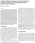
Wilson, F. H., 1989, Geologic setting, petrology, and age of Pliocene to Holocene volcanoes of the Stepovak Bay area, western Alaska Peninsula: in Dover, J. H. and Galloway, J. P., (eds.), Geological studies in Alaska by the U.S. Geological Survey, 1988, U.S. Geological Survey Bulletin 1903, p. 84-95.
full-text PDF 403 KB
Hard Copy held by AVO at FBKS - CEC file cabinet

Pavlof, 1989

Yount, E., Taber, J. J., Reeder, J. W., and Miller, T., 1989, Pavlof: in Annual report of the world volcanic eruptions in 1986, Bulletin of Volcanic Eruptions, v. 26, p. 54-57.
Hard Copy held by AVO at FBKS - CEC file cabinet

Satellite survey of sulfur dioxide emissions during explosive eruptions, 1989

Walter, L. S., Krueger, A. J., Schnetzler, C. C., Doiron, S. D., and Sullivan, D. P., 1989, Satellite survey of sulfur dioxide emissions during explosive eruptions [abs.]: in Continental magmatism: abstracts, New Mexico Bureau of Mines and Mineral Resources Bulletin 0131, p. 286.
Hard Copy held by AVO at FBKS - CEC file cabinet Hard Copy held by AVO at FBKS - CEC shelf

Alaska's thermal springs: A review of their biological and cultural significance in the lifeways of Alaskan natives, 1988

Griffin, D. G., and Sattler, R. A., 1988, Alaska's thermal springs: A review of their biological and cultural significance in the lifeways of Alaskan natives: Journal of Northern Sciences, v. 2, p. 49-73.

Brief description of mines, prospects, and mineral occurrences in the Port Moller and Stepovak Bay quadrangles, Alaska Peninsula, 1988

Wilson, F. H., White, W. H., and DuBois, G. D., 1988, Brief description of mines, prospects, and mineral occurrences in the Port Moller and Stepovak Bay quadrangles, Alaska Peninsula: U.S. Geological Survey Open-File Report 88-0666, 132 p., 1 plate, scale 1:250,000.

Pavlof, 1988

Smithsonian Institution, 1988, Pavlof: Scientific Event Alert Network Bulletin v. 13, n. 02, unpaged.

Pavlof, 1988

Smithsonian Institution, 1988, Pavlof: Scientific Event Alert Network Bulletin v. 13, n. 07, unpaged.

Pavlof, 1988

Smithsonian Institution, 1988, Pavlof: Scientific Event Alert Network Bulletin v. 13, n. 08, unpaged.

Eruption characteristics and cycles at Pavlof Volcano, Alaska, and their relation to regional earthquake activity (USA), 1987

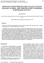
McNutt, S. R., 1987, Eruption characteristics and cycles at Pavlof Volcano, Alaska, and their relation to regional earthquake activity (USA): Journal of Volcanology and Geothermal Research, v. 31, n. 3, p. 239-267.

Eruptions of Pavlof Volcano and their possible modulation by ocean load and tectonic stresses, 1987

McNutt, S. R., and Beavan, R. J., 1987, Eruptions of Pavlof Volcano and their possible modulation by ocean load and tectonic stresses: Journal of Geophysical Research, B, Solid Earth and Planets, v. 92, n. 11, p. 11,509-11,523.

Potassium-argon age determinations from the Port Moller and Stepovak Bay quadrangles, Alaska Peninsula, 1987

DuBois, G. D., Wilson, F. H., and Shew, N. B., 1987, Potassium-argon age determinations from the Port Moller and Stepovak Bay quadrangles, Alaska Peninsula: U.S. Geological Survey Open-File Report 87-0191, unpaged, 1 sheet, scale 1:250,000.

Three volcanoes erupt in Alaska, 1987

Miller, T. P., 1987, Three volcanoes erupt in Alaska: Earthquakes and Volcanoes, v. 19, n. 6, p. 192-198.
Hard Copy held by AVO at FBKS - CEC file cabinet

Volcanic tremor at Pavlof Volcano, Alaska, October 1973-April 1986, 1987

McNutt, S. R., 1987, Volcanic tremor at Pavlof Volcano, Alaska, October 1973-April 1986: in Okal, E. A., (ed.), Advances in volcanic seismology, Pure and Applied Geophysics, v. 125, n. 6, p. 1051-1077.

Three volcanoes erupt in Alaska, 1987

Miller, T. P., 1987, Three volcanoes erupt in Alaska: in Fiscal year 1986, U.S. Geological Survey Yearbook p. 58-60.

Geothermal resources, 1987

Lister, C. R. B., 1987, Geothermal resources: in Scholl, D. W., Grantz, Arthur, and Vedder, J. G., (eds.), Geology and resource potential of the continental margin of western North America and adjacent ocean basins - Beaufort Sea to Baja California, v. 6, Houston Texas, Circum-Pacific council for energy and mineral resources, Earth Science Series, p. 739-751.

Volcanic tremor at Pavlof Volcano, Alaska 1973 - 1986, 1987

McNutt, S. R., 1987, Volcanic tremor at Pavlof Volcano, Alaska 1973 - 1986 [abs.]: in Hawaii Symposium on How Volcanoes Work, Abstract Volume, Hilo, Hawaii, January 19-25, 1987, p. 172.
Hard Copy held by AVO at FBKS - CEC file cabinet Hard Copy held by AVO at FBKS - CEC shelf

Late Quaternary caldera-forming eruptions in the eastern Aleutian arc, Alaska, 1987

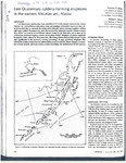
Miller, T. P., and Smith, R. L., 1987, Late Quaternary caldera-forming eruptions in the eastern Aleutian arc, Alaska: Geology, v. 15, n. 5, p. 434-438.
full-text PDF 2.5 MB
Hard Copy held by AVO at FBKS - CEC file cabinet

Pavlof, 1987

Smithsonian Institution, 1987, Pavlof: Scientific Event Alert Network Bulletin v. 12, n. 01, unpaged.

Pavlof, 1987

Smithsonian Institution, 1987, Pavlof: Scientific Event Alert Network Bulletin v. 12, n. 03, unpaged.

Pavlof, 1987

Smithsonian Institution, 1987, Pavlof: Scientific Event Alert Network Bulletin v. 12, n. 05, unpaged.

Pavlof, 1987

Smithsonian Institution, 1987, Pavlof: Scientific Event Alert Network Bulletin v. 12, n. 06, unpaged.

Pavlof, 1987

Smithsonian Institution, 1987, Pavlof: Scientific Event Alert Network Bulletin v. 12, n. 07, unpaged.

Pavlof, 1987

Smithsonian Institution, 1987, Pavlof: Scientific Event Alert Network Bulletin v. 12, n. 08, unpaged.

Pavlof, 1987

Smithsonian Institution, 1987, Pavlof: Scientific Event Alert Network Bulletin v. 12, n. 09, unpaged.

Pavlof, 1987

Smithsonian Institution, 1987, Pavlof: Scientific Event Alert Network Bulletin v. 12, n. 10, unpaged.

Pavlof, 1987

Smithsonian Institution, 1987, Pavlof: Scientific Event Alert Network Bulletin v. 12, n. 11, unpaged.

Pavlof, 1987

Yount, E., and McNutt, S., 1987, Pavlof: in Annual report of the world volcanic eruptions in 1984, Bulletin of Volcanic Eruptions, v. 24, p. 39.
Hard Copy held by AVO at FBKS - CEC file cabinet

Observations and analysis of B-type earthquakes, explosions, and volcanic tremor at Pavlof volcano, Alaska, 1986

McNutt, S. R., 1986, Observations and analysis of B-type earthquakes, explosions, and volcanic tremor at Pavlof volcano, Alaska: in Bulletin of the Seismological Society of America, v. 76, p. 153-175.

Determination of large-scale velocity structure of the crust and upper mantle in the vicinity of Pavlof Volcano, Alaska, 1986

McNutt, S. R., and Jacob, K. H., 1986, Determination of large-scale velocity structure of the crust and upper mantle in the vicinity of Pavlof Volcano, Alaska: Journal of Geophysical Research, B, Solid Earth and Planets, v. 91, n. 5, p. 5013-5022.

Seismicity, tectonics, and geohazards of the Gulf of Alaska, 1986

Jacob, K. H., 1986, Seismicity, tectonics, and geohazards of the Gulf of Alaska: in Hood, D. W. and Zimmerman, S. T., (eds.), The Gulf of Alaska: physical environment and biological recourses, Washington, DC, U.S. Department of Commerce & U.S. Department of the Interior, p. 145-184.

Map showing distribution, composition, and age of Late Cenozoic volcanic centers in Alaska, 1986

Luedke, R. G., and Smith, R. L., 1986, Map showing distribution, composition, and age of Late Cenozoic volcanic centers in Alaska: U.S. Geological Survey Miscellaneous Investigations Series Map I 1091-F, unpaged, 3 sheets, scale 1:1,000,000.

Pavlof, 1986

Smithsonian Institution, 1986, Pavlof: Scientific Event Alert Network Bulletin v. 11, n. 03, unpaged.

Pavlof, 1986

Smithsonian Institution, 1986, Pavlof: Scientific Event Alert Network Bulletin v. 11, n. 04, unpaged.

Pavlof, 1986

Smithsonian Institution, 1986, Pavlof: Scientific Event Alert Network Bulletin v. 11, n. 05, unpaged.

Pavlof, 1986

Smithsonian Institution, 1986, Pavlof: Scientific Event Alert Network Bulletin v. 11, n. 06, unpaged.

Pavlof, 1986

Smithsonian Institution, 1986, Pavlof: Scientific Event Alert Network Bulletin v. 11, n. 07, unpaged.

Pavlof, 1986

Smithsonian Institution, 1986, Pavlof: Scientific Event Alert Network Bulletin v. 11, n. 08, unpaged.

Pavlof, 1986

Smithsonian Institution, 1986, Pavlof: Scientific Event Alert Network Bulletin v. 11, n. 10, unpaged.

Pavlof, 1986

Smithsonian Institution, 1986, Pavlof: Scientific Event Alert Network Bulletin v. 11, n. 11, unpaged.

Pavlof, 1986

Smithsonian Institution, 1986, Pavlof: Scientific Event Alert Network Bulletin v. 11, n. 12, unpaged.

Pavlof, 1986

Miller, T., and McNutt, S., 1986, Pavlof: in Annual report of the world volcanic eruptions in 1983, Bulletin of Volcanic Eruptions, v. 23, p. 38.
Hard Copy held by AVO at FBKS - CEC file cabinet

The eruptive activity, seismicity, and velocity structure of Pavlof volcano, Eastern Aleutians, 1985

McNutt, S. R., 1985, The eruptive activity, seismicity, and velocity structure of Pavlof volcano, Eastern Aleutians: Columbia University unpublished Ph.D. dissertation, 214 p.
Hard Copy held by AVO at FBKS - CEC file cabinet Hard Copy held by AVO at FBKS - CEC shelf

Newly discovered Holocene volcanic vents. Port Moller and Stepovak Bay quadrangles, Alaska Peninsula, 1985

Yount, M. E., Wilson, F. H., and Miller, J. W., 1985, Newly discovered Holocene volcanic vents. Port Moller and Stepovak Bay quadrangles, Alaska Peninsula: in Bartsch-Winkler, Susan and Reed, K. M., (eds.), The United States Geological Survey in Alaska: accomplishments during 1983, U.S. Geological Survey Circular C 0945, p. 60-62.
Hard Copy held by AVO at FBKS - CEC file cabinet

Late Quaternary glaciation of the Pavlof Bay and Port Moller areas, Alaska Peninsula, 1985

Weber, F. R., 1985, Late Quaternary glaciation of the Pavlof Bay and Port Moller areas, Alaska Peninsula: in Bartsch-Winkler, Susan, (ed.), The United States Geological Survey in Alaska: accomplishments during 1984, U.S. Geological Survey Circular C 0967, p. 42-44.

Eruption characteristics, cycles, and the state of stress at Pavlof Volcano, eastern Aleutians, as inferred from seismicity, 1984

McNutt, S. R., 1984, Eruption characteristics, cycles, and the state of stress at Pavlof Volcano, eastern Aleutians, as inferred from seismicity [abs.]: Earthquake Notes, v. 55, n. 1, p. 12.

Large-scale velocity structure of the crust and upper mantle in the vicinity of Pavlof Volcano, Alaska, 1984

Luckman, M. A., and McNutt, S. R., 1984, Large-scale velocity structure of the crust and upper mantle in the vicinity of Pavlof Volcano, Alaska [abs.]: Eos, v. 65, n. 45, p. 1002.

Periodic eruptions at Pavlof Volcano, Alaska: the effects of sea level and an aseismic slip event, 1984

McNutt, S. R., and Beavan, R. J., 1984, Periodic eruptions at Pavlof Volcano, Alaska: the effects of sea level and an aseismic slip event [abs.]: Eos, v. 65, n. 45, p. 1149.

Eruption cycles and characteristics, and the state of stress at Pavlof Volcano, eastern Aleutians, 1984

McNutt, S. R., 1984, Eruption cycles and characteristics, and the state of stress at Pavlof Volcano, eastern Aleutians [abs.]: Eos, v. 65, n. 16, p. 242-243.

Pavlof, 1984

Smithsonian Institution, 1984, Pavlof: Scientific Event Alert Network Bulletin v. 09, n. 01, unpaged.

Pavlof, 1984

Smithsonian Institution, 1984, Pavlof: Scientific Event Alert Network Bulletin v. 09, n. 03, unpaged.

Tilt and seismicity changes in the Shumagin seismic gap (Alaska, USA), 1983

Beavan, J., Jacob, K. H., Hauksson, E., McNutt, S. R., and Bilham, R., 1983, Tilt and seismicity changes in the Shumagin seismic gap (Alaska, USA): Science, v. 222, n. 4621, p. 322-325.

Fracture vesiculation of andesitic magma, Pavlof area, Alaska, 1983

Woodruff, L. G., and Anderson, A. T. Jr., 1983, Fracture vesiculation of andesitic magma, Pavlof area, Alaska: The Journal of Geology, v. 91, n. 3, p. 323-329.

Analysis of B-type earthquakes and explosions at Pavlof Volcano, Alaska, 1983

McNutt, S. R., and Mori, J., 1983, Analysis of B-type earthquakes and explosions at Pavlof Volcano, Alaska [abs.]: Eos, v. 64, n. 5, p. 45.

Seismic and eruptive activity of Pavlof Volcano, 1973-1983, related to Shumagin seismic gap?, 1983

McNutt, S. R., 1983, Seismic and eruptive activity of Pavlof Volcano, 1973-1983, related to Shumagin seismic gap?: Eos, v. 64, n. 18, p. 258.

Analysis of volcanic earthquakes at Pavlof Volcano, Alaska, and Poas Volcano, Costa Rica, 1983

McNutt, S., 1983, Analysis of volcanic earthquakes at Pavlof Volcano, Alaska, and Poas Volcano, Costa Rica [abs.]: Earthquake Notes, v. 54, n. 3, p. 23.

Correlation of the solid Earth tide with volcanic earthquakes at Pavlof Volcano, Alaska, 1983

McNutt, S. R., and Beavan, R. J., 1983, Correlation of the solid Earth tide with volcanic earthquakes at Pavlof Volcano, Alaska: in International symposium on Earth tides, 9, Proceedings, New York, NY, Aug. 17-22, 1981, p. 703-713.

Historical activity of Pavlov volcano, 1983

Shackelford, D. C., 1983, Historical activity of Pavlov volcano: Volcano News, v. 14, p. 5-6.

Alaska, basic data for thermal springs and wells as recorded in GEOTHERM, 1983

Bliss, J. P., 1983, Alaska, basic data for thermal springs and wells as recorded in GEOTHERM: U.S. Geological Survey Open-File Report 83-0426, 114 p.

Selected data for low-temperature (less than 90 deg C) geothermal systems in the United States, 1983

Reed, M. J., Mariner, R. H., Brook, C. A., and Sorey, M. L., 1983, Selected data for low-temperature (less than 90 deg C) geothermal systems in the United States: U.S. Geological Survey Open-File Report 83-0250, 129 p.
Hard Copy held by AVO at FBKS - CEC shelf

Pavlof, 1983

Smithsonian Institution, 1983, Pavlof: Scientific Event Alert Network Bulletin v. 08, n. 10, unpaged.

Pavlof, 1983

Smithsonian Institution, 1983, Pavlof: Scientific Event Alert Network Bulletin v. 08, n. 11, unpaged.

Pavlof, 1983

Smithsonian Institution, 1983, Pavlof: Scientific Event Alert Network Bulletin v. 08, n. 12, unpaged.

Pavlof, 1983

McNutt, S., and Shackelford, D. C., 1983, Pavlof: in Annual report of the world volcanic eruptions in 1981, Bulletin of Volcanic Eruptions, v. 21, p. 60-61.
Hard Copy held by AVO at FBKS - CEC file cabinet

A seismotectonic analysis of the seismic and volcanic hazards in the Pribilof Islands - Eastern Aleutian Islands Region of the Bering Sea, 1983

Jacob, K. H., and Hauksson, Egill, 1983, A seismotectonic analysis of the seismic and volcanic hazards in the Pribilof Islands - Eastern Aleutian Islands Region of the Bering Sea: Lamont-Doherty Geological Observatory of Columbia University Annual Report NOAA 03--5-022-70, New York, 224 p.

Some volcanoes, volcanic eruption, and earthquakes in the former Russian America. Peter Doroshin's account of volcanic activity and earthquakes between 1840 and 1866, 1983

Kisslinger, J.B., 1983, Some volcanoes, volcanic eruption, and earthquakes in the former Russian America. Peter Doroshin's account of volcanic activity and earthquakes between 1840 and 1866: Pacific Northwest Quarterly, v. 74, n. 2, p. 59-68.
Hard Copy held by AVO at FBKS - CEC file cabinet

Seismic monitoring of volcanoes in the Aleutians, 1982

McNutt, S., 1982, Seismic monitoring of volcanoes in the Aleutians: Volcano News, v. 11, p. 7-8.

Analysis of volcanic tremor from Pavlof, Fuego, Pacaya, San Cristobal and Masaya volcanaoes, 1982

McNutt, Steve, 1982, Analysis of volcanic tremor from Pavlof, Fuego, Pacaya, San Cristobal and Masaya volcanaoes: Boletin de Vulcanologia, v. 14, p. 55-58.

Analysis of volcanic tremor from Pavlof, Fuego, Pacaya, San Cristobal, Masaya, and Poaz volcanoes, 1982

McNutt, S., 1982, Analysis of volcanic tremor from Pavlof, Fuego, Pacaya, San Cristobal, Masaya, and Poaz volcanoes [abs.]: Eos, v. 63, n. 18, p. 459.

The Aleutians, 1982

Marsh, B. D., 1982, The Aleutians: in Thorpe, R. S., (ed.), Andesites: orogenic andesites and related rocks, Chichester, United Kingdom, John Wiley & Sons, p. 99-114.
Hard Copy held by AVO at FBKS - CEC file cabinet

Pavlof, 1982

Shackelford, D. C., 1982, Pavlof: in Annual report of the world volcanic eruptions in 1980, Bulletin of Volcanic Eruptions, v. 20, p. 70.
Hard Copy held by AVO at FBKS - CEC file cabinet

Volcanic earthquakes at Pavlof volcano correlated with the solid earth tide, 1981

McNutt, S. R., and Beavan, R. J., 1981, Volcanic earthquakes at Pavlof volcano correlated with the solid earth tide: Nature, v. 294, n. 5842, p. 615-618.
pdf 349KB

Volcanoes of the world, 1981

Simkin, Tom, Siebert, Lee, McClelland, Lindsay, Bridge, David, Newhall, Christopher, and Latter, J. H., 1981, Volcanoes of the world: Stroudsburg, PA, Hutchinson Publishing Company, 233 p.

Reconnaissance of thermal spring sites in the Aleutian Arc, Atka Island to Becharof Lake, 1981

Motyka, R. J., and Moorman, M. A., 1981, Reconnaissance of thermal spring sites in the Aleutian Arc, Atka Island to Becharof Lake: in Geothermal Resources Council Transactions, v. 5, p. 111-114.

Assessment of thermal springs sites, Aleutian arc, Atka Island to Becharof Lake-preliminary results and evaluation, 1981

Motyka, R. J., Moorman, M. A., and Liss, S. A., 1981, Assessment of thermal springs sites, Aleutian arc, Atka Island to Becharof Lake-preliminary results and evaluation: Alaska Division of Geological & Geophysical Surveys Open-File Report AOF 0144, 173 p.
Hard Copy held by AVO at FBKS - CEC shelf

Pavlof, 1981

Smithsonian Institution, 1981, Pavlof: Scientific Event Alert Network Bulletin v. 06, n. 09, unpaged.

Shishaldin, 1981

Smithsonian Institution, 1981, Shishaldin: Scientific Event Alert Network Bulletin v. 06, n. 09, unpaged.

An arrested state of magma mixing, Pavlof Volcano, Alaska, 1980

Woodruff, L. G., and Anderson, A. T. Jr., 1980, An arrested state of magma mixing, Pavlof Volcano, Alaska [abs.]: Eos, v. 61, n. 6, p. 68.

Volcanic earthquakes correlated with Earth tides at Pavlof Volcano, 1980

McNutt, S., 1980, Volcanic earthquakes correlated with Earth tides at Pavlof Volcano [abs.]: Eos, v. 61, n. 6, p. 68, 69.

Thermal spring list for the United States, 1980

Berry, G. W., Grim, P. J., and Ikelman, J. A., 1980, Thermal spring list for the United States: National Oceanic and Atmospheric Administration Geophysical Records Document 0012, 60 p., 2 plates, scale 1:5,000,000.

Prehistory of the Alaska Peninsula as seen from the hot springs site, Port Moller, 1980

Okada, H., and Okada, A., 1980, Prehistory of the Alaska Peninsula as seen from the hot springs site, Port Moller: in Kotani, Y. and Workman, W. B., (eds.), Alaska native culture and history, National Museum of Ethnology Senri Ethnological Studies 0004, Osaka, Japan, p. 103-112.

Pavlof, 1980

Smithsonian Institution, 1980, Pavlof: Scientific Event Alert Network Bulletin v. 05, n. 07, unpaged.

Pavlof, 1980

Smithsonian Institution, 1980, Pavlof: Scientific Event Alert Network Bulletin v. 05, n. 11, unpaged.

Calc-alkaline plutonism along the Pacific rim of southern Alaska, 1979

Hudson, Travis, 1979, Calc-alkaline plutonism along the Pacific rim of southern Alaska: U.S. Geological Survey Open-File Report 79-0953, 31 p.

The Hot Springs Village site (3), preliminary report of the 1977 excavations at Port Moller, Alaska, 1979

Okada, H., Okada, A., and Kotani, Y., 1979, The Hot Springs Village site (3), preliminary report of the 1977 excavations at Port Moller, Alaska: Sapporo, Japan, The Institute for Study of North Eurasian Cultures, Hokkaido University, 49 p.

Pavlof, 1979

Shackelford, D. C., 1979, Pavlof: in Annual report of the world volcanic eruptions in 1977, Bulletin of Volcanic Eruptions, v. 17, p. 59.
Hard Copy held by AVO at FBKS - CEC file cabinet

Water in some hypersthenic magmas, 1979

Anderson, A.T., 1979, Water in some hypersthenic magmas: The Journal of Geology, v. 87, n. 5, p. 509-531.

Comprehensive tables giving physical data and thermal energy estimates for young igneous systems of the United States, 1978

Smith, R. L., Shaw, H. R., Luedke, R. G., and Russell, S. L., 1978, Comprehensive tables giving physical data and thermal energy estimates for young igneous systems of the United States: U.S. Geological Survey Open-File Report 78-0925, p. 1-25.
Hard Copy held by AVO at FBKS - CEC shelf

Aleutian/Pribilof Islands region community profiles, 1978

Arctic Environmental Information and Data Center, 1978, Aleutian/Pribilof Islands region community profiles: unpaged.

Pavlof, 1978

Shackelford, D. C., 1978, Pavlof: in Annual report of the world volcanic eruptions in 1976 with supplements to the previous issues, Bulletin of Volcanic Eruptions, v. 16, p. 50-52.
Hard Copy held by AVO at FBKS - CEC file cabinet

Pavlof, 1977

Smithsonian Institution, 1977, Pavlof: Scientific Event Alert Network Bulletin v. 02, n. 01, unpaged.

Pavlof, 1977

Smithsonian Institution, 1977, Pavlof: Scientific Event Alert Network Bulletin v. 02, n. 03, unpaged.

Pavlof, 1977

Smithsonian Institution, 1977, Pavlof: Scientific Event Alert Network Bulletin v. 02, n. 04, unpaged.

Pavlof, 1977

Shackelford, D. C., 1977, Pavlof: in Annual report of the world volcanic eruptions in 1975 with supplements to the previous issues, Bulletin of Volcanic Eruptions, v. 15, p. 41.
Hard Copy held by AVO at FBKS - CEC file cabinet

Geophysical monitoring of Augustine and Pavlof volcanoes, Alaska, 1976

Kienle, J., Lalla, D. J., and Johnston, D. A., 1976, Geophysical monitoring of Augustine and Pavlof volcanoes, Alaska [abs.]: Eos, v. 57, n. 2, p. 88.

Seismic monitoring of Pavlof Volcano, 1976

Kienle, J., 1976, Seismic monitoring of Pavlof Volcano: in Comprehensive study of seismotectonics of the Aleutian arc: Lamont-Doherty Geological Observatory, Columbia University Annual Progress Report for ERDA under contract (11-1) 3134, p. 38-40.

The Hot Springs Village site (2), preliminary report of the 1974 excavations at Port Moller, Alaska, 1976

Okada, H., Okada, A., Kotani, Y., and Hattori, K., 1976, The Hot Springs Village site (2), preliminary report of the 1974 excavations at Port Moller, Alaska: Sapporo, Japan, The Institute for Study of North Eurasian Cultures, Hokkaido University, 20 p., 20 plates, scale unknown.

Pavlof, 1976

Smithsonian Institution, 1976, Pavlof: Scientific Event Alert Network Bulletin v. 01, n. 04, unpaged.

Pavlof, 1976

Smithsonian Institution, 1976, Pavlof: Scientific Event Alert Network Bulletin v. 01, n. 05, unpaged.

Pavlof, 1976

Smithsonian Institution, 1976, Pavlof: Scientific Event Alert Network Bulletin v. 01, n. 06, unpaged.

Pavlof, 1976

Smithsonian Institution, 1976, Pavlof: Scientific Event Alert Network Bulletin v. 01, n. 07, unpaged.

Pavlof, 1976

Smithsonian Institution, 1976, Pavlof: Scientific Event Alert Network Bulletin v. 01, n. 08, unpaged.

Pavlof, 1976

Smithsonian Institution, 1976, Pavlof: Scientific Event Alert Network Bulletin v. 01, n. 09, unpaged.

Pavlof, 1976

Smithsonian Institution, 1976, Pavlof: Scientific Event Alert Network Bulletin v. 01, n. 10, unpaged.

Pavlof, 1976

Smithsonian Institution, 1976, Pavlof: Scientific Event Alert Network Bulletin v. 01, n. 11, unpaged.

Pavlof, 1976

Smithsonian Institution, 1976, Pavlof: Scientific Event Alert Network Bulletin v. 01, n. 13, unpaged.

Pavlof, 1976

Smithsonian Institution, 1976, Pavlof: Scientific Event Alert Network Bulletin v. 01, n. 14, unpaged.

Experts eye ash-spitting island, 1976

Anderson, Peggy, 1976, Experts eye ash-spitting island: Anchorage Times, v. 62, n. 24, p. A1.

Pavlof Volcano expedition, 1928, 1975

Unknown, 1975, Pavlof Volcano expedition, 1928: in 1890-1954 projects, National Geographic Society Research Report 0008, p. 185-186.

Glaciers of the Aleutian Range and Kodiak Island, 1975

Denton, G. H., and Field, W. O., 1975, Glaciers of the Aleutian Range and Kodiak Island: in Field, W. O., (ed.), Mountain glaciers of the Northern Hemisphere, v. 2, Hanover, NH, Cold Regions Research and Engineering Laboratory, p. 621-638.

Micro earthquake activity and volcanic tremor associated with strombolian eruptions of Pavlov Volcano, Alaska, 1975

Lalla, D. J., and Kienle, J., 1975, Micro earthquake activity and volcanic tremor associated with strombolian eruptions of Pavlov Volcano, Alaska [abs.]: in Deep and shallow structures of volcanoes, International Union of Geodesy and Geophysics Interdisciplinary Symposium, 14, Proceedings, Grenoble, France, Aug. 25 - Sept. 5, 1975, p. 107.

Pavlov, 1975

Stone, D. B., and Kienle, J., 1975, Pavlov: in Annual report of the world volcanic eruptions in 1973 with supplements to the previous issues, Bulletin of Volcanic Eruptions, v. 13, p. 50.
Hard Copy held by AVO at FBKS - CEC file cabinet

Pavlof, 1975

Smithsonian Institution, 1975, Pavlof: Scientific Event Alert Network Bulletin v. 01, n. 01, unpaged.

Pavlof, 1975

Smithsonian Institution, 1975, Pavlof: Scientific Event Alert Network Bulletin v. 01, n. 03, unpaged.

The Hot Springs Village site, preliminary report of the 1972 excavations at Port Moller, Alaska, 1974

Okada, H., and Okada, A., 1974, The Hot Springs Village site, preliminary report of the 1972 excavations at Port Moller, Alaska: Sapporo, Japan, The Institute for Study of North Eurasian Cultures, Hokkaido University, 20 p., 14 plates, scale unknown.

Distribution and chemical analyses of thermal springs in Alaska, 1973

Miller, T. P., 1973, Distribution and chemical analyses of thermal springs in Alaska: U.S. Geological Survey Open-File Report 0570, unpaged, 1 plate, scale 1:2,500,000.

Pavlof, 1973

Smithsonian Institution, 1973, Pavlof: Center for Short-Lived Phenomena Event Notification Card 1744, v. 144, n. 73, unpaged.

No danger seen, 1973

UPI, 1973, No danger seen: The Middlesboro Daily News, Kentucky, November 16, 1973, p. 7.
Hard Copy held by AVO at FBKS - CEC file cabinet

Account of a voyage of discovery to the north-east of Siberia, the frozen ocean, and the north-east sea, 1969

Sarychev, G.A., translated from Russian in 1806 and 1807, republished 1969, Account of a voyage of discovery to the north-east of Siberia, the frozen ocean, and the north-east sea: New York, Da Capo Press, 110 p.

Notes on the islands of the Unalashka district; and, Notes on the Atkhan Aleuts and the Kolosh [translated from Russian by Richard Henry Geogheghan], 1968

Veniaminov, Ivan, 1968, Notes on the islands of the Unalashka district; and, Notes on the Atkhan Aleuts and the Kolosh [translated from Russian by Richard Henry Geogheghan]: Martin, Fredericka, (ed.), Unpublished manuscript, Fairbanks, AK, 944 p.

Investigations at active volcanoes, 1967

Decker, R. W., 1967, Investigations at active volcanoes: Adams, L. H. and Schairer, J. F., (eds.), Eos, v. 48, n. 2, p. 639-647.
Hard Copy held by AVO at FBKS - CEC file cabinet

Alaska peak belches lava, fliers say, 1966

Associated Press, 1966, Alaska peak belches lava, fliers say: Walla Walla Union Bulletin, Walla Walla, WA, March 16, 1966, p. 1.
Hard Copy held by AVO at FBKS - CEC file cabinet

Pavlof spewing lava stream, 1966

Associated Press, 1966, Pavlof spewing lava stream: Fairbanks Daily News Miner, Thursday, March 3, 1966, p.3.

Eruption on Mt. Pavlof 'Not unusual', 1966

Associated Press, 1966, Eruption on Mt. Pavlof 'Not unusual': Fairbanks Daily News Miner, March 4, 1966, p. 2.

Thermal springs of the United States and other countries of the world - a summary, 1965

Waring, G. A., 1965, Thermal springs of the United States and other countries of the world - a summary: U.S. Geological Survey Professional Paper PP 0492, 383 p.
Hard Copy held by AVO at FBKS - CEC shelf

Aleutian Islands and Alaska, 1964

Coats, R. R., 1964, Aleutian Islands and Alaska: Bulletin of Volcanic Eruptions, v. 4, p. 4.
Hard Copy held by AVO at FBKS - CEC file cabinet

Alaska Peninsula-Aleutian Islands, 1958

Powers, H. A., 1958, Alaska Peninsula-Aleutian Islands: in Williams, H., (ed.), Landscapes of Alaska, Los Angeles, CA, University of California Press, p. 61-75.

Umnak residents ask for volcano study, 1958

Unknown, 1958, Umnak residents ask for volcano study: Anchorage Daily News, v. Aug. 19, 1958, Anchorage, AK, p. unknown.
Hard Copy held by AVO at FBKS - CEC file cabinet

Geology of Pavlof Volcano and vicinity, Alaska, 1955

Kennedy, G. C., and Waldron, H. H., 1955, Geology of Pavlof Volcano and vicinity, Alaska: in Investigations of Alaskan volcanoes, U.S. Geological Survey Bulletin 1028-A, 19 p., 1 sheet, scale 1:100,000.
full-text PDF 744 KB
plate 3 PDF 9.1 MB
Hard Copy held by AVO at FBKS - CEC shelf

Geology of Pavlof Volcano and vicinity, 1955

Kennedy, G. C., and Waldron, H. H., 1955, Geology of Pavlof Volcano and vicinity: U.S. Geological Survey Alaskan Volcano Investigations Report 0002, p. 7-18.

Uebersicht ueber die vulkanische Taetigkeit 1948-1950, 1955

Hantke, Gustav, 1955, Uebersicht ueber die vulkanische Taetigkeit 1948-1950: Bulletin Volcanlogique, v. 14, p. 151-184.
Hard Copy held by AVO at FBKS - CEC file cabinet

Volcano observations, 1954

Unknown, 1954, Volcano observations: Unpublished volcano observation sheets filled out by U.S. military and stored on file at the Geophyiscal Institute, University of Alaska Fairbanks, unpaged.
Hard Copy held by AVO at FBKS - CEC file cabinet

Eruption of Trident Volcano, Katmai National Monument, Alaska, Feb.-June 1953, 1954

Snyder, G. L., 1954, Eruption of Trident Volcano, Katmai National Monument, Alaska, Feb.-June 1953: U.S. Geological Survey Circular C 0318, 7 p., 2 sheets, scale unknown.
Hard Copy held by AVO at FBKS - CEC file cabinet

Current activity of Aleutian volcanoes, 1953

Powers, H. A., 1953, Current activity of Aleutian volcanoes: The Volcano Letter, v. 522, p. 6.
full-text PDF 397 KB
Hard Copy held by AVO at FBKS - CEC file cabinet

Aleutian volcanoes, 1952

Jones, A. E., 1952, Aleutian volcanoes: The Volcano Letter, v. 516, p. 8-9.
full-text PDF 2.4 MB
Hard Copy held by AVO at FBKS - CEC file cabinet

Uebersicht ueber die vulkanische Taetigkeit 1941-1947, 1951

Hantke, Gustav, 1951, Uebersicht ueber die vulkanische Taetigkeit 1941-1947: Bulletin Volcanologique, v. 11, p. 161-208.
Hard Copy held by AVO at FBKS - CEC file cabinet

Volcanic activity in the Aleutian Arc, 1950

Coats, R. R., 1950, Volcanic activity in the Aleutian Arc: U.S. Geological Survey Bulletin 0974-B, p. 35-49, 1 sheet, scale 1:5,000,000.
plate 1 PDF 819 KB
full-text PDF 783 KB
Hard Copy held by AVO at FBKS - CEC shelf

Alaska peak spews lava, 1950

UPI, 1950, Alaska peak spews lava: Syracuse Herald-Journal, Syracuse, NY, August 1, 1950, p. 9.
Hard Copy held by AVO at FBKS - CEC file cabinet

Alaska volcanoes ready big blow-up, 1950

MacDonald, Lachlan, 1950, Alaska volcanoes ready big blow-up: Oakland Tribune, Oakland, CA, September 10, 1950, p. B-5.
Hard Copy held by AVO at FBKS - CEC file cabinet

Exploring Aleutian volcanoes, 1948

Robinson, G. D., 1948, Exploring Aleutian volcanoes: National Geographic Magazine, v. 94, n. 4, p. 509-528.
Hard Copy held by AVO at FBKS - CEC file cabinet

Alaskan volcano investigations Report no. 2: Progress of investigations in 1946, 1947

Robinson, G. D., Kennedy, G. C., Waldron, H. H., Byers, F. M. Jr., Hopkins, D. M., Wier, K. L., Fisher, B., Simons, F. S., Mathewson, D. E., and Coats, R. R., 1947, Alaskan volcano investigations Report no. 2: Progress of investigations in 1946: U.S. Geological Survey Alaskan Volcano Investigations Report 0002, 105 p., 8 sheets, scale 1:250,000.
Hard Copy held by AVO at FBKS - CEC shelf

Reconnaissance geology of some western Aleutian Islands, 1947

Coats, R. R., 1947, Reconnaissance geology of some western Aleutian Islands: U.S. Geological Survey Alaskan Volcano Investigations Report 0002, p. 95-105.
Hard Copy held by AVO at FBKS - CEC shelf

United States coast pilot, Alaska Part 2, Yakutat Bay to Arctic Ocean, 1947

U.S. Department of Commerce, and Coast and Geodetic Survey, 1947, United States coast pilot, Alaska Part 2, Yakutat Bay to Arctic Ocean: Washington DC, United States Government Printing Office, 659 p.

Alaska and the Aleutian belt, 1946

Coleman, S. N., 1946, Alaska and the Aleutian belt: chapter 16 of Volcanoes, New and Old, New York, The John Day Company, p. 155-165.
Hard Copy held by AVO at FBKS - CEC file cabinet

Volcanoes declare war: logistics and strategy of Pacific volcano science, 1945

Jaggar, T. A., 1945, Volcanoes declare war: logistics and strategy of Pacific volcano science: Honolulu, Paradise of the Pacific, Ltd, 166 p.

Aleutian eruptions 1930-1932, 1932

Jaggar, T. A., 1932, Aleutian eruptions 1930-1932: The Volcano Letter, v. 375, p. 1-4.
full-text PDF 1232 KB
Hard Copy held by AVO at FBKS - CEC file cabinet

Notes from the Aleutian Islands, 1931

Finch, R. H., 1931, Notes from the Aleutian Islands: The Volcano Letter, v. 357, p. 2-3.
full-text PDF 577 KB

Alaska volcano erupting, says radio message, 1931

Associated Press, 1931, Alaska volcano erupting, says radio message: Fairbanks Daily News Miner, March 30, 1931, p. 1.
Hard Copy held by AVO at FBKS - CEC file cabinet

Volcano in Aleutians quiet again; Pavloff threw out clouds of smoke from Sunday night until Monday morning, 1931

Associated Press, 1931, Volcano in Aleutians quiet again; Pavloff threw out clouds of smoke from Sunday night until Monday morning: Fairbanks Daily News Miner, March 31, 1931, p. 4.
Hard Copy held by AVO at FBKS - CEC file cabinet

Mapping the home of the great brown bear: adventures of the National Geographic Society's Pavlof Volcano expedition to Alaska, 1929

Jaggar, T. A., 1929, Mapping the home of the great brown bear: adventures of the National Geographic Society's Pavlof Volcano expedition to Alaska: National Geographic Magazine, v. 55, p. 109-134.
Hard Copy held by AVO at FBKS - CEC file cabinet

Volcanoes in Aleutian area again active, 1929

Associated Press, 1929, Volcanoes in Aleutian area again active: The Greeley Daily Tribune, Greeley CO, Saturday December 14, 1929, p. 1.
Hard Copy held by AVO at FBKS - CEC file cabinet

The Pavlof volcano expedition, 1928

Wilson, R. M., 1928, The Pavlof volcano expedition: The Volcano Letter, v. 183, p. 1.
full-text PDF 358 KB
Hard Copy held by AVO at FBKS - CEC file cabinet

The Pavlof volcano expedition, 1928

Wilson, R. M., 1928, The Pavlof volcano expedition: The Volcano Letter, v. 191, p. 1.
full-text PDF 618 KB
Hard Copy held by AVO at FBKS - CEC file cabinet

The Aleutian Islands, 1927

Jaggar, T. A., 1927, The Aleutian Islands: The Volcano Letter, v. 116, p. 1.
full-text PDF 376 KB
Hard Copy held by AVO at FBKS - CEC file cabinet

Odd changes occurring on Alaskan coast, 1924

Unknown, 1924, Odd changes occurring on Alaskan coast: Modesto Evening News, Modesto, CA, v. LXXIV, n. 126, May 27, 1924, p. 1.

Belkofsky naives [sic] given scare eruption Pavlof, 1924

Unknown, 1924, Belkofsky naives [sic] given scare eruption Pavlof: Fairbanks Daily News Miner, February 6, 1924, p. 4.
Hard Copy held by AVO at FBKS - CEC file cabinet

Pacific volcano is active, 1923

Associated Press, 1923, Pacific volcano is active: The Lincoln State Journal, Illinois, June 26, 1923, p. 10.
Hard Copy held by AVO at FBKS - CEC file cabinet

Eruption blows top off volcano Alaska coast, 1923

Unknown, 1923, Eruption blows top off volcano Alaska coast: Nenana News, January 9, 1923, p. 1.
Hard Copy held by AVO at FBKS - CEC file cabinet

Aleutian island loses head; may disappear, 1923

Associated Press, 1923, Aleutian island loses head; may disappear: Fairbanks Daily News Miner, January 8, 1923, p. 1.
Hard Copy held by AVO at FBKS - CEC file cabinet

Reminiscences of Alaskan volcanoes, 1918

Dall, W. H., 1918, Reminiscences of Alaskan volcanoes: Scientific Monthly, v. 7, n. 1, p. 80-90.
Hard Copy held by AVO at FBKS - CEC file cabinet

Katalog der geschichtlichen vulkanausbruche, 1917

Sapper, Karl, 1917, Katalog der geschichtlichen vulkanausbruche: Strassburg, Germany, Karl J. Trubner, 358 p.
Hard Copy held by AVO at FBKS - CEC file cabinet

Logbooks of the US Coast and Geodetic steamer Patterson, 1915

Logbooks of the US Coast and Geodetic Survey steamer Patterson. Transcripts available at http://www.oldweather.org/ships/50874f4d09d4090755026716 .

Volcanoes in Alaska active, 1914

Associated Press, 1914, Volcanoes in Alaska active: The Ogden Standard, Ogden City, UT, July 10, 1914, p. 1.
Hard Copy held by AVO at FBKS - CEC file cabinet

The volcanoes of Alaska, 1910

Cordeiro, F. J. B., 1910, The volcanoes of Alaska: Appalachia, v. 12, p. 130-135.
Hard Copy held by AVO at FBKS - CEC file cabinet

An island rises from the sea to annex itself, 1906

Dunn, Robert, 1906, An island rises from the sea to annex itself: The Washington Post, Washington, D.C., October 14, 1906, p. 44.
Hard Copy held by AVO at FBKS - CEC file cabinet

Reported volcanic eruptions in Alaska, Puget Sound, etc., 1690-1896, 1898

Plummer, F. G., 1898, Reported volcanic eruptions in Alaska, Puget Sound, etc., 1690-1896: in Holden, E. S., (ed.), A Catalogue of Earthquakes on the Pacific Coast 1769-1897, Smithsonian Institution Miscellaneous Collections 1087, City of Washington D.C., Smithsonian Institution, p. 24-27.
Hard Copy held by AVO at FBKS - CEC file cabinet

Reconnaissance of the gold fields of southern Alaska with some notes on general geology, 1898

Becker, G. F., 1898, Reconnaissance of the gold fields of southern Alaska with some notes on general geology: U.S. Geological Survey Annual Report 0018, p. 1-86, 6 sheets, scale unknown.
full-text PDF 1.5 MB
Hard Copy held by AVO at FBKS - CEC file cabinet

Mineral springs of the United States, 1886

Peale, A. C., 1886, Mineral springs of the United States: U.S. Geological Survey Bulletin 0032, 235 p.

Alaska and its resources, 1870

Dall, W. H., 1870, Alaska and its resources: Boston, Lee and Shepard, 627 p.
Hard Copy held by AVO at FBKS - CEC file cabinet

Documents sur les tremblements de terre et les phenomenes volcaniques des iles Aleutiennes, de la peninsule d'Aljaska et de la cote no. d'Amerique, Extrait des memoires de l'Academie des sciences, arts et belles-lettres de Dijon, 1865, 1866

Perrey, Alexis, 1866, Documents sur les tremblements de terre et les phenomenes volcaniques des iles Aleutiennes, de la peninsule d'Aljaska et de la cote no. d'Amerique, Extrait des memoires de l'Academie des sciences, arts et belles-lettres de Dijon, 1865: Dijon, J.E. Rabutut, 131 p.
Hard Copy held by AVO at FBKS - CEC file cabinet

Grewingk's geology of Alaska and the Northwest Coast of America [edited by Marvin W. Falk, translation by Fritz Jaensch published 2003], 1850

Grewingk, Constantine, 1850, Grewingk's geology of Alaska and the Northwest Coast of America [edited by Marvin W. Falk, translation by Fritz Jaensch published 2003]: Rasmuson Library Historical Translation Series 11, Fairbanks, AK, The University of Alaska Press, 242 p.
Hard Copy held by AVO at FBKS - CEC shelf

Notes on the islands of the Unalaska district [translated from Russian by Lydia T. Black and R.H. Geoghegan in 1984], 1840

Veniaminov, Ivan, 1840, Notes on the islands of the Unalaska district [translated from Russian by Lydia T. Black and R.H. Geoghegan in 1984]: Pierce, R. A., (ed.), Kingston, Ontario, Limestone Press, 511 p.
Hard Copy held by AVO at FBKS - CEC file cabinet

Notes on the islands of the Unalashka district [Zapiski ob ostravakh Unalashkinskogo otdela], 1840

Veniaminov, I., 1840, Notes on the islands of the Unalashka district [Zapiski ob ostravakh Unalashkinskogo otdela]: v. 1-3, St. Petersburg, Russiisko-Amerikanskoi Kompanii, unknown.

Past volcanic activity in the Aleutian arc,

Coats, R. R., Past volcanic activity in the Aleutian arc: U.S. Geological Survey Volcano Investigations Report 1, 18 p.
full-text PDF 22.3 MB
Hard Copy held by AVO at FBKS - CEC file cabinet

Volcano observations,

Kienle, Juergen (comp.), Volcano observations: Notes about volcanoes and volcanic eruptions collected, made, and stored by Juergen Kienle, on file at University of Alaska Fairbanks, Geophysical Institute, unpublished, unpaged.

The U.S. Geological Survey Volcano Science Center's Response Plan for Significant Volcanic Events,

Moran, S.C., Neal, C.A., and Murray, T.L., The U.S. Geological Survey Volcano Science Center’s Response Plan for Significant Volcanic Events: U.S. Geological Survey Circular 1518, 65 p. https://doi.org/10.3133/ cir1518
Full-text PDF 11.7 MB

Ash Forecasting

Mathematical models developed by the USGS forecast various aspects of how a volcanic ash plume will interact with wind—where, how high, and how fast ash particles will be transported in the atmosphere, as well as where ash will fall out and accumulate on the ground. AVO runs these models when a volcano is restless by assuming a reasonable hypothetical eruption, to provide a pre-eruptive forecast of areas likely to be affected. During an ongoing eruption, AVO will update the forecast with actual observations (eruption start time and duration, plume height) as they become available.

View the current airborne ash cloud models for Pavlof

Ashfall thickness forecast

The Ash3d model was developed by the USGS to forecast how a volcanic ash plume will interact with wind and where ash will fall out and accumulate on the ground. AVO runs these models twice daily when a volcano is restless by assuming a reasonable hypothetical eruption altitude and duration. The map shows the model results of ashfall thickness for areas that are likely to be affected, if one were to occur. During an ongoing eruption, AVO will update the forecast with actual observations (eruption start time and duration, plume height) as they become available, and these plots will be automatically updated. The National Weather Service Anchorage Forecast Office will issue the official ashfall warning product and post them at weather.gov/afc

THESE PRODUCTS MAY NOT BE CURRENT.

During an actual eruption, see National Weather Service forecasts of ashfall:https://weather.gov/afc.

Ashfall Forecast

Click on the X on the graphic (upper right) to expand the map to show the map legend.

Ashfall Start Time

This map shows the modeled estimate of the time it would take for ashfall to begin following an eruption. It corresponds to the ashfall thickness forecast map shown above. This map uses the start time of either the twice-daily hypothetical model runs (time shown in the legend) or the actual eruption start time (if one were to occur). In the case of an actual eruption, the National Weather Service Anchorage Forecast Office will issue the official ashfall warning product that includes the ashfall start time and post them at weather.gov/afc

THESE PRODUCTS MAY NOT BE CURRENT.

During an actual eruption, see National Weather Service forecasts of ashfall:https://weather.gov/afc.

Ashfall Start Times Forecast

Click on the X on the graphic (upper right) to expand the map to show the map legend.
×