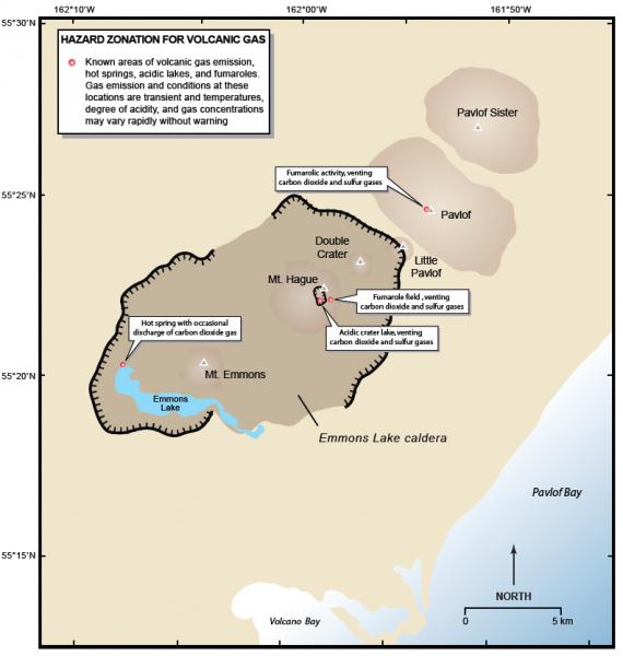
Map showing location of hot springs, fumaroles, and acidic lakes and potential sites for volcanic gas emission.
Date: 2000
Volcano(es): Pavlof
Photographer: Waythomas, C. F.
URL: avo.alaska.edu/image/view/13423
Credit: Image courtesy of AVO/USGS.
Use Restriction: Please cite the photographer and the Alaska Volcano Observatory / U.S. Geological Survey when using this image.
Full Resolution.
Volcano(es): Pavlof
Photographer: Waythomas, C. F.
URL: avo.alaska.edu/image/view/13423
Credit: Image courtesy of AVO/USGS.
Use Restriction: Please cite the photographer and the Alaska Volcano Observatory / U.S. Geological Survey when using this image.
Full Resolution.