Shishaldin

MarkerMarkerMarkerMarkerMarkerMarkerMarkerMarkerMarkerMarkerMarkerMarkerMarkerMarkerMarkerMarkerMarkerMarkerMarkerMarkerMarkerMarkerMarkerMarkerMarkerMarkerMarkerMarkerMarkerMarkerMarkerMarkerMarkerMarkerMarkerMarkerMarkerMarkerMarkerMarkerMarkerMarkerMarkerMarkerMarkerMarkerMarkerMarkerMarkerMarkerMarkerMarkerMarkerMarkerMarkerMarkerMarkerMarkerMarkerMarkerMarkerMarkerMarkerMarkerMarkerMarkerMarkerMarkerMarkerMarkerMarkerMarkerMarkerMarkerMarkerMarkerMarkerMarkerMarkerMarkerMarkerMarkerMarkerMarkerMarkerMarkerMarkerMarkerMarkerMarkerMarkerMarkerMarkerMarkerMarkerMarkerMarkerMarkerMarkerMarkerMarkerMarkerMarkerMarkerMarkerMarkerMarkerMarkerMarkerMarkerMarkerMarkerMarkerMarkerMarkerMarkerMarkerMarkerMarkerMarkerMarkerMarkerMarkerMarkerMarkerMarkerMarkerMarkerMarkerMarkerMarkerMarkerMarkerMarkerMarkerMarkerMarkerMarkerMarkerMarkerMarkerMarkerMarkerMarkerMarkerMarkerMarkerMarkerMarkerMarkerMarkerMarkerMarkerMarkerMarkerMarkerMarkerMarkerMarkerMarkerMarkerMarkerMarkerMarkerMarkerMarkerMarkerMarkerMarkerMarkerMarkerMarkerMarkerMarkerMarkerMarkerMarkerMarkerMarkerMarkerMarkerMarkerMarkerMarkerMarkerMarkerMarkerMarkerMarkerMarkerMarkerMarkerMarkerMarkerMarkerMarkerMarkerMarkerMarkerMarkerMarkerMarkerMarkerMarkerMarkerMarkerMarkerMarkerMarkerMarkerMarkerMarker
2
Legend
Red (Warning)
Orange (Watch)
Yellow (Advisory)
Green (Normal)
Uninstrumented
Community
Webcam
Instrument
Earthquake Magnitude
0 7+
Earthquake Age
Last 2 Hours
Last 2 Days
Last 1 Week


Facts


  • Official Name: Shishaldin Volcano
  • Seismically Monitored: Yes
  • Color Code: GREEN
  • Alert Level: NORMAL
  • Elevation: 2857m (9373ft)
  • Latitude: 54.7554
  • Longitude: -163.9711
  • Smithsonian VNum: 311360
  • Pronunciation:
  • Nearby Towns:
    • False Pass 23 mi (38 km) NE
    • Pauloff Harbor 55 mi (88 km) SE
    • Cold Bay 58 mi (93 km) NE
    • King Cove 69 mi (111 km) NE
    • Belkofski 80 mi (129 km) NE

    Distance from Anchorage: 679 mi (1093 km)

Description

From Miller and others (1998) [1] : "Shishaldin Volcano, located near the center of Unimak Island, is a spectacular symmetrical cone about 16 km in diameter at the base. The mountain, which rises to a summit 2857 m above sea level, is the highest peak in the Aleutian Islands and has a small summit crater from which a steady cloud of steam is emitted. The upper 2000 m is almost entirely covered by perennial snow and ice. It is flanked to the northwest by 24 monogenetic parasitic cones [2] . The Shishaldin cone is less than 10,000 year old and is constructed on a glacially eroded remnant of an ancestral soma and shield [2] , which in turn are underlain by volcaniclastic rocks of probable late Tertiary age [3] . Fournelle (1988) [2] suggests that the basement may consist, at least in part, of plutonic rocks."

Name Origin

Tebenkov (1852) named this volcano "So[pka] Shishaldinskaya," which was later transliterated to "Shishaldin Volcano." G.A. Sarichev reported its Unangam Tunuu name as "Agajedan (Grewingk, 1850). Wagner (1937) wrote that it was named Volcan de Fernandez, by Martinez (Orth, 1971).


References Cited

[1] Catalog of the historically active volcanoes of Alaska, 1998

Miller, T. P., McGimsey, R. G., Richter, D. H., Riehle, J. R., Nye, C. J., Yount, M. E., and Dumoulin, J. A., 1998, Catalog of the historically active volcanoes of Alaska: U.S. Geological Survey Open-File Report 98-0582, 104 p.

[2] Geology and petrology of Shishaldin volcano, Unimak Island, Aleutian Arc, Alaska, 1988

Fournelle, J. H., 1988, Geology and petrology of Shishaldin volcano, Unimak Island, Aleutian Arc, Alaska: The Johns Hopkins University Ph.D. dissertation, 507 p., 2 plates, scale unknown.

[3] Reconnaissance geologic map of the Cold Bay and False Pass quadrangles, Alaska, 1978

McLean, H., Engelhardt, C. L., and Howell, D. G., 1978, Reconnaissance geologic map of the Cold Bay and False Pass quadrangles, Alaska: U.S. Geological Survey Open-File Report 78-0323, unpaged, 1 plate.

Current Activity

No new updates for Shishaldin volcano since August 30, 2024, 11:02 am.

Webcams

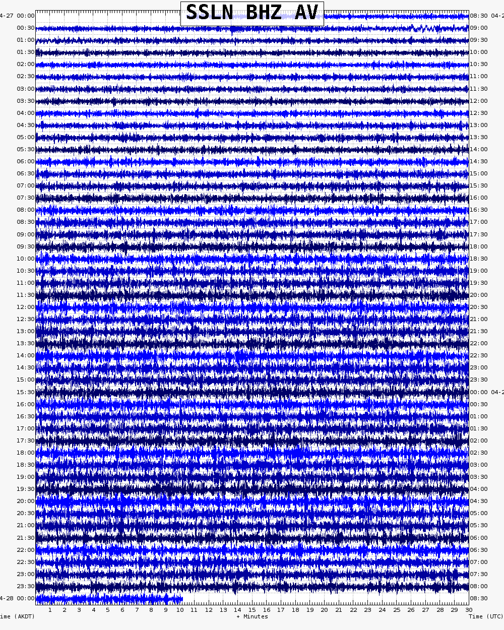
Webicorder

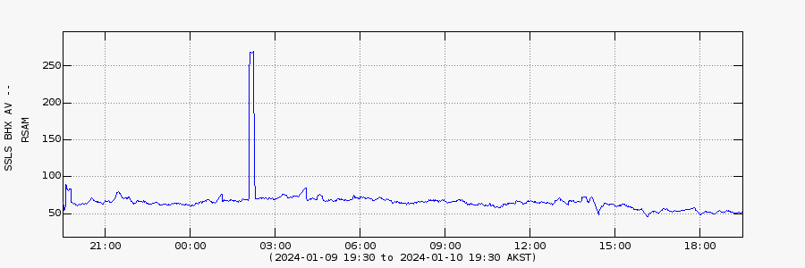
RSAM

Color Code Timeline

Reported Activity

Modern Eruptions

Okmok

Okmok Eruption Timeline

Okmok 400 yBP

1750 — 1650

From Beget and others (2005): "There is evidence that a lake filled the caldera to a depth of 150 meters over a period of several hundred years. The caldera lake drained catastrophically after failure of part of the caldera rim. The resultant flood caused deep erosion of the landscape on the north side of the volcano (Wolfe, 2001). Lahar deposits are present at low elevations in many of the stream valleys draining the volcano, and can be traced up to 12 kilometers down valley from the caldera rim. At most sites only a single lahar deposit is exposed, but at least three lahars, each more than 1 meter thick, occur in sea cliffs near the mouth of Ginger Creek on the west flank of the volcano, and are exposed intermittently for more than 2 kilometers along the beach. Radiocarbon dates suggest these lahars were emplaced 300 to 400 years ago."

Hantke (1951) wrote that there was "an eruption on Umnak" in 1805. It is difficult to say if this eruption occurred and was from Okmok. Grewingk (1850, translated 2003 by Fritz Jaensch) who compiled accounts of many travelers to the region during the time period 1760-1850, makes no mention of this eruption. Langsdorff (1812), who was present in the area from 1803 through 1807, also writes "The active volcano on Umnak * * * has been totally still for a fairly long time" - apparently discrediting the later report from Hantke.

Okmok 1817/3

March 2, 1817 — March 1, 1820

Grey (2003) has compiled and studied information about the 1817 Okmok eruption. From her thesis: "The first confirmed activity at Okmok was a large explosive eruption around 1817. There is a discrepancy as to the exact date and duration of the eruption. Veniaminov (1840, translated by Lydia T. Black and R.H. Geoghegan, 1984) maintains it was March 2, 1817; Postels (in Lutke, 1836) alleges it occurred on March 1, 1820. Grewingk (1850, translated 2003 by Fritz Jaensch) favors Veniaminov's assertion and 1817 is the date most often cited. However, Hantke (1951), who never visited the Aleutians, implies that Okmok was active during the entire four-year period and this is reflected in Simkin and Siebert (1994), though Hantke cites no specific references for his information. Whenever this eruption occurred (or perhaps there were two more separate eruptions?), there is general agreement about what happened during the explosive phase. During a storm with heavy SW winds, 'the range lying on the NE side of Umnak Island exploded * * * hurling great rocks for distances of up to 5 versts (~5 km)' (Veniaminov, 1840; Grewingk, 1850). The strong earthquake accompanying the eruption frightened the inhabitants of Unalaska, 120 km ENE of Okmok, who reportedly woke in the morning to find up to a foot of ash on the ground in some places (Lutke, 1836; Veniaminov, 1840; Grewingk, 1850). Iliuliuk Creek, which flows through Unalaska village, was reportedly so clogged with ash that it supported no fish for almost a year thereafter (Lutke, 1836; Grewingk, 1850). Though these reports all mention heavy ash fall in Unalaska, today no such thick ash layer can be found to substantiate this claim. It is quite possible that these eyewitness accounts overestimated the thickness of the deposit. It is also likely that any ash that was deposited in Unalaska has long since been eroded by the wind and rain action notorious in the Aleutians. Fieldworkers on Chuginadak Island in 2002 reported that the 2001 Cleveland ash fall on the island was approximately 20 cm thick up to 5 km from the vent, but still, no coherent ash layer can be found now, just some windblown pockets (J. Dehn, personal communication, 2003).
"The Aleut village of Egorkovskoe (or Adus), located on Cape Tanak (formerly called Egorkovskoi) on the northernmost end of Umnak, was destroyed by the 1817 eruption while its inhabitants were hunting in the Pribilof Islands (Grewingk, 1850). The villagers relocated to the Inanudak isthmus and in 1830 to the present site of Nikolski (Grewingk, 1850; Veniaminov, 1840). Because of the distance from the eruption source within the caldera, it is unlikely that the explosion itself was responsible for depositing the large boulders found near Cape Tanak. Wolfe and Beget (2002, and Wolfe, 2001) note a distinct absence of a thick enough tephra fall deposit at this site to bury a village. Rather, it is more likely that the boulders and gravel were carried in a syneruptive ash-laden outburst flood from Okmok caldera, either by disruption of an intracaldera lake or by melting of snow during the eruption. Radiocarbon date ranges for a 50-75 cm sand and gravel deposit found at Cape Tanak bracket the date of an outburst flood from the caldera between 1636-1951 AD from one soil sample, with a 55% probability between 1726-1813 AD, and between 1806-1931 AD for a second soil sample (Wolfe, 2001). These dates correspond well with the date of this eruption and support this hypothesis.
"It is possible that this explosive eruption originated from Cone E within the caldera because of the large, fresh pit crater in that cone that must have been formed by a forceful explosion quite recently. Alternatively, field evidence suggests that the eruption may have been through the intracaldera lake, originating at the site of Cone B, which is located close to the breach in the caldera wall (J. Beget and T. Neal, personal communication, 2003)."

Okmok 1824

1824 — 1830

From Grey (2003): "According to Grewingk (1850, translated 2003 by Fritz Jaensch), Lutke reported an eruption on the northeast end of Umnak Island, during which a 'mountain ridge opened up' in 1824 and was still 'smoking' in 1830. He also says that Postels (in Lutke, 1836) erroneously reported the activity as stretching along the northwest coast, but does not mention on what basis this presumption of error is made - perhaps the eruption was merely viewed from off the NW coast and appeared nearer than it was. I interpret these two reports as describing a linear (fissure) eruption and postulate that it may have taken place along the chain of small vents within the caldera that extends west from Cone B. This assumes fire fountains reaching above the caldera rim (500 m or more in height)."
Grey (2003) explains that fire fountains this high are unlikely, and then continues as follows: "Perhaps the observer saw the red glow of the eruption reflected on the underside of a low cloud deck. The relative freshness of the deposits from this arcuate fissure supports a historic time frame. There is also a young lava flow from Cone B that is so fresh it was originally mistaken for 1958 lava during field work in 2000 and could have been erupted in this time frame as well."
Powers (1958) also states that he believes a lava flow likely occurred during this eruption.

From Grey (2003): "A new crater is reported to have formed within the caldera in 1878 (Hantke, 1951), accompanied by earthquakes and a tsunami (location unknown). This could refer to the birth of Cone A, but since Hantke offers no additional information or references to support this notion, the report is apocryphal at best. It is intriguing to note that eruptions are also reported at Vsevidof, on the southwestern end of Umnak Island, in 1817, 1830, and 1878 (Miller and others, 1998). Of particular interest is the suggestion by Miller and others that the 1878 activity of Vsevidof 'may have been from a radial fissure eruption on the west flank; this event may have produced the youngest dacite flow, which extends west-southwest to Cape Kigushimkada.' Such a fissure eruption would probably produce earthquakes and could account for Hantke's 'new crater,' though not located inside a caldera. It is thus possible that Hantke misinterpreted the location of the 1878 activity, and there may not have been an eruption at Okmok in that year at all."
Sapper (1917), compiling information from Petroff (1884) and Fuchs, reports "a brief flame and ash eruption and a new crater developed from which came steam and hot cooking mud. This new crater appeared between Vsevidof and the settlement." This statement seems to support Miller and others's (1998) assertion that there was a radial fissure eruption at Vsevidof in 1878.

From Grey (2003): "An explosive eruption is said to have occurred in 1899 (Dunn, 1908). Robert Dunn (1908) details his visit to Umnak Island while 'vulcaneering' in the Aleutians. After landing on the beach south of Cape Aslik [see figure 4.2 in original text], he hiked up the slope past Jag Peak to the top of the ridge (the WSW rim), where he first laid eyes on the caldera: 'Below, yawned simply one titanic crater, five miles from far side to far side, if one single inch. Strewn on its floor, like toys perfectly carved, rose seven ash-cones; cones varied from symmetrical mounds that towered upon quite circular steep terraces, up to 500 feet and more, to the broken, chaotic black thing, like a big sand dump right under me. And that was the living soul of the discovery. Out of some vague cavern in its midst, undulated a column of white steam, a serpent-like Atlas, buoying the world's cloud cover.'
"Dunn also observed the ash spread to the west and south of the caldera: 'The devastation reached between four and five miles from the crater edge. This, of course, was the eruption of 1899.' Judging from Dunn's description of his location and his map, his black 'sand dump' is likely Cone A, thus implicating the then undeveloped cone as the source of this event [see figure 4.3 in original text]. Dunn is the first white man known to recognize the existence of the caldera and name it."

Okmok 1931/3

March 21, 1931 — May 13, 1931

From Grey (2003): "Jaggar (1931) relates the journal entry of Mrs. Esther Wendhab, who tended seismographs in Dutch Harbor, on March 23, 1931: 'Captain Nelson of the Eunice reported a volcano smoking terribly with thick black fumes, where before he had only observed white steam, at Tulik on Umnak Island. He passed it March 21 and so unusual was its action he believes it is about to erupt. There was no record on the seismograph.'
"This eruption is reported to have continued at least until May 13 (Jaggar, 1932; Coats, 1950), when 'smoke' was still observed. Because activity is recorded as lasting nearly two months, this may have been a time of development of the pre-1943 Cone A lava field. Byers (1959) noted that the pre-1943 lavas to the northeast of Cone A were nearly identical in appearance to the 1945 lavas and would have been nearly indistinguishable had the 1945 eruption not been so well observed. Also, Freiday (1945) reported that parts of what he called the 'WAVE SPAR WAC' flow (the Cone A lava field, see figure 4.4 in original text) were melted out of the snow when he flew over the caldera [see also figure 5.2 in original text]. The date of his visit is not specified, but probably during the winte rof 1942-1943 and again in early summer 1943. Hantke (1951) calls for simultaneous eruptive activity at Okmok and Tulik in 1931, but the deeply glaciated state of Tulik precludes it having been active in historic time (Coats, 1950; Miller and others, 1998)."

Okmok 1935/12

December 20, 1935

A UP article recounts a probable eruption of Okmok, on December 20, 1935. "Seward, Alaska - Dec. 30 - (UP) -- Violent eruption of Mt. Tulik, active volcano on nearly uninhabited Umnak Island in the Aleutian Archipelago was reported today by Capt. Chris Trondsen of the steamer Starr, who reached Seward after a cruise along the islands.
"Capt. Trondsen said great streams of flaming lava were pouring out of the cone of Mt. Tulik Dec. 20, and the sky for miles was red with the glare. There are no villages near the mountain."

Coats (1950) reports smoke at Okmok in 1936.

Okmok 1938/7

July 1938

The Anchorage Daily News reported on October 20, 1938, that U.S. Coast and Geodetic Survey crews of the ships Pioneer and Surveyor had reported "Mount Tulik on Umnak Island" active during the summer of 1938. The deeply glaciated nature of Mount Tulik (Coats, 1950; Miller and others, 1998) indicates that it has not been active within historic time. Eruptions attributed to Tulik are almost certainly eruptions at Okmok instead. Coats (1950) reports this eruption as occurring in October; this date probably references the date of the newspaper article and not the date of the eruption, which seems to have occurred sometime during the summer months. Powers (1958) reports a lava flow associated with this eruption, as well.

Cone A 1943/6

June 1943

From Grey (2003): "Servicemen stationed at Ft. Glenn [U.S. Army base established on Umnak Island in 1942 and decommissioned in 1950) would occasionally trek into Okmok caldera looking for adventure as evidence by the occasional spent shells found on the caldera floor. One sunny afternoon in June 1943, two GI's drove up to the caldera rim near the base of Tulik cone and rappelled down to the crater floor, probably between the sites of the small intracaldera glacier and Cone F (Keller, 1976 and 1991). After spending the day hiking across the caldera, one of the men twisted his ankle on their way back and they were forced to spend the night inside the 'Devil's Brewpot.' Mr. Keller's account of their overnight experience follows:
"'A trembling of the earth woke me, and the whole crater was alight with a rosy glow. That was a horrible awakening! Right inside a volcano, and it was coming to life! There was a deep, rumbling sound, and a nearby cone was hissing. About that time another cone some distance away burst forth with a magnificent display of pyrotechnics * * * By the time we reached the cliff the shaking had abated, but rocks were rolling down the steep incline to the bottom * * * A fine black ash began drifting down upon us, and as suddenly as it had begun, the shaking stopped. The rosy light faded away and the crater resounded with a deafening silence.'
"Though this was a minor eruption, it was enough to terrify the two men, who based on Keller's description were approximately 4 km away from Cone A, the vent that had the brief fountaining (again, from Keller's description) event. The cone they heard hissing was probably Cone C, which is near the location where they descended into the crater and still has active fumaroles at its summit (field observations, 2001). Alternatively, it could have been sound from Cone A reverberating off of Cone C or the caldera wall."

Cone A 1945/6

June 1, 1945 — December 1945

From Grey (2003): "The 1945 eruption was fairly well documented (Miller and others, 1998; Robinson, 1948; Wilcox, 1959; Byers, 1947). Robinson gave a detailed account of his visit to Okmok at the request of Lt. Gen. Delos C. Emmons, Commanding General of the Alaskan Department, who was concerned for the safety of Ft. Glenn army base. The eruption is believed to have begun on June 1, when a sharp earthquake was felt at Ft. Glenn. Cloud cover delayed the first observation until June 4, when pilots reported black ash rising to 3000 m. Weather precluded further observations until June 10, when the clouds and fog finally cleared. Robinson and his fellow party members witnessed strombolian activity of Cone A from the caldera rim, along with the accompanying lava flow [see figure 4.2 in original text]. An excerpt from Robinson's description:
"'A steady roar, like that of a railroad locomotive at the far end of a long tunnel, was punctuated every 10 to 15 seconds by a violent explosion which threw red-hot blobs of lava more than a thousand feet above the cone * * * About once a minute there was a particularly violent explosion in which bombs, some several feet long, were thrown far out on the caldera floor * * * A stream of lava, glowing red even in the bright sunlight, issued from a fissure in the southwest base of the cone, poured over a cliff as a "lava fall," and turned down a depression to the northeast toward the center of the caldera * * * Near the lava vent were three miniature volcanoes only a few feet high, throwing innumerable blobs of bright orange-hot lava into the air like many-armed jugglers and giving off, with a high-pitched hiss, large volumes of faintly bluish gases. The sides of the tiny volcanoes were spectacularly colored with white, yellow, orange, and red deposits made by the gases.'
"Robinson's crew also noticed 5 cm of ash accumulated on the caldera rim on June 10, and observed that the lava flow rate was about 0.15 m/s, and the flow had reached 1200 m long. By the end of the eruption, which continued intermittently until December, 1945, the main flow lobe reached about 6 km in length, with a second flow lobe about 2.5 km long to the north of the cone [see figure 1.2 in original text]. The estimated average thickness of the first lava lobe is 12 m. Estimated lava flow volume is 1x10^7 cubic m (Reeder, 1984) to 2x10^7 cubic meters (Byers and others, 1947). The summit of Cone A had two craters before the eruption (Robinson, 1948), whose rim heights were estimated at 150 m for the NW vent and 120 m for the SE vent. After the eruption, the SE vent, which had been the active vent for the duration of the 1945 eruption, had grown by an estimated 30 m (Robinson, 1948)."

Loading

Cone A 1953/3

March 2, 1953

From Snyder (1953): "On March 2 [1953] Richard McDonald, U.S. Geological Survey seismologist stationed at Adak, rode a Navy plane from Kodiak to Adak and back. He reported steam rising from Pavlof, Shishaldin, Makushin, and a small cone within Okmok Caldera on this day."

Cone A 1958/8

August 14, 1958 — September 2, 1958

From Grey (2003): "After a 13-year hiatus in reported eruptive activity, Okmok returned to life the evening of August 14, 1958. Eruptive activity was first reported by sheep ranchers on northeastern Umnak, and by Reeve Aleutian Airways personnel on the island (Anchorage Daily News/Times, August 15, 16, and 19, 1958). Reeve pilot Everett Skinner flew from Dutch Harbor to Nikolski on the SW end of Umnak Island on the morning of August 15 and observed an ash plume over Okmok reaching 5.5-6.0 km (Reeder, 1984). On his return flight from Nikolski, Skinner flew inside the caldera to photograph and observe the eruption [see figure 4.6 in original text]. The active vent was Cone A, where two ~35 m-high lava fountains at the NE base of the cone fed a basaltic a'a lava flow extending to the NNE, eventually reaching 7.8 km in length and covering 9.36 square km [see figure 4.7 in original text] (Reeder, 1984). According to James Bynum (Anchorage Daily News, August 29, 1958) the flow was still active on August 29, but when Skinner flew by Okmok again on September 5, he saw only steam rising from the cone and flow [see figure 4.6 in original text]. Thus, the effusion rate must have been relatively high in order for the flow to reach its full length in only two weeks. John Reeder estimated a mean thickness of 12.8 m and a volume of 1.2 x 10^8 cubic meters, which is 6-12 times larger than the estimated volume of the 1945 flows at 1-2 x 10^7 cubic meters (Reeder, 1984)."

Loading

Cone A 1960/10

October 15, 1960 — April 15, 1961

From Grey (2003): "An eruption that began in October, 1960 produced enough ash to reach Chernofski Sheep Ranch on western Unalaska Island [see figure 4.8 in original text] (Holmes, 1994). According to John Reeder of the Alaska Division of Geological & Geophysical Surveys, who interviewed Milton Holmes, resident Chernofski rancher, 'there were times when Milton could see lava shooting above the Okmok caldera only to fall back in. When the wind was not blowing, a red glow could be seen from the crater. At one time, he had to wear goggles while riding range because the ash was so thick' (Reeder, 1986). A concurrent report in the Anchorage Daily Times on October 17, 1960, states that Reeve Aleutian Airways passengers and crew 'were treated to an unexpected show of fireworks - the eruption of Tulik volcano' on October 15, involving a 'black cloud 9,500 feet into the air' and 'a 15-mile lava flow.' The flight attendant was quoted as seeing 'red lava and chunks of rock flying through the air at the base of the volcano.' This report is perplexing because in distinguishing between Tulik and 'Okmak Crater,' it limits the probability of misidentifying the active vent; yet as mentioned earlier [in other eruption descriptions], there is no geologic evidence to suggest an eruption from Tulik in historic times.
"Furthermore, there are no young lava flows associated with Tulik, and the maximum length of any lava flow exposed within the caldera is 7.8 km (the 1958 flow); there is no lava flow reaching 15 mi (25 km) in length anywhere on Okmok. Either the report was exaggerated or the number is a misprint and should have read '5-mile,' which would be reasonable. However, despite the vigorous level of activity implied by Holmes' observations and the Times report, no lava flow has been identified associated with this activity. It is probable that this was a brief burst of lava fountaining and the flow the Reeve passengers saw was the fresh 1958 flow.
"There is also one report of light ash fall in the community of Unalaska, 120 km ENE of Okmok in the late fall of 1960 (Reeder, 1986). Since neither Makushin nor Akutan volcano was erupting at the time, nor were those volcanoes immediately west of Okmok, that ash probably came from Okmok. Simkin and Siebert (1994) list the end date for this eruption as April 15, 1961. Based on measurements of tephra thickness within Okmok caldera by Reeder in 1980 and on western Unalaska Island by Holmes in 1961, the estimated total bulk volume of tephra from this eruption is 'greater than 1 x 10^7 cubic meters' (Reeder, 1986). It is possible that Reeder may have included tephra from the 1958 eruption in his calculations and overestimated the 1960 eruptive volume, since no lava flow is identified associated with this event."
From Black (1981): "Stanley Holmes, Unalaska, reports that when Tulik (Okmok) caldera erupted in 1960, lava ran across Crater Creek. The temperature of the water in the creek remained above normal for a year, disrupting the salmon run (personal communication, March 22, 1978)."

Cone A 1981/3

March 24, 1981

From Reeder (1987): "During the morning of 24 March 1981, pilot Harald Wilson observed a growing ash and steam eruption plume over Okmok Volcano. Harold was flying his Peninsula Airways, Inc. Navaho from Cold Bay to Dutch Harbor of Unalaska Island. His initial observation of the eruption plume was about 1000 local time (=GMT -10 h.) when he was about 80 km NNW of Dutch Harbor at a 2,600 m altitude. The plume of mixed steam and ash had reached an approximate 2,800 m altitude and was still growing. The visibility was good with a light wind from the ESE and with fairly cloudless sky. Before landing at Dutch Harbor 20 minutes later, Harold was able to watch the eruption plume grow to about a 5,500 m altitude, which was drifting to the NW.
"At 1100 on 24 March, Harold left Dutch Harbor for Nikolski of Umnak Island. During this flight, Harold flew over Okmok Caldera and circled the cinder cone that had just erupted (Cone A in the SW part of Okmok Caldera, see U.S. Geological Survey Bulletin 1028-L). The eruption had stopped and only steam was rising out of the cinder cone. Some ash was still in the air, but most of the plume had dissipated. A thin but very noticeable layer of black ash was deposited from the eruption on snow to the NW and WNW of the Cone A over the caldera floor as well as beyond.
"At 1500 of 24 March, Harold returned to Dutch Harbor from Nikolski. Only a small steam plume was being emitted from Cone A. Harold continued to fly to Nikolski about two to four times a week for Peninsula Airways, Inc. until late 1983. During these trips, Harold has only observed nearly continuous steam emission from Cone A, which is normal activity for this cone."

Cone A 1983/7

July 8, 1983

From Grey (2003): "A 100 km long plume was recognized in one NOAA 7 image at 1716 local time on July 8 [1983] (0216 UTM on July 9), but was not seen on images 12 hours earlier or later. This was apparently only a brief puff of ash and steam, accompanied by sulfurous gases, as reported by Aleutian Air pilot Tom Madsen (Reeder, 1986)."
From Reeder (1986), describing what Tom Madsen saw on his flight to Atka from Dutch Harbor on July 8: "Upon reaching Driftwood Bay, which is about 23 km WNW of Dutch Harbor, Tom could clearly see a hazy yellowish-brown smoke horizon straight west in the Okmok region. This smoke horizon was at an altitude of about 1,000 m and higher. The smoke was densest at Okmok, and the smoke horizon extended north across the Bering Sea as far as Tom could see (about 100 km). Due to thick fog and rain, Tom could not see the extent of the cloud to the south. Because Tom could not recognize the top altitude of this smoke cloud and because it appeared to extend over a very broad region, he elected to continue his normal route along the Bering Sea side of the Aleutian Island at an altitude of 500 m. Upon reaching Cape Idak of the most eastern part of Umnak Island, which is about 25 km NE of Okmok caldera, he was beneath the eastern edge of the cloud. Tom could detect sulfur gases. The cloud above him had a definite yellow tinge and at a distance was yellowish brown. He did not reach the other end of the cloud until he reached Inaudak Bay along the central Bering Sea side of Umnak Island, which is about 25 km SW of Okmok caldera and about 50 km SW of Cape Idak. No damage occurred to the Twin Beechcraft. Tom continued his normal route to Atka, arriving at about 1100. He then returned to Dutch Harbor by the same route, leaving Atka at about 1400 and arriving at Dutch Harbor at about 1600. During this return, he again had the same experience of flying under the Okmok eruption cloud, which started at about Inanudak Bay and ended at Cape Idak. During Tom's previous 3 years of flying in the Aleutian Islands, he has never had such an experience."
From Reeder (1986): "On 9 August, J.W. Reeder, while flying with Tom Madsen, made examinations of Okmok caldera. No new lava flows were recognized within Okmok caldera. Cinder Cone A, which is located in the SW region of Okmok caldera was teaming and some ash was noticeable over remaining winter-snow up to a 2 km radius from Cone A. A nearly transparent blueish smoke was also detected drifting to the east from the cone. J.W. Reeder and Tom Madsen have made several independent observations of the caldera during the previous 3 years. Cinder Cone A appeared to be similar in physical appearance, except it was steaming and smoking above average."

Cone A 1986/11

November 18, 1986 — February 26, 1988

From Miller and others (1998): "A commercial pilot reported a steam and ash plume above a cinder cone (probably the 1945 cone) in the southwestern part of the caldera on November 18, 1986. Another small ash eruption occurred from the same cone on January 5, 1987 about 13 hours after a shallow, magnitude 6.6 (Ms) earthquake struck 130 km south of Okmok. A small pyroclastic flow was produced on the southeast flank of the cone and ash emission from the cone continued intermittently from January 1987 to February 1988 (Smithsonian Institution, 1986, 1987, 1988)."

Cone A 1997/2

February 13, 1997 — May 23, 1997

From Grey (2003): "The latest eruption at Okmok began on or shortly before February 11, 1997 and originated at Cone A. An excellent synopsis of the eruption is found in U.S. Geological Survey Open-File Report 99-448 (McGimsey and Wallace, 1999) and is paraphrased here. Possible precursory activity included a steam plume observed by a passing pilot on November 11, 1996. The next report was of a dark plume, witnessed by a pilot and passengers en route from Atka to Dutch Harbor on February 11, 1997. Because these observations were not immediately reported, and because AVO did not yet have seismic instruments deployed on Umnak Island, AVO first became aware of unrest at Okmok with the detection of a thermal anomaly in Advanced Very High Resolution Radiometer (AVHRR) satellite imagery on February 13, 1997. The beginning of the eruption was confirmed with a phone call from ranchers at Ft. Glenn, 15 km E of Cone A, who reported a dark plume rising to 3000 m ASL and drifting to the SW.
"Inclement weather prevented further observation until February 18, when pilots reported an ash plume to 4600 m, and ranchers at Ft. Glenn reported a red glow reflected on the underside of clouds over the caldera. This was the first verification of lava at the surface. The thermal anomaly detected in AVHRR imagery continued to grow to 22 pixels by February 22. At this time, A Ft. Glenn rancher who had climbed to the caldera rim reported a lava flow extending 0.8 to 1.5 km northeast from Cone A. On February 28, a National Oceanic and Atmospheric Administration (NOAA) research crew passing by in a helicopter spent about twenty minutes flying inside the caldera, capturing six minutes of video footage and several still photographs of strombolian fountaining activity at Cone A. The photos document that the first (NE) lava flow lobe had reached its full length of 5.5 km from the base of Cone A by February 28 [ see figure 4.9 in original text], and the second (N) lobe had not yet begun to emanate from the cone.
"The satellite thermal imagery suggest that the second (N) lobe began to form sometime between March 1-4 (Moxey and others, 2001). Over the next three weeks, several pilot reports (PIREPs) were issued and satellite imagery continued to show high thermal activity and occasional ash plumes (AVO, unpublished data). On March 11, a PIREP reporting ash to 9000 m prompted the Federal Aviation Administration (FAA) to issue a NOTAM (Notice to Airmen; contents unknown). The largest thermal anomaly in AVHRR was on March 12 with 19 saturated pixels (Patrick, 2002). This probably coincides with the maximum areal extent of the lava flow, while low-level effusion, perhaps reactivated on the first (NE) lobe, likely continued until sometime between March 26-31 (Moxey and others, 2001; Patrick, 2002; Patrick and others, 2003). The presence of multiple flow units within the distal portion of the first (NE) lobe, as seen on Ikonos imagery and in the field suggest multiple pulses of effusion on this part of the flow. Three units were initially recognized, but field investigations suggest that the third (top) unit is perhaps an apparent additional unit, the result of lava flowing over a drop in the underlying 1958 flow. Intermittent ash bursts and low plumes continued for the next several months (McGimsey and Wallace, 1999).
"When the 1997 eruption of Okmok was over, the resulting lava flow covered a total area of 8.8 square km or about 10% of the caldera floor, based on the lava flow map produced in this study. Previous estimates range from 7.5 square km (Moxey and others, 2002) to 9.8 square km (Lu and others, 2003). With thickness varying from 5-45 m (Lu and others, 2002 and Lu and others, 2003), the calculated bulk volume is 1.5 x 10 ^8 cubic m (Lu and others, 2003)."

Okmok 2001/5

May 11, 2001 — May 15, 2001

McGimsey and others (2004) report on an earthquake swarm detected May 11, 2001, at Okmok Volcano: "At 8:00 ADT (16:00 UTC) on the morning of May 11, 2001, AVO seismologists detected on the Makushin seismic network a swarm of earthquakes occurring under Okmok volcano prompting AVO to release an Update at 17:00 ADT (01:00 UTC). The events were ML=2.0-3.6 - too small to be felt by nearby residents - and determined to be possibly of volcanic origin. Satellite observations revealed no volcanic activity nor thermal anomalies. On-going satellite-based deformation measurements (SAR interferometry) show that the center of the caldera has inflated 20 cm between the 1997 eruption and September 2000. In April, 2001, AVO scientists observed an area of snowmelt in the caldera; although possibly indicative of heat flux, the area corresponded to the thickest part of the 1997 lava flow, which may still be hot (Patrick and others, 2003). By May 15, 2001, the earthquake swarm had greatly diminished. Okmok was last mentioned in the May 25, 2001 AVO Weekly Update."

Ahmanilix 2008/7

July 12, 2008 — August 2008

From Neal and others (2011): "Okmok Volcano, a 10-km (6.2-mi) diameter Holocene caldera system in the central Aleutians [fig. 14; imageid 13283], began a protracted explosive eruption on July 12. The opening explosions consumed a portion of intracaldera Cone D within the east-central sector of the caldera, reaming several new craters into the caldera floor. Eruptive activity began only a few hours after a subtle increase in the rate of earthquakes followed by a short swarm sequence, both noted only in retrospect. Over the next 5 weeks, several hundred million cubic meters of tephra and lahar deposits blanketed much of northeast Umnak Island. Within the caldera, nearly continuous hydrovolcanic explosions accumulated many tens of meters of wet, mostly fine-grained tephra. Explosive activity completely disrupted existing groundwater and standing water bodies within the caldera, formed new lakes, and constructed a new tephra cone about 100-200 m (330-660 ft) high. This eruption was the first dominantly phreatomagmatic volcanic event in the United States since the Ukinrek Maars eruption in 1977. The following summary is taken largely from Larsen and others (2009).
"Other than the seismicity recognized in hindsight, AVO noted no clear signs of precursory unrest at Okmok prior to the eruption onset. In fact, during the 2 months prior to July 12, Okmok produced only three earthquakes and no tremor episodes (intermittent tremor episodes had been recorded since the seismic network was installed in 2003 and had continued into mid-2005; Reyes and McNutt, 2008). Campaign and continuous GPS data had recorded nearly continuous inflation from 1997 to 2005, quiescence between 2005 and 2007, and notable (but not unprecedented) inflation in early 2008. Pre-eruptive displacements measured by GPS and InSAR indicated inflation of a pressure source about 2.6-3.2 km (1.6-2.0 mi) below sea level and underneath the approximate center of the caldera (Lu and others, 2005; Fournier and others, 2009).
"AVO was first notified of the eruption by the USCG who had been contacted by the caretaker of Bering Pacific Ranch at Fort Glenn [Fort Glenn is a former U.S. Army base that now houses a cattle ranch operation about 10 km (6.2 mi) southeast of the caldera rim]. The caretaker and his family reported wet volcanic ash falling as they were evacuating the island first by helicopter and later by boat. An immediate check of Okmok seismicity by the AVO duty scientist confirmed that an eruption was in progress. AVO issued a notice of the eruption declaring Aviation Color Code RED and Volcano Alert Level WARNING and commenced 24-hour operations to respond to the event.
"In addition to 24-hour staffing of the operations room in Anchorage, AVO mounted two helicopter-supported field responses to the eruption. The first operated from Unalaska between July 29 and August 5 and the second was based at Fort Glenn over a week in mid-September about 3 weeks after the eruption had ended. AVO received photographs taken by Fort Glenn ranch caretaker Lonnie Kennedy on several occasions. These photographs along with images from commercial and USCG aircraft, satellite imagery, and mariner accounts provided critical visual documentation of the eruption through time.
"The most energetic phase of the eruption occurred over the first 10 hours of activity on July 12. The first satellite images of the ash plume were geostationary operational environmental satellite (GOES) images starting at 20:00 UTC on July 12. By 22:12 UTC, the ash cloud extended east over much of Unalaska Island [fig. 15; imageid 14279]. Both geometric image analysis of GOES and comparison of cloud motion with the PUFF ash dispersion model indicated a maximum initial column height of approximately 16 km (52,000 ft) ASL. Photographs of the eruption column by crews of a USCG C-130 and an Alaska Airlines jet taken about 5-6 hours into the eruption show a vertical, gray, ash-rich column rising into meteorological cloud layers; the top of the eruption plume appeared white and was estimated visually to be 30,000-35,000 ft (9,100 m-10,700 m) ASL. The ground was obscured and the aircraft too distant to make out any detail at the base of the eruption column.
"The opening explosions and heavy tephra fall destroyed or disabled several AVO seismometers and continuously recording GPS instruments, however the remaining network density was sufficient to track the eruption. From July 13 through the end of the month, seismicity varied but remained well below the intensity of the opening eruption sequence on July 12. Eruption columns and clouds seen in satellite imagery and by passing aircraft varied significantly in altitude although these changes were not often in phase with recorded seismic amplitude (Larsen and others, 2009; table 5 in Neal and others 2011). Characteristics of most eruption clouds implicated the continuous involvement of water in the eruption process. On July 13, a Moderate Resolution Imaging Spectroradiometer (MODIS) satellite image showed two plumes -- one dark and ash rich and the other light in color and inferred to be very rich in water vapor -- emanating from the eastern portion of the caldera floor. Between July 13 and 21, photographs from Alaska Airlines and aerial observations by AVO staff from a USCG plane showed a light-colored plume with a wide base and multiple potential sources of ash explosions [fig. 16; imageid 14436].
"Evacuated Fort Glenn ranch caretaker Lonnie Kennedy returned to the island on July 23 and, over the next several days, photographed eruption impacts and continuing ash emission and ash fall in the vicinity of the caldera. Kennedy documented ongoing muddy water flow across the lowlands surrounding the ranch; lahars in several drainages north of the ranch had been sufficiently energetic to destroy pre-existing wooden bridges and culverts and cause severe bank erosion. Dramatic new deltas had formed at the mouths of a number of creeks draining the northeast and southeast flanks of Okmok [fig. 17; imageid 15446]. The exact timing of lahar activity during the first days of the Okmok eruption is uncertain. It is also not clear if lahar formation was due to rain-remobilization of tephra, syn-eruptive condensation of water vapor entrained in the eruption cloud (W. Scott, USGS, written commun., 2008), dewatering of wet tephra fall, melting of snowpack, or some combination of these or other processes. Overbank deposits and the presence of large boulders atop the surface of the 2008 lahar fan at the mouth of Crater Creek (Crater Creek drains the caldera northwestward into the Bering Sea) suggest temporarily high discharge rates possibly caused by a sudden release of water from the caldera early in the eruption.
"Kennedy's aerial photographs of the caldera from August 1 show the upper Crater containing an active, braided channel of muddy water indicating some drainage from the caldera. The terrain immediately east of the caldera was thickly covered in light brown to gray tephra. Deep rills and dendritic drainage networks existed on most surfaces; at higher elevations, the pre-eruption snowpack was visible beneath the 2008 debris, and water flowed from the base of the snowpack in many places. A partially clear view into the caldera on August 1 showed ash and water-vapor-rich clouds boiling from at least two point sources on the northwest flank of Cone D and just to the west of Cone D [fig. 18; imageid 15666]. Dark collars of debris enclosed each locus of venting. The pre-eruption lake northeast of Cone D had been significantly modified: standing water covered a much smaller area and what had been the lake was now a surface of tephra and scattered ponds.
"The first AVO crew on scene in late July was unable to land near the caldera due to active ash emission. They focused on documenting the extent and character of ash fall and lahar deposits outside the caldera, taking observations of the ongoing eruption, repairing a key data repeater site on Makushin Volcano on Unalaska Island, and collecting samples and eye-witness accounts. They obtained some close-up views into the caldera and also distant views of the eruption column from the Fort Glenn ranch. On August 2 and 3, the eruption column had increased in intensity, height, and ash content [figs. 19; imageid 14700 and 20; imageid 14718]. This change was coincident with an increase in amplitude of seismic tremor. AVO crew observations, photographs, and film footage during this time of heightened activity suggest a migration of the location of active venting on the caldera floor over the span of minutes. On overflights near the eruption site, the field crew observed a ground-hugging cloud of tan-colored ash covering the caldera floor and obscuring views of the immediate area. In glimpses of the caldera floor near the site of the pre-eruption lake near Cone D, they noted chaotic, disrupted terrain and channels of flowing water.
"Due to the renewed intensity of the eruption, AVO elevated the Aviation Color Code and Volcano Alert Level again to RED/WARNING early on the morning of August 2 [see table 5 in original text], and the caretaker and family at the Fort Glenn ranch decided to evacuate for the second time. During the last days of July and the first days of August, prevailing winds shifted to be out of the northeast.
"Subsequently, over the first 2 weeks of August, eruption intensity and cloud height generally decreased and ash emission ceased altogether by August 19. A USGS helicopter crew working in the Aleutians entered the caldera on August 13 during the waning phase of eruption and photographed a single active vent enclosed within a steep-sided tephra cone [figs. 21; imageid 15120 and 22; imageid 15119]. Dark ash boiled out of the tephra cone surrounded by a collar of white water vapor; winds were from the northwest sending the ash and water vapor cloud over the summit of Cone D and the caldera rim. A significant lake was now present near the site of the pre-eruption lake and the landscape was completely covered with dark gray ash. The surface north of Cone D was pocked with craters several meters to several tens of meters in diameter. A series of scallop-margined basins and coalesced craters, some hosting standing water, extended in a line west of Cone D.
"On August 23, about 1 week after the end of the eruption, Lonnie Kennedy again photographed the eastern caldera from the air. Although Crater Creek was open and flowing just inside the caldera, a through-going surface connection between Crater Creek and the growing lakes had not been established. Wind re-suspended a tan-colored ash in the vicinity of the largest of the new vents.
"AVO's week-long September expedition to Okmok gathered reconnaissance information about the eruption deposits and impacts, repaired some seismic and GPS instruments, and deployed additional GPS recording stations (some of which were retrieved in the summer of 2009 by the Plate Boundary Observatory field crew). Most tephra sections excavated within and outside the caldera exposed planar to slightly wavy-bedded, fine-grained fall and surge deposits. Northeast of the vent region where tephra accumulation was thickest, the basal unit from the July 12 opening phase was a coarse ash-lapilli fall deposit; individual clasts were coated with a very fine ash [fig. 23; imageid 31902]. Evidence of significant water interaction throughout the 2008 tephra sequence includes (1) very high porosity of individual beds reflecting post-emplacement de-watering; (2) plastering texture on perpendicular surfaces facing the vent; (3) abundant accretionary lapilli; (4) overall fine-grained nature of the deposit. Outside the caldera, excavated sections contained mostly fall deposits with thin and discontinuous aeolian horizons; no clear evidence for energetic, far-traveled, extra-caldera surges was noted.
"Field observations in September combined with analysis of photographs and satellite images indicate that the eruption occurred from a series of vents that opened during the first 2 weeks of the eruption. These vents extended in a roughly linear zone about 2 km (1.2 mi) long across the caldera floor [figs. 24; imageid 15480 and 25; iin original text]. One crater formed next to, and eventually captured and drained, the pre-existing lake northeast of Cone D. A tephra cone ('New Cone') had been constructed atop the longest-lived 2008 vent [fig. 26; imageid 15476]. By mid-September, the explosion and collapse craters to the west of Cone D had filled with water and formed a new lake ('New Lake') about 0.6 km2 (0.2 mi2) in area [figs. 24; imageid 15480 and 25; in original text].
"Eruptive products from the 2008 sequence are basaltic andesite in composition, slightly more silicic than the range of Okmok chemistry represented by other post-caldera (last about 2,000 years BP) eruptions (Larsen and others, 2009). The fine-grained nature of most 2008 tephra and the lack of an effusive phase pose a challenge to understanding changes in eruption chemistry with time. Coarse juvenile lapilli from the opening phase of the 2008 eruption were collected on the caldera rim just above the outlet of Crater Creek in a notch through the caldera wall informally called 'The Gates' [fig. 14; imageid 13283]; this location was near the main northeast axis of deposition. Clast types in the July 12 opening tephra range from dense to vesicular scoria and pumice, and crystal fragments (Mariah Tilman, AVO/UAFGI, written commun., 2008). Some dense clasts may represent accidental lithics incorporated during the opening explosions through the caldera floor and lava flows of Cone D. Larger frothy pumiceous clasts were found along the shoreline of one of the shallow lakes within the caldera; because they are not in place, they cannot be confidently assigned to the 2008 event, but they were fresh-looking, fragile, and most likely represent material erupted on July 12. These clasts are up to 5-10 cm (2-4 in.) across and are light to dark brown, vesicular, scoriaceous pumice with irregular, fractured chill rinds.
"Following cessation of eruption in mid-August, seismicity remained relatively low with occasional bursts of higher amplitude tremor. AVO downgraded the Aviation Color Code and Volcano Alert Level to YELLOW/ADVISORY on August 27 [see table in original text] after a week with no ash clouds discerned in satellite images. Occasional thermal anomalies were visible by satellite and are likely attributable to the still-warm vent area, fumaroles, and/or lakes within the caldera. By mid-November, after 3 months of steadily decreasing seismicity, AVO changed the Aviation Color Code to GREEN and Volcanic Alert Level to NORMAL. In the accompanying remarks, AVO indicated that despite the cessation of eruptive activity, hazardous conditions persisted. Unstable, muddy surfaces and slopes of new volcanic debris within the caldera could collapse at any time. New and rapidly changing lakes, ponds, and multiple steep-walled craters through the new tephra blanket would present a hazard to anyone visiting the caldera. Magmatic gases and areas of high temperature could persist around the new tephra cone. All drainages leading downslope from the rim of the caldera are susceptible to remobilization of ash and other loose debris during heavy rains and spring melt. The Crater Creek drainage on the north-northeast flank of Okmok was considered especially vulnerable to sudden flooding events if tephra dams within the caldera were to fail suddenly and release impounded water.
"AVO maintained 24-hour staffing from July 12 through August 28. Over the course of the eruption, AVO issued 17 Volcanic Activity Notices and two Information Statements.
"Eruption impacts were modest except for the significant disruption to the ranch caretaker family on Umnak Island who evacuated twice from the island including the first time under great duress during the most energetic phase at the start of the eruption. Primitive roads on the east and south flanks of the caldera were cut by lahars and water floods and rendered at least temporarily impassable. Ash accumulation suppressed grass growth that resulted in diminished over-winter feed for the livestock that roam the island. According to the Kennedy family, it is possible that an increased number of cattle perished in the winter of 2008-09 because of this (Susan Kennedy, written commun., 2009). The island also hosts a large number of caribou, although we are unaware of any systematic population counts to gauge the impacts of the eruption. Offshore Umnak Island, volcanic sediment delivered to the coastline built significant new lahar deltas and fishermen reported dramatic changes to bottom conditions in the weeks after the eruption (Lonnie Kennedy, oral commun., 2008) Several boats received minor to trace ash fall with no ill-effects reported other than a single collapsed air filter (Dustin Dickerson, oral commun., 2008). Out of concern for the effects of ash fall, the U.S.Coast Guard closed Umnak Pass for several days in the immediate aftermath of July 12.
"Over the course of the eruption, trace amounts of ash fell on several occasions in Unalaska-Dutch Harbor 120 km (75 mi) northeast of the volcano. The airport closed briefly to allow for clean-up of the runway and taxi ways. Cannery workers and other residents were concerned about impacts of the ash fall, however slight, on their health, and AVO worked with local health care providers and cannery management, and with the Alaska Department of Environmental Conservation Air Quality Division to issue health related information. AVO and UAFGI staff installed a 3 stage DRUM impactor air sampler in Unalaska to sample volcanic particulate from the ash fall events (Peter Rinkleff, AVO/UAFGI, written commun., 2008). AVO staff also traveled to Unalaska in late July to meet with the local Director of Public Safety, the resident Department of Environmental Conservation employee, U.S. Coast Guard Station Chief, Native Health clinic supervisor, cannery management, contract weather observer, and airport supervisor and maintenance manager about their concerns and accounts of the eruption. AVO staff participated in local radio interviews, gave a public lecture on the eruption, and met with members of the community to gather eyewitness accounts and answer questions.
"AVO received both ash and pumice samples from citizens in Unalaska. By July 24, some Unalaska residents reported pea to gravel sized light to dark brown pumice washing ashore on several beaches in Unalaska; based on the timing and physical characteristics of the clasts, it is possible that these represented marine transported pumice from the July 12 eruption onset. Whether pumice of this size fell at sea or was washed into the sea by lahars or other flowage processes on Umnak is unknown.
"Flights across the North Pacific were impacted for a period of several days in mid-July as the July 12 eruption cloud drifted north and east over the Gulf of Alaska. During the week following the eruption, aircraft over the lower 48 States observed and photographed the remnant of the Okmok aerosol cloud as it transited across North America at elevations in excess of 30,000 ft (9,100 m) ASL. NWS maintained a nearly constant SIGMET for the area impacted by ongoing ash production during the event; SIGMET boundaries were modified over time on the basis of pilot reports of ash cloud drift as well as satellite images showing the cloud combined with forecast motion."

Loading

Okmok 2009/3

March 2, 2009

From McGimsey and others (2014): After the 2008 eruption, "activity at Okmok remained at background levels until the morning of March 2, 2009, when a series of relatively strong, tremor-like events were recorded on the local seismic network. The largest tremor burst occurred at about 21:11-21:18 UTC. These events were recorded on average about once per hour during a 24-hour period, but were not detected on adjacent networks. A clear satellite view on February 28 revealed a 1-pixel thermal anomaly in the caldera near the location of Cone D, on the northeastern floor of the caldera. Clouds obscured satellite view of the area on March 2, and any surface manifestation accompanying the seismic activity went unobserved. In response to this abrupt, anomalous seismicity, AVO upgraded the Aviation Color Code/Volcano Alert Level to YELLOW/ADVISORY on the evening of March 2, 2009. A pilot flying low over the caldera on March 3 made observations and took several photographs. Several of the photographs appear to show an indistinct flowage deposit down the flank of New Cone [Ahmanilix], a 400-m (1,300 ft) high tephra cone (Schaefer and others, 2012) developed inside the caldera at the primary eruption site (see fig. 25 of Neal and others, 2011 for location). A clear satellite view on March 9 revealed an area of broad, but apparently shallow, slope failure on the west-northwest side of New Cone, which partly filled the pair of shallow pits located between the cone and the new lake west of Cone D. Material - likely pumice - also spread out into the lake but had been windblown to the eastern shore.
"Deformation (uplift) of the caldera floor began in August 2008 following cessation of the eruption. The GPS data from September 1, 2008 to March 1, 2009, show a linear progression of 9 cm of uplift in the center of the caldera (J. Freymueller and T. Fournier, UAFGI, written commun., May 3, 2009, AVO internal log entry 29436). Although seemingly rapid, the uplift was not considered unusual compared to the considerably more rapid inflation pulse that occurred in 2002-03 during a non-eruptive episode (J. Freymueller, UAFGI, written commun., May 3, 2009, AVO internal log 29436).
"Seismicity remained at low, to near background levels for the next several weeks, and satellite views showed no activity, thus prompting AVO to lower the Aviation Color Code/Volcano Alert Level to GREEN/NORMAL on March 20, 2009. No significant changes or activity occurred for the next 2 months. Then, on May 24-25, 2009, a series of tremor bursts were recorded, including a 15-minute-long high amplitude signal that registered across the entire Okmok network. The activity ceased almost as quickly as it began, and the network returned to near background seismic levels.
"Activity at Okmok remained at background levels through the remainder of 2009. The only point of interest was that satellite imagery in June compared with earlier imagery revealed extensive erosion of the 2008 eruption features within the caldera (J. Larsen, UAFGI, written commun., 2009, AVO internal log entry). Many of the collapse pits had become filled with erosional debris, the flanks of New Cone became heavily rilled, and the crater floor enlarged as sediment began filling and raising the bottom. The two lakes adjacent to New Cone also increased significantly in size."
From Neal and others (2014): "The rapid inflation [during 2009] slowed somewhat by the middle of 2010. In 2011, in inflation at Okmok continued, increasing over recent (2010) rates (5-6 cm over a 12-month period ending in September 2011), but still at a lower rate than was recorded following the 2008 eruption (M. Kaufman, UAFGI, written commun., September 7, 2011). In summary, the inflation at Okmok continues - albeit in pulses - with rates in the 5-7 cm/yr range (J. Freymueller, UAFGI, written commun., September 28, 2013)."

Okmok 2013/3

March 7, 2013 — December 2014

From Dixon and others (2015): "No eruptive activity was reported at Okmok Volcano, but seismic and geodetic observations of note were made in 2013. Sporadic tremor episodes and three swarms of earthquakes caught the attention of duty personnel in 2013. Geodetic instruments within the Okmok caldera detected a mid-year pulse of inflation. The Aviation Color Code and Volcano Alert Level remained at GREEN/NORMAL throughout the year.
"On March 7, a 36-hour long swarm of over 1,000 low-frequency earthquakes was recorded on seismograph station OKTU, a station on Mount Tulik just outside the caldera (fig. 37 in original text). These earthquakes were too small to be recorded on adjacent stations and could not be located. The earthquakes formed two groups of earthquakes with similar waveforms (or earthquake families) that began at the same time, with the first earthquake family continuing for the duration of the swarm and the second family lasting for about the first 6 hours (fig. 38 in original text). Family 2 (short-duration family) contained larger events than family 1. After the family 2 (short-duration family) events ceased, the events in family 1 became larger and more infrequent than events earlier in the same earthquake family. Towards the end of the swarm, the event interval became more erratic, and the swarm ended abruptly.
"Beginning in May 2013, the geodetic network at Okmok detected a pulse of rapid inflation, one of the steepest rises at Okmok since the 2008 eruption (fig. 39 in original text). The spatial pattern of the deformation is similar to past inflation events at Okmok, and points to an inflation source beneath the center of the caldera. In a study of ambient noise correlations between the Okmok stations OKNC and OKCE, evidence was found of 0.2-percent decrease in seismic velocity during late August and September within the caldera, indicating a change in composition of the crust sampled by the ray paths (Matt Haney, USGS/AVO, written commun., 2013). The geodetic and seismic evidence suggests an infusion of fluid or gas and, although it is certain that this was a change, it is not clear whether this change was magmatic or hydrologic.
"A swarm of earthquakes began at 01:55 UTC on September 28 (17:55 AKDT on September 27) southwest of Okmok and northeast of Mount Recheshnoi in an active geothermal area. A second swarm occurred at Geyser Bight on October 9, forming a continuous zone of seismicity that extends from Recheshnoi towards Okmok (fig. 40 in original text). Neither swarm has led to eruptive activity and has continued to occur into 2014."
From Cameron and others, 2017: "Okmok volcano continued to inflate during 2014-a
general trend that started no more than 3 weeks after the volcano’s 2008 eruption (Freymueller and Kaufman, 2010). More specifically, analyses of GPS and InSAR data from 2008 to present (2016) show evidence for two major pulses of post-eruptive inflation (Qu and others, 2015). Inflation of the volcano began at a rapid rate immediately after eruption and slowed with time, largely ceasing by mid-2013. A new pulse of rapid inflation began at that time, its rate slowly decreasing over time. Inflation continued through 2014, although at a much slower rate."

From Cameron and others (2020): "AVO seismologists noted seismic tremor at Okmok Caldera (herein called Okmok volcano to include associated volcanic features exterior to the caldera) in September 2016. This activity did not lead to significant unrest, and the Aviation Color Code and Volcano Alert Level remained GREEN and NORMAL, respectively. Tremor episodes began on September 19 and were frequently noted during the following week. Tremor episodes occurred at a rate of 5-10 per day and were detected on seismic stations within the caldera but not on those located outside the caldera. The locatable tremor episodes occurred in the east side of the caldera, and relative lag times suggested a source near Cone D. Although depths were not well constrained, they often seemed to be shallower than 5 km; however, occasional and more broadly occurring events seen across the network often had depths of greater than 25 km in the same region of the caldera.
"Inflation coincident with the tremor was not initially noted with the GPS network, but re-evaluation found a westward motion on GPS sites OKCE and OKNC. This motion is not consistent with the typical inflation signal at Okmok volcano (Jeff Freymueller, University of Alaska Fairbanks Geophysical Institute, written commun., 2017). Seismic and infrasound alarms were crafted for the volcano to assist with monitoring, but no further activity ensued. Pulses of tremor were sporadically noted through October, and by early November the instances of tremor were no longer observed."

Okmok non-eruptive activity 2018

January 1, 2018 — December 31, 2021

From Cameron and others, 2023: "In 2018, Mount Okmok (a name which herein includes associated volcanic features outside Okmok Caldera, such as Jag Peak and Tulik Volcano) continued the long-term reinflation that began immediately after its last eruption in 2008. This deformation takes place in discrete pulses that appear modulated onto a lower-rate, steady background deformation pattern. In 2018, monitoring stations OKCE and OKNC recorded a complete pulse, with a total horizontal displacement of about 10 centimeters (cm) [4 in] and a vertical displacement of as much as 12 cm [4.7 in]. Past analyses of geodetic data (GPS and InSAR) indicate a shallow magma reservoir exists underneath the caldera floor (for example, see Freymueller and Kaufman, 2010; Lu and Dzurisin, 2014), and the continued volcanic inflation is consistent with an ongoing accumulation of shallow melt. Mount Okmok’s Aviation Color Code and Volcano Alert Level remained at GREEN and NORMAL throughout 2018."
From Orr and others, 2023: "In 2019, Mount Okmok continued the long-term reinflation that began after its last eruption in 2008. This deformation takes place in discrete pulses that appear modulated onto a lower-rate, steady background deformation (for example, Xue and others, 2020). Like in 2018, a complete pulse took place in 2019 and was visible in the time series of monitoring station OKCE. The total displacement values were much less for the 2019 pulse, however, producing amplitudes of 4-5 centimeters (cm) [1.6-2 inches] in the horizontal and ~5 cm [2 in] in the vertical components. These are roughly half the amplitudes of the horizontal and vertical components recorded in the 2018 pulse. Past analyses of geodetic data (GNSS and InSAR) suggested a magma reservoir lies 2-3 km [1.2-1.9 mi] below sea level beneath the caldera floor (for example, Freymueller and Kaufman, 2010; Lu and Dzurisin, 2014), but more recent work suggests the existence of a shallow sill at 0.9 km [0.6 mi] and a pressure point source at 3.2 km [2 mi] below sea level (Xue and others, 2020). Regardless, continued inflation of the volcano is consistent with ongoing accumulation of melt at shallow depths.
"AVO scientists identified several seismic tremor episodes at Mount Okmok in September 2019. These began with a short tremor burst recorded on September 4 following observations of a few deep, low-frequency earthquakes on August 21 and 24. Several more tremor bursts were recorded on September 5. A series of longer (2-3 minute) tremor bursts took place on September 6, with bursts recurring every 10 minutes for about 90 minutes. AVO observed similar seismic activity again on September 9. The tremor episodes were not formally locatable, but the difference in tremor amplitudes between seismic stations suggests the tremor took place near cone A. Note that cone A and the other cones in Okmok Caldera have no formal names; the names used herein are informal.
"In addition to monitoring this activity through daily seismic checks, AVO implemented internal seismic and infrasound alarms to detect any increases in unrest. Satellite data showed no signs of unrest at Mount Okmok during these events, and the local infrasound array recorded no acoustic emissions. A retrospective analysis, however, found that the tremor onset coincided with a stop in the long-term inflation signal typically seen in geodetic data. Intermittent tremor bursts continued after the early September activity before finally subsiding in late November. The tremor bursts of 2019 did not lead to greater unrest, so the Aviation Color Code and Volcano Alert Level of Mount Okmok remained at GREEN and NORMAL throughout the year."
From Orr and others, 2024: "In 2021, Mount Okmok continued the long-term deformation trend that began immediately after its 2008 eruption. This deformation takes place as discrete inflationary pulses superimposed onto a lower-rate, steady background inflation and is consistent with ongoing accumulation of melt at shallow levels. One such pulse was recorded in 2021, appearing on the time-series plots for GNSS stations OKCE, OKNC, and OKSO. The total displacements of the 2021 pulse were similar to the totals of 2019 but larger than those of 2020 (see, for instance, the OKCE time series in figure 31 [in the original reference]), with amplitudes of 4-5 cm [1.6-2 in] in the horizontal and ~5 cm [~2 in] in the vertical components. This inflation is roughly half that of 2018, when the volcano underwent ~10 cm [~4 in] of horizontal displacement and as many as 12 cm [4.7 in] of vertical displacement (Cameron and others, 2023).
"From roughly the beginning of October through November 2021, Mount Okmok departed from its common deformation pattern by producing an additional inflationary pulse, prompting AVO to release an Information Statement. This pulse, which was observed at stations OKCE and OKNC, was consistent with a pressure increase at less than 1 km [0.6 mi] depth that had a source located near Cone D, south of Ahmanilix. Past analyses of GNSS and InSAR geodetic data suggest a shallow magma reservoir exists underneath the caldera floor of Mount Okmok (for example, Freymueller and Kaufman, 2010; Lu and Dzurisin, 2014)."

Okmok 400 yBP

Okmok 1805

Okmok 1817/3

Okmok 1824

Okmok 1878

Okmok 1899

Okmok 1931/3

Okmok 1935/12

Okmok 1936

Okmok 1938/7

Cone A 1943/6

Cone A 1945/6

Cone A 1953/3

Cone A 1958/8

Cone A 1960/10

Cone A 1981/3

Cone A 1983/7

Cone A 1986/11

Cone A 1997/2

Okmok 2001/5

Ahmanilix 2008/7

Okmok 2009/3

Okmok 2013/3

Okmok unrest 2016

Okmok non-eruptive activity 2018

1000
1100
1200
1300
1400
1500
1600
1700
1800
1900
2000
2100
2200
2300
2400
2500
2600
1680
1690
1710
1720
1730
1740
1750
1760
1770
1780
1790
1810
1820
1830
1840
1850
1860
1870
1880
1890
1910
1920
1930
1940
1950
1960
1970
1980
1990
2010
2020
2030
2040
2050
2060
2070
2080

69 Event Date(s)

Past Activity Legend:
Eruption
Questionable eruption
Non-eruptive activity


Showing 1 - 20 of 844

Map Images


Map References


Recently active volcanoes of Alaska, 2023

Cameron, C.E., Bull, K.F., and Macpherson, A.E., 2023, Recently active volcanoes of Alaska: Alaska Division of Geological & Geophysical Surveys Miscellaneous Publication 133 v. 6, 2 sheets. https://doi.org/10.14509/31086.

Tephra occurrence in Alaska: a map-based compilation of stratigraphic tephra data, 2018

Worden, A.K., Schaefer, J.R., and Mulliken, K.M., 2018, Tephra occurrence in Alaska: a map-based compilation of stratigraphic tephra data: Alaska Division of Geological and Geophysical Surveys Miscellaneous Publication 165, 19 p., http://doi.org/10.14509/30059

Historically active volcanoes of Alaska, v. 3, 2018

Cameron, C.E., Schaefer, J.R., and Mulliken, K.M., 2018, Historically active volcanoes of Alaska: Alaska Division of Geological & Geophysical Surveys Miscellaneous Publication 133 v. 3, 2 sheets. Http://doi.org/10.14509/30142

Historically active volcanoes of Alaska, 2014

Schaefer, J.R., Cameron, C.E., and Nye, C.J., 2014, Historically active volcanoes of Alaska: Alaska Division of Geological & Geophysical Surveys Miscellaneous Publication 133 v. 1.2, 1 sheet, scale 1:3,000,000. This publication has been superseded. Newest version available at http://www.dggs.alaska.gov/pubs/id/20181 .

Preliminary volcano-hazard assessment for Shishaldin Volcano, Alaska, 2002

Beget, J. E., Nye, C. J., Schaefer, J. R., and Stelling, P. L., 2002, Preliminary volcano-hazard assessment for Shishaldin Volcano, Alaska: Alaska Division of Geological & Geophysical Surveys Report of Investigation 2002-4, 28 p., 1 sheet, scale 1:500,000.
full-text PDF 2.25 MB
Hard Copy held by AVO at FBKS - CEC file cabinet Hard Copy held by AVO at FBKS - CEC shelf

Historically active volcanoes of the Aleutian Arc, 2002

Schaefer, Janet, and Nye, C. J., 2002, Historically active volcanoes of the Aleutian Arc: Alaska Division of Geological & Geophysical Surveys Miscellaneous Publication MP 0123, unpaged, 1 sheet, scale 1:3,000,000. Superceded by Miscellaneous Publication 133: http://www.dggs.dnr.state.ak.us/pubs/pubs?reqtype=citation&ID=20181

Volcanoes of Alaska, 1998

Nye, C. J., Queen, Katherine, and McCarthy, A. M., 1998, Volcanoes of Alaska: Alaska Division of Geological & Geophysical Surveys Information Circular IC 0038, unpaged, 1 sheet, scale 1:4,000,000, available at http://www.dggs.dnr.state.ak.us/pubs/pubs?reqtype=citation&ID=7043 .
Hard Copy held by AVO at FBKS - CEC shelf

Revised geologic map of the Cold Bay and False Pass quadrangles, Alaska Peninsula, 1997

Wilson, F. H., Weber, F. R., Dochat, T. M., Miller, T. P., and Detterman, R. L., 1997, Revised geologic map of the Cold Bay and False Pass quadrangles, Alaska Peninsula: U.S. Geological Survey Open-File Report 97-0866, 34 p., 1 sheet, scale 1:250,000.

Volcanoes of Alaska, 1995

Alaska Division of Geological & Geophysical Surveys, 1995, Volcanoes of Alaska: Alaska Division of Geological & Geophysical Surveys Information Circular IC 0038, unpaged, 1 sheet, scale 1:4,000,000.

Aleutian arc volcanoes, 1994

Nye, C. J., 1994, Aleutian arc volcanoes: Alaska Division of Geological & Geophysical Surveys Public-Data File PDF 94-54, unpaged, 1 sheet, scale 1:2,126,841.

Geothermal resources of the Aleutian Arc, 1993

Motyka, R. J., Liss, S. A., Nye, C. J., and Moorman, M. A., 1993, Geothermal resources of the Aleutian Arc: Alaska Division of Geological & Geophysical Surveys Professional Report PR 0114, 17 p., 4 sheets, scale 1:1,000,000.
Hard Copy held by AVO at FBKS - CEC shelf

Holocene volcanoes of the Aleutian Arc, Alaska, 1993

March, G. D., 1993, Holocene volcanoes of the Aleutian Arc, Alaska: Alaska Division of Geological & Geophysical Surveys Public-Data File PDF 93-85, unpaged, 1 sheet, scale 1:2,000,000.

Preliminary geologic map of the Cold Bay and False Pass quadrangles, Alaska Peninsula, 1992

Wilson, F. H., Miller, T. P., and Detterman, R. L., 1992, Preliminary geologic map of the Cold Bay and False Pass quadrangles, Alaska Peninsula: U.S. Geological Survey Open-File Report 92-0545, 10 p., 1 plate, scale 1:250,000.

Geology and petrology of Shishaldin volcano, Unimak Island, Aleutian Arc, Alaska, 1988

Fournelle, J. H., 1988, Geology and petrology of Shishaldin volcano, Unimak Island, Aleutian Arc, Alaska: The Johns Hopkins University Ph.D. dissertation, 507 p., 2 plates, scale unknown.

Map showing distribution, composition, and age of Late Cenozoic volcanic centers in Alaska, 1986

Luedke, R. G., and Smith, R. L., 1986, Map showing distribution, composition, and age of Late Cenozoic volcanic centers in Alaska: U.S. Geological Survey Miscellaneous Investigations Series Map I 1091-F, unpaged, 3 sheets, scale 1:1,000,000.

Reconnaissance geologic map of the Cold Bay and False Pass quadrangles, Alaska, 1978

McLean, H., Engelhardt, C. L., and Howell, D. G., 1978, Reconnaissance geologic map of the Cold Bay and False Pass quadrangles, Alaska: U.S. Geological Survey Open-File Report 78-0323, unpaged, 1 plate.

Eruption of Trident Volcano, Katmai National Monument, Alaska, Feb.-June 1953, 1954

Snyder, G. L., 1954, Eruption of Trident Volcano, Katmai National Monument, Alaska, Feb.-June 1953: U.S. Geological Survey Circular C 0318, 7 p., 2 sheets, scale unknown.
Hard Copy held by AVO at FBKS - CEC file cabinet

Volcanic activity in the Aleutian Arc, 1950

Coats, R. R., 1950, Volcanic activity in the Aleutian Arc: U.S. Geological Survey Bulletin 0974-B, p. 35-49, 1 sheet, scale 1:5,000,000.
plate 1 PDF 819 KB
full-text PDF 783 KB
Hard Copy held by AVO at FBKS - CEC shelf

Reconnaissance of the gold fields of southern Alaska with some notes on general geology, 1898

Becker, G. F., 1898, Reconnaissance of the gold fields of southern Alaska with some notes on general geology: U.S. Geological Survey Annual Report 0018, p. 1-86, 6 sheets, scale unknown.
full-text PDF 1.5 MB
Hard Copy held by AVO at FBKS - CEC file cabinet

References

Automatic identification and quantification of volcanic hotspots in Alaska using HotLINK: the hotspot learning and identification network, 2024

Saunders-Schultz, P., Lopez, T., Dietterich, H., and Girona, T., 2024, Automatic identification and quantification of volcanic hotspots in Alaska using HotLINK - the hotspot learning and identification network: Frontiers in Earth Science v. 12, 1345104. https://doi.org/10.3389/feart.2024.1345104
Full-text PDF 46.1 MB

2020 volcanic activity in Alaska - Summary of events and response of the Alaska Volcano Observatory, 2024

Orr, T., Cameron, C.E., Dietterich, H.R., Loewen, M.W., Lopez, T., Lyons, J.J., Nakai, J., Power, J.A., Searcy, C., Tepp, G., and Waythomas, C.W., 2024, 2020 Volcanic activity in Alaska - Summary of events and response of the Alaska Volcano Observatory: U.S. Geological Survey Scientific Investigations Report 2024-5004, 34 p. https://doi.org/10.3133/sir20245004.
Full-text PDF 13.5 MB

Deep learning detection and quantification of volcanic thermal signals in infrared satellite data, 2024

Sanders-Schultz, P., 2024, Deep learning detection and quantification of volcanic thermal signals in infrared satellite data: Fairbanks, Alaska, University of Alaska Fairbanks, M.S. thesis, 64 p.
Full-text PDF 2.9 MB

From field station to forecast: managing data at the Alaska Volcano Observatory, 2024

Coombs, M.L., Cameron, C.E., Dietterich, H.R., Boyce, E.S., Wech, A.G., Grapenthin, R., Wallace, K.L., Parker, T., Lopez, T., Crass, S., Fee, D., Haney, M.M., Ketner, D., Loewen, M.W., Lyons, J.J., Nakai, J.S., Power, J.A., Botnick, S., Brewster, I., Enders, M.L., Harmon, D., Kelly, P.J., and Randall, M., 2024, From field station to forecast: managing data at the Alaska Volcano Observatory: Bulletin of Volcanology v. 86, 79. https://doi.org/10.1007/s00445-024-01766-0

Proximity to active volcanoes enhances glacier velocity, 2024

Mallalieu, J., Barr, I.D., Spagnolo, M., Mullan, D.J., Symeonakis, E., Edwards, B.R., and Martin, M.D., 2024, Proximity to active volcanoes enhances glacier velocity: Communications Earth & Environment v. 5, 679. https://doi.org/10.1038/s43247-024-01826-5
Full-text PDF 1.3 MB

Recently active volcanoes of Alaska, 2023

Cameron, C.E., Bull, K.F., and Macpherson, A.E., 2023, Recently active volcanoes of Alaska: Alaska Division of Geological & Geophysical Surveys Miscellaneous Publication 133 v. 6, 2 sheets. https://doi.org/10.14509/31086.

Along-arc volcanism in the western and central Aleutian from 2015 to 2021 revealed by cloud-based InSAR processing, 2023

Wang, J., Lu, Z., Bekaert, D., Marshak, C., Govorcin, M., Sangha, S., Kennedy, J., and Gregg, P., 2023, Along-arc volcanism in the western and central Aleutian from 2015 to 2021 revealed by cloud-based InSAR processing: Geophysical Research Letters v. 50, no. 23, e2023GL106323. https://doi.org/10.1029/2023GL106323
Full-text PDF 3.9 MB

Alaska interagency operating plan for volcanic ash episodes, 2022

Alaska Volcano Observatory, National Oceanic and Atmospheric Administration, National Weather Service, Federal Aviation Administration, Department of Defense, United States Coast Guard, Division of Homeland Security and Emergency Management, Alaska Department of Environmental Conservation, and Alaska Department of Health and Social Services (participating agencies), 2022, Alaska interagency operating plan for volcanic ash episodes, 85 p.

Quantifying large-scale surface change using SAR amplitude images: crater morphology changes during the 2019–2020 Shishaldin Volcano eruption, 2022

Angarita, Mario, Grapenthin, Ronni, Plank, Simon, Meyer, F.J., and Dietterich, Hannah, 2022, Quantifying large-scale surface change using SAR amplitude images: crater morphology changes during the 2019-2020 Shishaldin Volcano Eruption: Journal of Geophysical Research: Solid Earth, v. 127, 19 p., 10.1029/2022JB024344.

Geologic database of information on volcanoes in Alaska (GeoDIVA), 2022

Cameron, C.E., Crass, S.W., and AVO Staff, eds, 2022, Geologic database of information on volcanoes in Alaska (GeoDIVA): Alaska Division of Geologic and Geophysical Surveys Digital Data Series 20, https://doi.org/10.14509/geodiva, https://doi.org/10.14509/30901.

Quantifying eruptive and background seismicity, deformation, degassing, and thermal emissions at volcanoes in the United States during 1978-2020, 2021

Reath, K., Pritchard, M.E., Roman, D.C., Lopez, T., Carn, S., Fischer, T.P., Lu, Z., Poland, M.P., Vaughan, R.G., Wessels, R., Wike, L.L., and Tran, H.K., 2021, Quantifying eruptive and background seismicity, deformation, degassing, and thermal emissions at volcanoes in the United States during 1978-2020: Journal of Geophysical Research: Solid Earth, v. 126, e2021JB021684, doi: 10.1029/2021JB021684.

Local explosion detection and infrasound localization by reverse time migration using 3-D finite-difference wave propagation, 2021

Fee, David, Toney, Liam, Kim, Keehoon, Sanderson, R.W., Iezzi, A.M., Matoza, R.S., De Angelis, Silvio, Jolly, A.D., Lyons, J.J., and Haney, M.M., 2021, Local explosion detection and infrasound localization by reverse time migration using 3-D finite-difference wave propagation: Frontiers in Earth Science, v. 9, article no. 620813, 14 p., https://doi.org/10.3389/feart.2021.620813.

Goals and development of the Alaska Volcano Observatory seismic network and application to forecasting and detecting volcanic eruptions, 2020

Power, J.A., Haney, M.M., Botnick, S.M., Dixon, J.P., Fee, David, Kaufman, A.M., Ketner, D.M., Lyons, J.J., Parker, Tom, Paskievitch, J.F., Read, C.W., Searcy, Cheryl, Stihler, S.D., Tepp, Gabrielle, and Wech, A.G., 2020, Goals and development of the Alaska Volcano Observatory seismic network and application to forecasting and detecting volcanic eruptions: Seismological Research Letters, doi: 10.1785/0220190216 .

Historically active volcanoes of Alaska, v. 4, 2020

Cameron, C.E., Schaefer, J.R., and Ekberg, P.G., 2020, Historically active volcanoes of Alaska: Alaska Division of Geological & Geophysical Surveys Miscellaneous Publication 133 v. 4, 2 sheets. Http://doi.org/10.14509/30426

Field report for the collection of mafic tephra from the Aleutian Islands between Unimak and the Islands of Four Mountains (Alaska, USA), version 1.0, 2020

Plank, T., Rasmussen, D., Stelling, P., and Roman, D., 2020, Field report for the collection of mafic tephra from the Aleutian Islands between Unimak and the Islands of Four Mountains (Alaska, USA), version 1.0: Interdisciplinary Earth Data Alliance (IEDA), https://doi.org/10.26022/IEDA/111584. Accessed 2020-06-25.

2016 Volcanic activity in Alaska - Summary of events and response of the Alaska Volcano Observatory, 2020

Cameron, C.E., Dixon, J.P., Waythomas, C.F., Iezzi, A.M., Wallace, K.L., McGimsey, R.G., and Bull, K.F., 2020, 2016 Volcanic activity in Alaska-Summary of events and response of the Alaska Volcano Observatory: U.S. Geological Survey Scientific Investigations Report 2020-5125, 63 p., https://doi.org/10.3133/sir20205125.

2017 Volcanic activity in Alaska-Summary of events and response of the Alaska Volcano Observatory, 2020

Dixon, J.P., Cameron, C.E., Iezzi, A.M., Power, J.A., Wallace, K., and Waythomas, C.F., 2020, 2017 Volcanic activity in Alaska-Summary of events and response of the Alaska Volcano Observatory: U.S. Geological Survey Scientific Investigations Report 2020-5102, 61 p., https://doi.org/10.3133/sir20205102.

Field report for the collection of mafic tephra from the Aleutians Islands between Unimak and the Island of Four Mountains (Alaska, USA), version 1.0, 2020

Plank, T., Rasmussen, D. J., Stelling, P., and Roman, D. C., 2020, Field report for the collection of mafic tephra from the Aleutians Islands between Unimak and the Island of Four Mountains (Alaska, USA), version 1.0: Interdisciplinary Earth Data Alliance (IEDA). https://doi.org/10.26022/IEDA/111584

Catalog of earthquake parameters and description of seismograph and infrasound stations at Alaskan volcanoes - January 1, 2013, through December 31, 2017, 2019

Dixon, J.P., Stihler S.D., Haney, M.M., Lyons, J.J., Ketner, D.M., Mulliken, K.M., Parker, T., and Power, J.A., 2019, Catalog of earthquake parameters and description of seismograph and infrasound stations at Alaskan volcanoes - January 1, 2013, through December 31, 2017: U.S. Geological Survey Data Series 1115, 92 p., https://doi.org/10.3133/ds1115.

A process-based model of pre-eruption seismicity patterns and its use for eruption forecasting at dormant stratovolcanoes, 2019

White, R.A., and McCausland, W.A., 2019, A process-based model of pre-eruption seismicity patterns and its use for eruption forecasting at dormant stratovolcanoes: Journal of Volcanology and Geothermal Research, v. 382, p. 267-297, doi: http://dx.doi.org/10.1016/j.jvolgeores.2019.03.004.

A unified catalog of earthquake hypocenters and magnitudes at volcanoes in Alaska: 1989 to 2018, 2019

Power, J.A., Friberg, P.A., Haney, M.M., Parker, T., Stihler, S.D., and Dixon, J.P., 2019, A unified catalog of earthquake hypocenters and magnitudes at volcanoes in Alaska—1989 to 2018: U.S. Geological Survey Scientific Investigations Report 2019–5037, 17 p., https://doi.org/10.3133/sir20195037.

Bulk rock data for the central-eastern Aleutian volcanoes, version 1.0, 2019

Rasmussen, D.J., and Plank, T.A., 2019, Bulk rock data for the central-eastern Aleutian volcanoes, version 1.0: Interdisciplinary Earth Data Alliance (IEDA). https://doi.org/10.26022/IEDA/111870

When does eruption run-up begin? Multidisciplinary insight from the 1999 eruption of Shishaldin volcano, 2018

Rasmussen, D.J., Plank, T.P., Roman, D.C., Power, J.A., Bodnar, R.J., and Hauri, E.H., 2018, When does eruption run-up begin? Multidisciplinary insight from the 1999 eruption of Shishaldin volcano: Earth and Planetary Science Letters, v. 486, 14, p., https://doi.org/10.1016/j.epsl.2018.01.001.

Geospatial distribution of tephra fall in Alaska: a geodatabase compilation of published tephra fall occurrences from the Pleistocene to the present, 2018

Mulliken, K.M., Schaefer, J.R., and Cameron, C.E., 2018, Geospatial distribution of tephra fall in Alaska: a geodatabase compilation of published tephra fall occurrences from the Pleistocene to the present: Alaska Division of Geological & Geophysical Surveys Miscellaneous Publication 164, 46 p. http://doi.org/10.14509/29847

The Alaska Volcano Observatory: 30 years of protecting Alaskans from the effects of volcanic activity (1988-2018), 2018

Mulliken, K.M., 2018, The Alaska Volcano Observatory: 30 years of protecting Alaskans from the effects of volcanic activity (1988-2018): Alaska Division of Geological & Geophysical Surveys Information Circular 67, 2 p. http://doi.org/10.14509/30032

Analysis of the Alaska Volcano Observatory's response time to volcanic explosions - 1989 to 2016, 2018

Power, J.A., and Cameron, C.E., 2018, Analysis of the Alaska Volcano Observatory's response time to volcanic explosions - 1989 to 2016: Frontiers in Earth Science, v. 6, https://doi.org/10.3389/feart.2018.00072 .

Prevalence of seismic rate anomalies preceding volcanic eruptions in Alaska, 2018

Pesicek, J.D., Wellik, J.J., Prejean, S.G., and Ogburn, S.E., 2018, Prevalence of seismic rate anomalies preceding volcanic eruptions in Alaska: Frontiers in Earth Science, v. 6, article 100, doi: 10.3389/feart.2018.00100 .

The influence of tectonic environment on dynamic earthquake triggering: a review and case study on Alaskan volcanoes, 2018

Prejean, S.G., and Hill, D.P., 2018, The influence of tectonic environment on dynamic earthquake triggering: a review and case study on Alaskan volcanoes: Tectonophysics, v. 745, p. 293-304, doi.org/10.1016/j.tecto.2018.08.007.

Tephra occurrence in Alaska: a map-based compilation of stratigraphic tephra data, 2018

Worden, A.K., Schaefer, J.R., and Mulliken, K.M., 2018, Tephra occurrence in Alaska: a map-based compilation of stratigraphic tephra data: Alaska Division of Geological and Geophysical Surveys Miscellaneous Publication 165, 19 p., http://doi.org/10.14509/30059

2018 update to the U.S. Geological Survey national volcanic threat assessment, 2018

Ewert, J.W., Diefenbach, A.K., and Ramsey, D.W., 2018, 2018 update to the U.S. Geological Survey national volcanic threat assessment: U.S. Geological Survey Scientific Investigations Report 2018-5140, 40 p., https://pubs.usgs.gov/sir/2018/5140/sir20185140.pdf.

Volcanology at DGGS, 2018

Mulliken, K.M., 2018, Volcanology at DGGS: Alaska Division of Geological & Geophysical Surveys Information Circular 74, 2 p., http://doi.org/10.14509/30118

Historically active volcanoes of Alaska, v. 3, 2018

Cameron, C.E., Schaefer, J.R., and Mulliken, K.M., 2018, Historically active volcanoes of Alaska: Alaska Division of Geological & Geophysical Surveys Miscellaneous Publication 133 v. 3, 2 sheets. Http://doi.org/10.14509/30142

Volcanic impacts on modern glaciers: a global synthesis, 2018

Barr, I.D., Lynch, C.M., Mullan, Donal, De Siena, Luca, and Spagnolo, Matteo, 2018, Volcanic impacts on modern glaciers: a global synthesis: Earth-Science Reviews, v. 182, p. 186-203, doi: http://dx.doi.org/10.1016/j.earscirev.2018.04.008.

Uncertainties in Estimating Magma Source Parameters from InSAR Observation, 2017

Gong, W., Lu, Z., Meyer, F., 2017, Uncertainties in estimating magma source parameters from InSAR observation: Natural Hazard Uncertainty Assessment: Modeling and Decision Support, Geophysical Monograph 223, p. 89-104.

2014 Volcanic activity in Alaska - Summary of events and response of the Alaska Volcano Observatory, 2017

Cameron, C.E., Dixon, J.P., Neal, C.A., Waythomas, C.F., Schaefer, J.R., and McGimsey, R.G., 2017, 2014 Volcanic activity in Alaska - Summary of events and response of the Alaska Volcano Observatory: U.S. Geological Survey Scientific Investigations Report 2017-5077, 81 p., https://doi.org/10.3133/sir20175077.
full-text PDF 6.8 MB

2015 Volcanic activity in Alaska - Summary of events and response of the Alaska Volcano Observatory, 2017

Dixon, J.P., Cameron, C.E., Iezzi, A.M., and Wallace, Kristi, 2017, 2015 Volcanic activity in Alaska-Summary of events and response of the Alaska Volcano Observatory: U.S. Geological Survey Scientific Investigations Report 2017-5104, 61 p., https://doi.org/10.3133/sir20175104.

Volcano-tectonic earthquakes: A new tool for estimating intrusive volumes and forecasting eruptions, 2016

White, Randall, and McCausland, Wendy, 2016, Volcano-tectonic earthquakes: A new tool for estimating intrusive volumes and forecasting eruptions: Journal of Volcanology and Geothermal Research, v. 309, p. 139-155, doi:10.1016/j.jvolgeores.2015.10.020

Historically active volcanoes of Alaska, 2016

Cameron, C.E., and Schaefer, J.R., 2016, Historically active volcanoes of Alaska: Alaska Division of Geological & Geophysical Surveys Miscellaneous Publication 133 v. 2, 1 sheet, scale 1:3,000,000. http://doi.org/10.14509/20181

Computer aided detection of transient inflation events at Alaskan volcanoes using GPS measurements from 2005-2015, 2016

Li, J. D., Rude, C. M., Blair, D. M., Gowanlock, M. G., Herring, T. A., and Pankratius, V., 2016, Computer aided detection of transient inflation events at Alaskan volcanoes using GPS measurements from 2005-2015: Journal of Volcanology and Geothermal Research, v. 327, p. 634-642.

Computer aided detection of transient inflation events at Alaskan volcanoes using GPS measurements from 2005–2015, 2016

Li, J.D., Rude, C.M., Blair, D.M., Gowanlock, M.G., Herring, T.A., and Pankratius, V., 2016, Computer aided detection of transient inflation events at Alaskan volcanoes using GPS measurements from 2005-2015: Journal of Volcanology and Geothermal Research, v. 327, p. 634-642.

Interpretation of umbrella cloud growth and morphology: implications for flow regimes of short-lived and long-lived eruptions, 2016

Pouget, S., Bursik, M., Johnson, C.G., Hogg, A.J., Phillips, J.C., and Sparks, R.S.J., 2016, Interpretation of umbrella cloud growth and morphology; implications for flow regimes of short-lived and long-lived eruptions: Bulletin of Volcanology v. 78, n. 1, article 1, 19 p.

Alaska Volcano Observatory image database, 2016

Cameron, C.E., and Snedigar, S.F., 2016, Alaska Volcano Observatory image database: Alaska Division of Geological & Geophysical Surveys Digital Data Series 13, https://www.avo.alaska.edu/images/. https://doi.org/10.14509/29689.

Long-period seismicity at Shishaldin volcano (Alaska) in 2003-2004: Indications of an upward migration of the source before a minor eruption, 2015

Cusano, P., Palo, M., and West, M.E., 2015, Long-period seismicity at Shishaldin volcano (Alaska) in 2003-2004: Indications of an upward migration of the source before a minor eruption: Journal of Volcanology and Geothermal Research, v. 291, p. 14-24, doi: 10.1016/j.jvolgeores.2014.12.008

Seismic and infrasonic monitoring, 2015

McNutt, S.R., Thompson, G., Johnson, J.B., De Angelis, S., and Fee, D., 2015, Seismic and infrasound monitoring: in Sigurdsson, H., Houghton, B.F., Rymer, H., Stix, J., and McNutt, S. (eds.), The encyclopedia of volcanoes (2nd ed): Academic Press, p. 1071-1099, http://dx.doi.org/10.1016/B978-0-12-385938-9.00063-8

2013 Volcanic activity in Alaska - summary of events and response of the Alaska Volcano Observatory, 2015

Dixon, J.P., Cameron, Cheryl, McGimsey, R.G., Neal, C.A., and Waythomas, Chris, 2015, 2013 Volcanic activity in Alaska - Summary of events and response of the Alaska Volcano Observatory: U.S. Geological Survey Scientific Investigations Report 2015-5110, 92 p., http://dx.doi.org/10.3133/sir20155110.

Measurement and interpretation of subtle deformation signals at Unimak Island from 2003 to 2010 using weather model‐assisted time series InSAR, 2015

Gong, W., Meyer, F. J., Lee, C. W., Lu, Z., and Freymueller, J., 2015, Measurement and interpretation of subtle deformation signals at Unimak Island from 2003 to 2010 using weather model‐assisted time series InSAR: Journal of Geophysical Research: Solid Earth, v. 120, n. 2, p. 1175-1194.

Historically active volcanoes of Alaska, 2014

Schaefer, J.R., Cameron, C.E., and Nye, C.J., 2014, Historically active volcanoes of Alaska: Alaska Division of Geological & Geophysical Surveys Miscellaneous Publication 133 v. 1.2, 1 sheet, scale 1:3,000,000. This publication has been superseded. Newest version available at http://www.dggs.alaska.gov/pubs/id/20181 .

2009 Volcanic activity in Alaska, Kamchatka, and the Kurile Islands - summary of events and response of the Alaska Volcano Observatory, 2014

McGimsey, R.G., Neal, C.A., Girina, O.A., Chibisova, Marina, and Rybin, Alexander, 2014, 2009 Volcanic activity in Alaska, Kamchatka, and the Kurile Islands - summary of events and response of the Alaska Volcano Observatory: U.S. Geological Survey Scientific Investigations Report 2013-5213, 125 p., http://pubs.usgs.gov/sir/2013/5213/ .

Regional controls on volcano seismicity along the Aleutian Arc, 2014

Buurman, Helena, Nye, C.J., West, M.E., and Cameron, Cheryl, 2014, Regional controls on volcano seismicity along the Aleutian Arc: Geochemistry, Geophysics, Geosystems, doi:10.1002/2013GC005101

Preliminary database of Quaternary vents in Alaska, 2014

Cameron, C.E., and Nye, C.J., 2014, Preliminary database of Quaternary vents in Alaska: Alaska Division of Geological & Geophysical Surveys Miscellaneous Publication 153, 11 p., doi:10.14509/27357 .

Frequency based satellite monitoring of small scale explosive activity at remote North Pacific volcanoes, 2014

Worden, Anna, Dehn, Jonathan, and Webley, Peter, 2014. Frequency based satellite monitoring of small scale explosive activity at remote North Pacific volcanoes: Journal of Volcanology and Geothermal Research, v. 286, 14 p., http://dx.doi.org/10.1016/j.jvolgeores.2014.08.019

InSAR imaging of Aleutian volcanoes, 2014

Lu, Zhong, and Dzurisin, Daniel, 2014, InSAR imaging of Aleutian volcanoes: Chichester, UK, Springer-Praxis, 390 p.

Monitoring small scale explosive activity as a precursor to periods of heightened volcanic unrest, 2014

Worden, A. K., 2014, Monitoring small scale explosive activity as a precursor to periods of heightened volcanic unrest: University of Alaska Fairbanks M.S. thesis, 126 p.

A volcanic activity alert-level system for aviation: review of its development and application in Alaska, 2013

Guffanti, Marianne, and Miller, Tom, 2013, A volcanic activity alert-level system for aviation: review of its development and application in Alaska: Natural Hazards, 15 p., doi:0.1007/s11069-013-0761-4
full-text pdf 359 kb

Catalog of earthquake hypocenters at Alaskan volcanoes: January 1 through December 31, 2012, 2013

Dixon, J.P., Stihler, S.D, Power, J.A., Haney, Matt, Parker, Tom, Searcy, C.K., and Prejean, Stephanie, 2013, Catalog of earthquake hypocenters at Alaskan volcanoes: January 1 through December 31, 2012: U.S. Geological Survey Data Series 789, 84 p., available at http://pubs.usgs.gov/ds/789/ .
full-text pdf 6.5 MB

Katmai scientific studies, 2012

Winfree, Robert, with contributions from Bacon, C.R., Bennett, A.J., Bennington, Ninfa, Berg, E.E., Brooks, Margi, Coletti, H.A., Coombs, M.L., Fierstein, Judy, Freeburg, Gary, Frost, G.V., Haney, Matthew, Jorgenson, M.T., Miller, A.E., Moran, Seth, Murphy, Rachel, Partnow, Patricia, Paskievitch, John, Stevens, D.P., Powell, Lee, Power, John, Prejean, S.G., Schaaf, Jeanne, Sherriff, R.L., Thurber, Clifford, and Welchman, R.A., 2012, Katmai science studies: Alaska Park Science Journal, v. 11, n. 1, 96 p., available online at http://www.nps.gov/akso/nature/science/ak_park_science/volume_11_issue_1.cfm .

Volcanic National Natural Landmarks in Alaska, 2012

Brooks, Margi, 2012, Volcanic National Natural Landmarks in Alaska: in Winfree, Robert (project lead), Katmai Science Studies: Alaska Park Science Journal, v. 11, n. 1, p. 22-25, available online at http://www.nps.gov/akso/nature/science/ak_park_science/volume_11_issue_1.cfm .
Hard Copy held by AVO at FBKS - CEC shelf

Catalog of earthquake hypocenters at Alaskan volcanoes: January 1 through December 31, 2011, 2012

Dixon, J.P., Stihler, S.D., Power, J.A., and Searcy, C.K., 2012, Catalog of earthquake hypocenters at Alaskan volcanoes: January 1 through December 31, 2011: U.S. Geological Survey Data Series 730, 82 p., available online at http://pubs.usgs.gov/ds/730/pdf/ds730.pdf .

Written communication, 2012

Schaefer, J.R., 2012, written communication.

2008 Volcanic activity in Alaska, Kamchatka, and the Kurile Islands: Summary of events and response of the Alaska Volcano Observatory, 2011

Neal, C.A., McGimsey, R.G., Dixon, J.P., Cameron, C.E., Nuzhaev, A.A., and Chibisova, Marina, 2011, 2008 Volcanic activity in Alaska, Kamchatka, and the Kurile Islands: Summary of events and response of the Alaska Volcano Observatory: U.S. Geological Survey Scientific Investigations Report 2010-5243, 94 p., available at http://pubs.usgs.gov/sir/2010/5243 .

Catalog of earthquake hypocenters at Alaskan volcanoes: January 1 through December 31, 2010, 2011

Dixon, J.P., Stihler, S.D., Power, J.A., and Searcy, C.K., 2011, Catalog of earthquake hypocenters at Alaskan volcanoes: January 1 through December 31, 2010: U.S. Geological Survey Data Series 645, 82 p., available online at http://pubs.usgs.gov/ds/645/

Cooling-induced crystallization of microlite crystals in two basaltic pumice clasts, 2010

Szramek, Lindsay, Gardner, J.E., and Hort, Mattias, 2010. Cooling-induced crystallization of microlite crystals in two basaltic pumice clasts: American Mineralogist, v. 95, n. 4, p. 503-509.

Catalog of earthquake hypocenters at Alaskan volcanoes: January 1 through December 31, 2009, 2010

Dixon, J.P., Stihler, S.D., Power, J.A., and Searcy, C.K., 2010, Catalog of earthquake hypocenters at Alaskan volcanoes: January 1 through December 31, 2009: U.S. Geological Survey Data Series 531, 84 p., available online at http://pubs.usgs.gov/ds/531/ .

The role of water in generating the calc-alkaline trend: new volatile data for Aleutian magmas and a new tholeiitic index, 2010

Zimmer, M.M., Plank, Terry, Hauri, E.H., Yogodzinski, G.M., Stelling, Peter, Larsen, Jessica, Singer, Brad, Jicha, Brian, Mandeville, Charles, and Nye, C.J., 2010, The role of water in generating the calc-alkaline trend: new volatile data for Aleutian magmas and a new tholeiitic index: Journal of Petrology, v. 5, n. 12, p. 2411, 2444, doi:10.1093/petrology/egq062 .

210Pb-226Ra disequilibria in volcanic rocks, 2010

Berlo, Kim, and Turner, Simon, 2010, 210Pb-226Ra disequilibria in volcanic rocks: Earth and Planetary Science Letters, v. 296, p. 155-164, doi:10.1016/j.epsl.2010.05.023

Cooling-induced crystallization of microlite crystals in two basaltic pumice clasts, 2010

Szramek, L., Gardner, J.E., and Hort, M., 2010, Cooling-induced crystallization of microlite crystals in two basaltic pumice clasts: American Mineralogist v. 95, no. 4, p. 503-509. https://doi.org/10.2138/am.2010.3270.

Catalog of earthquake hypocenters at Alaskan volcanoes: January 1 through December 31, 2008, 2009

Dixon, J.P., and Stihler, S.D., 2009, Catalog of earthquake hypocenters at Alaskan volcanoes: January 1 through December 31, 2008: U.S. Geological Survey Data Series 467, 88 p., available at http://pubs.usgs.gov/ds/467/ .

Near-real-time volcanic ash cloud detection: Experiences from the Alaska Volcano Observatory, 2009

Webley, P.W., Dehn, J., Lovick, J., Dean, K.G., Bailey, J.E., and Valcic, L., 2009, Near-real-time volcanic ash cloud detection: Experiences from the Alaska Volcano Observatory: Journal of Volcanology and Geothermal Research, v. 186, n. 1-2, p. 79-90, doi:10.1016/j.jvolgeores.2009.02.010 .

Historically active volcanoes of Alaska reference deck, 2009

Snedigar, S.F., and Cameron, C.C., 2009, Historically active volcanoes of Alaska reference deck: Alaska Division of Geological & Geophysical Surveys Information Circular 59, 52 p, available to order from http://www.dggs.dnr.state.ak.us/pubs/pubs?reqtype=citation&ID=20401 .

Chronology and references of volcanic eruptions and selected unrest in the United States, 1980-2008, 2009

Diefenbach, A.K., Guffanti, Marianne, and Ewert, J.W., 2009, Chronology and references of volcanic eruptions and selected unrest in the United States, 1980-2008: U.S. Geological Survey Open-File Report 2009-1118, 85 p., available at http://pubs.usgs.gov/of/2009/1118/ .

Preliminary spreadsheet of eruption source parameters for volcanoes of the world, 2009

Mastin, L.G., Guffanti, Marianne, Ewert, J.E., and Spiegel, Jessica, 2009, Preliminary spreadsheet of eruption source parameters for volcanoes of the world: U.S. Geological Survey Open-File Report 2009-1133, v. 1.2, 25 p., available at http://pubs.usgs.gov/of/2009/1133/ .

Water in Aleutian magmas: its origins in the subduction zone and its effects on magma evolution, 2009

Zimmer M. M., 2009, Water in Aleutian Magmas: its origins in the subduction zone and its effects on magma evolution: Boston University Ph.D. dissertation, 356 p.
Hard Copy held by AVO at FBKS - CEC shelf

2005 Volcanic activity in Alaska, Kamchatka, and the Kurile Islands: Summary of events and response of the Alaska Volcano Observatory, 2008

McGimsey, R.G., Neal, C.A., Dixon, J.P., and Ushakov, Sergey, 2008, 2005 Volcanic activity in Alaska, Kamchatka, and the Kurile Islands: Summary of events and response of the Alaska Volcano Observatory: U.S. Geological Survey Scientific Investigations Report 2007-5269, 94 p., available at http://pubs.usgs.gov/sir/2007/5269/ .

Catalog of earthquake hypocenters at Alaskan volcanoes: January 1 through December 31, 2006, 2008

Dixon, J.P., Stihler, S.D., Power, J.A., and Searcy, Cheryl, 2008, Catalog of earthquake hypocenters at Alaskan volcanoes: January 1 through December 31, 2006: U.S. Geological Survey Data Series 326, 79 p., available at http://pubs.usgs.gov/ds/326/ .

The Alaska Volcano Observatory - 20 years of volcano research, monitoring, and eruption response, 2008

Schaefer, J.R., and Nye, Chris, 2008, The Alaska Volcano Observatory - 20 years of volcano research, monitoring, and eruption response: Alaska Division of Geological & Geophysical Surveys, Alaska GeoSurvey News, NL 2008-001, v. 11, n. 1, p. 1-9, available at http://wwwdggs.dnr.state.ak.us/pubs/pubs?reqtype=citation&ID=16061 .

20th anniversary of the Alaska Volcano Observatory, 2008

University of Alaska Fairbanks Geophysical Institute, 2008, 20th anniversary of the Alaska Volcano Observatory: University of Alaska Geophysical Institute pamphlet, 2 p.

Catalog of earthquake hypocenters at Alaskan volcanoes: January 1 through December 31, 2007, 2008

Dixon, J.P., Stihler, S.D. and Power, J.A., 2008, Catalog of earthquake hypocenters at Alaskan volcanoes: January 1 through December 31, 2007: U.S. Geological Survey Data Series 367, 82 p., available online at http://pubs.usgs.gov/ds/367/ .

Instrumentation recommendations for volcano monitoring at U.S. volcanoes under the National Volcano Early Warning System, 2008

Moran, S.C., Freymueller, J.T., LaHusen, R.G., McGee, K.A., Poland, M.P., Power, J.A., Schmidt, D.A., Schneider, D.J., Stephens, G., Werner, C.A., and White, R.A., 2008, Instrumentation recommendations for volcano monitoring at U.S. volcanoes under the National Volcano Early Warning System: U.S. Geological Survey Scientific Investigations Report 2008-5114, 47 p., available online at http://pubs.usgs.gov/sir/2008/5114/ .

The face of Alaska: A look at land cover and the potential drivers of change, 2008

Jones, B.M., 2008, The face of Alaska: A look at land cover and the potential drivers of change: U.S. Geological Survey Open-File Report 2008-1161, 39 p., available at http://pubs.usgs.gov/of/2008/1161/ .

Seismo-acoustic signals associated with degassing explosions recorded at Shishaldin Volcano, Alaska, 2003-2004, 2007

Petersen, Tanja, and McNutt, S.R., 2007, Seismo-acoustic signals associated with degassing explosions recorded at Shishaldin Volcano, Alaska, 2003-2004: Bulletin of Volcanology, v. 69, n. 5, p. 527-536, doi: 10.1007/s00445-006-0088-z.

InSAR imaging of volcanic deformation over cloud-prone areas - Aleutian Islands, 2007

Lu, Zhong, 2007, InSAR imaging of volcanic deformation over cloud-prone areas - Aleutian Islands: Photogrammetric Engineering and Remote Sensing, v. 73, n. 3, p. 245-257.

Swarms of repeating long-period earthquakes at Shishaldin Volcano, Alaska, 2001 - 2004, 2007

Petersen, Tanja, 2007, Swarms of repeating long-period earthquakes at Shishaldin Volcano, Alaska, 2001 - 2004: Journal of Volcanology and Geothermal Research, v. 166, n. 3-4, p. 177-192.

System for ranking relative threats of U.S. volcanoes, 2007

Ewert, John, 2007, System for ranking relative threats of U.S. volcanoes: Natural Hazards Review, v. 8, n. 4, p. 112-124.

Along-strike trace element and isotopic variation in Aleutian Island arc basalt: subduction melts sediments and dehydrates serpentine, 2007

Singer, B.S., Jicha, B.R., Leeman, W.P., Rogers, N.W., Thirlwall, M.F., Ryan, Jeff, and Nicolaysen, K.E., 2007, Along-strike trace element and isotopic variation in Aleutian Island arc basalt: subduction melts sediments and dehydrates serpentine: Journal of Geophysical Research, v. 112, n. B6, 26 p., doi: 10.1029/2006JB004897 .

On the absence of InSAR-detected volcano deformation spanning the 1995-1996 and 1999 eruptions of Shishaldin Volcano, Alaska, 2006

Moran, S.C., Kwoun, O., Masterlark, T., and Lu, Z., 2006, On the absence of InSAR-detected volcano deformation spanning the 1995-1996 and 1999 eruptions of Shishaldin Volcano, Alaska: Journal of Volcanology and Geothermal Research, v. 150, p. 119-131, doi: 10.1016/j.jvolgeores.2005.07.013.

Sustained long-period seismicity at Shishaldin Volcano, Alaska, 2006

Petersen, T., Caplan-Auerbach, J., and McNutt, S.R., 2006, Sustained long-period seismicity at Shishaldin Volcano, Alaska: Journal of Volcanology and Geothermal Research, v. 151, n. 4, pg. 365-381.

Basaltic thermals and Subplinian plumes: constraints from acoustic measurements at Shishaldin Volcano, Alaska, 2006

Vergniolle, Sylvie, and Caplan-Auerbach, Jacqueline, 2006, Basaltic thermals and Subplinian plumes: constraints from acoustic measurements at Shishaldin Volcano, Alaska: Bulletin of Volcanology, v. 68, n. 7-8, p. 611-630, doi: 10.1007/s00445-005-0035-4.

Catalog of earthquake hypocenters at Alaskan volcanoes: January 1 through December 31, 2005, 2006

Dixon, J.P., Stihler, S.D., Power, J.A., Tytgat, Guy, Estes, Steve, and McNutt, S.R., 2006, Catalog of earthquake hypocenters at Alaskan volcanoes: January 1 through December 31, 2005: U.S. Geological Survey Open-File Report 2006-1264, 78 p., available at http://pubs.usgs.gov/of/2006/1264/ .

Cross-correlation and double-difference techniques used in earthquake relocations at Shishaldin Volcano, Alaska, 2006

Meyer, N., Deshon, H., Thurber, C., and Prejean, S., 2006, Cross-correlation and double-difference techniques used in earthquake relocations at Shishaldin Volcano, Alaska [abs.]: Seismological Research Letters, v. 77, n. 2, p. 241.

Long-period seismicity at Shishaldin Volcano, Alaska, 2006

Petersen, T., 2006, Long-period seismicity at Shishaldin Volcano, Alaska: University of Alaska Fairbanks Ph.D. dissertation, 120 p.

March-April 2004, 2005

Alaska Volcano Observatory, 2005, March-April 2004: Alaska Volcano Observatory Bimonthly Report, v.16, n. 2, unpaged.

May-June 2004, 2005

Alaska Volcano Observatory, 2005, May-June 2004: Alaska Volcano Observatory Bimonthly Report, v. 16, n. 3, unpaged.

July-August 2004, 2005

Alaska Volcano Observatory, 2005, July-August 2004: Alaska Volcano Observatory Bimonthly Report, v. 16, n. 4, unpaged.

September-October 2004, 2005

Alaska Volcano Observatory, 2005, September-October 2004: Alaska Volcano Observatory Bimonthly Report, v. 16, n. 5, unpaged.

November-December 2004, 2005

Alaska Volcano Observatory, 2005, November-December 2004: Alaska Volcano Observatory Bimonthly Report, v. 16, n. 6, unpaged.

Repeating coupled earthquakes at Shishaldin Volcano, Alaska, 2005

Caplan-Auerbach, Jacqueline, and Petersen, Tanja, 2005, Repeating coupled earthquakes at Shishaldin Volcano, Alaska: Journal of Volcanology and Geothermal Research, v. 145, p. 151-172.

An assessment of volcanic threat and monitoring capabilities in the United States: framework for a National Volcano Early Warning System NVEWS, 2005

Ewert, J.W., Guffanti, Marianne, and Murray, T.L., 2005, An assessment of volcanic threat and monitoring capabilities in the United States: framework for a National Volcano Early Warning System NVEWS: U.S. Geological Survey Open-File Report 2005-1164, 62 p.
full-text PDF 2.90 MB

2002 Volcanic activity in Alaska and Kamchatka: Summary of events and response of the Alaska Volcano Observatory, 2005

Neal, C.A., McGimsey, R.G., and Girina, Olga, 2005, 2002 Volcanic activity in Alaska and Kamchatka: Summary of events and response of the Alaska Volcano Observatory: U.S. Geological Survey Open-File Report 2004-1058, 55 p., available online at http://pubs.usgs.gov/of/2004/1058/.
full-text PDF 5.15 MB

2003 volcanic activity in Alaska and Kamchatka: Summary of events and response of the Alaska Volcano Observatory, 2005

McGimsey, Robert G., Neal, Christina A., and Girina, Olga, 2005, 2003 volcanic activity in Alaska and Kamchatka: Summary of events and response of the Alaska Volcano Observatory: U.S. Geological Survey Open-File Report 2005-1310, 62 p., http://pubs.usgs.gov/of/2005/1310/.
full-text PDF 3.54 MB

2004 volcanic activity in Alaska and Kamchatka: summary of events and response of the Alaska Volcano Observatory, 2005

Neal, C.A., McGimsey, R.G., Dixon, Jim, and Melnikov, Dimitry, 2005, 2004 volcanic activity in Alaska and Kamchatka: summary of events and response of the Alaska Volcano Observatory: U.S. Geological Survey Open-File Report 2005-1308, 71 p., http://pubs.usgs.gov/of/2005/1308/.
full-text PDF 4.82 MB

Predicting regions susceptible to high concentrations of airborne volcanic ash in the North Pacific region, 2005

Papp, K.P., Dean, K.G., and Dehn, J., 2005, Predicting regions susceptible to high concentrations of airborne volcanic ash in the North Pacific region: Journal of Volcanology and Geothermal Research, v. 148, no. 3-4, p. 295-314, doi: 10.1016/j.jvolgeores.2005.04.020.

Catalog of earthquake hypocenters at Alaskan volcanoes: January 1 through December 31, 2004, 2005

Dixon, J.P., Stihler, S.D., Power, J.A., Tytgat, Guy, Estes, Steve, Prejean, Stephanie, Sanchez, J.J., Sanches, Rebecca, McNutt, S.R., and Paskievitch, John, 2005, Catalog of earthquake hypocenters at Alaskan volcanoes: January 1 through December 31, 2004: U.S. Geological Survey Open-File Report 2005-1312, 74 p., available online at http://pubs.usgs.gov/of/2005/1312/.

July-August 2001, 2004

Alaska Volcano Observatory, 2004, July-August 2001: Alaska Volcano Observatory Bimonthly Report, v. 13, n. 4, unpaged.

September-October 2001, 2004

Alaska Volcano Observatory, 2004, September-October 2001: Alaska Volcano Observatory Bimonthly Report, v. 13, n. 5, unpaged.

November-December 2001, 2004

Alaska Volcano Observatory, 2004, November-December 2001: Alaska Volcano Observatory Bimonthly Report, v. 13, n. 6, unpaged.

January-February 2002, 2004

Alaska Volcano Observatory, 2004, January-February 2002: Alaska Volcano Observatory Bimonthly Report, v. 14, n. 1, unpaged.

March-April 2002, 2004

Alaska Volcano Observatory, 2004, March-April 2002: Alaska Volcano Observatory Bimonthly Report, v. 14, n. 2, unpaged.

May-June 2002, 2004

Alaska Volcano Observatory, 2004, May-June 2002: Alaska Volcano Observatory Bimonthly Report, v. 14, n. 3, unpaged.

July-August 2002, 2004

Alaska Volcano Observatory, 2004, July-August 2002: Alaska Volcano Observatory Bimonthly Report, v. 14, n. 4, unpaged.

September-October 2002, 2004

Alaska Volcano Observatory, 2004, September-October 2002: Alaska Volcano Observatory Bimonthly Report, v. 14, n. 5, unpaged.

November-December 2002, 2004

Alaska Volcano Observatory, 2004, November-December 2002: Alaska Volcano Observatory Bimonthly Report, v. 14, n. 6, unpaged.

January-February 2003, 2004

Alaska Volcano Observatory, 2004, January-February 2003: Alaska Volcano Observatory Bimonthly Report, v. 15, n. 1, unpaged.

March-April 2003, 2004

Alaska Volcano Observatory, 2004, March-April 2003: Alaska Volcano Observatory Bimonthly Report, v. 15, n. 2, unpaged.

May-June 2003, 2004

Alaska Volcano Observatory, 2004, May-June 2003: Alaska Volcano Observatory Bimonthly Report, v. 15, n. 3, unpaged.

July-August 2003, 2004

Alaska Volcano Observatory, 2004, July-August 2003: Alaska Volcano Observatory Bimonthly Report, v. 15, n. 4, unpaged.

September-October 2003, 2004

Alaska Volcano Observatory, 2004, September-October 2003: Alaska Volcano Observatory Bimonthly Report, v. 15, n. 5, unpaged.

Catalog of earthquake hypocenters at Alaskan volcanoes: January 1 through December 31, 2003, 2004

Dixon, J. P., Stihler, S. D., Power, J. A., Tytgat, Guy, Moran, S. C., Sanchez, J. J., McNutt, S. R., Estes, Steve, and Paskievitch, John, 2004, Catalog of earthquake hypocenters at Alaskan volcanoes: January 1 through December 31, 2003: U.S. Geological Survey Open-File Report 2004-1234, 69 p.
full-text PDF 12.3 MB

The Alaska Volcano Observatory - Expanded monitoring of volcanoes yields results, 2004

Brantley, S. R., McGimsey, R. G., and Neal, C. A., 2004, The Alaska Volcano Observatory - Expanded monitoring of volcanoes yields results: U.S. Geological Survey Fact Sheet FS 2004-3084, 2 p.
full-text PDF 520 KB

Acoustic measurements of the 1999 eruption of Shishaldin Volcano, Alaska: (1) origin of Strombolian activity, 2004

Vergniolle, S., Boichu, M., and Caplan-Auerbach, J., 2004, Acoustic measurements of the 1999 eruption of Shishaldin Volcano, Alaska: (1) origin of Strombolian activity: in Special issue on conduit processes during explosive basaltic eruptions, Journal of Volcanology and Geothermal Research, v. 137, p. 109-134.

Acoustic measurements of the 1999 eruption of Shishaldin volcano, Alaska: (2) precursors to the Subplinian phase, 2004

Vergniolle, S., and Caplan-Auerbach, J., 2004, Acoustic measurements of the 1999 eruption of Shishaldin volcano, Alaska: (2) precursors to the Subplinian phase: in Special issue on conduit processes during explosive basaltic eruptions, Journal of Volcanology and Geothermal Research, v. 137, p. 135-151.

Observations of deep long-period (DLP) seismic events beneath Aleutian Arc volcanoes: 1989-2002, 2004

Power, J.A, Stihler, S.D., White, R.A., and Moran, S.C., 2004, Observations of deep long-period (DLP) seismic events beneath Aleutian Arc volcanoes: 1989-2002: Journal of Volcanology and Geothermal Research, v. 138, p. 243-266.

1999 Volcanic activity in Alaska and Kamchatka: Summary of events and response of the Alaska Volcano Observatory, 2004

McGimsey, R. G., Neal, C. A., and Girina, Olga, 2004: 1999 Volcanic activity in Alaska and Kamchatka: Summary of events and response of the Alaska Volcano Observatory: U.S. Geological Survey Open-File Report 2004-1033, 49 p.
full text PDF 2.5 MB

2000 Volcanic activity in Alaska and Kamchatka: Summary of events and response of the Alaska Volcano Observatory, 2004

Neal, C. A., McGimsey, R. G., and Chubarova, Olga, 2004: 2000 Volcanic activity in Alaska and Kamchatka: Summary of events and response of the Alaska Volcano Observatory: U.S. Geological Survey Open-File Report 2004-1034, 37 p.

January-February 2004, 2004

Alaska Volcano Observatory, 2004, January-February 2004: Alaska Volcano Observatory Bimonthly Report, v. 16, n. 1, unpaged.

November-December 2003, 2004

Alaska Volcano Observatory, 2004, November-December 2003: Alaska Volcano Observatory Bimonthly Report, v. 15, n. 6, unpaged.

2001 volcanic activity in Alaska and Kamchatka: Summary of events and response of the Alaska Volcano Observatory, 2004

McGimsey, R.G., Neal, C.A., and Girina, Olga, 2004: 2001 volcanic activity in Alaska and Kamchatka: Summary of events and response of the Alaska Volcano Observatory: U.S. Geological Survey Open-File Report 2004-1453, 53 p.

Variable impact of the subducted slab on Aleutian island arc magma sources; evidence from Sr, Nd, Pb, and Hf isotopes and trace element abundances, 2004

Jicha, B.R., Singer, B.S., Brophy, J.G., Fournelle, J.H., Johnson, C.M., Beard, B.L., Lapen, T.J., and Mahlen, N.J., 2004, Variable impact of the subducted slab on Aleutian island arc magma sources; evidence from Sr, Nd, Pb, and Hf isotopes and trace element abundances: Journal of Petrology, v. 45, n. 9, p. 1845-1875.

Shishaldin, 2004

Smithsonian Institution, 2004, Shishaldin: Global Volcanism Network Bulletin, v. 29, n. 6, unpaged, http://www.volcano.si.edu/world/volcano.cfm?vnum=1101-36-&VErupt=Y&VSources=Y&VRep=Y&VWeekly=Y&volpage=var#bgvn_2906.

210Pb-226Ra and 228Ra-232Th systematics in young arc lavas: implications for magma degassing and ascent rates, 2004

Turner, Simon, Black, Stuart, and Berlo, Kim, 2004, 210Pb-226Ra and 228Ra-232Th systematics in young arc lavas: implications for magma degassing and ascent rates: Earth and Planetary Science Letters, v. 227, n. 1-2, p. 1-16, doi: 10.1016/j.epsl.2004.08.017

Volcanoes of the world: an illustrated catalog of Holocene volcanoes and their eruptions, 2003

Siebert, L., and Simkin, T., 2002-, Volcanoes of the world: an illustrated catalog of Holocene volcanoes and their eruptions: Smithsonian Institution, Global Volcanism Program Digital Information Series GVP-3, http://volcano.si.edu/search_volcano.cfm, unpaged internet resource.

Bibliography of information on Alaska volcanoes, 2003

Cameron, C. E., Triplehorn, J. H., and Robar, C. L., 2003, Bibliography of information on Alaska volcanoes: Alaska Division of Geological & Geophysical Surveys Miscellaneous Publication MP 131, 1 CD-ROM.
Hard Copy held by AVO at FBKS - CEC file cabinet

Catalog of earthquake hypocenters at Alaskan volcanoes: January 1 through December 31, 2002, 2003

Dixon, J. P., Stihler, S. D., Power, J. A., Tytgat, Guy, Moran, S. C., Sanchez, John, Estes, Steve, McNutt, S. R., and Paskievitch, John, 2003, Catalog of earthquake hypocenters at Alaskan volcanoes: January 1 through December 31, 2002: U.S. Geological Survey Open-File Report 03-0267, 58 p.
full-text PDF 7.3 MB

1998 volcanic activity in Alaska and Kamchatka: Summary of events and response of the Alaska Volcano Observatory, 2003

McGimsey, R. G., Neal, C. A., and Girina, Olga, 2003, 1998 volcanic activity in Alaska and Kamchatka: Summary of events and response of the Alaska Volcano Observatory: U.S. Geological Survey Open-File Report 03-0423, 35 p.
full-text PDF 1.40 MB
Hard Copy held by AVO at FBKS - CEC file cabinet

Volcanism on Unimak Island, Alaska, USA: a special focus on Shishaldin and Fisher volcanoes, 2003

Stelling, P. L., 2003, Volcanism on Unimak Island, Alaska, USA: a special focus on Shishaldin and Fisher volcanoes: University of Alaska Fairbanks unpublished Ph.D. dissertation, 193 p. and one CD-ROM.

Repeating long-period and hybrid earthquakes at Shishaldin Volcano, Alaska, 2003

Caplan-Auerbach, J., and Petersen, T., 2003, Repeating long-period and hybrid earthquakes at Shishaldin Volcano, Alaska [abs.]: Abstracts of the 73rd annual meeting of the Seismological Society of America, 73rd annual meeting of the Seismological Society of America, 73, San Juan, Puerto Rico, April 29-May 3, 2003, Seismological Research Letters, v. 74, n. 2, p. 203-204.

Interferometric synthetic aperture radar studies of Alaska volcanoes, 2003

Lu, Zhong, Wicks, C. J., Dzurisin, Daniel, Power, John, Thatcher, Wayne, and Masterlark, Tim, 2003, Interferometric synthetic aperture radar studies of Alaska volcanoes: Earth Observation Magazine, v. 12, n. 3, p. 8-10.

New insights into the 1999 eruption of Shishaldin volcano, Alaska, based on acoustic data, 2003

Caplan-Auerbach, J., and McNutt, S. R., 2003, New insights into the 1999 eruption of Shishaldin volcano, Alaska, based on acoustic data: Bulletin of Volcanology, v. 65, n. 6, p. 405-417.

The 1999 eruption of Shishaldin Volcano, Alaska: monitoring a distant eruption, 2002

Nye, C. J., Keith, T. E. C., Eichelberger, J. C., Miller, T. P., McNutt, S. R., Moran, S., Schneider, D. J., Dehn, J., and Schaefer, J. R., 2002, The 1999 eruption of Shishaldin Volcano, Alaska: monitoring a distant eruption: Bulletin of Volcanology, v. 64, n. 8, p. 507-519.
Hard Copy held by AVO at FBKS - CEC file cabinet

Catalog of earthquake hypocenters at Alaskan volcanoes: January 1, 2000 through December 31, 2001, 2002

Dixon, J. P., Stihler, S. D., Power, J. A., Tytgat, Guy, Estes, Steve, Moran, S. C., Paskievitch, John, and McNutt, S. R., 2002, Catalog of earthquake hypocenters at Alaskan volcanoes: January 1, 2000 through December 31, 2001: U.S. Geological Survey Open-File Report 02-0342, 56 p.
Hard Copy held by AVO at FBKS - CEC file cabinet

Shishaldin, 2002

Smithsonian Institution, 2002, Shishaldin: Global Volcanism Network Bulletin v. 27, n. 05, unpaged.

Preliminary volcano-hazard assessment for Shishaldin Volcano, Alaska, 2002

Beget, J. E., Nye, C. J., Schaefer, J. R., and Stelling, P. L., 2002, Preliminary volcano-hazard assessment for Shishaldin Volcano, Alaska: Alaska Division of Geological & Geophysical Surveys Report of Investigation 2002-4, 28 p., 1 sheet, scale 1:500,000.
full-text PDF 2.25 MB
Hard Copy held by AVO at FBKS - CEC file cabinet Hard Copy held by AVO at FBKS - CEC shelf

Three distinct regimes of volcanic tremor associated with the eruption of Shishaldin Volcano, Alaska, 1999, 2002

Thompson, Glenn, McNutt, S. R., and Tytgat, Guy, 2002, Three distinct regimes of volcanic tremor associated with the eruption of Shishaldin Volcano, Alaska, 1999: Bulletin of Volcanology, v. 64, n. 8, p. 535-547.
Hard Copy held by AVO at FBKS - CEC file cabinet

Holocene tephrochronology of the Cold Bay area, southwest Alaska Peninsula, 2002

Carson, E. C., Fournelle, J. H., Miller, T. P., and Mickelson, D. M., 2002, Holocene tephrochronology of the Cold Bay area, southwest Alaska Peninsula: Quaternary Science Reviews, v. 21, n. 20-22, p. 2213-2228.
Hard Copy held by AVO at FBKS - CEC file cabinet

Operational satellite monitoring of volcanoes at the Alaska Volcano Observatory, 2002

Dean, K. G., Dehn, Jon, Engle, Kevin, Izbekov, Pavel, and Papp, Ken, 2002, Operational satellite monitoring of volcanoes at the Alaska Volcano Observatory: in Harris, A. J. H., Wooster, Martin, and Rothery, D. A., (eds.), Monitoring Volcanic Hotspots Using Thermal Remote Sensing, Advances in Environmental Monitoring and Modelling, v. 1, n. 3, p. 70-97.

Thermal precursors in satellite images of the 1999 eruption of Shishaldin Volcano, 2002

Dehn, Jonathan, Dean, K. G., Engle, Kevin, and Izbekov, Pavel, 2002, Thermal precursors in satellite images of the 1999 eruption of Shishaldin Volcano: Bulletin of Volcanology, v. 64, n. 8, p. 525-534.
Hard Copy held by AVO at FBKS - CEC file cabinet

A tectonic earthquake sequence preceding the April-May 1999 eruption of Shishaldin Volcano, Alaska, 2002

Moran, S. C., Stihler, S. D., and Power, J. A., 2002, A tectonic earthquake sequence preceding the April-May 1999 eruption of Shishaldin Volcano, Alaska: Bulletin of Volcanology, v. 64, n. 8, p. 520-524.

Geology and petrology of ejecta from the 1999 eruption of Shishaldin Volcano, Alaska, 2002

Stelling, P., Beget, J., Nye, C., Gardner, J., Devine, J. D., and George, R. M. M., 2002, Geology and petrology of ejecta from the 1999 eruption of Shishaldin Volcano, Alaska: Bulletin of Volcanology, v. 64, n. 8, p. 548-561.
Hard Copy held by AVO at FBKS - CEC file cabinet

Variable impact of the subducted slab on Aleutian Island arc magma sources; evidence from Sr, Nd, Pb, and Hf isotopes and trace element abundances, 2002

Jicha, B. R., 2002, Variable impact of the subducted slab on Aleutian Island arc magma sources; evidence from Sr, Nd, Pb, and Hf isotopes and trace element abundances: University of Wisconsin Madison unpublished M.S. thesis, 85 p.

Listening to volcanoes, 2002

Unknown, 2002, Listening to volcanoes: Futurist, v. 36, n. 4, p. 2.

Historically active volcanoes of the Aleutian Arc, 2002

Schaefer, Janet, and Nye, C. J., 2002, Historically active volcanoes of the Aleutian Arc: Alaska Division of Geological & Geophysical Surveys Miscellaneous Publication MP 0123, unpaged, 1 sheet, scale 1:3,000,000. Superceded by Miscellaneous Publication 133: http://www.dggs.dnr.state.ak.us/pubs/pubs?reqtype=citation&ID=20181

Volcano seismology and monitoring for eruptions, 2002

McNutt, S.R., 2002, Volcano seismology and monitoring for eruptions: in International Handbook of Earthquake and Engineering Seismology, v. 81A, p. 383-406.

The organization of complexity: A study of late prehistoric village organization in the eastern Aleutian region, 2002

Hoffman, B.W., 2002, The organization of complexity: A study of late prehistoric village organization in the eastern aleutian region: Madison, University of Wisconsin, Ph.D. dissertation, 384 p., 73 figs.

Catalog of earthquake hypocenters at Alaskan volcanoes: January 1, 1994 through December 31, 1999, 2001

Jolly, A. D., Stihler, S. D., Power, J. A., Lahr, J. C., Paskievitch, John, Tytgat, Guy, Estes, Steve, Lockheart, A. D., Moran, S. C., McNutt, S. R., and Hammond, W. R., 2001, Catalog of earthquake hypocenters at Alaskan volcanoes: January 1, 1994 through December 31, 1999: U.S. Geological Survey Open-File Report 01-0189, 22 p.
full-text PDF 552 KB
Hard Copy held by AVO at FBKS - CEC file cabinet

LIDAR and SAGE II observations of Shishaldin volcano aerosols and lower stratospheric transport, 2000

Rizi, V., Iarlori, M., Visconti, G., Thomason, L. W., Masci, F., Redaelli, G., and Di Carlo, P., 2000, LIDAR and SAGE II observations of Shishaldin volcano aerosols and lower stratospheric transport: Geophysical Research Letters, v. 27, n. 21, p. 3445-3448.

Historically active volcanoes in Alaska, a quick reference, 2000

Wallace, K. L., McGimsey, R. G., and Miller, T. P., 2000, Historically active volcanoes in Alaska, a quick reference: U.S. Geological Survey Fact Sheet FS 0118-00, 2 p.
full-text PDF 162 KB
Hard Copy held by AVO at FBKS - CEC file cabinet

Shishaldin, 2000

Smithsonian Institution, 2000, Shishaldin: Global Volcanism Network Bulletin v. 25, n. 02, unpaged.

Shishaldin, 2000

Smithsonian Institution, 2000, Shishaldin: Global Volcanism Network Bulletin v. 25, n. 08, unpaged.

Encyclopedia of volcanoes, 2000

Sigurdsson, Haraldur, (ed.), 2000, Encyclopedia of volcanoes: San Diego, CA, Academic Press, 1417 p.

January-February 2000, 2000

Alaska Volcano Observatory, 2000, January-February 2000: Alaska Volcano Observatory Bimonthly Report, v. 12, n. 1, 28 p.
Part 1 PDF 239 KB
Part 2 PDF 916 KB
Part 3 PDF 469 KB

POAM III observations of the Mt. Shishaldin volcanic plume, 2000

Hornstein, John, Fromm, Michael, Bevilacqua, Richard, Shettle, Eric, Alfred, Jerome, Ovarlez, Joelle, Schneider, D. J., Haack, Tracy, and Weisenstein, Debra, 2000, POAM III observations of the Mt. Shishaldin volcanic plume [abs.]: Eos, v. 81, n. 48, p. 1276.

Phreatic explosions at Shishaldin Volcano, Alaska, September 1999 to August 2000, 2000

McNutt, S. R., Dehn, Jonathan, and Gardner, James, 2000, Phreatic explosions at Shishaldin Volcano, Alaska, September 1999 to August 2000 [abs.]: Eos, v. 81, n. 48, p. 1376.

Multiple magma series at single volcanoes: examples from the Aleutian Arc, 2000

Nye, C. J., and Stelling, Pete, 2000, Multiple magma series at single volcanoes: examples from the Aleutian Arc [abs.]: Eos, v. 81, n. 48, p. 1354.

An airborne ash hazards map for Shishaldin Volcano, Alaska, 2000

Papp, K. R., Dean, K. G., Dehn, Jonathan, and Engle, Kevin, 2000, An airborne ash hazards map for Shishaldin Volcano, Alaska [abs.]: Eos, v. 81, n. 48, p. 1311-1312.

POAM III provides new altitude observations, 1999

Unknown, 1999, POAM III provides new altitude observations: Bulletin of the American Meteorological Society, v. 80, n. 8, p. 1731.
Hard Copy held by AVO at FBKS - CEC file cabinet

The gambler, 1999

Grenci, Lee, 1999, The gambler: Weatherwise, v. 52, n. 4, p. 63.

Bird's eye view of Shishaldin eruption, 1999

Unknown, 1999, Bird's eye view of Shishaldin eruption: Eos, v. 80, n. 18, p. 206.

Alaska volcano erupts with ash, steam, 1999

Unknown, 1999, Alaska volcano erupts with ash, steam: Whitehorse Star, v. 99, n. 76, p. 4.
Hard Copy held by AVO at FBKS - CEC file cabinet

Condition Red: in the offices of the Alaska Volcano Observatory, a seismograph clicks to life. One of the State's volcanoes is rumbling to life. What happens if it decides to blow?, 1999

Unknown, 1999, Condition Red: in the offices of the Alaska Volcano Observatory, a seismograph clicks to life. One of the State's volcanoes is rumbling to life. What happens if it decides to blow?: Up Here, v. 15, n. 6, p. 22-25.

A tectonic earthquake sequence preceding the April-May 1999 eruption of Shishaldin Volcano, Alaska, 1999

Moran, S. C., Hansen, R. A., Stihler, S. D., and Lees, J. M., 1999, A tectonic earthquake sequence preceding the April-May 1999 eruption of Shishaldin Volcano, Alaska [abs.]: Eos, v. 80, n. 46, p. 972.

Deposits of the 1999 eruptions of Shishaldin Volcano, Unimak Island, Alaska, 1999

Beget, James, Nye, C. J., Gardner, James, Devine, Joe, and Stelling, Peter, 1999, Deposits of the 1999 eruptions of Shishaldin Volcano, Unimak Island, Alaska [abs.]: Eos, v. 80, n. 46, p. 1147.

Volcanic clouds from the 1999 eruption of Shishaldin Volcano, Alaska: comparisons of satellite, seismic, and geologic observations, 1999

Schneider, D. J., Moran, S. C., and Nye, C. J., 1999, Volcanic clouds from the 1999 eruption of Shishaldin Volcano, Alaska: comparisons of satellite, seismic, and geologic observations [abs.]: Eos, v. 80, n. 46, p. 1146-1147.

Use of FLIR observations during eruption response at two Alaskan volcanoes, 1999

McGimsey, R. G., Schneider, D. J., Neal, C. A., and Roach, A. L., 1999, Use of FLIR observations during eruption response at two Alaskan volcanoes [abs.]: Eos, v. 80, n. 46, p. 1146.

Thermal satellite imagery of the 1999 eruption of Shishaldin Volcano, 1999

Dehn, Jonathan, Dean, Kenneson, Worley, Shelly, Izbekov, Pavel, Schneider, D. J., Theilen, Monica, and Engle, Kevin, 1999, Thermal satellite imagery of the 1999 eruption of Shishaldin Volcano [abs.]: Eos, v. 80, n. 46, p. 1146.

Monitoring and analysis of volcanic tremor reduced displacement and spectra associated with eruptions of Shishaldin Volcano, April 1999, 1999

Thompson, Glenn, McNutt, S. R., Mann, Dorte, and Bower, G. R., 1999, Monitoring and analysis of volcanic tremor reduced displacement and spectra associated with eruptions of Shishaldin Volcano, April 1999 [abs.]: Eos, v. 80, n. 46, p. 1146.

The 1999 eruption of Shishaldin Volcano, Alaska: a successful example of "remote" monitoring, 1999

Keith, T. C., Eichelberger, J. C., and Nye, C. J., 1999, The 1999 eruption of Shishaldin Volcano, Alaska: a successful example of "remote" monitoring [abs.]: Eos, v. 80, n. 46, p. 1145-1146.

Thermal satellite imagery of the 1999 eruption of Shishaldin Volcano, 1999

Dehn, J., Dean, K. G., Worley, S., Izbekov, P., Schneider, D., Theilen, M., and Engle, K., 1999, Thermal satellite imagery of the 1999 eruption of Shishaldin Volcano [abs.]: in Severin, Barb and Anderson, P. M., (eds.), Science in the north: 50 years of change, Arctic Science Conference, 50, Program and Abstracts, Denali National Park and Preserve, AK, Sept 19-22, 1999, p. 210-211.
Hard Copy held by AVO at FBKS - CEC file cabinet

1997 volcanic activity in Alaska and Kamchatka: Summary of events and response of the Alaska Volcano Observatory, 1999

McGimsey, R. G., and Wallace, K. L., 1999, 1997 volcanic activity in Alaska and Kamchatka: Summary of events and response of the Alaska Volcano Observatory: U.S. Geological Survey Open-File Report 99-0448, 42 p.
Hard Copy held by AVO at FBKS - CEC file cabinet

Shishaldin, 1999

Smithsonian Institution, 1999, Shishaldin: Global Volcanism Network Bulletin v. 24, n. 02, unpaged.

Shishaldin, 1999

Smithsonian Institution, 1999, Shishaldin: Global Volcanism Network Bulletin v. 24, n. 03, unpaged.

Shishaldin, 1999

Smithsonian Institution, 1999, Shishaldin: Global Volcanism Network Bulletin v. 24, n. 04, unpaged.

Shishaldin, 1999

Smithsonian Institution, 1999, Shishaldin: Global Volcanism Network Bulletin v. 24, n. 08, unpaged.

On volcano watch, 1999

Bristow, Martha, 1999, On volcano watch: Fairbanks Daily News-Miner, Heartland section, v. October 3, 1999, p. H9-H14.
Hard Copy held by AVO at FBKS - CEC file cabinet

January-April 1999, 1999

Alaska Volcano Observatory, 1999, January-April 1999: Alaska Volcano Observatory Bimonthly Report, v. 11, n. 1 and 2, 30 p.
Part 1 PDF 385 KB
Part 2 PDF 870 KB
Part 3 PDF 1 MB

May-August 1999, 1999

Alaska Volcano Observatory, 1999, May-August 1999: Alaska Volcano Observatory Bimonthly Report, v. 11, n. 3 and 4, 39 p.
Part 1 PDF 399 KB
Part 2 PDF 831 KB
Part 3 PDF 736 KB
Part 4 PDF 41 KB
Part 5 PDF 91 KB

September-December 1999, 1999

Alaska Volcano Observatory, 1999, September-December 1999: Alaska Volcano Observatory Bimonthly Report, v. 11, n. 5 and 6, 51 p.
Part 1 PDF 425 KB
Part 2 PDF 1.7 MB
Part 3 PDF 549 KB

Agayadan Village: Household archaeology on Unimak Island, Alaska, 1999

Hoffman, B.W., 1999, Agayadan Village: Household archaeology on Unimak Island, Alaska: Journal of Field Archaeology, v. 26, no. 2, p. 147-167, https://doi.org/10.1179/jfa.1999.26.2.147.

Volcanoes of Alaska, 1998

Nye, C. J., Queen, Katherine, and McCarthy, A. M., 1998, Volcanoes of Alaska: Alaska Division of Geological & Geophysical Surveys Information Circular IC 0038, unpaged, 1 sheet, scale 1:4,000,000, available at http://www.dggs.dnr.state.ak.us/pubs/pubs?reqtype=citation&ID=7043 .
Hard Copy held by AVO at FBKS - CEC shelf

Catalog of the historically active volcanoes of Alaska, 1998

Miller, T. P., McGimsey, R. G., Richter, D. H., Riehle, J. R., Nye, C. J., Yount, M. E., and Dumoulin, J. A., 1998, Catalog of the historically active volcanoes of Alaska: U.S. Geological Survey Open-File Report 98-0582, 104 p.
Hard Copy held by AVO at FBKS - CEC shelf

Holocene tephrochronology of the Cold Bay area, Southwest Alaska Peninsula, 1998

Carson, E. C., 1998, Holocene tephrochronology of the Cold Bay area, Southwest Alaska Peninsula: University of Wisconsin-Madison unpublished M.S. thesis, 178 p.

Postglacial collapse and regrowth of Shishaldin Volcano, Alaska, requires sustained high eruption rates, 1998

Beget, J. E., Nye, C., and Stelling, P., 1998, Postglacial collapse and regrowth of Shishaldin Volcano, Alaska, requires sustained high eruption rates [abs.]: in Eos, v. 79, n. 17, p. 359.

Holocene tephrochronology of the Cold Bay area, Southwest Alaska Peninsula, 1998

Carson, E. C., and Fournelle, John, 1998, Holocene tephrochronology of the Cold Bay area, Southwest Alaska Peninsula: Abstracts with Programs - Geological Society of America, v. 30, n. 2, p. 9.
Hard Copy held by AVO at FBKS - CEC file cabinet

January-April 1998, 1998

Alaska Volcano Observatory, 1998, January-April 1998: Alaska Volcano Observatory Bimonthly Report, v. 10, n. 1 and 2, 35 p.
Part 1 PDF 147 KB
Part 2 382 KB
Part 3 PDF 375 KB

May-August 1998, 1998

Alaska Volcano Observatory, 1998, May-August 1998: Alaska Volcano Observatory Bimonthly Report, v. 10, n. 3 and 4, 43 p.
Part 1PDF 847 KB
Part 2 PDF 630 KB
Part 3 PDF 2.2 MB

September-December 1998, 1998

Alaska Volcano Observatory, 1998, September-December 1998: Alaska Volcano Observatory Bimonthly Report, v. 10, n. 5 and 6, 51 p.
Part 1 PDF 330 KB
Part 2 PDF 919 KB
Part 3 PDF 780 KB
Part 4 PDF 276 KB
Part 5 PDF 1.5 MB

Alaska's search for a killer, 1946-1948 a seafaring medical adventure, 1998

Meredith, Susan, 1998, Alaska's search for a killer, 1946-1948 a seafaring medical adventure: Juneau, Alaska, Alaska Public Health Nursing History Association, 271 p.
Hard Copy held by AVO at FBKS - CEC shelf

Shishaldin Volcano, Aleutians: 1975 eruption and FeTi basalts, 1997

Fournelle, J. H., Simkin, Tom, Marsh, B. D., and Blaustein, M. K., 1997, Shishaldin Volcano, Aleutians: 1975 eruption and FeTi basalts [abs.]: Eos, v. 78, n. 46, p. 794.

Revised geologic map of the Cold Bay and False Pass quadrangles, Alaska Peninsula, 1997

Wilson, F. H., Weber, F. R., Dochat, T. M., Miller, T. P., and Detterman, R. L., 1997, Revised geologic map of the Cold Bay and False Pass quadrangles, Alaska Peninsula: U.S. Geological Survey Open-File Report 97-0866, 34 p., 1 sheet, scale 1:250,000.

1996 volcanic activity in Alaska and Kamchatka: Summary of events and response of the Alaska Volcano Observatory, 1997

Neal, Christina, and McGimsey, R. G., 1997, 1996 volcanic activity in Alaska and Kamchatka: Summary of events and response of the Alaska Volcano Observatory: U.S. Geological Survey Open-File Report 97-0433, 34 p.
full-text PDF 795 KB
Hard Copy held by AVO at FBKS - CEC file cabinet

Shishaldin, 1997

Smithsonian Institution, 1997, Shishaldin: Global Volcanism Network Bulletin v. 22, n. 09, unpaged.

January-April 1997, 1997

Alaska Volcano Observatory, 1997, January-April 1997: Alaska Volcano Observatory Bimonthly Report, v. 9, n. 1 and 2, 51 p.
Part 1 PDF 252 KB
Part 2 PDF 2.8 MB
Part 3 PDF 649 KB

May-June 1997, 1997

Alaska Volcano Observatory, 1997, May-June 1997: Alaska Volcano Observatory Bimonthly Report, v. 9, n. 3, 23 p.
full-text PDF 2.2 MB

July-August 1997, 1997

Alaska Volcano Observatory, 1997, July-August 1997: Alaska Volcano Observatory Bimonthly Report, v. 9, n. 4, 31 p.
Part 1 PDF 446 KB
Part 2 PDF 435 KB
Part 3 PDF 2 MB

September-December 1997, 1997

Alaska Volcano Observatory, 1997, September-December 1997: Alaska Volcano Observatory Bimonthly Report, v. 9, n. 5 and 6, 17 p.
Part 1 PDF 399 KB
Part 2 PDF 531 KB

Shishaldin, 1996

Smithsonian Institution, 1996, Shishaldin: Global Volcanism Network Bulletin v. 21, n. 01, unpaged.

Shishaldin, 1996

Neal, C. A., 1996, Shishaldin: in Annual report of the world volcanic eruptions in 1993, Bulletin of Volcanic Eruptions, v. 33, p. 93.
Hard Copy held by AVO at FBKS - CEC file cabinet

1993 volcanic activity in Alaska: summary of events and response of the Alaska Volcano Observatory, 1996

Neal, C. A., McGimsey, R. G., and Doukas, M. P., 1996, 1993 volcanic activity in Alaska: summary of events and response of the Alaska Volcano Observatory: U.S. Geological Survey Open-File Report 96-0024, 21 p.
full-text PDF 1149 KB
Hard Copy held by AVO at FBKS - CEC shelf

1995 volcanic activity in Alaska and Kamchatka: summary of events and response of the Alaska Volcano Observatory, 1996

McGimsey, R. G., and Neal, Christina, 1996, 1995 volcanic activity in Alaska and Kamchatka: summary of events and response of the Alaska Volcano Observatory: U.S. Geological Survey Open-File Report 96-0738, 22 p.
full-text PDF 1036 KB
Hard Copy held by AVO at FBKS - CEC file cabinet

Tsunamis affecting Alaska, 1996

Lander, J.F., 1996, Tsunamis affecting Alaska: U.S. Department of Commerce, National Oceanic and Atmospheric Administration, National Environmental Satellite Data and Information Service, National Geophysical Data Center, Boulder, CO, 195 p.
Hard Copy held by AVO at FBKS - CEC file cabinet

Volcano in Aleutians spews plume of ash, 1995

Unknown, 1995, Volcano in Aleutians spews plume of ash: New York Times, v. 145, n. 50287, p. A16.
Hard Copy held by AVO at FBKS - CEC file cabinet

1994 volcanic activity in Alaska: summary of events and response of the Alaska Volcano Observatory, 1995

Neal, C. A., Doukas, M. P., and McGimsey, R. G., 1995, 1994 volcanic activity in Alaska: summary of events and response of the Alaska Volcano Observatory: U.S. Geological Survey Open-File Report 95-0271, 18 p.
Hard Copy held by AVO at FBKS - CEC file cabinet

Quick reference to Alaska's active volcanoes and listing of historical eruptions, 1760-1994, 1995

McGimsey, R. G., and Miller, T. P., 1995, Quick reference to Alaska's active volcanoes and listing of historical eruptions, 1760-1994: U.S. Geological Survey Open-File Report 95-0520, 13 p.
Hard Copy held by AVO at FBKS - CEC file cabinet

Shishaldin, 1995

Smithsonian Institution, 1995, Shishaldin: Global Volcanism Network Bulletin v. 20, n. 05, unpaged.

Shishaldin, 1995

Smithsonian Institution, 1995, Shishaldin: Global Volcanism Network Bulletin v. 20, n. 12, unpaged.

Volcanoes of Alaska, 1995

Alaska Division of Geological & Geophysical Surveys, 1995, Volcanoes of Alaska: Alaska Division of Geological & Geophysical Surveys Information Circular IC 0038, unpaged, 1 sheet, scale 1:4,000,000.

Age, character, and significance of Aleutian arc volcanism, 1994

Fournelle, J. H., Marsh, B. D., and Myers, J. D., 1994, Age, character, and significance of Aleutian arc volcanism: in Plafker, George and Berg, H. C., (eds.), The Geology of Alaska, Geological Society of America The Geology of North America Series v. G-1, p. 723-758.

Aleutian magmas in space and time, 1994

Kay, S. M., and Kay, R. W., 1994, Aleutian magmas in space and time: in Plafker, George and Berg, H. C., (eds.), The Geology of Alaska, Geological Society of America The Geology of North America series v. G-1, p. 687-722.
Hard Copy held by AVO at FBKS - CEC file cabinet

Volcanoes of the world [2nd edition], 1994

Simkin, Tom, and Siebert, Lee, 1994, Volcanoes of the world [2nd edition]: Tucson, Arizona, Geoscience Press, 349 p.
Hard Copy held by AVO at FBKS - CEC shelf

The geology, geochemistry and petrology of the recent magmatic phase of the central and western Aleutian Arc, 1994

Myers, J. D., 1994, The geology, geochemistry and petrology of the recent magmatic phase of the central and western Aleutian Arc: unpublished manuscript unpaged.
Hard Copy held by AVO at FBKS - CEC shelf

Notes on Russian America, Parts II-V: Kad'iak, Unalashka, Atkha, the Pribylovs (translated by Marina Ramsay), 1994

Khlebnikov, K. T., 1994, Notes on Russian America, Parts II-V: Kad'iak, Unalashka, Atkha, the Pribylovs (translated by Marina Ramsay): Liapunova, R. G. and Fedorova, S. G., (comps.), Kingston, Ontario and Fairbanks, Alaska, The Limestone Press, 424 p.
Hard Copy held by AVO at FBKS - CEC file cabinet

Quaternary volcanism in the Alaska Peninsula and Wrangell Mountains, Alaska, 1994

Miller, T. P., and Richter, D. H., 1994, Quaternary volcanism in the Alaska Peninsula and Wrangell Mountains, Alaska: in Plafker, George, Jones, D. L., and Berg, H. C., (eds.), The Geology of Alaska, Geological Society of America The Geology of North America series v. G-1, p. 759-779.
Hard Copy held by AVO at FBKS - CEC file cabinet

Aleutian arc volcanoes, 1994

Nye, C. J., 1994, Aleutian arc volcanoes: Alaska Division of Geological & Geophysical Surveys Public-Data File PDF 94-54, unpaged, 1 sheet, scale 1:2,126,841.

Aleut dictionary, Unangam Tunudgusii, an unabridged lexicon of the Aleutian, Pribilof, and Commander Islands Aleut language, 1994

Bergsland, Knut, comp., 1994, Aleut dictionary, Unangam Tunudgusii, an unabridged lexicon of the Aleutian, Pribilof, and Commander Islands Aleut language: University of Alaska Fairbanks, Alaska Native Language Center, 739 p.

Geothermal resources of the Aleutian Arc, 1993

Motyka, R. J., Liss, S. A., Nye, C. J., and Moorman, M. A., 1993, Geothermal resources of the Aleutian Arc: Alaska Division of Geological & Geophysical Surveys Professional Report PR 0114, 17 p., 4 sheets, scale 1:1,000,000.
Hard Copy held by AVO at FBKS - CEC shelf

Shishaldin, 1993

Smithsonian Institution, 1993, Shishaldin: Global Volcanism Network Bulletin v. 18, n. 10, unpaged.

Holocene volcanoes of the Aleutian Arc, Alaska, 1993

March, G. D., 1993, Holocene volcanoes of the Aleutian Arc, Alaska: Alaska Division of Geological & Geophysical Surveys Public-Data File PDF 93-85, unpaged, 1 sheet, scale 1:2,000,000.

Oxygen isotope constraints on the petrogenesis of Aleutian arc magmas, 1992

Singer, B. S., O'Neil, J. R., and Brophy, J. G., 1992, Oxygen isotope constraints on the petrogenesis of Aleutian arc magmas: Geology, v. 20, n. 4, p. 367-370.

Preliminary geologic map of the Cold Bay and False Pass quadrangles, Alaska Peninsula, 1992

Wilson, F. H., Miller, T. P., and Detterman, R. L., 1992, Preliminary geologic map of the Cold Bay and False Pass quadrangles, Alaska Peninsula: U.S. Geological Survey Open-File Report 92-0545, 10 p., 1 plate, scale 1:250,000.

ERS-1 radar data for Aleutian and Alaskan volcanoes, 1992

Mouginis-Mark, P. J., Rowland, S. K., and Smith, G. A., 1992, ERS-1 radar data for Aleutian and Alaskan volcanoes [abs.]: Eos, v. 73, n. 43, p. 613-614.

Shishaldin Volcano: Aleutian high-alumina basalts and the question of plagioclase accumulation, 1991

Fournelle, John, and Marsh, B. D., 1991, Shishaldin Volcano: Aleutian high-alumina basalts and the question of plagioclase accumulation: Geology, v. 19, n. 3, p. 234-237.
Hard Copy held by AVO at FBKS - CEC file cabinet

Alaska's volcanoes, 1991

Rennick, Penny, (ed.), 1991, Alaska's volcanoes: Alaska Geographic, v. 18, n. 2, 80 p.
Hard Copy held by AVO at FBKS - CEC file cabinet

Alaska's volcanoes - an introduction, 1991

Unknown, 1991, Alaska's volcanoes - an introduction: in Rennick, Penny, (ed.), Alaska's volcanoes, Alaska Geographic, v. 18, n. 2, p. 5-9.

Shishaldin high-alumina basalts: plagioclase, europium anomalies and CSDs from an Aleutian volcano, 1990

Fournelle, J. H., 1990, Shishaldin high-alumina basalts: plagioclase, europium anomalies and CSDs from an Aleutian volcano [abs.]: Eos, v. 71, p. 664.

Volcanoes of North America: United States and Canada, 1990

Wood, C. A., and Kienle, Juergen, (eds.), 1990, Volcanoes of North America: United States and Canada: New York, Cambridge University Press, 354 p.
Hard Copy held by AVO at FBKS - CEC shelf

Shishaldin, 1990

Reeder, J. W., 1990, Shishaldin: in Annual report of the world volcanic eruptions in 1987, Bulletin of Volcanic Eruptions, v. 27, p. 50-51.
Hard Copy held by AVO at FBKS - CEC file cabinet

Geology and petrology of Shishaldin Volcano, Aleutian Arc, 1989

Fournelle, J., and Marsh, B. D., 1989, Geology and petrology of Shishaldin Volcano, Aleutian Arc [abs.]: in International Geological Congress, 28, Abstracts, p. 504-505.

Shishaldin, 1989

Reeder, J. W., 1989, Shishaldin: in Annual report of the world volcanic eruptions in 1986, Bulletin of Volcanic Eruptions, v. 26, p. 51-53.
Hard Copy held by AVO at FBKS - CEC file cabinet

Geology and petrology of Shishaldin volcano, Unimak Island, Aleutian Arc, Alaska, 1988

Fournelle, J. H., 1988, Geology and petrology of Shishaldin volcano, Unimak Island, Aleutian Arc, Alaska: The Johns Hopkins University Ph.D. dissertation, 507 p., 2 plates, scale unknown.

Low Mg basalts at Shishaldin (Aleutian Arc): evidence of low (not high) Mg parental magmas for Aleutian high alumina basalts, 1988

Fournelle, John, and Marsh, B. D., 1988, Low Mg basalts at Shishaldin (Aleutian Arc): evidence of low (not high) Mg parental magmas for Aleutian high alumina basalts [abs.]: Abstracts with Programs - Geological Society of America, v. 20, n. 7, p. 195-196.

"Low temperature" Fo94 olivine to high magnesian basalt from Shishaldin Volcano, Unimak Island, Aleutians, 1987

Marsh, B. D., and Fournelle, John, 1987, "Low temperature" Fo94 olivine to high magnesian basalt from Shishaldin Volcano, Unimak Island, Aleutians [abs.]: Eos, v. 68, n. 44, p. 1525.

Diopsidic Cpx produced by assimilation of Fo rich olivine by magmas at Shishaldin Volcano: implications for Alaskan layered complexes, 1987

Fournelle, John, and Marsh, B. D., 1987, Diopsidic Cpx produced by assimilation of Fo rich olivine by magmas at Shishaldin Volcano: implications for Alaskan layered complexes [abs.]: Eos, v. 68, n. 44, p. 1525.

Shishaldin Volcano, Unimak Island, Aleutians: Unordinary arc lavas II: Significant REE patterns, 1987

Fournelle, John, and Marsh, B. D., 1987, Shishaldin Volcano, Unimak Island, Aleutians: Unordinary arc lavas II: Significant REE patterns: Eos, v. 68, n. 16, p. 461.

Shishaldin, 1987

Smithsonian Institution, 1987, Shishaldin: Scientific Event Alert Network Bulletin v. 12, n. 02, unpaged.

A voyage around the world, 1826-1829, 1987

Litke, Frederic, 1987, A voyage around the world, 1826-1829: Pierce, R. A., Alaska History 29, v. 1, Kingston, Ontario, Limestone Press, 230 p.
Hard Copy held by AVO at FBKS - CEC shelf

Shishaldin Volcano, Unimak Island, Aleutians: unordinary arc lavas: I, Chemistry, mineralogy and petrology, 1986

Fournelle, John, and Marsh, B. D., 1986, Shishaldin Volcano, Unimak Island, Aleutians: unordinary arc lavas: I, Chemistry, mineralogy and petrology [abs.]: Eos, v. 67, n. 44, p. 1276.

Seismicity, tectonics, and geohazards of the Gulf of Alaska, 1986

Jacob, K. H., 1986, Seismicity, tectonics, and geohazards of the Gulf of Alaska: in Hood, D. W. and Zimmerman, S. T., (eds.), The Gulf of Alaska: physical environment and biological recourses, Washington, DC, U.S. Department of Commerce & U.S. Department of the Interior, p. 145-184.

Map showing distribution, composition, and age of Late Cenozoic volcanic centers in Alaska, 1986

Luedke, R. G., and Smith, R. L., 1986, Map showing distribution, composition, and age of Late Cenozoic volcanic centers in Alaska: U.S. Geological Survey Miscellaneous Investigations Series Map I 1091-F, unpaged, 3 sheets, scale 1:1,000,000.

Shishaldin, 1986

Smithsonian Institution, 1986, Shishaldin: Scientific Event Alert Network Bulletin v. 11, n. 04, unpaged.

Shishaldin, 1986

Smithsonian Institution, 1986, Shishaldin: Scientific Event Alert Network Bulletin v. 11, n. 05, unpaged.

Shishaldin, 1986

Smithsonian Institution, 1986, Shishaldin: Scientific Event Alert Network Bulletin v. 11, n. 08, unpaged.

Shishaldin, 1986

Smithsonian Institution, 1986, Shishaldin: Scientific Event Alert Network Bulletin v. 11, n. 09, unpaged.

Shishaldin, 1986

Smithsonian Institution, 1986, Shishaldin: Scientific Event Alert Network Bulletin v. 11, n. 12, unpaged.

Alaska, the Harriman expedition, 1899, 1986

Burroughs, John, and Muir, John, 1986, Alaska, the Harriman expedition, 1899: New York, Dover Publications, Inc., 383 p.
Hard Copy held by AVO at FBKS - CEC file cabinet

Shishaldin, 1983

McNutt, S., 1983, Shishaldin: in Annual report of the world volcanic eruptions in 1981, Bulletin of Volcanic Eruptions, v. 21, p. 59.
Hard Copy held by AVO at FBKS - CEC file cabinet

Some volcanoes, volcanic eruption, and earthquakes in the former Russian America. Peter Doroshin's account of volcanic activity and earthquakes between 1840 and 1866, 1983

Kisslinger, J.B., 1983, Some volcanoes, volcanic eruption, and earthquakes in the former Russian America. Peter Doroshin's account of volcanic activity and earthquakes between 1840 and 1866: Pacific Northwest Quarterly, v. 74, n. 2, p. 59-68.
Hard Copy held by AVO at FBKS - CEC file cabinet

The Aleutians, 1982

Marsh, B. D., 1982, The Aleutians: in Thorpe, R. S., (ed.), Andesites: orogenic andesites and related rocks, Chichester, United Kingdom, John Wiley & Sons, p. 99-114.
Hard Copy held by AVO at FBKS - CEC file cabinet

Volcanoes of the world, 1981

Simkin, Tom, Siebert, Lee, McClelland, Lindsay, Bridge, David, Newhall, Christopher, and Latter, J. H., 1981, Volcanoes of the world: Stroudsburg, PA, Hutchinson Publishing Company, 233 p.

Shishaldin, 1981

Smithsonian Institution, 1981, Shishaldin: Scientific Event Alert Network Bulletin v. 06, n. 09, unpaged.

Shishaldin, 1981

Morgan, G., 1981, Shishaldin: in Annual report of the world volcanic eruptions in 1979, Bulletin of Volcanic Eruptions, v. 19, p. 62.
Hard Copy held by AVO at FBKS - CEC file cabinet

Shishaldin, 1980

Kienle, J., 1980, Shishaldin: in Annual report of the world volcanic eruptions in 1978, Bulletin of Volcanic Eruptions, v. 18, p. 66.
Hard Copy held by AVO at FBKS - CEC file cabinet

Shishaldin, 1979

Smithsonian Institution, 1979, Shishaldin: Scientific Event Alert Network Bulletin v. 04, n. 02, unpaged.

Comprehensive tables giving physical data and thermal energy estimates for young igneous systems of the United States, 1978

Smith, R. L., Shaw, H. R., Luedke, R. G., and Russell, S. L., 1978, Comprehensive tables giving physical data and thermal energy estimates for young igneous systems of the United States: U.S. Geological Survey Open-File Report 78-0925, p. 1-25.
Hard Copy held by AVO at FBKS - CEC shelf

Shishaldin, 1978

Smithsonian Institution, 1978, Shishaldin: Scientific Event Alert Network Bulletin v. 03, n. 02, unpaged.

Reconnaissance geologic map of the Cold Bay and False Pass quadrangles, Alaska, 1978

McLean, H., Engelhardt, C. L., and Howell, D. G., 1978, Reconnaissance geologic map of the Cold Bay and False Pass quadrangles, Alaska: U.S. Geological Survey Open-File Report 78-0323, unpaged, 1 plate.

Aleutian/Pribilof Islands region community profiles, 1978

Arctic Environmental Information and Data Center, 1978, Aleutian/Pribilof Islands region community profiles: unpaged.

Shishaldin, 1978

Shackelford, D. C., 1978, Shishaldin: in Annual report of the world volcanic eruptions in 1976 with supplements to the previous issues, Bulletin of Volcanic Eruptions, v. 16, p. 49-50.
Hard Copy held by AVO at FBKS - CEC file cabinet

Shishaldin, 1977

Smithsonian Institution, 1977, Shishaldin: Scientific Event Alert Network Bulletin v. 02, n. 03, unpaged.

Shishaldin, 1977

Shackelford, D. C., 1977, Shishaldin: in Annual report of the world volcanic eruptions in 1975 with supplements to the previous issues, Bulletin of Volcanic Eruptions, v. 15, p. 40.
Hard Copy held by AVO at FBKS - CEC file cabinet

Shishaldin, 1976

Smithsonian Institution, 1976, Shishaldin: Scientific Event Alert Network Bulletin v. 01, n. 04, unpaged.

Shishaldin, 1976

Smithsonian Institution, 1976, Shishaldin: Scientific Event Alert Network Bulletin v. 01, n. 06, unpaged.

Shishaldin, 1976

Smithsonian Institution, 1976, Shishaldin: Scientific Event Alert Network Bulletin v. 01, n. 07, unpaged.

Shishaldin, 1976

Smithsonian Institution, 1976, Shishaldin: Scientific Event Alert Network Bulletin v. 01, n. 08, unpaged.

Shishaldin, 1976

Smithsonian Institution, 1976, Shishaldin: Scientific Event Alert Network Bulletin v. 01, n. 09, unpaged.

Shishaldin, 1976

Smithsonian Institution, 1976, Shishaldin: Scientific Event Alert Network Bulletin v. 01, n. 10, unpaged.

Shishaldin, 1976

Smithsonian Institution, 1976, Shishaldin: Scientific Event Alert Network Bulletin v. 01, n. 11, unpaged.

Shishaldin, 1976

Smithsonian Institution, 1976, Shishaldin: Scientific Event Alert Network Bulletin v. 01, n. 13, unpaged.

Shishaldin, 1976

Smithsonian Institution, 1976, Shishaldin: Scientific Event Alert Network Bulletin v. 01, n. 14, unpaged.

Experts eye ash-spitting island, 1976

Anderson, Peggy, 1976, Experts eye ash-spitting island: Anchorage Times, v. 62, n. 24, p. A1.

Assessment of geothermal resources of the United States - 1975, 1975

White, D. E., and Williams, D. L., 1975, Assessment of geothermal resources of the United States - 1975: U.S. Geological Survey Circular C 0726, 155 p.

Shishaldin, 1975

Smithsonian Institution, 1975, Shishaldin: Scientific Event Alert Network Bulletin v. 01, n. 01, unpaged.

Shishaldin, 1975

Smithsonian Institution, 1975, Shishaldin: Scientific Event Alert Network v. 01, n. 03, unpaged.

A catalogue of tsunamis on the western shore of the Pacific Ocean, 1974

Soloviev, S.L., and Go, Ch. N., 1974, A catalogue of tsunamis on the western shore of the Pacific Ocean: Nauka Publishing House, Moscow, USSR, 310 p. Translated from Russian in 1984, Canadian Translation of Fisheries and Aquatic Sciences 5077.
Hard Copy held by AVO at FBKS - CEC file cabinet

Volcanic landforms and surface features, a photographic atlas and glossary, 1971

Green, Jack, and Short, N. M., 1971, Volcanic landforms and surface features, a photographic atlas and glossary: Springer-Verlag New York, 519 p.
Hard Copy held by AVO at FBKS - CEC file cabinet

Catalog of tsunamis in Alaska, 1969

Cox, D.C., and Pararas-Carayannis, George, 1969, Catalog of tsunamis in Alaska: Washington, D.C., U.S. Department of Commerce, Environmental Services Administration, Coast and Geodetic Survey, 39 p.

Account of a voyage of discovery to the north-east of Siberia, the frozen ocean, and the north-east sea, 1969

Sarychev, G.A., translated from Russian in 1806 and 1807, republished 1969, Account of a voyage of discovery to the north-east of Siberia, the frozen ocean, and the north-east sea: New York, Da Capo Press, 110 p.

Notes on the islands of the Unalashka district; and, Notes on the Atkhan Aleuts and the Kolosh [translated from Russian by Richard Henry Geogheghan], 1968

Veniaminov, Ivan, 1968, Notes on the islands of the Unalashka district; and, Notes on the Atkhan Aleuts and the Kolosh [translated from Russian by Richard Henry Geogheghan]: Martin, Fredericka, (ed.), Unpublished manuscript, Fairbanks, AK, 944 p.

Preliminary catalog of tsunamis occuring in the Pacific Ocean, 1967

Iida, Kumiji, Cox, D.C., and Parara-Carayannis, George, 1967, Preliminary catalog of tsunamis occurring in the Pacific Ocean: University of Hawaii Institute of Geophysics HIG-67-10, unpaged.

Aleutian Islands and Alaska, 1964

Coats, R. R., 1964, Aleutian Islands and Alaska: Bulletin of Volcanic Eruptions, v. 4, p. 4.
Hard Copy held by AVO at FBKS - CEC file cabinet

Alaska Peninsula-Aleutian Islands, 1958

Powers, H. A., 1958, Alaska Peninsula-Aleutian Islands: in Williams, H., (ed.), Landscapes of Alaska, Los Angeles, CA, University of California Press, p. 61-75.

Uebersicht ueber die vulkanische Taetigkeit 1948-1950, 1955

Hantke, Gustav, 1955, Uebersicht ueber die vulkanische Taetigkeit 1948-1950: Bulletin Volcanlogique, v. 14, p. 151-184.
Hard Copy held by AVO at FBKS - CEC file cabinet

Eruption of Shishaldin continuing, 1955

Unknown, 1955, Eruption of Shishaldin continuing: Anchorage Daily News, v. VIII, n. 61, p. 1.

Aleutian volcano spewing smoke, ash, 1955

Associated Press, 1955, Aleutian volcano spewing smoke, ash: The Lima News, Lima, OH, July 23, 1955, p. 5.
Hard Copy held by AVO at FBKS - CEC file cabinet

Aleutian peak blows its top, 1955

UP, 1955, Aleutian peak blows its top: San Mateo Times, San Mateo, CA, July 22, 1955, p. 5.
Hard Copy held by AVO at FBKS - CEC file cabinet

Volcano observations, 1954

Unknown, 1954, Volcano observations: Unpublished volcano observation sheets filled out by U.S. military and stored on file at the Geophyiscal Institute, University of Alaska Fairbanks, unpaged.
Hard Copy held by AVO at FBKS - CEC file cabinet

Eruption of Trident Volcano, Katmai National Monument, Alaska, Feb.-June 1953, 1954

Snyder, G. L., 1954, Eruption of Trident Volcano, Katmai National Monument, Alaska, Feb.-June 1953: U.S. Geological Survey Circular C 0318, 7 p., 2 sheets, scale unknown.
Hard Copy held by AVO at FBKS - CEC file cabinet

Current activity of Aleutian volcanoes, 1953

Powers, H. A., 1953, Current activity of Aleutian volcanoes: The Volcano Letter, v. 522, p. 6.
full-text PDF 397 KB
Hard Copy held by AVO at FBKS - CEC file cabinet

Alaskan volcanoes, 1952

Jones, A. E., 1952, Alaskan volcanoes: The Volcano Letter, v. 515, p. 7.
full-text PDF 284 KB
Hard Copy held by AVO at FBKS - CEC file cabinet

Aleutian volcanoes, 1952

Jones, A. E., 1952, Aleutian volcanoes: The Volcano Letter, v. 516, p. 8-9.
full-text PDF 2.4 MB
Hard Copy held by AVO at FBKS - CEC file cabinet

Aleutian volcanic activity, 1951

Jones, A. E., 1951, Aleutian volcanic activity: The Volcano Letter, v. 514, p. 6.
full-text PDF 288 KB
Hard Copy held by AVO at FBKS - CEC file cabinet

Uebersicht ueber die vulkanische Taetigkeit 1941-1947, 1951

Hantke, Gustav, 1951, Uebersicht ueber die vulkanische Taetigkeit 1941-1947: Bulletin Volcanologique, v. 11, p. 161-208.
Hard Copy held by AVO at FBKS - CEC file cabinet

Volcanic activity in the Aleutian Arc, 1950

Coats, R. R., 1950, Volcanic activity in the Aleutian Arc: U.S. Geological Survey Bulletin 0974-B, p. 35-49, 1 sheet, scale 1:5,000,000.
plate 1 PDF 819 KB
full-text PDF 783 KB
Hard Copy held by AVO at FBKS - CEC shelf

Alaska volcanoes ready big blow-up, 1950

MacDonald, Lachlan, 1950, Alaska volcanoes ready big blow-up: Oakland Tribune, Oakland, CA, September 10, 1950, p. B-5.
Hard Copy held by AVO at FBKS - CEC file cabinet

United States coast pilot, Alaska Part 2, Yakutat Bay to Arctic Ocean, 1947

U.S. Department of Commerce, and Coast and Geodetic Survey, 1947, United States coast pilot, Alaska Part 2, Yakutat Bay to Arctic Ocean: Washington DC, United States Government Printing Office, 659 p.

2nd volcano in Aleutians erupts, 1947

Associated Press, 1947, 2nd volcano in Aleutians erupts: Sitka Sentinel, v. VIII, n. 18, January 10, 1947, p. 1, 4.
Hard Copy held by AVO at FBKS - CEC file cabinet

New volcano now active in far north, 1947

Associated Press, 1947, New volcano now active in far north: Walla Walla Union-Bulletin, Walla Walla, WA, January 10, 1947, p. 5.
Hard Copy held by AVO at FBKS - CEC file cabinet

Alaska and the Aleutian belt, 1946

Coleman, S. N., 1946, Alaska and the Aleutian belt: chapter 16 of Volcanoes, New and Old, New York, The John Day Company, p. 155-165.
Hard Copy held by AVO at FBKS - CEC file cabinet

Glaciers of the Aleutian Islands, 1945

Denton, G. H., 1945, Glaciers of the Aleutian Islands: in Field, W. O., (ed.), Mountain glaciers of the Northern Hemisphere, v. 2, Hanover, NH, Cold Regions Research and Engineering Laboratory, p. 641-650.

The Aleutian and Commander Islands and their inhabitants, 1945

Hrdlicka, Ales, 1945, The Aleutian and Commander Islands and their inhabitants: Philadelphia, PA, Wistar Institute of Anatomy and Biology, 630 p.
Hard Copy held by AVO at FBKS - CEC file cabinet

Volcanoes declare war: logistics and strategy of Pacific volcano science, 1945

Jaggar, T. A., 1945, Volcanoes declare war: logistics and strategy of Pacific volcano science: Honolulu, Paradise of the Pacific, Ltd, 166 p.

North Pacific, Japan, Siberia, Alaska, Canada, 1936

Allen, E.W., 1936, North Pacific, Japan, Siberia, Alaska, Canada: New York, Professional and Technical Press, 282 p.

Cradle of the storms, 1935

Hubbard, B. R., 1935, Cradle of the storms: New York, Dodd, Mead, 285 p.

Shishaldin volcano, 1934

Finch, R. H., 1934, Shishaldin volcano: in Pacific Science Congress, 5, Proceedings, v. 3, Victoria and Vancouver, BC, 1933, p. 2369-2376.
Hard Copy held by AVO at FBKS - CEC file cabinet

Aleutian eruptions 1930-1932, 1932

Jaggar, T. A., 1932, Aleutian eruptions 1930-1932: The Volcano Letter, v. 375, p. 1-4.
full-text PDF 1232 KB
Hard Copy held by AVO at FBKS - CEC file cabinet

Aniakchak, the moon crater explodes, 1932

Hubbard, B. R., 1932, Aniakchak, the moon crater explodes: The Saturday Evening Post, v. Jan. 2, p. 6.
Hard Copy held by AVO at FBKS - CEC file cabinet

Erdbebengeographie, 1932

Sieberg, August, 1932, Erdbebengeographie: Handbuch der Geophysik, Berlin, Borntraeger, 319 p.

Old Mother Nature's teakettles blowing off again in Alaska, 1932

Associated Press, 1932, Old Mother Nature's teakettles blowing off again in Alaska: The Daily Northwestern, Oshkosh, WI, February 5, 1932, p. 22.
Hard Copy held by AVO at FBKS - CEC file cabinet

Volcano menaces Alaska island, Shishaldin is shooting rocks, ashes, and lava for distance of miles around, 1932

Associated Press, 1932, Volcano menaces Alaska island, Shishaldin is shooting rocks, ashes, and lava for distance of miles around: The Portsmouth Herald, Portsmouth, ME, February 16, 1932, p. 1.
Hard Copy held by AVO at FBKS - CEC file cabinet

Aleutian notes, 1929

Jaggar, T. A., 1929, Aleutian notes: The Volcano Letter, v. 246, p. 1.
full-text PDF 360 KB
Hard Copy held by AVO at FBKS - CEC file cabinet

Volcanoes in Aleutian area again active, 1929

Associated Press, 1929, Volcanoes in Aleutian area again active: The Greeley Daily Tribune, Greeley CO, Saturday December 14, 1929, p. 1.
Hard Copy held by AVO at FBKS - CEC file cabinet

Alaskan notes, 1928

Jaggar, T. A., 1928, Alaskan notes: The Volcano Letter, v. 162, p. 1.
full-text PDF 731 KB
Hard Copy held by AVO at FBKS - CEC file cabinet

Volcano on Aleutian isle in eruption, 1928

Associated Press, 1928, Volcano on Aleutian isle in eruption: Oakland Tribune, Oakland, CA, May 16, 1928, p. 8.
Hard Copy held by AVO at FBKS - CEC file cabinet

The Aleutian Islands, 1927

Jaggar, T. A., 1927, The Aleutian Islands: The Volcano Letter, v. 116, p. 1.
full-text PDF 376 KB
Hard Copy held by AVO at FBKS - CEC file cabinet

Magmatic problems of the Aleutians, 1926

Fenner, C. N., 1926, Magmatic problems of the Aleutians: National Research Council Bulletin 56, n. 11, p. 124-127.
Hard Copy held by AVO at FBKS - CEC file cabinet

Climactic change Alaskan coast due to volcanoes, 1925

Associated Press, 1925, Climactic change Alaskan coast due to volcanoes: Fairbanks Daily News Miner, November 14, 1925, p. 1.
Hard Copy held by AVO at FBKS - CEC file cabinet

Pacific volcano is active, 1923

Associated Press, 1923, Pacific volcano is active: The Lincoln State Journal, Illinois, June 26, 1923, p. 10.
Hard Copy held by AVO at FBKS - CEC file cabinet

Reminiscences of Alaskan volcanoes, 1918

Dall, W. H., 1918, Reminiscences of Alaskan volcanoes: Scientific Monthly, v. 7, n. 1, p. 80-90.
Hard Copy held by AVO at FBKS - CEC file cabinet

Katalog der geschichtlichen vulkanausbruche, 1917

Sapper, Karl, 1917, Katalog der geschichtlichen vulkanausbruche: Strassburg, Germany, Karl J. Trubner, 358 p.
Hard Copy held by AVO at FBKS - CEC file cabinet

Volcanoes in Alaska active, 1914

Associated Press, 1914, Volcanoes in Alaska active: The Ogden Standard, Ogden City, UT, July 10, 1914, p. 1.
Hard Copy held by AVO at FBKS - CEC file cabinet

Katmai still emits smoke, 1913

UP, 1913, Katmai still emits smoke: Nevada State Journal, Reno, NV, June 15, 1913, p. 7.
Hard Copy held by AVO at FBKS - CEC file cabinet

Volcanoes active on southern coast, 1913

Unknown, 1913, Volcanoes active on southern coast: Fairbanks Daily Times, June 8, 1913, p. 1.
Hard Copy held by AVO at FBKS - CEC file cabinet

Volcano story was stretched, 1913

Unknown, 1913, Volcano story was stretched: Fairbanks Daily Times, June 11, 1913, p. 1.
Hard Copy held by AVO at FBKS - CEC file cabinet

Volcanoes of North America, 1910

Russell, I. C., 1910, Volcanoes of North America: London, The Macmillan Company, 346 p.
Hard Copy held by AVO at FBKS - CEC file cabinet

Mount Shishaldin active, 1910

Unknown, 1910, Mount Shishaldin active: Warren Evening Mirror, Warren, PA, August 15, 1910, p. 6.
Hard Copy held by AVO at FBKS - CEC file cabinet

Journal of the technology expedition to the Aleutian Islands, 1907, 1908

Jaggar, T. A., 1908, Journal of the technology expedition to the Aleutian Islands, 1907: The Technology Review, v. 10, n. 1, p. 1-37.
Hard Copy held by AVO at FBKS - CEC file cabinet

Mountains on Unimak Island, Alaska, 1903

Westdahl, F., 1903, Mountains on Unimak Island, Alaska: National Geographic Magazine, v. 14, n. 3, p. 91-99.
Hard Copy held by AVO at FBKS - CEC file cabinet

Shishaldin as a field for exploration, 1899

Stanley-Brown, J.., 1899, Shishaldin as a field for exploration: National Geographic Magazine, v. 10, n. 8, p. 281-288.
Hard Copy held by AVO at FBKS - CEC file cabinet

Appleton's guide-book to Alaska and the northwest coast, including the shores of Washington, British Columbia, southeastern Alaska, the Aleutian and Seal Islands, the Bering and the Arctic coasts, 1899

Scidmore, E. R., 1899, Appleton's guide-book to Alaska and the northwest coast, including the shores of Washington, British Columbia, southeastern Alaska, the Aleutian and Seal Islands, the Bering and the Arctic coasts: New York, D. Appleton and Co., 167 p.

Reported volcanic eruptions in Alaska, Puget Sound, etc., 1690-1896, 1898

Plummer, F. G., 1898, Reported volcanic eruptions in Alaska, Puget Sound, etc., 1690-1896: in Holden, E. S., (ed.), A Catalogue of Earthquakes on the Pacific Coast 1769-1897, Smithsonian Institution Miscellaneous Collections 1087, City of Washington D.C., Smithsonian Institution, p. 24-27.
Hard Copy held by AVO at FBKS - CEC file cabinet

Reconnaissance of the gold fields of southern Alaska with some notes on general geology, 1898

Becker, G. F., 1898, Reconnaissance of the gold fields of southern Alaska with some notes on general geology: U.S. Geological Survey Annual Report 0018, p. 1-86, 6 sheets, scale unknown.
full-text PDF 1.5 MB
Hard Copy held by AVO at FBKS - CEC file cabinet

Logbooks of the U.S. Revenue Cutter Service Bear, 1898

Logbooks of the U.S. Revenue Cutter Service Bear. Transcripts available at http://www.oldweather.org/ships/500dc362cd0db40002000455 .

The volcanic region of Alaska, 1884

Petroff, Ivan, 1884, The volcanic region of Alaska: in Population, Industries, and Resources of Alaska, Washington DC, Government Printing Office, p. 93-96.
full-text PDF 10.9 MB
Hard Copy held by AVO at FBKS - CEC file cabinet

Alaska and its resources, 1870

Dall, W. H., 1870, Alaska and its resources: Boston, Lee and Shepard, 627 p.
Hard Copy held by AVO at FBKS - CEC file cabinet

Documents sur les tremblements de terre et les phenomenes volcaniques des iles Aleutiennes, de la peninsule d'Aljaska et de la cote no. d'Amerique, Extrait des memoires de l'Academie des sciences, arts et belles-lettres de Dijon, 1865, 1866

Perrey, Alexis, 1866, Documents sur les tremblements de terre et les phenomenes volcaniques des iles Aleutiennes, de la peninsule d'Aljaska et de la cote no. d'Amerique, Extrait des memoires de l'Academie des sciences, arts et belles-lettres de Dijon, 1865: Dijon, J.E. Rabutut, 131 p.
Hard Copy held by AVO at FBKS - CEC file cabinet

Note sur les tremblements de terre en 1856, avec supplements pour les anness anterieures, 1859

Perrey, Alexis, 1859, Note sur les tremblements de terre en 1856, avec supplements pour les anness anterieures: Mémoires couronnés et autres mémoires, Bruxelles, Hayez, 79 p.

Grewingk's geology of Alaska and the Northwest Coast of America [edited by Marvin W. Falk, translation by Fritz Jaensch published 2003], 1850

Grewingk, Constantine, 1850, Grewingk's geology of Alaska and the Northwest Coast of America [edited by Marvin W. Falk, translation by Fritz Jaensch published 2003]: Rasmuson Library Historical Translation Series 11, Fairbanks, AK, The University of Alaska Press, 242 p.
Hard Copy held by AVO at FBKS - CEC shelf

Notes on the islands of the Unalaska district [translated from Russian by Lydia T. Black and R.H. Geoghegan in 1984], 1840

Veniaminov, Ivan, 1840, Notes on the islands of the Unalaska district [translated from Russian by Lydia T. Black and R.H. Geoghegan in 1984]: Pierce, R. A., (ed.), Kingston, Ontario, Limestone Press, 511 p.
Hard Copy held by AVO at FBKS - CEC file cabinet

Notes on the islands of the Unalashka district [Zapiski ob ostravakh Unalashkinskogo otdela], 1840

Veniaminov, I., 1840, Notes on the islands of the Unalashka district [Zapiski ob ostravakh Unalashkinskogo otdela]: v. 1-3, St. Petersburg, Russiisko-Amerikanskoi Kompanii, unknown.

Expedition to the northern parts of Russia, for ascertaining the degree of latitude and longitude of the mouth of the river Kovima; of the whole coast of the Tshutski, to East Cape; and of the islands in the eastern ocean, stretching to the American coast, 1802

Sauer, Martin, 1802, Expedition to the northern parts of Russia, for ascertaining the degree of latitude and longitude of the mouth of the river Kovima; of the whole coast of the Tshutski, to East Cape; and of the islands in the eastern ocean, stretching to the American coast: London, A. Strahan, 3332 p.

Past volcanic activity in the Aleutian arc,

Coats, R. R., Past volcanic activity in the Aleutian arc: U.S. Geological Survey Volcano Investigations Report 1, 18 p.
full-text PDF 22.3 MB
Hard Copy held by AVO at FBKS - CEC file cabinet

Volcano observations,

Kienle, Juergen (comp.), Volcano observations: Notes about volcanoes and volcanic eruptions collected, made, and stored by Juergen Kienle, on file at University of Alaska Fairbanks, Geophysical Institute, unpublished, unpaged.

The U.S. Geological Survey Volcano Science Center's Response Plan for Significant Volcanic Events,

Moran, S.C., Neal, C.A., and Murray, T.L., The U.S. Geological Survey Volcano Science Center’s Response Plan for Significant Volcanic Events: U.S. Geological Survey Circular 1518, 65 p. https://doi.org/10.3133/ cir1518
Full-text PDF 11.7 MB

Ash Forecasting

Mathematical models developed by the USGS forecast various aspects of how a volcanic ash plume will interact with wind—where, how high, and how fast ash particles will be transported in the atmosphere, as well as where ash will fall out and accumulate on the ground. AVO runs these models when a volcano is restless by assuming a reasonable hypothetical eruption, to provide a pre-eruptive forecast of areas likely to be affected. During an ongoing eruption, AVO will update the forecast with actual observations (eruption start time and duration, plume height) as they become available.

View the current airborne ash cloud models for Shishaldin

Ashfall thickness forecast

The Ash3d model was developed by the USGS to forecast how a volcanic ash plume will interact with wind and where ash will fall out and accumulate on the ground. AVO runs these models twice daily when a volcano is restless by assuming a reasonable hypothetical eruption altitude and duration. The map shows the model results of ashfall thickness for areas that are likely to be affected, if one were to occur. During an ongoing eruption, AVO will update the forecast with actual observations (eruption start time and duration, plume height) as they become available, and these plots will be automatically updated. The National Weather Service Anchorage Forecast Office will issue the official ashfall warning product and post them at weather.gov/afc

THESE PRODUCTS MAY NOT BE CURRENT.

During an actual eruption, see National Weather Service forecasts of ashfall:https://weather.gov/afc.

Ashfall Forecast

Click on the X on the graphic (upper right) to expand the map to show the map legend.

Ashfall Start Time

This map shows the modeled estimate of the time it would take for ashfall to begin following an eruption. It corresponds to the ashfall thickness forecast map shown above. This map uses the start time of either the twice-daily hypothetical model runs (time shown in the legend) or the actual eruption start time (if one were to occur). In the case of an actual eruption, the National Weather Service Anchorage Forecast Office will issue the official ashfall warning product that includes the ashfall start time and post them at weather.gov/afc

THESE PRODUCTS MAY NOT BE CURRENT.

During an actual eruption, see National Weather Service forecasts of ashfall:https://weather.gov/afc.

Ashfall Start Times Forecast

Click on the X on the graphic (upper right) to expand the map to show the map legend.
×