References
Loewen, M.W., Wallace, Kristi, Coombs, M.L., and Mulliken, K.M., 2023, Tephra samples and analyses from Cook Inlet source volcanoes and Anchor Point, Alaska: Alaska Division of Geological & Geophysical Surveys Raw Data File 2023-25, 4 p. https://doi.org/10.14509/31090
Orr, T.R., Dietterich, H.R., Fee D., Girona, T., Grapenthin, R., Haney, M.M., Loewen, M.W., Lyons, J.J., Power, J.A., Schwaiger, H.F., Schneider, D.J., Tan, D., Toney, L., Wasser, V.K., and Waythomas, C.F., 2024, 2021 Volcanic activity in Alaska and the Commonwealth of the Northern Mariana Islands - Summary of events and response of the Alaska Volcano Observatory: U.S. Geological Survey Scientific Investigations Report 2024-5014, 64 p. https://doi.org/10.3133/sir20245014.
Mallalieu, J., Barr, I.D., Spagnolo, M., Mullan, D.J., Symeonakis, E., Edwards, B.R., and Martin, M.D., 2024, Proximity to active volcanoes enhances glacier velocity: Communications Earth & Environment v. 5, 679. https://doi.org/10.1038/s43247-024-01826-5
Cameron, C.E., Bull, K.F., and Macpherson, A.E., 2023, Recently active volcanoes of Alaska: Alaska Division of Geological & Geophysical Surveys Miscellaneous Publication 133 v. 6, 2 sheets. https://doi.org/10.14509/31086.
Toney, L., 2023, Characterization of geohazards via seismic and acoustic waves: Fairbanks, A.K., University of Alaska Fairbanks, Ph.D. thesis, 139 p.
Kern, C., and Kelly, P.J., 2023, Weak degassing from remote Alaska volcanoes characterized with a new airborne imaging DOAS instrument and a suite of in situ sensors: Fronteirs in Earth Science v. 11, 1088056. https://doi.org/10.3389/feart.2023.1088056.
Bartz, K.K., Hannam, M.P., Wilson, T.L., Lepak, R.F., Ogorek, J.M., Young, D.B., Eagles-Smith, C.A., and Krabbenhoft, D.P., 2023, Understanding drivers of mercury in lake trout (Salvelinus namaycush), a top-predator fish in southwest Alaska's parklands: Environmental Pollution v. 330, 121678. https://doi.org/10.1016/j.envpol.2023.121678
Alaska Volcano Observatory, National Oceanic and Atmospheric Administration, National Weather Service, Federal Aviation Administration, Department of Defense, United States Coast Guard, Division of Homeland Security and Emergency Management, Alaska Department of Environmental Conservation, and Alaska Department of Health and Social Services (participating agencies), 2022, Alaska interagency operating plan for volcanic ash episodes, 85 p.
Cameron, C.E., Crass, S.W., and AVO Staff, eds, 2022, Geologic database of information on volcanoes in Alaska (GeoDIVA): Alaska Division of Geologic and Geophysical Surveys Digital Data Series 20, https://doi.org/10.14509/geodiva, https://doi.org/10.14509/30901.
Werner, C., Power, J.A., Kelly, P.J., Prejean, S., and Kern, C., 2022, Characterizing unrest - A retrospective look at 20 years of gas emissions and seismicity at Iliamna Volcano, Alaska: Journal of Volcanology and Geothermal Research v. 422, 107448. https://doi.org/10.1016/j.jvolgeores.2021.107448
Peterson, D.E., Finn, C.A., and Bedrosian, P.A., 2021, Airborne geophysical imaging of weak zones on Iliamna Volcano, Alaska: implications for slope stability: Journal of Geophysical Research Solid Earth, v. 126, 21 p., https://doi.org/10.1029/2020JB020807.
Toney, Liam, Fee, David, Allstadt, K.E., Haney, M.M., and Matoza, R.S., 2021, Reconstructing the dynamics of the highly similar May 2016 and June 2019 Iliamna Volcano (Alaska) ice-rock avalanches from seismoacoustic data: Earth Surface Dynamics, v. 9, p. 271-293, https://doi.org/10.5194/esurf-9-271-2021.
Kelly, P., Kern, C., Werner, C., and Clor, L., 2021, Airborne volcanic gas measurements at Iliamna Volcano, Alaska 2004-2017: U.S. Geological Survey data release, https://doi.org/10.5066/P9MC3G1N.
Power, J.A., Haney, M.M., Botnick, S.M., Dixon, J.P., Fee, David, Kaufman, A.M., Ketner, D.M., Lyons, J.J., Parker, Tom, Paskievitch, J.F., Read, C.W., Searcy, Cheryl, Stihler, S.D., Tepp, Gabrielle, and Wech, A.G., 2020, Goals and development of the Alaska Volcano Observatory seismic network and application to forecasting and detecting volcanic eruptions: Seismological Research Letters, doi: 10.1785/0220190216 .
Cameron, C.E., Schaefer, J.R., and Ekberg, P.G., 2020, Historically active volcanoes of Alaska: Alaska Division of Geological & Geophysical Surveys Miscellaneous Publication 133 v. 4, 2 sheets. Http://doi.org/10.14509/30426
Peterson, D.E., Finn, C.A., and Bedrosian, P.A., 2020, Airborne electromagnetic and magnetic survey data, Iliamna Volcano, Alaska, June 2012: U.S. Geological Survey data release, https://doi.org/10.5066/P949B5C2.
Peterson, D.E., and Finn, C.A., 2020, Bouguer gravity and magnetic susceptibility measurements at Iliamna Volcano, Alaska 2019:U.S. Geological Survey data release, https://doi.org/10.5066/P90Q3ZQ8.
Cameron, C.E., Dixon, J.P., Waythomas, C.F., Iezzi, A.M., Wallace, K.L., McGimsey, R.G., and Bull, K.F., 2020, 2016 Volcanic activity in Alaska-Summary of events and response of the Alaska Volcano Observatory: U.S. Geological Survey Scientific Investigations Report 2020-5125, 63 p., https://doi.org/10.3133/sir20205125.
Dixon, J.P., Cameron, C.E., Iezzi, A.M., Power, J.A., Wallace, K., and Waythomas, C.F., 2020, 2017 Volcanic activity in Alaska-Summary of events and response of the Alaska Volcano Observatory: U.S. Geological Survey Scientific Investigations Report 2020-5102, 61 p., https://doi.org/10.3133/sir20205102.
Dixon, J.P., Stihler S.D., Haney, M.M., Lyons, J.J., Ketner, D.M., Mulliken, K.M., Parker, T., and Power, J.A., 2019, Catalog of earthquake parameters and description of seismograph and infrasound stations at Alaskan volcanoes - January 1, 2013, through December 31, 2017: U.S. Geological Survey Data Series 1115, 92 p., https://doi.org/10.3133/ds1115.
Power, J.A., Friberg, P.A., Haney, M.M., Parker, T., Stihler, S.D., and Dixon, J.P., 2019, A unified catalog of earthquake hypocenters and magnitudes at volcanoes in Alaska—1989 to 2018: U.S. Geological Survey Scientific Investigations Report 2019–5037, 17 p., https://doi.org/10.3133/sir20195037.
Nye, C.J., Beget, J.E., Layer, P.W., Mangan, M.T., McConnell, V.S., McGimsey, R.G., Miller, T.P., Moore, R.B., and Stelling, P.L., 2018, Geochemistry of some quaternary lavas from the Aleutian Arc and Mt. Wrangell: Alaska Division of Geological & Geophysical Surveys Raw Data File 2018-1, 29 p. http://doi.org/10.14509/29843
Prejean, S.G., and Hill, D.P., 2018, The influence of tectonic environment on dynamic earthquake triggering: a review and case study on Alaskan volcanoes: Tectonophysics, v. 745, p. 293-304, doi.org/10.1016/j.tecto.2018.08.007.
Ewert, J.W., Diefenbach, A.K., and Ramsey, D.W., 2018, 2018 update to the U.S. Geological Survey national volcanic threat assessment: U.S. Geological Survey Scientific Investigations Report 2018-5140, 40 p., https://pubs.usgs.gov/sir/2018/5140/sir20185140.pdf.
Cameron, C.E., Schaefer, J.R., and Mulliken, K.M., 2018, Historically active volcanoes of Alaska: Alaska Division of Geological & Geophysical Surveys Miscellaneous Publication 133 v. 3, 2 sheets. Http://doi.org/10.14509/30142
Cameron, C.E., Dixon, J.P., Neal, C.A., Waythomas, C.F., Schaefer, J.R., and McGimsey, R.G., 2017, 2014 Volcanic activity in Alaska - Summary of events and response of the Alaska Volcano Observatory: U.S. Geological Survey Scientific Investigations Report 2017-5077, 81 p., https://doi.org/10.3133/sir20175077.
Dixon, J.P., Cameron, C.E., Iezzi, A.M., and Wallace, Kristi, 2017, 2015 Volcanic activity in Alaska-Summary of events and response of the Alaska Volcano Observatory: U.S. Geological Survey Scientific Investigations Report 2017-5104, 61 p., https://doi.org/10.3133/sir20175104.
Cameron, C.E., and Schaefer, J.R., 2016, Historically active volcanoes of Alaska: Alaska Division of Geological & Geophysical Surveys Miscellaneous Publication 133 v. 2, 1 sheet, scale 1:3,000,000. http://doi.org/10.14509/20181
Dixon, J.P., Cameron, Cheryl, McGimsey, R.G., Neal, C.A., and Waythomas, Chris, 2015, 2013 Volcanic activity in Alaska - Summary of events and response of the Alaska Volcano Observatory: U.S. Geological Survey Scientific Investigations Report 2015-5110, 92 p., http://dx.doi.org/10.3133/sir20155110.
Schaefer, J.R., Cameron, C.E., and Nye, C.J., 2014, Historically active volcanoes of Alaska: Alaska Division of Geological & Geophysical Surveys Miscellaneous Publication 133 v. 1.2, 1 sheet, scale 1:3,000,000.
This publication has been superseded. Newest version available at http://www.dggs.alaska.gov/pubs/id/20181 .
Buurman, Helena, Nye, C.J., West, M.E., and Cameron, Cheryl, 2014, Regional controls on volcano seismicity along the Aleutian Arc: Geochemistry, Geophysics, Geosystems, doi:10.1002/2013GC005101
Herrick, J.A., Neal, C.A., Cameron, C.E., Dixon, J.P., and McGimsey, R.G., 2014, 2012 Volcanic activity in Alaska: Summary of events and response of the Alaska Volcano Observatory: U.S. Geological Survey Scientific Investigations Report 2014-5160, 82p., http://dx.doi.org/10.3133/sir20145160.
Cameron, C.E., and Nye, C.J., 2014, Preliminary database of Quaternary vents in Alaska: Alaska Division of Geological & Geophysical Surveys Miscellaneous Publication 153, 11 p., doi:10.14509/27357 .
Lu, Zhong, and Dzurisin, Daniel, 2014, InSAR imaging of Aleutian volcanoes: Chichester, UK, Springer-Praxis, 390 p.
Dixon, J.P., Stihler, S.D, Power, J.A., Haney, Matt, Parker, Tom, Searcy, C.K., and Prejean, Stephanie, 2013, Catalog of earthquake hypocenters at Alaskan volcanoes: January 1 through December 31, 2012: U.S. Geological Survey Data Series 789, 84 p., available at http://pubs.usgs.gov/ds/789/ .
Winfree, Robert, with contributions from Bacon, C.R., Bennett, A.J., Bennington, Ninfa, Berg, E.E., Brooks, Margi, Coletti, H.A., Coombs, M.L., Fierstein, Judy, Freeburg, Gary, Frost, G.V., Haney, Matthew, Jorgenson, M.T., Miller, A.E., Moran, Seth, Murphy, Rachel, Partnow, Patricia, Paskievitch, John, Stevens, D.P., Powell, Lee, Power, John, Prejean, S.G., Schaaf, Jeanne, Sherriff, R.L., Thurber, Clifford, and Welchman, R.A., 2012, Katmai science studies: Alaska Park Science Journal, v. 11, n. 1, 96 p., available online at http://www.nps.gov/akso/nature/science/ak_park_science/volume_11_issue_1.cfm .
Brooks, Margi, 2012, Volcanic National Natural Landmarks in Alaska: in Winfree, Robert (project lead), Katmai Science Studies: Alaska Park Science Journal, v. 11, n. 1, p. 22-25, available online at http://www.nps.gov/akso/nature/science/ak_park_science/volume_11_issue_1.cfm .
Hard Copy held by AVO at FBKS - CEC shelf
Prejean, Stephanie, Moran, Seth, and Power, John, 2012, Volcanic earthquakes in Alaska's National Parks: in Winfree, Robert (project lead), Katmai Science Studies: Alaska Park Science Journal, v. 11, n. 1, p. 40-45, available online at http://www.nps.gov/akso/nature/science/ak_park_science/volume_11_issue_1.cfm .
Hard Copy held by AVO at FBKS - CEC shelf
Dixon, J.P., Stihler, S.D., Power, J.A., and Searcy, C.K., 2012, Catalog of earthquake hypocenters at Alaskan volcanoes: January 1 through December 31, 2011: U.S. Geological Survey Data Series 730, 82 p., available online at http://pubs.usgs.gov/ds/730/pdf/ds730.pdf .
Prejean, S.G., Werner, C.A., Buurman, H., Doukas, M.P., Kelly, P.J., Kern, C., Ketner, D.M., Stihler, S.D., Thurber, C.H., and West, M.E., 2012, Seismic and gas analyses imply magmatic intrusion at Iliamna Volcano, Alaska in 2012 [abs.]: Eos Trans., American Geophysical Union, Fall meeting supplement, Abstract number V53B-2826.
Werner, C.A., Doukas, M.P., and Kelly, P.J., 2011, Gas emission from failed and actual eruptions from Cook Inlet Volcanoes, Alaska, 1989-2006: Bulletin of Volcanology, v. 73, n. 2, p. 155-173, doi: 10.1007/s00445-011-0453-4 .
Roman, D.C., and Power, J.A., 2011, Mechanism of the 1996-97 non-eruptive volcano-tectonic earthquake swarm at Iliamna Volcano, Alaska: Bulletin of Volcanology, v. 73, n. 2, p. 143-153, doi:10.1007/s00445-010-0439-7 .
Dixon, J.P., Stihler, S.D., Power, J.A., and Searcy, C.K., 2011, Catalog of earthquake hypocenters at Alaskan volcanoes: January 1 through December 31, 2010: U.S. Geological Survey Data Series 645, 82 p., available online at http://pubs.usgs.gov/ds/645/
Werner, C.A., Doukas, M.P., and Kelly, P.J., 2011, Gas emissions from failed and actual eruptions from Cook Inlet volcanoes, Alaska, 1989-2006, in Roman, D.C., Moran, S.C., and Newhall, Chris (eds.), Failed eruptions: Late-stage cessation of magma ascent: Bulletin of Volcanology, v. 73, p. 155-173.
Dixon, J.P., Stihler, S.D., Power, J.A., and Searcy, C.K., 2010, Catalog of earthquake hypocenters at Alaskan volcanoes: January 1 through December 31, 2009: U.S. Geological Survey Data Series 531, 84 p., available online at http://pubs.usgs.gov/ds/531/ .
Schneider, Demian, Bartelt, Perry, Caplan-Auerbach, Jacqueline, Christen, Marc, Huggel, Christian, and McArdell, B.W., 2010, Insights into rock-ice avalanche dynamics by combined analysis of seismic recordings and a numerical avalanche model: Journal of Geophysical Research, v. 115, F04026, 20 p., doi: 10.1029/2010JF001734 .
Roman, D.C., 2010, Investigating volcanic plumbing systems through 'inversion' of seismologically-determinted crustal stress fields [abs.]: Seismological Research Letters, v. 81, n. 2, p. 351.
Wilson, F.H., Hults, C.P., Schmoll, H.R., Haeussler, P.J., Schmidt, J.M., Yehle, L.A., and Labay, K.A., compilers; digital files prepared by Wilson, F.H., Hults, C.P., Labay, K.A., and Shew, Nora, 2009, Preliminary geologic map of the Cook Inlet Region, Alaska - including parts of the Talkeetna, Talkeetna Mountains, Tyonek, Lake Clark, Kenai, Seward, Iliamna, Seldovia, Mount Katmai, and Afognak 1:250,000-scale Quadrangles: U.S. Geological Survey Open-File Report 2009-1108, scale 1:250:000, available at http://pubs.usgs.gov/of/2009/1108/ .
Statz-Boyer, Patrick, Thurber, Clifford, Pesicek, Jeremy, and Prejean, Stephanie, 2009, High precision relocation of earthquakes at Iliamna Volcano, Alaska: Journal of Volcanology and Geothermal Research, v. 184, p. 323-332, doi: 10.1016/j.jvolgeores.2009.04.016 .
Dixon, J.P., and Stihler, S.D., 2009, Catalog of earthquake hypocenters at Alaskan volcanoes: January 1 through December 31, 2008: U.S. Geological Survey Data Series 467, 88 p., available at http://pubs.usgs.gov/ds/467/ .
van Stiphout, T., Kissling, E., Wiemer, S., and Ruppert, N., 2009, Magmatic processes in the Alaska subduction zone by combined 3-D b value imaging and targeted seismic tomography: Journal of Geophysical Research, v. 114, n. B11, 16 p., doi: 10.1029/2008JB005958 .
Diefenbach, A.K., Guffanti, Marianne, and Ewert, J.W., 2009, Chronology and references of volcanic eruptions and selected unrest in the United States, 1980-2008: U.S. Geological Survey Open-File Report 2009-1118, 85 p., available at http://pubs.usgs.gov/of/2009/1118/ .
Mastin, L.G., Guffanti, Marianne, Ewert, J.E., and Spiegel, Jessica, 2009, Preliminary spreadsheet of eruption source parameters for volcanoes of the world: U.S. Geological Survey Open-File Report 2009-1133, v. 1.2, 25 p., available at http://pubs.usgs.gov/of/2009/1133/ .
Snedigar, S.F., and Cameron, C.C., 2009, Historically active volcanoes of Alaska reference deck: Alaska Division of Geological & Geophysical Surveys Information Circular 59, 52 p, available to order from http://www.dggs.dnr.state.ak.us/pubs/pubs?reqtype=citation&ID=20401 .
McGimsey, R.G., Neal, C.A., Dixon, J.P., and Ushakov, Sergey, 2008, 2005 Volcanic activity in Alaska, Kamchatka, and the Kurile Islands: Summary of events and response of the Alaska Volcano Observatory: U.S. Geological Survey Scientific Investigations Report 2007-5269, 94 p., available at http://pubs.usgs.gov/sir/2007/5269/ .
Dixon, J.P., Stihler, S.D., Power, J.A., and Searcy, Cheryl, 2008, Catalog of earthquake hypocenters at Alaskan volcanoes: January 1 through December 31, 2006: U.S. Geological Survey Data Series 326, 79 p., available at http://pubs.usgs.gov/ds/326/ .
Schaefer, J.R., and Nye, Chris, 2008, The Alaska Volcano Observatory - 20 years of volcano research, monitoring, and eruption response: Alaska Division of Geological & Geophysical Surveys, Alaska GeoSurvey News, NL 2008-001, v. 11, n. 1, p. 1-9, available at http://wwwdggs.dnr.state.ak.us/pubs/pubs?reqtype=citation&ID=16061 .
Schiff, C.J., Kaufman, D.S., Wallace, K.L., Werner, A., Ku, T.L., and Brown, T.A., 2008, Modeled tephra ages from lake sediments, base of Redoubt Volcano, Alaska: Quaternary Geochronology, v. 3, p. 56-67.
Dixon, J.P., Stihler, S.D. and Power, J.A., 2008, Catalog of earthquake hypocenters at Alaskan volcanoes: January 1 through December 31, 2007: U.S. Geological Survey Data Series 367, 82 p., available online at http://pubs.usgs.gov/ds/367/ .
Schneider, D., Huggel, C., Caplan-Auerbach, J., Wessels, R., McArdell, B.W., Waythomas, C.F., 2008. Dynamic modeling of large rock-ice avalanches from active volcanoes: case study at Iliamna Volcano [abs.]: IAVCEI 2008 Abstracts, August 17-22, Reykjavik, Iceland, p. 75.
Huggel, C., Caplan-Auerbach, J., and Wessels, R., 2008, Recent extreme avalanches; triggered by climate change?: Eos Transactions American Geophysical Union, v. 89, p. 469-470.
Roman, D.C., 2008, Multiple mechanisms for noneruptive volcanotectonic earthquake swarms: examples from Iliamna Volcano and Crater Peak (Mt. Spurr), Alaska [abs.]: Eos, Transactions, American Geophysical Union, v. 89, n. 53.
DeRuwe, A.D., 2008, An 18,700 year record of tephra-fall frequency as recorded in peat cores recovered from the Kenai Peninsula, Alaska: Alaska Pacific University M.S. thesis, 28 p.
Caplan-Auerbach, Jacqueline, Huggel, Christian, 2007, Precursory seismicity associated with frequent, large ice avalanches on Iliamna volcano, Alaska, USA: Journal of Glaciology, v. 53, n. 180, p. 128-140.
Huggel, Christian, Caplan-Auerbach, Jacqueline, Waythomas, C.F., and Wessels, Rick, 2007, Monitoring and modeling ice-rock avalanches from ice-capped volcanoes: a case study of frequent large avalanches on Iliamna Volcano, Alaska: Journal of Volcanology and Geothermal Research, v. 168, p. 114-136, doi:10.1016/j.jvolgeores.2007.08.009.
Ewert, John, 2007, System for ranking relative threats of U.S. volcanoes: Natural Hazards Review, v. 8, n. 4, p. 112-124.
Doukas, M.P., and McGee, K.A., 2007, A compilation of gas emission-rate data from volcanoes of Cook Inlet (Spurr, Crater Peak, Redoubt, Iliamna, and Augustine) and Alaska Peninsula (Douglas, Fourpeaked, Griggs, Mageik, Martin, Peulik, Ukinrek Maars, and Veniaminof), Alaska, from 1995-2006: U.S. Geological Survey Open-File Report 2007-1400, 13 p., available at http://pubs.usgs.gov/of/2007/1400/ .
Dixon, J.P., Stihler, S.D., Power, J.A., Tytgat, Guy, Estes, Steve, and McNutt, S.R., 2006, Catalog of earthquake hypocenters at Alaskan volcanoes: January 1 through December 31, 2005: U.S. Geological Survey Open-File Report 2006-1264, 78 p., available at http://pubs.usgs.gov/of/2006/1264/ .
Waythomas, C.F., 2006, Assessment of tephra fall hazards at Aleutian Arc volcanoes using numerical models, geologic data, and historical observations [abs]: Eos, Joint Assembly Supplement, v. 87, abstract V33B-0661.
Caplan-Auerbach, J., 2006, Why do some ice avalanches give warning prior to failure? [abs.]: Eos, Joint Assembly Supplement, v. 87, abstract S41A-1315.
Alaska Volcano Observatory, 2005, March-April 2004: Alaska Volcano Observatory Bimonthly Report, v.16, n. 2, unpaged.
Alaska Volcano Observatory, 2005, May-June 2004: Alaska Volcano Observatory Bimonthly Report, v. 16, n. 3, unpaged.
Alaska Volcano Observatory, 2005, July-August 2004: Alaska Volcano Observatory Bimonthly Report, v. 16, n. 4, unpaged.
Alaska Volcano Observatory, 2005, September-October 2004: Alaska Volcano Observatory Bimonthly Report, v. 16, n. 5, unpaged.
Alaska Volcano Observatory, 2005, November-December 2004: Alaska Volcano Observatory Bimonthly Report, v. 16, n. 6, unpaged.
Ewert, J.W., Guffanti, Marianne, and Murray, T.L., 2005, An assessment of volcanic threat and monitoring capabilities in the United States: framework for a National Volcano Early Warning System NVEWS: U.S. Geological Survey Open-File Report 2005-1164, 62 p.
Alaska Volcano Observatory, 2005, May-June 2005: Alaska Volcano Observatory Bimonthly report, v. 17, n. 3, unpaged, http://www.avo.alaska.edu/avobm/introduction.php?volume=17&number=3.
McGimsey, Robert G., Neal, Christina A., and Girina, Olga, 2005, 2003 volcanic activity in Alaska and Kamchatka: Summary of events and response of the Alaska Volcano Observatory: U.S. Geological Survey Open-File Report 2005-1310, 62 p., http://pubs.usgs.gov/of/2005/1310/.
Dixon, J.P., Stihler, S.D., Power, J.A., Tytgat, Guy, Estes, Steve, Prejean, Stephanie, Sanchez, J.J., Sanches, Rebecca, McNutt, S.R., and Paskievitch, John, 2005, Catalog of earthquake hypocenters at Alaskan volcanoes: January 1 through December 31, 2004: U.S. Geological Survey Open-File Report 2005-1312, 74 p., available online at http://pubs.usgs.gov/of/2005/1312/.
Alaska Volcano Observatory, 2004, July-August 2001: Alaska Volcano Observatory Bimonthly Report, v. 13, n. 4, unpaged.
Alaska Volcano Observatory, 2004, September-October 2001: Alaska Volcano Observatory Bimonthly Report, v. 13, n. 5, unpaged.
Alaska Volcano Observatory, 2004, November-December 2001: Alaska Volcano Observatory Bimonthly Report, v. 13, n. 6, unpaged.
Alaska Volcano Observatory, 2004, January-February 2002: Alaska Volcano Observatory Bimonthly Report, v. 14, n. 1, unpaged.
Alaska Volcano Observatory, 2004, May-June 2002: Alaska Volcano Observatory Bimonthly Report, v. 14, n. 3, unpaged.
Alaska Volcano Observatory, 2004, July-August 2002: Alaska Volcano Observatory Bimonthly Report, v. 14, n. 4, unpaged.
Alaska Volcano Observatory, 2004, September-October 2002: Alaska Volcano Observatory Bimonthly Report, v. 14, n. 5, unpaged.
Alaska Volcano Observatory, 2004, November-December 2002: Alaska Volcano Observatory Bimonthly Report, v. 14, n. 6, unpaged.
Alaska Volcano Observatory, 2004, January-February 2003: Alaska Volcano Observatory Bimonthly Report, v. 15, n. 1, unpaged.
Alaska Volcano Observatory, 2004, March-April 2003: Alaska Volcano Observatory Bimonthly Report, v. 15, n. 2, unpaged.
Alaska Volcano Observatory, 2004, May-June 2003: Alaska Volcano Observatory Bimonthly Report, v. 15, n. 3, unpaged.
Alaska Volcano Observatory, 2004, July-August 2003: Alaska Volcano Observatory Bimonthly Report, v. 15, n. 4, unpaged.
Alaska Volcano Observatory, 2004, September-October 2003: Alaska Volcano Observatory Bimonthly Report, v. 15, n. 5, unpaged.
Roman, D. C., Power, J. A., Moran, S. C., Cashman, K. V., Doukas, M. P., Neal, C. A., and Gerlach, T. M., 2004, Evidence for dike emplacement beneath Iliamna Volcano, Alaska in 1996: Journal of Volcanology and Geothermal Research, v. 130, n. 3-4, p. 265-284.
Dixon, J. P., Stihler, S. D., Power, J. A., Tytgat, Guy, Moran, S. C., Sanchez, J. J., McNutt, S. R., Estes, Steve, and Paskievitch, John, 2004, Catalog of earthquake hypocenters at Alaskan volcanoes: January 1 through December 31, 2003: U.S. Geological Survey Open-File Report 2004-1234, 69 p.
Brantley, S. R., McGimsey, R. G., and Neal, C. A., 2004, The Alaska Volcano Observatory - Expanded monitoring of volcanoes yields results: U.S. Geological Survey Fact Sheet FS 2004-3084, 2 p.
Hess, H. D., 2004, Iliamna: along the rim of fire: Frederick, MD, PublishAmerica, 214 p.
Power, J.A, Stihler, S.D., White, R.A., and Moran, S.C., 2004, Observations of deep long-period (DLP) seismic events beneath Aleutian Arc volcanoes: 1989-2002: Journal of Volcanology and Geothermal Research, v. 138, p. 243-266.
McGimsey, R. G., Neal, C. A., and Girina, Olga, 2004: 1999 Volcanic activity in Alaska and Kamchatka: Summary of events and response of the Alaska Volcano Observatory: U.S. Geological Survey Open-File Report 2004-1033, 49 p.
Alaska Volcano Observatory, 2004, January-February 2004: Alaska Volcano Observatory Bimonthly Report, v. 16, n. 1, unpaged.
Alaska Volcano Observatory, 2004, November-December 2003: Alaska Volcano Observatory Bimonthly Report, v. 15, n. 6, unpaged.
Roman, D.C., 2004, Changes in local stress field orientation in response to magmatic activity: University of Oregon Ph.D. dissertation, 188 p.
McNutt, S.R., and Marzocchi, W., 2005, Simultaneous earthquake swarms and eruption in Alaska, fall 1996: Statistical significance and inference of a large aseismic slip event: Bulletin of the Seismological Society of America, v. 94, n. 5, p. 1831-1841.
Caplan-Auerbach, Jacqueline, Prejean, S.G., and Power, J.A., 2004, Seismic recordings of ice and debris avalanches of Iliamna Volcano (Alaska): Acta Vulcanologica, v. 16, n. 1-2, p. 9-20.
Siebert, L., and Simkin, T., 2002-, Volcanoes of the world: an illustrated catalog of Holocene volcanoes and their eruptions: Smithsonian Institution, Global Volcanism Program Digital Information Series GVP-3, http://volcano.si.edu/search_volcano.cfm, unpaged internet resource.
Cameron, C. E., Triplehorn, J. H., and Robar, C. L., 2003, Bibliography of information on Alaska volcanoes: Alaska Division of Geological & Geophysical Surveys Miscellaneous Publication MP 131, 1 CD-ROM.
Hard Copy held by AVO at FBKS - CEC file cabinet
Dixon, J. P., Stihler, S. D., Power, J. A., Tytgat, Guy, Moran, S. C., Sanchez, John, Estes, Steve, McNutt, S. R., and Paskievitch, John, 2003, Catalog of earthquake hypocenters at Alaskan volcanoes: January 1 through December 31, 2002: U.S. Geological Survey Open-File Report 03-0267, 58 p.
Dixon, J. P., Stihler, S. D., Power, J. A., Tytgat, Guy, Estes, Steve, Moran, S. C., Paskievitch, John, and McNutt, S. R., 2002, Catalog of earthquake hypocenters at Alaskan volcanoes: January 1, 2000 through December 31, 2001: U.S. Geological Survey Open-File Report 02-0342, 56 p.
Hard Copy held by AVO at FBKS - CEC file cabinet
Schaefer, Janet, and Nye, C. J., 2002, Historically active volcanoes of the Aleutian Arc: Alaska Division of Geological & Geophysical Surveys Miscellaneous Publication MP 0123, unpaged, 1 sheet, scale 1:3,000,000. Superceded by Miscellaneous Publication 133: http://www.dggs.dnr.state.ak.us/pubs/pubs?reqtype=citation&ID=20181
Jolly, A. D., Stihler, S. D., Power, J. A., Lahr, J. C., Paskievitch, John, Tytgat, Guy, Estes, Steve, Lockheart, A. D., Moran, S. C., McNutt, S. R., and Hammond, W. R., 2001, Catalog of earthquake hypocenters at Alaskan volcanoes: January 1, 1994 through December 31, 1999: U.S. Geological Survey Open-File Report 01-0189, 22 p.
Hard Copy held by AVO at FBKS - CEC file cabinet
Waythomas, C. F., Miller, T. P., and Beget, J. E., 2000, Record of Late Holocene debris avalanches and lahars at Iliamna Volcano, Alaska: Journal of Volcanology and Geothermal Research, v. 104, n. 1, p. 97-130.
Wallace, K. L., McGimsey, R. G., and Miller, T. P., 2000, Historically active volcanoes in Alaska, a quick reference: U.S. Geological Survey Fact Sheet FS 0118-00, 2 p.
Hard Copy held by AVO at FBKS - CEC file cabinet
Sigurdsson, Haraldur, (ed.), 2000, Encyclopedia of volcanoes: San Diego, CA, Academic Press, 1417 p.
Alaska Volcano Observatory, 2000, January-February 2000: Alaska Volcano Observatory Bimonthly Report, v. 12, n. 1, 28 p.
Waythomas, C. F., and Miller, T. P., 1999, Preliminary volcano-hazard assessment for Iliamna Volcano, Alaska: U.S. Geological Survey Open-File Report 99-0373, 31 p., 1 sheet, scale unknown.
Trabant, Dennis, 1999, Perennial snow and ice volumes on Iliamna Volcano, Alaska, estimated with ice radar and volume modeling: U.S. Geological Survey Water-resources investigations report WRI 99-4176, 11 p.
McGimsey, R. G., and Wallace, K. L., 1999, 1997 volcanic activity in Alaska and Kamchatka: Summary of events and response of the Alaska Volcano Observatory: U.S. Geological Survey Open-File Report 99-0448, 42 p.
Hard Copy held by AVO at FBKS - CEC file cabinet
Alaska Volcano Observatory, 1999, January-April 1999: Alaska Volcano Observatory Bimonthly Report, v. 11, n. 1 and 2, 30 p.
Alaska Volcano Observatory, 1999, May-August 1999: Alaska Volcano Observatory Bimonthly Report, v. 11, n. 3 and 4, 39 p.
Alaska Volcano Observatory, 1999, September-December 1999: Alaska Volcano Observatory Bimonthly Report, v. 11, n. 5 and 6, 51 p.
Nye, C. J., Queen, Katherine, and McCarthy, A. M., 1998, Volcanoes of Alaska: Alaska Division of Geological & Geophysical Surveys Information Circular IC 0038, unpaged, 1 sheet, scale 1:4,000,000, available at http://www.dggs.dnr.state.ak.us/pubs/pubs?reqtype=citation&ID=7043 .
Hard Copy held by AVO at FBKS - CEC shelf
Miller, T. P., McGimsey, R. G., Richter, D. H., Riehle, J. R., Nye, C. J., Yount, M. E., and Dumoulin, J. A., 1998, Catalog of the historically active volcanoes of Alaska: U.S. Geological Survey Open-File Report 98-0582, 104 p.
Hard Copy held by AVO at FBKS - CEC shelf
Alaska Volcano Observatory, 1998, January-April 1998: Alaska Volcano Observatory Bimonthly Report, v. 10, n. 1 and 2, 35 p.
Alaska Volcano Observatory, 1998, May-August 1998: Alaska Volcano Observatory Bimonthly Report, v. 10, n. 3 and 4, 43 p.
Alaska Volcano Observatory, 1998, September-December 1998: Alaska Volcano Observatory Bimonthly Report, v. 10, n. 5 and 6, 51 p.
Layer, P. W., Drake, J., Gilmer, A. K., McConnell, V. S., and Martini, B., 1997, (super 40) Ar/ (super 39) Ar laser dating of low-K Quaternary volcanic rocks from the Aleutian Arc, Alaska [abs.]: Eos, v. 78, n. 46, p. 771.
Neal, Christina, and McGimsey, R. G., 1997, 1996 volcanic activity in Alaska and Kamchatka: Summary of events and response of the Alaska Volcano Observatory: U.S. Geological Survey Open-File Report 97-0433, 34 p.
Hard Copy held by AVO at FBKS - CEC file cabinet
Smithsonian Institution, 1997, Iliamna: Global Volcanism Network Bulletin v. 22, n. 09, unpaged.
Alaska Volcano Observatory, 1997, January-April 1997: Alaska Volcano Observatory Bimonthly Report, v. 9, n. 1 and 2, 51 p.
Alaska Volcano Observatory, 1997, May-June 1997: Alaska Volcano Observatory Bimonthly Report, v. 9, n. 3, 23 p.
Alaska Volcano Observatory, 1997, July-August 1997: Alaska Volcano Observatory Bimonthly Report, v. 9, n. 4, 31 p.
Alaska Volcano Observatory, 1997, September-December 1997: Alaska Volcano Observatory Bimonthly Report, v. 9, n. 5 and 6, 17 p.
Rozell, N., 1996, Alaska volcano a just-awakened, grumbling giant: Yukon News, v. 36, n. 71, p. 19.
Jolly, A. D., Power, J. A., Stihler, S. D., Rao, L. N., Davidson, G., Paskievitch, J. F., Estes, S. A., and Lahr, J. C., 1996, Catalog of earthquake hypocenters for Augustine, Redoubt, Iliamna, and Mount Spurr volcanoes, Alaska: January 1, 1991 - December 31, 1993: U.S. Geological Survey Open-File Report 96-0070, 90 p., 1 disk.
Hard Copy held by AVO at FBKS - CEC shelf
Beget, James, 1996, Dendrochronologic, archeologic, and radiocarbon data on Recent eruptions of Iliamna and Augustine volcanoes, Alaska [abs.]: Eos, v. 77, n. 46, p. 814.
Hard Copy held by AVO at FBKS - CEC file cabinet
Miller, T. P., Beget, J. E., Stephens, C. D., and Moore, R. B., 1996, Geology and hazards of Iliamna Volcano, Alaska [abs.]: Eos, v. 77, n. 46, p. 815.
Hard Copy held by AVO at FBKS - CEC file cabinet
Neal, Christina, and McGimsey, Robert, 1996, Volcanoes of the Wrangell Mountains and Cook Inlet Region, Alaska-selected photographs: U.S. Geological Survey Digital Data Series DDS 0039, 1 CD-ROM.
Smithsonian Institution, 1996, Iliamna: Global Volcanism Network Bulletin v. 21, n. 08, unpaged.
Smithsonian Institution, 1996, Iliamna: Global Volcanism Network Bulletin v. 21, n. 09, unpaged.
Smithsonian Institution, 1996, Iliamna: Global Volcanism Network Bulletin v. 21, n. 10, unpaged.
Smithsonian Institution, 1996, Iliamna: Global Volcanism Network Bulletin v. 21, n. 12, unpaged.
Lemke, K. J., May, B. A., and Vanderpool, A. M., 1995, Bibliography for Hayes, Spurr, Crater Peak, Redoubt, Iliamna, Augustine, Douglas, and Aniakchak volcanoes, Alaska: U.S. Geological Survey Open-File Report 95-0435, 33 p.
Hard Copy held by AVO at FBKS - CEC file cabinet
Dorava, J. M., and Waythomas, C. F., 1995, Hydrologic hazards at recently active volcanoes in the Cook Inlet Region, Alaska: in Herrman, R., (ed.), Annual summer symposium -- 1995, Water resources and environmental hazards: emphasis on hydrologic and cultural insight in the Pacific Rim, Honolulu, HI, American Water Resources Association, p. 91-98.
Hard Copy held by AVO at FBKS - CEC file cabinet
Doukas, M. P., 1995, A compilation of sulfur dioxide and carbon dioxide emission-rate data from Cook Inlet volcanoes (Redoubt, Spurr, Iliamna, and Augustine), Alaska during the period from 1990 to 1994: U.S. Geological Survey Open-File Report 95-0055, 15 p.
Hard Copy held by AVO at FBKS - CEC file cabinet
McGimsey, R. G., Neal, C. A., and Doukas, M. P., 1995, Volcanic activity in Alaska: Summary of events and response of the Alaska Volcano Observatory 1992: U.S. Geological Survey Open-File Report 95-83, 26 p.
Hard Copy held by AVO at FBKS - CEC shelf
Neal, C. A., Doukas, M. P., and McGimsey, R. G., 1995, 1994 volcanic activity in Alaska: summary of events and response of the Alaska Volcano Observatory: U.S. Geological Survey Open-File Report 95-0271, 18 p.
Hard Copy held by AVO at FBKS - CEC file cabinet
Nye, C. J., and Spring, S. A., 1995, Contamination by heterogeneous continental crust in easternmost Aleutian Arc volcanoes: and implications for the rest of the arc [abs.]: Eos, v. 76, n. 46, p. 655.
McGimsey, R. G., and Miller, T. P., 1995, Quick reference to Alaska's active volcanoes and listing of historical eruptions, 1760-1994: U.S. Geological Survey Open-File Report 95-0520, 13 p.
Hard Copy held by AVO at FBKS - CEC file cabinet
Nye, C. J., 1995, Comparative geochemistry of some volcanoes of the easternmost Aleutian Arc [abs.]: Abstracts with Programs - Geological Society of America, v. 27, n. 5, p. 69.
Alaska Division of Geological & Geophysical Surveys, 1995, Volcanoes of Alaska: Alaska Division of Geological & Geophysical Surveys Information Circular IC 0038, unpaged, 1 sheet, scale 1:4,000,000.
Beget, J. E., 1994, Volcanic eruptions and tsunami generation in the eastern Aleutian arc: the geologic record [abs.]: Abstracts with Programs - Geological Society of America, v. 26, n. 7, p. A138.
Fournelle, J. H., Marsh, B. D., and Myers, J. D., 1994, Age, character, and significance of Aleutian arc volcanism: in Plafker, George and Berg, H. C., (eds.), The Geology of Alaska, Geological Society of America The Geology of North America Series v. G-1, p. 723-758.
Miller, T. P., and Richter, D. H., 1994, Quaternary volcanism in the Alaska Peninsula and Wrangell Mountains, Alaska: in Plafker, George, Jones, D. L., and Berg, H. C., (eds.), The Geology of Alaska, Geological Society of America The Geology of North America series v. G-1, p. 759-779.
Hard Copy held by AVO at FBKS - CEC file cabinet
Simkin, Tom, and Siebert, Lee, 1994, Volcanoes of the world [2nd edition]: Tucson, Arizona, Geoscience Press, 349 p.
Hard Copy held by AVO at FBKS - CEC shelf
Motyka, R. J., Liss, S. A., Nye, C. J., and Moorman, M. A., 1993, Geothermal resources of the Aleutian Arc: Alaska Division of Geological & Geophysical Surveys Professional Report PR 0114, 17 p., 4 sheets, scale 1:1,000,000.
Hard Copy held by AVO at FBKS - CEC shelf
March, G. D., 1993, Holocene volcanoes of the Aleutian Arc, Alaska: Alaska Division of Geological & Geophysical Surveys Public-Data File PDF 93-85, unpaged, 1 sheet, scale 1:2,000,000.
March, G. D., and Murray, T. L., 1992, VOLPLOT: a PC-based program for viewing Cook Inlet volcano-seismic data: U.S. Geological Survey Open-File Report 92-0560-A, Menlo Park, CA, 6 p.
March, G. D., and Murray, T. L., 1992, VOLPLOT: a PC-based program for viewing Cook Inlet volcano-seismic data: U.S. Geological Survey Open-File Report 92-0560-B, unpaged.
Preece, S. J., Westgate, J. A., and Gorton, M. P., 1992, Compositional variation and provenance of late Cenozoic distal tephra beds, Fairbanks area, Alaska: Quaternary International, v. 13/14, p. 97-101.
Hard Copy held by AVO at FBKS - CEC file cabinet
Riehle, Jim, 1991, Volcanic ash in the Cook Inlet region: in Rennick, Penny, (ed.), Alaska's volcanoes, Alaska Geographic, v. 18, n. 2, p. 43-47.
Neal, C., and Power, J. (compilers), 1991, Alaska Volcano Observatory summary report: January 1, 1991 - February 28, 1991: Alaska Volcano Observatory bimonthly report series, 13 p.
Neal, C. (compiler), 1991, Alaska Volcano Observatory summary report: July 1, 1991 - August 31, 1991: Alaska Volcano Observatory bimonthly report series, 15 p.
Neal, C.A. (compiler), 1991, Alaska Volcano Observatory summary report: March 1, 1991 - April 30, 1991: Alaska Volcano Observatory bimonthly report series, 19 p.
Neal, C.A. (compiler), 1991, Alaska Volcano Observatory summary report: May 1, 1991 - June 30, 1991: Alaska Volcano Observatory bimonthly report series, 8 p.
Neal, C.A. (compiler), 1991, Alaska Volcano Observatory summary report: September 1, 1991 - October 31, 1991: Alaska Volcano Observatory bimonthly report series, 7 p.
Davies, J. N., Miller, T. P., Power, J. A., and Forbes, R. B., 1990, The Alaska Volcano Observatory: a multisite, multiagency consortium for volcano monitoring and research [abs.]: Eos, v. 71, n. 43, p. 1709.
Wood, C. A., and Kienle, Juergen, (eds.), 1990, Volcanoes of North America: United States and Canada: New York, Cambridge University Press, 354 p.
Hard Copy held by AVO at FBKS - CEC shelf
Reeder, J. W., 1990, Iliamna: in Annual report of the world volcanic eruptions in 1987, Bulletin of Volcanic Eruptions, v. 27, p. 58.
Hard Copy held by AVO at FBKS - CEC file cabinet
Neal, C., and Power, J. (compilers), 1990, Alaska Volcano Observatory summer report: June 1, 1990 - September 30, 1990: Alaska Volcano Observatory bimonthly report series, 38 p.
Biswas, N. N., Tytgat, G., Page, R. A., and Fogleman, K. A., 1988, Earthquake cluster beneath Iliamna Volcano in Alaska [abs.]: Eos, v. 69, n. 44, p. 1317.
Mathisen, O. A., and Poe, P. H., 1987, Effect of volcanic ash deposits on sockeye salmon lakes: in Internationale Vereinigung fr Theoretische und Angewandte Limnologie, Proceedings, v. 20, Copenhagen, Denmark, p. 165-172.
Hard Copy held by AVO at FBKS - CEC file cabinet
Smithsonian Institution, 1987, Iliamna: Scientific Event Alert Network Bulletin v. 03, n. 12, unpaged.
Smithsonian Institution, 1987, Iliamna: Scientific Event Alert Network Bulletin v. 12, n. 03, unpaged.
Luedke, R. G., and Smith, R. L., 1986, Map showing distribution, composition, and age of Late Cenozoic volcanic centers in Alaska: U.S. Geological Survey Miscellaneous Investigations Series Map I 1091-F, unpaged, 3 sheets, scale 1:1,000,000.
Case, J. E., 1986, Maps showing aeromagnetic survey and geologic interpretation of the Lake Clark quadrangle, Alaska: U.S. Geological Survey Miscellaneous Field Studies Map MF 1114-E, unpaged, 1 plate, scale 1:250,000.
Riehle, J. R., 1985, A reconnaissance of the major Holocene tephra deposits in the upper Cook Inlet region, Alaska: Journal of Volcanology and Geothermal Research, v. 26, n. 1-2, p. 37-74.
Hard Copy held by AVO at FBKS - CEC file cabinet
Steele, W. C., 1985, Map showing interpretation of Landsat imagery of the Lake Clark quadrangle, Alaska: U.S. Geological Survey Miscellaneous Field Studies Map MF 1114-F, unpaged, 1 plate, scale 1:250,000.
Tilling, R. I., and Bailey, R. A., 1984, Volcano hazards program in the USA: in Fedotov, S. A., Galkin, I. N., Nikolaev, A. V., and Sedova, E. N., (eds.), Earthquakes and geological hazard prediction, International Geological Congress, 27, Report, v. 6, Moscow, USSR, August 4-14, 1984, p. 106-118.
Page, R. A., Waller, J. A., and Stephens, C. D., 1983, Recent seismicity around Spurr, Redoubt, and Iliamna volcanoes, southern Alaska [abs.]: Eos, v. 64, n. 9, p. 90.
Kienle, J., Swanson, S. E., and Pulpan, H., 1983, Magmatism and subduction in the eastern Aleutian Arc: in Shimozuru, D. and Yokoyama, I., (eds.), Arc volcanism: physics and tectonics, IAVCEI symposium, Proceedings, Tokyo and Hakone, Japan, Aug. 3l -Sept. 5, 1981, Tokyo, Terra Scientific Publishing Co., p. 191-224.
Hard Copy held by AVO at FBKS - CEC file cabinet
Kienle, Juergen, and Swanson, S. E., 1983, Volcanism in the eastern Aleutian Arc: late Quaternary and Holocene centers, tectonic setting and petrology: Journal of Volcanology and Geothermal Research, v. 17, n. 1-4, p. 393-432.
Hard Copy held by AVO at FBKS - CEC file cabinet
Kisslinger, J.B., 1983, Some volcanoes, volcanic eruption, and earthquakes in the former Russian America. Peter Doroshin's account of volcanic activity and earthquakes between 1840 and 1866: Pacific Northwest Quarterly, v. 74, n. 2, p. 59-68.
Hard Copy held by AVO at FBKS - CEC file cabinet
Swanson, S. E., and Kienle, Juergen, 1982, Plate subduction and volcanism in the eastern Aleutian Arc: 2, Petrology [abs.]: Abstracts with Programs - Geological Society of America, v. 14, n. 7, p. 628.
Page, R. A., Waller, J. A., and Stephens, C. D., 1982, Recent seismicity around Spurr, Redoubt, and Iliamna volcanoes, southern Alaska [abs.]: in Science in the North, Alaska Science Conference held in conjunction with the American Geophysical Union 29th Pacific Northwest Meeting, 33, Proceedings, Fairbanks, AK, 16-18 September, 1982, p. 129.
Hard Copy held by AVO at FBKS - CEC file cabinet
Hard Copy held by AVO at FBKS - CEC shelf
Marsh, B. D., 1982, The Aleutians: in Thorpe, R. S., (ed.), Andesites: orogenic andesites and related rocks, Chichester, United Kingdom, John Wiley & Sons, p. 99-114.
Hard Copy held by AVO at FBKS - CEC file cabinet
Simkin, Tom, Siebert, Lee, McClelland, Lindsay, Bridge, David, Newhall, Christopher, and Latter, J. H., 1981, Volcanoes of the world: Stroudsburg, PA, Hutchinson Publishing Company, 233 p.
Poreda, R., Craig, H., and Motyka, R., 1981, Helium isotope variations along the Alaskan-Aleutian Arc [abs.]: Eos, v. 62, n. 45, p. 1092.
Fisher, M. A., Bruns, T. R., and vonHuene, Roland, 1981, Transverse tectonic boundaries near Kodiak Island: Geological Society of America Bulletin, v. 92, p. 10-18.
Proffett, J., Kienle, J., and Lahl, J., 1980, Iliamna: in Annual report of the world volcanic eruptions in 1978, Bulletin of Volcanic Eruptions, v. 18, p. 67.
Hard Copy held by AVO at FBKS - CEC file cabinet
Johnston, D. A., 1979, Volcanic gas studies at Alaskan volcanoes: in Johnson, K. M. and Williams, J. R., (eds.), The United States Geological Survey in Alaska: accomplishments during 1978, U.S. Geological Survey Circular C 0804-B, p. B83-B84.
Hard Copy held by AVO at FBKS - CEC shelf
Hudson, Travis, 1979, Calc-alkaline plutonism along the Pacific rim of southern Alaska: U.S. Geological Survey Open-File Report 79-0953, 31 p.
Stith, J. L., Hobbs, P. V., and Radke, L. F., 1978, Airborne particle and gas measurements in the emissions from six volcanoes: Journal of Geophysical Research, C, v. 83, n. 8, p. 4009-4017.
Smith, R. L., Shaw, H. R., Luedke, R. G., and Russell, S. L., 1978, Comprehensive tables giving physical data and thermal energy estimates for young igneous systems of the United States: U.S. Geological Survey Open-File Report 78-0925, p. 1-25.
Hard Copy held by AVO at FBKS - CEC shelf
Sims, J. D., and Rymer, M. J., 1976, Correlation of deformed glaciolacustrine sediments and historic earthquakes, Skilak Lake, Kenai Peninsula, Alaska [abs.]: Abstracts with Programs - Geological Society of America, v. 8, n. 3, p. 410.
Hard Copy held by AVO at FBKS - CEC file cabinet
Rymer, M. J., and Sims, J. D., 1976, Preliminary survey of modern glaciolacustrine sediments for earthquake-induced deformational structures, south-central Alaska: U.S. Geological Survey Open-File Report 76-373, p. 1-31.
Hard Copy held by AVO at FBKS - CEC shelf
Hackett, S. W., 1976, Regional gravity survey of the Beluga basin and adjacent areas, Cook Inlet region, South Central Alaska: Alaska Division of Geological & Geophysical Surveys Open-File Report AOF 0100, 38 p.
Hard Copy held by AVO at FBKS - CEC shelf
Magoon, L.B., Adkison, W.L., and Egbert, R.M., 1976, Map showing geology, wildcat wells, Tertiary plant fossil localities, K-Ar age dates, and petroleum operations, Cook Inlet area, Alaska: U.S. Geological Survey Miscellaneous Investigations Series Map 1019, 3 sheets.
Ward, P. L., Eaton, J. P., Endo, Elliot, Harlow, David, Marquez, Daniel, and Allen, Rex, 1973, Establishment, test, and evaluation of a prototype volcano-surveillance system: in Freden, S. C., Mercanti, E. P., and Becker, M. A., (eds./comps.), Symposium on significant results obtained from the Earth Resources Technology, U.S. National Aeronautics and Space Administration Special Publication SP 0327, v. 1, n. A, p. 305-315.
Green, Jack, and Short, N. M., 1971, Volcanic landforms and surface features, a photographic atlas and glossary: Springer-Verlag New York, 519 p.
Hard Copy held by AVO at FBKS - CEC file cabinet
Kienle, Juergen, 1968, Gravity survey in the general area of the Katmai National Monument, Alaska: University of Alaska Fairbanks Ph.D. dissertation, 151 p.
Detterman, R. L., and Hartsock, J. K., 1966, Geology of Iniskin-Tuxedni region, Alaska: U.S. Geological Survey Professional Paper PP 0512, 78 p., 6 sheets, scale 1:63,360, 1:96,000, 1:1,000,000.
Associated Press, 1965, Geologists say gushing not unusual: Fairbanks Daily News-Miner, v. XLIII, n. 28, Fairbanks, Alaska, p. 9.
Hard Copy held by AVO at FBKS - CEC file cabinet
Hantke, Gustav, 1959, Uebersicht ueber die vulkanische Taetigkeit 1954-1956: Bulletin Volcanologique, v. 20, p. 3-33.
Hard Copy held by AVO at FBKS - CEC file cabinet
Powers, H. A., 1958, Alaska Peninsula-Aleutian Islands: in Williams, H., (ed.), Landscapes of Alaska, Los Angeles, CA, University of California Press, p. 61-75.
Donnay, J.D.H., 1956, The geological studies of Rolf Werner Juhle (1929-1953) - In memorium: Journal of Geological Education v. 4, no. 2, p. 47-51. https://doi.org/10.5408/0022-1368-4.2-1.47
Juhle, R. W., 1955, Iliamna volcano and its basement: U.S. Geological Survey Open-File Report 55-0077, 74 p., 2 plates, scale unknown.
Hard Copy held by AVO at FBKS - CEC file cabinet
Snyder, G. L., 1954, Eruption of Trident Volcano, Katmai National Monument, Alaska, Feb.-June 1953: U.S. Geological Survey Circular C 0318, 7 p., 2 sheets, scale unknown.
Hard Copy held by AVO at FBKS - CEC file cabinet
Juhle, R. W., 1953, Iliamna volcano and its basement: The Johns Hopkins University unpublished Ph.D. dissertation, 74 p.
Coats, R. R., 1950, Volcanic activity in the Aleutian Arc: U.S. Geological Survey Bulletin 0974-B, p. 35-49, 1 sheet, scale 1:5,000,000.
Hard Copy held by AVO at FBKS - CEC shelf
U.S. Department of Commerce, and Coast and Geodetic Survey, 1947, United States coast pilot, Alaska Part 2, Yakutat Bay to Arctic Ocean: Washington DC, United States Government Printing Office, 659 p.
Associated Press, 1933, New volcanic eruption: Nome Nugget, v. 34, n. 22, Nome, Alaska, p. 3.
Hard Copy held by AVO at FBKS - CEC file cabinet
Unknown, 1933, Huge cracks in earth near to town of Tyonek; Natives report peak between Redoubt and Mt. Spurr smoking: Anchorage Daily Times, v. XVIL, n. 171, Anchorage, Alaska, p. 3.
Hard Copy held by AVO at FBKS - CEC file cabinet
Unknown, 1933, West Alaska crater said to be active; Smoke reported to be seen near Tyonek -- Iliamna quiets down: The Daily Alaska Empire, v. XLII, n. 6339, Juneau, Alaska, p. 1.
Hard Copy held by AVO at FBKS - CEC file cabinet
Hubbard, B. R., 1932, Aniakchak, the moon crater explodes: The Saturday Evening Post, v. Jan. 2, p. 6.
Hard Copy held by AVO at FBKS - CEC file cabinet
Moffit, F. H., 1922, Geology of the vicinity of Tuxedni Bay, Cook Inlet, Alaska: U.S. Geological Survey Bulletin 0722-D, p. 141-147, 1 plate, scale unknown.
Dall, W. H., 1918, Reminiscences of Alaskan volcanoes: Scientific Monthly, v. 7, n. 1, p. 80-90.
Hard Copy held by AVO at FBKS - CEC file cabinet
Sapper, Karl, 1917, Katalog der geschichtlichen vulkanausbruche: Strassburg, Germany, Karl J. Trubner, 358 p.
Hard Copy held by AVO at FBKS - CEC file cabinet
UP, 1913, Katmai still emits smoke: Nevada State Journal, Reno, NV, June 15, 1913, p. 7.
Hard Copy held by AVO at FBKS - CEC file cabinet
Martin, G. C., and Katz, F. J., 1912, A geologic reconnaissance of the Iliamna region, Alaska: U.S. Geological Survey Bulletin 0485, 138 p., 2 sheets, scale 1:250,000
Russell, I. C., 1910, Volcanoes of North America: London, The Macmillan Company, 346 p.
Hard Copy held by AVO at FBKS - CEC file cabinet
Martin, G. C., and Katz, F. J., 1910, Outline of the geology and mineral resources of the Iliamna and Clark lakes region: U.S. Geological Survey Bulletin 0442-E, p. 179-200, 1 sheet, scale 1:750,000.
Unknown, 1902, A trio of smoking volcanoes; are plainly visible and can be seen from the steamers: The Alaskan, June 21, 1902.
Hard Copy held by AVO at FBKS - CEC file cabinet
Plummer, F. G., 1898, Reported volcanic eruptions in Alaska, Puget Sound, etc., 1690-1896: in Holden, E. S., (ed.), A Catalogue of Earthquakes on the Pacific Coast 1769-1897, Smithsonian Institution Miscellaneous Collections 1087, City of Washington D.C., Smithsonian Institution, p. 24-27.
Hard Copy held by AVO at FBKS - CEC file cabinet
Becker, G. F., 1898, Reconnaissance of the gold fields of southern Alaska with some notes on general geology: U.S. Geological Survey Annual Report 0018, p. 1-86, 6 sheets, scale unknown.
Hard Copy held by AVO at FBKS - CEC file cabinet
Petroff, Ivan, 1884, The volcanic region of Alaska: in Population, Industries, and Resources of Alaska, Washington DC, Government Printing Office, p. 93-96.
Hard Copy held by AVO at FBKS - CEC file cabinet
Dall, W. H., 1870, Alaska and its resources: Boston, Lee and Shepard, 627 p.
Hard Copy held by AVO at FBKS - CEC file cabinet
Perrey, Alexis, 1866, Documents sur les tremblements de terre et les phenomenes volcaniques des iles Aleutiennes, de la peninsule d'Aljaska et de la cote no. d'Amerique, Extrait des memoires de l'Academie des sciences, arts et belles-lettres de Dijon, 1865: Dijon, J.E. Rabutut, 131 p.
Hard Copy held by AVO at FBKS - CEC file cabinet
Grewingk, Constantine, 1850, Grewingk's geology of Alaska and the Northwest Coast of America [edited by Marvin W. Falk, translation by Fritz Jaensch published 2003]: Rasmuson Library Historical Translation Series 11, Fairbanks, AK, The University of Alaska Press, 242 p.
Hard Copy held by AVO at FBKS - CEC shelf
Coats, R. R., Past volcanic activity in the Aleutian arc: U.S. Geological Survey Volcano Investigations Report 1, 18 p.
Hard Copy held by AVO at FBKS - CEC file cabinet
Kienle, Juergen (comp.), Volcano observations: Notes about volcanoes and volcanic eruptions collected, made, and stored by Juergen Kienle, on file at University of Alaska Fairbanks, Geophysical Institute, unpublished, unpaged.


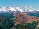
![Iliamna [Ninilchik, 131 ft]](https://www.avo.alaska.edu/ashcam-api/images/iliamna_nnl/2025/96/iliamna_nnl-20250407T144600Z.jpg)

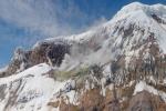
![Iliamna [IVE, 3976 ft]](https://www.avo.alaska.edu/ashcam-api/images/iliamna_ive/2025/96/iliamna_ive-20250407T040100Z.jpg)


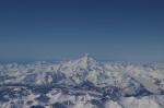
![Iliamna [ILCB, 2336 ft]](https://www.avo.alaska.edu/ashcam-api/images/iliamna_ilcb/2025/96/iliamna_ilcb-20250407T040000Z.jpg)


