Iliamna

MarkerMarkerMarkerMarkerMarkerMarkerMarkerMarkerMarkerMarkerMarkerMarkerMarkerMarkerMarkerMarkerMarkerMarkerMarkerMarkerMarkerMarkerMarkerMarkerMarkerMarkerMarkerMarkerMarkerMarkerMarkerMarkerMarkerMarkerMarkerMarkerMarkerMarkerMarkerMarkerMarkerMarkerMarkerMarkerMarkerMarkerMarkerMarkerMarkerMarkerMarkerMarkerMarkerMarkerMarkerMarkerMarkerMarkerMarkerMarkerMarkerMarkerMarkerMarkerMarkerMarkerMarkerMarkerMarkerMarkerMarkerMarkerMarkerMarkerMarkerMarkerMarkerMarkerMarkerMarkerMarkerMarkerMarkerMarkerMarkerMarkerMarkerMarkerMarkerMarkerMarkerMarkerMarkerMarkerMarkerMarkerMarkerMarkerMarkerMarkerMarkerMarkerMarkerMarkerMarkerMarkerMarkerMarkerMarkerMarkerMarkerMarkerMarkerMarkerMarkerMarkerMarkerMarkerMarkerMarkerMarkerMarkerMarkerMarkerMarkerMarkerMarkerMarkerMarkerMarkerMarkerMarkerMarkerMarkerMarkerMarkerMarkerMarkerMarkerMarkerMarkerMarkerMarkerMarkerMarkerMarkerMarkerMarkerMarkerMarkerMarkerMarkerMarkerMarkerMarkerMarkerMarkerMarkerMarkerMarkerMarkerMarkerMarkerMarkerMarkerMarkerMarkerMarkerMarkerMarkerMarkerMarkerMarkerMarkerMarkerMarkerMarkerMarkerMarkerMarkerMarkerMarkerMarkerMarkerMarkerMarkerMarkerMarkerMarkerMarkerMarkerMarkerMarkerMarkerMarkerMarkerMarkerMarkerMarkerMarkerMarkerMarkerMarkerMarkerMarkerMarkerMarkerMarkerMarkerMarkerMarkerMarker
Legend
Red (Warning)
Orange (Watch)
Yellow (Advisory)
Green (Normal)
Uninstrumented
Community
Webcam
Instrument
Earthquake Magnitude
0 7+
Earthquake Age
Last 2 Hours
Last 2 Days
Last 1 Week


Facts


  • Official Name: Iliamna Volcano
  • Seismically Monitored: Yes
  • Color Code: GREEN
  • Alert Level: NORMAL
  • Elevation: 3053m (10016ft)
  • Latitude: 60.0319
  • Longitude: -153.0918
  • Smithsonian VNum: 313020
  • Pronunciation:
  • Nearby Towns:
    • Pedro Bay 39 mi (63 km) SW
    • Port Alsworth 44 mi (70 km) NW
    • Anchor Point 47 mi (76 km) SE
    • Happy Valley 47 mi (76 km) SE
    • Ninilchik 49 mi (79 km) NE

    Distance from Anchorage: 136 mi (218 km)

  • Subfeatures:
    • Johnson Glacier
    • South Twin

Description

From Miller and others (1998) [1] : "Iliamna volcano is a broad, deeply dissected and highly altered, roughly cone-shaped mountain at the north end of a 5-km-long ridge trending N10W. Most of the volcano is covered by perennial snow and ice and numerous glaciers radiate from the summit area. Large avalanche deposits occur on the flanks of the volcano, particularly down the Umbrella Glacier on the southwest side of the volcano.
"The volcano is a typical composite stratovolcano composed of interbedded andesite lava flows and pyroclastic rocks. Steep, inaccessible 600-m-high headwalls along the southern and eastern flanks extend nearly to the summit exposing a cross section of the volcanic stratigraphy.
"Iliamna is built on a basement of Jurassic granitic rocks of the Aleutian Range batholith [2] that are juxtaposed against older, Lower Jurassic lava flows and pyroclastic rocks by the Bruin Bay fault, which lies several kilometers east of the summit."

Name Origin

Iliamna Volcano's name was first published by the Russians as "S[opka] Ilymna" (Tebenkov, 1852). This appears to be the volcano called "Volcan de Miranda" by the 1779 Don Ignacio Arteaga expedition, which was probably named in honor of Fernando Bernardo de Quiros y Miranda, the second officer of the vessel La Princesa. The nearby Iliamna Lake, according to G.C. Martin, gets its name from the name of a "mythical great blackfish, supposed to inhabit this lake, which bites holes in the bidarkas of bad natives" (Orth, 1971).


References Cited

[1] Catalog of the historically active volcanoes of Alaska, 1998

Miller, T. P., McGimsey, R. G., Richter, D. H., Riehle, J. R., Nye, C. J., Yount, M. E., and Dumoulin, J. A., 1998, Catalog of the historically active volcanoes of Alaska: U.S. Geological Survey Open-File Report 98-0582, 104 p.

[2] Geology of Iniskin-Tuxedni region, Alaska, 1966

Detterman, R. L., and Hartsock, J. K., 1966, Geology of Iniskin-Tuxedni region, Alaska: U.S. Geological Survey Professional Paper PP 0512, 78 p., 6 sheets, scale 1:63,360, 1:96,000, 1:1,000,000.
full-text PDF 4.6 MB
plate 1 PDF 15 MB
plate 2 PDF 1.7 MB
plate 3 PDF 2.5 MB
plate 4 PDF 376 KB
plate 5 PDF 606 KB
plate 6 PDF 192 KB

Current Activity

No new updates for Iliamna volcano since June 9, 2023, 11:53 am.

Webcams

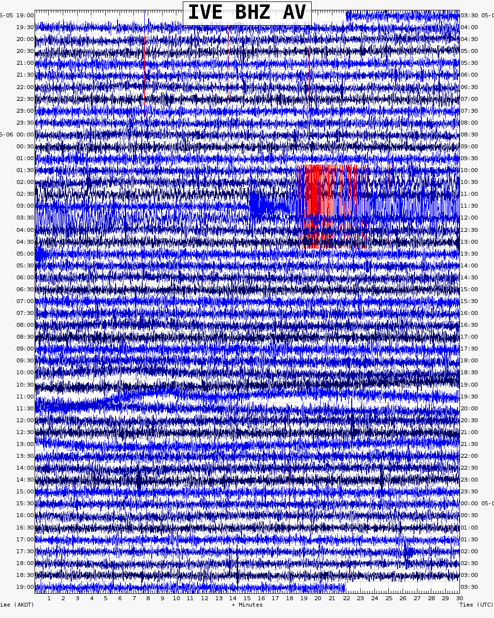
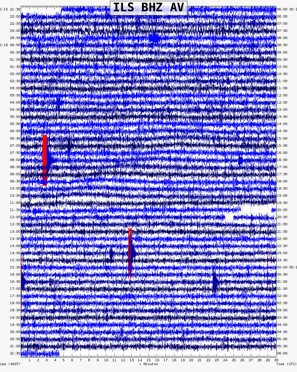
Webicorder

Color Code Timeline

Reported Activity

Modern Eruptions

Spurr

Spurr Eruption Timeline

Crater Peak 1953/7

July 9, 1953 — July 16, 1953

Initial newspaper accounts of this eruption exclaim "City blacked out by 3 volcanoes!" in large bold type, but in reality, only one volcano, Mt. Spurr, was actually erupting. "Mt. Torbert," as well as the third "unnamed volcano" are not volcanic, and were not erupting. Precursory activity to this eruption may have been observed in mid-May, 1953, when Northern Consolidated Airline pilots reported increased steaming from the summit of Spurr (Unknown, 1953; Fairbanks News-Miner, May 21, 1953).
From Waythomas and Nye (2002): "The first known historical eruption of Crater Peak occurred at about 5 a.m. on July 9, 1953 (Juhle and Coulter, 1955; Miller and others, 1998). For at least 30 years prior to the 1953 eruption, plumes of whitish steam commonly were observed rising from the summit of Crater Peak;" [Note: Although Waythomas and Nye report steaming from Crater Peak, newspaper accounts and pilot observations of the area state that the steaming came from the summit of Spurr.] Waythomas and Nye continue: "pilots reported an increase in the vigor of steaming in late spring 1953 (Juhle and Coulter, 1955). At the time of the 1953 eruption, instruments to monitor the seismic activity were not available. The 1953 eruption was a single explosive burst lasting about one hour, and it generated an ash cloud that rose more than 10,000 meters above sea level (Juhle and Coulter, 1955). Ash fall occurred east of the volcano [see fig. 6 in original text] and approximately 6 millimeters of ash accumulated in Anchorage. A light dusting of ash was reported as far away as Valdez and as close as 48 km to Cordova (Juhle and Coulter, 1955). Pyroclastic flows mixed with snow and ice high on the crater rim and combined with heavy rainfall to produce lahars that inundated tributaries to the Chakachatna River on the south flank of Crater Peak. The lahars flowed into the Chakachatna River and formed a substantial debris dam across the river (Juhle and Coulter, 1955; Meyer and Trabant, 1995)."
Wilcox (1959) gives detailed eruption descriptions: "On July 10 at 5:00 am the vent was only steaming. At 3:30 pm an especially strong surge of ash-laden steam rose to 20,000 feet." Juhle and Coulter (1955) state that the eruption continued with steam and small bursts of ash from July 11 to July 16, 1953.
Ash began to fall in Anchorage at about noon on July 9, 1953, and darkened the sky from 1 p.m. until about 3 p.m. (Wilcox, 1953; Juhle and Coulter, 1955; Wilcox, 1959). This ashfall was disruptive to traffic at Elmendorf Air Force Base and Anchorage International Airport. Three jet aircraft that were sent to investigate the ash plume returned with sandblasted wing leading edges, windshields, side panels, and front portions of their canopies. Elmendorf Air Force Base was closed to air traffic from July 9 -17 due to the eruption (Kienle, 1994). See Wilcox (1959) for detailed pilot descriptions of the ash cloud.

Loading

Spurr 1965/1

January 31, 1965 — February 2, 1965

On January 31, 1965 an Elmendorf Air Force Base pilot reported hot ashes in the crater and said the crater appeared to be greenish in color (Anchorage Daily Times, unknown author, 1965). On February 2 a Northern Consolidation pilot reported seeing smoke and steam clouds (Associated Press, 1965). This activity may not constitute an eruption.

Crater Peak 1992/6

June 27, 1992 — July 8, 1992

For 220 pages of information on the three 1992 eruptions of Crater Peak, please see the USGS Bulletin 2139, available online at: www.avo.alaska.edu/pdfs/B2139.… ; this file is 9 MB.
From McGimsey and others (1995): "On June 27, after 39 years of quiescence, the Crater Peak vent on Spurr volcano began the first of 3 eruptions (June 27, August 18, and September 16-17) in 1992 (Alaska Volcano Observatory, 1993; Eichelberger and others, 1995). The eruption was preceded by 10 months of gradually increasing seismicity that culminated in 19 hours of precursory volcanic tremor. Upwellings in the crater lake and a color change from green to gray were observed three weeks prior to eruption onset. In response to increasing seismicity and changes in the crater lake, AVO issued an alert on June 8 and observatory scientists briefed local officials on June 17 about potential volcanic activity."
From Eichelberger and others (2005): "Seismic behavior changed ominously on June 24 when a tremor episode lasted 154 minutes, followed 12 hours later by a similar episode that lasted 142 minutes. Eight additional tremor bursts occurred within the next 8 hours. The weekly update of 10:30 a.m. Alaska daylight time (ADT) on June 26 reported 'well above normal' seismic activity but still cautioned that an eruption might not be imminent in view of an absence of long-period (LP) earthquakes. At about the same time, aerial observations of the crater revealed that the lake had almost completely drained and that several large rocks had impacted the resulting mud flat. At 12:04 p.m. ADT, tremor that was continuous and stronger than earlier bursts began. AVO formally issued a warning of level of concern color code Yellow at 4:30 p.m. on ADT and went on 24-hour duty. At 3:00 a.m. ADT on June 27, a swarm of VT (volcano-tectonic) earthquakes struck at 0- to 2-km depths beneath Crater Peak; their rate soon increased to about one every 2 minutes. Three LP events accompanied this swarm. Tremor amplitude abruptly doubled at 7:04 a.m. ADT. This increase in amplitude was later interpreted to represent the onset of eruption, although weather clouds prevented visual verification. At 7:16 a.m. ADT, AVO began an emergency calldown announcing level of concern color code Orange. About the same time, telemetry was lost from the seismic station 400 m from the vent and an Alaska Airlines pilot reported that an eruption plume had risen 5,000 m above the cloud cover. AVO announced color code Red at 9:10 a.m. ADT. Tremor amplitude gradually increased, peaking between 9:35 a.m. and 10:25 a.m. ADT and registering on stations more than 100 km away. Pilots estimated the plume at mid-morning as high as 9,000 m and the National Weather Service (NWS) measured a maximum plume height of 14,500 m with C-band radar (Alaska Volcano Observatory, 1993; Rose and others, this volume [USGS Bulletin 2139]). The tephra cloud moved northward and ash began falling on Denali National Park at 10:30 a.m. ADT. Debris flows swept southward down narrow drainages and entered the Chakachatna River in three places. Most debris followed the course of the 1953 lahar. At about 11:30 a.m. ADT, seismicity decreased abruptly and the eruption was over. Weather and steam obscured Crater Peak and the eruption plume track from aerial observation on the afternoon of June 27, but paths of the debris flows were visible on the lower flanks of the volcano (Meyer and Trabant, this volume [USGS Bulletin 2139]).
"At 9:00 a.m. ADT on June 28, the level of concern was downgraded to Yellow. Aerial observation revealed a black northward-broadening swath of tephra on snow fields and glaciers. Ash thickness was about 1 to 2 mm at Denali National Park and Manley Hot Springs, 260 and 420 km north of Crater Peak (Neal and others, this volume [USGS Bulletin 2139]). This region is sparsely populated and there were no other reports of tephra there. The ash cloud continued northward to the Beaufort Sea, then it turned southeast into Canada and the coterminous United States, where it became indistinguishable from weather clouds about July 2.
"The level of concern color code was downgraded to Green on July 8. This was done partly on the basis of greatly reduced seismicity and SO2 emission, but also on the basis of analogy to the single-eruption pattern of 1953. The downgrading to color code Green proved to be premature." The next eruption was on August 18, 1992.
Eichelberger and others (1995) state that the June 27, 1992 eruption produced 44 million cubic meters of tephra, with a Dense Rock Equivalent (DRE) of 12 million cubic meters.

Loading

Crater Peak 1992/8

August 18, 1992

For 220 pages of information on the three 1992 eruptions of Crater Peak, please see the USGS Bulletin 2139, available online at: www.avo.alaska.edu/pdfs/B2139.… ; this file is 9 MB.
From Eichelberger and others (1995): "Following the June [June 27, 1992] eruption, seismicity remained low through the first half of August. Only one shallow and two deep earthquakes were recorded between August 12 and 17. Because the closest operational seismic station at that time was 5 km from the vent, several attempts were made to reestablish a seismic station on the crater rim. These were unsuccessful because of poor weather conditions. At 3:37 p.m. ADT on August 18, a 16-minute episode of weak tremor and several LP [long-period] events began, but these rather obscure events were not identified until post-eruption analysis of the data. At 3:48 p.m. ADT, a pilot reported an ash-rich plume. With confirmation of this plume at 4:25 p.m., AVO began a calldown announcing level of concern color code Yellow. The main eruption began at 4:42 p.m. ADT, when strong tremor was recorded by all Mount Spurr seismic stations. AVO began a calldown announcing color code Orange at 4:47 p.m. ADT, but repeated the calldown process 11 minutes later to raise the color code to Red. By 4:58 p.m. ADT, a subplinian column had risen through low clouds to a height of 11,000 m, and it ultimately reached nearly 14,000 m. From an aircraft only 2.5 km away, AVO staff observed and videotaped a dark roiling cloud that was periodically surrounded by lenticular shock waves. Large bombs were thrown 800 m above the vent. Small-volume pyroclastic flows of breadcrusted blocks descended the east and southeast flanks of Crater Peak; these flows formed coarse, clast-supported lobate deposits with steep-fronted margins. Other flows mixed with snow and ice high on the cone and became lahars. A late fusillade of mostly lithic ballistic projectiles, some as large as 1 m, were hurled as far as 10 km southeastward (Waitt and others, this volume [USGS Bulletin 2139]). More than 170 lightning strikes were detected by the AVO lightning detection system (LDS) during the second half of the eruption (Paskievitch and others, this volume [USGS Bulletin 2139]). The eruption ended at 8:10 p.m. ADT.
"Upper level winds moved the eruption plume east-southeast directly over Anchorage, where it deposited as much as 3 mm of sand-sized ash (Neal and others, this volume [USGS Bulletin 2139]). A satellite image 44 minutes after the onset of the eruption shows the plume extending 80 km east from the volcano over an area of 20,000 square km. Three hours after onset of eruption, the leading edge of the plume was 300 km southeast of Mount Spurr, and its area had grown to 21,000 square km.
"Ashfall forced the closing of Anchorage International Airport for 20 hours (N.W. Gibson, Anchorage International Airport, written commun., 1993). Air quality alerts were issued in Anchorage during the fallout period and also on the following day, as vehicle traffic stirred up ash again (R.B. Stewart, Office of Emergency Management, Municipality of Anchorage, written commun., 1993). Reworked windblown ash continued to reduce air quality until the first snow of autumn, and then it reappeared during the summer of 1993."
Eichelberger and others (1995) state that this eruption produced 52 million cubic m of tephra (14 million cubic m Dense Rock Equivalent).

Loading

Crater Peak 1992/9

September 16, 1992 — September 17, 1992

For 220 pages of information on the three 1992 eruptions of Crater Peak, please see the USGS Bulletin 2139, available online at: www.avo.alaska.edu/pdfs/B2139.… ; this file is 9 MB.
From Eichelberger and others (1995): "Following the August eruption, deep seismicity gradually increased, and by mid-September it had returned to levels comparable to mid-June. AVO teams visiting the crater on September 7 and 16 noted nothing unusual. At about 7:30 p.m. ADT on September 16, however, discrete seismic events and weak tremor were detected by the newly reinstalled crater rim station. Tremor amplitude increased at 10:25 p.m. ADT, and at 10:33 p.m. ADT, AVO declared concern color code Red and began the emergency calldown. An eruption began at 10:36 p.m. ADT that lasted 11 minutes. Incandescence was recorded on the video camera at AVO-Anchorage and on the telemetered slow-scan television camera at Kasilof, 120 km southeast of Crater Peak just south of Kenai on the Kenai Peninsula. Weak tremor through the next hour foreshadowed the main phase of the eruption, which began at 12:03 a.m. ADT on September 17. Intermittent bright incandescence could be seen from Anchorage.
"The September 17 eruption lasted 3.6 hours. Pyroclastic flows swept down the south-southeast and southeast flanks of Crater Peak and mixed with snow and ice to become lahars. These flows were similar in appearance to pyroclastic flows, but they were cool and water saturated hours after emplacement. Tephra fallout on the Kidazgeni Glacier generated a debris flow that temporarily dammed the Chakachatna River. Once again, a narrow ballistic field extended at least 10 km from the vent along the south margin of the tephra plume. The eruption closed with a strong swarm of about 50 VT [volcano-tectonic] shocks between 5 and 10 km in depth, which may reflect readjustment of the conduit after magma withdrawal.
"The plume moved eastward, dusted the north edge of Anchorage and deposited about 1.5 mm of ash in Palmer, Wasilla, and nearby communities in the Matanuska-Susitna Valley north of Anchorage. Very light ashfall was reported in the town of Glenallen, 350 km east of Crater Peak."
Eichelberger and others (1995) state that this eruption produced 56 million cubic m of tephra (15 million m Dense Rock Equivalent).

Loading

Spurr 2004/7

July 2004 — February 2006

For a complete report of the unrest at Spurr between 2004 and 2006, please see Coombs and others (2006), available online at pubs.usgs.gov/pp/pp1732/pp1732….
From Neal and others (2005): "In early July 2004, AVO seismologists noted an increase in volcano-tectonic and long-period earthquake activity beneath the summit of Mount Spurr Volcano (Power, 2004; Power and others, 2004). About the same time, AVO was contacted by a long-time Alaskan pilot who flew near the volcano on July 11 and saw a small steam plume from the approximate 5,500 foot level of the east side of Crater Peak. She also reported an unusual sulfur dioxide odor. Based on this pilot report and the increase in seismicity, AVO launched a fixed-wing observation flight on July 15. Clouds prevented a view of the summit of Spurr, but Crater Peak and the lower south and east flanks of the Spurr summit dome were clear. Crater Peak appeared unchanged from previous views following the 1992 eruption and nothing unusual was noted along any of the glacier margins or termini around Crater Peak. The east flank of the Spurr summit dome, however, was marked by as many as a dozen dark debris flow lobes that emanated primarily from point-sources within the glacial cover [see fig. 5 in original text] (McGimsey and others, 2004).
"Increased daily counts of shallow (5-10 km or 3-6 mi below sea level) earthquake activity combined with observations of debris flows from the summit prompted concern about the possibility of volcanic unrest at Spurr. On Monday July 26, AVO elevated the Level of Concern Color Code to YELLOW. A second AVO overflight on August 2 revealed a circular depression in the Spurr summit ice cap, approximately 50-60 m (165-200 ft) in diameter and 25 m (82 ft) deep [see figs. 6A and B in original text]. The pit contained an ice-encrusted pond with small areas of open water that were distinctly blue-gray in color [see fig. 6C in original text]. This feature became known as the 'ice-cauldron' following usage of the term at ice-covered Icelandic volcanoes.
"From early August though early December, the summit ice-cauldron gradually enlarged as blocks of ice ringing the depression sagged and then collapsed into the pit [see figs. 6A, B in original text]. Careful measurements from images taken on August 10 and October 30 indicate that the pit enlarged from about 65 x 95 m (210 x 310 ft) across to 130 x 130 m (430 ft x 430 ft) across in two months' time (M. Coombs, written commun., 2004). Overflights throughout the late summer and fall documented the changing size of the feature, continuing deformation and collapse of surrounding ice walls, and the variability of open water on the surface of the lake. The lake remained a dark battleship gray color, and circular ice-free zones perhaps 5-10 m (16 x 33 ft) across occurred near bedrock lake shoreline and at several points further from the shore [see fig. 6C in original text]. By early December, the areas of exposed bedrock near the bottom of the cauldron had grown and were occasionally observed steaming. Yellow-tinted snow, ice, and rock outcrops in the vicinity of the lake reflected sulfur deposition near the lake margin.
"AVO staff conducted several airborne Forward Looking Infrared Radiometer (FLIR) measurements using both a hand held and helicopter-mounted camera and video system. FLIR data confirmed the presence of at least two prominent areas of warm bedrock -- with temperatures as high as ~39o C or 102o F -- on the margins of the lake [see fig. 7A in original text] and on the outer flanks of the summit dome. Lake surface temperatures as measured by FLIR ranged from -10o to 0o C (14o to 32o F) for areas of floating ice and snow debris as well as open water [see fig. 7B in original text].
"AVO also gathered an extensive library of satellite imagery of the Spurr edifice and increased satellite analysis frequency using the standard AVO monitoring imagery (Geostationary Operational Environmental Satellites [GOES], Advanced Very High Resolution Radiometer [AVHRR]) and higher resolution imagery (Advanced Spaceborne Thermal Emission and Reflection Radiometer [ASTER], Moderate Resolution Imaging Spectroradiometer [MODIS]). ASTER imagery showed the first signs of a summit thermal anomaly in nighttime thermal infrared data on August 17, 2004; as the summit lake grew in size, the intensity of the ASTER thermal infrared anomaly increased (R. Wessels, oral commun., 2005).
"Five fixed-wing gas measurement flights of the Mount Spurr plume were conducted between early August and the end of October. Emission-rate measurements of SO2, H2S, and CO2 gas were made during each of these flights following protocols developed by the USGS (Gerlach and others, 1997; Gerlach and others, 1999; McGee and others, 2001 -- see original paper for complete references). Preliminary results show that CO2 degassing from the summit of Mount Spurr increased from 600 tonnes/day (t/d) in August to 1,300 t/d in September and finally to 1,400 t/d in October. At Crater Peak, CO2 emission rates were 160 t/d, 1,000 t/d and 120 t/d for the same measurement periods. Very small amounts of H2S (=3 t/d) were consistently measured on all of the flights at both degassing locations while no SO2 was detected at all.
"Crater Peak has consistently degassed a small amount of CO2 since 1994 that, except for an anomalously higher value in 1997, is typically <200 t/d (Doukas, 1995; M. Doukas, pers. commun., 2004). Carbon dioxide degassing from the summit of Mount Spurr had previously not been detected, although airborne measurements directed specifically at the summit have been rare. The absence of SO2 throughout this period is likely caused by the extremely wet environment at this glacier-clad volcano, where abundant groundwater dissolves SO2 (Doukas and Gerlach, 1995). This scrubbing process would also be greatly enhanced by the presence of the lake at the summit, and the distinctive battleship gray color of this lake might be partly due to dissolved sulfur compounds. The low but positive values for H2S can reflect the release of H2S from a boiling hydrothermal system (Symonds and others, 2001 -- see original text for full citation). This is consistent with historical reports of pressurized fumaroles described by climbers in the summit region and the presence of diffuse boiling-point fumaroles on outcrops of bedrock on the east side of the Mount Spurr summit dome (Turner and Wescott, 1986; C.J. Nye written commun., 2004).
"Seismicity at Mount Spurr remained consistently above the pre-July 2004 background level for the remainder of the year, although daily rates of seismicity varied considerably from several to several tens of volcano-tectonic (VT) events per day. The largest tally of identifiable earthquakes in one day was 80 on October 26. Particularly energetic swarms of VT earthquakes located within 20 km (12 mi) of Mount Spurr occurred on October 26 (6.6 earthquakes per hour), November 4 (5.8 earthquakes per hour), August 14 (2.6 earthquakes per hour), and August 21 (1.8 earthquakes per hour). Throughout the unrest in 2004, VT seismicity was concentrated within 5 km (3 mi) of the Mount Spurr summit, in stark contrast to the pre-1992 seismicity (Power, 2004; Power and others, 2004). Located long-period (LP) events occurred at an average depth of approximately 7 km (4 mi) and at variable rates, peaking in November. Deep earthquakes (> 20 km or 12 mi) were located beneath and south of Crater Peak in the same area as the deep seismicity associated with the end of the 1992 eruption of Crater Peak.
"Although no eruptive activity ensued in 2004, AVO did experience an eruption response drill. A pilot report of possible ash from Mount Spurr on August 12, followed by a public ash fall advisory issued by the NWS, prompted a daylong flurry of calls, inquiries, and media attention. AVO issued a special Information Release stating that no eruption had occurred. This event— certainly not the first or last of its kind in AVO history—underscored the level of public concern regarding the situation at Mount Spurr and likely reflected a fresh memory of ash fall in 1992. The drill also facilitated review and improvement of communication protocols between AVO and its partner in ash warnings, the National Weather Service.
"How unusual is this drastic change in the summit morphology at Mount Spurr? To our knowledge, this is the first documented episode of significant geothermal heating and generation of a substantial lake at the summit, as well as the first known occurrence of watery debris flows from the summit. Historical reports and aerial photographs from the 1950s, 60's and 70's, however, document significant variability in the snow and ice cover at the Mount Spurr summit. During periods of lower-snow levels, a crater-like structure becomes visible. This feature was described in March and others (1997) as a ~200 to 300 m (650-1,000 ft) diameter feature open to the east-northeast. In this same 1957 aerial photograph, a steep-walled, snow and ice pit, 20-30 m (65-100 ft) wide, is located in the ice cap near the base of the north summit crater wall. No open water can be seen in the bottom of the pit, however, several dark patches occur and could possibly represent warm bedrock.
"AVO interprets this 2004 period of elevated seismicity and heat flux, summit melting, debris flow generation, and magmatic gas emission from both Spurr and Crater Peak to be the result of new injection of magma to a shallow level beneath the Spurr edifice (Power, 2004; Power and others, 2004). Magmatic gas flux from both Crater Peak and Mount Spurr suggests an open connection to the surface from the zone of intrusion or magma storage along two conduits. An alternative interpretation invokes release of volatiles from the still-cooling intrusions from the 1992 eruption series (Power and others, 1998; 2002).
"Mount Spurr remained at Level of Concern Color Code YELLOW through the end of the year. Nearly all information release statements, weekly summaries, and daily status reports emphasized that despite the departure from background activity at Spurr, there were no signs of imminent eruptive activity. As part of this response, AVO mounted a number of observation flights, gas measurement and FLIR imaging flights, increased the frequency of satellite analysis, and installed six new seismometers and 3 permanent, continuous GPS receivers to improve seismic monitoring and track deformation of the volcanic edifice. On October 8, AVO announced the public availability of Internet web camera images of Mount Spurr on the AVO web site (www.avo.alaska.edu).
"AVO issued three Information Releases on Mount Spurr activity in 2004 in addition to summarizing the Spurr situation in standard weekly updates on all Alaskan volcanoes. A number of articles appeared in the Anchorage Daily News (Anchorage Daily News 2004). In response to the YELLOW Level of Concern Color Code declaration, NWS issued a one-time Volcanic Ash Advisory (VAAS) and the FAA issued a Notice to Airmen (NOTAM) on July 26. The NOTAM was cancelled on November 9 (NOTAM 4/2284; B. Brown, FAA, pers. commun., 2005)."
From McGimsey and others (2007): "During 2005, elevated seismicity continued beneath Mt. Spurr, and the summit ice-collapse pit enlarged - becoming a large cauldron - as heat was supplied to the summit area. The lake changed in size, and the amount of ice debris on the lake varied. Lake level declined in May, seemingly associated with the generation of a small debris flow on the upper southeast flank. With the decline in water level, subaqueous fumaroles emerged and the area of hot, steaming wall rock increased. Temperatures of the warm zones measured with Forward-Looking Infrared Radiometer (FLIR) increased somewhat over the year. Emissions of CO2 and SO2 decreased. The Level of Concern Color Code for Mount Spurr remained at Yellow for all of 2005 (see table 6 in original text)."
Neal and others (2009) report that the"Level of Concern Color Code for Mount Spurr at the beginning of 2006 was YELLOW due to continued above-background seismicity, magmatic degassing, and the presence of an open, warm lake within a 300-m-diameter (980 ft) rock- and ice-walled cauldron atop the summit cone. Following months of no significant change in activity, AVO downgraded the Level of Concern from YELLOW to GREEN on February 21 [2006]. The information release cited a steady decrease in shallow seismicity between April and June 2005, after which earthquake activity remained slightly elevated above background levels through the remainder of 2005 and into 2006. By May 2006, seismicity at Mount Spurr ahd returned to background levels and remained there with few exceptions through the end of 2006. Intermittent observations permitted sporadic documentation of ongoing changes in the summit area as the geothermal activity continued to disrupt the ice field around the summit cone [see table 5 in original text]."

Loading

Spurr 2012/6

June 25, 2012

From Herrick and others (2014): "In January [2012], the number of located earthquakes beneath Mount Spurr increased over background. By January 30, the rate of small events was 1-3 events per hour, increasing to 2-4 events per hour on January 31. Seismicity remained slightly elevated into early February (up to 2-6 events per hour) but abated by February 12. AVO seismologists attributed the swarm to deformation within glaciers covering the edifice triggered by unseasonably warm weather. Several deep, low frequency events also occurred in February and March, but this was not considered a significant departure from background.
"On May 15, a pilot familiar with the volcano reported sulfur odors, likely hydrogen sulfide, during an overflight of the Mount Spurr area. He noted typical fumarolic activity on the summit cone, describing white plumes rising vertically in calm wind conditions. Some yellow-tinged (sulfur) snow was visible, but otherwise, the pilot reported no significant changes in the summit region. Snow continued to slowly infill the southern portion of the 2004 summit melt cauldron (Coombs and others, 2006) compared to previous views. An airborne gas measurement flight to Mount Spurr on June 22 took advantage of clear conditions to photograph the summit area. White vapor plumes rose from the long-lived fumarolic vents within the summit crater. Sulfur-dioxide (SO2) flux was low, but flying conditions were difficult and the aircraft may have been unable to travel completely below the plume (C. Werner, USGS, written commun., 2012).
"On June 25, a glacial outburst flood was recorded on seismograph station CKN located downstream of the Kidazgeni Glacier that flows from the Mount Spurr summit icefield and around the eastern flank of Crater Peak. Based on the duration of seismicity, the event lasted at least 45 minutes. Later observations indicated that water had escaped from beneath the Kidazgeni Glacier, flowing downstream and into the Chakachatna River that drains into Cook Inlet. By June 27, seismicity related to the outburst flood at ended. The seismic record of this event was similar to that observed during another Kidazgeni outburst flood in 1993 (Nye and others, 1995).
"On October 17, a pilot contacted AVO to report visible vapor emissions from the summit area of Mount Spurr. After AVO staff reviewed avialable satellite images, the local web camera, and seismic data, it was determined that no significant change had occurred. Slightly elevated surface temperatures were detected at Mount Spurr in satellite images on October 18 and 23, however, they were not considered significant departures from background."

Spurr 2014/6

June 2014 — October 2014

From Cameron and others, 2017: "A swarm of low-frequency earthquakes began in early June, following a M3.8 earthquake 13 km (8 mi) west of Mount Spurr. A total of 300 earthquakes were located in this swarm, which ended in mid-October. A swarm in the same area occurred in late 2012. The cause of the swarm remains undetermined. In 2004, seismicity, surface heat flux, and gas emissions suggested a magmatic intrusion (Power, 2004; Neal and others, 2005; Coombs and others, 2006).
"At 20:20 UTC (11:20 a.m. AKDT) on September 10, the Spurr seismograph network recorded a signal interpreted by AVO seismologists as a glacial outburst flood. The flow appears as a single event lasting about 20 minutes. Similar events, but of longer duration, have been recorded at Mount Spurr on several occasions, most recently in 2012 (Herrick and others, 2014). AVO was unable to visually confirm the inferred outburst event."

Loading

Spurr 2015/7

June 2015 — 2017

From Dixon and others, 2017: "No volcanic activity was reported at Mount Spurr in 2015; the only activity noted was an earthquake swarm 12 km (6.5 mi) north of the summit. First noted in the AVO internal logs in mid-October, earthquakes in this area occurred sporadically for the previous 5 months with the rate increasing from 1-2 per week in July to several per day in October. The swarm peaked in November, with 47 earthquakes during the month. The rate of located earthquakes decreased by one-half in December and the swarm continued into 2016 at a much-reduced level of activity. The earthquakes in this cluster were shallow with 90 percent occurring between 3 and 5 km (1.6 to 2.7 mi) below sea level. The Aviation Color Code and Volcano Alert Level remained at GREEN/NORMAL through the year at Spurr."
In 2016, there were four distinct clusters of seismicity at Spurr: "the typical Mount Spurr summit earthquakes that occurred throughout the year, earthquakes near Pothole Glacier (west of Mount Spurr) in late summer, an ongoing swarm of low-frequency earthquakes 10–15 km (6–9 mi) north of the summit (north Spurr earthquakes in fig. 5), and a cluster of earthquakes located 5 km (about 3 mi) east of the summit in May (east Spurr earthquakes in fig. 5). In addition to these areas of high activity, there are three, less-distinct zones of activity. These zones are 10 km (6.2 mi) south, 5 km (3 mi) west, and 20–30 km (12–18.5 mi) northeast of Mount Spurr and are in the area of the 1996 Strandline earthquake (Kilgore and others, 2011). The Aviation Color Code and Volcano Alert Level remained at GREEN and NORMAL, respectively, throughout the year for Spurr." (Cameron and others, 2020).
Dixon and others (2020) report the seismicity at Spurr continued into 2017, including the unusual earthquake sequence that began in 2015. "This cluster of low-frequency earthquakes (north Spurr earthquakes), was located 12 kilometers (km; 7 mi) north of Mount Spurr and continued to show activity throughout 2017. Although the character of the earthquakes is similar to glacial earthquakes, AVO has not determined a definite cause for this cluster of seismicity. The other four clusters (Mount Spurr summit, south Spurr, west Spurr, and the Strandline Lake earthquakes) are typical seismicity seen year-round in the vicinity of Mount Spurr (fig 2). An April 20 gas observation flight noted that the small plume emanating from the fumaroles in Spurr’s summit crater contained detectable quantities of SO2, H2S, and HCl. The Aviation Color Code and Volcano Alert Level remained at GREEN and NORMAL throughout the year at Mount Spurr."

Loading

Spurr non-eruptive activity 2018

June 6, 2018 — June 9, 2018

From Cameron and others, 2018: "From June 6 to 9, 2018, AVO noted a sequence of seismic events on seismograph station STLK, located about 31 km [20 miles] east of Mount Spurr near Strandline Lake. This sequence was interpreted as glacial movement in the Strandline Lake area, but its precise source could not be located because only one station recorded the seismicity. The activity began on June 6 at 17:07 UTC (09:07 AKDT) with a series of weak, low-frequency earthquakes that increased in rate for an hour, at which point a 9-minute tremor-like signal was recorded (fig. 2). Earthquakes resumed after the tremor, and although they took place at a lower event rate, they also produced the highest amplitudes of the sequence. Earthquakes decreased in amplitude considerably over the next 9 hours, but weak earthquakes continued until 15:35 UTC (07:35 AKDT) on June 9. About 950 earthquakes were detected in the entire sequence, with 90 taking place prior to the tremor. This sequence was similar to previously described seismicity produced by weather-related glacial movements (for example, Thelen and others, 2013; Allstadt and Malone, 2014), and the earthquakes likely reflected stick-slip movement of the glacier, with the tremor burst produced by a period of continuous motion. Changes in the character of the earthquakes, including increasing durations, through the sequence indicate the seismicity source was changing over time - either in location or source conditions."

From Orr and others, 2023: "On July 15, 2019, at 16:32 UTC (08:32 AKDT), a large ice and rock avalanche took place on the southeast flank of Mount Spurr. A retrospective analysis of satellite imagery indicated the starting zone of the avalanche was less than 1 km from the summit of the volcano. Clear satellite images of the flow deposit showed that it widened before splitting into two lobes that flowed around an elevated lateral moraine dividing the west and east branches of K’idazq’eni Glacier (March and others, 1997; Molnia, 2008). One lobe flowed down the west branch between the moraine and the Crater Peak cone, while the other traveled slightly farther down the east branch of the glacier. Satellite imagery indicated the ice and rock avalanche spanned an area of approximately 2.3×10^6 square meters (m2) [25,000,000 square feet]. Assuming an average deposit thickness of 0.5 m [1.6 feet] yields a volume of about 1.2×10^6 cubic meters (m3) [42,000,000 cubic feet].
"The ice and rock avalanche generated energetic seismic and acoustic signals, recorded both locally and regionally. High-frequency signals were detected on the local seismic network and long-period (LP) seismic signals were recorded more than 700 km [435 mi] away. Several local seismic stations also recorded approximately 10 minutes of precursory seismicity. Pre-avalanche seismicity has been previously documented at Iliamna Volcano (Caplan-Auerbach and Huggel, 2007). In addition to the recordings of seismic signals, an infrasound array in Dillingham, Alaska, detected acoustic waves from the event.
"During an overflight on August 27, AVO staff noted the terrain of the source area consisted of exposed 'slope-parallel lava, with rivulets of meltwater running on its surface.' They found no evidence of increased non-meteorological heating at the summit area (a phenomenon which can trigger ice and rock avalanches) and observed nothing unusual on the other flanks of the summit cone (M. Coombs, USGS, written commun., 2019). The July 15 avalanche took place in an area known for debris flows, as documented by Coombs and others (2006), but previous flows were smaller and more water-rich than the July 15 event. Mount Spurr remained at an Aviation Color Code and Volcano Alert Level of GREEN and NORMAL throughout 2019."

Loading

From Orr and others, 2024: "Although no eruptive activity or unrest took place at Mount Spurr in 2021, one notable ice and rock avalanche was large enough to be recorded by regional geophysical sensors. This mass movement signal was recorded on Mount Spurr’s local seismic network on April 7 at 05:22 AKDT (13:22 UTC). The event's seismic waveforms indicated that it had a duration of ~2 minutes. Acoustic waves were likewise detected at station SPCP (on Mount Spurr) and at KENI infrasound array (near the City of Kenai, Alaska); these waves also had a coherent signal duration of ~2 minutes. No clear satellite views were available for this event, precluding AVO from identifying a precise source or deposit area and estimating the avalanche volume. However, the peak period of the long-period (LP) seismic energy was ~15 seconds, indicating that the event was smaller than the widely recorded Mount Spurr ice and rock avalanche of July 15, 2019 (Orr and others, 2023)."

Spurr unrest 2024

October 16, 2024

On October 16, 2024, AVO raised the color code and alert level to YELLOW/ADVISORY, stating: "AVO has observed a gradual increase in volcanic unrest over a period of several months at Mount Spurr, located about 120 km (75 miles) west of Anchorage (avo.alaska.edu/image/view/1961…). GNSS receivers have detected sustained upward and outward ground deformation since March 2024. An increase in seismic activity has also been noted since April (avo.alaska.edu/image/view/1961…). Other indications of elevated activity include the development of a small lake in the summit crater in early summer of 2024.
"The largest magnitude earthquake detected in this current period of unrest is a M2.3 earthquake on October 6th. This increase in activity was described in detail in an Information Statement (avo.alaska.edu/news/hans/DOI-U…) that AVO released on October 9th. Analysis of seismic data indicates a subtle increase in the rate and size of earthquakes over the past few weeks. Because this is a notable departure from the normal background seismicity of the volcano, AVO is raising the Aviation Color Code to YELLOW and the Volcano Alert Level to ADVISORY. However, there are no indications that an eruption is imminent. Often this type of seismicity and ground deformation will decline without producing an eruption.
"AVO continues to closely monitor activity at Mount Spurr for signals that would indicate that the volcano is moving closer to an eruption. Based on previous eruptions, changes from current activity in the earthquakes, ground deformation, summit lake, and fumaroles would be expected if magma began to move closer to the surface. Therefore, it is very likely that if an eruption were to occur it would be preceded by additional signals that would allow advance warning. "
Over the following two weeks, there were more than 180 small earthquakes at Mount Spurr. Over the week of November 1st, there were also a few episodes of possible volcanic tremor, which might indicate deep fluid movement. No unusual activity or surface changes were observed in satellite data or webcam views. AVO staff visited on October 24th to conduct pre-winter maintenance on Spurr’s monitoring network and noted that the fumaroles (steam/gas vents) in Spurr summit’s crater were steaming.
Over the following weeks, earthquakes continued at varying rates, as is typical during periods of unrest. Steam was occasionally visible rising from Spurr’s summit during clear weather. On December 10, there was a M2.8 earthquake beneath the summit, and a few more episodes of tremor were recorded that week.
On Wednesday, December 18, AVO staff conducted a gas flight at Mount Spurr. Measurements of H2O, SO2, H2S, and CO2 were collected. Results were similar to the previous gas flight conducted on June 23, 2024. Personnel also took images and video during the flight that allowed accurate measurements of the crater lake that formed this year, showing that it has grown considerably since June despite the transition into winter. No activity was observed at Crater Peak.
As the new year turned, there were some notable periods of increased earthquake activity within the context of the larger unrest episode. The week of January 3, 2025, over 260 earthquakes were located, the largest being an M2.9 on January 2. Meanwhile, GPS data continued to show slow, steady inflation of the ground surface. Satellite radar data the week of January 10 showed that the crevasses in the summit crater were widening, demonstrating continued heat input to the area.
During late January, the monitoring network at Mount Spurr experienced some issues transmitting data back to AVO due to poor weather, not unusual for this time of year.
On January 31, AVO reported that over the past few weeks more of the ongoing earthquakes had clustered under Crater Peak, the vent that produced the 1953 and 1992 eruptions.
On February 6, AVO released an Information Statement detailing the activity since the color code change in October. The statement noted that over 2700 earthquakes had been detected to date during the period of unrest, which as of this date was ten months long. Movement of the ground surface near the area of Spurr was now about 2.4 inches total, as measured at the closest monitoring station to the mountain. Based on the earthquakes, deformation, growth of the lake in the Spurr summit crater, and low levels of volcanic gases measured, AVO rated the odds of no eruption and a future eruption at the Crater Peak vent as equally likely, with an eruption from Spurr summit less likely. However, additional signs of unrest would be expected in the lead up to an eruption.
On February 7, AVO staff visited the Spurr monitoring network to clear snow and ice from the instruments. They also collected additional volcanic gas measurements which showed no significant changes since the previous gas flight in December.
The remaining weeks of February followed the same general trends, with earthquake rates varying quite a bit while other signs of unrest-deformation and occasional steaming from the summit-remaining consistent. Fewer earthquakes were located close to Crater Peak.
On March 7 and March 11, AVO conducted flights to once again measure any volcanic gases emitted by Spurr. These flights, while consistent with one another, yielded considerably altered results from the previous flights. Elevated levels of sulfur dioxide and carbon dioxide were measured at Spurr summit, while very high levels of carbon dioxide were measured at Crater Peak. Staff also observed newly reactivated fumaroles within Crater Peak. These new changes led AVO to release an Information Statement on March 12 stating that likelihood of an eruption had increased and that AVO considered an eruption similar to 1953 and 1992 at Crater Peak to be the most likely outcome of the current unrest episode.
On March 17, AVO staff visited the Spurr monitoring network to conduct maintenance and clear the snow and ice from the CKT webcam.

Loading

Crater Peak 1953/7

Spurr 1965/1

Crater Peak 1992/6

Crater Peak 1992/8

Crater Peak 1992/9

Spurr 2004/7

Spurr 2012/6

Spurr 2014/6

Spurr 2015/7

Spurr non-eruptive activity 2018

Spurr non-eruptive activity 2019

Spurr non-eruptive activity 2021

Spurr unrest 2024

1770
1780
1790
1800
1810
1820
1830
1840
1850
1860
1870
1880
1890
1900
1910
1920
1930
1940
1950
1960
1970
1980
1990
2000
2010
2020
2030
2040
2050
2060
2070
2080
2090
2100
2110
2120
2130
2140
2150
2160
2170
2180
2190
1935
1936
1937
1938
1939
1941
1942
1943
1944
1945
1946
1947
1948
1949
1951
1952
1953
1954
1955
1956
1957
1958
1959
1961
1962
1963
1964
1965
1966
1967
1968
1969
1971
1972
1973
1974
1975
1976
1977
1978
1979
1981
1982
1983
1984
1985
1986
1987
1988
1989
1991
1992
1993
1994
1995
1996
1997
1998
1999
2001
2002
2003
2004
2005
2006
2007
2008
2009
2011
2012
2013
2014
2015
2016
2017
2018
2019
2021
2022
2023
2024
2025
2026
2027
2028
2029
2031
2032
2033
2034
2035
2036
2037
2038
2039
2041

37 Event Date(s)

Past Activity Legend:
Eruption
Questionable eruption
Non-eruptive activity


Showing 1 - 20 of 287

Map Images


Map References


Recently active volcanoes of Alaska, 2023

Cameron, C.E., Bull, K.F., and Macpherson, A.E., 2023, Recently active volcanoes of Alaska: Alaska Division of Geological & Geophysical Surveys Miscellaneous Publication 133 v. 6, 2 sheets. https://doi.org/10.14509/31086.

Airborne electromagnetic and magnetic survey data, Iliamna Volcano, Alaska, June 2012, 2020

Peterson, D.E., Finn, C.A., and Bedrosian, P.A., 2020, Airborne electromagnetic and magnetic survey data, Iliamna Volcano, Alaska, June 2012: U.S. Geological Survey data release, https://doi.org/10.5066/P949B5C2.

Historically active volcanoes of Alaska, v. 3, 2018

Cameron, C.E., Schaefer, J.R., and Mulliken, K.M., 2018, Historically active volcanoes of Alaska: Alaska Division of Geological & Geophysical Surveys Miscellaneous Publication 133 v. 3, 2 sheets. Http://doi.org/10.14509/30142

Historically active volcanoes of Alaska, 2014

Schaefer, J.R., Cameron, C.E., and Nye, C.J., 2014, Historically active volcanoes of Alaska: Alaska Division of Geological & Geophysical Surveys Miscellaneous Publication 133 v. 1.2, 1 sheet, scale 1:3,000,000. This publication has been superseded. Newest version available at http://www.dggs.alaska.gov/pubs/id/20181 .

Preliminary geologic map of the Cook Inlet Region, Alaska - including parts of the Talkeetna, Talkeetna Mountains, Tyonek, Lake Clark, Kenai, Seward, Iliamna, Seldovia, Mount Katmai, and Afognak 1:250,000-scale Quadrangles, 2009

Wilson, F.H., Hults, C.P., Schmoll, H.R., Haeussler, P.J., Schmidt, J.M., Yehle, L.A., and Labay, K.A., compilers; digital files prepared by Wilson, F.H., Hults, C.P., Labay, K.A., and Shew, Nora, 2009, Preliminary geologic map of the Cook Inlet Region, Alaska - including parts of the Talkeetna, Talkeetna Mountains, Tyonek, Lake Clark, Kenai, Seward, Iliamna, Seldovia, Mount Katmai, and Afognak 1:250,000-scale Quadrangles: U.S. Geological Survey Open-File Report 2009-1108, scale 1:250:000, available at http://pubs.usgs.gov/of/2009/1108/ .

Historically active volcanoes of the Aleutian Arc, 2002

Schaefer, Janet, and Nye, C. J., 2002, Historically active volcanoes of the Aleutian Arc: Alaska Division of Geological & Geophysical Surveys Miscellaneous Publication MP 0123, unpaged, 1 sheet, scale 1:3,000,000. Superceded by Miscellaneous Publication 133: http://www.dggs.dnr.state.ak.us/pubs/pubs?reqtype=citation&ID=20181

Preliminary volcano-hazard assessment for Iliamna Volcano, Alaska, 1999

Waythomas, C. F., and Miller, T. P., 1999, Preliminary volcano-hazard assessment for Iliamna Volcano, Alaska: U.S. Geological Survey Open-File Report 99-0373, 31 p., 1 sheet, scale unknown.
full-text PDF 2.84 MB

Volcanoes of Alaska, 1998

Nye, C. J., Queen, Katherine, and McCarthy, A. M., 1998, Volcanoes of Alaska: Alaska Division of Geological & Geophysical Surveys Information Circular IC 0038, unpaged, 1 sheet, scale 1:4,000,000, available at http://www.dggs.dnr.state.ak.us/pubs/pubs?reqtype=citation&ID=7043 .
Hard Copy held by AVO at FBKS - CEC shelf

Volcanoes of Alaska, 1995

Alaska Division of Geological & Geophysical Surveys, 1995, Volcanoes of Alaska: Alaska Division of Geological & Geophysical Surveys Information Circular IC 0038, unpaged, 1 sheet, scale 1:4,000,000.

Geothermal resources of the Aleutian Arc, 1993

Motyka, R. J., Liss, S. A., Nye, C. J., and Moorman, M. A., 1993, Geothermal resources of the Aleutian Arc: Alaska Division of Geological & Geophysical Surveys Professional Report PR 0114, 17 p., 4 sheets, scale 1:1,000,000.
Hard Copy held by AVO at FBKS - CEC shelf

Holocene volcanoes of the Aleutian Arc, Alaska, 1993

March, G. D., 1993, Holocene volcanoes of the Aleutian Arc, Alaska: Alaska Division of Geological & Geophysical Surveys Public-Data File PDF 93-85, unpaged, 1 sheet, scale 1:2,000,000.

Map showing distribution, composition, and age of Late Cenozoic volcanic centers in Alaska, 1986

Luedke, R. G., and Smith, R. L., 1986, Map showing distribution, composition, and age of Late Cenozoic volcanic centers in Alaska: U.S. Geological Survey Miscellaneous Investigations Series Map I 1091-F, unpaged, 3 sheets, scale 1:1,000,000.

Maps showing aeromagnetic survey and geologic interpretation of the Lake Clark quadrangle, Alaska, 1986

Case, J. E., 1986, Maps showing aeromagnetic survey and geologic interpretation of the Lake Clark quadrangle, Alaska: U.S. Geological Survey Miscellaneous Field Studies Map MF 1114-E, unpaged, 1 plate, scale 1:250,000.

Map showing interpretation of Landsat imagery of the Lake Clark quadrangle, Alaska, 1985

Steele, W. C., 1985, Map showing interpretation of Landsat imagery of the Lake Clark quadrangle, Alaska: U.S. Geological Survey Miscellaneous Field Studies Map MF 1114-F, unpaged, 1 plate, scale 1:250,000.

Iliamna volcano and its basement, 1955

Juhle, R. W., 1955, Iliamna volcano and its basement: U.S. Geological Survey Open-File Report 55-0077, 74 p., 2 plates, scale unknown.
Hard Copy held by AVO at FBKS - CEC file cabinet

Eruption of Trident Volcano, Katmai National Monument, Alaska, Feb.-June 1953, 1954

Snyder, G. L., 1954, Eruption of Trident Volcano, Katmai National Monument, Alaska, Feb.-June 1953: U.S. Geological Survey Circular C 0318, 7 p., 2 sheets, scale unknown.
Hard Copy held by AVO at FBKS - CEC file cabinet

Volcanic activity in the Aleutian Arc, 1950

Coats, R. R., 1950, Volcanic activity in the Aleutian Arc: U.S. Geological Survey Bulletin 0974-B, p. 35-49, 1 sheet, scale 1:5,000,000.
plate 1 PDF 819 KB
full-text PDF 783 KB
Hard Copy held by AVO at FBKS - CEC shelf

Geology of the vicinity of Tuxedni Bay, Cook Inlet, Alaska, 1922

Moffit, F. H., 1922, Geology of the vicinity of Tuxedni Bay, Cook Inlet, Alaska: U.S. Geological Survey Bulletin 0722-D, p. 141-147, 1 plate, scale unknown.
full-text PDF 482 KB

Reconnaissance of the gold fields of southern Alaska with some notes on general geology, 1898

Becker, G. F., 1898, Reconnaissance of the gold fields of southern Alaska with some notes on general geology: U.S. Geological Survey Annual Report 0018, p. 1-86, 6 sheets, scale unknown.
full-text PDF 1.5 MB
Hard Copy held by AVO at FBKS - CEC file cabinet

References

Tephra samples and analyses from Cook Inlet source volcanoes and Anchor Point, Alaska, 2024

Loewen, M.W., Wallace, Kristi, Coombs, M.L., and Mulliken, K.M., 2023, Tephra samples and analyses from Cook Inlet source volcanoes and Anchor Point, Alaska: Alaska Division of Geological & Geophysical Surveys Raw Data File 2023-25, 4 p. https://doi.org/10.14509/31090

2021 Volcanic activity in Alaska and the Commonwealth of the Northern Mariana Islands - Summary of events and response of the Alaska Volcano Observatory, 2024

Orr, T.R., Dietterich, H.R., Fee D., Girona, T., Grapenthin, R., Haney, M.M., Loewen, M.W., Lyons, J.J., Power, J.A., Schwaiger, H.F., Schneider, D.J., Tan, D., Toney, L., Wasser, V.K., and Waythomas, C.F., 2024, 2021 Volcanic activity in Alaska and the Commonwealth of the Northern Mariana Islands - Summary of events and response of the Alaska Volcano Observatory: U.S. Geological Survey Scientific Investigations Report 2024-5014, 64 p. https://doi.org/10.3133/sir20245014.
Full-text PDF 25.7 MB

Proximity to active volcanoes enhances glacier velocity, 2024

Mallalieu, J., Barr, I.D., Spagnolo, M., Mullan, D.J., Symeonakis, E., Edwards, B.R., and Martin, M.D., 2024, Proximity to active volcanoes enhances glacier velocity: Communications Earth & Environment v. 5, 679. https://doi.org/10.1038/s43247-024-01826-5
Full-text PDF 1.3 MB

Recently active volcanoes of Alaska, 2023

Cameron, C.E., Bull, K.F., and Macpherson, A.E., 2023, Recently active volcanoes of Alaska: Alaska Division of Geological & Geophysical Surveys Miscellaneous Publication 133 v. 6, 2 sheets. https://doi.org/10.14509/31086.

Characterization of geohazards via seismic and acoustic waves, 2023

Toney, L., 2023, Characterization of geohazards via seismic and acoustic waves: Fairbanks, A.K., University of Alaska Fairbanks, Ph.D. thesis, 139 p.

Weak degassing from remote Alaska volcanoes characterized with a new airborne imaging DOAS instrument and a suite of in situ sensors, 2023

Kern, C., and Kelly, P.J., 2023, Weak degassing from remote Alaska volcanoes characterized with a new airborne imaging DOAS instrument and a suite of in situ sensors: Fronteirs in Earth Science v. 11, 1088056. https://doi.org/10.3389/feart.2023.1088056.

Understanding drivers of mercury in lake trout (Salvelinus namaycush), a top-predator fish in southwest Alaska's parklands, 2023

Bartz, K.K., Hannam, M.P., Wilson, T.L., Lepak, R.F., Ogorek, J.M., Young, D.B., Eagles-Smith, C.A., and Krabbenhoft, D.P., 2023, Understanding drivers of mercury in lake trout (Salvelinus namaycush), a top-predator fish in southwest Alaska's parklands: Environmental Pollution v. 330, 121678. https://doi.org/10.1016/j.envpol.2023.121678
Full-text PDF 3.8 MB

Alaska interagency operating plan for volcanic ash episodes, 2022

Alaska Volcano Observatory, National Oceanic and Atmospheric Administration, National Weather Service, Federal Aviation Administration, Department of Defense, United States Coast Guard, Division of Homeland Security and Emergency Management, Alaska Department of Environmental Conservation, and Alaska Department of Health and Social Services (participating agencies), 2022, Alaska interagency operating plan for volcanic ash episodes, 85 p.

Geologic database of information on volcanoes in Alaska (GeoDIVA), 2022

Cameron, C.E., Crass, S.W., and AVO Staff, eds, 2022, Geologic database of information on volcanoes in Alaska (GeoDIVA): Alaska Division of Geologic and Geophysical Surveys Digital Data Series 20, https://doi.org/10.14509/geodiva, https://doi.org/10.14509/30901.

Characterizing unrest - A retrospective look at 20 years of gas emissions and seismicity at Iliamna Volcano, Alaska, 2022

Werner, C., Power, J.A., Kelly, P.J., Prejean, S., and Kern, C., 2022, Characterizing unrest - A retrospective look at 20 years of gas emissions and seismicity at Iliamna Volcano, Alaska: Journal of Volcanology and Geothermal Research v. 422, 107448. https://doi.org/10.1016/j.jvolgeores.2021.107448

Airborne geophysical imaging of weak zones on Iliamna Volcano, Alaska: implications for slope stability, 2021

Peterson, D.E., Finn, C.A., and Bedrosian, P.A., 2021, Airborne geophysical imaging of weak zones on Iliamna Volcano, Alaska: implications for slope stability: Journal of Geophysical Research Solid Earth, v. 126, 21 p., https://doi.org/10.1029/2020JB020807.

Reconstructing the dynamics of the highly similar May 2016 and June 2019 Iliamna Volcano (Alaska) ice-rock avalanches from seismoacoustic data, 2021

Toney, Liam, Fee, David, Allstadt, K.E., Haney, M.M., and Matoza, R.S., 2021, Reconstructing the dynamics of the highly similar May 2016 and June 2019 Iliamna Volcano (Alaska) ice-rock avalanches from seismoacoustic data: Earth Surface Dynamics, v. 9, p. 271-293, https://doi.org/10.5194/esurf-9-271-2021.

Airborne volcanic gas measurements at Iliamna Volcano, Alaska 2004-2017, 2021

Kelly, P., Kern, C., Werner, C., and Clor, L., 2021, Airborne volcanic gas measurements at Iliamna Volcano, Alaska 2004-2017: U.S. Geological Survey data release, https://doi.org/10.5066/P9MC3G1N.

Goals and development of the Alaska Volcano Observatory seismic network and application to forecasting and detecting volcanic eruptions, 2020

Power, J.A., Haney, M.M., Botnick, S.M., Dixon, J.P., Fee, David, Kaufman, A.M., Ketner, D.M., Lyons, J.J., Parker, Tom, Paskievitch, J.F., Read, C.W., Searcy, Cheryl, Stihler, S.D., Tepp, Gabrielle, and Wech, A.G., 2020, Goals and development of the Alaska Volcano Observatory seismic network and application to forecasting and detecting volcanic eruptions: Seismological Research Letters, doi: 10.1785/0220190216 .

Historically active volcanoes of Alaska, v. 4, 2020

Cameron, C.E., Schaefer, J.R., and Ekberg, P.G., 2020, Historically active volcanoes of Alaska: Alaska Division of Geological & Geophysical Surveys Miscellaneous Publication 133 v. 4, 2 sheets. Http://doi.org/10.14509/30426

Airborne electromagnetic and magnetic survey data, Iliamna Volcano, Alaska, June 2012, 2020

Peterson, D.E., Finn, C.A., and Bedrosian, P.A., 2020, Airborne electromagnetic and magnetic survey data, Iliamna Volcano, Alaska, June 2012: U.S. Geological Survey data release, https://doi.org/10.5066/P949B5C2.

Bouguer gravity and magnetic susceptibility measurements at Iliamna Volcano, Alaska 2019, 2020

Peterson, D.E., and Finn, C.A., 2020, Bouguer gravity and magnetic susceptibility measurements at Iliamna Volcano, Alaska 2019:U.S. Geological Survey data release, https://doi.org/10.5066/P90Q3ZQ8.

2016 Volcanic activity in Alaska - Summary of events and response of the Alaska Volcano Observatory, 2020

Cameron, C.E., Dixon, J.P., Waythomas, C.F., Iezzi, A.M., Wallace, K.L., McGimsey, R.G., and Bull, K.F., 2020, 2016 Volcanic activity in Alaska-Summary of events and response of the Alaska Volcano Observatory: U.S. Geological Survey Scientific Investigations Report 2020-5125, 63 p., https://doi.org/10.3133/sir20205125.

2017 Volcanic activity in Alaska-Summary of events and response of the Alaska Volcano Observatory, 2020

Dixon, J.P., Cameron, C.E., Iezzi, A.M., Power, J.A., Wallace, K., and Waythomas, C.F., 2020, 2017 Volcanic activity in Alaska-Summary of events and response of the Alaska Volcano Observatory: U.S. Geological Survey Scientific Investigations Report 2020-5102, 61 p., https://doi.org/10.3133/sir20205102.

Catalog of earthquake parameters and description of seismograph and infrasound stations at Alaskan volcanoes - January 1, 2013, through December 31, 2017, 2019

Dixon, J.P., Stihler S.D., Haney, M.M., Lyons, J.J., Ketner, D.M., Mulliken, K.M., Parker, T., and Power, J.A., 2019, Catalog of earthquake parameters and description of seismograph and infrasound stations at Alaskan volcanoes - January 1, 2013, through December 31, 2017: U.S. Geological Survey Data Series 1115, 92 p., https://doi.org/10.3133/ds1115.

A unified catalog of earthquake hypocenters and magnitudes at volcanoes in Alaska: 1989 to 2018, 2019

Power, J.A., Friberg, P.A., Haney, M.M., Parker, T., Stihler, S.D., and Dixon, J.P., 2019, A unified catalog of earthquake hypocenters and magnitudes at volcanoes in Alaska—1989 to 2018: U.S. Geological Survey Scientific Investigations Report 2019–5037, 17 p., https://doi.org/10.3133/sir20195037.

Geochemistry of some Quaternary lavas from the Aleutian Arc and Mt. Wrangell, 2018

Nye, C.J., Beget, J.E., Layer, P.W., Mangan, M.T., McConnell, V.S., McGimsey, R.G., Miller, T.P., Moore, R.B., and Stelling, P.L., 2018, Geochemistry of some quaternary lavas from the Aleutian Arc and Mt. Wrangell: Alaska Division of Geological & Geophysical Surveys Raw Data File 2018-1, 29 p. http://doi.org/10.14509/29843

The influence of tectonic environment on dynamic earthquake triggering: a review and case study on Alaskan volcanoes, 2018

Prejean, S.G., and Hill, D.P., 2018, The influence of tectonic environment on dynamic earthquake triggering: a review and case study on Alaskan volcanoes: Tectonophysics, v. 745, p. 293-304, doi.org/10.1016/j.tecto.2018.08.007.

2018 update to the U.S. Geological Survey national volcanic threat assessment, 2018

Ewert, J.W., Diefenbach, A.K., and Ramsey, D.W., 2018, 2018 update to the U.S. Geological Survey national volcanic threat assessment: U.S. Geological Survey Scientific Investigations Report 2018-5140, 40 p., https://pubs.usgs.gov/sir/2018/5140/sir20185140.pdf.

Historically active volcanoes of Alaska, v. 3, 2018

Cameron, C.E., Schaefer, J.R., and Mulliken, K.M., 2018, Historically active volcanoes of Alaska: Alaska Division of Geological & Geophysical Surveys Miscellaneous Publication 133 v. 3, 2 sheets. Http://doi.org/10.14509/30142

2014 Volcanic activity in Alaska - Summary of events and response of the Alaska Volcano Observatory, 2017

Cameron, C.E., Dixon, J.P., Neal, C.A., Waythomas, C.F., Schaefer, J.R., and McGimsey, R.G., 2017, 2014 Volcanic activity in Alaska - Summary of events and response of the Alaska Volcano Observatory: U.S. Geological Survey Scientific Investigations Report 2017-5077, 81 p., https://doi.org/10.3133/sir20175077.
full-text PDF 6.8 MB

2015 Volcanic activity in Alaska - Summary of events and response of the Alaska Volcano Observatory, 2017

Dixon, J.P., Cameron, C.E., Iezzi, A.M., and Wallace, Kristi, 2017, 2015 Volcanic activity in Alaska-Summary of events and response of the Alaska Volcano Observatory: U.S. Geological Survey Scientific Investigations Report 2017-5104, 61 p., https://doi.org/10.3133/sir20175104.

Historically active volcanoes of Alaska, 2016

Cameron, C.E., and Schaefer, J.R., 2016, Historically active volcanoes of Alaska: Alaska Division of Geological & Geophysical Surveys Miscellaneous Publication 133 v. 2, 1 sheet, scale 1:3,000,000. http://doi.org/10.14509/20181

2013 Volcanic activity in Alaska - summary of events and response of the Alaska Volcano Observatory, 2015

Dixon, J.P., Cameron, Cheryl, McGimsey, R.G., Neal, C.A., and Waythomas, Chris, 2015, 2013 Volcanic activity in Alaska - Summary of events and response of the Alaska Volcano Observatory: U.S. Geological Survey Scientific Investigations Report 2015-5110, 92 p., http://dx.doi.org/10.3133/sir20155110.

Historically active volcanoes of Alaska, 2014

Schaefer, J.R., Cameron, C.E., and Nye, C.J., 2014, Historically active volcanoes of Alaska: Alaska Division of Geological & Geophysical Surveys Miscellaneous Publication 133 v. 1.2, 1 sheet, scale 1:3,000,000. This publication has been superseded. Newest version available at http://www.dggs.alaska.gov/pubs/id/20181 .

Regional controls on volcano seismicity along the Aleutian Arc, 2014

Buurman, Helena, Nye, C.J., West, M.E., and Cameron, Cheryl, 2014, Regional controls on volcano seismicity along the Aleutian Arc: Geochemistry, Geophysics, Geosystems, doi:10.1002/2013GC005101

2012 Volcanic activity in Alaska: Summary of events and response of the Alaska Volcano Observatory, 2014

Herrick, J.A., Neal, C.A., Cameron, C.E., Dixon, J.P., and McGimsey, R.G., 2014, 2012 Volcanic activity in Alaska: Summary of events and response of the Alaska Volcano Observatory: U.S. Geological Survey Scientific Investigations Report 2014-5160, 82p., http://dx.doi.org/10.3133/sir20145160.

Preliminary database of Quaternary vents in Alaska, 2014

Cameron, C.E., and Nye, C.J., 2014, Preliminary database of Quaternary vents in Alaska: Alaska Division of Geological & Geophysical Surveys Miscellaneous Publication 153, 11 p., doi:10.14509/27357 .

InSAR imaging of Aleutian volcanoes, 2014

Lu, Zhong, and Dzurisin, Daniel, 2014, InSAR imaging of Aleutian volcanoes: Chichester, UK, Springer-Praxis, 390 p.

Catalog of earthquake hypocenters at Alaskan volcanoes: January 1 through December 31, 2012, 2013

Dixon, J.P., Stihler, S.D, Power, J.A., Haney, Matt, Parker, Tom, Searcy, C.K., and Prejean, Stephanie, 2013, Catalog of earthquake hypocenters at Alaskan volcanoes: January 1 through December 31, 2012: U.S. Geological Survey Data Series 789, 84 p., available at http://pubs.usgs.gov/ds/789/ .
full-text pdf 6.5 MB

Katmai scientific studies, 2012

Winfree, Robert, with contributions from Bacon, C.R., Bennett, A.J., Bennington, Ninfa, Berg, E.E., Brooks, Margi, Coletti, H.A., Coombs, M.L., Fierstein, Judy, Freeburg, Gary, Frost, G.V., Haney, Matthew, Jorgenson, M.T., Miller, A.E., Moran, Seth, Murphy, Rachel, Partnow, Patricia, Paskievitch, John, Stevens, D.P., Powell, Lee, Power, John, Prejean, S.G., Schaaf, Jeanne, Sherriff, R.L., Thurber, Clifford, and Welchman, R.A., 2012, Katmai science studies: Alaska Park Science Journal, v. 11, n. 1, 96 p., available online at http://www.nps.gov/akso/nature/science/ak_park_science/volume_11_issue_1.cfm .

Volcanic National Natural Landmarks in Alaska, 2012

Brooks, Margi, 2012, Volcanic National Natural Landmarks in Alaska: in Winfree, Robert (project lead), Katmai Science Studies: Alaska Park Science Journal, v. 11, n. 1, p. 22-25, available online at http://www.nps.gov/akso/nature/science/ak_park_science/volume_11_issue_1.cfm .
Hard Copy held by AVO at FBKS - CEC shelf

Volcanic earthquakes in Alaska's National Parks, 2012

Prejean, Stephanie, Moran, Seth, and Power, John, 2012, Volcanic earthquakes in Alaska's National Parks: in Winfree, Robert (project lead), Katmai Science Studies: Alaska Park Science Journal, v. 11, n. 1, p. 40-45, available online at http://www.nps.gov/akso/nature/science/ak_park_science/volume_11_issue_1.cfm .
Hard Copy held by AVO at FBKS - CEC shelf

Catalog of earthquake hypocenters at Alaskan volcanoes: January 1 through December 31, 2011, 2012

Dixon, J.P., Stihler, S.D., Power, J.A., and Searcy, C.K., 2012, Catalog of earthquake hypocenters at Alaskan volcanoes: January 1 through December 31, 2011: U.S. Geological Survey Data Series 730, 82 p., available online at http://pubs.usgs.gov/ds/730/pdf/ds730.pdf .

Seismic and gas analyses imply magmatic intrusion at Iliamna Volcano, Alaska in 2012, 2012

Prejean, S.G., Werner, C.A., Buurman, H., Doukas, M.P., Kelly, P.J., Kern, C., Ketner, D.M., Stihler, S.D., Thurber, C.H., and West, M.E., 2012, Seismic and gas analyses imply magmatic intrusion at Iliamna Volcano, Alaska in 2012 [abs.]: Eos Trans., American Geophysical Union, Fall meeting supplement, Abstract number V53B-2826.

Gas emission from failed and actual eruptions from Cook Inlet Volcanoes, Alaska, 1989-2006, 2011

Werner, C.A., Doukas, M.P., and Kelly, P.J., 2011, Gas emission from failed and actual eruptions from Cook Inlet Volcanoes, Alaska, 1989-2006: Bulletin of Volcanology, v. 73, n. 2, p. 155-173, doi: 10.1007/s00445-011-0453-4 .

Mechanism of the 1996-97 non-eruptive volcano-tectonic earthquake swarm at Iliamna Volcano, Alaska, 2011

Roman, D.C., and Power, J.A., 2011, Mechanism of the 1996-97 non-eruptive volcano-tectonic earthquake swarm at Iliamna Volcano, Alaska: Bulletin of Volcanology, v. 73, n. 2, p. 143-153, doi:10.1007/s00445-010-0439-7 .

Catalog of earthquake hypocenters at Alaskan volcanoes: January 1 through December 31, 2010, 2011

Dixon, J.P., Stihler, S.D., Power, J.A., and Searcy, C.K., 2011, Catalog of earthquake hypocenters at Alaskan volcanoes: January 1 through December 31, 2010: U.S. Geological Survey Data Series 645, 82 p., available online at http://pubs.usgs.gov/ds/645/

Gas emissions from failed and actual eruptions from Cook Inlet volcanoes, Alaska, 1989-2006, 2011

Werner, C.A., Doukas, M.P., and Kelly, P.J., 2011, Gas emissions from failed and actual eruptions from Cook Inlet volcanoes, Alaska, 1989-2006, in Roman, D.C., Moran, S.C., and Newhall, Chris (eds.), Failed eruptions: Late-stage cessation of magma ascent: Bulletin of Volcanology, v. 73, p. 155-173.

Catalog of earthquake hypocenters at Alaskan volcanoes: January 1 through December 31, 2009, 2010

Dixon, J.P., Stihler, S.D., Power, J.A., and Searcy, C.K., 2010, Catalog of earthquake hypocenters at Alaskan volcanoes: January 1 through December 31, 2009: U.S. Geological Survey Data Series 531, 84 p., available online at http://pubs.usgs.gov/ds/531/ .

Insights into rock-ice avalanche dynamics by combined analysis of seismic recordings and a numerical avalanche model, 2010

Schneider, Demian, Bartelt, Perry, Caplan-Auerbach, Jacqueline, Christen, Marc, Huggel, Christian, and McArdell, B.W., 2010, Insights into rock-ice avalanche dynamics by combined analysis of seismic recordings and a numerical avalanche model: Journal of Geophysical Research, v. 115, F04026, 20 p., doi: 10.1029/2010JF001734 .

Investigating volcanic plumbing systems through 'inversion' of seismologically-determinted crustal stress fields, 2010

Roman, D.C., 2010, Investigating volcanic plumbing systems through 'inversion' of seismologically-determinted crustal stress fields [abs.]: Seismological Research Letters, v. 81, n. 2, p. 351.

Preliminary geologic map of the Cook Inlet Region, Alaska - including parts of the Talkeetna, Talkeetna Mountains, Tyonek, Lake Clark, Kenai, Seward, Iliamna, Seldovia, Mount Katmai, and Afognak 1:250,000-scale Quadrangles, 2009

Wilson, F.H., Hults, C.P., Schmoll, H.R., Haeussler, P.J., Schmidt, J.M., Yehle, L.A., and Labay, K.A., compilers; digital files prepared by Wilson, F.H., Hults, C.P., Labay, K.A., and Shew, Nora, 2009, Preliminary geologic map of the Cook Inlet Region, Alaska - including parts of the Talkeetna, Talkeetna Mountains, Tyonek, Lake Clark, Kenai, Seward, Iliamna, Seldovia, Mount Katmai, and Afognak 1:250,000-scale Quadrangles: U.S. Geological Survey Open-File Report 2009-1108, scale 1:250:000, available at http://pubs.usgs.gov/of/2009/1108/ .

High precision relocation of earthquakes at Iliamna Volcano, Alaska, 2009

Statz-Boyer, Patrick, Thurber, Clifford, Pesicek, Jeremy, and Prejean, Stephanie, 2009, High precision relocation of earthquakes at Iliamna Volcano, Alaska: Journal of Volcanology and Geothermal Research, v. 184, p. 323-332, doi: 10.1016/j.jvolgeores.2009.04.016 .

Catalog of earthquake hypocenters at Alaskan volcanoes: January 1 through December 31, 2008, 2009

Dixon, J.P., and Stihler, S.D., 2009, Catalog of earthquake hypocenters at Alaskan volcanoes: January 1 through December 31, 2008: U.S. Geological Survey Data Series 467, 88 p., available at http://pubs.usgs.gov/ds/467/ .

Magmatic processes in the Alaska subduction zone by combined 3-D b value imaging and targeted seismic tomography, 2009

van Stiphout, T., Kissling, E., Wiemer, S., and Ruppert, N., 2009, Magmatic processes in the Alaska subduction zone by combined 3-D b value imaging and targeted seismic tomography: Journal of Geophysical Research, v. 114, n. B11, 16 p., doi: 10.1029/2008JB005958 .

Chronology and references of volcanic eruptions and selected unrest in the United States, 1980-2008, 2009

Diefenbach, A.K., Guffanti, Marianne, and Ewert, J.W., 2009, Chronology and references of volcanic eruptions and selected unrest in the United States, 1980-2008: U.S. Geological Survey Open-File Report 2009-1118, 85 p., available at http://pubs.usgs.gov/of/2009/1118/ .

Preliminary spreadsheet of eruption source parameters for volcanoes of the world, 2009

Mastin, L.G., Guffanti, Marianne, Ewert, J.E., and Spiegel, Jessica, 2009, Preliminary spreadsheet of eruption source parameters for volcanoes of the world: U.S. Geological Survey Open-File Report 2009-1133, v. 1.2, 25 p., available at http://pubs.usgs.gov/of/2009/1133/ .

Historically active volcanoes of Alaska reference deck, 2009

Snedigar, S.F., and Cameron, C.C., 2009, Historically active volcanoes of Alaska reference deck: Alaska Division of Geological & Geophysical Surveys Information Circular 59, 52 p, available to order from http://www.dggs.dnr.state.ak.us/pubs/pubs?reqtype=citation&ID=20401 .

2005 Volcanic activity in Alaska, Kamchatka, and the Kurile Islands: Summary of events and response of the Alaska Volcano Observatory, 2008

McGimsey, R.G., Neal, C.A., Dixon, J.P., and Ushakov, Sergey, 2008, 2005 Volcanic activity in Alaska, Kamchatka, and the Kurile Islands: Summary of events and response of the Alaska Volcano Observatory: U.S. Geological Survey Scientific Investigations Report 2007-5269, 94 p., available at http://pubs.usgs.gov/sir/2007/5269/ .

Catalog of earthquake hypocenters at Alaskan volcanoes: January 1 through December 31, 2006, 2008

Dixon, J.P., Stihler, S.D., Power, J.A., and Searcy, Cheryl, 2008, Catalog of earthquake hypocenters at Alaskan volcanoes: January 1 through December 31, 2006: U.S. Geological Survey Data Series 326, 79 p., available at http://pubs.usgs.gov/ds/326/ .

The Alaska Volcano Observatory - 20 years of volcano research, monitoring, and eruption response, 2008

Schaefer, J.R., and Nye, Chris, 2008, The Alaska Volcano Observatory - 20 years of volcano research, monitoring, and eruption response: Alaska Division of Geological & Geophysical Surveys, Alaska GeoSurvey News, NL 2008-001, v. 11, n. 1, p. 1-9, available at http://wwwdggs.dnr.state.ak.us/pubs/pubs?reqtype=citation&ID=16061 .

Modeled tephra ages from lake sediments, base of Redoubt Volcano, Alaska, 2008

Schiff, C.J., Kaufman, D.S., Wallace, K.L., Werner, A., Ku, T.L., and Brown, T.A., 2008, Modeled tephra ages from lake sediments, base of Redoubt Volcano, Alaska: Quaternary Geochronology, v. 3, p. 56-67.

Catalog of earthquake hypocenters at Alaskan volcanoes: January 1 through December 31, 2007, 2008

Dixon, J.P., Stihler, S.D. and Power, J.A., 2008, Catalog of earthquake hypocenters at Alaskan volcanoes: January 1 through December 31, 2007: U.S. Geological Survey Data Series 367, 82 p., available online at http://pubs.usgs.gov/ds/367/ .

Dynamic modeling of large rock-ice avalanches from active volcanoes: case study at Iliamna Volcano, 2008

Schneider, D., Huggel, C., Caplan-Auerbach, J., Wessels, R., McArdell, B.W., Waythomas, C.F., 2008. Dynamic modeling of large rock-ice avalanches from active volcanoes: case study at Iliamna Volcano [abs.]: IAVCEI 2008 Abstracts, August 17-22, Reykjavik, Iceland, p. 75.

Recent extreme avalanches triggered by climate change?, 2008

Huggel, C., Caplan-Auerbach, J., and Wessels, R., 2008, Recent extreme avalanches; triggered by climate change?: Eos Transactions American Geophysical Union, v. 89, p. 469-470.

Multiple mechanisms for noneruptive volcanotectonic earthquake swarms: examples from Iliamna Volcano and Crater Peak (Mt. Spurr), Alaska, 2008

Roman, D.C., 2008, Multiple mechanisms for noneruptive volcanotectonic earthquake swarms: examples from Iliamna Volcano and Crater Peak (Mt. Spurr), Alaska [abs.]: Eos, Transactions, American Geophysical Union, v. 89, n. 53.

An 18,700 year record of tephra-fall frequency as recorded in peat cores recovered from the Kenai Peninsula, Alaska, 2008

DeRuwe, A.D., 2008, An 18,700 year record of tephra-fall frequency as recorded in peat cores recovered from the Kenai Peninsula, Alaska: Alaska Pacific University M.S. thesis, 28 p.

Precursory seismicity associated with frequent, large ice avalanches on Iliamna volcano, Alaska, USA, 2007

Caplan-Auerbach, Jacqueline, Huggel, Christian, 2007, Precursory seismicity associated with frequent, large ice avalanches on Iliamna volcano, Alaska, USA: Journal of Glaciology, v. 53, n. 180, p. 128-140.

Monitoring and modeling ice-rock avalanches from ice-capped volcanoes: a case study of frequent large avalanches on Iliamna Volcano, Alaska, 2007

Huggel, Christian, Caplan-Auerbach, Jacqueline, Waythomas, C.F., and Wessels, Rick, 2007, Monitoring and modeling ice-rock avalanches from ice-capped volcanoes: a case study of frequent large avalanches on Iliamna Volcano, Alaska: Journal of Volcanology and Geothermal Research, v. 168, p. 114-136, doi:10.1016/j.jvolgeores.2007.08.009.

System for ranking relative threats of U.S. volcanoes, 2007

Ewert, John, 2007, System for ranking relative threats of U.S. volcanoes: Natural Hazards Review, v. 8, n. 4, p. 112-124.

A compilation of gas emission-rate data from volcanoes of Cook Inlet (Spurr, Crater Peak, Redoubt, Iliamna, and Augustine) and Alaska Peninsula (Douglas, Fourpeaked, Griggs, Mageik, Martin, Peulik, Ukinrek Maars, and Veniaminof), Alaska, from 1995-2006, 2007

Doukas, M.P., and McGee, K.A., 2007, A compilation of gas emission-rate data from volcanoes of Cook Inlet (Spurr, Crater Peak, Redoubt, Iliamna, and Augustine) and Alaska Peninsula (Douglas, Fourpeaked, Griggs, Mageik, Martin, Peulik, Ukinrek Maars, and Veniaminof), Alaska, from 1995-2006: U.S. Geological Survey Open-File Report 2007-1400, 13 p., available at http://pubs.usgs.gov/of/2007/1400/ .

Catalog of earthquake hypocenters at Alaskan volcanoes: January 1 through December 31, 2005, 2006

Dixon, J.P., Stihler, S.D., Power, J.A., Tytgat, Guy, Estes, Steve, and McNutt, S.R., 2006, Catalog of earthquake hypocenters at Alaskan volcanoes: January 1 through December 31, 2005: U.S. Geological Survey Open-File Report 2006-1264, 78 p., available at http://pubs.usgs.gov/of/2006/1264/ .

Assessment of tephra fall hazards at Aleutian Arc volcanoes using numerical models, geologic data, and historical observations, 2006

Waythomas, C.F., 2006, Assessment of tephra fall hazards at Aleutian Arc volcanoes using numerical models, geologic data, and historical observations [abs]: Eos, Joint Assembly Supplement, v. 87, abstract V33B-0661.

Why do some ice avalanches give warning prior to failure?, 2006

Caplan-Auerbach, J., 2006, Why do some ice avalanches give warning prior to failure? [abs.]: Eos, Joint Assembly Supplement, v. 87, abstract S41A-1315.

March-April 2004, 2005

Alaska Volcano Observatory, 2005, March-April 2004: Alaska Volcano Observatory Bimonthly Report, v.16, n. 2, unpaged.

May-June 2004, 2005

Alaska Volcano Observatory, 2005, May-June 2004: Alaska Volcano Observatory Bimonthly Report, v. 16, n. 3, unpaged.

July-August 2004, 2005

Alaska Volcano Observatory, 2005, July-August 2004: Alaska Volcano Observatory Bimonthly Report, v. 16, n. 4, unpaged.

September-October 2004, 2005

Alaska Volcano Observatory, 2005, September-October 2004: Alaska Volcano Observatory Bimonthly Report, v. 16, n. 5, unpaged.

November-December 2004, 2005

Alaska Volcano Observatory, 2005, November-December 2004: Alaska Volcano Observatory Bimonthly Report, v. 16, n. 6, unpaged.

An assessment of volcanic threat and monitoring capabilities in the United States: framework for a National Volcano Early Warning System NVEWS, 2005

Ewert, J.W., Guffanti, Marianne, and Murray, T.L., 2005, An assessment of volcanic threat and monitoring capabilities in the United States: framework for a National Volcano Early Warning System NVEWS: U.S. Geological Survey Open-File Report 2005-1164, 62 p.
full-text PDF 2.90 MB

May-June 2005, 2005

Alaska Volcano Observatory, 2005, May-June 2005: Alaska Volcano Observatory Bimonthly report, v. 17, n. 3, unpaged, http://www.avo.alaska.edu/avobm/introduction.php?volume=17&number=3.

2003 volcanic activity in Alaska and Kamchatka: Summary of events and response of the Alaska Volcano Observatory, 2005

McGimsey, Robert G., Neal, Christina A., and Girina, Olga, 2005, 2003 volcanic activity in Alaska and Kamchatka: Summary of events and response of the Alaska Volcano Observatory: U.S. Geological Survey Open-File Report 2005-1310, 62 p., http://pubs.usgs.gov/of/2005/1310/.
full-text PDF 3.54 MB

Catalog of earthquake hypocenters at Alaskan volcanoes: January 1 through December 31, 2004, 2005

Dixon, J.P., Stihler, S.D., Power, J.A., Tytgat, Guy, Estes, Steve, Prejean, Stephanie, Sanchez, J.J., Sanches, Rebecca, McNutt, S.R., and Paskievitch, John, 2005, Catalog of earthquake hypocenters at Alaskan volcanoes: January 1 through December 31, 2004: U.S. Geological Survey Open-File Report 2005-1312, 74 p., available online at http://pubs.usgs.gov/of/2005/1312/.

July-August 2001, 2004

Alaska Volcano Observatory, 2004, July-August 2001: Alaska Volcano Observatory Bimonthly Report, v. 13, n. 4, unpaged.

September-October 2001, 2004

Alaska Volcano Observatory, 2004, September-October 2001: Alaska Volcano Observatory Bimonthly Report, v. 13, n. 5, unpaged.

November-December 2001, 2004

Alaska Volcano Observatory, 2004, November-December 2001: Alaska Volcano Observatory Bimonthly Report, v. 13, n. 6, unpaged.

January-February 2002, 2004

Alaska Volcano Observatory, 2004, January-February 2002: Alaska Volcano Observatory Bimonthly Report, v. 14, n. 1, unpaged.

May-June 2002, 2004

Alaska Volcano Observatory, 2004, May-June 2002: Alaska Volcano Observatory Bimonthly Report, v. 14, n. 3, unpaged.

July-August 2002, 2004

Alaska Volcano Observatory, 2004, July-August 2002: Alaska Volcano Observatory Bimonthly Report, v. 14, n. 4, unpaged.

September-October 2002, 2004

Alaska Volcano Observatory, 2004, September-October 2002: Alaska Volcano Observatory Bimonthly Report, v. 14, n. 5, unpaged.

November-December 2002, 2004

Alaska Volcano Observatory, 2004, November-December 2002: Alaska Volcano Observatory Bimonthly Report, v. 14, n. 6, unpaged.

January-February 2003, 2004

Alaska Volcano Observatory, 2004, January-February 2003: Alaska Volcano Observatory Bimonthly Report, v. 15, n. 1, unpaged.

March-April 2003, 2004

Alaska Volcano Observatory, 2004, March-April 2003: Alaska Volcano Observatory Bimonthly Report, v. 15, n. 2, unpaged.

May-June 2003, 2004

Alaska Volcano Observatory, 2004, May-June 2003: Alaska Volcano Observatory Bimonthly Report, v. 15, n. 3, unpaged.

July-August 2003, 2004

Alaska Volcano Observatory, 2004, July-August 2003: Alaska Volcano Observatory Bimonthly Report, v. 15, n. 4, unpaged.

September-October 2003, 2004

Alaska Volcano Observatory, 2004, September-October 2003: Alaska Volcano Observatory Bimonthly Report, v. 15, n. 5, unpaged.

Evidence for dike emplacement beneath Iliamna Volcano, Alaska in 1996, 2004

Roman, D. C., Power, J. A., Moran, S. C., Cashman, K. V., Doukas, M. P., Neal, C. A., and Gerlach, T. M., 2004, Evidence for dike emplacement beneath Iliamna Volcano, Alaska in 1996: Journal of Volcanology and Geothermal Research, v. 130, n. 3-4, p. 265-284.

Catalog of earthquake hypocenters at Alaskan volcanoes: January 1 through December 31, 2003, 2004

Dixon, J. P., Stihler, S. D., Power, J. A., Tytgat, Guy, Moran, S. C., Sanchez, J. J., McNutt, S. R., Estes, Steve, and Paskievitch, John, 2004, Catalog of earthquake hypocenters at Alaskan volcanoes: January 1 through December 31, 2003: U.S. Geological Survey Open-File Report 2004-1234, 69 p.
full-text PDF 12.3 MB

The Alaska Volcano Observatory - Expanded monitoring of volcanoes yields results, 2004

Brantley, S. R., McGimsey, R. G., and Neal, C. A., 2004, The Alaska Volcano Observatory - Expanded monitoring of volcanoes yields results: U.S. Geological Survey Fact Sheet FS 2004-3084, 2 p.
full-text PDF 520 KB

Iliamna: along the rim of fire, 2004

Hess, H. D., 2004, Iliamna: along the rim of fire: Frederick, MD, PublishAmerica, 214 p.

Observations of deep long-period (DLP) seismic events beneath Aleutian Arc volcanoes: 1989-2002, 2004

Power, J.A, Stihler, S.D., White, R.A., and Moran, S.C., 2004, Observations of deep long-period (DLP) seismic events beneath Aleutian Arc volcanoes: 1989-2002: Journal of Volcanology and Geothermal Research, v. 138, p. 243-266.

1999 Volcanic activity in Alaska and Kamchatka: Summary of events and response of the Alaska Volcano Observatory, 2004

McGimsey, R. G., Neal, C. A., and Girina, Olga, 2004: 1999 Volcanic activity in Alaska and Kamchatka: Summary of events and response of the Alaska Volcano Observatory: U.S. Geological Survey Open-File Report 2004-1033, 49 p.
full text PDF 2.5 MB

January-February 2004, 2004

Alaska Volcano Observatory, 2004, January-February 2004: Alaska Volcano Observatory Bimonthly Report, v. 16, n. 1, unpaged.

November-December 2003, 2004

Alaska Volcano Observatory, 2004, November-December 2003: Alaska Volcano Observatory Bimonthly Report, v. 15, n. 6, unpaged.

Changes in local stress field orientation in response to magmatic activity, 2004

Roman, D.C., 2004, Changes in local stress field orientation in response to magmatic activity: University of Oregon Ph.D. dissertation, 188 p.

Simultaneous earthquake swarms and eruption in Alaska, fall 1996: Statistical significance and inference of a large aseismic slip event, 2004

McNutt, S.R., and Marzocchi, W., 2005, Simultaneous earthquake swarms and eruption in Alaska, fall 1996: Statistical significance and inference of a large aseismic slip event: Bulletin of the Seismological Society of America, v. 94, n. 5, p. 1831-1841.

Seismic recordings of ice and debris avalanches of Iliamna Volcano (Alaska), 2004

Caplan-Auerbach, Jacqueline, Prejean, S.G., and Power, J.A., 2004, Seismic recordings of ice and debris avalanches of Iliamna Volcano (Alaska): Acta Vulcanologica, v. 16, n. 1-2, p. 9-20.

Volcanoes of the world: an illustrated catalog of Holocene volcanoes and their eruptions, 2003

Siebert, L., and Simkin, T., 2002-, Volcanoes of the world: an illustrated catalog of Holocene volcanoes and their eruptions: Smithsonian Institution, Global Volcanism Program Digital Information Series GVP-3, http://volcano.si.edu/search_volcano.cfm, unpaged internet resource.

Bibliography of information on Alaska volcanoes, 2003

Cameron, C. E., Triplehorn, J. H., and Robar, C. L., 2003, Bibliography of information on Alaska volcanoes: Alaska Division of Geological & Geophysical Surveys Miscellaneous Publication MP 131, 1 CD-ROM.
Hard Copy held by AVO at FBKS - CEC file cabinet

Catalog of earthquake hypocenters at Alaskan volcanoes: January 1 through December 31, 2002, 2003

Dixon, J. P., Stihler, S. D., Power, J. A., Tytgat, Guy, Moran, S. C., Sanchez, John, Estes, Steve, McNutt, S. R., and Paskievitch, John, 2003, Catalog of earthquake hypocenters at Alaskan volcanoes: January 1 through December 31, 2002: U.S. Geological Survey Open-File Report 03-0267, 58 p.
full-text PDF 7.3 MB

Catalog of earthquake hypocenters at Alaskan volcanoes: January 1, 2000 through December 31, 2001, 2002

Dixon, J. P., Stihler, S. D., Power, J. A., Tytgat, Guy, Estes, Steve, Moran, S. C., Paskievitch, John, and McNutt, S. R., 2002, Catalog of earthquake hypocenters at Alaskan volcanoes: January 1, 2000 through December 31, 2001: U.S. Geological Survey Open-File Report 02-0342, 56 p.
Hard Copy held by AVO at FBKS - CEC file cabinet

Historically active volcanoes of the Aleutian Arc, 2002

Schaefer, Janet, and Nye, C. J., 2002, Historically active volcanoes of the Aleutian Arc: Alaska Division of Geological & Geophysical Surveys Miscellaneous Publication MP 0123, unpaged, 1 sheet, scale 1:3,000,000. Superceded by Miscellaneous Publication 133: http://www.dggs.dnr.state.ak.us/pubs/pubs?reqtype=citation&ID=20181

Catalog of earthquake hypocenters at Alaskan volcanoes: January 1, 1994 through December 31, 1999, 2001

Jolly, A. D., Stihler, S. D., Power, J. A., Lahr, J. C., Paskievitch, John, Tytgat, Guy, Estes, Steve, Lockheart, A. D., Moran, S. C., McNutt, S. R., and Hammond, W. R., 2001, Catalog of earthquake hypocenters at Alaskan volcanoes: January 1, 1994 through December 31, 1999: U.S. Geological Survey Open-File Report 01-0189, 22 p.
full-text PDF 552 KB
Hard Copy held by AVO at FBKS - CEC file cabinet

Record of Late Holocene debris avalanches and lahars at Iliamna Volcano, Alaska, 2000

Waythomas, C. F., Miller, T. P., and Beget, J. E., 2000, Record of Late Holocene debris avalanches and lahars at Iliamna Volcano, Alaska: Journal of Volcanology and Geothermal Research, v. 104, n. 1, p. 97-130.

Historically active volcanoes in Alaska, a quick reference, 2000

Wallace, K. L., McGimsey, R. G., and Miller, T. P., 2000, Historically active volcanoes in Alaska, a quick reference: U.S. Geological Survey Fact Sheet FS 0118-00, 2 p.
full-text PDF 162 KB
Hard Copy held by AVO at FBKS - CEC file cabinet

Encyclopedia of volcanoes, 2000

Sigurdsson, Haraldur, (ed.), 2000, Encyclopedia of volcanoes: San Diego, CA, Academic Press, 1417 p.

January-February 2000, 2000

Alaska Volcano Observatory, 2000, January-February 2000: Alaska Volcano Observatory Bimonthly Report, v. 12, n. 1, 28 p.
Part 1 PDF 239 KB
Part 2 PDF 916 KB
Part 3 PDF 469 KB

Preliminary volcano-hazard assessment for Iliamna Volcano, Alaska, 1999

Waythomas, C. F., and Miller, T. P., 1999, Preliminary volcano-hazard assessment for Iliamna Volcano, Alaska: U.S. Geological Survey Open-File Report 99-0373, 31 p., 1 sheet, scale unknown.
full-text PDF 2.84 MB

Perennial snow and ice volumes on Iliamna Volcano, Alaska, estimated with ice radar and volume modeling, 1999

Trabant, Dennis, 1999, Perennial snow and ice volumes on Iliamna Volcano, Alaska, estimated with ice radar and volume modeling: U.S. Geological Survey Water-resources investigations report WRI 99-4176, 11 p.
full text PDF 0.9 MB

1997 volcanic activity in Alaska and Kamchatka: Summary of events and response of the Alaska Volcano Observatory, 1999

McGimsey, R. G., and Wallace, K. L., 1999, 1997 volcanic activity in Alaska and Kamchatka: Summary of events and response of the Alaska Volcano Observatory: U.S. Geological Survey Open-File Report 99-0448, 42 p.
Hard Copy held by AVO at FBKS - CEC file cabinet

January-April 1999, 1999

Alaska Volcano Observatory, 1999, January-April 1999: Alaska Volcano Observatory Bimonthly Report, v. 11, n. 1 and 2, 30 p.
Part 1 PDF 385 KB
Part 2 PDF 870 KB
Part 3 PDF 1 MB

May-August 1999, 1999

Alaska Volcano Observatory, 1999, May-August 1999: Alaska Volcano Observatory Bimonthly Report, v. 11, n. 3 and 4, 39 p.
Part 1 PDF 399 KB
Part 2 PDF 831 KB
Part 3 PDF 736 KB
Part 4 PDF 41 KB
Part 5 PDF 91 KB

September-December 1999, 1999

Alaska Volcano Observatory, 1999, September-December 1999: Alaska Volcano Observatory Bimonthly Report, v. 11, n. 5 and 6, 51 p.
Part 1 PDF 425 KB
Part 2 PDF 1.7 MB
Part 3 PDF 549 KB

Volcanoes of Alaska, 1998

Nye, C. J., Queen, Katherine, and McCarthy, A. M., 1998, Volcanoes of Alaska: Alaska Division of Geological & Geophysical Surveys Information Circular IC 0038, unpaged, 1 sheet, scale 1:4,000,000, available at http://www.dggs.dnr.state.ak.us/pubs/pubs?reqtype=citation&ID=7043 .
Hard Copy held by AVO at FBKS - CEC shelf

Catalog of the historically active volcanoes of Alaska, 1998

Miller, T. P., McGimsey, R. G., Richter, D. H., Riehle, J. R., Nye, C. J., Yount, M. E., and Dumoulin, J. A., 1998, Catalog of the historically active volcanoes of Alaska: U.S. Geological Survey Open-File Report 98-0582, 104 p.
Hard Copy held by AVO at FBKS - CEC shelf

January-April 1998, 1998

Alaska Volcano Observatory, 1998, January-April 1998: Alaska Volcano Observatory Bimonthly Report, v. 10, n. 1 and 2, 35 p.
Part 1 PDF 147 KB
Part 2 382 KB
Part 3 PDF 375 KB

May-August 1998, 1998

Alaska Volcano Observatory, 1998, May-August 1998: Alaska Volcano Observatory Bimonthly Report, v. 10, n. 3 and 4, 43 p.
Part 1PDF 847 KB
Part 2 PDF 630 KB
Part 3 PDF 2.2 MB

September-December 1998, 1998

Alaska Volcano Observatory, 1998, September-December 1998: Alaska Volcano Observatory Bimonthly Report, v. 10, n. 5 and 6, 51 p.
Part 1 PDF 330 KB
Part 2 PDF 919 KB
Part 3 PDF 780 KB
Part 4 PDF 276 KB
Part 5 PDF 1.5 MB

(super 40) Ar/ (super 39) Ar laser dating of low-K Quaternary volcanic rocks from the Aleutian Arc, Alaska, 1997

Layer, P. W., Drake, J., Gilmer, A. K., McConnell, V. S., and Martini, B., 1997, (super 40) Ar/ (super 39) Ar laser dating of low-K Quaternary volcanic rocks from the Aleutian Arc, Alaska [abs.]: Eos, v. 78, n. 46, p. 771.

1996 volcanic activity in Alaska and Kamchatka: Summary of events and response of the Alaska Volcano Observatory, 1997

Neal, Christina, and McGimsey, R. G., 1997, 1996 volcanic activity in Alaska and Kamchatka: Summary of events and response of the Alaska Volcano Observatory: U.S. Geological Survey Open-File Report 97-0433, 34 p.
full-text PDF 795 KB
Hard Copy held by AVO at FBKS - CEC file cabinet

Iliamna, 1997

Smithsonian Institution, 1997, Iliamna: Global Volcanism Network Bulletin v. 22, n. 09, unpaged.

January-April 1997, 1997

Alaska Volcano Observatory, 1997, January-April 1997: Alaska Volcano Observatory Bimonthly Report, v. 9, n. 1 and 2, 51 p.
Part 1 PDF 252 KB
Part 2 PDF 2.8 MB
Part 3 PDF 649 KB

May-June 1997, 1997

Alaska Volcano Observatory, 1997, May-June 1997: Alaska Volcano Observatory Bimonthly Report, v. 9, n. 3, 23 p.
full-text PDF 2.2 MB

July-August 1997, 1997

Alaska Volcano Observatory, 1997, July-August 1997: Alaska Volcano Observatory Bimonthly Report, v. 9, n. 4, 31 p.
Part 1 PDF 446 KB
Part 2 PDF 435 KB
Part 3 PDF 2 MB

September-December 1997, 1997

Alaska Volcano Observatory, 1997, September-December 1997: Alaska Volcano Observatory Bimonthly Report, v. 9, n. 5 and 6, 17 p.
Part 1 PDF 399 KB
Part 2 PDF 531 KB

Alaska volcano a just-awakened, grumbling giant, 1996

Rozell, N., 1996, Alaska volcano a just-awakened, grumbling giant: Yukon News, v. 36, n. 71, p. 19.

Catalog of earthquake hypocenters for Augustine, Redoubt, Iliamna, and Mount Spurr volcanoes, Alaska: January 1, 1991 - December 31, 1993, 1996

Jolly, A. D., Power, J. A., Stihler, S. D., Rao, L. N., Davidson, G., Paskievitch, J. F., Estes, S. A., and Lahr, J. C., 1996, Catalog of earthquake hypocenters for Augustine, Redoubt, Iliamna, and Mount Spurr volcanoes, Alaska: January 1, 1991 - December 31, 1993: U.S. Geological Survey Open-File Report 96-0070, 90 p., 1 disk.
Hard Copy held by AVO at FBKS - CEC shelf

Dendrochronologic, archeologic, and radiocarbon data on Recent eruptions of Iliamna and Augustine volcanoes, Alaska, 1996

Beget, James, 1996, Dendrochronologic, archeologic, and radiocarbon data on Recent eruptions of Iliamna and Augustine volcanoes, Alaska [abs.]: Eos, v. 77, n. 46, p. 814.
Hard Copy held by AVO at FBKS - CEC file cabinet

Geology and hazards of Iliamna Volcano, Alaska, 1996

Miller, T. P., Beget, J. E., Stephens, C. D., and Moore, R. B., 1996, Geology and hazards of Iliamna Volcano, Alaska [abs.]: Eos, v. 77, n. 46, p. 815.
Hard Copy held by AVO at FBKS - CEC file cabinet

Volcanoes of the Wrangell Mountains and Cook Inlet Region, Alaska-selected photographs, 1996

Neal, Christina, and McGimsey, Robert, 1996, Volcanoes of the Wrangell Mountains and Cook Inlet Region, Alaska-selected photographs: U.S. Geological Survey Digital Data Series DDS 0039, 1 CD-ROM.

Iliamna, 1996

Smithsonian Institution, 1996, Iliamna: Global Volcanism Network Bulletin v. 21, n. 08, unpaged.

Iliamna, 1996

Smithsonian Institution, 1996, Iliamna: Global Volcanism Network Bulletin v. 21, n. 09, unpaged.

Iliamna, 1996

Smithsonian Institution, 1996, Iliamna: Global Volcanism Network Bulletin v. 21, n. 10, unpaged.

Iliamna, 1996

Smithsonian Institution, 1996, Iliamna: Global Volcanism Network Bulletin v. 21, n. 12, unpaged.

Bibliography for Hayes, Spurr, Crater Peak, Redoubt, Iliamna, Augustine, Douglas, and Aniakchak volcanoes, Alaska, 1995

Lemke, K. J., May, B. A., and Vanderpool, A. M., 1995, Bibliography for Hayes, Spurr, Crater Peak, Redoubt, Iliamna, Augustine, Douglas, and Aniakchak volcanoes, Alaska: U.S. Geological Survey Open-File Report 95-0435, 33 p.
Hard Copy held by AVO at FBKS - CEC file cabinet

Hydrologic hazards at recently active volcanoes in the Cook Inlet Region, Alaska, 1995

Dorava, J. M., and Waythomas, C. F., 1995, Hydrologic hazards at recently active volcanoes in the Cook Inlet Region, Alaska: in Herrman, R., (ed.), Annual summer symposium -- 1995, Water resources and environmental hazards: emphasis on hydrologic and cultural insight in the Pacific Rim, Honolulu, HI, American Water Resources Association, p. 91-98.
Hard Copy held by AVO at FBKS - CEC file cabinet

A compilation of sulfur dioxide and carbon dioxide emission-rate data from Cook Inlet volcanoes (Redoubt, Spurr, Iliamna, and Augustine), Alaska during the period from 1990 to 1994, 1995

Doukas, M. P., 1995, A compilation of sulfur dioxide and carbon dioxide emission-rate data from Cook Inlet volcanoes (Redoubt, Spurr, Iliamna, and Augustine), Alaska during the period from 1990 to 1994: U.S. Geological Survey Open-File Report 95-0055, 15 p.
Hard Copy held by AVO at FBKS - CEC file cabinet

Volcanic activity in Alaska: Summary of events and response of the Alaska Volcano Observatory 1992, 1995

McGimsey, R. G., Neal, C. A., and Doukas, M. P., 1995, Volcanic activity in Alaska: Summary of events and response of the Alaska Volcano Observatory 1992: U.S. Geological Survey Open-File Report 95-83, 26 p.
Hard Copy held by AVO at FBKS - CEC shelf

1994 volcanic activity in Alaska: summary of events and response of the Alaska Volcano Observatory, 1995

Neal, C. A., Doukas, M. P., and McGimsey, R. G., 1995, 1994 volcanic activity in Alaska: summary of events and response of the Alaska Volcano Observatory: U.S. Geological Survey Open-File Report 95-0271, 18 p.
Hard Copy held by AVO at FBKS - CEC file cabinet

Contamination by heterogeneous continental crust in easternmost Aleutian Arc volcanoes: and implications for the rest of the arc, 1995

Nye, C. J., and Spring, S. A., 1995, Contamination by heterogeneous continental crust in easternmost Aleutian Arc volcanoes: and implications for the rest of the arc [abs.]: Eos, v. 76, n. 46, p. 655.

Quick reference to Alaska's active volcanoes and listing of historical eruptions, 1760-1994, 1995

McGimsey, R. G., and Miller, T. P., 1995, Quick reference to Alaska's active volcanoes and listing of historical eruptions, 1760-1994: U.S. Geological Survey Open-File Report 95-0520, 13 p.
Hard Copy held by AVO at FBKS - CEC file cabinet

Comparative geochemistry of some volcanoes of the easternmost Aleutian Arc, 1995

Nye, C. J., 1995, Comparative geochemistry of some volcanoes of the easternmost Aleutian Arc [abs.]: Abstracts with Programs - Geological Society of America, v. 27, n. 5, p. 69.

Volcanoes of Alaska, 1995

Alaska Division of Geological & Geophysical Surveys, 1995, Volcanoes of Alaska: Alaska Division of Geological & Geophysical Surveys Information Circular IC 0038, unpaged, 1 sheet, scale 1:4,000,000.

Volcanic eruptions and tsunami generation in the eastern Aleutian arc: the geologic record, 1994

Beget, J. E., 1994, Volcanic eruptions and tsunami generation in the eastern Aleutian arc: the geologic record [abs.]: Abstracts with Programs - Geological Society of America, v. 26, n. 7, p. A138.

Age, character, and significance of Aleutian arc volcanism, 1994

Fournelle, J. H., Marsh, B. D., and Myers, J. D., 1994, Age, character, and significance of Aleutian arc volcanism: in Plafker, George and Berg, H. C., (eds.), The Geology of Alaska, Geological Society of America The Geology of North America Series v. G-1, p. 723-758.

Quaternary volcanism in the Alaska Peninsula and Wrangell Mountains, Alaska, 1994

Miller, T. P., and Richter, D. H., 1994, Quaternary volcanism in the Alaska Peninsula and Wrangell Mountains, Alaska: in Plafker, George, Jones, D. L., and Berg, H. C., (eds.), The Geology of Alaska, Geological Society of America The Geology of North America series v. G-1, p. 759-779.
Hard Copy held by AVO at FBKS - CEC file cabinet

Volcanoes of the world [2nd edition], 1994

Simkin, Tom, and Siebert, Lee, 1994, Volcanoes of the world [2nd edition]: Tucson, Arizona, Geoscience Press, 349 p.
Hard Copy held by AVO at FBKS - CEC shelf

Geothermal resources of the Aleutian Arc, 1993

Motyka, R. J., Liss, S. A., Nye, C. J., and Moorman, M. A., 1993, Geothermal resources of the Aleutian Arc: Alaska Division of Geological & Geophysical Surveys Professional Report PR 0114, 17 p., 4 sheets, scale 1:1,000,000.
Hard Copy held by AVO at FBKS - CEC shelf

Holocene volcanoes of the Aleutian Arc, Alaska, 1993

March, G. D., 1993, Holocene volcanoes of the Aleutian Arc, Alaska: Alaska Division of Geological & Geophysical Surveys Public-Data File PDF 93-85, unpaged, 1 sheet, scale 1:2,000,000.

VOLPLOT: a PC-based program for viewing Cook Inlet volcano-seismic data, 1992

March, G. D., and Murray, T. L., 1992, VOLPLOT: a PC-based program for viewing Cook Inlet volcano-seismic data: U.S. Geological Survey Open-File Report 92-0560-A, Menlo Park, CA, 6 p.

VOLPLOT: a PC-based program for viewing Cook Inlet volcano-seismic data, 1992

March, G. D., and Murray, T. L., 1992, VOLPLOT: a PC-based program for viewing Cook Inlet volcano-seismic data: U.S. Geological Survey Open-File Report 92-0560-B, unpaged.

Compositional variation and provenance of late Cenozoic distal tephra beds, Fairbanks area, Alaska, 1992

Preece, S. J., Westgate, J. A., and Gorton, M. P., 1992, Compositional variation and provenance of late Cenozoic distal tephra beds, Fairbanks area, Alaska: Quaternary International, v. 13/14, p. 97-101.
Hard Copy held by AVO at FBKS - CEC file cabinet

Volcanic ash in the Cook Inlet region, 1991

Riehle, Jim, 1991, Volcanic ash in the Cook Inlet region: in Rennick, Penny, (ed.), Alaska's volcanoes, Alaska Geographic, v. 18, n. 2, p. 43-47.

Alaska Volcano Observatory summary report: January 1, 1991 - February 28, 1991, 1991

Neal, C., and Power, J. (compilers), 1991, Alaska Volcano Observatory summary report: January 1, 1991 - February 28, 1991: Alaska Volcano Observatory bimonthly report series, 13 p.
full-text PDF 1.39 MB

Alaska Volcano Observatory summary report: July 1, 1991 - August 31, 1991, 1991

Neal, C. (compiler), 1991, Alaska Volcano Observatory summary report: July 1, 1991 - August 31, 1991: Alaska Volcano Observatory bimonthly report series, 15 p.

Alaska Volcano Observatory summary report: March 1, 1991 - April 30, 1991, 1991

Neal, C.A. (compiler), 1991, Alaska Volcano Observatory summary report: March 1, 1991 - April 30, 1991: Alaska Volcano Observatory bimonthly report series, 19 p.

Alaska Volcano Observatory summary report: May 1, 1991 - June 30, 1991, 1991

Neal, C.A. (compiler), 1991, Alaska Volcano Observatory summary report: May 1, 1991 - June 30, 1991: Alaska Volcano Observatory bimonthly report series, 8 p.

Alaska Volcano Observatory summary report: September 1, 1991 - October 31, 1991, 1991

Neal, C.A. (compiler), 1991, Alaska Volcano Observatory summary report: September 1, 1991 - October 31, 1991: Alaska Volcano Observatory bimonthly report series, 7 p.

The Alaska Volcano Observatory: a multisite, multiagency consortium for volcano monitoring and research, 1990

Davies, J. N., Miller, T. P., Power, J. A., and Forbes, R. B., 1990, The Alaska Volcano Observatory: a multisite, multiagency consortium for volcano monitoring and research [abs.]: Eos, v. 71, n. 43, p. 1709.

Volcanoes of North America: United States and Canada, 1990

Wood, C. A., and Kienle, Juergen, (eds.), 1990, Volcanoes of North America: United States and Canada: New York, Cambridge University Press, 354 p.
Hard Copy held by AVO at FBKS - CEC shelf

Iliamna, 1990

Reeder, J. W., 1990, Iliamna: in Annual report of the world volcanic eruptions in 1987, Bulletin of Volcanic Eruptions, v. 27, p. 58.
Hard Copy held by AVO at FBKS - CEC file cabinet

Alaska Volcano Observatory summer report: June 1, 1990 - September 30, 1990, 1990

Neal, C., and Power, J. (compilers), 1990, Alaska Volcano Observatory summer report: June 1, 1990 - September 30, 1990: Alaska Volcano Observatory bimonthly report series, 38 p.

Earthquake cluster beneath Iliamna Volcano in Alaska, 1988

Biswas, N. N., Tytgat, G., Page, R. A., and Fogleman, K. A., 1988, Earthquake cluster beneath Iliamna Volcano in Alaska [abs.]: Eos, v. 69, n. 44, p. 1317.

Effect of volcanic ash deposits on sockeye salmon lakes, 1987

Mathisen, O. A., and Poe, P. H., 1987, Effect of volcanic ash deposits on sockeye salmon lakes: in Internationale Vereinigung fr Theoretische und Angewandte Limnologie, Proceedings, v. 20, Copenhagen, Denmark, p. 165-172.
Hard Copy held by AVO at FBKS - CEC file cabinet

Iliamna, 1987

Smithsonian Institution, 1987, Iliamna: Scientific Event Alert Network Bulletin v. 03, n. 12, unpaged.

Iliamna, 1987

Smithsonian Institution, 1987, Iliamna: Scientific Event Alert Network Bulletin v. 12, n. 03, unpaged.

Map showing distribution, composition, and age of Late Cenozoic volcanic centers in Alaska, 1986

Luedke, R. G., and Smith, R. L., 1986, Map showing distribution, composition, and age of Late Cenozoic volcanic centers in Alaska: U.S. Geological Survey Miscellaneous Investigations Series Map I 1091-F, unpaged, 3 sheets, scale 1:1,000,000.

Maps showing aeromagnetic survey and geologic interpretation of the Lake Clark quadrangle, Alaska, 1986

Case, J. E., 1986, Maps showing aeromagnetic survey and geologic interpretation of the Lake Clark quadrangle, Alaska: U.S. Geological Survey Miscellaneous Field Studies Map MF 1114-E, unpaged, 1 plate, scale 1:250,000.

A reconnaissance of the major Holocene tephra deposits in the upper Cook Inlet region, Alaska, 1985

Riehle, J. R., 1985, A reconnaissance of the major Holocene tephra deposits in the upper Cook Inlet region, Alaska: Journal of Volcanology and Geothermal Research, v. 26, n. 1-2, p. 37-74.
Hard Copy held by AVO at FBKS - CEC file cabinet

Map showing interpretation of Landsat imagery of the Lake Clark quadrangle, Alaska, 1985

Steele, W. C., 1985, Map showing interpretation of Landsat imagery of the Lake Clark quadrangle, Alaska: U.S. Geological Survey Miscellaneous Field Studies Map MF 1114-F, unpaged, 1 plate, scale 1:250,000.

Volcano hazards program in the USA, 1984

Tilling, R. I., and Bailey, R. A., 1984, Volcano hazards program in the USA: in Fedotov, S. A., Galkin, I. N., Nikolaev, A. V., and Sedova, E. N., (eds.), Earthquakes and geological hazard prediction, International Geological Congress, 27, Report, v. 6, Moscow, USSR, August 4-14, 1984, p. 106-118.

Recent seismicity around Spurr, Redoubt, and Iliamna volcanoes, southern Alaska, 1983

Page, R. A., Waller, J. A., and Stephens, C. D., 1983, Recent seismicity around Spurr, Redoubt, and Iliamna volcanoes, southern Alaska [abs.]: Eos, v. 64, n. 9, p. 90.

Magmatism and subduction in the eastern Aleutian Arc, 1983

Kienle, J., Swanson, S. E., and Pulpan, H., 1983, Magmatism and subduction in the eastern Aleutian Arc: in Shimozuru, D. and Yokoyama, I., (eds.), Arc volcanism: physics and tectonics, IAVCEI symposium, Proceedings, Tokyo and Hakone, Japan, Aug. 3l -Sept. 5, 1981, Tokyo, Terra Scientific Publishing Co., p. 191-224.
Hard Copy held by AVO at FBKS - CEC file cabinet

Volcanism in the eastern Aleutian Arc: late Quaternary and Holocene centers, tectonic setting and petrology, 1983

Kienle, Juergen, and Swanson, S. E., 1983, Volcanism in the eastern Aleutian Arc: late Quaternary and Holocene centers, tectonic setting and petrology: Journal of Volcanology and Geothermal Research, v. 17, n. 1-4, p. 393-432.
Hard Copy held by AVO at FBKS - CEC file cabinet

Some volcanoes, volcanic eruption, and earthquakes in the former Russian America. Peter Doroshin's account of volcanic activity and earthquakes between 1840 and 1866, 1983

Kisslinger, J.B., 1983, Some volcanoes, volcanic eruption, and earthquakes in the former Russian America. Peter Doroshin's account of volcanic activity and earthquakes between 1840 and 1866: Pacific Northwest Quarterly, v. 74, n. 2, p. 59-68.
Hard Copy held by AVO at FBKS - CEC file cabinet

Plate subduction and volcanism in the eastern Aleutian Arc: 2, Petrology, 1982

Swanson, S. E., and Kienle, Juergen, 1982, Plate subduction and volcanism in the eastern Aleutian Arc: 2, Petrology [abs.]: Abstracts with Programs - Geological Society of America, v. 14, n. 7, p. 628.

Recent seismicity around Spurr, Redoubt, and Iliamna volcanoes, southern Alaska, 1982

Page, R. A., Waller, J. A., and Stephens, C. D., 1982, Recent seismicity around Spurr, Redoubt, and Iliamna volcanoes, southern Alaska [abs.]: in Science in the North, Alaska Science Conference held in conjunction with the American Geophysical Union 29th Pacific Northwest Meeting, 33, Proceedings, Fairbanks, AK, 16-18 September, 1982, p. 129.
Hard Copy held by AVO at FBKS - CEC file cabinet Hard Copy held by AVO at FBKS - CEC shelf

The Aleutians, 1982

Marsh, B. D., 1982, The Aleutians: in Thorpe, R. S., (ed.), Andesites: orogenic andesites and related rocks, Chichester, United Kingdom, John Wiley & Sons, p. 99-114.
Hard Copy held by AVO at FBKS - CEC file cabinet

Volcanoes of the world, 1981

Simkin, Tom, Siebert, Lee, McClelland, Lindsay, Bridge, David, Newhall, Christopher, and Latter, J. H., 1981, Volcanoes of the world: Stroudsburg, PA, Hutchinson Publishing Company, 233 p.

Helium isotope variations along the Alaskan-Aleutian Arc, 1981

Poreda, R., Craig, H., and Motyka, R., 1981, Helium isotope variations along the Alaskan-Aleutian Arc [abs.]: Eos, v. 62, n. 45, p. 1092.

Transverse tectonic boundaries near Kodiak Island, 1981

Fisher, M. A., Bruns, T. R., and vonHuene, Roland, 1981, Transverse tectonic boundaries near Kodiak Island: Geological Society of America Bulletin, v. 92, p. 10-18.

Iliamna, 1980

Proffett, J., Kienle, J., and Lahl, J., 1980, Iliamna: in Annual report of the world volcanic eruptions in 1978, Bulletin of Volcanic Eruptions, v. 18, p. 67.
Hard Copy held by AVO at FBKS - CEC file cabinet

Volcanic gas studies at Alaskan volcanoes, 1979

Johnston, D. A., 1979, Volcanic gas studies at Alaskan volcanoes: in Johnson, K. M. and Williams, J. R., (eds.), The United States Geological Survey in Alaska: accomplishments during 1978, U.S. Geological Survey Circular C 0804-B, p. B83-B84.
Hard Copy held by AVO at FBKS - CEC shelf

Calc-alkaline plutonism along the Pacific rim of southern Alaska, 1979

Hudson, Travis, 1979, Calc-alkaline plutonism along the Pacific rim of southern Alaska: U.S. Geological Survey Open-File Report 79-0953, 31 p.

Airborne particle and gas measurements in the emissions from six volcanoes, 1978

Stith, J. L., Hobbs, P. V., and Radke, L. F., 1978, Airborne particle and gas measurements in the emissions from six volcanoes: Journal of Geophysical Research, C, v. 83, n. 8, p. 4009-4017.

Comprehensive tables giving physical data and thermal energy estimates for young igneous systems of the United States, 1978

Smith, R. L., Shaw, H. R., Luedke, R. G., and Russell, S. L., 1978, Comprehensive tables giving physical data and thermal energy estimates for young igneous systems of the United States: U.S. Geological Survey Open-File Report 78-0925, p. 1-25.
Hard Copy held by AVO at FBKS - CEC shelf

Correlation of deformed glaciolacustrine sediments and historic earthquakes, Skilak Lake, Kenai Peninsula, Alaska, 1976

Sims, J. D., and Rymer, M. J., 1976, Correlation of deformed glaciolacustrine sediments and historic earthquakes, Skilak Lake, Kenai Peninsula, Alaska [abs.]: Abstracts with Programs - Geological Society of America, v. 8, n. 3, p. 410.
Hard Copy held by AVO at FBKS - CEC file cabinet

Preliminary survey of modern glaciolacustrine sediments for earthquake-induced deformational structures, south-central Alaska, 1976

Rymer, M. J., and Sims, J. D., 1976, Preliminary survey of modern glaciolacustrine sediments for earthquake-induced deformational structures, south-central Alaska: U.S. Geological Survey Open-File Report 76-373, p. 1-31.
Hard Copy held by AVO at FBKS - CEC shelf

Regional gravity survey of the Beluga basin and adjacent areas, Cook Inlet region, South Central Alaska, 1976

Hackett, S. W., 1976, Regional gravity survey of the Beluga basin and adjacent areas, Cook Inlet region, South Central Alaska: Alaska Division of Geological & Geophysical Surveys Open-File Report AOF 0100, 38 p.
Hard Copy held by AVO at FBKS - CEC shelf

Map showing geology, wildcat wells, Tertiary plant fossil localities, K-Ar age dates, and petroleum operations, Cook Inlet area, Alaska, 1976

Magoon, L.B., Adkison, W.L., and Egbert, R.M., 1976, Map showing geology, wildcat wells, Tertiary plant fossil localities, K-Ar age dates, and petroleum operations, Cook Inlet area, Alaska: U.S. Geological Survey Miscellaneous Investigations Series Map 1019, 3 sheets.

Establishment, test, and evaluation of a prototype volcano-surveillance system, 1973

Ward, P. L., Eaton, J. P., Endo, Elliot, Harlow, David, Marquez, Daniel, and Allen, Rex, 1973, Establishment, test, and evaluation of a prototype volcano-surveillance system: in Freden, S. C., Mercanti, E. P., and Becker, M. A., (eds./comps.), Symposium on significant results obtained from the Earth Resources Technology, U.S. National Aeronautics and Space Administration Special Publication SP 0327, v. 1, n. A, p. 305-315.

Volcanic landforms and surface features, a photographic atlas and glossary, 1971

Green, Jack, and Short, N. M., 1971, Volcanic landforms and surface features, a photographic atlas and glossary: Springer-Verlag New York, 519 p.
Hard Copy held by AVO at FBKS - CEC file cabinet

Gravity survey in the general area of the Katmai National Monument, Alaska, 1968

Kienle, Juergen, 1968, Gravity survey in the general area of the Katmai National Monument, Alaska: University of Alaska Fairbanks Ph.D. dissertation, 151 p.

Geology of Iniskin-Tuxedni region, Alaska, 1966

Detterman, R. L., and Hartsock, J. K., 1966, Geology of Iniskin-Tuxedni region, Alaska: U.S. Geological Survey Professional Paper PP 0512, 78 p., 6 sheets, scale 1:63,360, 1:96,000, 1:1,000,000.
full-text PDF 4.6 MB
plate 1 PDF 15 MB
plate 2 PDF 1.7 MB
plate 3 PDF 2.5 MB
plate 4 PDF 376 KB
plate 5 PDF 606 KB
plate 6 PDF 192 KB

Geologists say gushing not unusual, 1965

Associated Press, 1965, Geologists say gushing not unusual: Fairbanks Daily News-Miner, v. XLIII, n. 28, Fairbanks, Alaska, p. 9.
Hard Copy held by AVO at FBKS - CEC file cabinet

Uebersicht ueber die vulkanische Taetigkeit 1954-1956, 1959

Hantke, Gustav, 1959, Uebersicht ueber die vulkanische Taetigkeit 1954-1956: Bulletin Volcanologique, v. 20, p. 3-33.
Hard Copy held by AVO at FBKS - CEC file cabinet

Alaska Peninsula-Aleutian Islands, 1958

Powers, H. A., 1958, Alaska Peninsula-Aleutian Islands: in Williams, H., (ed.), Landscapes of Alaska, Los Angeles, CA, University of California Press, p. 61-75.

The geological studies of Rolf Werner Juhle (1929-1953) - In memorium, 1956

Donnay, J.D.H., 1956, The geological studies of Rolf Werner Juhle (1929-1953) - In memorium: Journal of Geological Education v. 4, no. 2, p. 47-51. https://doi.org/10.5408/0022-1368-4.2-1.47

Iliamna volcano and its basement, 1955

Juhle, R. W., 1955, Iliamna volcano and its basement: U.S. Geological Survey Open-File Report 55-0077, 74 p., 2 plates, scale unknown.
Hard Copy held by AVO at FBKS - CEC file cabinet

Eruption of Trident Volcano, Katmai National Monument, Alaska, Feb.-June 1953, 1954

Snyder, G. L., 1954, Eruption of Trident Volcano, Katmai National Monument, Alaska, Feb.-June 1953: U.S. Geological Survey Circular C 0318, 7 p., 2 sheets, scale unknown.
Hard Copy held by AVO at FBKS - CEC file cabinet

Iliamna volcano and its basement, 1953

Juhle, R. W., 1953, Iliamna volcano and its basement: The Johns Hopkins University unpublished Ph.D. dissertation, 74 p.

Volcanic activity in the Aleutian Arc, 1950

Coats, R. R., 1950, Volcanic activity in the Aleutian Arc: U.S. Geological Survey Bulletin 0974-B, p. 35-49, 1 sheet, scale 1:5,000,000.
plate 1 PDF 819 KB
full-text PDF 783 KB
Hard Copy held by AVO at FBKS - CEC shelf

United States coast pilot, Alaska Part 2, Yakutat Bay to Arctic Ocean, 1947

U.S. Department of Commerce, and Coast and Geodetic Survey, 1947, United States coast pilot, Alaska Part 2, Yakutat Bay to Arctic Ocean: Washington DC, United States Government Printing Office, 659 p.

New volcanic eruption, 1933

Associated Press, 1933, New volcanic eruption: Nome Nugget, v. 34, n. 22, Nome, Alaska, p. 3.
Hard Copy held by AVO at FBKS - CEC file cabinet

Huge cracks in earth near to town of Tyonek; Natives report peak between Redoubt and Mt. Spurr smoking, 1933

Unknown, 1933, Huge cracks in earth near to town of Tyonek; Natives report peak between Redoubt and Mt. Spurr smoking: Anchorage Daily Times, v. XVIL, n. 171, Anchorage, Alaska, p. 3.
Hard Copy held by AVO at FBKS - CEC file cabinet

West Alaska crater said to be active; Smoke reported to be seen near Tyonek -- Iliamna quiets down, 1933

Unknown, 1933, West Alaska crater said to be active; Smoke reported to be seen near Tyonek -- Iliamna quiets down: The Daily Alaska Empire, v. XLII, n. 6339, Juneau, Alaska, p. 1.
Hard Copy held by AVO at FBKS - CEC file cabinet

Aniakchak, the moon crater explodes, 1932

Hubbard, B. R., 1932, Aniakchak, the moon crater explodes: The Saturday Evening Post, v. Jan. 2, p. 6.
Hard Copy held by AVO at FBKS - CEC file cabinet

Geology of the vicinity of Tuxedni Bay, Cook Inlet, Alaska, 1922

Moffit, F. H., 1922, Geology of the vicinity of Tuxedni Bay, Cook Inlet, Alaska: U.S. Geological Survey Bulletin 0722-D, p. 141-147, 1 plate, scale unknown.
full-text PDF 482 KB

Reminiscences of Alaskan volcanoes, 1918

Dall, W. H., 1918, Reminiscences of Alaskan volcanoes: Scientific Monthly, v. 7, n. 1, p. 80-90.
Hard Copy held by AVO at FBKS - CEC file cabinet

Katalog der geschichtlichen vulkanausbruche, 1917

Sapper, Karl, 1917, Katalog der geschichtlichen vulkanausbruche: Strassburg, Germany, Karl J. Trubner, 358 p.
Hard Copy held by AVO at FBKS - CEC file cabinet

Katmai still emits smoke, 1913

UP, 1913, Katmai still emits smoke: Nevada State Journal, Reno, NV, June 15, 1913, p. 7.
Hard Copy held by AVO at FBKS - CEC file cabinet

A geologic reconnaissance of the Iliamna region, Alaska, 1912

Martin, G. C., and Katz, F. J., 1912, A geologic reconnaissance of the Iliamna region, Alaska: U.S. Geological Survey Bulletin 0485, 138 p., 2 sheets, scale 1:250,000
full-text PDF 4.2 MB
plate 1 PDF 6.7 MB
plate 2 PDF 6.2 MB

Volcanoes of North America, 1910

Russell, I. C., 1910, Volcanoes of North America: London, The Macmillan Company, 346 p.
Hard Copy held by AVO at FBKS - CEC file cabinet

Outline of the geology and mineral resources of the Iliamna and Clark lakes region, 1910

Martin, G. C., and Katz, F. J., 1910, Outline of the geology and mineral resources of the Iliamna and Clark lakes region: U.S. Geological Survey Bulletin 0442-E, p. 179-200, 1 sheet, scale 1:750,000.
full-text PDF 295 Kb
plate 5 PDF 214 KB

A trio of smoking volcanoes; are plainly visible and can be seen from the steamers, 1902

Unknown, 1902, A trio of smoking volcanoes; are plainly visible and can be seen from the steamers: The Alaskan, June 21, 1902.
Hard Copy held by AVO at FBKS - CEC file cabinet

Reported volcanic eruptions in Alaska, Puget Sound, etc., 1690-1896, 1898

Plummer, F. G., 1898, Reported volcanic eruptions in Alaska, Puget Sound, etc., 1690-1896: in Holden, E. S., (ed.), A Catalogue of Earthquakes on the Pacific Coast 1769-1897, Smithsonian Institution Miscellaneous Collections 1087, City of Washington D.C., Smithsonian Institution, p. 24-27.
Hard Copy held by AVO at FBKS - CEC file cabinet

Reconnaissance of the gold fields of southern Alaska with some notes on general geology, 1898

Becker, G. F., 1898, Reconnaissance of the gold fields of southern Alaska with some notes on general geology: U.S. Geological Survey Annual Report 0018, p. 1-86, 6 sheets, scale unknown.
full-text PDF 1.5 MB
Hard Copy held by AVO at FBKS - CEC file cabinet

The volcanic region of Alaska, 1884

Petroff, Ivan, 1884, The volcanic region of Alaska: in Population, Industries, and Resources of Alaska, Washington DC, Government Printing Office, p. 93-96.
full-text PDF 10.9 MB
Hard Copy held by AVO at FBKS - CEC file cabinet

Alaska and its resources, 1870

Dall, W. H., 1870, Alaska and its resources: Boston, Lee and Shepard, 627 p.
Hard Copy held by AVO at FBKS - CEC file cabinet

Documents sur les tremblements de terre et les phenomenes volcaniques des iles Aleutiennes, de la peninsule d'Aljaska et de la cote no. d'Amerique, Extrait des memoires de l'Academie des sciences, arts et belles-lettres de Dijon, 1865, 1866

Perrey, Alexis, 1866, Documents sur les tremblements de terre et les phenomenes volcaniques des iles Aleutiennes, de la peninsule d'Aljaska et de la cote no. d'Amerique, Extrait des memoires de l'Academie des sciences, arts et belles-lettres de Dijon, 1865: Dijon, J.E. Rabutut, 131 p.
Hard Copy held by AVO at FBKS - CEC file cabinet

Grewingk's geology of Alaska and the Northwest Coast of America [edited by Marvin W. Falk, translation by Fritz Jaensch published 2003], 1850

Grewingk, Constantine, 1850, Grewingk's geology of Alaska and the Northwest Coast of America [edited by Marvin W. Falk, translation by Fritz Jaensch published 2003]: Rasmuson Library Historical Translation Series 11, Fairbanks, AK, The University of Alaska Press, 242 p.
Hard Copy held by AVO at FBKS - CEC shelf

Past volcanic activity in the Aleutian arc,

Coats, R. R., Past volcanic activity in the Aleutian arc: U.S. Geological Survey Volcano Investigations Report 1, 18 p.
full-text PDF 22.3 MB
Hard Copy held by AVO at FBKS - CEC file cabinet

Volcano observations,

Kienle, Juergen (comp.), Volcano observations: Notes about volcanoes and volcanic eruptions collected, made, and stored by Juergen Kienle, on file at University of Alaska Fairbanks, Geophysical Institute, unpublished, unpaged.

Ash Forecasting

Mathematical models developed by the USGS forecast various aspects of how a volcanic ash plume will interact with wind—where, how high, and how fast ash particles will be transported in the atmosphere, as well as where ash will fall out and accumulate on the ground. AVO runs these models when a volcano is restless by assuming a reasonable hypothetical eruption, to provide a pre-eruptive forecast of areas likely to be affected. During an ongoing eruption, AVO will update the forecast with actual observations (eruption start time and duration, plume height) as they become available.

View the current airborne ash cloud models for Iliamna

Ashfall thickness forecast

The Ash3d model was developed by the USGS to forecast how a volcanic ash plume will interact with wind and where ash will fall out and accumulate on the ground. AVO runs these models twice daily when a volcano is restless by assuming a reasonable hypothetical eruption altitude and duration. The map shows the model results of ashfall thickness for areas that are likely to be affected, if one were to occur. During an ongoing eruption, AVO will update the forecast with actual observations (eruption start time and duration, plume height) as they become available, and these plots will be automatically updated. The National Weather Service Anchorage Forecast Office will issue the official ashfall warning product and post them at weather.gov/afc

THESE PRODUCTS MAY NOT BE CURRENT.

During an actual eruption, see National Weather Service forecasts of ashfall:https://weather.gov/afc.

Ashfall Forecast

Click on the X on the graphic (upper right) to expand the map to show the map legend.

Ashfall Start Time

This map shows the modeled estimate of the time it would take for ashfall to begin following an eruption. It corresponds to the ashfall thickness forecast map shown above. This map uses the start time of either the twice-daily hypothetical model runs (time shown in the legend) or the actual eruption start time (if one were to occur). In the case of an actual eruption, the National Weather Service Anchorage Forecast Office will issue the official ashfall warning product that includes the ashfall start time and post them at weather.gov/afc

THESE PRODUCTS MAY NOT BE CURRENT.

During an actual eruption, see National Weather Service forecasts of ashfall:https://weather.gov/afc.

Ashfall Start Times Forecast

Click on the X on the graphic (upper right) to expand the map to show the map legend.
×