Iliamna

MarkerMarkerMarkerMarkerMarkerMarkerMarkerMarkerMarkerMarkerMarkerMarkerMarkerMarkerMarkerMarkerMarkerMarkerMarkerMarkerMarkerMarkerMarkerMarkerMarkerMarkerMarkerMarkerMarkerMarkerMarkerMarkerMarkerMarkerMarkerMarkerMarkerMarkerMarkerMarkerMarkerMarkerMarkerMarkerMarkerMarkerMarkerMarkerMarkerMarkerMarkerMarkerMarkerMarkerMarkerMarkerMarkerMarkerMarkerMarkerMarkerMarkerMarkerMarkerMarkerMarkerMarkerMarkerMarkerMarkerMarkerMarkerMarkerMarkerMarker
3
MarkerMarkerMarkerMarkerMarkerMarkerMarkerMarkerMarkerMarkerMarkerMarkerMarkerMarkerMarkerMarkerMarkerMarkerMarkerMarkerMarkerMarkerMarkerMarkerMarkerMarkerMarkerMarkerMarkerMarkerMarkerMarkerMarkerMarkerMarkerMarkerMarkerMarkerMarkerMarkerMarkerMarkerMarkerMarkerMarkerMarkerMarkerMarkerMarkerMarkerMarkerMarkerMarkerMarkerMarkerMarkerMarkerMarkerMarkerMarkerMarkerMarkerMarkerMarkerMarkerMarkerMarkerMarkerMarkerMarkerMarkerMarkerMarkerMarkerMarkerMarkerMarkerMarkerMarkerMarkerMarkerMarkerMarkerMarkerMarkerMarkerMarkerMarkerMarkerMarkerMarkerMarkerMarkerMarkerMarkerMarkerMarkerMarkerMarkerMarkerMarkerMarkerMarkerMarkerMarkerMarkerMarkerMarkerMarkerMarkerMarkerMarkerMarkerMarkerMarkerMarkerMarkerMarkerMarkerMarkerMarkerMarkerMarkerMarkerMarkerMarkerMarkerMarkerMarkerMarkerMarkerMarkerMarkerMarkerMarkerMarkerMarkerMarkerMarker
Legend
Red (Warning)
Orange (Watch)
Yellow (Advisory)
Green (Normal)
Uninstrumented
Community
Webcam
Instrument
Earthquake Magnitude
0 7+
Earthquake Age
Last 2 Hours
Last 2 Days
Last 1 Week


Facts


  • Official Name: Iliamna Volcano
  • Seismically Monitored: Yes
  • Color Code: GREEN
  • Alert Level: NORMAL
  • Elevation: 3053m (10016ft)
  • Latitude: 60.0319
  • Longitude: -153.0918
  • Smithsonian VNum: 313020
  • Pronunciation:
  • Nearby Towns:
    • Pedro Bay 39 mi (63 km) SW
    • Port Alsworth 44 mi (70 km) NW
    • Anchor Point 47 mi (76 km) SE
    • Happy Valley 47 mi (76 km) SE
    • Ninilchik 49 mi (79 km) NE

    Distance from Anchorage: 136 mi (218 km)

  • Subfeatures:
    • Johnson Glacier
    • South Twin

Description

From Miller and others (1998) [1] : "Iliamna volcano is a broad, deeply dissected and highly altered, roughly cone-shaped mountain at the north end of a 5-km-long ridge trending N10W. Most of the volcano is covered by perennial snow and ice and numerous glaciers radiate from the summit area. Large avalanche deposits occur on the flanks of the volcano, particularly down the Umbrella Glacier on the southwest side of the volcano.
"The volcano is a typical composite stratovolcano composed of interbedded andesite lava flows and pyroclastic rocks. Steep, inaccessible 600-m-high headwalls along the southern and eastern flanks extend nearly to the summit exposing a cross section of the volcanic stratigraphy.
"Iliamna is built on a basement of Jurassic granitic rocks of the Aleutian Range batholith [2] that are juxtaposed against older, Lower Jurassic lava flows and pyroclastic rocks by the Bruin Bay fault, which lies several kilometers east of the summit."

Name Origin

Iliamna Volcano's name was first published by the Russians as "S[opka] Ilymna" (Tebenkov, 1852). This appears to be the volcano called "Volcan de Miranda" by the 1779 Don Ignacio Arteaga expedition, which was probably named in honor of Fernando Bernardo de Quiros y Miranda, the second officer of the vessel La Princesa. The nearby Iliamna Lake, according to G.C. Martin, gets its name from the name of a "mythical great blackfish, supposed to inhabit this lake, which bites holes in the bidarkas of bad natives" (Orth, 1971).


References Cited

[1] Catalog of the historically active volcanoes of Alaska, 1998

Miller, T. P., McGimsey, R. G., Richter, D. H., Riehle, J. R., Nye, C. J., Yount, M. E., and Dumoulin, J. A., 1998, Catalog of the historically active volcanoes of Alaska: U.S. Geological Survey Open-File Report 98-0582, 104 p.

[2] Geology of Iniskin-Tuxedni region, Alaska, 1966

Detterman, R. L., and Hartsock, J. K., 1966, Geology of Iniskin-Tuxedni region, Alaska: U.S. Geological Survey Professional Paper PP 0512, 78 p., 6 sheets, scale 1:63,360, 1:96,000, 1:1,000,000.
full-text PDF 4.6 MB
plate 1 PDF 15 MB
plate 2 PDF 1.7 MB
plate 3 PDF 2.5 MB
plate 4 PDF 376 KB
plate 5 PDF 606 KB
plate 6 PDF 192 KB

Current Activity

No new updates for Iliamna volcano since June 9, 2023, 11:53 am.

Webcams

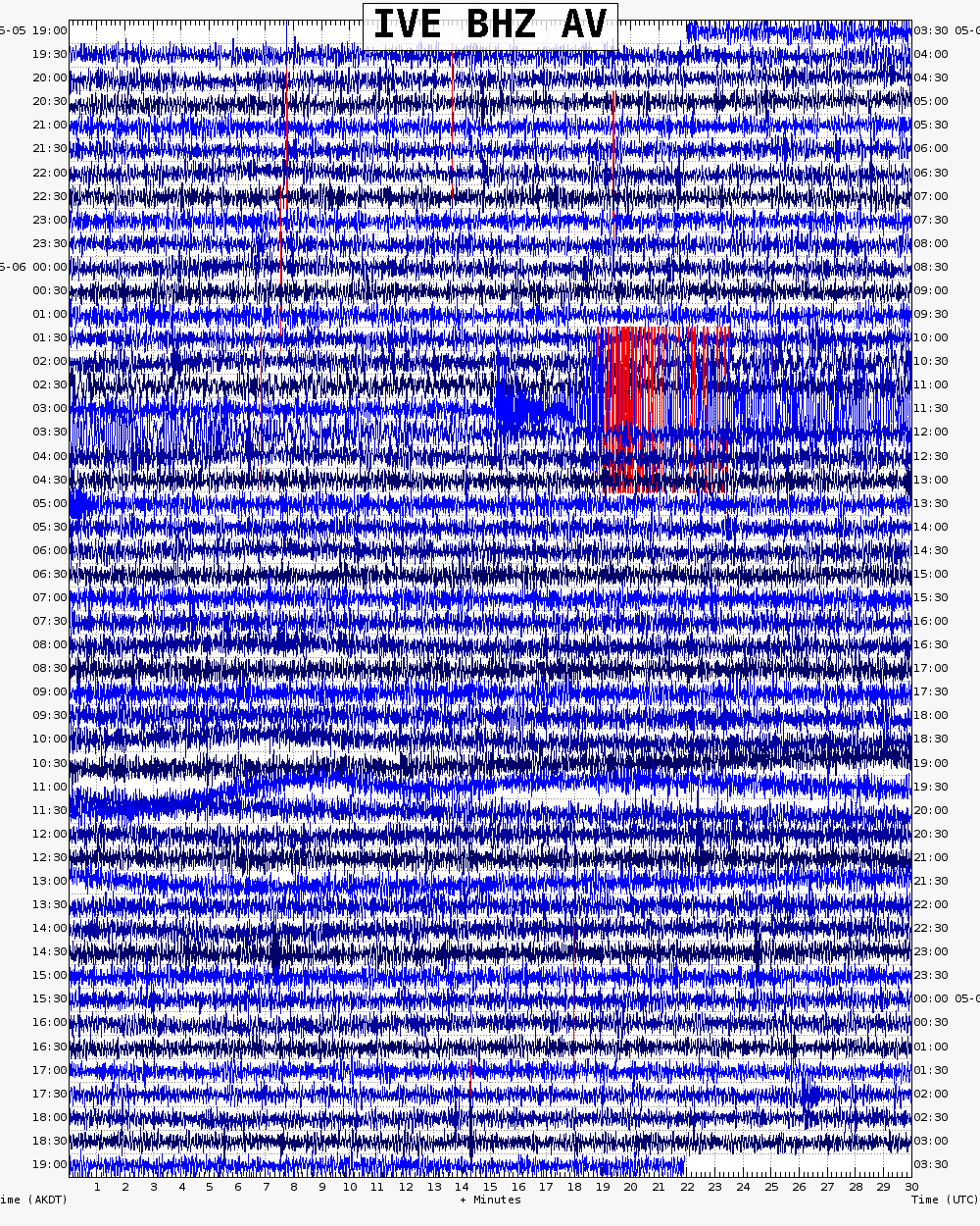
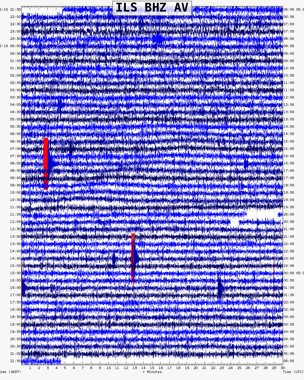
Webicorder

Color Code Timeline

Reported Activity

Modern Eruptions

Novarupta

Novarupta Eruption Timeline

Loading

Novarupta 1912/6

June 6, 1912 — June 9, 1912

Fierstein and Hildreth (2001) provide information about the magitude of the 1912 eruption at Novarupta and Katmai: "The world's largest volcanic eruption of the 20th century broke out at Novarupta [see fig. 1 in original text] in June 1912, filling with hot ash what came to be called the Valley of Ten Thousand Smokes and spreading downwind more fallout than all other historical Alaskan eruptions combined. Although almost all the magma vented at Novarupta, most of it had been stored beneath Mount Katmai 10 km away, which collapsed during the eruption. Airborne ash from the 3-day event blanketed all of southern Alaska, and its gritty fallout was reported as far away as Dawson, Ketchikan, and Puget Sound [see fig. 21 in original text]. Volcanic dust and sulfurous aerosol were detected within days over Wisconsin and Virginia; within 2 weeks over California, Europe, and North Africa; and in latter-day ice cores recently drilled on the Greenland ice cap."
Schaaf (2004) contains excerpts and summaries of eyewitness accounts of the eruption; a copy of this publication is available online at www.nps.gov/articles/aps-v11-i…. Detailed, firsthand narratives of the events as experienced at Kodiak are given in Perry, 1914, and Erskine, 1962.
Hildreth and Fierstein also published a free download tome of information about this eruption: pubs.usgs.gov/pp/1791/
From Fierstein and others (1998): "On the afternoon of June 6, 1912, an ominous cloud rose into the sky above Mount Katmai on the Alaska Peninsula. The cloud quickly reached an altitude of 20 miles, and within 4 hours, ash from a huge volcanic eruption began to fall on the village of Kodiak, 100 miles to the southeast. By the end of the eruption on June 9th, the ash cloud, now thousands of miles across, shrouded southern Alaska and western Canada, and sulfurous ash was falling on Vancouver, British Columbia, and Seattle, Washington. The next day the cloud passed over Virginia, and by June 17th it reached Algeria in Africa.
"During the 3 days of the eruption, darkness and suffocating conditions caused by falling ash and sulfur dioxide gas immobilized the population of Kodiak. Sore eyes and respiratory distress were rampant, and water became undrinkable. Radio communications were totally disrupted, and with visibility near zero, ships couldn't dock. Roofs in Kodiak collapsed under the weight of more than a foot of ash, buildings were wrecked by ash avalanches that rushed down from nearby hillslopes, and other structures burned after being struck by lightning from the ash cloud.
"Similar conditions prevailed elsewhere in southern Alaska, and several villages were abandoned forever. Animal and plant life was decimated by ash and acid rain from the eruption. Bears and other large animals were blinded by ash and starved when large numbers of the plants and small animals they lived on were wiped out. Millions of dead birds that had been blinded and coated by volcanic ash littered the ground. Aquatic organisms, such as mussels, insect larvae, and kelp, as well as the fish that fed upon them, perished in ash-choked shallow water. Alaska's salmon-fishing industry was devastated, especially from 1915 to 1919, because of the starvation and failure of many adult fish to spawn in ash-choked streams.
"In 1916, a National Geographic Society expedition led by Robert Griggs visited Mount Katmai and found a 2-mile-wide crater where its summit had been before 1912. Nearby, the expedition discovered a newly formed lava dome they called 'Novarupta' and huge flows of volcanic ash filling what they named the 'Valley of Ten Thousand Smokes' for the numerous plumes of steam rising from the still hot ground. Griggs' descriptions of these spectacular features helped persuade President Woodrow Wilson to create Katmai National Monument (now National Park) in 1918.
"In the 1950's, volcanologists discovered that the 1912 eruption was actually from Novarupta, not Mount Katmai. Novarupta's eruption had removed so much molten rock (magma) from beneath Mount Katmai that it caused a cubic mile of Katmai's summit to collapse."
Hildreth (1983) gives the following detailed description of the events of the eruption: "Because there were no geophysical instruments in Alaska, no scientfic observers in the district, and no eyewitnesses with a view of the VTTS [Valley of Ten Thousand Smokes], most reports of seismic, acoustic, and eruptive phenomena were not necessarily very accurate, chronologically or descriptively. The most reliable data are the visual observations from aboard the steamer Dora and the record of tephra falls at Kodiak [see figs. 1, 4, in original text] (Martin, 1913; Griggs, 1922). Martin visited Kodiak, Uyak, Katmai village, and Cold Bay [see fig. 1 in original text] in August of 1912 and gathered what accounts he could from residents of the district, but he did not venture inland to the volcanoes nor was he able to interview anyone from the two bands of native hunter-fishermen said to have been within 30 and 40 km, respectively, north and south of Novarupta at the time of the initial outburst. Reconstructions of the eruptive sequence by Griggs (1922) and Fenner (1923, 1925, 1950) are heavily inferential, overinterpretive both of Martin's data and of latter-day interviews with people said to have been at Savonoski when the eruption began (see below), and suffer badly from the incorrect assumption that much of the tephra had come from Mt. Katmai. The following is a critical reappraisal of what appear to be the facts, as assembled largely by G.C. Martin (1913; and unpublished USGS field notes); all times cited are adjusted to Alaskan local time.
"Earthquakes were reported to have been felt at Katmai village (30 km SSE of Novarupta) as early as the evening of 31 May, and severe shocks were felt at Uyak, Kanatak, and Nushugak (200 km WNW) on 4 and 5 June. On the morning of 6 June, explosions were heard at Nushugak and at Seldovia (240 km ENE) but there were no reports of accompanying seismicity or ash clouds. The same morning the Dora left Uyak at 0845 and steamed north-eastward up Shelikof Strait, the Katmai-group volcanoes in full view with a 'strong westerly breeze and fine clear weather,' but no one aboard noticed a tephra column until 1300 (when the vessel was ~88 km southeast of Novarupta). That column was clearly Plinian and, as shown below by the stratigraphic data, it was predominantly rhyolitic; the cloud overtook the Dora by 1500 and began dropping ash at Kodiak (170 km ESE) [see figs. 1, 4, in original text] by 1700.
"Separate interviews with two individuals said to have been in or near Savonoski (30 km N) on the morning of 6 June were conducted in 1918 (Griggs, 1922, p. 17) and in 1923 (Fenner, 1925, p. 216); these have been interpreted to suggest that the ash flow in the VTTS began in the morning several hours prior to the first high tephra column. This is quite unlikely in view of: (1) the record of the Dora; (2) the fact that the basal tephra layer in the VTTS, the distinctively rhyolitic Layer A, does not occur atop the ash-flow deposit; and (3) the common association of pumiceous pyroclastic flows with the collapse of vertical eruption columns. Preliminary eruptive activity at Novarupta on the morning of 6 June is quite reasonable and may be the best explanation of the noise and dust reported that morning at Savonoski and the explosions heard at Nushugak and Seldovia; but a major eruption column and a rhyolitic ash flow several km^3 in volume are certainly excluded prior to 1300.
"Major shocks that punctuated virtually continuous seismic activity were reported locally at ~1300 and ~2300 on 6 June and ~2240 on 7 June. These times are not necessarily very accurate. The first instrumentally recorded teleseism (at Seattle) is reported to have arrived at 1241 on 6 June (Fenner, 1925). Harvard, Ottawa, and several Eurasian stations recorded many teleseisms originating in southwest Alaska between 1805 on 6 June and ~2100 on 11 June. One of these near midnight on 6/7 June has been estimated at magnitude 6.4 and another at 0606 on 10 June at magnitude 7.0 (Coffman and von Hake, 1973). Earthquakes following the main phases of the eruption were felt at Cold Bay (60 km SSW) on 50 of the 70 days through mid-August (Fenner, 1925).
"A great explosion, accompanied by an earthquake felt at Cold Bay ~1300 on 6 June (Martin, 1913), was audible throughout the region and close in time to the first recorded teleseism and to the first sighting of tephra by the Dora. Another blast at ~1500 on 6 June, for which no accompanying earthquake was noted, may have been the most severe outburst of all, being heard for hundreds of kilometers (Martin, 1913). Martin suggested, but did not cite any evidence for, explosions synchronous with the large earthquakes felt nearby at ~2300 on 6 June and 2240 on 7 June. There were, however, reports of loud noises between midnight and 0200 on 8 June, at Katanak (95 km SW) and at Cordova (590 km ENE) (Martin, 1913; Fenner, 1925). Explosions continued to be heard, some as far away as Juneau (1200 km) until 10 June, though how many of the noises may have been thunder is impossible to assess.
"Major tephra eruptions, first noted by the Dora at 1300 on 6 June, continued to fall heavily on downwind settlements nearby until 9 June. The principal sector of dispersal was southeastward [see fig. 1 in original text], and the most distant positive record of ashfall was in Puget Sound (2400 km SE); atmospheric effects were worldwide (Griggs, 1922; Volz, 1975). In the main downwind direction at Kodiak (170 km ESE) there were three discrete periods of ashfall [see fig. 4 in original text]: (1) 1700 6 June until 0910 7 June; (2) ~1200 7 June until 1430 8 June; and (3) during the night of 8/9 June. The 9th of June dawned clear, and no further ash-falls were recorded on Kodiak Island. A major vapor plume and, possibly, sporadic ashfalls close to the source lasted all summer (Martin, 1913; Griggs, 1922; Fenner, 1925). Timing of the emplacement of the Novarupta dome is poorly known; its extrusion followed the last major tephra fall and was complete at the time of discovery on 31 July 1916.
"Details of correlation between audible explosions, tephra falls, and seismic events are not well known. Martin (1913) is the principal source, but his article has been misread and overinterpreted and ensuing errors propagated in successive publications. The seismicity does not correlate very well with eruptive events, and indeed there need be no correspondence (e.g. Filson and others, 1973; Nairn and others, 1976; Yokoyama and others, 1981). Much of the seismic activity seems more likely to have been related to fitful subsidence of Katmai and Novarupta calderas.
"At the onset of eruption, no one is known to have had a view of the VTTS (much less the Novarupta area itself), and only the party of native fishermen then southwest of Katmai village en route to Cold Bay may have been in a position to see Mt. Katmai. The Savonoski interviews (above) smack of ex post facto embellishment, although Martin (1913, p. 147) accepted a third hand report in 1912 that the villagers there may have seen Mt. Katmai after its collapse, but before 9 June. It is not clear where they might have had such a view, because, even notwithstanding the ash clouds, Mt. Katmai is not visible from Savonoski or along their escape route down the lake to Naknek [see fig. 1 in original text]. Martin, Griggs, and Fenner accepted such reports to mean that Mt. Katmai had lost its top by the afternoon of 6 June. This may be true, but it is not clear how Mt. Katmai could have been seen at all during the eruptive interval at Novarupta or what meaning should be attached to such expressions as 'blown off' or 'blown up.' No definitive geologic evidence has been found to fix the timing of Mt. Katmai's collapse, but it may be a reasonable inference that in addition to the syneruptive earthquakes, much of the summer-long seismicity can be attributed to such collapse, as well as to tectonic adjustments over a somewhat wider area, or even to dome emplacement at Novarupta."
Hildreth (1983) also reports that "pumice in the intial fall unit (A) is 100% rhyolite, but fall units atop the ash flow are >98% datcite; black andesitic scoria is common only in the ash flows and in near-vent air-fall tephra." He also states: The Novarupta lava dome is "diameter 380 m, its hieight ~65 m, and the intermediate (mostly dacite) lava interbanded with the rhyolite consitutes no more than 5% of the exposure; most of the conspicuous banding reflects textural variation in the rhyolite."
Fierstein and Hildreth (2001) estimate that the Novarupta eruption of 1912 ejected "at least 17 cubic km of fall deposits and about 11 cubic km of ash-flow tuff (ignimbrite) * * * emplaced in about 60 hours, representing a magma volume of about 13 cubic km (Fierstein and Hildreth, 1992). Hildreth (1987) estimates the volume of the Novarupta lava dome to be 0.005 cubic km.

Loading

Novarupta 1949/5

May 19, 1949

Eicher and Rousefell (1957) give the following account of a 1949 eruption at Novarupta: "Following a long period of dormancy Novarupta erupted violently for approximately two hours on May 19, 1949, a heavy outfall of ash being carried down Shelikof Strait by a westerly wind (observed by senior author)." However, Hildreth (1983) states: "Published compilations notwithstanding, there are no credible reports of historic eruptions in the Katmai group except at Novarupta in 1912 and at Trident in 1953 - 1968." The ash seen by Eicher was probably remobilized from the 1912 eruption.

From Sumner (1952): "In 1950 National Park Service observers discovered at its base [Novarupta's] a small new cone, perhaps fifty feet high, which apparently had been pushed up during a minor outburst of activity observed abut the first of July that year." However, Hildreth (1983) states: "Published compilations notwithstanding, there are no credible reports of historic eruptions in the Katmai group except at Novarupta in 1912 and at Trident in 1953 - 1968."

Novarupta 1953

1953 — 1954

Keller and Reiser (1959) reported Novarupta steaming during 1953 and 1954. This type of activity does not represent a volcanic eruption.

Novarupta 2014/5

May 19, 2014 — October 23, 2014

From Cameron and others, 2017: "Resuspension and transport of fine-grained volcanic ash from the Katmai National Park and Preserve region of Alaska frequently have been observed and documented for decades (Hadley and others, 2004; McGimsey and others, 2005), and five episodes of resuspended ash were documented in 2014. The 1912 eruption of Novarupta deposited large quantities of ash in valleys of the Katmai area, and the landscape remains desolate and largely vegetation-free, even more than a century later. During times of no snow and strong northwesterly winds, the ash can be resuspended and transported southeast across Shelikof Strait, Kodiak Island, and the Gulf of Alaska. These events commonly are identified by the presence of ash blowing from the Katmai area, often detected in satellite imagery, coupled with existing high winds and a lack of other volcanic signals (no thermal anomalies, no increased seismicity).
"On May 19, flights to Karluk on Kodiak Island were delayed because of weather conditions and a visible plume of resuspended ash originating from the Katmai area. The ash was weakly visible in satellite imagery, and strong northwesterly winds were blowing from the Katmai area towards the southeast. The National Weather Service Alaska Aviation Weather Unit (NWS AAWU) issued a Special Weather Statement. The NWS AAWU also issued SIGnificant METeorological information statements (SIGMETs) for resuspended Katmai ash due to strong winds on September 29 and October 5, when ash again was visible in satellite imagery blowing toward Kodiak Island. During the October 5 event, a citizen of Kodiak reported ash to AVO using via AVO’s "Is Ash Falling" system. Ash reached an altitude as high as 1,200-1,800 m (4,000-6,000 ft) ASL during the October 5 event.
On October 14, strong winds in the Katmai area once again picked up loose 1912 volcanic ash and carried it east over Shelikof Strait and Kodiak Island. The National Weather Service estimated the top of the cloud at an altitude of 1,200 m (4,000 ft) ASL. The NWS issued a Special Weather Statement, and AVO received a report of hazy conditions and trace ashfall (less than 1/32 in. deep) at Karluk on the southwestern side of Kodiak Island through AVO’s "Is Ash Falling" online ash reporting system. Federal Aviation Administration (FAA) Web camera images in Karluk also showed hazy conditions. AVO mentioned the resuspended ash event in the Friday, October 17, weekly update.
"The last ash resuspension event of 2014 occurred on Thursday, October 23, when strong winds resuspended 1912 volcanic ash and carried it southeast over Shelikof Strait, Kodiak Island, and the Gulf of Alaska. The ash was detected in satellite imagery, and the NWS issued Special Weather Statements, SIGMETs, and a Volcanic Ash Advisory. AVO
included the ash resuspension event in its Friday, October 24, weekly update."

Loading

Novarupta 2015/3

March 11, 2015 — October 30, 2015

From Dixon and others, 2017: "High winds entrained and resuspended ash from Novarupta-Katmai 1912 on March 11, 2015, continuing into March 12, 2015. Alaska Airlines and Ravn Alaska cancelled flights into and out of Kodiak, due to high winds and ash. The ash was visible in satellite imagery, and strong winds were blowing from the Katmai area toward the southeast (fig. 7 [original text]). The National Weather Service Alaska Aviation Weather Unit (NWS AAWU) issued a Special Weather Statement.
"Four episodes of resuspended ash were observed during August through October. A multi-day ash resuspension event began on August 28, 2015, and continued through August 31, 2015. On August 30, the NWS issued a SIGnificant METeorological (SIGMET) information statement, and AVO mentioned the resuspended ash in its August 28 weekly update and issued a separate information statement on August 31. The ash was weakly visible in satellite imagery. Two ash resuspension events occurred in September-on
September23, with ash confined to altitudes less than 1,500 m (5,000ft) ASL, and another on September 29-30.
Residents of Kodiak reported a fall of fine ash on the night of September 29-30, mixed with sleet and snow. AVO issued information statements on both occasions. The final ash resuspension event of 2015 occurred on October 29-30, when strong winds in the Katmai area again entrained loose 1912 volcanic ash and carried it east over Shelikof Strait and Kodiak Island. AVO again issued an information statement regarding the event."

Loading

Novarupta 2017/11

November 10, 2017 — November 13, 2017

From Dixon and others (2020): "On June 4, 2017, a National Oceanic and Atmospheric Administration (NOAA) and National Environmental Satellite, Data, and Information Service ash alert reported a possible resuspension event over the Valley of Ten Thousand Smokes (fig. 9). Atypical, easterly winds carried resuspended ash away from population centers so that an AVO Information Statement was not issued. AVO alerted the NWS Alaska Aviation Weather Unit * * * ,
"Two ash resuspension events were detected in November, and the first was identified by a NOAA and Cooperative Institute for Meteorological Satellite Studies ash alert. On November 10, strong northwest winds over the Valley of Ten Thousand Smokes resuspended volcanic ash into a visible cloud and transported it eastward across Shelikof Strait and over Kodiak Island, where it was detected by the AVO particulate monitors at Larson Bay on the west coast of Kodiak Island. A similar sensor in the city of Kodiak, Alaska, on the east coast of Kodiak Island did not record any ash for this episode. AVO issued an Information Statement corroborating the hazard notifications issued by the NWS. By the evening of November 10, the resuspension event started to wane despite the surface winds continuing with gusts up to 20 meters per second (66 feet per second). A similar resuspension event occurred on November 13. The resuspended ash cloud extended 120 km (72 mi) to the southeast over the south end of Kodiak Island where no particulate monitors were installed. (fig. 10). AVO issued another Information Statement after the detection of this resuspension event."

Loading

Novarupta ash resuspension 2020

September 14, 2020 — November 2, 2020

From Orr and others, 2024: "On September 14 (AKDT), strong winds entrained and resuspended ash from the Katmai region, carrying it northwestward at an altitude of ~4,000 ft (~1,200 m). Strong winds again picked up ash on October 31 (AKDT), carrying it southward at an altitude of ~5,000 ft (~1,500 m), as well as on November 2 (AKDT), carrying the ash southeastward at an altitude of ~5,000 ft (~1,500 m). During each resuspension event, the National Weather Service Alaska Aviation Weather Unit issued a significant meteorological weather advisory for aviators and AVO issued an information statement. The Aviation Color Code and Volcano Alert Level remained GREEN and NORMAL for Mount Katmai during 2020."

Novarupta ash resuspension 2021

August 21, 2021 — November 25, 2021

From Orr and others, 2024: "On August 28, 2021, strong winds picked up loose volcanic ash from the Mount Katmai (Novarupta) region and carried it southeastward toward Kodiak Island. The National Weather Service (NWS) had forecasted this event a few days prior, and when it occurred, the NWS Alaska Aviation Weather Unit (AAWU) reported cloud heights as much as ~6,000 ft (~1,800 m) ASL, issuing a significant meteorological information statement (SIGMET) for aviators. AVO also issued an Information Statement.
"The following month, strong winds again generated a cloud of resuspended ash that drifted over Kodiak Island. This event, like the one a month prior, was anticipated by the NWS a few days in advance. The drifting ash cloud appeared clearly in satellite data for ~24 hours, starting in the afternoon of September 20. AAWU issued a SIGMET reporting ash at altitudes as high as ~8,000 ft (~2,400 m) ASL; AVO correspondingly issued an Information Statement. Trace ash fall was reported in the City of Kodiak, Alaska, and owing to the forecast of this event, a local observer was able to sample the ash fall and send it to AVO.
"The ash resuspension had ceased for only two days when, beginning late in the afternoon on September 23, winds again picked up loose ash. This ash cloud drifted east across northern Kodiak Island at an apparently lower altitude (~5,000 ft [~1,500 m] ASL), though no ashfall was reported. This resuspension event also lasted ~24 hours, during which time AAWU issued a SIGMET and AVO issued an Information Statement.
"AVO observed the next minor cloud of resuspended ash in satellite views on September 26. This cloud drifted southeastward toward the middle of Shelikof Strait, never reaching Kodiak Island. No Information Statements were issued for this minor event.
"Before dawn on October 2, strong winds near Mount Katmai once again picked up loose volcanic ash and carried it southeastward toward Kodiak Island. As with most previous resuspension events at Mount Katmai in 2021, the NWS had forecasted the event a few days prior. AAWU issued a SIGMET and the NWS Forecast Office issued a Marine Weather Statement. AVO issued an Information Statement reporting ash clouds that reached altitudes of ~6,000 ft (~1,800 m) ASL. Meteorological clouds obscured satellite observations the next day, but the SIGMET remained in place for ~24 hours owing to the likelihood of continued ash resuspension.
"Starting on the morning of November 17, another cloud of resuspended ash appeared clearly in satellite data. Most of the typical source region for resuspended ash at Mount Katmai was covered in snow at the time, so this event’s ash source was apparently confined to valleys on the north side of Shelikof Strait, in the vicinity of Mount Katmai. AAWU issued a SIGMET reporting a cloud altitude as high as ~7,000 ft (~2,100 m) ASL; AVO correspondingly issued an Information Statement. Resuspended ash was visible in satellite data until about midnight, although reports of resuspended ash from the City of Kodiak continued into the following day. Residents in Kodiak collected trace ashfall.
"The last resuspension event in the Mount Katmai region in 2021 occurred on November 25. AAWU issued a SIGMET reporting a cloud that drifted over Kodiak Island at an altitude as high as ~5,000 ft (~1,500 m) ASL. The NWS Forecast Office issued a Marine Weather Statement and AVO issued an Information Statement."

Loading

Novarupta 1912/6

Novarupta 1949/5

Novarupta 1950/7

Novarupta 1953

Novarupta 2014/5

Novarupta 2015/3

Novarupta 2017/11

Novarupta ash resuspension 2020

Novarupta ash resuspension 2021

1630
1640
1650
1660
1670
1680
1690
1700
1710
1720
1730
1740
1750
1760
1770
1780
1790
1800
1810
1820
1830
1840
1850
1860
1870
1880
1890
1900
1910
1920
1930
1940
1950
1960
1970
1980
1990
2000
2010
2020
2030
2040
2050
2060
2070
2080
2090
2100
2110
2120
2130
2140
2150
2160
2170
2180
2190
2200
2210
2220
2230
2240
2250
2260
2270
2280
1885
1886
1887
1888
1889
1891
1892
1893
1894
1895
1896
1897
1898
1899
1901
1902
1903
1904
1905
1906
1907
1908
1909
1911
1912
1913
1914
1915
1916
1917
1918
1919
1921
1922
1923
1924
1925
1926
1927
1928
1929
1931
1932
1933
1934
1935
1936
1937
1938
1939
1941
1942
1943
1944
1945
1946
1947
1948
1949
1951
1952
1953
1954
1955
1956
1957
1958
1959
1961
1962
1963
1964
1965
1966
1967
1968
1969
1971
1972
1973
1974
1975
1976
1976
1977
1978
1979
1981
1982
1983
1984
1985
1986
1987
1988
1989
1991
1992
1993
1994
1995
1996
1997
1998
1999
2001
2002
2003
2004
2005
2006
2007
2008
2009
2011
2012
2013
2014
2015
2016
2017
2018
2019
2021
2022
2023
2024
2025
2026
2027
2028
2029
2031
2032
2033
2034
2035
2036
2037
2038
2039
2041
2042
2043
2044
2045
2046
2047
2048

37 Event Date(s)

Past Activity Legend:
Eruption
Questionable eruption
Non-eruptive activity


Showing 1 - 20 of 287

Map Images


Map References


Recently active volcanoes of Alaska, 2023

Cameron, C.E., Bull, K.F., and Macpherson, A.E., 2023, Recently active volcanoes of Alaska: Alaska Division of Geological & Geophysical Surveys Miscellaneous Publication 133 v. 6, 2 sheets. https://doi.org/10.14509/31086.

Airborne electromagnetic and magnetic survey data, Iliamna Volcano, Alaska, June 2012, 2020

Peterson, D.E., Finn, C.A., and Bedrosian, P.A., 2020, Airborne electromagnetic and magnetic survey data, Iliamna Volcano, Alaska, June 2012: U.S. Geological Survey data release, https://doi.org/10.5066/P949B5C2.

Historically active volcanoes of Alaska, v. 3, 2018

Cameron, C.E., Schaefer, J.R., and Mulliken, K.M., 2018, Historically active volcanoes of Alaska: Alaska Division of Geological & Geophysical Surveys Miscellaneous Publication 133 v. 3, 2 sheets. Http://doi.org/10.14509/30142

Historically active volcanoes of Alaska, 2014

Schaefer, J.R., Cameron, C.E., and Nye, C.J., 2014, Historically active volcanoes of Alaska: Alaska Division of Geological & Geophysical Surveys Miscellaneous Publication 133 v. 1.2, 1 sheet, scale 1:3,000,000. This publication has been superseded. Newest version available at http://www.dggs.alaska.gov/pubs/id/20181 .

Preliminary geologic map of the Cook Inlet Region, Alaska - including parts of the Talkeetna, Talkeetna Mountains, Tyonek, Lake Clark, Kenai, Seward, Iliamna, Seldovia, Mount Katmai, and Afognak 1:250,000-scale Quadrangles, 2009

Wilson, F.H., Hults, C.P., Schmoll, H.R., Haeussler, P.J., Schmidt, J.M., Yehle, L.A., and Labay, K.A., compilers; digital files prepared by Wilson, F.H., Hults, C.P., Labay, K.A., and Shew, Nora, 2009, Preliminary geologic map of the Cook Inlet Region, Alaska - including parts of the Talkeetna, Talkeetna Mountains, Tyonek, Lake Clark, Kenai, Seward, Iliamna, Seldovia, Mount Katmai, and Afognak 1:250,000-scale Quadrangles: U.S. Geological Survey Open-File Report 2009-1108, scale 1:250:000, available at http://pubs.usgs.gov/of/2009/1108/ .

Historically active volcanoes of the Aleutian Arc, 2002

Schaefer, Janet, and Nye, C. J., 2002, Historically active volcanoes of the Aleutian Arc: Alaska Division of Geological & Geophysical Surveys Miscellaneous Publication MP 0123, unpaged, 1 sheet, scale 1:3,000,000. Superceded by Miscellaneous Publication 133: http://www.dggs.dnr.state.ak.us/pubs/pubs?reqtype=citation&ID=20181

Preliminary volcano-hazard assessment for Iliamna Volcano, Alaska, 1999

Waythomas, C. F., and Miller, T. P., 1999, Preliminary volcano-hazard assessment for Iliamna Volcano, Alaska: U.S. Geological Survey Open-File Report 99-0373, 31 p., 1 sheet, scale unknown.
full-text PDF 2.84 MB

Volcanoes of Alaska, 1998

Nye, C. J., Queen, Katherine, and McCarthy, A. M., 1998, Volcanoes of Alaska: Alaska Division of Geological & Geophysical Surveys Information Circular IC 0038, unpaged, 1 sheet, scale 1:4,000,000, available at http://www.dggs.dnr.state.ak.us/pubs/pubs?reqtype=citation&ID=7043 .
Hard Copy held by AVO at FBKS - CEC shelf

Volcanoes of Alaska, 1995

Alaska Division of Geological & Geophysical Surveys, 1995, Volcanoes of Alaska: Alaska Division of Geological & Geophysical Surveys Information Circular IC 0038, unpaged, 1 sheet, scale 1:4,000,000.

Geothermal resources of the Aleutian Arc, 1993

Motyka, R. J., Liss, S. A., Nye, C. J., and Moorman, M. A., 1993, Geothermal resources of the Aleutian Arc: Alaska Division of Geological & Geophysical Surveys Professional Report PR 0114, 17 p., 4 sheets, scale 1:1,000,000.
Hard Copy held by AVO at FBKS - CEC shelf

Holocene volcanoes of the Aleutian Arc, Alaska, 1993

March, G. D., 1993, Holocene volcanoes of the Aleutian Arc, Alaska: Alaska Division of Geological & Geophysical Surveys Public-Data File PDF 93-85, unpaged, 1 sheet, scale 1:2,000,000.

Map showing distribution, composition, and age of Late Cenozoic volcanic centers in Alaska, 1986

Luedke, R. G., and Smith, R. L., 1986, Map showing distribution, composition, and age of Late Cenozoic volcanic centers in Alaska: U.S. Geological Survey Miscellaneous Investigations Series Map I 1091-F, unpaged, 3 sheets, scale 1:1,000,000.

Maps showing aeromagnetic survey and geologic interpretation of the Lake Clark quadrangle, Alaska, 1986

Case, J. E., 1986, Maps showing aeromagnetic survey and geologic interpretation of the Lake Clark quadrangle, Alaska: U.S. Geological Survey Miscellaneous Field Studies Map MF 1114-E, unpaged, 1 plate, scale 1:250,000.

Map showing interpretation of Landsat imagery of the Lake Clark quadrangle, Alaska, 1985

Steele, W. C., 1985, Map showing interpretation of Landsat imagery of the Lake Clark quadrangle, Alaska: U.S. Geological Survey Miscellaneous Field Studies Map MF 1114-F, unpaged, 1 plate, scale 1:250,000.

Iliamna volcano and its basement, 1955

Juhle, R. W., 1955, Iliamna volcano and its basement: U.S. Geological Survey Open-File Report 55-0077, 74 p., 2 plates, scale unknown.
Hard Copy held by AVO at FBKS - CEC file cabinet

Eruption of Trident Volcano, Katmai National Monument, Alaska, Feb.-June 1953, 1954

Snyder, G. L., 1954, Eruption of Trident Volcano, Katmai National Monument, Alaska, Feb.-June 1953: U.S. Geological Survey Circular C 0318, 7 p., 2 sheets, scale unknown.
Hard Copy held by AVO at FBKS - CEC file cabinet

Volcanic activity in the Aleutian Arc, 1950

Coats, R. R., 1950, Volcanic activity in the Aleutian Arc: U.S. Geological Survey Bulletin 0974-B, p. 35-49, 1 sheet, scale 1:5,000,000.
plate 1 PDF 819 KB
full-text PDF 783 KB
Hard Copy held by AVO at FBKS - CEC shelf

Geology of the vicinity of Tuxedni Bay, Cook Inlet, Alaska, 1922

Moffit, F. H., 1922, Geology of the vicinity of Tuxedni Bay, Cook Inlet, Alaska: U.S. Geological Survey Bulletin 0722-D, p. 141-147, 1 plate, scale unknown.
full-text PDF 482 KB

Reconnaissance of the gold fields of southern Alaska with some notes on general geology, 1898

Becker, G. F., 1898, Reconnaissance of the gold fields of southern Alaska with some notes on general geology: U.S. Geological Survey Annual Report 0018, p. 1-86, 6 sheets, scale unknown.
full-text PDF 1.5 MB
Hard Copy held by AVO at FBKS - CEC file cabinet

References

Tephra samples and analyses from Cook Inlet source volcanoes and Anchor Point, Alaska, 2024

Loewen, M.W., Wallace, Kristi, Coombs, M.L., and Mulliken, K.M., 2023, Tephra samples and analyses from Cook Inlet source volcanoes and Anchor Point, Alaska: Alaska Division of Geological & Geophysical Surveys Raw Data File 2023-25, 4 p. https://doi.org/10.14509/31090

2021 Volcanic activity in Alaska and the Commonwealth of the Northern Mariana Islands - Summary of events and response of the Alaska Volcano Observatory, 2024

Orr, T.R., Dietterich, H.R., Fee D., Girona, T., Grapenthin, R., Haney, M.M., Loewen, M.W., Lyons, J.J., Power, J.A., Schwaiger, H.F., Schneider, D.J., Tan, D., Toney, L., Wasser, V.K., and Waythomas, C.F., 2024, 2021 Volcanic activity in Alaska and the Commonwealth of the Northern Mariana Islands - Summary of events and response of the Alaska Volcano Observatory: U.S. Geological Survey Scientific Investigations Report 2024-5014, 64 p. https://doi.org/10.3133/sir20245014.
Full-text PDF 25.7 MB

Proximity to active volcanoes enhances glacier velocity, 2024

Mallalieu, J., Barr, I.D., Spagnolo, M., Mullan, D.J., Symeonakis, E., Edwards, B.R., and Martin, M.D., 2024, Proximity to active volcanoes enhances glacier velocity: Communications Earth & Environment v. 5, 679. https://doi.org/10.1038/s43247-024-01826-5
Full-text PDF 1.3 MB

Recently active volcanoes of Alaska, 2023

Cameron, C.E., Bull, K.F., and Macpherson, A.E., 2023, Recently active volcanoes of Alaska: Alaska Division of Geological & Geophysical Surveys Miscellaneous Publication 133 v. 6, 2 sheets. https://doi.org/10.14509/31086.

Characterization of geohazards via seismic and acoustic waves, 2023

Toney, L., 2023, Characterization of geohazards via seismic and acoustic waves: Fairbanks, A.K., University of Alaska Fairbanks, Ph.D. thesis, 139 p.

Weak degassing from remote Alaska volcanoes characterized with a new airborne imaging DOAS instrument and a suite of in situ sensors, 2023

Kern, C., and Kelly, P.J., 2023, Weak degassing from remote Alaska volcanoes characterized with a new airborne imaging DOAS instrument and a suite of in situ sensors: Fronteirs in Earth Science v. 11, 1088056. https://doi.org/10.3389/feart.2023.1088056.

Understanding drivers of mercury in lake trout (Salvelinus namaycush), a top-predator fish in southwest Alaska's parklands, 2023

Bartz, K.K., Hannam, M.P., Wilson, T.L., Lepak, R.F., Ogorek, J.M., Young, D.B., Eagles-Smith, C.A., and Krabbenhoft, D.P., 2023, Understanding drivers of mercury in lake trout (Salvelinus namaycush), a top-predator fish in southwest Alaska's parklands: Environmental Pollution v. 330, 121678. https://doi.org/10.1016/j.envpol.2023.121678
Full-text PDF 3.8 MB

Alaska interagency operating plan for volcanic ash episodes, 2022

Alaska Volcano Observatory, National Oceanic and Atmospheric Administration, National Weather Service, Federal Aviation Administration, Department of Defense, United States Coast Guard, Division of Homeland Security and Emergency Management, Alaska Department of Environmental Conservation, and Alaska Department of Health and Social Services (participating agencies), 2022, Alaska interagency operating plan for volcanic ash episodes, 85 p.

Geologic database of information on volcanoes in Alaska (GeoDIVA), 2022

Cameron, C.E., Crass, S.W., and AVO Staff, eds, 2022, Geologic database of information on volcanoes in Alaska (GeoDIVA): Alaska Division of Geologic and Geophysical Surveys Digital Data Series 20, https://doi.org/10.14509/geodiva, https://doi.org/10.14509/30901.

Characterizing unrest - A retrospective look at 20 years of gas emissions and seismicity at Iliamna Volcano, Alaska, 2022

Werner, C., Power, J.A., Kelly, P.J., Prejean, S., and Kern, C., 2022, Characterizing unrest - A retrospective look at 20 years of gas emissions and seismicity at Iliamna Volcano, Alaska: Journal of Volcanology and Geothermal Research v. 422, 107448. https://doi.org/10.1016/j.jvolgeores.2021.107448

Airborne geophysical imaging of weak zones on Iliamna Volcano, Alaska: implications for slope stability, 2021

Peterson, D.E., Finn, C.A., and Bedrosian, P.A., 2021, Airborne geophysical imaging of weak zones on Iliamna Volcano, Alaska: implications for slope stability: Journal of Geophysical Research Solid Earth, v. 126, 21 p., https://doi.org/10.1029/2020JB020807.

Reconstructing the dynamics of the highly similar May 2016 and June 2019 Iliamna Volcano (Alaska) ice-rock avalanches from seismoacoustic data, 2021

Toney, Liam, Fee, David, Allstadt, K.E., Haney, M.M., and Matoza, R.S., 2021, Reconstructing the dynamics of the highly similar May 2016 and June 2019 Iliamna Volcano (Alaska) ice-rock avalanches from seismoacoustic data: Earth Surface Dynamics, v. 9, p. 271-293, https://doi.org/10.5194/esurf-9-271-2021.

Airborne volcanic gas measurements at Iliamna Volcano, Alaska 2004-2017, 2021

Kelly, P., Kern, C., Werner, C., and Clor, L., 2021, Airborne volcanic gas measurements at Iliamna Volcano, Alaska 2004-2017: U.S. Geological Survey data release, https://doi.org/10.5066/P9MC3G1N.

Goals and development of the Alaska Volcano Observatory seismic network and application to forecasting and detecting volcanic eruptions, 2020

Power, J.A., Haney, M.M., Botnick, S.M., Dixon, J.P., Fee, David, Kaufman, A.M., Ketner, D.M., Lyons, J.J., Parker, Tom, Paskievitch, J.F., Read, C.W., Searcy, Cheryl, Stihler, S.D., Tepp, Gabrielle, and Wech, A.G., 2020, Goals and development of the Alaska Volcano Observatory seismic network and application to forecasting and detecting volcanic eruptions: Seismological Research Letters, doi: 10.1785/0220190216 .

Historically active volcanoes of Alaska, v. 4, 2020

Cameron, C.E., Schaefer, J.R., and Ekberg, P.G., 2020, Historically active volcanoes of Alaska: Alaska Division of Geological & Geophysical Surveys Miscellaneous Publication 133 v. 4, 2 sheets. Http://doi.org/10.14509/30426

Airborne electromagnetic and magnetic survey data, Iliamna Volcano, Alaska, June 2012, 2020

Peterson, D.E., Finn, C.A., and Bedrosian, P.A., 2020, Airborne electromagnetic and magnetic survey data, Iliamna Volcano, Alaska, June 2012: U.S. Geological Survey data release, https://doi.org/10.5066/P949B5C2.

Bouguer gravity and magnetic susceptibility measurements at Iliamna Volcano, Alaska 2019, 2020

Peterson, D.E., and Finn, C.A., 2020, Bouguer gravity and magnetic susceptibility measurements at Iliamna Volcano, Alaska 2019:U.S. Geological Survey data release, https://doi.org/10.5066/P90Q3ZQ8.

2016 Volcanic activity in Alaska - Summary of events and response of the Alaska Volcano Observatory, 2020

Cameron, C.E., Dixon, J.P., Waythomas, C.F., Iezzi, A.M., Wallace, K.L., McGimsey, R.G., and Bull, K.F., 2020, 2016 Volcanic activity in Alaska-Summary of events and response of the Alaska Volcano Observatory: U.S. Geological Survey Scientific Investigations Report 2020-5125, 63 p., https://doi.org/10.3133/sir20205125.

2017 Volcanic activity in Alaska-Summary of events and response of the Alaska Volcano Observatory, 2020

Dixon, J.P., Cameron, C.E., Iezzi, A.M., Power, J.A., Wallace, K., and Waythomas, C.F., 2020, 2017 Volcanic activity in Alaska-Summary of events and response of the Alaska Volcano Observatory: U.S. Geological Survey Scientific Investigations Report 2020-5102, 61 p., https://doi.org/10.3133/sir20205102.

Catalog of earthquake parameters and description of seismograph and infrasound stations at Alaskan volcanoes - January 1, 2013, through December 31, 2017, 2019

Dixon, J.P., Stihler S.D., Haney, M.M., Lyons, J.J., Ketner, D.M., Mulliken, K.M., Parker, T., and Power, J.A., 2019, Catalog of earthquake parameters and description of seismograph and infrasound stations at Alaskan volcanoes - January 1, 2013, through December 31, 2017: U.S. Geological Survey Data Series 1115, 92 p., https://doi.org/10.3133/ds1115.

A unified catalog of earthquake hypocenters and magnitudes at volcanoes in Alaska: 1989 to 2018, 2019

Power, J.A., Friberg, P.A., Haney, M.M., Parker, T., Stihler, S.D., and Dixon, J.P., 2019, A unified catalog of earthquake hypocenters and magnitudes at volcanoes in Alaska—1989 to 2018: U.S. Geological Survey Scientific Investigations Report 2019–5037, 17 p., https://doi.org/10.3133/sir20195037.

Geochemistry of some Quaternary lavas from the Aleutian Arc and Mt. Wrangell, 2018

Nye, C.J., Beget, J.E., Layer, P.W., Mangan, M.T., McConnell, V.S., McGimsey, R.G., Miller, T.P., Moore, R.B., and Stelling, P.L., 2018, Geochemistry of some quaternary lavas from the Aleutian Arc and Mt. Wrangell: Alaska Division of Geological & Geophysical Surveys Raw Data File 2018-1, 29 p. http://doi.org/10.14509/29843

The influence of tectonic environment on dynamic earthquake triggering: a review and case study on Alaskan volcanoes, 2018

Prejean, S.G., and Hill, D.P., 2018, The influence of tectonic environment on dynamic earthquake triggering: a review and case study on Alaskan volcanoes: Tectonophysics, v. 745, p. 293-304, doi.org/10.1016/j.tecto.2018.08.007.

2018 update to the U.S. Geological Survey national volcanic threat assessment, 2018

Ewert, J.W., Diefenbach, A.K., and Ramsey, D.W., 2018, 2018 update to the U.S. Geological Survey national volcanic threat assessment: U.S. Geological Survey Scientific Investigations Report 2018-5140, 40 p., https://pubs.usgs.gov/sir/2018/5140/sir20185140.pdf.

Historically active volcanoes of Alaska, v. 3, 2018

Cameron, C.E., Schaefer, J.R., and Mulliken, K.M., 2018, Historically active volcanoes of Alaska: Alaska Division of Geological & Geophysical Surveys Miscellaneous Publication 133 v. 3, 2 sheets. Http://doi.org/10.14509/30142

2014 Volcanic activity in Alaska - Summary of events and response of the Alaska Volcano Observatory, 2017

Cameron, C.E., Dixon, J.P., Neal, C.A., Waythomas, C.F., Schaefer, J.R., and McGimsey, R.G., 2017, 2014 Volcanic activity in Alaska - Summary of events and response of the Alaska Volcano Observatory: U.S. Geological Survey Scientific Investigations Report 2017-5077, 81 p., https://doi.org/10.3133/sir20175077.
full-text PDF 6.8 MB

2015 Volcanic activity in Alaska - Summary of events and response of the Alaska Volcano Observatory, 2017

Dixon, J.P., Cameron, C.E., Iezzi, A.M., and Wallace, Kristi, 2017, 2015 Volcanic activity in Alaska-Summary of events and response of the Alaska Volcano Observatory: U.S. Geological Survey Scientific Investigations Report 2017-5104, 61 p., https://doi.org/10.3133/sir20175104.

Historically active volcanoes of Alaska, 2016

Cameron, C.E., and Schaefer, J.R., 2016, Historically active volcanoes of Alaska: Alaska Division of Geological & Geophysical Surveys Miscellaneous Publication 133 v. 2, 1 sheet, scale 1:3,000,000. http://doi.org/10.14509/20181

2013 Volcanic activity in Alaska - summary of events and response of the Alaska Volcano Observatory, 2015

Dixon, J.P., Cameron, Cheryl, McGimsey, R.G., Neal, C.A., and Waythomas, Chris, 2015, 2013 Volcanic activity in Alaska - Summary of events and response of the Alaska Volcano Observatory: U.S. Geological Survey Scientific Investigations Report 2015-5110, 92 p., http://dx.doi.org/10.3133/sir20155110.

Historically active volcanoes of Alaska, 2014

Schaefer, J.R., Cameron, C.E., and Nye, C.J., 2014, Historically active volcanoes of Alaska: Alaska Division of Geological & Geophysical Surveys Miscellaneous Publication 133 v. 1.2, 1 sheet, scale 1:3,000,000. This publication has been superseded. Newest version available at http://www.dggs.alaska.gov/pubs/id/20181 .

Regional controls on volcano seismicity along the Aleutian Arc, 2014

Buurman, Helena, Nye, C.J., West, M.E., and Cameron, Cheryl, 2014, Regional controls on volcano seismicity along the Aleutian Arc: Geochemistry, Geophysics, Geosystems, doi:10.1002/2013GC005101

2012 Volcanic activity in Alaska: Summary of events and response of the Alaska Volcano Observatory, 2014

Herrick, J.A., Neal, C.A., Cameron, C.E., Dixon, J.P., and McGimsey, R.G., 2014, 2012 Volcanic activity in Alaska: Summary of events and response of the Alaska Volcano Observatory: U.S. Geological Survey Scientific Investigations Report 2014-5160, 82p., http://dx.doi.org/10.3133/sir20145160.

Preliminary database of Quaternary vents in Alaska, 2014

Cameron, C.E., and Nye, C.J., 2014, Preliminary database of Quaternary vents in Alaska: Alaska Division of Geological & Geophysical Surveys Miscellaneous Publication 153, 11 p., doi:10.14509/27357 .

InSAR imaging of Aleutian volcanoes, 2014

Lu, Zhong, and Dzurisin, Daniel, 2014, InSAR imaging of Aleutian volcanoes: Chichester, UK, Springer-Praxis, 390 p.

Catalog of earthquake hypocenters at Alaskan volcanoes: January 1 through December 31, 2012, 2013

Dixon, J.P., Stihler, S.D, Power, J.A., Haney, Matt, Parker, Tom, Searcy, C.K., and Prejean, Stephanie, 2013, Catalog of earthquake hypocenters at Alaskan volcanoes: January 1 through December 31, 2012: U.S. Geological Survey Data Series 789, 84 p., available at http://pubs.usgs.gov/ds/789/ .
full-text pdf 6.5 MB

Katmai scientific studies, 2012

Winfree, Robert, with contributions from Bacon, C.R., Bennett, A.J., Bennington, Ninfa, Berg, E.E., Brooks, Margi, Coletti, H.A., Coombs, M.L., Fierstein, Judy, Freeburg, Gary, Frost, G.V., Haney, Matthew, Jorgenson, M.T., Miller, A.E., Moran, Seth, Murphy, Rachel, Partnow, Patricia, Paskievitch, John, Stevens, D.P., Powell, Lee, Power, John, Prejean, S.G., Schaaf, Jeanne, Sherriff, R.L., Thurber, Clifford, and Welchman, R.A., 2012, Katmai science studies: Alaska Park Science Journal, v. 11, n. 1, 96 p., available online at http://www.nps.gov/akso/nature/science/ak_park_science/volume_11_issue_1.cfm .

Volcanic National Natural Landmarks in Alaska, 2012

Brooks, Margi, 2012, Volcanic National Natural Landmarks in Alaska: in Winfree, Robert (project lead), Katmai Science Studies: Alaska Park Science Journal, v. 11, n. 1, p. 22-25, available online at http://www.nps.gov/akso/nature/science/ak_park_science/volume_11_issue_1.cfm .
Hard Copy held by AVO at FBKS - CEC shelf

Volcanic earthquakes in Alaska's National Parks, 2012

Prejean, Stephanie, Moran, Seth, and Power, John, 2012, Volcanic earthquakes in Alaska's National Parks: in Winfree, Robert (project lead), Katmai Science Studies: Alaska Park Science Journal, v. 11, n. 1, p. 40-45, available online at http://www.nps.gov/akso/nature/science/ak_park_science/volume_11_issue_1.cfm .
Hard Copy held by AVO at FBKS - CEC shelf

Catalog of earthquake hypocenters at Alaskan volcanoes: January 1 through December 31, 2011, 2012

Dixon, J.P., Stihler, S.D., Power, J.A., and Searcy, C.K., 2012, Catalog of earthquake hypocenters at Alaskan volcanoes: January 1 through December 31, 2011: U.S. Geological Survey Data Series 730, 82 p., available online at http://pubs.usgs.gov/ds/730/pdf/ds730.pdf .

Seismic and gas analyses imply magmatic intrusion at Iliamna Volcano, Alaska in 2012, 2012

Prejean, S.G., Werner, C.A., Buurman, H., Doukas, M.P., Kelly, P.J., Kern, C., Ketner, D.M., Stihler, S.D., Thurber, C.H., and West, M.E., 2012, Seismic and gas analyses imply magmatic intrusion at Iliamna Volcano, Alaska in 2012 [abs.]: Eos Trans., American Geophysical Union, Fall meeting supplement, Abstract number V53B-2826.

Gas emission from failed and actual eruptions from Cook Inlet Volcanoes, Alaska, 1989-2006, 2011

Werner, C.A., Doukas, M.P., and Kelly, P.J., 2011, Gas emission from failed and actual eruptions from Cook Inlet Volcanoes, Alaska, 1989-2006: Bulletin of Volcanology, v. 73, n. 2, p. 155-173, doi: 10.1007/s00445-011-0453-4 .

Mechanism of the 1996-97 non-eruptive volcano-tectonic earthquake swarm at Iliamna Volcano, Alaska, 2011

Roman, D.C., and Power, J.A., 2011, Mechanism of the 1996-97 non-eruptive volcano-tectonic earthquake swarm at Iliamna Volcano, Alaska: Bulletin of Volcanology, v. 73, n. 2, p. 143-153, doi:10.1007/s00445-010-0439-7 .

Catalog of earthquake hypocenters at Alaskan volcanoes: January 1 through December 31, 2010, 2011

Dixon, J.P., Stihler, S.D., Power, J.A., and Searcy, C.K., 2011, Catalog of earthquake hypocenters at Alaskan volcanoes: January 1 through December 31, 2010: U.S. Geological Survey Data Series 645, 82 p., available online at http://pubs.usgs.gov/ds/645/

Gas emissions from failed and actual eruptions from Cook Inlet volcanoes, Alaska, 1989-2006, 2011

Werner, C.A., Doukas, M.P., and Kelly, P.J., 2011, Gas emissions from failed and actual eruptions from Cook Inlet volcanoes, Alaska, 1989-2006, in Roman, D.C., Moran, S.C., and Newhall, Chris (eds.), Failed eruptions: Late-stage cessation of magma ascent: Bulletin of Volcanology, v. 73, p. 155-173.

Catalog of earthquake hypocenters at Alaskan volcanoes: January 1 through December 31, 2009, 2010

Dixon, J.P., Stihler, S.D., Power, J.A., and Searcy, C.K., 2010, Catalog of earthquake hypocenters at Alaskan volcanoes: January 1 through December 31, 2009: U.S. Geological Survey Data Series 531, 84 p., available online at http://pubs.usgs.gov/ds/531/ .

Insights into rock-ice avalanche dynamics by combined analysis of seismic recordings and a numerical avalanche model, 2010

Schneider, Demian, Bartelt, Perry, Caplan-Auerbach, Jacqueline, Christen, Marc, Huggel, Christian, and McArdell, B.W., 2010, Insights into rock-ice avalanche dynamics by combined analysis of seismic recordings and a numerical avalanche model: Journal of Geophysical Research, v. 115, F04026, 20 p., doi: 10.1029/2010JF001734 .

Investigating volcanic plumbing systems through 'inversion' of seismologically-determinted crustal stress fields, 2010

Roman, D.C., 2010, Investigating volcanic plumbing systems through 'inversion' of seismologically-determinted crustal stress fields [abs.]: Seismological Research Letters, v. 81, n. 2, p. 351.

Preliminary geologic map of the Cook Inlet Region, Alaska - including parts of the Talkeetna, Talkeetna Mountains, Tyonek, Lake Clark, Kenai, Seward, Iliamna, Seldovia, Mount Katmai, and Afognak 1:250,000-scale Quadrangles, 2009

Wilson, F.H., Hults, C.P., Schmoll, H.R., Haeussler, P.J., Schmidt, J.M., Yehle, L.A., and Labay, K.A., compilers; digital files prepared by Wilson, F.H., Hults, C.P., Labay, K.A., and Shew, Nora, 2009, Preliminary geologic map of the Cook Inlet Region, Alaska - including parts of the Talkeetna, Talkeetna Mountains, Tyonek, Lake Clark, Kenai, Seward, Iliamna, Seldovia, Mount Katmai, and Afognak 1:250,000-scale Quadrangles: U.S. Geological Survey Open-File Report 2009-1108, scale 1:250:000, available at http://pubs.usgs.gov/of/2009/1108/ .

High precision relocation of earthquakes at Iliamna Volcano, Alaska, 2009

Statz-Boyer, Patrick, Thurber, Clifford, Pesicek, Jeremy, and Prejean, Stephanie, 2009, High precision relocation of earthquakes at Iliamna Volcano, Alaska: Journal of Volcanology and Geothermal Research, v. 184, p. 323-332, doi: 10.1016/j.jvolgeores.2009.04.016 .

Catalog of earthquake hypocenters at Alaskan volcanoes: January 1 through December 31, 2008, 2009

Dixon, J.P., and Stihler, S.D., 2009, Catalog of earthquake hypocenters at Alaskan volcanoes: January 1 through December 31, 2008: U.S. Geological Survey Data Series 467, 88 p., available at http://pubs.usgs.gov/ds/467/ .

Magmatic processes in the Alaska subduction zone by combined 3-D b value imaging and targeted seismic tomography, 2009

van Stiphout, T., Kissling, E., Wiemer, S., and Ruppert, N., 2009, Magmatic processes in the Alaska subduction zone by combined 3-D b value imaging and targeted seismic tomography: Journal of Geophysical Research, v. 114, n. B11, 16 p., doi: 10.1029/2008JB005958 .

Chronology and references of volcanic eruptions and selected unrest in the United States, 1980-2008, 2009

Diefenbach, A.K., Guffanti, Marianne, and Ewert, J.W., 2009, Chronology and references of volcanic eruptions and selected unrest in the United States, 1980-2008: U.S. Geological Survey Open-File Report 2009-1118, 85 p., available at http://pubs.usgs.gov/of/2009/1118/ .

Preliminary spreadsheet of eruption source parameters for volcanoes of the world, 2009

Mastin, L.G., Guffanti, Marianne, Ewert, J.E., and Spiegel, Jessica, 2009, Preliminary spreadsheet of eruption source parameters for volcanoes of the world: U.S. Geological Survey Open-File Report 2009-1133, v. 1.2, 25 p., available at http://pubs.usgs.gov/of/2009/1133/ .

Historically active volcanoes of Alaska reference deck, 2009

Snedigar, S.F., and Cameron, C.C., 2009, Historically active volcanoes of Alaska reference deck: Alaska Division of Geological & Geophysical Surveys Information Circular 59, 52 p, available to order from http://www.dggs.dnr.state.ak.us/pubs/pubs?reqtype=citation&ID=20401 .

2005 Volcanic activity in Alaska, Kamchatka, and the Kurile Islands: Summary of events and response of the Alaska Volcano Observatory, 2008

McGimsey, R.G., Neal, C.A., Dixon, J.P., and Ushakov, Sergey, 2008, 2005 Volcanic activity in Alaska, Kamchatka, and the Kurile Islands: Summary of events and response of the Alaska Volcano Observatory: U.S. Geological Survey Scientific Investigations Report 2007-5269, 94 p., available at http://pubs.usgs.gov/sir/2007/5269/ .

Catalog of earthquake hypocenters at Alaskan volcanoes: January 1 through December 31, 2006, 2008

Dixon, J.P., Stihler, S.D., Power, J.A., and Searcy, Cheryl, 2008, Catalog of earthquake hypocenters at Alaskan volcanoes: January 1 through December 31, 2006: U.S. Geological Survey Data Series 326, 79 p., available at http://pubs.usgs.gov/ds/326/ .

The Alaska Volcano Observatory - 20 years of volcano research, monitoring, and eruption response, 2008

Schaefer, J.R., and Nye, Chris, 2008, The Alaska Volcano Observatory - 20 years of volcano research, monitoring, and eruption response: Alaska Division of Geological & Geophysical Surveys, Alaska GeoSurvey News, NL 2008-001, v. 11, n. 1, p. 1-9, available at http://wwwdggs.dnr.state.ak.us/pubs/pubs?reqtype=citation&ID=16061 .

Modeled tephra ages from lake sediments, base of Redoubt Volcano, Alaska, 2008

Schiff, C.J., Kaufman, D.S., Wallace, K.L., Werner, A., Ku, T.L., and Brown, T.A., 2008, Modeled tephra ages from lake sediments, base of Redoubt Volcano, Alaska: Quaternary Geochronology, v. 3, p. 56-67.

Catalog of earthquake hypocenters at Alaskan volcanoes: January 1 through December 31, 2007, 2008

Dixon, J.P., Stihler, S.D. and Power, J.A., 2008, Catalog of earthquake hypocenters at Alaskan volcanoes: January 1 through December 31, 2007: U.S. Geological Survey Data Series 367, 82 p., available online at http://pubs.usgs.gov/ds/367/ .

Dynamic modeling of large rock-ice avalanches from active volcanoes: case study at Iliamna Volcano, 2008

Schneider, D., Huggel, C., Caplan-Auerbach, J., Wessels, R., McArdell, B.W., Waythomas, C.F., 2008. Dynamic modeling of large rock-ice avalanches from active volcanoes: case study at Iliamna Volcano [abs.]: IAVCEI 2008 Abstracts, August 17-22, Reykjavik, Iceland, p. 75.

Recent extreme avalanches triggered by climate change?, 2008

Huggel, C., Caplan-Auerbach, J., and Wessels, R., 2008, Recent extreme avalanches; triggered by climate change?: Eos Transactions American Geophysical Union, v. 89, p. 469-470.

Multiple mechanisms for noneruptive volcanotectonic earthquake swarms: examples from Iliamna Volcano and Crater Peak (Mt. Spurr), Alaska, 2008

Roman, D.C., 2008, Multiple mechanisms for noneruptive volcanotectonic earthquake swarms: examples from Iliamna Volcano and Crater Peak (Mt. Spurr), Alaska [abs.]: Eos, Transactions, American Geophysical Union, v. 89, n. 53.

An 18,700 year record of tephra-fall frequency as recorded in peat cores recovered from the Kenai Peninsula, Alaska, 2008

DeRuwe, A.D., 2008, An 18,700 year record of tephra-fall frequency as recorded in peat cores recovered from the Kenai Peninsula, Alaska: Alaska Pacific University M.S. thesis, 28 p.

Precursory seismicity associated with frequent, large ice avalanches on Iliamna volcano, Alaska, USA, 2007

Caplan-Auerbach, Jacqueline, Huggel, Christian, 2007, Precursory seismicity associated with frequent, large ice avalanches on Iliamna volcano, Alaska, USA: Journal of Glaciology, v. 53, n. 180, p. 128-140.

Monitoring and modeling ice-rock avalanches from ice-capped volcanoes: a case study of frequent large avalanches on Iliamna Volcano, Alaska, 2007

Huggel, Christian, Caplan-Auerbach, Jacqueline, Waythomas, C.F., and Wessels, Rick, 2007, Monitoring and modeling ice-rock avalanches from ice-capped volcanoes: a case study of frequent large avalanches on Iliamna Volcano, Alaska: Journal of Volcanology and Geothermal Research, v. 168, p. 114-136, doi:10.1016/j.jvolgeores.2007.08.009.

System for ranking relative threats of U.S. volcanoes, 2007

Ewert, John, 2007, System for ranking relative threats of U.S. volcanoes: Natural Hazards Review, v. 8, n. 4, p. 112-124.

A compilation of gas emission-rate data from volcanoes of Cook Inlet (Spurr, Crater Peak, Redoubt, Iliamna, and Augustine) and Alaska Peninsula (Douglas, Fourpeaked, Griggs, Mageik, Martin, Peulik, Ukinrek Maars, and Veniaminof), Alaska, from 1995-2006, 2007

Doukas, M.P., and McGee, K.A., 2007, A compilation of gas emission-rate data from volcanoes of Cook Inlet (Spurr, Crater Peak, Redoubt, Iliamna, and Augustine) and Alaska Peninsula (Douglas, Fourpeaked, Griggs, Mageik, Martin, Peulik, Ukinrek Maars, and Veniaminof), Alaska, from 1995-2006: U.S. Geological Survey Open-File Report 2007-1400, 13 p., available at http://pubs.usgs.gov/of/2007/1400/ .

Catalog of earthquake hypocenters at Alaskan volcanoes: January 1 through December 31, 2005, 2006

Dixon, J.P., Stihler, S.D., Power, J.A., Tytgat, Guy, Estes, Steve, and McNutt, S.R., 2006, Catalog of earthquake hypocenters at Alaskan volcanoes: January 1 through December 31, 2005: U.S. Geological Survey Open-File Report 2006-1264, 78 p., available at http://pubs.usgs.gov/of/2006/1264/ .

Assessment of tephra fall hazards at Aleutian Arc volcanoes using numerical models, geologic data, and historical observations, 2006

Waythomas, C.F., 2006, Assessment of tephra fall hazards at Aleutian Arc volcanoes using numerical models, geologic data, and historical observations [abs]: Eos, Joint Assembly Supplement, v. 87, abstract V33B-0661.

Why do some ice avalanches give warning prior to failure?, 2006

Caplan-Auerbach, J., 2006, Why do some ice avalanches give warning prior to failure? [abs.]: Eos, Joint Assembly Supplement, v. 87, abstract S41A-1315.

March-April 2004, 2005

Alaska Volcano Observatory, 2005, March-April 2004: Alaska Volcano Observatory Bimonthly Report, v.16, n. 2, unpaged.

May-June 2004, 2005

Alaska Volcano Observatory, 2005, May-June 2004: Alaska Volcano Observatory Bimonthly Report, v. 16, n. 3, unpaged.

July-August 2004, 2005

Alaska Volcano Observatory, 2005, July-August 2004: Alaska Volcano Observatory Bimonthly Report, v. 16, n. 4, unpaged.

September-October 2004, 2005

Alaska Volcano Observatory, 2005, September-October 2004: Alaska Volcano Observatory Bimonthly Report, v. 16, n. 5, unpaged.

November-December 2004, 2005

Alaska Volcano Observatory, 2005, November-December 2004: Alaska Volcano Observatory Bimonthly Report, v. 16, n. 6, unpaged.

An assessment of volcanic threat and monitoring capabilities in the United States: framework for a National Volcano Early Warning System NVEWS, 2005

Ewert, J.W., Guffanti, Marianne, and Murray, T.L., 2005, An assessment of volcanic threat and monitoring capabilities in the United States: framework for a National Volcano Early Warning System NVEWS: U.S. Geological Survey Open-File Report 2005-1164, 62 p.
full-text PDF 2.90 MB

May-June 2005, 2005

Alaska Volcano Observatory, 2005, May-June 2005: Alaska Volcano Observatory Bimonthly report, v. 17, n. 3, unpaged, http://www.avo.alaska.edu/avobm/introduction.php?volume=17&number=3.

2003 volcanic activity in Alaska and Kamchatka: Summary of events and response of the Alaska Volcano Observatory, 2005

McGimsey, Robert G., Neal, Christina A., and Girina, Olga, 2005, 2003 volcanic activity in Alaska and Kamchatka: Summary of events and response of the Alaska Volcano Observatory: U.S. Geological Survey Open-File Report 2005-1310, 62 p., http://pubs.usgs.gov/of/2005/1310/.
full-text PDF 3.54 MB

Catalog of earthquake hypocenters at Alaskan volcanoes: January 1 through December 31, 2004, 2005

Dixon, J.P., Stihler, S.D., Power, J.A., Tytgat, Guy, Estes, Steve, Prejean, Stephanie, Sanchez, J.J., Sanches, Rebecca, McNutt, S.R., and Paskievitch, John, 2005, Catalog of earthquake hypocenters at Alaskan volcanoes: January 1 through December 31, 2004: U.S. Geological Survey Open-File Report 2005-1312, 74 p., available online at http://pubs.usgs.gov/of/2005/1312/.

July-August 2001, 2004

Alaska Volcano Observatory, 2004, July-August 2001: Alaska Volcano Observatory Bimonthly Report, v. 13, n. 4, unpaged.

September-October 2001, 2004

Alaska Volcano Observatory, 2004, September-October 2001: Alaska Volcano Observatory Bimonthly Report, v. 13, n. 5, unpaged.

November-December 2001, 2004

Alaska Volcano Observatory, 2004, November-December 2001: Alaska Volcano Observatory Bimonthly Report, v. 13, n. 6, unpaged.

January-February 2002, 2004

Alaska Volcano Observatory, 2004, January-February 2002: Alaska Volcano Observatory Bimonthly Report, v. 14, n. 1, unpaged.

May-June 2002, 2004

Alaska Volcano Observatory, 2004, May-June 2002: Alaska Volcano Observatory Bimonthly Report, v. 14, n. 3, unpaged.

July-August 2002, 2004

Alaska Volcano Observatory, 2004, July-August 2002: Alaska Volcano Observatory Bimonthly Report, v. 14, n. 4, unpaged.

September-October 2002, 2004

Alaska Volcano Observatory, 2004, September-October 2002: Alaska Volcano Observatory Bimonthly Report, v. 14, n. 5, unpaged.

November-December 2002, 2004

Alaska Volcano Observatory, 2004, November-December 2002: Alaska Volcano Observatory Bimonthly Report, v. 14, n. 6, unpaged.

January-February 2003, 2004

Alaska Volcano Observatory, 2004, January-February 2003: Alaska Volcano Observatory Bimonthly Report, v. 15, n. 1, unpaged.

March-April 2003, 2004

Alaska Volcano Observatory, 2004, March-April 2003: Alaska Volcano Observatory Bimonthly Report, v. 15, n. 2, unpaged.

May-June 2003, 2004

Alaska Volcano Observatory, 2004, May-June 2003: Alaska Volcano Observatory Bimonthly Report, v. 15, n. 3, unpaged.

July-August 2003, 2004

Alaska Volcano Observatory, 2004, July-August 2003: Alaska Volcano Observatory Bimonthly Report, v. 15, n. 4, unpaged.

September-October 2003, 2004

Alaska Volcano Observatory, 2004, September-October 2003: Alaska Volcano Observatory Bimonthly Report, v. 15, n. 5, unpaged.

Evidence for dike emplacement beneath Iliamna Volcano, Alaska in 1996, 2004

Roman, D. C., Power, J. A., Moran, S. C., Cashman, K. V., Doukas, M. P., Neal, C. A., and Gerlach, T. M., 2004, Evidence for dike emplacement beneath Iliamna Volcano, Alaska in 1996: Journal of Volcanology and Geothermal Research, v. 130, n. 3-4, p. 265-284.

Catalog of earthquake hypocenters at Alaskan volcanoes: January 1 through December 31, 2003, 2004

Dixon, J. P., Stihler, S. D., Power, J. A., Tytgat, Guy, Moran, S. C., Sanchez, J. J., McNutt, S. R., Estes, Steve, and Paskievitch, John, 2004, Catalog of earthquake hypocenters at Alaskan volcanoes: January 1 through December 31, 2003: U.S. Geological Survey Open-File Report 2004-1234, 69 p.
full-text PDF 12.3 MB

The Alaska Volcano Observatory - Expanded monitoring of volcanoes yields results, 2004

Brantley, S. R., McGimsey, R. G., and Neal, C. A., 2004, The Alaska Volcano Observatory - Expanded monitoring of volcanoes yields results: U.S. Geological Survey Fact Sheet FS 2004-3084, 2 p.
full-text PDF 520 KB

Iliamna: along the rim of fire, 2004

Hess, H. D., 2004, Iliamna: along the rim of fire: Frederick, MD, PublishAmerica, 214 p.

Observations of deep long-period (DLP) seismic events beneath Aleutian Arc volcanoes: 1989-2002, 2004

Power, J.A, Stihler, S.D., White, R.A., and Moran, S.C., 2004, Observations of deep long-period (DLP) seismic events beneath Aleutian Arc volcanoes: 1989-2002: Journal of Volcanology and Geothermal Research, v. 138, p. 243-266.

1999 Volcanic activity in Alaska and Kamchatka: Summary of events and response of the Alaska Volcano Observatory, 2004

McGimsey, R. G., Neal, C. A., and Girina, Olga, 2004: 1999 Volcanic activity in Alaska and Kamchatka: Summary of events and response of the Alaska Volcano Observatory: U.S. Geological Survey Open-File Report 2004-1033, 49 p.
full text PDF 2.5 MB

January-February 2004, 2004

Alaska Volcano Observatory, 2004, January-February 2004: Alaska Volcano Observatory Bimonthly Report, v. 16, n. 1, unpaged.

November-December 2003, 2004

Alaska Volcano Observatory, 2004, November-December 2003: Alaska Volcano Observatory Bimonthly Report, v. 15, n. 6, unpaged.

Changes in local stress field orientation in response to magmatic activity, 2004

Roman, D.C., 2004, Changes in local stress field orientation in response to magmatic activity: University of Oregon Ph.D. dissertation, 188 p.

Simultaneous earthquake swarms and eruption in Alaska, fall 1996: Statistical significance and inference of a large aseismic slip event, 2004

McNutt, S.R., and Marzocchi, W., 2005, Simultaneous earthquake swarms and eruption in Alaska, fall 1996: Statistical significance and inference of a large aseismic slip event: Bulletin of the Seismological Society of America, v. 94, n. 5, p. 1831-1841.

Seismic recordings of ice and debris avalanches of Iliamna Volcano (Alaska), 2004

Caplan-Auerbach, Jacqueline, Prejean, S.G., and Power, J.A., 2004, Seismic recordings of ice and debris avalanches of Iliamna Volcano (Alaska): Acta Vulcanologica, v. 16, n. 1-2, p. 9-20.

Volcanoes of the world: an illustrated catalog of Holocene volcanoes and their eruptions, 2003

Siebert, L., and Simkin, T., 2002-, Volcanoes of the world: an illustrated catalog of Holocene volcanoes and their eruptions: Smithsonian Institution, Global Volcanism Program Digital Information Series GVP-3, http://volcano.si.edu/search_volcano.cfm, unpaged internet resource.

Bibliography of information on Alaska volcanoes, 2003

Cameron, C. E., Triplehorn, J. H., and Robar, C. L., 2003, Bibliography of information on Alaska volcanoes: Alaska Division of Geological & Geophysical Surveys Miscellaneous Publication MP 131, 1 CD-ROM.
Hard Copy held by AVO at FBKS - CEC file cabinet

Catalog of earthquake hypocenters at Alaskan volcanoes: January 1 through December 31, 2002, 2003

Dixon, J. P., Stihler, S. D., Power, J. A., Tytgat, Guy, Moran, S. C., Sanchez, John, Estes, Steve, McNutt, S. R., and Paskievitch, John, 2003, Catalog of earthquake hypocenters at Alaskan volcanoes: January 1 through December 31, 2002: U.S. Geological Survey Open-File Report 03-0267, 58 p.
full-text PDF 7.3 MB

Catalog of earthquake hypocenters at Alaskan volcanoes: January 1, 2000 through December 31, 2001, 2002

Dixon, J. P., Stihler, S. D., Power, J. A., Tytgat, Guy, Estes, Steve, Moran, S. C., Paskievitch, John, and McNutt, S. R., 2002, Catalog of earthquake hypocenters at Alaskan volcanoes: January 1, 2000 through December 31, 2001: U.S. Geological Survey Open-File Report 02-0342, 56 p.
Hard Copy held by AVO at FBKS - CEC file cabinet

Historically active volcanoes of the Aleutian Arc, 2002

Schaefer, Janet, and Nye, C. J., 2002, Historically active volcanoes of the Aleutian Arc: Alaska Division of Geological & Geophysical Surveys Miscellaneous Publication MP 0123, unpaged, 1 sheet, scale 1:3,000,000. Superceded by Miscellaneous Publication 133: http://www.dggs.dnr.state.ak.us/pubs/pubs?reqtype=citation&ID=20181

Catalog of earthquake hypocenters at Alaskan volcanoes: January 1, 1994 through December 31, 1999, 2001

Jolly, A. D., Stihler, S. D., Power, J. A., Lahr, J. C., Paskievitch, John, Tytgat, Guy, Estes, Steve, Lockheart, A. D., Moran, S. C., McNutt, S. R., and Hammond, W. R., 2001, Catalog of earthquake hypocenters at Alaskan volcanoes: January 1, 1994 through December 31, 1999: U.S. Geological Survey Open-File Report 01-0189, 22 p.
full-text PDF 552 KB
Hard Copy held by AVO at FBKS - CEC file cabinet

Record of Late Holocene debris avalanches and lahars at Iliamna Volcano, Alaska, 2000

Waythomas, C. F., Miller, T. P., and Beget, J. E., 2000, Record of Late Holocene debris avalanches and lahars at Iliamna Volcano, Alaska: Journal of Volcanology and Geothermal Research, v. 104, n. 1, p. 97-130.

Historically active volcanoes in Alaska, a quick reference, 2000

Wallace, K. L., McGimsey, R. G., and Miller, T. P., 2000, Historically active volcanoes in Alaska, a quick reference: U.S. Geological Survey Fact Sheet FS 0118-00, 2 p.
full-text PDF 162 KB
Hard Copy held by AVO at FBKS - CEC file cabinet

Encyclopedia of volcanoes, 2000

Sigurdsson, Haraldur, (ed.), 2000, Encyclopedia of volcanoes: San Diego, CA, Academic Press, 1417 p.

January-February 2000, 2000

Alaska Volcano Observatory, 2000, January-February 2000: Alaska Volcano Observatory Bimonthly Report, v. 12, n. 1, 28 p.
Part 1 PDF 239 KB
Part 2 PDF 916 KB
Part 3 PDF 469 KB

Preliminary volcano-hazard assessment for Iliamna Volcano, Alaska, 1999

Waythomas, C. F., and Miller, T. P., 1999, Preliminary volcano-hazard assessment for Iliamna Volcano, Alaska: U.S. Geological Survey Open-File Report 99-0373, 31 p., 1 sheet, scale unknown.
full-text PDF 2.84 MB

Perennial snow and ice volumes on Iliamna Volcano, Alaska, estimated with ice radar and volume modeling, 1999

Trabant, Dennis, 1999, Perennial snow and ice volumes on Iliamna Volcano, Alaska, estimated with ice radar and volume modeling: U.S. Geological Survey Water-resources investigations report WRI 99-4176, 11 p.
full text PDF 0.9 MB

1997 volcanic activity in Alaska and Kamchatka: Summary of events and response of the Alaska Volcano Observatory, 1999

McGimsey, R. G., and Wallace, K. L., 1999, 1997 volcanic activity in Alaska and Kamchatka: Summary of events and response of the Alaska Volcano Observatory: U.S. Geological Survey Open-File Report 99-0448, 42 p.
Hard Copy held by AVO at FBKS - CEC file cabinet

January-April 1999, 1999

Alaska Volcano Observatory, 1999, January-April 1999: Alaska Volcano Observatory Bimonthly Report, v. 11, n. 1 and 2, 30 p.
Part 1 PDF 385 KB
Part 2 PDF 870 KB
Part 3 PDF 1 MB

May-August 1999, 1999

Alaska Volcano Observatory, 1999, May-August 1999: Alaska Volcano Observatory Bimonthly Report, v. 11, n. 3 and 4, 39 p.
Part 1 PDF 399 KB
Part 2 PDF 831 KB
Part 3 PDF 736 KB
Part 4 PDF 41 KB
Part 5 PDF 91 KB

September-December 1999, 1999

Alaska Volcano Observatory, 1999, September-December 1999: Alaska Volcano Observatory Bimonthly Report, v. 11, n. 5 and 6, 51 p.
Part 1 PDF 425 KB
Part 2 PDF 1.7 MB
Part 3 PDF 549 KB

Volcanoes of Alaska, 1998

Nye, C. J., Queen, Katherine, and McCarthy, A. M., 1998, Volcanoes of Alaska: Alaska Division of Geological & Geophysical Surveys Information Circular IC 0038, unpaged, 1 sheet, scale 1:4,000,000, available at http://www.dggs.dnr.state.ak.us/pubs/pubs?reqtype=citation&ID=7043 .
Hard Copy held by AVO at FBKS - CEC shelf

Catalog of the historically active volcanoes of Alaska, 1998

Miller, T. P., McGimsey, R. G., Richter, D. H., Riehle, J. R., Nye, C. J., Yount, M. E., and Dumoulin, J. A., 1998, Catalog of the historically active volcanoes of Alaska: U.S. Geological Survey Open-File Report 98-0582, 104 p.
Hard Copy held by AVO at FBKS - CEC shelf

January-April 1998, 1998

Alaska Volcano Observatory, 1998, January-April 1998: Alaska Volcano Observatory Bimonthly Report, v. 10, n. 1 and 2, 35 p.
Part 1 PDF 147 KB
Part 2 382 KB
Part 3 PDF 375 KB

May-August 1998, 1998

Alaska Volcano Observatory, 1998, May-August 1998: Alaska Volcano Observatory Bimonthly Report, v. 10, n. 3 and 4, 43 p.
Part 1PDF 847 KB
Part 2 PDF 630 KB
Part 3 PDF 2.2 MB

September-December 1998, 1998

Alaska Volcano Observatory, 1998, September-December 1998: Alaska Volcano Observatory Bimonthly Report, v. 10, n. 5 and 6, 51 p.
Part 1 PDF 330 KB
Part 2 PDF 919 KB
Part 3 PDF 780 KB
Part 4 PDF 276 KB
Part 5 PDF 1.5 MB

(super 40) Ar/ (super 39) Ar laser dating of low-K Quaternary volcanic rocks from the Aleutian Arc, Alaska, 1997

Layer, P. W., Drake, J., Gilmer, A. K., McConnell, V. S., and Martini, B., 1997, (super 40) Ar/ (super 39) Ar laser dating of low-K Quaternary volcanic rocks from the Aleutian Arc, Alaska [abs.]: Eos, v. 78, n. 46, p. 771.

1996 volcanic activity in Alaska and Kamchatka: Summary of events and response of the Alaska Volcano Observatory, 1997

Neal, Christina, and McGimsey, R. G., 1997, 1996 volcanic activity in Alaska and Kamchatka: Summary of events and response of the Alaska Volcano Observatory: U.S. Geological Survey Open-File Report 97-0433, 34 p.
full-text PDF 795 KB
Hard Copy held by AVO at FBKS - CEC file cabinet

Iliamna, 1997

Smithsonian Institution, 1997, Iliamna: Global Volcanism Network Bulletin v. 22, n. 09, unpaged.

January-April 1997, 1997

Alaska Volcano Observatory, 1997, January-April 1997: Alaska Volcano Observatory Bimonthly Report, v. 9, n. 1 and 2, 51 p.
Part 1 PDF 252 KB
Part 2 PDF 2.8 MB
Part 3 PDF 649 KB

May-June 1997, 1997

Alaska Volcano Observatory, 1997, May-June 1997: Alaska Volcano Observatory Bimonthly Report, v. 9, n. 3, 23 p.
full-text PDF 2.2 MB

July-August 1997, 1997

Alaska Volcano Observatory, 1997, July-August 1997: Alaska Volcano Observatory Bimonthly Report, v. 9, n. 4, 31 p.
Part 1 PDF 446 KB
Part 2 PDF 435 KB
Part 3 PDF 2 MB

September-December 1997, 1997

Alaska Volcano Observatory, 1997, September-December 1997: Alaska Volcano Observatory Bimonthly Report, v. 9, n. 5 and 6, 17 p.
Part 1 PDF 399 KB
Part 2 PDF 531 KB

Alaska volcano a just-awakened, grumbling giant, 1996

Rozell, N., 1996, Alaska volcano a just-awakened, grumbling giant: Yukon News, v. 36, n. 71, p. 19.

Catalog of earthquake hypocenters for Augustine, Redoubt, Iliamna, and Mount Spurr volcanoes, Alaska: January 1, 1991 - December 31, 1993, 1996

Jolly, A. D., Power, J. A., Stihler, S. D., Rao, L. N., Davidson, G., Paskievitch, J. F., Estes, S. A., and Lahr, J. C., 1996, Catalog of earthquake hypocenters for Augustine, Redoubt, Iliamna, and Mount Spurr volcanoes, Alaska: January 1, 1991 - December 31, 1993: U.S. Geological Survey Open-File Report 96-0070, 90 p., 1 disk.
Hard Copy held by AVO at FBKS - CEC shelf

Dendrochronologic, archeologic, and radiocarbon data on Recent eruptions of Iliamna and Augustine volcanoes, Alaska, 1996

Beget, James, 1996, Dendrochronologic, archeologic, and radiocarbon data on Recent eruptions of Iliamna and Augustine volcanoes, Alaska [abs.]: Eos, v. 77, n. 46, p. 814.
Hard Copy held by AVO at FBKS - CEC file cabinet

Geology and hazards of Iliamna Volcano, Alaska, 1996

Miller, T. P., Beget, J. E., Stephens, C. D., and Moore, R. B., 1996, Geology and hazards of Iliamna Volcano, Alaska [abs.]: Eos, v. 77, n. 46, p. 815.
Hard Copy held by AVO at FBKS - CEC file cabinet

Volcanoes of the Wrangell Mountains and Cook Inlet Region, Alaska-selected photographs, 1996

Neal, Christina, and McGimsey, Robert, 1996, Volcanoes of the Wrangell Mountains and Cook Inlet Region, Alaska-selected photographs: U.S. Geological Survey Digital Data Series DDS 0039, 1 CD-ROM.

Iliamna, 1996

Smithsonian Institution, 1996, Iliamna: Global Volcanism Network Bulletin v. 21, n. 08, unpaged.

Iliamna, 1996

Smithsonian Institution, 1996, Iliamna: Global Volcanism Network Bulletin v. 21, n. 09, unpaged.

Iliamna, 1996

Smithsonian Institution, 1996, Iliamna: Global Volcanism Network Bulletin v. 21, n. 10, unpaged.

Iliamna, 1996

Smithsonian Institution, 1996, Iliamna: Global Volcanism Network Bulletin v. 21, n. 12, unpaged.

Bibliography for Hayes, Spurr, Crater Peak, Redoubt, Iliamna, Augustine, Douglas, and Aniakchak volcanoes, Alaska, 1995

Lemke, K. J., May, B. A., and Vanderpool, A. M., 1995, Bibliography for Hayes, Spurr, Crater Peak, Redoubt, Iliamna, Augustine, Douglas, and Aniakchak volcanoes, Alaska: U.S. Geological Survey Open-File Report 95-0435, 33 p.
Hard Copy held by AVO at FBKS - CEC file cabinet

Hydrologic hazards at recently active volcanoes in the Cook Inlet Region, Alaska, 1995

Dorava, J. M., and Waythomas, C. F., 1995, Hydrologic hazards at recently active volcanoes in the Cook Inlet Region, Alaska: in Herrman, R., (ed.), Annual summer symposium -- 1995, Water resources and environmental hazards: emphasis on hydrologic and cultural insight in the Pacific Rim, Honolulu, HI, American Water Resources Association, p. 91-98.
Hard Copy held by AVO at FBKS - CEC file cabinet

A compilation of sulfur dioxide and carbon dioxide emission-rate data from Cook Inlet volcanoes (Redoubt, Spurr, Iliamna, and Augustine), Alaska during the period from 1990 to 1994, 1995

Doukas, M. P., 1995, A compilation of sulfur dioxide and carbon dioxide emission-rate data from Cook Inlet volcanoes (Redoubt, Spurr, Iliamna, and Augustine), Alaska during the period from 1990 to 1994: U.S. Geological Survey Open-File Report 95-0055, 15 p.
Hard Copy held by AVO at FBKS - CEC file cabinet

Volcanic activity in Alaska: Summary of events and response of the Alaska Volcano Observatory 1992, 1995

McGimsey, R. G., Neal, C. A., and Doukas, M. P., 1995, Volcanic activity in Alaska: Summary of events and response of the Alaska Volcano Observatory 1992: U.S. Geological Survey Open-File Report 95-83, 26 p.
Hard Copy held by AVO at FBKS - CEC shelf

1994 volcanic activity in Alaska: summary of events and response of the Alaska Volcano Observatory, 1995

Neal, C. A., Doukas, M. P., and McGimsey, R. G., 1995, 1994 volcanic activity in Alaska: summary of events and response of the Alaska Volcano Observatory: U.S. Geological Survey Open-File Report 95-0271, 18 p.
Hard Copy held by AVO at FBKS - CEC file cabinet

Contamination by heterogeneous continental crust in easternmost Aleutian Arc volcanoes: and implications for the rest of the arc, 1995

Nye, C. J., and Spring, S. A., 1995, Contamination by heterogeneous continental crust in easternmost Aleutian Arc volcanoes: and implications for the rest of the arc [abs.]: Eos, v. 76, n. 46, p. 655.

Quick reference to Alaska's active volcanoes and listing of historical eruptions, 1760-1994, 1995

McGimsey, R. G., and Miller, T. P., 1995, Quick reference to Alaska's active volcanoes and listing of historical eruptions, 1760-1994: U.S. Geological Survey Open-File Report 95-0520, 13 p.
Hard Copy held by AVO at FBKS - CEC file cabinet

Comparative geochemistry of some volcanoes of the easternmost Aleutian Arc, 1995

Nye, C. J., 1995, Comparative geochemistry of some volcanoes of the easternmost Aleutian Arc [abs.]: Abstracts with Programs - Geological Society of America, v. 27, n. 5, p. 69.

Volcanoes of Alaska, 1995

Alaska Division of Geological & Geophysical Surveys, 1995, Volcanoes of Alaska: Alaska Division of Geological & Geophysical Surveys Information Circular IC 0038, unpaged, 1 sheet, scale 1:4,000,000.

Volcanic eruptions and tsunami generation in the eastern Aleutian arc: the geologic record, 1994

Beget, J. E., 1994, Volcanic eruptions and tsunami generation in the eastern Aleutian arc: the geologic record [abs.]: Abstracts with Programs - Geological Society of America, v. 26, n. 7, p. A138.

Age, character, and significance of Aleutian arc volcanism, 1994

Fournelle, J. H., Marsh, B. D., and Myers, J. D., 1994, Age, character, and significance of Aleutian arc volcanism: in Plafker, George and Berg, H. C., (eds.), The Geology of Alaska, Geological Society of America The Geology of North America Series v. G-1, p. 723-758.

Quaternary volcanism in the Alaska Peninsula and Wrangell Mountains, Alaska, 1994

Miller, T. P., and Richter, D. H., 1994, Quaternary volcanism in the Alaska Peninsula and Wrangell Mountains, Alaska: in Plafker, George, Jones, D. L., and Berg, H. C., (eds.), The Geology of Alaska, Geological Society of America The Geology of North America series v. G-1, p. 759-779.
Hard Copy held by AVO at FBKS - CEC file cabinet

Volcanoes of the world [2nd edition], 1994

Simkin, Tom, and Siebert, Lee, 1994, Volcanoes of the world [2nd edition]: Tucson, Arizona, Geoscience Press, 349 p.
Hard Copy held by AVO at FBKS - CEC shelf

Geothermal resources of the Aleutian Arc, 1993

Motyka, R. J., Liss, S. A., Nye, C. J., and Moorman, M. A., 1993, Geothermal resources of the Aleutian Arc: Alaska Division of Geological & Geophysical Surveys Professional Report PR 0114, 17 p., 4 sheets, scale 1:1,000,000.
Hard Copy held by AVO at FBKS - CEC shelf

Holocene volcanoes of the Aleutian Arc, Alaska, 1993

March, G. D., 1993, Holocene volcanoes of the Aleutian Arc, Alaska: Alaska Division of Geological & Geophysical Surveys Public-Data File PDF 93-85, unpaged, 1 sheet, scale 1:2,000,000.

VOLPLOT: a PC-based program for viewing Cook Inlet volcano-seismic data, 1992

March, G. D., and Murray, T. L., 1992, VOLPLOT: a PC-based program for viewing Cook Inlet volcano-seismic data: U.S. Geological Survey Open-File Report 92-0560-A, Menlo Park, CA, 6 p.

VOLPLOT: a PC-based program for viewing Cook Inlet volcano-seismic data, 1992

March, G. D., and Murray, T. L., 1992, VOLPLOT: a PC-based program for viewing Cook Inlet volcano-seismic data: U.S. Geological Survey Open-File Report 92-0560-B, unpaged.

Compositional variation and provenance of late Cenozoic distal tephra beds, Fairbanks area, Alaska, 1992

Preece, S. J., Westgate, J. A., and Gorton, M. P., 1992, Compositional variation and provenance of late Cenozoic distal tephra beds, Fairbanks area, Alaska: Quaternary International, v. 13/14, p. 97-101.
Hard Copy held by AVO at FBKS - CEC file cabinet

Volcanic ash in the Cook Inlet region, 1991

Riehle, Jim, 1991, Volcanic ash in the Cook Inlet region: in Rennick, Penny, (ed.), Alaska's volcanoes, Alaska Geographic, v. 18, n. 2, p. 43-47.

Alaska Volcano Observatory summary report: January 1, 1991 - February 28, 1991, 1991

Neal, C., and Power, J. (compilers), 1991, Alaska Volcano Observatory summary report: January 1, 1991 - February 28, 1991: Alaska Volcano Observatory bimonthly report series, 13 p.
full-text PDF 1.39 MB

Alaska Volcano Observatory summary report: July 1, 1991 - August 31, 1991, 1991

Neal, C. (compiler), 1991, Alaska Volcano Observatory summary report: July 1, 1991 - August 31, 1991: Alaska Volcano Observatory bimonthly report series, 15 p.

Alaska Volcano Observatory summary report: March 1, 1991 - April 30, 1991, 1991

Neal, C.A. (compiler), 1991, Alaska Volcano Observatory summary report: March 1, 1991 - April 30, 1991: Alaska Volcano Observatory bimonthly report series, 19 p.

Alaska Volcano Observatory summary report: May 1, 1991 - June 30, 1991, 1991

Neal, C.A. (compiler), 1991, Alaska Volcano Observatory summary report: May 1, 1991 - June 30, 1991: Alaska Volcano Observatory bimonthly report series, 8 p.

Alaska Volcano Observatory summary report: September 1, 1991 - October 31, 1991, 1991

Neal, C.A. (compiler), 1991, Alaska Volcano Observatory summary report: September 1, 1991 - October 31, 1991: Alaska Volcano Observatory bimonthly report series, 7 p.

The Alaska Volcano Observatory: a multisite, multiagency consortium for volcano monitoring and research, 1990

Davies, J. N., Miller, T. P., Power, J. A., and Forbes, R. B., 1990, The Alaska Volcano Observatory: a multisite, multiagency consortium for volcano monitoring and research [abs.]: Eos, v. 71, n. 43, p. 1709.

Volcanoes of North America: United States and Canada, 1990

Wood, C. A., and Kienle, Juergen, (eds.), 1990, Volcanoes of North America: United States and Canada: New York, Cambridge University Press, 354 p.
Hard Copy held by AVO at FBKS - CEC shelf

Iliamna, 1990

Reeder, J. W., 1990, Iliamna: in Annual report of the world volcanic eruptions in 1987, Bulletin of Volcanic Eruptions, v. 27, p. 58.
Hard Copy held by AVO at FBKS - CEC file cabinet

Alaska Volcano Observatory summer report: June 1, 1990 - September 30, 1990, 1990

Neal, C., and Power, J. (compilers), 1990, Alaska Volcano Observatory summer report: June 1, 1990 - September 30, 1990: Alaska Volcano Observatory bimonthly report series, 38 p.

Earthquake cluster beneath Iliamna Volcano in Alaska, 1988

Biswas, N. N., Tytgat, G., Page, R. A., and Fogleman, K. A., 1988, Earthquake cluster beneath Iliamna Volcano in Alaska [abs.]: Eos, v. 69, n. 44, p. 1317.

Effect of volcanic ash deposits on sockeye salmon lakes, 1987

Mathisen, O. A., and Poe, P. H., 1987, Effect of volcanic ash deposits on sockeye salmon lakes: in Internationale Vereinigung fr Theoretische und Angewandte Limnologie, Proceedings, v. 20, Copenhagen, Denmark, p. 165-172.
Hard Copy held by AVO at FBKS - CEC file cabinet

Iliamna, 1987

Smithsonian Institution, 1987, Iliamna: Scientific Event Alert Network Bulletin v. 03, n. 12, unpaged.

Iliamna, 1987

Smithsonian Institution, 1987, Iliamna: Scientific Event Alert Network Bulletin v. 12, n. 03, unpaged.

Map showing distribution, composition, and age of Late Cenozoic volcanic centers in Alaska, 1986

Luedke, R. G., and Smith, R. L., 1986, Map showing distribution, composition, and age of Late Cenozoic volcanic centers in Alaska: U.S. Geological Survey Miscellaneous Investigations Series Map I 1091-F, unpaged, 3 sheets, scale 1:1,000,000.

Maps showing aeromagnetic survey and geologic interpretation of the Lake Clark quadrangle, Alaska, 1986

Case, J. E., 1986, Maps showing aeromagnetic survey and geologic interpretation of the Lake Clark quadrangle, Alaska: U.S. Geological Survey Miscellaneous Field Studies Map MF 1114-E, unpaged, 1 plate, scale 1:250,000.

A reconnaissance of the major Holocene tephra deposits in the upper Cook Inlet region, Alaska, 1985

Riehle, J. R., 1985, A reconnaissance of the major Holocene tephra deposits in the upper Cook Inlet region, Alaska: Journal of Volcanology and Geothermal Research, v. 26, n. 1-2, p. 37-74.
Hard Copy held by AVO at FBKS - CEC file cabinet

Map showing interpretation of Landsat imagery of the Lake Clark quadrangle, Alaska, 1985

Steele, W. C., 1985, Map showing interpretation of Landsat imagery of the Lake Clark quadrangle, Alaska: U.S. Geological Survey Miscellaneous Field Studies Map MF 1114-F, unpaged, 1 plate, scale 1:250,000.

Volcano hazards program in the USA, 1984

Tilling, R. I., and Bailey, R. A., 1984, Volcano hazards program in the USA: in Fedotov, S. A., Galkin, I. N., Nikolaev, A. V., and Sedova, E. N., (eds.), Earthquakes and geological hazard prediction, International Geological Congress, 27, Report, v. 6, Moscow, USSR, August 4-14, 1984, p. 106-118.

Recent seismicity around Spurr, Redoubt, and Iliamna volcanoes, southern Alaska, 1983

Page, R. A., Waller, J. A., and Stephens, C. D., 1983, Recent seismicity around Spurr, Redoubt, and Iliamna volcanoes, southern Alaska [abs.]: Eos, v. 64, n. 9, p. 90.

Magmatism and subduction in the eastern Aleutian Arc, 1983

Kienle, J., Swanson, S. E., and Pulpan, H., 1983, Magmatism and subduction in the eastern Aleutian Arc: in Shimozuru, D. and Yokoyama, I., (eds.), Arc volcanism: physics and tectonics, IAVCEI symposium, Proceedings, Tokyo and Hakone, Japan, Aug. 3l -Sept. 5, 1981, Tokyo, Terra Scientific Publishing Co., p. 191-224.
Hard Copy held by AVO at FBKS - CEC file cabinet

Volcanism in the eastern Aleutian Arc: late Quaternary and Holocene centers, tectonic setting and petrology, 1983

Kienle, Juergen, and Swanson, S. E., 1983, Volcanism in the eastern Aleutian Arc: late Quaternary and Holocene centers, tectonic setting and petrology: Journal of Volcanology and Geothermal Research, v. 17, n. 1-4, p. 393-432.
Hard Copy held by AVO at FBKS - CEC file cabinet

Some volcanoes, volcanic eruption, and earthquakes in the former Russian America. Peter Doroshin's account of volcanic activity and earthquakes between 1840 and 1866, 1983

Kisslinger, J.B., 1983, Some volcanoes, volcanic eruption, and earthquakes in the former Russian America. Peter Doroshin's account of volcanic activity and earthquakes between 1840 and 1866: Pacific Northwest Quarterly, v. 74, n. 2, p. 59-68.
Hard Copy held by AVO at FBKS - CEC file cabinet

Plate subduction and volcanism in the eastern Aleutian Arc: 2, Petrology, 1982

Swanson, S. E., and Kienle, Juergen, 1982, Plate subduction and volcanism in the eastern Aleutian Arc: 2, Petrology [abs.]: Abstracts with Programs - Geological Society of America, v. 14, n. 7, p. 628.

Recent seismicity around Spurr, Redoubt, and Iliamna volcanoes, southern Alaska, 1982

Page, R. A., Waller, J. A., and Stephens, C. D., 1982, Recent seismicity around Spurr, Redoubt, and Iliamna volcanoes, southern Alaska [abs.]: in Science in the North, Alaska Science Conference held in conjunction with the American Geophysical Union 29th Pacific Northwest Meeting, 33, Proceedings, Fairbanks, AK, 16-18 September, 1982, p. 129.
Hard Copy held by AVO at FBKS - CEC file cabinet Hard Copy held by AVO at FBKS - CEC shelf

The Aleutians, 1982

Marsh, B. D., 1982, The Aleutians: in Thorpe, R. S., (ed.), Andesites: orogenic andesites and related rocks, Chichester, United Kingdom, John Wiley & Sons, p. 99-114.
Hard Copy held by AVO at FBKS - CEC file cabinet

Volcanoes of the world, 1981

Simkin, Tom, Siebert, Lee, McClelland, Lindsay, Bridge, David, Newhall, Christopher, and Latter, J. H., 1981, Volcanoes of the world: Stroudsburg, PA, Hutchinson Publishing Company, 233 p.

Helium isotope variations along the Alaskan-Aleutian Arc, 1981

Poreda, R., Craig, H., and Motyka, R., 1981, Helium isotope variations along the Alaskan-Aleutian Arc [abs.]: Eos, v. 62, n. 45, p. 1092.

Transverse tectonic boundaries near Kodiak Island, 1981

Fisher, M. A., Bruns, T. R., and vonHuene, Roland, 1981, Transverse tectonic boundaries near Kodiak Island: Geological Society of America Bulletin, v. 92, p. 10-18.

Iliamna, 1980

Proffett, J., Kienle, J., and Lahl, J., 1980, Iliamna: in Annual report of the world volcanic eruptions in 1978, Bulletin of Volcanic Eruptions, v. 18, p. 67.
Hard Copy held by AVO at FBKS - CEC file cabinet

Volcanic gas studies at Alaskan volcanoes, 1979

Johnston, D. A., 1979, Volcanic gas studies at Alaskan volcanoes: in Johnson, K. M. and Williams, J. R., (eds.), The United States Geological Survey in Alaska: accomplishments during 1978, U.S. Geological Survey Circular C 0804-B, p. B83-B84.
Hard Copy held by AVO at FBKS - CEC shelf

Calc-alkaline plutonism along the Pacific rim of southern Alaska, 1979

Hudson, Travis, 1979, Calc-alkaline plutonism along the Pacific rim of southern Alaska: U.S. Geological Survey Open-File Report 79-0953, 31 p.

Airborne particle and gas measurements in the emissions from six volcanoes, 1978

Stith, J. L., Hobbs, P. V., and Radke, L. F., 1978, Airborne particle and gas measurements in the emissions from six volcanoes: Journal of Geophysical Research, C, v. 83, n. 8, p. 4009-4017.

Comprehensive tables giving physical data and thermal energy estimates for young igneous systems of the United States, 1978

Smith, R. L., Shaw, H. R., Luedke, R. G., and Russell, S. L., 1978, Comprehensive tables giving physical data and thermal energy estimates for young igneous systems of the United States: U.S. Geological Survey Open-File Report 78-0925, p. 1-25.
Hard Copy held by AVO at FBKS - CEC shelf

Correlation of deformed glaciolacustrine sediments and historic earthquakes, Skilak Lake, Kenai Peninsula, Alaska, 1976

Sims, J. D., and Rymer, M. J., 1976, Correlation of deformed glaciolacustrine sediments and historic earthquakes, Skilak Lake, Kenai Peninsula, Alaska [abs.]: Abstracts with Programs - Geological Society of America, v. 8, n. 3, p. 410.
Hard Copy held by AVO at FBKS - CEC file cabinet

Preliminary survey of modern glaciolacustrine sediments for earthquake-induced deformational structures, south-central Alaska, 1976

Rymer, M. J., and Sims, J. D., 1976, Preliminary survey of modern glaciolacustrine sediments for earthquake-induced deformational structures, south-central Alaska: U.S. Geological Survey Open-File Report 76-373, p. 1-31.
Hard Copy held by AVO at FBKS - CEC shelf

Regional gravity survey of the Beluga basin and adjacent areas, Cook Inlet region, South Central Alaska, 1976

Hackett, S. W., 1976, Regional gravity survey of the Beluga basin and adjacent areas, Cook Inlet region, South Central Alaska: Alaska Division of Geological & Geophysical Surveys Open-File Report AOF 0100, 38 p.
Hard Copy held by AVO at FBKS - CEC shelf

Map showing geology, wildcat wells, Tertiary plant fossil localities, K-Ar age dates, and petroleum operations, Cook Inlet area, Alaska, 1976

Magoon, L.B., Adkison, W.L., and Egbert, R.M., 1976, Map showing geology, wildcat wells, Tertiary plant fossil localities, K-Ar age dates, and petroleum operations, Cook Inlet area, Alaska: U.S. Geological Survey Miscellaneous Investigations Series Map 1019, 3 sheets.

Establishment, test, and evaluation of a prototype volcano-surveillance system, 1973

Ward, P. L., Eaton, J. P., Endo, Elliot, Harlow, David, Marquez, Daniel, and Allen, Rex, 1973, Establishment, test, and evaluation of a prototype volcano-surveillance system: in Freden, S. C., Mercanti, E. P., and Becker, M. A., (eds./comps.), Symposium on significant results obtained from the Earth Resources Technology, U.S. National Aeronautics and Space Administration Special Publication SP 0327, v. 1, n. A, p. 305-315.

Volcanic landforms and surface features, a photographic atlas and glossary, 1971

Green, Jack, and Short, N. M., 1971, Volcanic landforms and surface features, a photographic atlas and glossary: Springer-Verlag New York, 519 p.
Hard Copy held by AVO at FBKS - CEC file cabinet

Gravity survey in the general area of the Katmai National Monument, Alaska, 1968

Kienle, Juergen, 1968, Gravity survey in the general area of the Katmai National Monument, Alaska: University of Alaska Fairbanks Ph.D. dissertation, 151 p.

Geology of Iniskin-Tuxedni region, Alaska, 1966

Detterman, R. L., and Hartsock, J. K., 1966, Geology of Iniskin-Tuxedni region, Alaska: U.S. Geological Survey Professional Paper PP 0512, 78 p., 6 sheets, scale 1:63,360, 1:96,000, 1:1,000,000.
full-text PDF 4.6 MB
plate 1 PDF 15 MB
plate 2 PDF 1.7 MB
plate 3 PDF 2.5 MB
plate 4 PDF 376 KB
plate 5 PDF 606 KB
plate 6 PDF 192 KB

Geologists say gushing not unusual, 1965

Associated Press, 1965, Geologists say gushing not unusual: Fairbanks Daily News-Miner, v. XLIII, n. 28, Fairbanks, Alaska, p. 9.
Hard Copy held by AVO at FBKS - CEC file cabinet

Uebersicht ueber die vulkanische Taetigkeit 1954-1956, 1959

Hantke, Gustav, 1959, Uebersicht ueber die vulkanische Taetigkeit 1954-1956: Bulletin Volcanologique, v. 20, p. 3-33.
Hard Copy held by AVO at FBKS - CEC file cabinet

Alaska Peninsula-Aleutian Islands, 1958

Powers, H. A., 1958, Alaska Peninsula-Aleutian Islands: in Williams, H., (ed.), Landscapes of Alaska, Los Angeles, CA, University of California Press, p. 61-75.

The geological studies of Rolf Werner Juhle (1929-1953) - In memorium, 1956

Donnay, J.D.H., 1956, The geological studies of Rolf Werner Juhle (1929-1953) - In memorium: Journal of Geological Education v. 4, no. 2, p. 47-51. https://doi.org/10.5408/0022-1368-4.2-1.47

Iliamna volcano and its basement, 1955

Juhle, R. W., 1955, Iliamna volcano and its basement: U.S. Geological Survey Open-File Report 55-0077, 74 p., 2 plates, scale unknown.
Hard Copy held by AVO at FBKS - CEC file cabinet

Eruption of Trident Volcano, Katmai National Monument, Alaska, Feb.-June 1953, 1954

Snyder, G. L., 1954, Eruption of Trident Volcano, Katmai National Monument, Alaska, Feb.-June 1953: U.S. Geological Survey Circular C 0318, 7 p., 2 sheets, scale unknown.
Hard Copy held by AVO at FBKS - CEC file cabinet

Iliamna volcano and its basement, 1953

Juhle, R. W., 1953, Iliamna volcano and its basement: The Johns Hopkins University unpublished Ph.D. dissertation, 74 p.

Volcanic activity in the Aleutian Arc, 1950

Coats, R. R., 1950, Volcanic activity in the Aleutian Arc: U.S. Geological Survey Bulletin 0974-B, p. 35-49, 1 sheet, scale 1:5,000,000.
plate 1 PDF 819 KB
full-text PDF 783 KB
Hard Copy held by AVO at FBKS - CEC shelf

United States coast pilot, Alaska Part 2, Yakutat Bay to Arctic Ocean, 1947

U.S. Department of Commerce, and Coast and Geodetic Survey, 1947, United States coast pilot, Alaska Part 2, Yakutat Bay to Arctic Ocean: Washington DC, United States Government Printing Office, 659 p.

New volcanic eruption, 1933

Associated Press, 1933, New volcanic eruption: Nome Nugget, v. 34, n. 22, Nome, Alaska, p. 3.
Hard Copy held by AVO at FBKS - CEC file cabinet

Huge cracks in earth near to town of Tyonek; Natives report peak between Redoubt and Mt. Spurr smoking, 1933

Unknown, 1933, Huge cracks in earth near to town of Tyonek; Natives report peak between Redoubt and Mt. Spurr smoking: Anchorage Daily Times, v. XVIL, n. 171, Anchorage, Alaska, p. 3.
Hard Copy held by AVO at FBKS - CEC file cabinet

West Alaska crater said to be active; Smoke reported to be seen near Tyonek -- Iliamna quiets down, 1933

Unknown, 1933, West Alaska crater said to be active; Smoke reported to be seen near Tyonek -- Iliamna quiets down: The Daily Alaska Empire, v. XLII, n. 6339, Juneau, Alaska, p. 1.
Hard Copy held by AVO at FBKS - CEC file cabinet

Aniakchak, the moon crater explodes, 1932

Hubbard, B. R., 1932, Aniakchak, the moon crater explodes: The Saturday Evening Post, v. Jan. 2, p. 6.
Hard Copy held by AVO at FBKS - CEC file cabinet

Geology of the vicinity of Tuxedni Bay, Cook Inlet, Alaska, 1922

Moffit, F. H., 1922, Geology of the vicinity of Tuxedni Bay, Cook Inlet, Alaska: U.S. Geological Survey Bulletin 0722-D, p. 141-147, 1 plate, scale unknown.
full-text PDF 482 KB

Reminiscences of Alaskan volcanoes, 1918

Dall, W. H., 1918, Reminiscences of Alaskan volcanoes: Scientific Monthly, v. 7, n. 1, p. 80-90.
Hard Copy held by AVO at FBKS - CEC file cabinet

Katalog der geschichtlichen vulkanausbruche, 1917

Sapper, Karl, 1917, Katalog der geschichtlichen vulkanausbruche: Strassburg, Germany, Karl J. Trubner, 358 p.
Hard Copy held by AVO at FBKS - CEC file cabinet

Katmai still emits smoke, 1913

UP, 1913, Katmai still emits smoke: Nevada State Journal, Reno, NV, June 15, 1913, p. 7.
Hard Copy held by AVO at FBKS - CEC file cabinet

A geologic reconnaissance of the Iliamna region, Alaska, 1912

Martin, G. C., and Katz, F. J., 1912, A geologic reconnaissance of the Iliamna region, Alaska: U.S. Geological Survey Bulletin 0485, 138 p., 2 sheets, scale 1:250,000
full-text PDF 4.2 MB
plate 1 PDF 6.7 MB
plate 2 PDF 6.2 MB

Volcanoes of North America, 1910

Russell, I. C., 1910, Volcanoes of North America: London, The Macmillan Company, 346 p.
Hard Copy held by AVO at FBKS - CEC file cabinet

Outline of the geology and mineral resources of the Iliamna and Clark lakes region, 1910

Martin, G. C., and Katz, F. J., 1910, Outline of the geology and mineral resources of the Iliamna and Clark lakes region: U.S. Geological Survey Bulletin 0442-E, p. 179-200, 1 sheet, scale 1:750,000.
full-text PDF 295 Kb
plate 5 PDF 214 KB

A trio of smoking volcanoes; are plainly visible and can be seen from the steamers, 1902

Unknown, 1902, A trio of smoking volcanoes; are plainly visible and can be seen from the steamers: The Alaskan, June 21, 1902.
Hard Copy held by AVO at FBKS - CEC file cabinet

Reported volcanic eruptions in Alaska, Puget Sound, etc., 1690-1896, 1898

Plummer, F. G., 1898, Reported volcanic eruptions in Alaska, Puget Sound, etc., 1690-1896: in Holden, E. S., (ed.), A Catalogue of Earthquakes on the Pacific Coast 1769-1897, Smithsonian Institution Miscellaneous Collections 1087, City of Washington D.C., Smithsonian Institution, p. 24-27.
Hard Copy held by AVO at FBKS - CEC file cabinet

Reconnaissance of the gold fields of southern Alaska with some notes on general geology, 1898

Becker, G. F., 1898, Reconnaissance of the gold fields of southern Alaska with some notes on general geology: U.S. Geological Survey Annual Report 0018, p. 1-86, 6 sheets, scale unknown.
full-text PDF 1.5 MB
Hard Copy held by AVO at FBKS - CEC file cabinet

The volcanic region of Alaska, 1884

Petroff, Ivan, 1884, The volcanic region of Alaska: in Population, Industries, and Resources of Alaska, Washington DC, Government Printing Office, p. 93-96.
full-text PDF 10.9 MB
Hard Copy held by AVO at FBKS - CEC file cabinet

Alaska and its resources, 1870

Dall, W. H., 1870, Alaska and its resources: Boston, Lee and Shepard, 627 p.
Hard Copy held by AVO at FBKS - CEC file cabinet

Documents sur les tremblements de terre et les phenomenes volcaniques des iles Aleutiennes, de la peninsule d'Aljaska et de la cote no. d'Amerique, Extrait des memoires de l'Academie des sciences, arts et belles-lettres de Dijon, 1865, 1866

Perrey, Alexis, 1866, Documents sur les tremblements de terre et les phenomenes volcaniques des iles Aleutiennes, de la peninsule d'Aljaska et de la cote no. d'Amerique, Extrait des memoires de l'Academie des sciences, arts et belles-lettres de Dijon, 1865: Dijon, J.E. Rabutut, 131 p.
Hard Copy held by AVO at FBKS - CEC file cabinet

Grewingk's geology of Alaska and the Northwest Coast of America [edited by Marvin W. Falk, translation by Fritz Jaensch published 2003], 1850

Grewingk, Constantine, 1850, Grewingk's geology of Alaska and the Northwest Coast of America [edited by Marvin W. Falk, translation by Fritz Jaensch published 2003]: Rasmuson Library Historical Translation Series 11, Fairbanks, AK, The University of Alaska Press, 242 p.
Hard Copy held by AVO at FBKS - CEC shelf

Past volcanic activity in the Aleutian arc,

Coats, R. R., Past volcanic activity in the Aleutian arc: U.S. Geological Survey Volcano Investigations Report 1, 18 p.
full-text PDF 22.3 MB
Hard Copy held by AVO at FBKS - CEC file cabinet

Volcano observations,

Kienle, Juergen (comp.), Volcano observations: Notes about volcanoes and volcanic eruptions collected, made, and stored by Juergen Kienle, on file at University of Alaska Fairbanks, Geophysical Institute, unpublished, unpaged.

Ash Forecasting

Mathematical models developed by the USGS forecast various aspects of how a volcanic ash plume will interact with wind—where, how high, and how fast ash particles will be transported in the atmosphere, as well as where ash will fall out and accumulate on the ground. AVO runs these models when a volcano is restless by assuming a reasonable hypothetical eruption, to provide a pre-eruptive forecast of areas likely to be affected. During an ongoing eruption, AVO will update the forecast with actual observations (eruption start time and duration, plume height) as they become available.

View the current airborne ash cloud models for Iliamna

Ashfall thickness forecast

The Ash3d model was developed by the USGS to forecast how a volcanic ash plume will interact with wind and where ash will fall out and accumulate on the ground. AVO runs these models twice daily when a volcano is restless by assuming a reasonable hypothetical eruption altitude and duration. The map shows the model results of ashfall thickness for areas that are likely to be affected, if one were to occur. During an ongoing eruption, AVO will update the forecast with actual observations (eruption start time and duration, plume height) as they become available, and these plots will be automatically updated. The National Weather Service Anchorage Forecast Office will issue the official ashfall warning product and post them at weather.gov/afc

THESE PRODUCTS MAY NOT BE CURRENT.

During an actual eruption, see National Weather Service forecasts of ashfall:https://weather.gov/afc.

Ashfall Forecast

Click on the X on the graphic (upper right) to expand the map to show the map legend.

Ashfall Start Time

This map shows the modeled estimate of the time it would take for ashfall to begin following an eruption. It corresponds to the ashfall thickness forecast map shown above. This map uses the start time of either the twice-daily hypothetical model runs (time shown in the legend) or the actual eruption start time (if one were to occur). In the case of an actual eruption, the National Weather Service Anchorage Forecast Office will issue the official ashfall warning product that includes the ashfall start time and post them at weather.gov/afc

THESE PRODUCTS MAY NOT BE CURRENT.

During an actual eruption, see National Weather Service forecasts of ashfall:https://weather.gov/afc.

Ashfall Start Times Forecast

Click on the X on the graphic (upper right) to expand the map to show the map legend.
×