Seguam

MarkerMarkerMarkerMarkerMarkerMarkerMarkerMarkerMarkerMarkerMarkerMarkerMarkerMarkerMarkerMarkerMarkerMarkerMarkerMarkerMarkerMarkerMarkerMarkerMarkerMarkerMarkerMarkerMarkerMarkerMarkerMarkerMarkerMarkerMarkerMarkerMarkerMarkerMarkerMarkerMarkerMarkerMarkerMarkerMarkerMarkerMarkerMarkerMarkerMarkerMarkerMarkerMarkerMarkerMarkerMarkerMarkerMarkerMarkerMarkerMarkerMarkerMarkerMarkerMarkerMarkerMarkerMarkerMarkerMarkerMarkerMarkerMarkerMarkerMarker
3
MarkerMarkerMarkerMarkerMarkerMarkerMarkerMarkerMarkerMarkerMarkerMarkerMarkerMarkerMarkerMarkerMarkerMarkerMarkerMarkerMarkerMarkerMarkerMarkerMarkerMarkerMarkerMarkerMarkerMarkerMarkerMarkerMarkerMarkerMarkerMarkerMarkerMarkerMarkerMarkerMarkerMarkerMarkerMarkerMarkerMarkerMarkerMarkerMarkerMarkerMarkerMarkerMarkerMarkerMarkerMarkerMarkerMarkerMarkerMarkerMarkerMarkerMarkerMarkerMarkerMarkerMarkerMarkerMarkerMarkerMarkerMarkerMarkerMarkerMarkerMarkerMarkerMarkerMarkerMarkerMarkerMarkerMarkerMarkerMarkerMarkerMarkerMarkerMarkerMarkerMarkerMarkerMarkerMarkerMarkerMarkerMarkerMarkerMarkerMarkerMarkerMarkerMarkerMarkerMarkerMarkerMarkerMarkerMarkerMarkerMarkerMarkerMarkerMarkerMarkerMarkerMarkerMarkerMarkerMarkerMarkerMarkerMarkerMarkerMarkerMarkerMarkerMarkerMarkerMarkerMarkerMarkerMarkerMarkerMarkerMarkerMarkerMarker
Legend
✕
Red (Warning)
Orange (Watch)
Yellow (Advisory)
Green (Normal)
Uninstrumented
Community
Webcam
Instrument
Earthquake Magnitude
0 7+
Earthquake Age
Last 2 Hours
Last 2 Days
Last 1 Week


Facts


  • Official Name: Seguam Island
  • Seismically Monitored: No
  • Color Code: UNASSIGNED
  • Alert Level: UNASSIGNED
  • Elevation: 1054m (3458ft)
  • Latitude: 52.316
  • Longitude: -172.51
  • Smithsonian VNum: 311180
  • Pronunciation:
  • Nearby Towns:
    • Atka 72 mi (116 km) SW
    • Nikolski 159 mi (255 km) NE
    • Adak 177 mi (286 km) SW
    • Unalaska 270 mi (435 km) NE
    • Akutan 306 mi (492 km) NE

    Distance from Anchorage: 1045 mi (1683 km)

  • Subfeatures:
    • Pyre Peak
    • Wilcox
    • Moundhill

Description

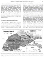
From Miller and others (1998) [1] : "Seguam Island consists of the remnants of two late Quaternary calderas. Holocene volcanic cones occur in both of the calderas and a third Holocene cone lies at the east end of the island. Pyre Peak, commonly referred to as Sequam volcano, highest of the young cones, dominates the western half of the island and occupies the center of the western caldera [2] that is defined by remnants of a semi-circular ridge about 3 km in original diameter and about 700 m high. A Holocene basalt field surrounds Pyre Peak [2] extending down to shoreline. This general area has been the site of most if not all historical volcanic activity. Late Quaternary lavas and pyroclastic rocks ranging in age from 1.1 Ma to 0.03 Ma underlie the basalt. The two Holocene cones to the east are surrounded by andesite and dacite lava flows with well preserved constructional features [2] ."

Name Origin

Seguam Island was called "Ostrov Seguam" by Lieutenant Sarichev, from an Unangam Tunuu name. Lutke called it "Segouam ile" and "Gorely Ile (1836). "Goreli" is Russian for "burnt" (Orth, 1971).


References Cited

[1] Catalog of the historically active volcanoes of Alaska, 1998

Miller, T. P., McGimsey, R. G., Richter, D. H., Riehle, J. R., Nye, C. J., Yount, M. E., and Dumoulin, J. A., 1998, Catalog of the historically active volcanoes of Alaska: U.S. Geological Survey Open-File Report 98-0582, 104 p.

[2] Mid-Pleistocene lavas from the Seguam volcanic center, central Aleutian arc: closed-system fractional crystallization of a basalt to rhyodacite eruptive suite, 1992

Singer, B. S., Myers, J. D., and Frost, C. D., 1992, Mid-Pleistocene lavas from the Seguam volcanic center, central Aleutian arc: closed-system fractional crystallization of a basalt to rhyodacite eruptive suite: Contributions to Mineralogy and Petrology, v. 110, p. 87-112.

Reported Activity

Modern Eruptions

Akutan

Akutan Eruption Timeline

Coxe (1787) reports "The flames of sulfur are occasionally seen at night upon the mountains of Unalaska and Akutan." Jacob and Hauksson (1983) interpret this statement to mean eruptions at Akutan during the 1760's.

Akutan 1790/6

June 18, 1790

Grewingk (1850, translated 2003 by Fritz Jaensch) writes that Sauer and Sarychev reported Akutan smoking on June 7, 1790 [Julian calendar date]. The English translation of Sarychev states that on June 17, 1791 "At midnight a thick mist arose, which lasted till seven in the morning, when the island Atrutan, with its smoking crater, and the circumjacent islets, gradually opened to view." Sauer states that they saw the island of Akutan on June 18th, 1791 [Gregorian calendar date], and makes no mention of smoke.

Grewingk (1850, translated 2003 by Fritz Jaensch) writes that Postels [Russian naturalist aboard the Seniavin] reported Akutan smoking and having hot springs in 1828. Dall (1870) writes: "Little Sitkin, Akun, Akutan, Tanak-Angunakh, Atka, Koniushi, Goreloi, and Shishaldin smoked. The same disturbances continued for two years." This sentence appears to say that all of these volcanoes smoked for two years, which was probably not the case, according to the earlier statements found in Grewingk, which states that Shishaldin smoked for multiple years and doesn't say that Akutan smoked beyond 1828. However, some successive compilers since Dall, including Plummer (1898) and Jacob and Hauksson (1983), state that Akutan was in eruption for two years.

Dall (1870) reports Akutan smoking in 1838.

Kisslinger (1983), translating Doroshin (1870): "In the same year [1845] volcanoes on Akutan smoked, as did Makushin Volcano on Unalaska Island."

Akutan 1848/3

March 5, 1848

Kisslinger (1983), translating Doroshin (1870): "In 1848, in the first few days of March, a volcano on Akutan began to eject flames, ash, and stones, with a rumble and a shaking of the ground."

From Waythomas (1999): "A second, younger noncohesive lahar deposit is present at sections 74, 56, 57, 41, and 41a (Fig. 10 [in original text]). This deposit is similar to the basal gray lahar except that it is deformed and reworked. Folded strata, hummocky surface morphology (Fig. 11 [in original text]), and a prominent headscarp in the upper part of the valley indicate that, after deposition, approximately 3 km 2 of the lahar (70-80% of the total area) was remobilized and flowed a short distance downstream. This may have been caused by ground motion associated with local earthquakes, which are common in this region. The lack of a tephra mantle or soil on the upper lahar in Cascade Bight valley also indicates that the lahar is young, possibly 100 years old or less."

Akutan 1852/9

September 1, 1852

Davidson (1884), speaking of two peaks on Akutan: "I made a sketch of them in 1867, when the eastern one was smoking, and I was then informed by one of the Russian-American navigators that on the night of Sept. 1, 1852, he saw one or two eruptions form the northwest side of these two cones. Frequently fire and great noises issue from the eastern peak."

Byers and Barth (1953) report Akutan smoking in 1862. Dall (1870) does not mention this event in his compilation.

Dall (1870) reports that in 1865, "light was observed at night in the direction of Akhun and Akutan."

Davidson (1884): speaking of two peaks on Akutan: "I made a sketch of them in 1867, when the eastern one was smoking * * *."
Byers and Barth (1953) report that Akutan in 1867 produced "smoke, fire, and 'great noises.'"

Becker (1898) reported a steam and ash eruption at Akutan in 1883.

Becker (1898) reported a lava eruption at Akutan in 1887.

Akutan 1892/8

August 1892 — September 23, 1892

From Stanley-Brown (1899): "One unusually favorable day in August, 1892, Mr. Charles H. Townsend, of the United States Fish Commission, and I climbed one of the peaks of Unalaska bay, which brought Akutan in full view. To our great surprise, we saw gigantic rings of smoke, such as sometimes come in miniature from the smokestacks of locomotives, issuing from the crater at regular intervals of about twenty minutes. As each succeeding ring appeared, its predecessor was slowly breaking up and fading away in the air. Four such rings were seen, but how long the display lasted it was not possible to determine, as the peak became obscured in drifting banners of fog."
Jacob and Hauksson (1983) additionally list that this eruption had explosions that were heard 30 miles away, plumes to 1000' feet high on September 23, and earthquakes.

Akutan 1895/8

August 1, 1895

A letter dated August 2, 1895, was printed in the August 30th, 1895 edition of the San Francisco Call: chroniclingamerica.loc.gov/lcc… . This letter describes an observation of Aktuan: "A volcano on Akutan, a few miles west of here, is sending out great volumes of smoke, and it is doing a little in the way of belching out fire and lava. Last night we were close to it, and it was clear, a good view was had. I believe this is only periodically active, as I was in this vicinity last season and twice before that, but have not noticed so much smoke from it. There are five volcanoes within 100 miles, four of them at present active, or at least smoking."
On August 14, 1895, the Fish Commission Steamer Albatross reported "Mt. Akutan in eruption." Logbooks transcribed by the Old Weather project give the ship's position as N 54 03' , W 166 40'. Scanned images of the relevant logbook pages are available here: oldweather.s3.amazonaws.com/ow… and oldweather.s3.amazonaws.com/ow…
Transcription notes here: forum.oldweather.org/index.php…

Byers and Barth (1953) write that Akutan was "glowing" in 1896.

A March 15, 1907, Washington Post newspaper article describes the eruption observed in March, 1907: "Word has been received from Valdez, Alaska, that the volcano on the Island of Akutan, off the Peninsula of Alaska, and not far from Unalaska, was in active eruption when the steamer Dora passed the island at 2 a.m. on February 28. All the passengers were aroused to witness the sight, which is said to have been magnificent.
"At about the same hour, a severe earthquake occurred occurred at Unalaska, although it did no serious damage."
The U.S. Revenue Service Cutter Perry reported Akutan 'emitting considerable smoke' on June 21, 1907. (Logbook entry available on Old Weather project website: oldweather.s3.amazonaws.com/ow… ).
Jaggar (1908) reports that on June 28, 1907, the "lower active cone of Akutan near the shore is throwing up columns of black factory 'smoke' - steam charged with dust. Continues to say that on the slopes and in the gulch descending from the crater there is much snow, soiled with new-fallen volcanic dust" and on July 3, 1907, Akutan was smoking, and they observed 4 black puffs.
Eakle (1908) writes: "Last summer Akutan was sending up intermittently a huge column of vapor, which spread out above into the well known cauliflower or umbrella shape, similar to the smoke column that hung over San Francisco during the recent conflagration."
And Finch (1935) states that "In 1907 the volcano was more or less continuously active for most of the year."

Akutan 1908/2

February 22, 1908

Sapper (1917) reports Akutan in eruption on February 22, 1908. Coats (1950) says this eruption also had a lava flow. The US Revenue Cutter Perry reported Akutan "smoking" on September 22, 1908.

Akutan 1909/9

September 8, 1909

A newspaper account of a possible eruption at Akutan in 1909 is as follows:
From the Nevada State Journal, September 8, 1909: "Captain M. Webber, of the Alaska pack steamer Lehua, which arrived [to San Francisco] today from the Aleutian Islands, reports that when his vessel left the island the volcano Akutan was in violent eruption. Lava was issuing in great volume." The article then continues to state erroneously that this is the first "disturbance" reported since 1887.

Finch (1935) writes that Hugh McGlashan said that the 1911 eruption of Akutan threw an "appreciable" amount of ash over Akutan Village.

Sapper (1917) reports that during 1912, Akutan was "smoking or steaming" whenever the mountain was visible.

Akutan 1927

1927 — 1928

From Jaggar (1945): Akutan was "smoking and flaming more in 1928 than 1927." Finch (1935) also reported slight earthquakes with rumbles in 1927. Newspaper accounts are more detailed.
From the Warren Tribune, June 6, 1928: "The largest volcanic mountain on Akutan Island was believed to be in eruption today. The motorship Patterson, some distance away, reported to Dutch Harbor that dense clouds of black smoke could be seen rolling from the island."
From the Fairbanks Daily News Miner, June 7, 1928: "Captain Pederson of the motorship Patterson reported that clouds of black smoke and fire are bursting from a new place on the mountain of Akutan on Unalga Pass, while the old vent on the peak, which heretofore has been continually smoking, is quiet."
From the Evening State Journal, July 17, 1928: "Heavy volcanic eruptions on Akutan Island, one of the Aleutian chain, were reported here today by the U.S. coast guard cutter Unalga.
"The inhabitants of native villages on the island are being terrorized by earthquake shocks, the Unalga reported.
"Steam and lava were seen coming from the crater of the volcano on the island, officers of the boat said."

Akutan 1929/6

June 1, 1929 — December 1929

A June 1, 1929 Associated Press article provides the first news of this eruption: "Intermittenly lighting the sky with flames and darkening it with ashes a new volcano today was pouring molten lava down the sides of an unnamed mountain and threatning to cover all of Akutan Island, residents of the upper Aleutian Islands reported here.
"The island, 1,000 miles southwest of Cordova, normally would have about a dozen residents at this time of year. * * * Heavy ash from the volcano was gradually covering neighboring islands, observers reported, and blanketing vegetation with a coat of grey. Volcanic ash has been seen here [Cordova, AK] but whether this was from the Akutan eruption or from some unreported disturbance in turbulent islands of the Bering Sea was unknown."
From Jaggar (1929): Akutan's "lower slopes were covered with ash June 18, 1929." July 1929, he reported it was fuming again.
An Associated Press article published in the June 25, 1929, edition of the Fairbanks Daily News Miner reported "Passengers arriving here [Seattle] yesterday morning on the steamer W.M. Tupper from Bethel said that a volcano in the Aleutian Islands just west of Unimak Pass is active. It is casting a dull red glow in the sky."
From Finch (1935): The December, 1929 eruption was witnessed by Axel Swenson, watchman at the whaling station. "A branch of a flow poured through the northwest gap in the crater rim, but it reached only a short distance down the flank of the mountain. During the summer of 1929 puffs of smoke or ash-laden steam frequently arose from the crater, and these puffs were usually followed by a crackling roar. In December 1929 a glow was observed over the crater for several days."
Byers and Barth (1953) report puffs of smoke in 1929, and a glow seen over crater for several days during December, with lava flow through crater gap. "The December, 1929, lava flow rests on an older ash-covered flow, which is grouped with the 1929 lava * * * as pre-1947 lava. A mud flow, which moved down through the crater gorge, originated at the front of the December, 1929, lava flow, with which it is gradational. This mud flow extends down to the valley bottom, north and north-west of the volcano, and there rests on older interbedded mud flows and ash deposits."

Akutan 1931/5

May 1931 — August 11, 1931

Finch (1935) reports that on August 11, 1931: "One vent in the cone emitted dark smoke or ash along with a rumble." He also reports that smoke was observed in May 1931.
Jaggar (1931) reports that on August 11, 1931 a rumbling was heard, and on July 24, 1931, an ascent of Akutan showed the crater was hot, with steam.

Akutan 1946/12

December 1946 — January 1947

From Byers and Barth (1953): "The most recent lava eruption of Akutan volcano was first seen on January 4, 1947, at 4 pm. An Associated Press article dated January 8 quoted a Navy report that the lava had flowed down the sides of the volcano threatening Akutan village. * * * Actually, inasmuch as the lava of the January, 1947, eruption did not flow out of the crater, the village was never threatened by flowing lava. The small lava tongue that extends through the crater gap and down the crater gorge is part of the December, 1929 lava flow, according to a local resident, Axel Swenson (Finch, 1935, p. 159)." Specimens of the lava flow were collected and analyzed by thin section and found to be saturated calcic basalt.
Seventy-five residents were evacuated from Akutan Island in January, 1947.
A January 11, 1947 Associated Press article describes the lava flow: "A half-mile stream of red-hot lava was described today in the first eye witness account of this week's eruptions of Akutan and Shishaldin volcanoes. * * * Lt. P.T. Kissling, * * * piloted a long range patrol plane * * * from which J.C. Betterton, chief photographer's mate * * * photographed the spectacles.
"Flight conditions were bad, but Lieutenant Kissling reported:
"'Arriving over Akutan peak at dawn, the mountain presented a rare sight, in that visiblity was unlimited in the area, permitting eruptions to be observed in detail. They (eruptions) were confined to newly-formed cone about 300 feet high within the larger crater of Akutan Peak which is three miles in diameter.
"'A red stream of molten lava was flowing down the peak for a distance of about half mile, ending in a lake of greenish brown water formed in melted ice of the glacier.
"'An unforgettable sight of colors was noted -- the red-orange lava and the bright orange flames from lava-flow contrasting with dirty-gray ash on the snow -- the ice in the crater -- and the pure white snow untouched by the ashes.'
"On one flight above the cone, the plane flew through the smoke, and the cabin filled with acrid fumes."
And from Unknown (1949): "* * * Akutan volcano erupted during January 1947, and a thick flood of lava covering an area one half mile square was poured out into the crater. Very little ash fell on Akutan village then, because fortunately the wind remained in the right direction to blow the erupting ash out to sea. At the onset of the 1947 eruption, the commandant of the Seventeenth Naval District at Kodiak ordered a Navy auxiliary tug to evacuate the villagers if necessary."

Akutan 1948/8

August 1948

From Unknown (Earth Science Digest, 1949): "During August 1948 the crater area of Akutan volcano was examined by geologists of the U.S. Geological Survey, who mapped the limits of the 1947 lava flow and of earlier lava flows. During the geologists' visit large boulders and ash were noisily ejected from the cinder cone inside the crater at irregular intervals ranging from a few minutes to several hours. The boulders fell over a limited area around the base of the cone, but some of the lighter ash fell on the geologists' tent pitched 3 miles from the volcano."
From Byers and Barth (1953): "The activity of Akutan volcano in August, 1948, was confined to the cone inside the crater. During successive days from August 4 to August 7, the writers had opportunity to observe the volcano close at hand for several hours. The activity was sufficient to make unsafe any attempt to climb the cone, and indeed, even to approach within 200 yards of its base. During the time the cone was under observation, all the major blasts came from the westernmost part of the three craterlets at the top of the cone. At intervals ranging from one to five hours, one or two, rarely three, blasts spaced a few minutes apart would issue from this craterlet. These major blasts consisted of a loud rush of ash-laden gas, followed by a surprisingly loud clatter of falling rocks, some of which were incandescent. The blocks ranged in maximum dimension from a few inches to a few feet. The average long dimension of blocks embedded in snow near the base of the cone was about six inches." Byers and Barth (1953) analyzed a block ejected during the summer of 1948 and found it was calcic basalt.

Akutan 1949/4

April 29, 1949 — June 1949

Unknown (Earth Science Digest, 1949) reports: "* * * According to Hugh McGlashan, postmaster at Akutan, a village 8 miles east of the volcano, 1/8 inch of ash fell on the village during the night of April 29. Ash mixed with sleet continued to fall all during the following day because of a steady west wind from the direction of the volcano. Now snow on the higher slopes of the volcano is covered by a heavy black layer of ash. The eruption continued full scale until May 10 and then decreased somewhat in intensity.
"On May 17 several of the villagers made a closer approach to the volcano and reported hot lava flowing down the northwest slope. Considerable steam was rising at the front of the lava where it encountered the winter blanket of snow. This material may have been a hot mudflow, formed by lava mixing with snow, ice, and boulders inside the crater.
"* * * * Approximately two weeks prior to the recent eruption, three heavy earthquakes were felt at the village."
From Byers and Barth (1953): "The clatter of falling rock was perhaps what had been heard by local residents as a "crackling roar" (Finch, 1935, p. 159) during the 1929 eruption.
"Within a minute after the first discharge, a dark grey cauliflower-shaped cloud extending nearly a mile above the cone could be seen on a clear day. This cloud was soon dissipated by the wind. Frequently, the blasts were sharp enough to be termed explosions, and then resembled quarry blasts. Some of the explosions were loud enough to be heard at Akutan village, 8 miles distant.
"Smaller puffs of lighter grey, ash-laden clouds [see fig. 5 in original text] occurred between major blasts at intervals ranging from a few minutes to a few hours. Usually, several smaller puffs followed a major blast." A block ejected during this time period was analyzed in thin section and found to be saturated calcic basalt.

Akutan 1951/10

October 1951

Jones (1951) reported minor ash showers and fume emissions from Akutan in 1951, and he also (Jones, 1952) reported that during October 1951, the lower slopes of Akutan showed fresh black ash on top of the snow, but the summit of the volcano was concealed in cloud.

Powers (1958) reports an ash eruption at Akutan from 1948-1953. Other compilers state only an eruption or possible eruption at Akutan in 1953.

Akutan 1962/11

November 7, 1962

From Reeder (1988): "Some evening during the first part of November 1962, Nick Borenin of Akutan village observed from his boat that was just outside of Akutan Harbor lava "fire" that was being emitted from the summit caldera of Akutan volcano. Larry Mensoff of Akutan village said that at the time one could hear a rumbling sound from the volcano at the village, which is 12 km east of Akutan volcano. In the next morning, the village awoke to find snow and window ledges covered with a very noticeable layer of ash. The ash was thick enough that the village board walks had to be swept off. The ash also got into the village water system for several days.
"Vince Tutiakoff of Unalaska village also reported that up to 0.0025 m of fine to coarse sand-size tephra had also fallen early the same morning at Unalaska village, which is located 47 km SW of Akutan volcano. The event was so rare for Unalaska village that there was no school that day.
"The exact day in the early part of November 1962 of this eruption event is unknown, but numerous residents of both Unalaska and Akutan villages clearly remembered the event when they first told me about it in 1985."

Akutan 1972/2

February 11, 1972

From Shackelford (1976): "The crew of the S.S. Summit observed Akutan in eruption at 0900 GMT on 11 February 1974. Ejecta was thrown to heights exceeding 100 meters, while a lava flow poured down the west flank of the volcano toward the Lava Bight. The lava flow was several hundred meters in length. The eruption was of a pulsating, intermittent nature (Information from Smithsonian Institution, 1974).
"Since the original report said that the lava was flowing down the side of the 634 m peak, and because Akutan is 1293 m tall, it may well have been a flank eruption."

Akutan 1972/9

September 1972 — May 1973

From Stone (1975): "Pilots from Reeve-Aleutian Airways reported on 22 May 1973 that the Akutan volcano apparently had been erupting ash and steam for several months.
"A survey of ERTS satellite data from past months revealed that Image No. 1056-21331 of 17 September 1972 showed the mountain to be essentially snow-free as contrasted with other nearby peaks at similar altitudes."

Akutan 1976/10

October 1976 — May 9, 1977

From Shackelford (1979): "Sporadic ash eruptions, which began in fall 1976, were still continuing as of May 1977. Observations of the activity during May 1977 showed explosive ejection of light brown ash clouds (every 1/4 hour between 17:00 and 20:00 on 5 May) with the ash cloud drifting N. During the inter-eruption periods, white fume emission occurred. Incandescent tephra was noted on 6 May at 17:30, and further eruptions were noted the following day. Similar activity was noted on 9 May. It is not unlikely that this explosive activity continued beyond the last date of observed activity, as Akutan typically is in a state of mild explosive activity lasting months or years. No further information known to this reporter."

Akutan 1978/9

September 21, 1978 — October 1978

From Compton and others (1980), describing activity at Akutan beginning in late September, 1978 and ending in October, 1978: "Akutan began to erupt in late September, 1978. Airline pilots reported incandescent fragments, some 'as big as a car' rising about 100 m above the crater. The U.S. Coast Guard Cutter Morgenthau passed N of Akutan during the evening of 6 October. Crew members observed incandescent tephra ejection from the summit and glow reflecting upward onto an eruption column. A deep red glow about 1 km long which appeared to be a lava flow, moved down the slopes of the volcano."

Akutan 1980/7

July 8, 1980

From Shackelford (1982): "Akutan's central cone was observed to be in light eruption in July 1980. Observations on 3 July showed no eruptive activity. However, observers noted on 8 July a plume of steam and dark brownish gray ash rising over the volcano's central cone, to perhaps 0.5 -1.0 km above the crater. No glow was visible. Also, the July observations included the discovery of a fresh-looking lava flow of small dimensions that had moved through the breach in the caldera wall on the NW."

Akutan 1982/10

October 7, 1982 — May 1983

From Reeder (1986): "Steam has been emitted continuously from the large cinder cone within the Akutan summit caldera since its last July, 1980 eruption * * *. Then, sometime during the first part of October 1982 very light ash falls from this cone occurred in Akutan village, which is located about 12 kms to the east. For example, Charles McGlashan of Akutan noticed during the first part of October 1982 ash on his white canvas tent, which he had originally erected at the village in August. By the end of October, the tent was light grey in color because of the light ash falls. Larry Mensoff of Akutan noticed a small ash fall that occurred in Akutan village in November. Then, on the morning of 18 +/- December, 1982, the community has a light but very noticeable layer of ash that had fallen the previous night over snow (sources of information: Paul Mahoney of Dutch Harbor, and others from Akutan village). The same day, Paul Mahoney left for Dutch Harbor by boat.
"* * * Airpac pilot Dave Henley on 22+/- December noticed fresh ash deposits on the Akutan summit region as well as the healthy emission of steam with some dark smoke from the cinder cone within the Akutan caldera. On his first flight to Akutan on the 23 +/- December, he again noticed some smoke emissions from the cinder cone.
"Paul Mahoney returned to Akutan on the second Airpac flight from Dutch Harbor to Akutan village on 23 +/- December. This midday flight was also flown by Dave Henley. Both were in favor of investigating the summit region of Akutan volcano, especially since the weather was clear enough to see Akutan volcano when air-borne from Dutch Harbor. A smoky haze could be seen above Akutan volcano as they approached and sulfur gases were detected even before they reached the volcano. They then circled the steaming Akutan cinder cone several times, flying just above (approximately 100 m above) the rim of the Akutan caldera. Suddenly, the steaming cinder cone started to erupt ash, lapilli, and blocks of rock. Paul Mahoney took photographs. Fearing damage to the plane, Dave immediately left the caldera and completed his flight to the village. Dave estimated, while he was returning to Dutch Harbor about 20 minutes later, that the tephra cloud had reached a height of 2 km above the volcano (an altitude of 3.3 km). No ash-fall occurred at Akutan village during this particular eruption."
"A visit to Akutan volcano was made by J.W. Reeder on 16 January, 1983. At this time, a small amount of ash was observed on the eastern side of the volcano over 14-15 January snow deposits (EOS, Trans. Amer. Geophy. Union, v. 64, no. 28, p. 451). Steam was being emitted from the cinder cone.
"After this visit, several similar fresh ash deposits were noted by pilot Dave Henley (Airpac Inc., Dutch Harbor) up into May 1983. Unfortunately, there is no dated record of these observations. No 1983 ash falls occurred in the Akutan village, which is located about 12 km east of the cone.
"J.W. Reeder, with the climbing assistance of Scott Kerr from Unalaska and of Mark Larsen from Anchorage, climbed to the summit of the Akutan volcano on July of 1981. Based on this 1981 observation and on the 16 January, 1983 observation, no new lava flows nor major changes to the steaming cinder cone had occurred during the 1982-83 eruption."

Akutan 1986/2

February 3, 1986 — June 14, 1986

From Reeder (1989): "Intermittent steam-blast eruptions with or without ash occurred from the tephra cone inside the summit caldera of Akutan volcano during 3 February through 8 May 1986. Intermittent tephra eruptions occurred from this cone during 1 June through 14 June 1986." See original text for chart and details of observed activity.
Miller (1987) gives this summary of the activity: "The eruption was characterized by sporadic ejection of ash to heights of 15,000 feet from a 4,275-foot-high intracaldera cone. No ashfalls were recorded in the nearby villages of Dutch Harbor and Akutan, and the eruption was not considered a hazard."

Akutan 1987/1

January 31, 1987 — June 24, 1987

From Reeder (1990): "During 1987, nearly continuous minor steam emissions occurred from the tephra cone in the Akutan summit caldera. Between 31 January and 24 June, numerous tephra emissions occurred from the caldera cone, causing it to increase in height by about an estimated 100 m." The highest tephra plume went to 4,900 m on February 10, 1987. Ash plumes were often observed by pilots and by residents of Akutan. Incandescence was observed on the evening of April 22 (+/- 1 day). See Reeder (1990) for detailed observations and chronology.

Akutan 1988/3

March 26, 1988 — July 20, 1988

From Reeder (1991), concerning eruptive activity at Akutan during 1988: "Only minor but nearly continuous steam emissions from the summit cone were reported up until 26 March 1988 when another series of tephra explosions, principally without steam, occurred from the cone up through 20 July 1988. One of the largest tephra plumes reached 2.7 km above the summit of the volcano at 0919 LT (=GMT - 8 hours) on June 2. Minor ash dustings also occurred three times during this 1988 eruptive period at the Akutan village that is 12.5 km to the E of the volcano. Only minor but nearly continuous steam emissions occurred from the summit cone since 20 July 1988 for the rest of the year." For detailed observations and chronology, please see Reeder (1991).

Akutan 1989/2

February 27, 1989 — March 31, 1989

From Reeder (1992): "During 1989, nearly continuous minor steam emissions occurred from the tephra cone in the Akutan summit caldera. Between February 27 and March 28, several tephra explosions occurred from the caldera tephra cone.
"On February 27, 1989, at about 1200, Lawrence Prokopioff, a resident of Akutan village, observed a small vertical blast of ash with steam from the summit tephra cone of Akutan volcano from his small boat just north of Akutan Island. The plume was large enough to be easily noticed (probably the plume had a height of under 500 m above the volcano).
"On March 15 and 0900, pilot Nic Sias of Peninsula Airways Inc. felt an atmospheric shock wave while he was southbound for Dutch Harbor in his Grumman Goose over the west shore of Akutan volcano. He then noticed the unusual rapid growth and rise of a black eruption plume from the summit tephra cone of Akutan volcano. The top of the rising plume quickly disappeared into the 1,800 m altitude cloud cover. The visibility was very good for Nic underneath this cloud cover, but he could not see through the cloud cover. With no additional eruption observation, he landed at his destination (Dutch Harbor) at about 0930. Richard Petrie of Trident Seafoods Corporation near Akutan village noticed from his office window the same eruption plume. Richard was able to see through the broken 1,800 m cloud cover, and he estimated that the black plume rapidly rose up to 2,300 m above the volcano. The plume changed to a smaller grayish steam plume and then eventually to a much smaller white steam plume. This sequence occurred over a period of several hours. At about 1430, David McGlashan, president of the Akutan Corporation, noticed from the Akutan village a small dark gray eruption plume from Akutan volcano that was drifting south. At about 1500, Pilot Nic Sias and photographer Harold Wilson flew new the volcano. Some dark steam was being emitted from the summit tephra cone. Fresh ash covered snow on the entire W and SW flanks of the volcano above a 600 m elevation, which was the only sides of the volcano they got views of.
"In the morning of March 16, 1989, David McGlashan reported that a very light ash dusting occurred at the Akutan village the night before. A trace of ash was easily noticed on window sills in the village. At 1100, Harold Wilson reported that the summit region of Akutan volcano was white with fresh snow as he flew by it from Dutch Harbor to Anchorage.
"Sometime between March 17 and 31, 1989, David McGlashan noticed for the first time that steam emissions were occurring from a crater on the E side of the near summit tephra cone. Before, all steam emissions were occurring from the W side of the near summit cone.
"Craig Leth of FAA noticed on March 28 and 29, 1989, that the top of Akutan volcano was black with fresh looking ash deposits. Minor steam emissions were occurring at the time.
"On March 31, 1989, at about 1945, Lieutenant Commander Steve Rapalus and his crew observed a large white plume above Akutan volcano from his U.S. Coast Guard C-130 as he was flying from Dutch Harbor to Kodiak. The plume was at least 600 m above the volcano and the top had drifted to the south for up to 7 km. The plume did appear white to Steve. Earlier, at 1900, Linda Logan of Trident Seafoods Corporation near Akutan village noticed no eruptive activity from the volcano, which she could see at the time."

Akutan 1990/1

January 22, 1990

From Reeder (1993): "Mark Owen of Trident Seafood Corporation in Akutan village reported several short lived and small tephra plumes rising from the summit tephra cone in the Akutan Volcano summit caldera for several days during the latter part of January 1990. The exact date of this activity is unknown."

Akutan 1990/9

September 6, 1990 — October 1, 1990

From Smithsonian Institution (1990): "A series of small, short-lived tephra clouds from Akutan were observed in September. No ashfall was noted at Akutan village. Tephra ejection had last been reported in January. Observer's initials, in brackets, follow their information in the chronology below.
"6 September: An ash plume was rising 200 m above the tephra cone in the summit caldera at 0910. By 1022, only a thin atmospheric ash layer remained, extending at least 24 km at 1200 m altitude [RL]. At about 1220, a gray cloud reached 1700 m altitude. Ash was again being emitted at 1330, and was drifting E [JRo].
"21 September: Tephra plumes rose about 300 m above the summit at 0915 and 1345 [JRi]. Another plume was seen from Akutan village at about 1600 [MO]. At 1815, a dark gray plume rose to an altitude estimated from the ground at 2400 m, then drifted NE [JRi]. A tephra column ejected at about 2030 that was initially black, then faded to a brown tone, grew into a mushroom-shaped cloud that reached approximately 2,400 m above the volcano [MO]. Observers from the village estimated that each of the day's plumes had risen at least 1,200 m.
"22 September: A small tephra plume rose about 150 m at 1030. Steam emission was above normal through the day [JRi].
"Several similar small tephra clouds were seen during the following days, but no records were kept of dates and times.
"30 September: A very dark black plume ejected at 2005 rose about 1800 m and drifted E toward Akutan village [DH].
"1 October: At 1055, a dark black cloud rapidly emerged and reached 1,500 m above the summit before moving E. After the initial burst, the plume weakened to a light brown color. Activity was apparently limited to emission of a 60-m steam plume for the rest of the day [MO].
"Observers (initials in brackets): David Hamilton and Mark Owen (Trident Seafood, Akutan village); Robert LeBlanc, Jerry Richardson, and Jean Robert (MarkAir)."

Akutan 1991/9

September 15, 1991 — November 28, 1991

From Reeder (1994): "Tephra emissions from the summit tephra cone of Akutan volcano began September 15, 1991, and have occurred up through November, 1991.
"* * * A fisherman from the Seattle based fishing boat Richards reported at Dutch Harbor that he observed from his fishing boat at about 0800 LT September 15, 1991, lots of black material being emitted from the summit tephra cone of the Akutan volcano that rose about 300 meters above the volcano and that drifted sharply to the NE. The black emission stopped by about 0900. Shortly after 0900, the volcano billowed white steam with some black material for a short time.
"An unknown fisherman other than the above reported at Dutch Harbor that he observed on September 17, some eruptive activity of Akutan volcano. He made this report without any knowledge of the September 15 observation.
"On September 17, pilot Darren Talmadge reported to the FAA Flight Service in Cold Bay, as observed from his MarkAir Express Caravan Cessna 208 during the morning, a very dark gray billowy eruption plume from Akutan volcano that went up to an altitude of about 2,400 m. Cloud cover obscured the volcano for the rest of the day. On September 29, Jodeanne Ryan of MarkAir Inc. observed at about 1315 an Akutan eruption plume from the 737 Boeing Jet that had just departed from Dutch Harbor at about 1305. The mushroomed plume had already formed above the volcano to an altitude estimated to be less than 2,400 m. The tephra plume was drifting slightly to the NE. Later on September 29, Mark Owen and his Trident Seafoods Corporation group observed 6 short-lived but impressive tephra plumes form above the volcano. The first three occurred at 1517, 1520, and then 1535. These plumes rose within at least 1 minute to an estimated 3000 m above the volcano as black to light brown tephra plumes that drifted to the NW. At 1800, the Russian yacht, Tarpon, of Petropavlosk-Kamchatsky as it was returning to Dutch Harbor from Seattle on the Pacific side of Akutan Island observed black smoke for 3 minutes hit the clouds above the erupting Akutan summit tephra cone. A beautiful tephra plume formed sometime between 2000 and 2100 that rose about 4,500 above the volcano as estimated by Mark Owen. The snow cover on the volcano, which was above the 300 m altitude, was white at the time. The upper part of the volcano was still covered with cloud, but the plumes could be seen above because the cloud cover was broken. Bret Joines of Trident Seafoods Corporation at Akutan reported that some fine ash could be detected the next afternoon in the Akutan village region over windowsills. Mark Owen also observed that the snow on the volcano was then ash covered.
"On October 11, MarkAir Express pilot Darren Talmadge observed during the day from his Cessna 208 Caravan two short-lived eruption plumes from Akutan volcano that reached altitudes of 2,400 m and 2,100 m, respectively. These occurred at about 1030 and 1100, respectively.
"The Trident Seafoods Corporation group at Akutan reported an ash dusting in the Akutan village midday on October 13 as noticed in the afternoon on windowsills. They also noted ash falling through the cloud cover in the afternoon of October 13 at the western end of Akutan Bay.
"On October 14, Mark Owen and his Trident Seafoods Corporation group at Akutan observed about 0935 an eruption plume form from the Akutan summit tephra cone that reached a height above the volcano of about 1,500 m. Pilot Nic Sias of Peninsula Airways Inc. observed from his Grumman Goose the same eruption plume, which he estimated reached a maximum height of 1,800 m above the volcano. The winds were out of the west. The Trident group reported nearly continuous steam and black smoke rising over 200 m above the summit tephra cone of the volcano for the entire morning with large blasting events such as occurred at 0935 about every hour. They felt eruptive activity was occurring earlier in the morning but they could not see it because daylight came just before the 0935 event. Bret Joines of Trident Seafoods observed 6 dark eruption events rising at least 460 m above the volcano between 1530 and 1730 on October 14.
"At 1600, the Dutch Harbor Weather Center (Alaska Aviation Weather Radio) at the Dutch Harbor airport also observed the eruptive activity from Akutan volcano. Jack Wood of OESI Corporation out of Sparks, Nevada, observed and videoed the from the northern part of Amaknak Island just north of the Dutch Harbor airport an eruption plume rise up to about 1,500 m above the Akutan volcano at a start time of 1721. The plume then drifted to the NNE.
"On October 18, Mark Owen of Trident Seafoods reported that the volcano was steaming continuously during the entire day, with at least six dark 460 to 600 m high short-lived plumes that trailed to the W. On October 19, Bret Joines of Trident Seafoods reported that the upper part of the volcano was completely covered by cloud, but that the visible 300 m snow line on the volcano was all black with ash all the way up into the clouds. Their last good snow was on October 15.
"Between 0800 and 1000 November 30, Michael Lockhart and Mark Owen of Trident Seafoods Corporation at Akutan village observed a fairly steady-state 600 m high white steam plume above the summit tephra cone of Akutan volcano. Mark had Michael climb the 700 m ridge N of Akutan village to observe between 1300 and 1500 the impressive eruption of Westdahl volcano to the ENE. During this time, Michael had excellent views of Akutan volcano, which was not steaming. He could see fresh ash north of the rim of the Akutan summit crater that must have been deposited within the last 48 hours since their last good snow."

Akutan 1992/3

March 8, 1992 — May 31, 1992

From McGimsey and others (1995): "On March 8 at 1645, a pilot reported a small steam plume, possibly containing ash, rising about 2 km above the summit of Akutan (summit elevation 1303 m). Localized ashfall at the summit accompanied the eruption. Minor steam and ash plumes (<100 m high) were reported on March 11-12. On March 22 a pilot reported at 4.3-km-high ash plume at 1637 and fishing vessels off Akutan Island reported ashfall. A resident of Akutan Village, located 16 km east of the volcano, reported ash plumes rising 450-550 m above the summit on April 7. Two days later, at 10:00 am AST, a pilot reported an ash cloud at about 3-3.5 altitude, drifting northwest. On April 26, a pilot reported ash rising to about 2.5 km altitude (1.2 km above summit). The next report of activity came on May 21 when an observer in Akutan Village saw fresh ash on the snow-covered flank and small ash emissions rising 250-300 m above the summit. Inclement weather prevented frequent observation of the summit during March-May and there were probably many more plumes than reported. Nearly continuous low-level emission of ash and steam is typical of historical eruptions at Akutan. The final episode of activity was reported at 2:45 pm AST on December 18 when a pilot observed a small ash cloud rising several hundred meters above the summit.
"AVO responded to reports of eruptive activity by monitoring pilot reports and satellite imagery, making daily inquiries to observers in Akutan and Dutch Harbor, studying video footage provided by commercial and private pilots, and issuing the information to federal and state agencies and the media."

Akutan 1992/12

December 18, 1992

From Smithsonian Institution (1992): "A small ash cloud * * * rose to a maximum altitude of 1.8 km (several hundred meters above the summit) shortly after 1445 on 18 December. The plume was carried ~20 km N, then rapidly dissipated."

Akutan 1996/3

March 10, 1996 — March 18, 1996

This seismic swarm is not considered to be an eruption of Akutan.
From Neal and McGimsey (1997): "On March 10 [1996], a seismic swarm severe enough to seriously alarm residents began beneath the island of Akutan in the eastern Aleutians. Nearly continuous ground shaking punctuated by occasional large shocks continued for 24 hours. After a lull, a second swarm occurred on March 13 and lasted for about 18 hours. During both episodes, felt earthquakes occurred at rates of up to one per minute; 30-40 earthquakes per hour were recorded on a seismic station at Dutton Volcano 270 km to the northeast. The largest of the individual shocks reached M5.3 and were felt in Dutch Harbor 50 km to the west. The second swarm caused minor damage to household items, interior walls and plumbing in the City of Akutan, 5 km east of the volcano. Although interpreted to be the result of a magmatic intrusion, the seismic swarm decayed over the next several weeks and no eruption ensued. AVO responded to the March seismic crisis by deploying a team to Akutan to install an emergency seismic network and begin real-time monitoring of continuing seismicity (Power and others, 1996). The team also discussed potential hazards with residents of Akutan and met with various groups of citizens and workers at the seafood processing plant to update them on the situation and potential hazards. Satellite images were routinely examined for anomalous thermal features or ash clouds. AVO staff in Anchorage and Fairbanks handled the information flow, interacted with a variety of private and public officials and the media, and established the receiving end of a new seismic data stream from Akutan. AVO went on 24-hour duty for a period of several weeks while Level of Concern Color Code Orange was instituted. Subsequently, during the summer, the Akutan seismic network was upgraded as part of the Central Aleutian seismic expansion [see fig. 8 in original text]. During this effort, AVO crews found a 20-km-long system of en echelon ground cracks that presumably formed during this event [see fig. 9 in original text]."

Loading

Akutan unrest 1998/3

March 26, 1998

From McGimsey and others (2003): "On March 26, 1998, AVO received phone calls from the Trident seafood processing plant in Akutan reporting lighting and a possible steam cloud over the summit of the volcano [Akutan]. At the same time, an increase in high-frequency seismicity was detected. The tremor-like seismic signal was confined to a single station. A strong storm with high winds was passing through the region and AVO ultimately concluded that the seismic signals were weather-related."

Akutan 2003/10

October 15, 2003

From McGimsey and others (2005): "AVO received reports on October 15, 2003 from several sources - both on land and at sea - of increased steaming from the northeast flank of the volcano. All reports indicate that the steaming was located at about the 1,500 to 2,000 ft. elevation (~500 to 600 m), and not from the summit crater or cone. A review of seismic data indicated nothing unusual. Hot Springs Bay Valley, which contains a string of thermal springs, heads on the northeast flank of Akutan, and a well-documented and long-lived fumarolic field exists at about the 1,500 ft. level (Richter and others, 1998) [see figs. 20 and 21 in original text]. Under favorable meteorological and visibility conditions, steam coalescing from this field can produce persistent steam clouds. AVO staff further reviewed recent seismic data and queried local residents in Akutan village. Nothing unusual was found and no further reports came forth."

Akutan non-eruptive activity 2005

January 1, 2005 — July 1, 2019

From Cameron and others, 2023: "In 2018, Akutan Volcano continued its long-term reinflation, which AVO has recorded since the installation of a GPS network at the volcano in 2005. The deformation was slightly faster in 2018 compared to its long-term rate. DeGrandpre and others (2017) noted that inflation at Akutan Volcano is episodic and suggested a shallow magma reservoir resides 6-10 km [3.7-6.2 mi] beneath the volcano. Continued inflation of the volcano is consistent with an ongoing accumulation of magma at shallow levels. The Aviation Color Code and Volcano Alert Level for the volcano remained at GREEN and NORMAL throughout 2018."

From Orr and others, 2023: "In prior years, activity at Akutan Volcano was characterized by a pattern of long-term reinflation, first observed after AVO field crews installed a Global Positioning System (GPS) network on the volcano in 2005. In 2019, however, the volcano deviated from this long-term trend by showing no systematic deformation that could be confidently linked to a volcanic source."

Loading

Akutan 2007/1

January 13, 2007 — October 2007

From McGimsey and others (2011): Akutan is one of several Alaska volcanoes at which seismicity was triggered by the M8.2 earthquake generated in the Kurile Islands on January 13, 2007, 0423 UTC. Four of the seven largest triggered Akutan events, ranging in magnitude from 0.0 to 0.5 and depths from 0.86 to -2.17 km, were located (see fig. 36 in original text; John Power, AVO/USGS, written commun., 2010). The earthquake locations fall along the trend of intense seismicity and ground breakage that occurred in March 1996 at Akutan (Neal and others, 1997; Waythomas and others, 1998, fig. 10; Lu and others, 2005). The AVO Akutan seismic network was installed in the summer of 1996, and this was the first instance of observed triggered seismicity at Akutan; however, it was short-lived and did not result in any detectable surface disturbance.
"In early October 2007, AVO remote sensors using GPS time series for Akutan detected signs of renewed inflation over the previous month of the west flank, the same area that inflated during the 1996 seismic crisis. A few days later, on October 8, the manager of the Trident seafood processing plant called to alert AVO of 'strong steaming' from a 'new' area in the Hot Springs Bay valley [see fig. 37 in original text]. Long-known thermal springs occur along the lower course of the stream draining the valley, and the photograph of figure 37 shows a steam column apparently rising from further up-valley of the springs area. This also is the area of maximum deflation following the 1996 seismic swarms. No unusual seismic activity was noted for the period of west-flank inflation or this steaming episode. This location for a steam plume was considered 'new' by local observers because the lower-valley thermal springs rarely emit a concentrated, vertically rising plume of steam and most reports of steaming arise from the prominent fumarole field located at the 1,500-ft-level of the eastern flank at the headwaters of Hot Springs Bay valley [see fig. 38 in original text]."

Akutan 2013/1

January 5, 2013

From Dixon and others (2015): "Following the M=7.5 Queen Charlotte earthquake in southeast Alaska on January 5, 2013, the seismograph network on Akutan Volcano recorded episodes of phase modulated tectonic tremor. Other possible earthquake-triggered seismicity was noted at nearby Westdahl and within the Katmai volcanic cluster. AVO internal log entries periodically noted tremor at Akutan, with tectonic tremor as the most probable origin. Short sequences of low-frequency earthquakes were located on February 8, May 29, and September 13, with a small swarm of volcanic-tectonic events reported on July 12. The Aviation Color Code and Volcano Alert Level remained at GREEN/NORMAL throughout the year."

Akutan 2014/7

July 15, 2014

From Cameron and others, 2017: "A series of 34 earthquakes occurred on Akutan volcano on July 15, 2014. Nine of theearthquakes had a magnitude between 1 and 2; the rest were smaller. Following the earthquake swarm, AVO re-analyzed GPS data and concluded that Akutan experienced about 1 cm (0.4 in.) uplift around the time of the seismic swarm. The GPS data clearly show a volcanic inflation signal (outward and upward) with a start date at the beginning of 2014, most likely indicating intrusion of magma (Jeff Freymueller, UAFGI/AVO, written commun., 2014). A second earthquake swarm of 24 earthquakes occurred 5 months later on December 7, including a M2.5 earthquake, 2-3 km (1.2-1.9 mi) south of Akutan. Tectonic tremor was noted throughout 2014, and is typical for the Akutan seismograph network."

Loading

Akutan 1765

Akutan 1790/6

Akutan 1828

Akutan 1838

Akutan 1845

Akutan 1848/3

Akutan Cascade Bight Valley Young Lahar

Akutan 1852/9

Akutan 1862

Akutan 1865

Akutan 1867

Akutan 1883

Akutan 1887

Akutan 1892/8

Akutan 1895/8

Akutan 1896

Akutan 1907

Akutan 1908/2

Akutan 1909/9

Akutan 1911

Akutan 1912

Akutan 1927

Akutan 1929/6

Akutan 1931/5

Akutan 1946/12

Akutan 1948/8

Akutan 1949/4

Akutan 1951/10

Akutan 1953

Akutan 1962/11

Akutan 1972/2

Akutan 1972/9

Akutan 1976/10

Akutan 1978/9

Akutan 1980/7

Akutan 1982/10

Akutan 1986/2

Akutan 1987/1

Akutan 1988/3

Akutan 1989/2

Akutan 1990/1

Akutan 1990/9

Akutan 1991/9

Akutan 1992/3

Akutan 1992/12

Akutan 1996/3

Akutan unrest 1998/3

Akutan 2003/10

Akutan non-eruptive activity 2005

Akutan 2007/1

Akutan 2013/1

Akutan 2014/7

1100
1200
1300
1400
1500
1600
1700
1800
1900
2000
2100
2200
2300
2400
2500
2600
1710
1720
1730
1740
1750
1760
1770
1780
1790
1810
1820
1830
1840
1850
1860
1870
1880
1890
1910
1920
1930
1940
1950
1960
1970
1980
1990
2010
2020
2030
2040
2050
2060
2070
2080

13 Event Date(s)

Past Activity Legend:
Eruption
Questionable eruption
Non-eruptive activity


Showing 1 - 20 of 30

Map Images


Map References


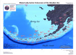
Recently active volcanoes of Alaska, 2023

Cameron, C.E., Bull, K.F., and Macpherson, A.E., 2023, Recently active volcanoes of Alaska: Alaska Division of Geological & Geophysical Surveys Miscellaneous Publication 133 v. 6, 2 sheets. https://doi.org/10.14509/31086.

Historically active volcanoes of Alaska, v. 3, 2018

Cameron, C.E., Schaefer, J.R., and Mulliken, K.M., 2018, Historically active volcanoes of Alaska: Alaska Division of Geological & Geophysical Surveys Miscellaneous Publication 133 v. 3, 2 sheets. Http://doi.org/10.14509/30142

Historically active volcanoes of Alaska, 2014

Schaefer, J.R., Cameron, C.E., and Nye, C.J., 2014, Historically active volcanoes of Alaska: Alaska Division of Geological & Geophysical Surveys Miscellaneous Publication 133 v. 1.2, 1 sheet, scale 1:3,000,000. This publication has been superseded. Newest version available at http://www.dggs.alaska.gov/pubs/id/20181 .

Historically active volcanoes of the Aleutian Arc, 2002

Schaefer, Janet, and Nye, C. J., 2002, Historically active volcanoes of the Aleutian Arc: Alaska Division of Geological & Geophysical Surveys Miscellaneous Publication MP 0123, unpaged, 1 sheet, scale 1:3,000,000. Superceded by Miscellaneous Publication 133: http://www.dggs.dnr.state.ak.us/pubs/pubs?reqtype=citation&ID=20181

Volcanoes of Alaska, 1998

Nye, C. J., Queen, Katherine, and McCarthy, A. M., 1998, Volcanoes of Alaska: Alaska Division of Geological & Geophysical Surveys Information Circular IC 0038, unpaged, 1 sheet, scale 1:4,000,000, available at http://www.dggs.dnr.state.ak.us/pubs/pubs?reqtype=citation&ID=7043 .
Hard Copy held by AVO at FBKS - CEC shelf

Volcanoes of Alaska, 1995

Alaska Division of Geological & Geophysical Surveys, 1995, Volcanoes of Alaska: Alaska Division of Geological & Geophysical Surveys Information Circular IC 0038, unpaged, 1 sheet, scale 1:4,000,000.

Aleutian arc volcanoes, 1994

Nye, C. J., 1994, Aleutian arc volcanoes: Alaska Division of Geological & Geophysical Surveys Public-Data File PDF 94-54, unpaged, 1 sheet, scale 1:2,126,841.

Geothermal resources of the Aleutian Arc, 1993

Motyka, R. J., Liss, S. A., Nye, C. J., and Moorman, M. A., 1993, Geothermal resources of the Aleutian Arc: Alaska Division of Geological & Geophysical Surveys Professional Report PR 0114, 17 p., 4 sheets, scale 1:1,000,000.
Hard Copy held by AVO at FBKS - CEC shelf

Holocene volcanoes of the Aleutian Arc, Alaska, 1993

March, G. D., 1993, Holocene volcanoes of the Aleutian Arc, Alaska: Alaska Division of Geological & Geophysical Surveys Public-Data File PDF 93-85, unpaged, 1 sheet, scale 1:2,000,000.

Map showing distribution, composition, and age of Late Cenozoic volcanic centers in Alaska, 1986

Luedke, R. G., and Smith, R. L., 1986, Map showing distribution, composition, and age of Late Cenozoic volcanic centers in Alaska: U.S. Geological Survey Miscellaneous Investigations Series Map I 1091-F, unpaged, 3 sheets, scale 1:1,000,000.

Geothermal energy resources of Alaska, 1980

Turner, D. L., Forbes, R. B., Albanese, Mary, Macbeth, Joyce, Lockhart, A. B., and Seed, S. M., 1980, Geothermal energy resources of Alaska: University of Alaska Fairbanks Geophysical Institute Report UAG-R 279, 19 p., 3 sheets, scale 1 at 1:2,500,000.

Volcanic activity in the Aleutian Arc, 1950

Coats, R. R., 1950, Volcanic activity in the Aleutian Arc: U.S. Geological Survey Bulletin 0974-B, p. 35-49, 1 sheet, scale 1:5,000,000.
plate 1 PDF 819 KB
full-text PDF 783 KB
Hard Copy held by AVO at FBKS - CEC shelf

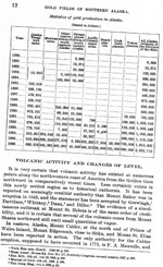
Reconnaissance of the gold fields of southern Alaska with some notes on general geology, 1898

Becker, G. F., 1898, Reconnaissance of the gold fields of southern Alaska with some notes on general geology: U.S. Geological Survey Annual Report 0018, p. 1-86, 6 sheets, scale unknown.
full-text PDF 1.5 MB
Hard Copy held by AVO at FBKS - CEC file cabinet

References

Deformation mapping and modeling of the Aleutian volcanoes with InSAR and numerical models, 2024

Wang, J., 2024, Deformation mapping and modeling of the Aleutian volcanoes with InSAR and numerical models: University Park, Tex., Southern Methodist University, Ph.D. dissertation, 143 p.
Full-text PDF 8.4 MB

Recently active volcanoes of Alaska, 2023

Cameron, C.E., Bull, K.F., and Macpherson, A.E., 2023, Recently active volcanoes of Alaska: Alaska Division of Geological & Geophysical Surveys Miscellaneous Publication 133 v. 6, 2 sheets. https://doi.org/10.14509/31086.

Along-arc volcanism in the western and central Aleutian from 2015 to 2021 revealed by cloud-based InSAR processing, 2023

Wang, J., Lu, Z., Bekaert, D., Marshak, C., Govorcin, M., Sangha, S., Kennedy, J., and Gregg, P., 2023, Along-arc volcanism in the western and central Aleutian from 2015 to 2021 revealed by cloud-based InSAR processing: Geophysical Research Letters v. 50, no. 23, e2023GL106323. https://doi.org/10.1029/2023GL106323
Full-text PDF 3.9 MB

Alaska interagency operating plan for volcanic ash episodes, 2022

Alaska Volcano Observatory, National Oceanic and Atmospheric Administration, National Weather Service, Federal Aviation Administration, Department of Defense, United States Coast Guard, Division of Homeland Security and Emergency Management, Alaska Department of Environmental Conservation, and Alaska Department of Health and Social Services (participating agencies), 2022, Alaska interagency operating plan for volcanic ash episodes, 85 p.

Geologic database of information on volcanoes in Alaska (GeoDIVA), 2022

Cameron, C.E., Crass, S.W., and AVO Staff, eds, 2022, Geologic database of information on volcanoes in Alaska (GeoDIVA): Alaska Division of Geologic and Geophysical Surveys Digital Data Series 20, https://doi.org/10.14509/geodiva, https://doi.org/10.14509/30901.

Quantifying eruptive and background seismicity, deformation, degassing, and thermal emissions at volcanoes in the United States during 1978-2020, 2021

Reath, K., Pritchard, M.E., Roman, D.C., Lopez, T., Carn, S., Fischer, T.P., Lu, Z., Poland, M.P., Vaughan, R.G., Wessels, R., Wike, L.L., and Tran, H.K., 2021, Quantifying eruptive and background seismicity, deformation, degassing, and thermal emissions at volcanoes in the United States during 1978-2020: Journal of Geophysical Research: Solid Earth, v. 126, e2021JB021684, doi: 10.1029/2021JB021684.

Historically active volcanoes of Alaska, v. 4, 2020

Cameron, C.E., Schaefer, J.R., and Ekberg, P.G., 2020, Historically active volcanoes of Alaska: Alaska Division of Geological & Geophysical Surveys Miscellaneous Publication 133 v. 4, 2 sheets. Http://doi.org/10.14509/30426

The prevalence and significance of offset magma reservoirs at arc volcanoes, 2020

Lerner, A.H., O'Hara, D., Karlstrom, L., Ebmeier, S.K., Anderson, K.R., and Hurwitz, S., 2020, The prevalence and significance of offset magma reservoirs at arc volcanoes: Geophysical Research Letters, v. 47, doi:10.1029/2020GL087856.

The depths and locations of magma reservoirs and their consequences for the behavior of sulfur and volcanic degassing, 2020

Lerner, A.H., 2020, The depths and locations of magma reservoirs and their consequences for the behavior of sulfur and volcanic degassing: University of Oregon Ph.D. thesis, 378 p. Available at https://search.proquest.com/openview/cec1ff16af338dce2495b5a1a491aa88/1?pq-origsite=gscholar&cbl=44156.

Vapor-bubble growth in olivine-hosted melt inclusions, 2020

Rasmussen, D.J., Plank, T.A., Wallace, P.J., Newcombe, M.E., and Lowenstern, J.B., 2020, Vapor-bubble growth in olivine-hosted melt inclusions: American Mineralogist, v. 105, no. 12, p. 1898-1919, https://doi.org/10.2138/am-2020-7377.

The Alaska Volcano Observatory: 30 years of protecting Alaskans from the effects of volcanic activity (1988-2018), 2018

Mulliken, K.M., 2018, The Alaska Volcano Observatory: 30 years of protecting Alaskans from the effects of volcanic activity (1988-2018): Alaska Division of Geological & Geophysical Surveys Information Circular 67, 2 p. http://doi.org/10.14509/30032

2018 update to the U.S. Geological Survey national volcanic threat assessment, 2018

Ewert, J.W., Diefenbach, A.K., and Ramsey, D.W., 2018, 2018 update to the U.S. Geological Survey national volcanic threat assessment: U.S. Geological Survey Scientific Investigations Report 2018-5140, 40 p., https://pubs.usgs.gov/sir/2018/5140/sir20185140.pdf.

Historically active volcanoes of Alaska, v. 3, 2018

Cameron, C.E., Schaefer, J.R., and Mulliken, K.M., 2018, Historically active volcanoes of Alaska: Alaska Division of Geological & Geophysical Surveys Miscellaneous Publication 133 v. 3, 2 sheets. Http://doi.org/10.14509/30142

Quantifying arc migration and the role of forearc subduction erosion in the central Aleutians, 2018

Jicha, B.R., and Kay, S.M., 2018, Quantifying arc migration and the role of forearc subduction erosion in the central Aleutians: Journal of Volcanology and Geothermal Research, v, 360, p. 84-99, doi: http://dx.doi.org/10.1016/j.jvolgeores.2018.06.016.

Historically active volcanoes of Alaska, 2016

Cameron, C.E., and Schaefer, J.R., 2016, Historically active volcanoes of Alaska: Alaska Division of Geological & Geophysical Surveys Miscellaneous Publication 133 v. 2, 1 sheet, scale 1:3,000,000. http://doi.org/10.14509/20181

An assessment of clinopyroxene as a recorder of magmatic water and magma ascent rate, 2016

Lloyd, A.S., Ferriss, E., Ruprecht, P., Hauri, E.H., Jicha, B.R., and Plank, T., 2016, An assessment of clinopyroxene as a recorder of magmatic water and magma ascent rate: Journal of Petrology, v. 57, n. 10, p. 1865-1886.

Alaska Volcano Observatory image database, 2016

Cameron, C.E., and Snedigar, S.F., 2016, Alaska Volcano Observatory image database: Alaska Division of Geological & Geophysical Surveys Digital Data Series 13, https://www.avo.alaska.edu/images/. https://doi.org/10.14509/29689.

Historically active volcanoes of Alaska, 2014

Schaefer, J.R., Cameron, C.E., and Nye, C.J., 2014, Historically active volcanoes of Alaska: Alaska Division of Geological & Geophysical Surveys Miscellaneous Publication 133 v. 1.2, 1 sheet, scale 1:3,000,000. This publication has been superseded. Newest version available at http://www.dggs.alaska.gov/pubs/id/20181 .

InSAR imaging of Aleutian volcanoes, 2014

Lu, Zhong, and Dzurisin, Daniel, 2014, InSAR imaging of Aleutian volcanoes: Chichester, UK, Springer-Praxis, 390 p.

Dynamic deformation of Seguam Island, Alaska, 1992-2008, from multi-interferogram InSAR processing, 2013

Lee, Chang-Wook, Lu, Zhong, Won, Joong-Sun, Jung, Hyung-Sun, and Dzurisin, Daniel, 2013, Dynamic deformation of Seguam Island, Alaska, 1992-2008, from multi-interferogram InSAR processing: Journal of Volcanology and Geothermal Research, v. 260, p. 43-51, doi:10.1016/j.jvolgeores.2013.05.009

Volcano collapse along the Aleutian Ridge (western Aleutian Arc), 2011

Montanaro, C., and Beget, J., 2011, Volcano collapse along the Aleutian Ridge (western Aleutian Arc): Natural Hazards and Earth System Sciences, v. 11, n. 3., p. 715-730, available online at http://www.nat-hazards-earth-syst-sci.net/11/715/2011/nhess-11-715-2011.pdf .
full-text pdf 915 KB

Subduction controls of Hf and Nd isotopes in lavas of the Aleutian island arc, 2010

Yogodzinski, G.M., Vervoort, J.D., Brown, S.T., and Gerseny, M., 2010. Subduction controls of Hf and Nd isotopes in lavas of the Aleutian island arc: Earth and Planetary Science Letters, v. 300, p. 226-238, doi: 10.1016/j.epsl.2010.09.035 .

The role of water in generating the calc-alkaline trend: new volatile data for Aleutian magmas and a new tholeiitic index, 2010

Zimmer, M.M., Plank, Terry, Hauri, E.H., Yogodzinski, G.M., Stelling, Peter, Larsen, Jessica, Singer, Brad, Jicha, Brian, Mandeville, Charles, and Nye, C.J., 2010, The role of water in generating the calc-alkaline trend: new volatile data for Aleutian magmas and a new tholeiitic index: Journal of Petrology, v. 5, n. 12, p. 2411, 2444, doi:10.1093/petrology/egq062 .

Pacific Basin tsunami hazards associated with mass flows in the Aleutian arc of Alaska, 2009

Waythomas, C.F., Watts, Philip, Shi, Fengyan, and Kirby, J.T., 2009, Pacific Basin tsunami hazards associated with mass flows in the Aleutian arc of Alaska: Quaternary Science Reviews, v. 28, p. 1006-1019, doi:10.1016/j.quascirev.2009.02.019 .

Historically active volcanoes of Alaska reference deck, 2009

Snedigar, S.F., and Cameron, C.C., 2009, Historically active volcanoes of Alaska reference deck: Alaska Division of Geological & Geophysical Surveys Information Circular 59, 52 p, available to order from http://www.dggs.dnr.state.ak.us/pubs/pubs?reqtype=citation&ID=20401 .

Chronology and references of volcanic eruptions and selected unrest in the United States, 1980-2008, 2009

Diefenbach, A.K., Guffanti, Marianne, and Ewert, J.W., 2009, Chronology and references of volcanic eruptions and selected unrest in the United States, 1980-2008: U.S. Geological Survey Open-File Report 2009-1118, 85 p., available at http://pubs.usgs.gov/of/2009/1118/ .

Preliminary spreadsheet of eruption source parameters for volcanoes of the world, 2009

Mastin, L.G., Guffanti, Marianne, Ewert, J.E., and Spiegel, Jessica, 2009, Preliminary spreadsheet of eruption source parameters for volcanoes of the world: U.S. Geological Survey Open-File Report 2009-1133, v. 1.2, 25 p., available at http://pubs.usgs.gov/of/2009/1133/ .

Water in Aleutian magmas: its origins in the subduction zone and its effects on magma evolution, 2009

Zimmer M. M., 2009, Water in Aleutian Magmas: its origins in the subduction zone and its effects on magma evolution: Boston University Ph.D. dissertation, 356 p.
Hard Copy held by AVO at FBKS - CEC shelf

The Alaska Volcano Observatory - 20 years of volcano research, monitoring, and eruption response, 2008

Schaefer, J.R., and Nye, Chris, 2008, The Alaska Volcano Observatory - 20 years of volcano research, monitoring, and eruption response: Alaska Division of Geological & Geophysical Surveys, Alaska GeoSurvey News, NL 2008-001, v. 11, n. 1, p. 1-9, available at http://wwwdggs.dnr.state.ak.us/pubs/pubs?reqtype=citation&ID=16061 .

20th anniversary of the Alaska Volcano Observatory, 2008

University of Alaska Fairbanks Geophysical Institute, 2008, 20th anniversary of the Alaska Volcano Observatory: University of Alaska Geophysical Institute pamphlet, 2 p.

The role of volatile exsolution and sub-solidus fluid/rock interactions in producing high 56Fe/54Fe ratios in siliceous igneous rocks, 2008

Heimann, Adriana, Beard, B.L., and Johnson, C.M., 2008, The role of volatile exsolution and sub-solidus fluid/rock interactions in producing high 56Fe/54Fe ratios in siliceous igneous rocks: Geochimica et Cosmochimica Acta, v. 72, n. 17, p. 4379-4396, doi: 10.1016/j.gca.2008.06.009 .

InSAR imaging of volcanic deformation over cloud-prone areas - Aleutian Islands, 2007

Lu, Zhong, 2007, InSAR imaging of volcanic deformation over cloud-prone areas - Aleutian Islands: Photogrammetric Engineering and Remote Sensing, v. 73, n. 3, p. 245-257.

System for ranking relative threats of U.S. volcanoes, 2007

Ewert, John, 2007, System for ranking relative threats of U.S. volcanoes: Natural Hazards Review, v. 8, n. 4, p. 112-124.

Along-strike trace element and isotopic variation in Aleutian Island arc basalt: subduction melts sediments and dehydrates serpentine, 2007

Singer, B.S., Jicha, B.R., Leeman, W.P., Rogers, N.W., Thirlwall, M.F., Ryan, Jeff, and Nicolaysen, K.E., 2007, Along-strike trace element and isotopic variation in Aleutian Island arc basalt: subduction melts sediments and dehydrates serpentine: Journal of Geophysical Research, v. 112, n. B6, 26 p., doi: 10.1029/2006JB004897 .

Volcanic history and magmatic evolution of Seguam Island, Aleutian island arc, Alaska, 2006

Jicha, B.R., and Singer, B.S., 2006, Volcanic history and magmatic evolution of Seguam Island, Aleutian island arc, Alaska: Geological Society of America Bulletin, v. 118, n. 7-8, p. 805-822.

Catalog of earthquake hypocenters at Alaskan volcanoes: January 1 through December 31, 2005, 2006

Dixon, J.P., Stihler, S.D., Power, J.A., Tytgat, Guy, Estes, Steve, and McNutt, S.R., 2006, Catalog of earthquake hypocenters at Alaskan volcanoes: January 1 through December 31, 2005: U.S. Geological Survey Open-File Report 2006-1264, 78 p., available at http://pubs.usgs.gov/of/2006/1264/ .

The National Volcano Early Warning System (NVEWS), 2006

Ewert, John, Guffanti, Marianne, Cervelli, Peter, and Quick, James, 2006, The National Volcano Early Warning System (NVEWS): U.S. Geological Survey Fact Sheet FS 2006-3142, 2 p., available at http://pubs.usgs.gov/fs/2006/3142 .

Geochronic and isotopic constraints on the magmatic evolution of Pleistocene-Recent Aleutian and Andean volcanic complexes, 2006

Jicha, B.R., 2006, Geochronic and isotopic constraints on the magmatic evolution of Pleistocene-Recent Aleutian and Andean volcanic complexes: University of Wisconsin Madison Ph.D. dissertation, 195 p.

An assessment of volcanic threat and monitoring capabilities in the United States: framework for a National Volcano Early Warning System NVEWS, 2005

Ewert, J.W., Guffanti, Marianne, and Murray, T.L., 2005, An assessment of volcanic threat and monitoring capabilities in the United States: framework for a National Volcano Early Warning System NVEWS: U.S. Geological Survey Open-File Report 2005-1164, 62 p.
full-text PDF 2.90 MB

Contrasting timescales of crystallization and magma storage beneath the Aleutian Island arc, 2005

Jicha, B.R., Singer, B.S., Beard, B.L., Johnson, C.M., 2005, Contrasting timescales of crystallization and magma storage beneath the Aleutian Island arc: Earth and Planetary Science Letters, v. 236, p. 195-210.

InSAR studies of Alaska volcanoes, 2005

Lu, Z., Wicks, C., Dzurisin, D., and Power, J., 2005, InSAR studies of Alaska volcanoes: Korean Journal of Remote Sensing v. 21, no. 1, pg. 59-72. https://doi.org/10.7780/kjrs.2005.21.1.59

Transient volcano deformation sources imaged with interferometric synthetic aperture radar: application to Seguam Island, Alaska, 2004

Masterlark, Tim, and Lu, Zhong, 2004, Transient volcano deformation sources imaged with interferometric synthetic aperture radar: application to Seguam Island, Alaska: Journal of Geophysical Research, v. 109, n. 1, p. 1-16.

Dynamic deformation of Seguam Island, Aleutian Islands, Alaska, 1993-2000: implications for magmatic and hydrothermal processes, 2004

Price, E.J., 2004, Dynamic deformation of Seguam Island, Aleutian Islands, Alaska, 1993-2000: implications for magmatic and hydrothermal processes: Journal of Geophysical Research, v. 109, n. 4, 15 p.

Variable impact of the subducted slab on Aleutian island arc magma sources; evidence from Sr, Nd, Pb, and Hf isotopes and trace element abundances, 2004

Jicha, B.R., Singer, B.S., Brophy, J.G., Fournelle, J.H., Johnson, C.M., Beard, B.L., Lapen, T.J., and Mahlen, N.J., 2004, Variable impact of the subducted slab on Aleutian island arc magma sources; evidence from Sr, Nd, Pb, and Hf isotopes and trace element abundances: Journal of Petrology, v. 45, n. 9, p. 1845-1875.

Volcanoes of the world: an illustrated catalog of Holocene volcanoes and their eruptions, 2003

Siebert, L., and Simkin, T., 2002-, Volcanoes of the world: an illustrated catalog of Holocene volcanoes and their eruptions: Smithsonian Institution, Global Volcanism Program Digital Information Series GVP-3, http://volcano.si.edu/search_volcano.cfm, unpaged internet resource.

Bibliography of information on Alaska volcanoes, 2003

Cameron, C. E., Triplehorn, J. H., and Robar, C. L., 2003, Bibliography of information on Alaska volcanoes: Alaska Division of Geological & Geophysical Surveys Miscellaneous Publication MP 131, 1 CD-ROM.
Hard Copy held by AVO at FBKS - CEC file cabinet

Interferometric synthetic aperture radar studies of Alaska volcanoes, 2003

Lu, Zhong, Wicks, C. J., Dzurisin, Daniel, Power, John, Thatcher, Wayne, and Masterlark, Tim, 2003, Interferometric synthetic aperture radar studies of Alaska volcanoes: Earth Observation Magazine, v. 12, n. 3, p. 8-10.

Along-strike variation in the Aleutian Island Arc: Genesis of high Mg# andesite and implications for continental crust, 2003

Kelemen, P.B., Yogodzinski, G.M., and Scholl, D.M., 2003, Along-strike variation in the Aleutian Island Arc: Genesis of high Mg# andesite and implications for continental crust, in Eiler, J., ed., Inside the Subduction Factory: AGU Monograph 138, p. 223-276.

Variable impact of the subducted slab on Aleutian Island arc magma sources; evidence from Sr, Nd, Pb, and Hf isotopes and trace element abundances, 2002

Jicha, B. R., 2002, Variable impact of the subducted slab on Aleutian Island arc magma sources; evidence from Sr, Nd, Pb, and Hf isotopes and trace element abundances: University of Wisconsin Madison unpublished M.S. thesis, 85 p.

Historically active volcanoes of the Aleutian Arc, 2002

Schaefer, Janet, and Nye, C. J., 2002, Historically active volcanoes of the Aleutian Arc: Alaska Division of Geological & Geophysical Surveys Miscellaneous Publication MP 0123, unpaged, 1 sheet, scale 1:3,000,000. Superceded by Miscellaneous Publication 133: http://www.dggs.dnr.state.ak.us/pubs/pubs?reqtype=citation&ID=20181

Historically active volcanoes in Alaska, a quick reference, 2000

Wallace, K. L., McGimsey, R. G., and Miller, T. P., 2000, Historically active volcanoes in Alaska, a quick reference: U.S. Geological Survey Fact Sheet FS 0118-00, 2 p.
full-text PDF 162 KB
Hard Copy held by AVO at FBKS - CEC file cabinet

Encyclopedia of volcanoes, 2000

Sigurdsson, Haraldur, (ed.), 2000, Encyclopedia of volcanoes: San Diego, CA, Academic Press, 1417 p.

Volcanoes of Alaska, 1998

Nye, C. J., Queen, Katherine, and McCarthy, A. M., 1998, Volcanoes of Alaska: Alaska Division of Geological & Geophysical Surveys Information Circular IC 0038, unpaged, 1 sheet, scale 1:4,000,000, available at http://www.dggs.dnr.state.ak.us/pubs/pubs?reqtype=citation&ID=7043 .
Hard Copy held by AVO at FBKS - CEC shelf

Catalog of the historically active volcanoes of Alaska, 1998

Miller, T. P., McGimsey, R. G., Richter, D. H., Riehle, J. R., Nye, C. J., Yount, M. E., and Dumoulin, J. A., 1998, Catalog of the historically active volcanoes of Alaska: U.S. Geological Survey Open-File Report 98-0582, 104 p.
Hard Copy held by AVO at FBKS - CEC shelf

Slab melting in the Aleutians: implications of an ion probe study of clinopyroxene in primitive adakite and basalt, 1998

Yogodzinski, G. M., and Kelemen, P. B., 1998, Slab melting in the Aleutians: implications of an ion probe study of clinopyroxene in primitive adakite and basalt: Earth and Planetary Science Letters, v. 158, n. 1-2, p. 53-65.

A multichannel seismic reflection image of part of the Aleutian seismogenic zone, 1997

McGeary, S., 1997, A multichannel seismic reflection image of part of the Aleutian seismogenic zone [abs.]: Eos, v. 78, n. 46, p. 627.

Volcanoes of the Alaska Peninsula and Aleutian Islands selected photographs, 1997

Neal, Christina, and McGimsey, R. G., 1997, Volcanoes of the Alaska Peninsula and Aleutian Islands selected photographs: U.S. Geological Survey Digital Data Series DDS 0040, 1 CD-ROM.

Does fracture zone subduction increase sediment flux and mantle melting in subduction zones? Trace element evidence from Aleutian Arc basalt, 1996

Singer, B. S., Leeman, W. P., Thirwall, M. F., and Rogers, N. W., 1996, Does fracture zone subduction increase sediment flux and mantle melting in subduction zones? Trace element evidence from Aleutian Arc basalt: in Bebout, G. E., Scholl, D. W., Kirby, S. H., and Platt, J. P., (eds.), Subduction top to bottom, American Geophysical Union Geophysical Monograph 0096, p. 285-291.

Seguam, 1996

Neal, C. A., 1996, Seguam: in Annual report of the world volcanic eruptions in 1993, Bulletin of Volcanic Eruptions, v. 33, p. 90-91.
Hard Copy held by AVO at FBKS - CEC file cabinet

1993 volcanic activity in Alaska: summary of events and response of the Alaska Volcano Observatory, 1996

Neal, C. A., McGimsey, R. G., and Doukas, M. P., 1996, 1993 volcanic activity in Alaska: summary of events and response of the Alaska Volcano Observatory: U.S. Geological Survey Open-File Report 96-0024, 21 p.
full-text PDF 1149 KB
Hard Copy held by AVO at FBKS - CEC shelf

10 years of volcanic activity in Alaska: 1983-1992: A video (Pyre Peak, Akutan, Bogoslof, Westdahl, Veniaminof, Augustine, Redoubt, and Spurr volcanoes), 1995

Doukas, M. P., McGimsey, R. G., and Dorava, J. M., 1995, 10 years of volcanic activity in Alaska: 1983-1992: A video (Pyre Peak, Akutan, Bogoslof, Westdahl, Veniaminof, Augustine, Redoubt, and Spurr volcanoes): U.S. Geological Survey Open-File Report 95-0061-A, Anchorage, AK, KAKM Video, 1 videocassette.
Hard Copy held by AVO at FBKS - CEC shelf

10 years of volcanic activity in Alaska: 1983 to 1992: a video, 1995

Doukas, M. P., McGimsey, R. G., and Dorava, J. M., 1995, 10 years of volcanic activity in Alaska: 1983 to 1992: a video: U.S. Geological Survey Open-File Report 95-61-B, 12 p.
Hard Copy held by AVO at FBKS - CEC file cabinet Hard Copy held by AVO at FBKS - CEC shelf

Volcanic activity in Alaska: Summary of events and response of the Alaska Volcano Observatory 1992, 1995

McGimsey, R. G., Neal, C. A., and Doukas, M. P., 1995, Volcanic activity in Alaska: Summary of events and response of the Alaska Volcano Observatory 1992: U.S. Geological Survey Open-File Report 95-83, 26 p.
Hard Copy held by AVO at FBKS - CEC shelf

A video of 10 years of volcanic activity in Alaska: 1983 to 1992, 1995

Doukas, M. P., McGimsey, R. G., and Dorava, J. M., 1995, A video of 10 years of volcanic activity in Alaska: 1983 to 1992 [abs.]: Abstracts with Programs - Geological Society of America, v. 27, n. 5, p. 15.
Hard Copy held by AVO at FBKS - CEC file cabinet

Quick reference to Alaska's active volcanoes and listing of historical eruptions, 1760-1994, 1995

McGimsey, R. G., and Miller, T. P., 1995, Quick reference to Alaska's active volcanoes and listing of historical eruptions, 1760-1994: U.S. Geological Survey Open-File Report 95-0520, 13 p.
Hard Copy held by AVO at FBKS - CEC file cabinet

Volcanoes of Alaska, 1995

Alaska Division of Geological & Geophysical Surveys, 1995, Volcanoes of Alaska: Alaska Division of Geological & Geophysical Surveys Information Circular IC 0038, unpaged, 1 sheet, scale 1:4,000,000.

Seguam, 1995

McGimsey, R. G., 1995, Seguam: in Annual report of the world volcanic eruptions in 1992, Bulletin of Volcanic Eruptions, v. 32, p. 87.
Hard Copy held by AVO at FBKS - CEC file cabinet

Sr and Pb isotopic evidence for temporal and spatial controls on arc magmatic processes: new data from the central Aleutian Arc, 1994

Myers, J. D., Nicolaysen, K. E., and Frost, C. D., 1994, Sr and Pb isotopic evidence for temporal and spatial controls on arc magmatic processes: new data from the central Aleutian Arc [abs.]: Abstracts with Programs - Geological Society of America, v. 26, n. 7, p. 368.

Aleutian magmas in space and time, 1994

Kay, S. M., and Kay, R. W., 1994, Aleutian magmas in space and time: in Plafker, George and Berg, H. C., (eds.), The Geology of Alaska, Geological Society of America The Geology of North America series v. G-1, p. 687-722.
Hard Copy held by AVO at FBKS - CEC file cabinet

Geologic framework of the Aleutian arc, Alaska, 1994

Vallier, T. L., Scholl, D. W., Fisher, M. A., Bruns, T. R., Wilson, F. H., von Huene, Roland, and Stevenson, A. J., 1994, Geologic framework of the Aleutian arc, Alaska: in Plafker, George and Berg, H. C., (eds.), The Geology of Alaska, Geological Society of America The Geology of North America series v. G-1, p. 367-388.
Hard Copy held by AVO at FBKS - CEC file cabinet

Volcanoes of the world [2nd edition], 1994

Simkin, Tom, and Siebert, Lee, 1994, Volcanoes of the world [2nd edition]: Tucson, Arizona, Geoscience Press, 349 p.
Hard Copy held by AVO at FBKS - CEC shelf

Geothermal resources of Alaska, 1994

Miller, T. P., 1994, Geothermal resources of Alaska: in Plafker, George and Berg, H. C., (eds.), The Geology of Alaska, Geological Society of America The Geology of North America series v. G-1, p. 979-987.
Hard Copy held by AVO at FBKS - CEC file cabinet Hard Copy held by AVO at FBKS - CEC shelf

The geology, geochemistry and petrology of the recent magmatic phase of the central and western Aleutian Arc, 1994

Myers, J. D., 1994, The geology, geochemistry and petrology of the recent magmatic phase of the central and western Aleutian Arc: unpublished manuscript unpaged.
Hard Copy held by AVO at FBKS - CEC shelf

Age, character, and significance of Aleutian arc volcanism, 1994

Fournelle, J. H., Marsh, B. D., and Myers, J. D., 1994, Age, character, and significance of Aleutian arc volcanism: in Plafker, George and Berg, H. C., (eds.), The Geology of Alaska, Geological Society of America The Geology of North America Series v. G-1, p. 723-758.

Notes on Russian America, Parts II-V: Kad'iak, Unalashka, Atkha, the Pribylovs (translated by Marina Ramsay), 1994

Khlebnikov, K. T., 1994, Notes on Russian America, Parts II-V: Kad'iak, Unalashka, Atkha, the Pribylovs (translated by Marina Ramsay): Liapunova, R. G. and Fedorova, S. G., (comps.), Kingston, Ontario and Fairbanks, Alaska, The Limestone Press, 424 p.
Hard Copy held by AVO at FBKS - CEC file cabinet

Aleutian arc volcanoes, 1994

Nye, C. J., 1994, Aleutian arc volcanoes: Alaska Division of Geological & Geophysical Surveys Public-Data File PDF 94-54, unpaged, 1 sheet, scale 1:2,126,841.

Aleut dictionary, Unangam Tunudgusii, an unabridged lexicon of the Aleutian, Pribilof, and Commander Islands Aleut language, 1994

Bergsland, Knut, comp., 1994, Aleut dictionary, Unangam Tunudgusii, an unabridged lexicon of the Aleutian, Pribilof, and Commander Islands Aleut language: University of Alaska Fairbanks, Alaska Native Language Center, 739 p.

Geothermal resources of the Aleutian Arc, 1993

Motyka, R. J., Liss, S. A., Nye, C. J., and Moorman, M. A., 1993, Geothermal resources of the Aleutian Arc: Alaska Division of Geological & Geophysical Surveys Professional Report PR 0114, 17 p., 4 sheets, scale 1:1,000,000.
Hard Copy held by AVO at FBKS - CEC shelf

Plagioclase zoning in mid-Pleistocene lavas from the Seguam volcanic center, central Aleutian arc, Alaska, 1993

Singer, B. S., Pearce, T. H., Kolisnik, A. M., and Myers, J. D., 1993, Plagioclase zoning in mid-Pleistocene lavas from the Seguam volcanic center, central Aleutian arc, Alaska: American Mineralogist, v. 78, n. 1-2, p. .143-157.

Plagioclase phenocryst compositions and zoning patterns: the Finch Cove Formation, Seguam volcanic center, central Aleutian Arc, 1993

Myers, J. D., 1993, Plagioclase phenocryst compositions and zoning patterns: the Finch Cove Formation, Seguam volcanic center, central Aleutian Arc [abs.]: Eos, v. 74, n. 16, p. 348.

Plagioclase zonation in a basalt to rhyodacite eruptive suite, Seguam Island, Alaska: observations by Nomarski contrast interference, 1993

Singer, B. S., and Pearce, T. H., 1993, Plagioclase zonation in a basalt to rhyodacite eruptive suite, Seguam Island, Alaska: observations by Nomarski contrast interference: The Canadian Mineralogist, v. 31, n. 2, p. 459-466.

Seguam, 1993

Smithsonian Institution, 1993, Seguam: Global Volcanism Network Bulletin v. 18, n. 05, unpaged.

Seguam, 1993

Smithsonian Institution, 1993, Seguam: Global Volcanism Network Bulletin v. 18, n. 07, unpaged.

Seguam, 1993

Smithsonian Institution, 1993, Seguam: Global Volcanism Network Bulletin v. 18, n. 08, unpaged.

Holocene volcanoes of the Aleutian Arc, Alaska, 1993

March, G. D., 1993, Holocene volcanoes of the Aleutian Arc, Alaska: Alaska Division of Geological & Geophysical Surveys Public-Data File PDF 93-85, unpaged, 1 sheet, scale 1:2,000,000.

Oxygen isotope constraints on the petrogenesis of Aleutian arc magmas, 1992

Singer, B. S., O'Neil, J. R., and Brophy, J. G., 1992, Oxygen isotope constraints on the petrogenesis of Aleutian arc magmas: Geology, v. 20, n. 4, p. 367-370.

Mid-Pleistocene basalt from the Seguam volcanic center, central Aleutian Arc, Alaska: local lithospheric structures and source variability in the Aleutian Arc, 1992

Singer, B. S., Myers, J. D., and Frost, C. D., 1992, Mid-Pleistocene basalt from the Seguam volcanic center, central Aleutian Arc, Alaska: local lithospheric structures and source variability in the Aleutian Arc: Journal of Geophysical Research, v. 97, n. B4, p. 4561-4578.
Hard Copy held by AVO at FBKS - CEC file cabinet

Plagioclase zoning in mid-Pleistocene basalt to rhyodacite lavas from the Seguam volcanic center, central Aleutian Arc, 1992

Singer, B. S., Pearce, T. H., Kolisnik, A. M., and Myers, J. D., 1992, Plagioclase zoning in mid-Pleistocene basalt to rhyodacite lavas from the Seguam volcanic center, central Aleutian Arc [abs.]: Eos, v. 73, n. 14, p. 353.

Mid-Pleistocene lavas from the Seguam volcanic center, central Aleutian arc: closed-system fractional crystallization of a basalt to rhyodacite eruptive suite, 1992

Singer, B. S., Myers, J. D., and Frost, C. D., 1992, Mid-Pleistocene lavas from the Seguam volcanic center, central Aleutian arc: closed-system fractional crystallization of a basalt to rhyodacite eruptive suite: Contributions to Mineralogy and Petrology, v. 110, p. 87-112.
Hard Copy held by AVO at FBKS - CEC file cabinet

Seguam, 1992

Smithsonian Institution, 1992, Seguam: Global Volcanism Network Bulletin v. 17, n. 12, unpaged.
Mid-Pleistocene basalts from the Seguam Volcanic Center, central Aleutian Arc, Alaska: Local lithospheric structures and source variability in the Aleutian Arc, 1991

Singer, B. S., Myers, J. D., and Frost, C. D., 1991, Mid-Pleistocene basalts from the Seguam Volcanic Center, central Aleutian Arc, Alaska: Local lithospheric structures and source variability in the Aleutian Arc [abs.]: Abstracts with Programs - Geological Society of America, v. 23, n. 5, p. A330.

Late-Pleistocene magmatic activity at the Seguam volcanic center, central Aleutian Arc, Alaska: the Finch Cove Formation, 1991

Myers, J. D., and Singer, B. S., 1991, Late-Pleistocene magmatic activity at the Seguam volcanic center, central Aleutian Arc, Alaska: the Finch Cove Formation [abs.]: Abstracts with Programs - Geological Society of America, v. 23, n. 5, p. 330-331.

Intra-arc extension and magmatic evolution in the central Aleutian arc, Alaska, 1990

Singer, B. S., and Myers, J. D., 1990, Intra-arc extension and magmatic evolution in the central Aleutian arc, Alaska: Geology, v. 18, n. 11, p. 1050-1053.

Petrology and geochemistry of mid-Pleistocene lavas from Seguam Island, central Aleutian Islands, Alaska: implications for the chemical and physical evolution of oceanic island arc magmatic centers, 1990

Singer, B. S., 1990, Petrology and geochemistry of mid-Pleistocene lavas from Seguam Island, central Aleutian Islands, Alaska: implications for the chemical and physical evolution of oceanic island arc magmatic centers: University of Wyoming Ph.D. dissertation, 205 p.

Mid-Pleistocene low-K lavas from the Seguam Island volcanic center, central Aleutian Arc, Alaska I: The effect of intra-arc extension on low pressure liquid lines of descent, 1990

Singer, B. S., Myers, J. D., and Frost, C. D., 1990, Mid-Pleistocene low-K lavas from the Seguam Island volcanic center, central Aleutian Arc, Alaska I: The effect of intra-arc extension on low pressure liquid lines of descent [abs.]: Abstracts with Programs - Geological Society of America, v. 22, n. 7, p. 165-166.

Volcanoes of North America: United States and Canada, 1990

Wood, C. A., and Kienle, Juergen, (eds.), 1990, Volcanoes of North America: United States and Canada: New York, Cambridge University Press, 354 p.
Hard Copy held by AVO at FBKS - CEC shelf

Major and trace element characteristics of lavas from Seguam Island, central Aleutian Islands, Alaska, 1988

Singer, B. S., and Myers, J. D., 1988, Major and trace element characteristics of lavas from Seguam Island, central Aleutian Islands, Alaska: Abstracts with programs - Geological Society of America, v. 20, p. 196.

Seguam Island, central Aleutian Islands: I. Geologic field relations, 1987

Myers, J. D., and Singer, B. S., 1987, Seguam Island, central Aleutian Islands: I. Geologic field relations [abs.]: Eos, v. 68, n. 44, p. 1525.
Hard Copy held by AVO at FBKS - CEC file cabinet

Map showing distribution, composition, and age of Late Cenozoic volcanic centers in Alaska, 1986

Luedke, R. G., and Smith, R. L., 1986, Map showing distribution, composition, and age of Late Cenozoic volcanic centers in Alaska: U.S. Geological Survey Miscellaneous Investigations Series Map I 1091-F, unpaged, 3 sheets, scale 1:1,000,000.

The Aleutians, 1982

Marsh, B. D., 1982, The Aleutians: in Thorpe, R. S., (ed.), Andesites: orogenic andesites and related rocks, Chichester, United Kingdom, John Wiley & Sons, p. 99-114.
Hard Copy held by AVO at FBKS - CEC file cabinet

Volcanoes of the world, 1981

Simkin, Tom, Siebert, Lee, McClelland, Lindsay, Bridge, David, Newhall, Christopher, and Latter, J. H., 1981, Volcanoes of the world: Stroudsburg, PA, Hutchinson Publishing Company, 233 p.

Geothermal energy resources of Alaska, 1980

Turner, D. L., Forbes, R. B., Albanese, Mary, Macbeth, Joyce, Lockhart, A. B., and Seed, S. M., 1980, Geothermal energy resources of Alaska: University of Alaska Fairbanks Geophysical Institute Report UAG-R 279, 19 p., 3 sheets, scale 1 at 1:2,500,000.

Igneous-related geothermal systems, 1979

Smith, R. L., and Shaw, H. R., 1979, Igneous-related geothermal systems: in Muffler, L. J. P., (ed.), Assessment of geothermal resources of the United States 1978, U.S. Geological Survey Circular C 790, p. 12-17.

Assessment of geothermal resources of the United States--1978, 1979

Muffler, L. J. P., 1979, Assessment of geothermal resources of the United States--1978: U.S. Geological Survey Circular C 0790, 163 p.
Hard Copy held by AVO at FBKS - CEC shelf

Comprehensive tables giving physical data and thermal energy estimates for young igneous systems of the United States, 1978

Smith, R. L., Shaw, H. R., Luedke, R. G., and Russell, S. L., 1978, Comprehensive tables giving physical data and thermal energy estimates for young igneous systems of the United States: U.S. Geological Survey Open-File Report 78-0925, p. 1-25.
Hard Copy held by AVO at FBKS - CEC shelf

Seguam, 1977

Smithsonian Institution, 1977, Seguam: Scientific Event Alert Network Bulletin v. 02, n. 03, unpaged.

Volcano in Aleutians is spotted by sailors, 1977

Unknown, 1977, Volcano in Aleutians is spotted by sailors: Anchorage Times, March 7, 1977, pages unknown.
Account of a voyage of discovery to the north-east of Siberia, the frozen ocean, and the north-east sea, 1969

Sarychev, G.A., translated from Russian in 1806 and 1807, republished 1969, Account of a voyage of discovery to the north-east of Siberia, the frozen ocean, and the north-east sea: New York, Da Capo Press, 110 p.

Alaska Peninsula-Aleutian Islands, 1958

Powers, H. A., 1958, Alaska Peninsula-Aleutian Islands: in Williams, H., (ed.), Landscapes of Alaska, Los Angeles, CA, University of California Press, p. 61-75.

Volcanic activity in the Aleutian Arc, 1950

Coats, R. R., 1950, Volcanic activity in the Aleutian Arc: U.S. Geological Survey Bulletin 0974-B, p. 35-49, 1 sheet, scale 1:5,000,000.
plate 1 PDF 819 KB
full-text PDF 783 KB
Hard Copy held by AVO at FBKS - CEC shelf

United States coast pilot, Alaska Part 2, Yakutat Bay to Arctic Ocean, 1947

U.S. Department of Commerce, and Coast and Geodetic Survey, 1947, United States coast pilot, Alaska Part 2, Yakutat Bay to Arctic Ocean: Washington DC, United States Government Printing Office, 659 p.

Volcanoes declare war: logistics and strategy of Pacific volcano science, 1945

Jaggar, T. A., 1945, Volcanoes declare war: logistics and strategy of Pacific volcano science: Honolulu, Paradise of the Pacific, Ltd, 166 p.

The Aleutian Islands, 1927

Jaggar, T. A., 1927, The Aleutian Islands: The Volcano Letter, v. 116, p. 1.
full-text PDF 376 KB
Hard Copy held by AVO at FBKS - CEC file cabinet

Katalog der geschichtlichen vulkanausbruche, 1917

Sapper, Karl, 1917, Katalog der geschichtlichen vulkanausbruche: Strassburg, Germany, Karl J. Trubner, 358 p.
Hard Copy held by AVO at FBKS - CEC file cabinet

The volcanoes of Alaska, 1910

Cordeiro, F. J. B., 1910, The volcanoes of Alaska: Appalachia, v. 12, p. 130-135.
Hard Copy held by AVO at FBKS - CEC file cabinet

Journal of the technology expedition to the Aleutian Islands, 1907, 1908

Jaggar, T. A., 1908, Journal of the technology expedition to the Aleutian Islands, 1907: The Technology Review, v. 10, n. 1, p. 1-37.
Hard Copy held by AVO at FBKS - CEC file cabinet

An island rises from the sea to annex itself, 1906

Dunn, Robert, 1906, An island rises from the sea to annex itself: The Washington Post, Washington, D.C., October 14, 1906, p. 44.
Hard Copy held by AVO at FBKS - CEC file cabinet

Reported volcanic eruptions in Alaska, Puget Sound, etc., 1690-1896, 1898

Plummer, F. G., 1898, Reported volcanic eruptions in Alaska, Puget Sound, etc., 1690-1896: in Holden, E. S., (ed.), A Catalogue of Earthquakes on the Pacific Coast 1769-1897, Smithsonian Institution Miscellaneous Collections 1087, City of Washington D.C., Smithsonian Institution, p. 24-27.
Hard Copy held by AVO at FBKS - CEC file cabinet

Reconnaissance of the gold fields of southern Alaska with some notes on general geology, 1898

Becker, G. F., 1898, Reconnaissance of the gold fields of southern Alaska with some notes on general geology: U.S. Geological Survey Annual Report 0018, p. 1-86, 6 sheets, scale unknown.
full-text PDF 1.5 MB
Hard Copy held by AVO at FBKS - CEC file cabinet

The volcanic region of Alaska, 1884

Petroff, Ivan, 1884, The volcanic region of Alaska: in Population, Industries, and Resources of Alaska, Washington DC, Government Printing Office, p. 93-96.
full-text PDF 10.9 MB
Hard Copy held by AVO at FBKS - CEC file cabinet

Alaska and its resources, 1870

Dall, W. H., 1870, Alaska and its resources: Boston, Lee and Shepard, 627 p.
Hard Copy held by AVO at FBKS - CEC file cabinet

Documents sur les tremblements de terre et les phenomenes volcaniques des iles Aleutiennes, de la peninsule d'Aljaska et de la cote no. d'Amerique, Extrait des memoires de l'Academie des sciences, arts et belles-lettres de Dijon, 1865, 1866

Perrey, Alexis, 1866, Documents sur les tremblements de terre et les phenomenes volcaniques des iles Aleutiennes, de la peninsule d'Aljaska et de la cote no. d'Amerique, Extrait des memoires de l'Academie des sciences, arts et belles-lettres de Dijon, 1865: Dijon, J.E. Rabutut, 131 p.
Hard Copy held by AVO at FBKS - CEC file cabinet

Grewingk's geology of Alaska and the Northwest Coast of America [edited by Marvin W. Falk, translation by Fritz Jaensch published 2003], 1850

Grewingk, Constantine, 1850, Grewingk's geology of Alaska and the Northwest Coast of America [edited by Marvin W. Falk, translation by Fritz Jaensch published 2003]: Rasmuson Library Historical Translation Series 11, Fairbanks, AK, The University of Alaska Press, 242 p.
Hard Copy held by AVO at FBKS - CEC shelf

Past volcanic activity in the Aleutian arc,

Coats, R. R., Past volcanic activity in the Aleutian arc: U.S. Geological Survey Volcano Investigations Report 1, 18 p.
full-text PDF 22.3 MB
Hard Copy held by AVO at FBKS - CEC file cabinet

Volcano observations,

Kienle, Juergen (comp.), Volcano observations: Notes about volcanoes and volcanic eruptions collected, made, and stored by Juergen Kienle, on file at University of Alaska Fairbanks, Geophysical Institute, unpublished, unpaged.