Pavlof Sister

MarkerMarkerMarkerMarkerMarkerMarkerMarkerMarkerMarkerMarkerMarkerMarkerMarkerMarkerMarkerMarkerMarkerMarkerMarkerMarkerMarkerMarkerMarkerMarkerMarkerMarkerMarkerMarkerMarkerMarkerMarkerMarkerMarkerMarkerMarkerMarkerMarkerMarkerMarkerMarkerMarkerMarkerMarkerMarkerMarkerMarkerMarkerMarkerMarkerMarkerMarkerMarkerMarkerMarkerMarkerMarkerMarkerMarkerMarkerMarkerMarkerMarkerMarkerMarkerMarkerMarkerMarkerMarkerMarkerMarkerMarkerMarkerMarkerMarkerMarkerMarkerMarkerMarkerMarkerMarkerMarkerMarkerMarkerMarkerMarkerMarkerMarkerMarkerMarkerMarkerMarkerMarkerMarkerMarkerMarkerMarkerMarkerMarkerMarkerMarkerMarkerMarkerMarkerMarkerMarkerMarkerMarkerMarkerMarkerMarkerMarkerMarkerMarkerMarkerMarkerMarkerMarkerMarkerMarkerMarkerMarkerMarkerMarkerMarkerMarkerMarkerMarkerMarkerMarkerMarkerMarkerMarkerMarkerMarkerMarkerMarkerMarkerMarkerMarkerMarkerMarkerMarkerMarkerMarkerMarkerMarkerMarkerMarkerMarkerMarkerMarkerMarkerMarkerMarkerMarkerMarkerMarkerMarkerMarkerMarkerMarkerMarkerMarkerMarkerMarkerMarkerMarkerMarkerMarkerMarkerMarkerMarkerMarkerMarkerMarkerMarkerMarkerMarkerMarkerMarkerMarkerMarkerMarkerMarkerMarkerMarkerMarkerMarkerMarkerMarkerMarkerMarkerMarkerMarkerMarkerMarkerMarkerMarkerMarkerMarkerMarkerMarkerMarkerMarkerMarkerMarkerMarkerMarkerMarker
Legend
Red (Warning)
Orange (Watch)
Yellow (Advisory)
Green (Normal)
Uninstrumented
Community
Webcam
Instrument
Earthquake


Facts


  • Official Name: Pavlof Sister
  • Seismically Monitored: No
  • Color Code: UNASSIGNED
  • Alert Level: UNASSIGNED
  • Elevation: 2142m (7027ft)
  • Latitude: 55.4569
  • Longitude: -161.8544
  • Smithsonian VNum: 312040
  • Pronunciation:
  • Nearby Towns:
    • Belkofski 26 mi (41 km) SW
    • King Cove 33 mi (53 km) SW
    • Cold Bay 39 mi (63 km) SW
    • Nelson Lagoon 45 mi (73 km) NE
    • Sand Point 54 mi (87 km) SE

    Distance from Anchorage: 587 mi (945 km)

Description

From Smithsonian Institution, online database, accessed December 8, 2003: "Located at the end of a chain of volcanoes trending NE from Emmons Lake caldera, the symmetrical Pavlof Sister stratovolcano is somewhat more eroded than its twin volcano to the SW, Pavlof. The 2142-m-high Pavlof Sister is almost 400 m lower than Pavlof and has a sharper-peaked summit. Only one historical eruption, in the 18th century, was recorded from Pavlof Sister. The two symmetrical volcanoes form a dramatic backdrop to Pavlof Bay and Volcano Bay near the western end of the Alaska Peninsula."

Name Origin

The U.S. Geological Survey named Pavlof Sister in 1929 (Orth, 1971).


Reported Activity

Modern Eruptions

Shishaldin

Shishaldin Eruption Timeline

Loading

From Veniaminov (1840, translated by Lydia T. Black and R.H. Geoghegan, 1984): "About 1795, with the wind from the SW, the range on the SW end of Unimak blew up with a terrible thunder and an eruption of ash [pepel] or soot [sazha], white in color, in such a great quantity that, for several hours in the middle of the day, not only in the neighboring villages on Aliaksa but even on Unga, there was absolute darkness. The eternal ice, lying on that range, slid down along both sides together with a large quantity of water and burned rocks of different sizes. The last stopped about half-way along and formed a trench or a black belt visible even now. There are still signs in place where the water flows and where the ice, which had slid down the mountain, rested for several years (the vegetation has only just begun to appear there)."
From Grewingk (1850, translated 2003 by Fritz Jaensch): "From Zaikov's report (Pallas, N.B. III, p. 281) we receive the first detailed news about Unimak, on which island he sojourned from 1775 to 1778. 'The western promontory is rocky on both sides, and steep; and the shoreline is sandy, precipitous, and full of sandbars. The middle of the island is mountainous; and there is a volcano (Shishaldin), which is frequently on fire.'"
And Grewingk (1850, translated 2003 by Fritz Jaensch) continues "Cook (Vol. II, p. 117, [Eng. ed., London, 1784, vol. 2, p. 416]) sighted this volcano on the twenty-first of June 1778, and fixed its location at 54 degrees, 48 minutes N. Lat. And 164 degrees 15 minutes W. Long. He believed, however, that it still belonged to the mainland. 'Over this [Halibut Island, Sanak] and the adjoining islands we could see the main land covered with snow; but particularly, some hills, whose elevated tops were seen, towering above the clouds, to a most stupendous height. The most South Westerly of these hills was discovered to have a volcano, which continually threw up vast columns of black smoke.' This obviously was Shishaldin Mountain of Unimak."

Shishaldin 1790/4

April 19, 1790 — June 18, 1790

From Grewingk (1850, translated 2003 by Fritz Jaensch): "In Sauer (Billings's exped. [Sauer, Eng. Ed., London, 1802, p. 164]) it states: '[The terrain of Unimak Island] is high, broken, and rugged, and there are three very conspicuous mountains upon it. The summit of the first [Pogromnaia?] is very irregular; the second [Shishaldin] is a perfect cone towering to an immense height, and discharging a considerable body of smoke from its summit [19 April 1790]; the third (Khaginak) has its summit apparently rent and broken, covered with snow, and towering above the fog which covered the middle of the land.' Sarichev (II, pp. 28-29, with two profiles) sighted the three sugarloaf-shaped mountains on the eighteenth of June 1790. He named them Agayedan (Shishaldin), Khagman (Khaginak), and Kugidahk-Yagutcha (Pogromnaya). The first of them was smoking; the second had the appearance of a caved-in cone."
The English translation of Sarychev states that on June 17, 1790, at ten o'clock, "we discovered the conical summits of the island of Unimak, one of which, called Agagedan, is likewise volcanic, and at that time emitted a thick smoke."

Shishaldin 1824

1824 — March 10, 1825

From Veniaminov (1840, translated by Lydia T. Black and R.H. Geoghegan, 1984), writing of Shishaldin Volcano: "[T]oward the end of 1824 and early in 1825, up to the 10th of March, that is, until the explosion of the Issanakhskii Range, it was burning with a fierce flame." Although Veniaminov writes that the eruption of the 10th of March was from the "northeast range of Unimak" and that "Shishaldinskaia sopka, located not far from this range on the west, emitted flame before this time, but after the explosion began just to smoke," suggesting that the March 10, 1825 eruption was not from Shishaldin, and perhaps from Isanotski, Alaska Volcano Observatory geologists now believe that this eruption did come from Shishaldin. Alaska Volcano Observatory geologists flying over Isantoski in 1987, 1988, and 1989 failed to find any apparently Holocene vents on Isanotski, and saw only glacially polished rocks. Field investigations of Shishaldin, however, reveal numerous Holocene vents, including a very large flank feature called "The Blister" that has melted through the modern ice cover of Shishaldin, and which could be the vent for eruptions during the 1800s. In addition, several streams draining from Shishaldin look capable of carrying large amounts of sediment to the sea (as described by Veniaminov for the March 10 eruption), but all of the streams draining Isanotski are heavily vegetated, suggesting that they did not carry large amount of sediment within the last few hundred years (Chris Nye, personal commun., 2004). Finch (1934) and Grewingk (1850, translated 2003 by Fritz Jaensch) also believe that the March 10 eruption occurred at Shishaldin.
Veniaminov's description of the March 10, 1825 eruption is as follows: "On March 10, 1825, after a loud subterranean thunder very similar to a cannonade, which lasted almost the whole day and was audible on Unalashka, Akun, and the tip of Aliaksa, in the middle of the day, the northeast range of Unimak exploded in five or more places and a great quantity of black ashes which covered the whole end of Aliaksa for several inches. At nearby Aliaksa, and especially at Morzhevoskoi settlement, it was dark for 3 or 4 hours. On this occasion the ice and snow, lying on the range melted and for several days flowed in a dreadful river, 5 to 10 versts wide. These waters poured over the eastern side of the island in such a quantity that the nearby sea remained muddy until late autumn."
From Grewingk (1850, translated 2003 by Fritz Jaensch): "In the year 1824 and early in 1825 the eruptions of Shishaldin Volcano were especially violent (cf. Lutke's p.n., or Berghaus: Geography and Ethnography, II, p. 724). And toward the middle of the month of March, a low ridge NE of this mountain split open in five or six places after a terrible subterranean detonation that was heard on Unalaska Island and on Alaska. Flames and black ashes were expelled, which covered the Alaska Peninsula all the way to Pavlof Bay. At high noon it was dark as night even in Morzhovoi Village, 10 German miles away. At the same time a flash-flood [jokulhlaup] descended from the mountain, down the south side of the island, covering a section of land more than two German miles long, as it catapulted pumice stones along with it. But the flood did not last long. Even the waters of the ocean were murky far into the autumn season. Since that event the volcano has burned less strongly. The ridge, through which the subterranean powers released their pressure, continues to smoke constantly; likewise a small cone, which began to rise from the middle of the ridge."

Shishaldin 1826/10

October 1826 — March 1831

Shishaldin Volcano appears to have been in intermittent eruption from October, 1826, until 1831.
This description by Litke (translated in 1987 by R.A. Pierce) perhaps refers to Shishaldin: "From October 1826 until January 1827 there had been almost uninterrupted eruptions of ash of almost unparalleled violence at a location where no one had seen a crater before. The ash, pushed first one way and then another by the wind, had covered all the surrounding countryside and even the quite distant islands of Unalaska and Unga with ash, thus causing considerable damage. Similar movement, although not as widespread, had occurred before the eruption and had been going on since. Not long before our arrival at Unalashka a thunder like roar, a well known signal, announced that Unimak was by no means sleeping."
Litke (translated in 1987 by R.A. Pierce) also writes: "On September 1st [1827], a superb morning revealed to us the magnificent panorama which surrounded us on all sides. East northeast, at a distance of sixty-five miles, we could see the Island of Unimak, with its enormous volcanoes. One of these, Shishaldin, whose form resembles that of a regular cone, appeared at this distance to be completely isolated. A whitish smoke rose up from its summit."
Veniaminov (1840, translated by Lydia T. Black and R.H. Geoghegan, 1984) writes about Shishaldin: "Later, and until March 1827, it was only smoking. Afterwards, again up to 1829, it threw out strong flame then, from that time, until the fall of 1830, it changed in an extraordinary way. In November and December, while enveloped in fog, it thundered violently and, when the fog lifted, the appearance of the mountain had been wholly altered. On the north side, from the very crater downward, three clefts of relatively large size had formed, looking as if filled with red-hot iron. Appalling flames were emitted from its crater, subterranean thunder was heard from time to time, and there were perceptible tremors. The eternal snow and ice, lying on its summit on the N, W, and S sides of its tip and from the peak to about the midheight, melted completely. This appearance it retained until March, when the clefts one after another closed and in the fall it was covered with new snow. Since then it has merely smoked. During all this period, there were scarcely any eruptions, except that on the 20th of April some volcanic ash fell on the snow. The foot of this volcano toward the NE was rather hot and, it was said, trembled perceptibly."
Khlebnikov (translated in 1994 by Marina Ramsay) writes that in November and December 1830, "Shishaldin rumbled violently, and after the mist cleared they saw that almost all the snow which had covered it for many years had melted and it appeared black. At the same time to the north, south and west three enormous openings appeared from top to bottom and began to disgorge terrible flames into the air. These flames, which were always visible from the north on a clear night, three times in a minute broke out in explosions, and after three or four such eruptions only sparks were seen. They say that at its foot to the northeast it was hot. Then, in March 1831 all the openings closed except one remaining to the north-northeast, going from the crater itself no less than a fifth of the entire mountain in length, and in width about a seventh part long. It was like hot iron and never changed its appearance. However, no eruptions from the mountains were observed. These remarks Khlebnikov took from a letter to him from I.E. Veniaminov dated 13 August 1831."
In a footnote, Veniaminov (1840, translated by Lydia T. Black and R.H. Geoghegan, 1984) further writes: "During my [visit] on March 6 and 7, 1831, the volcano was fully visible twice. From its crater lying to the NE, every ten or fifteen issued fire and sparks, not every time with the same force but sometimes more flames and less sparks or vice versa. Downward and to the NE from the crater one could see a crevice, in length exceeding more than 1/5 of the mountain's height, its width was about 1/8 of its length. At night the crevice seemed like red hot iron, not changing in the least. So it must be considered that this crevice was not the continuation of the crater but a crust or wall at which the flame was active. Bridging this crevice, several dark, narrow necks were visible. The appearance of the whole volcano was most sad and horrifying - black, snowless, pitted to mid-height with deep longitudinal ravines and covered with protruding rocks, it stood [like] a frightful bonfire, surrounded by glistening white mountains. Only on its E side was there snow, extending almost to its very summit. This signified that the crust on this side was thicker than on the other sides."
Grewingk (1850, translated 2003 by Fritz Jaensch) summarizes the November and December 1830 activity as follows: "Shishaldin roared terribly out of the fog which enveloped it. After the fog had lifted, everyone was surprised about the black color which the mountain had taken on. The snow, which had always covered it, had disappeared; and long fissures, which expelled frightful flames, appeared on three sides simultaneously: on the north, west, and south side. The northern side was constantly aflame. The fire erupted in spurts three times per minute and after every third or fourth normal emission there comes a stronger flame accompanied by sparks. In March of 1831, two fissures closed up. Only the northern one remained, which from base to top extended no less than one-fifth of the way up the entire elevation of the mountain. Its width is about one-seventh of its length. It looks like glowing iron, and it never changes its appearance. On the northeastern base, too, the mountain is supposed to be on fire. After these eruptions, the natives believed they noticed a diminishing of the earthquakes. It is reported that blueberry bushes did appear in the aftermath of the falling of the fertile ashes near Pogromnoi village. Formerly they had not been there. In the aftermath of the eruption of 1827, the fish and shellfish near the same village became more rare. The former drifted about, dead on the ocean, and were washed ashore."

Grewingk (1850, translated 2003 by Fritz Jaensch) reports "three smoking locations on Unimak" and Shishaldin "erupting with fire" in 1836. This eruption is not found in subsequent compilations (other than Sapper, 1917), although other compilations list a 1838 eruption for Shishaldin that is not listed in Grewingk.

Grewingk (1850, translated 2003 by Fritz Jaensch) does not report an eruption for Shishaldin during 1838, but rather 1836. However, all other compilers report an eruption for Shishaldin during 1838. Dall (1870; the first compiler after Grewingk) says Shishaldin "emitted fire, and smoke arose from three points." This description is very similar to Grewingk's description of the 1836 eruption. It is unclear if these two citations are describing the same eruption (in 1836, rather than 1838?) or two separate eruptions.

From Kisslinger (1983), translating Doroshin (1870): "In 1842, Shishaldin volcano on Unimak Island erupted, at which time lava flowed forth. Flames appeared on the volcano intermittently thereafter."

Shishaldin 1856/7

July 26, 1856

From Lander (1996): "1856, July 26. There was a volcanic eruption in Unimak Pass. It is described by Captain Neville, of the whaler Alice Fraser. Crossing Unimak Pass on his ship with six other whalers, he observed an enormous mass of dense black smoke from a volcanic eruption on the adjacent islands. The ships were becalmed, leaving them exposed to the danger of the eruption. After twelve hours, a light breeze enabled the ships to begin moving away in the pitch blackness. Sailing west and north of the eastern shore they were near the northern base of the volcano when a prolonged dull rumble was heard and an underwater eruption began almost under the flotilla. The water churned and began to rise stormily in the form of disorganized waves. Then it rushed up, as if ejected from an enormous spring, forming a dazzling column of water of colossal height. A shaft of fire and smoke rose from the depths, with peals of thunder. Volcanic ejecta, the size of walnuts to cannon balls, landed on the ships. This phase ended quickly and water rushed into the abyss forming a colossal whirlpool. The ships escaped (Perrey, 1859, 1866 : in French). The volcano was Mount Shishaldin."
From Soloviev and Go, 1974: "There was a volcanic eruption in Unimak Pass, apparently near 54 degrees 34 minutes N., 165 degrees W. It is described by Neville, the captain of the whaler 'Alice Fraser.' Crossing the pass on his ship with six other whalers, he observed that as a result of the volcanic eruption, enormous masses of dense black smoke were rising over the conical peaks of the mountains on the adjacent islands.
"He and the captains of the other whalers made ready to round the eastern tip of Unalaska Island, in order to get a good look at the eruption, which was accompanied by a prolonged dull roar and tremors, which by that time they had already felt repeatedly. At precisely this instant, the strong breeze which had been blowing completely died down, and the ships found themselves at the mercy of the eruption, in danger of being run aground.
"The eruption, lasting several hours with variable intensity, then appeared to reach its climax. The thunder of the eruption and the underground rumble rapidly intensified and became ever more ominous. The air was so still that dense black smoke was ejected straight up into the sky, without deviating in the slightest. It spread out above, at cloud level, and ashes, like flakes of snow, fell down in abundance.
"After 12 hours of still, a light breeze arose from the south, enabling the ships to move away from the volcano. But this breeze carried the column of smoke to the water surface, and a pitch darkness set in over a distance, as was later established, of more than 180 km, and the ships lost sight of the shore.
"The ashes fell like snow in a blizzard, covering the ships with gray substance from the deck to the top of the masts, blinding and choking all those on deck.
"Sailing west and north of the eastern shore, the ships tore out of the cloud of smoke. When they were near the northern base of the volcano, a prolonged dull rumble pealed out under them, and an underwater eruption occurred almost right in the centre of the flotilla.
"First the water churned and began to rise stormily in the form of disorderly waves. Then it rushed up, as if ejected from an enormous spring, forming a dazzling column of water of colossal height, which gradually disintegrated. Then a shaft of fire and smoke rose from the bottom upwards with peals of thunder. Lava and stones from a walnut to a cannon ball were disgorged, and fell on deck.
"This lasted no more than an instant, and the eruption ended as quickly as it had began. The water rushed into the abyss which had formed, forming a colossal whirlpool. The noise was like Niagara Falls.
"The ships rushed to safety, leaving the volcano in a state of regular alternation of relative calm and eruption (Perrey, 1859, 1866; [in French]; Mushketov and Orlov 1893 [in Russian]). This event is mentioned very briefly in a number of publications (Sieberg, 1932 [in German]; Iida and others, 1967; Cox and Pararas-Carayannis, 1969)."

Dall (1870) reported Shishaldin smoking in 1865.

Shishaldin 1871

1871 — 1874

Becker (1898) reported steaming at Shishaldin from 1871-1874. However, Sapper (1917) points out that this notation of Becker's is identical to his remarks for Makushin, raising the possibility that this report is erroneous.

Shishaldin 1880

1880 — 1881

Becker reported smoke from Shishaldin between 1880-1881. However, Sapper (1917) points out that this notation of Becker's is identical to his remarks for Makushin, raising the possibility that this report is erroneous. Many subsequent compilers list smoke from Shishaldin during 1880-1881.

Becker reported steam and ash from Shishaldin in 1883. However, Sapper (1917) points out that this notation of Becker's is identical to his remarks for Makushin, raising the possibility that this report is erroneous.

Becker reported steam at Shishaldin in 1895. However, Sapper (1917) points out that this notation of Becker's is identical to his remarks for Makushin, raising the possibility that this report is erroneous.

Stanley-Brown (1899) reported that he saw "what appeared to be banners of steam issuing" from Shishaldin.

The April 29, 1898 logbook entry for the US Revenue Cutter Service vessel Bear reads, in part: "Mid to 4 A.M. * * * 3:00 saw Shishaldin volcano in eruption, smoke and flames." Images of the logbook are available at the Old Weather project website: oldweather.s3.amazonaws.com/ow… , oldweather.s3.amazonaws.com/ow… , oldweather.s3.amazonaws.com/ow… .
Stanley-Brown (1899) writes "There are two very intelligent and well-to-do traders (Charles Rosenberg and Charles Swanson) who live with their families at Morshovia village, near the base of the mountain [Shishaldin]. While on a trip in their schooner to Dutch Harbor, Unalaska Bay, last summer [1898?] for supplies they told me that the volcano is now in a state of eruption, and that at night they had seen, high on the slopes, tongues of molten lava creeping slowly down the mountain side and branching around obstacles lying in their course, thus leaving islands between the fiery streams. They asserted also that ashes are ejected from the crater, and that on hunting trips they had ascended far enough to detect the heat and recognize the sulphurous fumes."

Coats (1950) reports Shishaldin smoking in 1899.

Shishaldin 1901/9

September 1901

Dunn (1906) reports an eruption from Shishaldin in September, 1901.

Shishaldin 1903/6

June 30, 1903

The July 30, 1903 logbook entry for the US Revenue Cutter Service vessel Bear reads, in part: "8 P.M. - Mid. Partly clear, moderate to very fresh S.S.E. breeze choppy sea. Observed gas flames from Shishaldin. ?? S.S.W. 1/2 W. steam alone. Images of relevant pages from the logbook are available at the Old Weather project website: oldweather.s3.amazonaws.com/ow… and oldweather.s3.amazonaws.com/ow… .

Shishaldin 1910/8

August 7, 1910

A newspaper account from August 15, 1910, describes an eruption of Shishaldin: "The steamer Corwin has arrived from Nome [to Seward] with the report that Mount Shishaldin, the highest volcanic peak in the Unimak Islands, is again in eruption. Officers of the Corwin say that when they passed the island a few days ago the volcano was more active than during the former eruption.
"A great column of fire shot high into the air and volumes of smoke poured from the crater. The snow which at the time of the previous eruption had not melted far from the crater has entirely disappeared from the sides of the mountain. The Corwin was covered with volcanic ashes."

Loading

Sapper (1917) reported smoke or steam from Shishaldin in 1912.

Shishaldin 1913/6

June 5, 1913

Although initial accounts from the steamship Dora report a volcanic eruption of Shishaldin, with vivid descriptions, the June 11 edition of the Fairbanks Daily Times published a retraction of the accounts, saying "The reports of volcanic activity, which were sent from here [Seward] several days ago and which circulated generally throughout the States, were of a character more sensational than the actual conditions warranted.
"It is true that reports of activity were received here from the westward, but the activity was mostly in the form of vapor and smoke. No ashes were seen by those who brought the story to Seward."
The initial accounts of the event included such vivid descriptions as this one, from the June 8, 1913 edition of the Fairbanks Daily Times: "All volcanoes to the westward of this place [Seward] are in active eruption, according to reports brought by the steamship Dora, which arrived here today. The volcanic stretch in the Aleutians is particularly active.
"On Unimak Island, Mount Shishaldin, one of the largest volcanoes in the eastern Aleutians, is active and is throwing ashes and flame high into the air. Practically all of the volcanoes of the Aleutian chain are spouting ashes."

Shishaldin 1914/7

July 1, 1914

An Associated Press article of July 10, 1914, gives an account of an eruption at Shishaldin: "Further details of the tremendous volcanic activity in progress along the Alaskan peninsula west of Seward, and reaching to the Aleutian Islands, were given today by Captain McMullen of the steamer Dirigo, which brought first news of the outburst.
"Observations made by the crew of the Dirigo July 1 showed that a new crater had opened on the north side of Mount Shishaldin, the most westerly of the three peaks reported in eruption. Flowing lava had cut a wide path in the snow for miles down the side of the mountain. A strong westerly wind blew a heavy cloud of smoke from the mountain."

Shishaldin 1922/10

October 1922 — January 1923

From Finch (1934): In autumn of 1922, the Daly brothers of False Pass reported "glowing material for down the north slope and mud flows bearing blocks of ice in Clinker Creek" at Shishaldin Volcano.
An Associated Press article from June 26, 1923, gives additional description of the November 20, 1922 eruption: "The 1922 eruption of Shishaldin was picturesque, according to eyewitnesses. Great flames burst from the crater and the top of the volcano was blown high into the air, about two hundred feet of the summit disappearing. Lava poured down the canyons, melting the snow, and the black streams could be seen for miles. Lava continued to flow for three days, and heavy smoke was observed for more than a week. At one of the light houses on Unimak Pass, the flames lighted up the sky for days, appearing to, according to the keepers, in the form of a cross."
Juergen Kienle's unpublished notes on file at the University of Alaska Fairbanks contain a notation about this eruption, stating that Shishaldin between December 1922 and Jan 1923 was "in eruption" and deposited considerable ash.
The June 23, 1923 Associated Press article also describes Shishaldin as "emitting heavy bursts of smoke in May [1923]" according to the crew of the Coast Guard Cutter Haida.

Coats (1950) reported Shishaldin "active; type of activity unknown" in 1925.
An Associated Press article published in the November 14, 1925 edition of the Fairbanks Daily News Miner attributes a warm Alaskan winter to "the eruption of Mount Shishaldin" but gives no details about eruption date or description.

Shishaldin 1927/11

November 28, 1927 — December 8, 1927

Jaggar (1928): "A notice of December 8 [1927] states that two volcanoes on Unimak had been smoking for ten days, after a season of unusual activity in the Aleutians. The smoke and vapor is stated to be 'in comparatively small quantities.'" One of these volcanoes is probably Shishaldin.

Shishaldin 1928/5

May 15, 1928

An Associated Press article of May 16, 1928 states that Shishaldin was erupting on May 15, 1928: "* * * Captain L.W. Perkins, commanding officer of the coast guard cutter Unalga reported that Shishaldin, volcano on Unimak Island, was in a state of eruption.
"The message, which was sent from Dutch Harbor, Alaska, read: 'At one o'clock on the morning of the 15th, the coast guard cutter Unalaga Shishaldin on Unimak Island. At that time the volcano was showing unusual activity, emitting heavy smoke and frequent bursts of flame.'"
From Jaggar (1929): "In 1928 Shishaldin was smoking heavily in August."

Shishaldin 1929/5

May 28, 1929 — June 23, 1929

From Jaggar (1929): "Shishaldin, the great volcano on Unimak Island, was 'flaming high' on May 28, 1929, and glowing matter was overwelling the edge of the crater and rolling down the slopes. On June 17 Shishaldin was quiet though steam was visible when the crater was inspected with field glasses. It was fiery again June 23 and appeared to have opened three new craters low on the north side. On August 4 the summit steam was barely visible to the naked eye."

Shishaldin 1932/2

February 1, 1932 — May 21, 1932

An Associated Press article of February 5, 1932, reported: "Shishaldin is reported in the most violent and spectacular eruption for many years, with huge quantities of lava pouring down its uninhabited slopes and smoke and ash scattered over the Bering sea by a strong wind.
"'The volcano presented a beautiful display of fireworks after dark, day before yesterday [February 3],' a radio message sent out by Joseph Nasenius".
From Jaggar (1932): "On February 10, 1932, a radio from John Gardner in False Pass informed me that Shishaldin erupted February 1, 1932, the outbreak lasting for several days with glowing material flowing down the mountain. A newspaper dispatch of February 4 called this eruption 'the most violent and spectacular seen in the past century' for this volcano. The report from Squaw Harbor described 'streams of lava flowing down the sides,' but this glowing material is quite as likely to be trains of red-hot bowlders [sic] for these Aleutian cones. A strong wind carried the ashes many miles northward over the Bering Sea. A dispatch of February 16 said that Shishaldin had again renewed its activity with boomings coming form the crater [sic] at two-minute intervals, the volcano hurling hot rocks thousands of feet into the air." An Associated Press article published on the same day stated that the eruption could be heard from a distance of 50 miles.
From Finch (1932): "While passing to the south of Shishaldin during the night of May 5-6, 1932, the writer observed a brilliant glow over the summit and for a short distance down the north-west slope.
"There were light falls of basaltic pumice from time to time after the outbreak of February 1, 1932, until, at least, the latter part of May. Shishaldin was grey most of the time during the spring of 1932. The white of each new snowfall was usually darkened within a day or two by a film of ash."
Finch (1932) continues: "The pressure within the volcano was never great enough during 1932 to produce a major explosion. Fragments of pumice a little larger than a walnut were picked up at a distance of 25 miles to the north-east. Their distribution to this distance was caused by a strong south-west wind. Most of the material ejected quietly overwelled the crater edge and rolled down the north slope. As a large part of this material was red hot, it continued to glow for a considerable distance below the summit. It was noticed that the summit vent would shift slightly in position and at times there was no visible crater. At the time of Father Hubbard's visit to the summit no crater was found. The small crater would become plugged when the pressure was sufficient to lift the clinkers to the crater throat but insufficient to eject them.
"The highest point we reached, 6,500 feet, was on a line up the northwest shoulder of the mountain. From that elevation at 10:30 a.m. on May 21 mild explosions were noticed and pumice fragments were scattered over the north slope. Several times, sounds that closely resembled the noise produced by rocks falling into a deep narrow crater were heard coming from within the mountain.
"As Shishaldin's flanks are always covered with snow and ice, the hot cinders erupted produced mud flows. During such mud flows, the source of Clinker Creek may be said to be the summit of the mountain, as most of the material of the mud flow course shown in figure 2 finds its way into Clinker Creek drainage. When the volume of the mud flow was especially large, part of the material overflowed into the next creek to the east."

Loading

Edward Weber Allen, in his 1936 book about his 1935 journey to Japan, Siberia, Alaska, and Canada, aboard the Santa Ana, seems to describe possible eruptive activity at Shishaldin - perhaps hot or molten lava within the crater. The text of his account is as follows: "The sky almost cleared and the late sun, setting tardily, silhouetted the volcanic cone of Shishaldin symmetrically. Dark and ominous it loomed. Dense smoke poured forth from its dull-glowing top. Its spell lured us with a mysterious, diabolical enchantment.
"Then the sun set, completely disappearing to the northwest, leaving a pinkish tinge upon the few fleeting clouds that still remained. A new moon came drifting silently into the star-lighted heavens, its pale glimmer futile against the night. The huge hulk of Shishaldin towered ever bigger, darker, and more fascinating in the magnifying power of the dusk. At last all was wrapped in the night's secretive dimness except the weird volcanic glow that seemed floating in the sky. Brain and body almost benumbed by the overwhelming tenseness of watching this gigantic scheme, we silently turned away and sought for rest."

Shishaldin 1946/8

August 1946 — January 1947

Robinson (1948) reported a small steam plume from Shishaldin on June 6, 1946. Coats (1950) reports a minor explosive eruptions at Shishaldin from August - September 1946, December, 1946, and January, 1947. Hantke (1951) reported "ashfall over the Aleutians" in 1946 from Shishaldin. The January 10, 1947 edition of the Sitka Sentinel reports "A second volcanic disturbance in Alaska's Aleutian islands was reported today by the Navy, which said 9387 foot Mount Shishaldin on Unimak Island was erupting with such violence that it showered ashes two inches deep on the village of False Pass 20 miles away. * * * The USS Passiac, a netlayer, visited False Pass January 2 and reached Dutch Harbor today with news of the new eruption. Postmaster Frank Bell of False Pass told Passiac crewmen that Shishaldin had been erupting every five days for several weeks."
The Associated Press article from the January 10, 1947 edition of the Walla Walla Union-Bulletin gives a few additional details: "Quartermaster 1-c Allan E. Sitter of Los Angeles, said he observed heavy black puffs of smoke bursting from the mountain. False Pass residents said the eruption caused electrical disturbances which looked like lightning flashes and lighted the entire area. Sitter said the village was covered with a two-inch coating of volcanic ash, and that cinders an inch and a half in diameter, lay on the wharf."
A January 11, 1947 Associated Press article describes the eruption: "The eruption of Mt. Shishaldin * * * also was photographed from Lieutenant Kissling's plane.
"He said cinders, smoke, and steam were spewing from an opening on the south side of Shishaldin's cone, and were being carried northward, obscuring the view of that side of the peak.
"Shishaldin's activity, at the time, was of less intensity than had been reported by Frank Bell, postmaster at False Pass. That village, about 30 miles east of the peak, has a blanket several inches deep of cinders and ash."
Meredith (1998) reports that on September 7, 1947, she could see "Mt. Shishaldin's smoking peak about 20 miles away."

Coats (1950) reported a minor explosive eruption at Shishaldin in 1948.

Shishaldin 1951/4

April 1951 — October 1951

Jones (1952) reported that during April, 1951, "on a moonlit night, glow was reflected high above Shishaldin volcano, the most active vent on Unimak Island." He also reports that during July, 1951, Shishaldin was "throwing fire and glowing" and glowing during September and early October.

Shishaldin 1953/10

October 3, 1953

Snyder (1954): "On March 2 [1953] Richard McDonald, U.S. Geological Survey seismologist stationed at Adak, rode a Navy plane from Kodiak to Adak and back. He reported steam rising from Pavlof, Shishaldin, Makushin, and a small cone within Okmok Caldera on this day." Powers (1953; 1958) reports an ash eruption at Shishaldin in October, 1953.

Shishaldin 1954/1

January 4, 1954 — October 31, 1954

Military pilots documented many observations of Shishaldin Volcano during 1954. A summary of their observations follows: Jan. 4: Steam rising from peak crater only, to 100ft above peak, dispersing to N. Several burned-off streaks along slopes but no evidence of recent ash or lava activity. Three small orifices in crater showed fire from close aerial range; Jan. 5: Small light grey smoke rose from peak, dispersing to SE. No visible activity other than this single small column; Jan. 8: Steam or light smoke rising from peak only. Usual evidence of hot ashes along N slope where snow is darkened. Wind blew the smoke straight off the peak; Jan. 14: Steam or light smoke filling entire crater rising 25-50 ft in the air. Single spire of steam or light smoke extended several miles to the NW from the peak; Jan. 16: Continuous flow of smoke coming from summit towards N. No lava. Smoke clung to and drifted down N side of mtn. Smoke visible from as far away as Pavlof; Feb. 12: Very small steam coming from summit. Ash on NW side. No lava; Feb. 22: Small steam and smoke rising to SE, ash covered SE side. No evidence of lava; Apr. 5: Heavy steam from crater only; May 21: Steam rising 100 ft from central crater; June 3: Some steam coming out of top of volcano crater; July 16: Heavy brown-black smoke rising to 13,000 ft. Lava running down slope. Smoke rising to 13,000 ft from base on N side; Aug. 14: Considerable steam coming out of the top of the crater. Steam drawn out about a mile horizontally before dissipating to the north; Oct. 31: Steady steam from peak

Shishaldin 1955/7

July 1, 1955

From Anchorage Daily News (1955): "Heavy volcanic ash today is blanketing the Cold Bay area, near the tip of the Alaska Peninsula.
"Ashes from 'Old Smoking Moses,' Mt. Shishaldin, the active volcano some fifty miles southwest of Cold Bay on Unimak Island. Shishaldin has been in a state of eruption for the past two weeks.
"Weather reports from Cold Bay advise that the ash fall is from Shishaldin rather than Mt. Pavlof which is located only 25 to 30 miles northeast from Cold Bay. Winds in the area have been recorded as being from the southwest instead of the northeast.
"The report was confirmed by the Anchorage weather bureau today.
"Last Sunday, a river of flaming lava poured down the steep slopes of 9,979-foot Shishaldin in what was termed a major eruption.
"Coast Guard officials at Cape Sarichef have reported Shishaldin in a state of 'intermittent eruption.'
"Fire and huge plumes of smoke were observed to belch from the cone all day Sunday."
A July 22, 1955 UP article reported: "Mount Shishaldin is continuing to blow its top following the largest eruption in the memory of the island's residents.
The entire top of the mountain 'seems to have exploded,' according to a report received today from the Cape Sarichef coast guard station * * *. Huge blots of lighting flashed over the volcano's fiery cone following the latest eruption, causing radio interference in the area, a coast guard official reported.
"Mount Shishaldin's top has been partially blown away, the commanding officer at Cape Sarichef reported. A new fissure has been ripped into the side of the peak and it is spewing a gusher of lava for a distance of several thousand feet."
An Associated Press article from July 23, 1955, states that Gordon Gay, Cold Bay agent for Reeve Aleutian Airways, estimated the "clouds of smoke, soot, and ash are rising in the air over Shishaldin to an estimated 50,000 feet."

Shishaldin 1963/12

December 28, 1963 — December 31, 1963

Coats (1964) reported an eruption at Shishaldin, December 28-31, 1963.

Shishaldin 1967/1

January 28, 1967

Decker (1967) reports that on January 28, 1967, Shishaldin had an explosive eruption. He writes that "[a]sh charged clouds succeeded by intense steam emission. No lava reported."

Shishaldin 1975/9

September 16, 1975 — October 31, 1975

From Smithsonian Institution (1975): "Shishaldin, during the few times it could be observed from Cold Bay, was seen to be continually active in September and into October. At 2215 on 16 September, NOAA's RV Millard Freeman, at 55.55N, 163.82W experienced rainfall that contained ash. This continued for 15 minutes while the ship was headed on course 250 true. The ash eruptions had apparently ceased by the end of October."

Shishaldin 1976/4

April 6, 1976 — February 27, 1977

From Shackelford (1978): "From April to November 1976 Shishaldin volcano occasionally displayed weak explosive activity from the summit, with intervals of steaming. Frequent poor weather obscured the volcano, so the following observations are incomplete to an unknown degree. Cited times are local time, except those of August, which are GMT."
April 6th, some radial ash sprays on the snow were visible at 16:00; April 27th, at 12:10 there was a faint veil-like ash cloud over the summit. In 10 minutes it had disappeared, leaving new ash on the surface of the snow. Also observed was a black streak extending 5-10 km down the NW flank form the summit to about 300 m a.s.l.; April 30th, ash on the snow surface, more apparent than when visible on the 29th (Shackelford, 1978).
May 14th, dark ash visible on the cone; May 16th, ash on snow, May 20th, the NE flank had an extensive ash cover between 1600 and 2500 m a.s.l (Shackelford, 1978).
June 3rd, ash on snow (?); June 4th, occasional ash eruptions were noted between 09:00 and 21:00. The visible flanks were about 70% ash-covered; June 10th, at 15:30 there were intermittent black smoke emissions. Although no longer erupting at 21:00, Shishaldin's upper 600 m were mantled with ash; June 22nd, ash on NE flank over the snow surface; June 27th, light to heavy ash cover on the cone above about 1500 m a.s.l (Shackelford, 1978).
July 6th, between 14:00 and 22:00 dark ash was observed falling on the N flank; July 8th, smoke and ash eruptions were visible during the period 22:00 to 23:00 (Shackelford, 1978).
August 4th, an intensification of the steam emission began after 02:00, becoming 'smoke' after 16:15. There was no observation of a new ash-fall however. By the 30th an estimated 90% of the ash had been blown off Shishaldin (Shackelford, 1978).
September 27th there was a 1 minute projection of a jet of incandescent gas which recurved to the S; September 28th, observations at 06:50 showed the volcano to be occasionally erupting ash clouds (Shackelford, 1978).
October 24th, during the period 16:05 to 17:30 there were puffs of dense smoke observed, with intervals of approximately 5 minutes between puffs, which moved (were blown?) downhill some 100 m down the E flank (Shackelford, 1978).
According to the Smithsonian Institution (1976), Shishaldin continued to steam throughout November, 1976.
In February, 1977, ash emission from Shishaldin was observed on February 14 or 15, and on the 27th, by Peninsula Airways pilots (Smithsonian Institution, 1977).

Shishaldin 1978/2

February 8, 1978

From Smithsonian Institution (1978): "A NOAA satellite image on 8 February at 1835 shows simultaneous 60-km plumes emerging from the summits of Shishaldin and Westdahl, about 50 km apart. No plume from Shishaldin is visible in images taken 8 hours earlier and 16 hours later. No ashfall at Shishaldin can be seen in the latter image, but resolution is only 0.9 km and a light or moderate ashfall would probably not be visible." See the Smithsonian website for figures of the satellite images: www.volcano.si.edu/world/volca…

Shishaldin 1979/2

February 14, 1979 — February 27, 1979

From Smithsonian Institution (1979): "Peninsula Airways pilots reported unusually strong ash emission during overflights on 14 or 15, and 27 February. Ashfall, usually confined to the summit area, was occurring on the upper half of the volcano."

Shishaldin 1981/9

September 25, 1981

From Smithsonian Institution (1981): "Activity accompanied some of the eruption at Pavlof (about 150 km ENE) [see 6:9 Pavlof; Pavlof and Shishaldin are in different time zones]. At 1315 on 25 September, NOAA weather satellite imagery revealed plumes emerging from both Shishaldin and Pavlof (Pavlof was also emitting a plume 4 hours earlier when weather clouds had last allowed a clear view of the area). By 1445, Shishaldin's plume had reached an altitude estimated at 6-7.5 km based on cloud top temperatures calculated from infrared imagery. The plume remained evident on the imagery until 1845, drifting E.
"However, no activity from Shishaldin accompanied the ejection of a new cloud from Pavlof at 1845. Satellite images next showed a plume from Shishaldin at 0830 the next morning, when plumes from both volcanoes could be seen drifting ESE. On the next image with clear visibility, at 1315, no activity could be seen from Shishaldin. Reports from pilots through this period were very sketchy, but Shishaldin was said to be 'steaming hard.' No unusual activity was observed after 26 September by pilots or on satellite imagery."

Shishaldin 1986/3

March 19, 1986 — March 1987

From Reeder (1989): "Steam-blast eruptive activity with and without ash occurred intermittently during 19 March 1986 up into 1987." Details of the 1986 eruption are in Reeder, 1989; details of the 1987 eruption are in Reeder, 1990.
From Reeder (1989): "At about 1325LT 19 march 1986, James Dickson, a resident of Unlaska, observed, while on a MarkAir Inc. flight from Dutch Harbor to Anchorage, yellow to brown wisp rise about 90 m above the summit crater of Shishaldin Volcano. Previous emissions strung out as a nearly transparent brown horizon toward the SW, which could be seen for over 50 km.
"Captain Jerry Chisum of MarkAir Inc., who flies the Dutch Harbor to Anchorage route often, observed another ash horizon from the volcano on 28 March. Based on Jerry's observations, Shishaldin normally emits intermittenly only minor amounts of steam from its summit crater.
"Several pilots observed anomalous steam and ash emission activity from the summit crater of Shishaldin Volcano on the 5 through 8 May 1986.
"At 1400LT 5 May, pilot Harold Wilson of Peninsula Airways Inc. observed continuous and very strong steam and ash emission from the summit crater that was rising 500 m above the volcano and trailing as far as one could see to the WNW over the Bering Sea. Harold observed some hot rock with debris avalanching from the crater rim.
"Captain Jerry Chisum observed at 1320LT 6 May an impressive steam plume with some ash that was continuously rising at a 45 degree angle to the 3,400 m altitude, and it had drifted then horizontally for 25 km. Captain Lee Goch of Reeve Aleutian Airways Inc. at 1350LT observed a steam plume with traces of ash. The slightly gray plume was drifting to the NE for at least 40 km at a 3,600 m altitude.
"Pilot Thomas Madsen, President of Aleutian Air Ltd. at Dutch Harbor, observed the plume at 1300LT 7 May. The plume trailed at about 3,600 m altitude to the S for at least 130 km. The plume had a definite gray tone with some streaks of dark ash. Captain Jerry Chisum also observed the impressive plume at 1320LT, at which time large puffs were occurring from the crater about every 20 minutes.
"Less intense activity was reported by both Tom and Lee on the 8 May. On the same day, Tom still detected a grayish plume that drifted for a considerable distance to the E."
From the 10th of May until the end of June, 1986, only steam plumes were observed at Shishaldin. Minor amounts of ash were observed on June 19th, and "smoke" throughout July.
Reeder (1989) continues: "On the 20 August 1986, Jason Currier, a resident of Unalaska, observed at 'close range' traces of ash along with voluminous amounts of steam being emitted from the volcano at 1345LT, while he was on a MarkAir Inc. flight from Dutch Harbor to Anchorage." Another steam plume was observed on 21 August.
Reeder (1989), continued: "On the 2 October 1986, Captain Jerry Chisum observed anomalous steam-blast activity with minor amounts of ash. Stephanie Madsen of Aleutian Air Ltd. of Dutch Harbor was on Jerry's flight to Dutch Harbor, and she observed at about 1145LT the Shishaldin steam plume with minor amounts of 'smoke' trailed to the SW for at least 15 km.
"On the 3 October 1986, Captain Harold Blake of Reeve Aleutian Airways Inc. observed at 1330LT anomalous steam puffs with minor amounts of ash from the Shishaldin summit crater." The steam plume drifted about 400 m above the summit crater, and puffs lasted about 3 minutes each, and were 3 minutes apart. Steam-blasts were observed on 4 October, and minor amounts of ash were visible on the flanks. Steam plumes were also observed on 8, 10, and 27 October. On 17 November, a steam plume with an ash haze was observed. Steam plumes were observed periodically throughout the end of the year.
Activity continued into 1987. Steam plumes were common at Shishaldin from January 1987 until March, 1987. Ash was observed on 15 February, and possibly on 26 February. Reeder (1990): "Marsha Brown observed from Cold Bay at 1600LT 15 February a large dark (apparent ash rich) plume that rose at least 600 m above the volcano and that then was drifting an unknown distance ENE toward Cold Bay. The plume did not exist two hours earlier. The plume was dark gray while other lower altitude nearby clouds were white to very light gray. She watched the plume until darkness at 1830LT.
"At 0925LT 26 February, Theresa Dubber at Cold Bay observed a 300 m high steam plume above the volcano that was drifting to the SW. Pilot Tom Madsen observed this plume at close range and thought he could recognize some traces of ash in the plume."

Shishaldin 1993/10

October 26, 1993

From Neal and others (1996): "AVO received a flurry of calls on September 4, 27, and October 4, 1993 relaying pilot reports of vigorous steaming and on one occasion (September 4) 'possible ash' to 3 km. This was not confirmed by satellite imagery or ground observations of ashfall. On October 26, an experienced USFWS observer noted ash on the upper 300 m of the cone as well as a gray coloration to the plume emanating from the summit crater. More pilot reports of steaming were received on October 28. On October 29, USFWS personnel in Cold Bay reported the steam plume was perhaps 'darker and more vigorous' than usual; NWS also relayed a pilot report of steam to 20,000 ft. Again, no satellite or ground detection of distant ashfall were noted.

Loading

Shishaldin 1994/10

October 4, 1994

From Neal and others (1995): "Satellite image [of Shishaldin Volcano] shows plume-like cloud on 5-23-94; subsequently confirmed to be meteorological. Possible ash eruption on 10-4-94; pilot report of steam plume 3 km (9,840 ft) above the volcano with minor amounts of ash.
"* * * A plume-like image was recognized on an AVHRR satellite image prompting NWS to issue a SIGMET on the night of May 23, 1994. There were no pilot confirmations of any eruption and it is likely that this feature was a meteorologically enhanced fumarolic cloud."

Shishaldin 1995/12

December 23, 1995 — December 24, 1995

From McGimsey and Neal (1996): "Around 6:30 p.m. AST (0330 UTC) on December 23, 1995, the FAA received a pilot report that Shishaldin had apparently erupted, sending an ash cloud to 35,000 ft ASL with prevailing winds carrying the plume to the north and northwest. AVO analysis of a satellite image taken at 7 pm AST revealed a possible small ash plume extending about 50 km northwest from the volcano. A resident of Cold Bay, 90 km (56 mi) northeast of Shishaldin, reported that a very light dusting of ash may have occurred about 1:30 am AST the next morning, December 24. However, low-level winds indicated transport from the southeast, which would have taken ash into the Bering Sea away from Cold Bay. The ash plume observed on satellite imagery dissipated by mid-day on December 24."

Shishaldin 1996/5

May 16, 1996

From Neal and McGimsey (1997): "Following the late 1995 eruption (McGimsey and Neal, 1996), AVO staff examined satellite images of Shishaldin on a daily basis and tracked the decay of a hot spot at the summit of the volcano. AVO also reviewed USCG footage of the volcano taken during routine patrol missions; the footage showed no unequivocal signs of eruptive activity but commonly captured a vigorous steam plume emanating from the summit crater. Photographs by AVO personnel on May 16, 1996, however, clearly display fresh ash on the upper flanks and crater rim [see figures 7a, 7b, in original text]; no specific eruptive event had been documented to account for this ash, and its origin is unknown. Based on its fresh and snow-free appearance, it was likely deposited not long before the photos were taken.

Loading

Shishaldin 1997/6

June 2, 1997

From McGimsey and Wallace (1999): "On Monday afternoon, June 2, 1997, a NWS observer in Cold Bay, 96 km (60 mi) northeast of the volcano, viewed through field glasses a steam and ash plume rising about 1,000-1,500 ft (~300-450 m) above the summit vent and drifting 3-4 mi (5-6 km) to the north. At the time, the volcano was not seismically monitored. This eruptive activity appears to be similar to that documented in 1993 (Neal and others, 1996), and 1994 (Neal and others, 1995)."

Shishaldin 1998/11

November 4, 1998

From McGimsey and others (2003): "On November 4, 1998, AVO received word from the U.S. Coast Guard (USCG) of a possible ash plume above the summit crater of Shishaldin Volcano. The report reads, 'Ash and smoke extending up to 100 ft above volcano vent; dark in color. Puffs approximately 10 minutes apart.' This type of activity is typical of Shishaldin and probably reflects a continuing high-level heat source and intermittent phreatic explosive activity within the summit crater."

Shishaldin 1999/2

February 9, 1999 — May 28, 1999

From McGimsey and others (2004): "During the summer of 1998, the volcano became seismically restless. Activity slowly escalated and culminated in a subplinian eruption on April 19, 1999 that placed an ash cloud to 45,000 ft ASL (~13,700 m). The eruption style almost immediately changed to that of vigorous strombolian fountaining (Nye and others, 2002), which characterized the activity for the following six weeks. AVO closely monitored the activity using seismic data, daily imagery from weather satellites, rare local ground and aerial observations, and an airborne thermal instrument. The eruption was deemed over in the last few days of May.
"* * * At 10:14 AM AST on January 7, 1999, a shallow, M1.4 earthquake was recorded under Shishaldin Volcano (Jolly and others, 2001). On January 9 at 5:55 PM AST, AVO received a call from National Weather Service (NWS) personnel in Cold Bay reporting that a larger than usual steam plume with possible ash at the base was rising from Shishaldin Volcano to an estimated 10,000 to 15,000 feet ASL and extending several tens of kilometers to the northeast. No anomalous seismicity was occurring and the activity was not visible on Advanced Very High Resolution Radiometer (AVHRR) satellite imagery from 0113Z and 0222Z. A follow-up report from NWS at 6:40 PM AST indicated that the steam plume was somewhat diffuse but still more voluminous than usual.
"On February 2, AVO seismologists noted a high level of tiny seismic events occurring beneath the volcano. NWS personnel in Cold Bay reported seeing a 'good plume' at Shishaldin on February 9 rising 5,000-6,000 ft. above the vent and trailing to the south. A weak thermal anomaly was also observed on this date. Steaming continued for the next couple of days and a one-pixel thermal anomaly was visible in the AVHRR 1715Z satellite image on February 12. Shishaldin was clearly restless, and AVO announced the activity in the weekly update that morning (Friday, Feb. 12) and warned that while a thermal anomaly persisted, there was a chance of a sudden, low-level ash burst. A pilot reported a steam plume rising 9,000 ft. above the vent on the morning of February 18; this was corroborated by a NWS observer in Cold Bay. AVO seismologists determined on this date that low-level but continuous seismic tremor was occurring at the volcano. This, and the persistence of a thermal anomaly prompted AVO to raise the Level of Concern Color Code from GREEN to YELLOW at 3:15 PM AST (0015 UTC) on Thursday, February 18. [See Table 5 in original text for an explanation of the Level of Concern Color Code.]
"Steam activity seemed to wane for the next several weeks. On March 4, a shallow M5.2 earthquake struck 9 miles (14 km) southwest of Shishaldin (Moran and others, 2002). NWS observers in Cold Bay reported that on March 5 the summit crater rim of the volcano was snow-free -- an indication of increased heating of the summit; no ash was present on the snow-covered upper flanks. On March 8, AVO reported that the summit vent thermal anomaly had increased over the weekend, seismic tremor was continuing, and that an ash burst could occur with little or no warning.
"During the next three weeks -- when weather permitted a view -- NWS observers in Cold Bay reported that no steam plume was present but the upper flanks were snow-free. The summit vent thermal anomaly persisted, as did low-level seismic tremor. On April 2, a pilot confirmed the snowmelt at the summit.
"After nearly two and a half months of precursory activity strong seismic tremor began on April 7 at about 8:00 AM ADT (1600 UTC). AVO raised the Level of Concern Color Code to ORANGE and warned that an explosive ash burst or lava eruption could occur over the next several hours or days. By that afternoon, although the strong seismic tremor had subsided, the Color Code was held at ORANGE and AVO began a 24-hour monitoring effort, which would last until June 18, 1999.
"On April 12, with seismicity back down to somewhat-above-background levels since April 7, AVO reduced the Level of Concern Color Code to YELLOW; the summit vent thermal anomaly persisted. Then, late on the night of April 13, seismic tremor increased significantly following a M4.5 earthquake and aftershocks that occurred west of the volcano. AVO raised the Color Code back up to ORANGE the following afternoon, April 14.
"Seismic tremor levels began to steadily increase on April 17. On this day, an AVO scientist accompanied the Alaska State Troopers in their Forward-Looking-Infrared-Radiometer (FLIR)- equipped twin-engine aircraft on a flight down the Alaska Peninsula. Although a steam cloud obscured the summit area of Shishaldin, FLIR images revealed that energetic strombolian fountaining was occurring with blocks and spatter hurled up to 600 feet (~200 m) within the vent [see figs. 9, 10 in original text]. NWS observers and a ship's crew offshore reported that snowmelt had run partway down the northwest flank.
"At 11:33 AM ADT (1933 UTC) on April 19, seismic tremor amplitudes dramatically increased and at 11:45 AM a pilot reported seeing a steam and ash plume that rose to 30,000 ft (~9,150 m). AVO raised the Color Code to RED at 12:15 PM ADT (2015 UTC) and announced that a significant eruption was in progress. By early afternoon the plume had reached 45,000 ft (~13,700 m).
Satellite data suggests that the plume reached a maximum height of about 56,000 ft. (17,000 m) (Dave Schneider, oral communication). Ash was dispersed southward at higher altitudes and northward at lower altitudes [See fig. 11 in original text].
"The eruption lasted about 7 hours, and by 11 PM on April 19, seismic tremor had substantially decreased although strombolian eruptive activity likely continued based on seismicity. A further abrupt and significant decrease of seismicity in the early morning hours of April 20 indicated that explosive activity had subsided, prompting AVO to lower the Color Code to ORANGE. A thermal anomaly persisted in the summit crater. However, about 4 PM ADT (0000 UTC) on April 20, seismic tremor began to increase again and strengthened about 11 PM ADT (0700 UTC). By midmorning on April 21, seismicity was back up to levels similar to that in the hours prior to the explosive eruption on April 19 prompting AVO to raise the Color Code to RED at 11:15 AM ADT (1915 UTC) and issue a warning that a moderately strong strombolian eruption was likely occurring and that a significant explosive event could occur at any time. Satellite imagery on this day revealed no major ash cloud but a very large thermal anomaly was visible through the night; lava fountaining to a few hundred feet above the summit was observed along with occasional steam and ash clouds under 15,000 ft. (~4,600 m).
"An explosive eruption was not forthcoming and on Thursday morning, April 22, although seismicity continued to fluctuate, the overall level had decreased from that of the previous morning. AVO lowered the Color Code to ORANGE at 10 AM ADT (1800 UTC) April 22. AVO personnel flying with the Alaska State Troopers late that afternoon observed low-level strombolian activity. Seismicity soon began to increase and by 9 PM ADT (0500 UTC), based on rapid increase of tremor levels, an explosive eruption began prompting AVO to again elevate the Color Code to RED (9:50 PM ADT, 0550 UTC, April 22). The tremor signals that occurred during the eruptions of Shishaldin Volcano on April 19 and 23 were the strongest ever recorded in the Aleutian Arc by AVO in its 11-year history (Thompson and others, 2002).
"About 4 hours later, seismic tremor rapidly diminished heralding an end to this eruptive event. Later that morning AVO reduced the Color Code to ORANGE (7:50 AM ADT, 1550 UTC, April 23). The size of the summit thermal anomaly indicated the continuance of low-level strombolian activity, although no ash clouds were visible on satellite images. Seismicity continued to be relatively low throughout the day. An AVO observer aboard the State Troopers plane documented a short-lived, mildly explosive ash burst that rose to about 15,000 ft ASL (~4,600 m) [See cover of original document]. Also observed was that the flanks were mantled with ash, mudflows, and probable spatter-fed lava flows from earlier eruptive activity [See figure 12 in original text].
"For the next two days, occasional strombolian eruptions occurred—based on continuation of relatively low seismicity and persistence of the summit thermal anomaly—and on the morning of April 26, a fishing vessel located 40 miles east of the volcano reported light ashfall. Satellite data confirmed a narrow plume extending for more than 100 mi (161 km) to the northeast and a weak summit thermal anomaly. By April 28, seismicity had declined to levels that indicated that eruptive activity was not likely occurring, no ash clouds had been observed in the past 2 days, and the summit thermal anomaly, which had persisted since early February, was not present on clear satellite images. AVO responded by lowering the Color Code to YELLOW but warning that eruptive activity could resume with little or no warning.
"Nothing much changed until the night of May 12 when a weak thermal anomaly appeared on a GOES satellite image and weak seismic tremor was recorded. The following morning, May 13, the crew of a NWS boat at the north end of False Pass observed a small steam and ash burst (~10:25 AM ADT, 1825 UTC). A PIREP at 11:15 AM ADT (1955 UTC) confirmed a small plume that rose to about 1,000 ft (300 m) above the summit. A weak thermal anomaly and lowlevel seismic tremor continued for the next 10 days. Then, late in the evening of May 24 (11:11 PM ADT, 0711 UTC), a PIREP indicated that a plume was present to about 20,000 ft. ASL (6,100 m) above the volcano. Satellite data at 6:59 AM ADT (1459 UTC) on the following morning revealed a narrow, ash-rich steam plume extending 100 miles (161 km) south from Shishaldin at an altitude of about 15,000 ft. ASL (4,600 m). Low to moderate levels of seismicity continued. AVO raised the Color Code to (9:30 AM ADT, 1730 UTC, May 25) and announced that low-level steam-and-ash eruptions and ash bursts were occurring at the volcano.
"For the next several days, narrow, ash-rich plumes were observed via satellite emanating from the volcano and seismicity indicated that short-lived, low-level steam and ash explosions were occurring. A small thermal anomaly persisted. Satellite images on May 28 revealed no evidence of ash plumes or a thermal anomaly and the seismicity declined. An AVO field crew working on the north flank of the volcano reported that only white steam was rising from the summit crater. The lowered level of seismicity and the absence of ash plumes and a thermal anomaly prompted AVO to decrease the Color Code to YELLOW on June 1. This effectively marked the end of the 1999 Shishaldin eruption. The seismicity remained just slightly above normal background levels for the next several weeks and no plumes or thermal anomalies were present. Activity at the volcano had returned to 'normal', that is, a nearly continuous low-level steam plume, non-tremor micro-seismicity associated with minor phreatic activity. AVO reduced the Level of Concern Color Code to GREEN on Friday, June 18 (the 14th Color Code change of the eruption, see Table 3 in original text), and ended its 24-hour-a-day surveillance of the volcano. The AVO weekly update of volcano activity in Alaska dropped Shishaldin as a feature on Friday, June 25, 1999.
"In addition to local minor ash dustings, the eruption produced minor mudflows down the flanks [See figure 12 in original text], a significant ash deposit on the south flank, and a lahar deposit down the north flank [See figure 13 in original text]. The lava produced in this eruption of Shishaldin is evolved basalt of about 49% SiO2 (Nye and others, 2002)."
Stelling and others (2002) estimate a total tephra volume of 4.7x10^7 cubic meters, with a Dense Rock Equivalent (assuming solid rock density of 2,600 kg m^-3) of 1.4x10^7 cubic meters.
For detailed chronologic tables of the events in this eruption, see Nye and others (2002) or McGimsey and others (2004).

Loading

Shishaldin 1999/9

September 25, 1999 — February 4, 2000

From Neal and others (2004): "Following anomalous, post-eruption seismicity of late December 1999, a series of seismic events caused by small explosions were identified on January 15, 2000. No associated plumes or thermal anomalies appeared on satellite images. Re-analysis of seismic data for the previous several months revealed that similar small 'explosion' seismic signals had been occurring intermittently since September 1999, several months after the end of the main phase of the 1999 eruptive activity (Nye and others, 2002). The January events were low-level and difficult to discern during the frequently inclement weather when background noise was high. The explosions prompted AVO to mention the change in the weekly update, however, the level of concern color code remained GREEN (table 4.) On January 28 and 29, vigorous steam plumes were observed rising up to about 3,000 ft (1,000 m) over Shishaldin. By early February, the frequency and amplitude of the overall seismicity, including the explosion events, had increased (up to 200 per day) and were accompanied by reports of vigorous steam plumes. The activity was interpreted to be small phreatic explosions within the cone's deep central crater. Noting that a similar pattern had developed in February 1999 prior to the onset of strombolian eruptive activity, AVO upgraded the color code to YELLOW on February 3. Fortuitously, the number of seismic events abruptly decreased the next day. The color code was lowered to GREEN on February 18. A small steam plume was observed in satellite images on February 22 that extended 15-20 km (9-12 mi) east of the volcano, and small, low-frequency seismic events continued through the spring.
"Satellite analysis detected a few weak thermal anomalies in the summit crater through the spring and summer of 2000. On occasion, steam plumes extended up to 15 km (9 mi) from the summit. In early May, a significant increase in the number of small, low-frequency earthquakes was recorded, however no attendant change in thermal character or visual observations was noted, and
seismicity declined by the end of summer. AVO mentioned both the seismicity and thermal anomalies in weekly updates for a period of one month, but remained at Level of Concern Color Code GREEN for the remainder of the year."

Loading

Shishaldin 2000/8

August 11, 2000

From Smithsonian Institution (2000): "The Alaska Volcano Observatory (AVO) reported on 11 August that recent satellite data indicated a weak thermal anomaly at Shishaldin's summit, although no known seismic activity occurred above background levels in the area. Pilot reports did not disclose any noticeable change in steam emission from the summit crater. Accordingly, the AVO decided to keep the Level of Concern Color Code for Shishaldin at Green.
"After 11 August, clear days allowed unobstructed remote sensing, and satellite observations, which suggested no further thermal anomaly. On 18 August, AVO issued an update stating that new seismic data analysis showed several small explosions occurring coeval with the thermal anomaly reported on 11 August. These explosions were similar to those observed throughout 1999 and in early 2000 (Bulletin v. 24, nos. 2, 3, 4, and 8; v. 25, no. 2). The thermal anomaly and seismic disturbances did not recur in the remainder of August, however, so the hazard status remained Green."

Shishaldin 2001/6

June 2001 — November 2001

Shishaldin Volcano experienced some seismic unrest and a possible steam plume during 2001. McGimsey and others (2004) report: "AVO detected that seismic activity began increasing at Shishaldin Volcano in early June, 2001 and continued through about the end of November, 2001. On April 26, 2001, a pilot reported a steam cloud rising to about 2,000 ft. (~600 m) above the summit. Although the Color Code status of the volcano was never raised above 'GREEN', and the restlessness was not reported in any of our weekly updates, AVO seismologists and remote sensing specialists maintained a close watch on the activity."

Shishaldin 2002/5

May 15, 2002 — August 16, 2002

From Neal and others (2005): "In mid-May 2002, AVO detected an increase in the number of shallow, low-frequency seismic events at Shishaldin. In addition, a number of 2-3 minute-long tremor-like signals were recorded. No correlative thermal anomalies or other observations of unusual activity were reported to AVO. AVO mentioned the activity in its weekly update of May 17. On May 24, AVO reported in its weekly update that the numbers of locatable low-frequency seismic events had decreased to background levels. Based upon this observation and the lack of correlative satellite-detected thermal anomalies or ground observer reports of anomalous activity, AVO concluded that the seismicity was probably typical of ongoing phreatic activity in the central crater and did not reflected significant restlessness. AVO made no further mention of Shishaldin in May or June weekly updates.
"On August 16, AVO received notification of a pilot report of possible volcanic activity at Shishaldin via the NWS Alaska Aviation Weather Unit (AAWU). The pilot report indicated: 'Shishaldin Volcano appears to be erupting. Steam and dark clouds rising to 10,500 [feet] moving NW-SE'. During a follow up phone call to the area, AVO learned that a NWS weather observer in Cold Bay, about 100 km (60 miles) east of the volcano, reported a steam plume above Shishaldin. According to operational protocols, the AAWU issued an eruption SIGMET advising the aviation community of the possibility of airborne volcanic ash.
"Upon receiving the pilot report, AVO examined seismic and satellite data and determined that Shishaldin was at a normal background state and had not erupted. Further discussions with the NWS weather observer in Cold Bay indicated that the observed steam plume was not unlike those commmonly seen at Shishaldin."

From McGimsey and others (2005): "The AAWU [Alaska Aviation Weather Unit] called AVO on January 31, 2003 to relay an 11:00 AST (2000 UTC) PIREP from the Cold Bay Flight Service Station of a steam plume from Shishaldin with tops to 16,000 ft (4,875 m) ASL and moving to the north. The pilot reported no sulfur smell. AVO staff checked the seismic data for Shishaldin and found no change at the time of the PIREP. Another PIREP was reported to AVO on the morning of September 12, 2003 concerning a steam plume observed rising 500 ft (~150 m) above the top of Shishaldin. The time of the report was 11:07 ADT (19:07 UTC) and neither satellite nor seismic data indicated anything unusual. This information was subsequently reported back to AAWU."

Shishaldin 2004/2

February 17, 2004 — May 17, 2004

From Neal and others (2005): "Since its last eruption in 1999, the background level of seismic activity at this frequently active volcano has remained relatively high and consists of many small, discrete, volcano-tectonic earthquakes, small explosion signals, and short (2-6 min) periods of tremor-like signals. Typically, this activity is interpreted to reflect either hydrothermal or magmatic processes occurring high in the conduit and deep in the summit crater of Shishaldin (Caplan-Auerbach and Petersen, 2005). Reports of ash emission or other eruptive phenomena that may have been related to this seismicity were few. However, on February 17, a Peninsula Airlines pilot noted a hazy ash layer above Shishaldin (R. Hazen, written commun., 2004). On February 20, a pilot report reached AVO describing an ash cloud to 16,000-18,000 ft ASL (4.8-5.5 km) above Shishaldin [note: AVO also received an incorrect pilot observation of ash from Mt. Dutton on February 20; this was later corrected to be Shishaldin.]. AVO seismologists identified no correlative seismicity or anything unusual on associated satellite images. NWS issued a one-time SIGMET based on the pilot report per operational protocols. A similar report from a long-time Cold Bay resident arrived via email on February 26 stating that Shishaldin was emitting steam and ash to 2,000-3,000 ft (600-900 m) above the summit; seismic and satellite data indicated no eruptive activity.
"In late April and early May of 2004, seismicity at Shishaldin intensified and volcanic tremor similar to that observed during the eruption in 1999 reappeared. A thermal anomaly over the summit was noted on May 3 in MODIS imagery. Airwaves detected by acoustic pressure sensors suggested a shallowing of the source of this tremor over time (Petersen and others, 2004). In response, AVO raised the Level of Concern Color Code to YELLOW on May 3. On May 16, a pilot reported an ash plume rising 1,000 feet above the summit. Satellite data showed a vigorous steam plume possibly containing a minor amount of ash. Volcanic tremor and small explosions recorded on a pressure sensor continued into the summer and satellite images continued to record an intermittent, weak thermal anomaly into mid-August (S. Smith, written commun., 2005). On July 24, an AVO field crew approached the volcano by helicopter and observed vigorous steaming from the summit crater and recent (?) ash on the upper slopes of the volcano [See figures 18-20 in original text].
"Low-level volcanic tremor continued at Shishaldin with little variation from late summer through the end of the year. AVO received at least two additional pilot reports of 'smoke' and 'steam' from Shishaldin, both on September 24. After more than five months at Color Code YELLOW, AVO downgraded Shishaldin to GREEN on October 26 based on the lack of any confirmed ash emission or other eruptive activity. Unlike most other Alaskan volcanoes, Shishaldin appears to have a high level of background seismicity, at least during the period following an eruption sequence (Caplan-Auerbach and Petersen, 2005; Nye and others 2002)."

Shishaldin 2005/12

December 22, 2005

From McGimsey and others (2007): "Following more than a year of relative quiescence, on December 22, 2005, a pilot reported a steam plume rising 3,000 ft above the summit of Shishaldin. The FAA issued an Urgent Pilot Report. Commensurate with this report, a few small explosions were recorded on the pressure sensor located on the north flank. AVO seismologists also noted that the amplitudes of seismic events had increased since about mid-November. Because no ash apparently was released and the activity did not continue, AVO did not issue a formal information release nor increase the level of concern color code."

Shishaldin 2008/1

January 8, 2008

From Neal and others (2011): "AVO received a number of calls during 2008 regarding possible steam and ash emissions from Shishaldin. The first caller on January 8 reported a plume rising just a few thousand feet above the summit. On February 11, AVO received word from the National Weather Service of several pilot reports of a plume containing ash to an estimated 15,000 ft (4,600 m) ASL and extending south for about 25 mi (40 km). A check of seismicity showed nothing unusual that would reflect an increase in activity or ash emission. A one-time SIGMET was issued by National Weather Service. The following day, the USCG inquired about the status of the volcano and its potential for impacting operations in the area."

Shishaldin 2008/6

June 3, 2008 — August 3, 2008

From Neal and others (2011): "On June 3, AVO received a pilot report of a steam plume rising about 2,000 ft (610 m) above the summit. On July 27, AVO was contacted by a mariner from the fishing vessel Castle Cape who reported Shishaldin 'puffing' on July 26 between about 8 p.m. and 12 a.m. local time. He described ash falling from the dissipating puffs. For all of these reports, there were no unequivocal correlative changes in seismicity, nor did any ash signal or thermal anomaly appear in satellite images. On July 29, AVO staff flying by Shishaldin from Dutch Harbor en route to Anchorage noted a faint wisp of vapor from the summit crater; there was a hint of dark discoloration high on the east flank, but views were quite distant. AVO received images of the volcano from a NOAA scientist on July 30 and several additional pilot reports of a steam plume from Shishaldin arrived on August 3. It is possible that this spike in reports reflected increased vigilance on the part of pilots and others traveling in the Aleutians in the wake of the highly explosive and continuing eruption of Okmok Volcano about 300 km (190 mi) west of Shishaldin. Shishaldin also is easily visible from the air on approach into Dutch Harbor.
"AVO staff and colleagues from the Plate Boundary Observatory field team conducted instrument maintenance, installed 13 GPS stations, a broadband seismometer, 6 borehole tiltmeters, and a web camera, and relocated 4 seismic stations on Unimak Island from July 30 to August 22, 2008. They noted no obvious evidence of recent ash fall on the surface although they did observe some discoloration of the upper ice and snow cover, along with typical, weak fumarolic emission from the summit crater [figs. 10; imageid 15239, and 11; imageid 31882]."

Shishaldin 2009/1

January 5, 2009 — August 16, 2009

From McGimsey and others (2014): "Shishaldin Volcano is one of the most active volcanoes of the Aleutian arc. Minor unrest and eruptive activity have been documented for all but a couple of the past 20 years. In 2008, Shishaldin maintained the pattern of producing steam plumes, occasionally with minor phreatic ash emissions (Neal and others, 2011). Thermal anomalies (TA) were observed on September 5 and December 18, 2008. This activity increased in early 2009 with the occurrence of a significant 2-pixel thermal anomaly and a slight increase in seismicity on January 5. AVO issued a VAN the following day upgrading the Aviation Color Code/Volcano Alert Level to YELLOW/ADVISORY. That day, pilots and ground observers reported a constant steam plume rising about 1,000 ft (about 300 m) above the summit and trailing of 16-25 km (10-15 mi) to the southeast. Satellite views on January 8 showed a steam-filled crater and no ash on the snow-covered flanks, and a pilot's photograph taken January 11 shows a pulsing steam plume. A few days later, on January 13, AVO seismologists identified low-amplitude, minor tremor in the seismicity at Shishaldin, which continued for several weeks and then apparently faded out.
"On January 17, the on-island Shishaldin Web camera, which had been out of service since October 22, 2008, was made operational again, although images were not recorded until February 20. Over the next couple of weeks, thermal anomalies were few, seismicity remained low, and although the reports of steaming continued, steam emissions from Shishaldin are considered normal. The return to background conditions prompted AVO to downgrade the Color Code/Alert Level to GREEN/NORMAL on February 11, 2009. A February 28 Web camera image shows a modest steam plume rising from the summit. Image quality problems with the Web camera in March and April led to the camera being taken off-line on April 30.
"Over the next 7 weeks, occasional thermal anomalies were observed along with continuous low-level tremor, which was not considered unusual activity for Shishaldin. Then, on April 7, a PenAir pilot reported Shishaldin streaming more vigorously than in the previous 16 months of observing during his weekly flights by the volcano. A thermal anomaly was reported in satellite imagery that day as well. Activity continued during the next couple of weeks, and on April 20, thermal activity at the summit spiked with the recording of multiple thermal anomalies having saturated pixels, indicative of high ground temperatures (more than 300C; about 600F). This level of thermal activity was last observed at Shishaldin during the run-up to the 1999 eruption (J. Dehn, AVO UAFGI, 2009 internal log entry 31659). A pilot reported steaming on May 5, and an observer on a different flight that day reported also seeing dark colored, linear features on the northern side of the summit. These would later be interpreted to be minor streams of 'dirty' water; no significant deposits were produced.
"Throughout June, thermal anomalies were detected on about one-third of the days, with a particular strong anomaly noted on June 9; no unusual seismicity was detected. A clustering of thermal anomalies appeared to coincide with favorable vertical view angles. On the night of June 25, an ASTER thermal infrared satellite image showed a thermal anomaly and a 22-km-long (14 mi) steam plume extending east-northeast from Shishaldin. Clouds blanketed most of Unimak Island, but the top of Shishaldin was visible above the cloud deck. An observer in Cold Bay, Alaska, called on June 29 to report increased steaming at Shishaldin during the previous couple of days. During the first full week of July, thermal anomalies increased in strength, with a return of saturated pixels (high ground temperatures). Based on this trend, as well as the persistence of the thermal anomaly, AVO elevated the Color Code/Alert Level to
YELLOW/ADVISORY on July 10, 2009. Neither seismicity nor deformation had changed appreciably, and satellite data showed no significant sulfur dioxide gas emissions.
"Airborne emissions were detected in the daily analysis of satellite imagery on July 13, which was a day of rare, cloud free conditions, and a pilot also reported a steam plume rising 2,000 ft (600 m) above Shishaldin and moving to the northwest. Then, on July 15, the Ozone Monitoring Instrument (OMI) satellite imagery appeared to show a small plume-like cloud rich in SO2 originating at Shishaldin; a PUFF simulation using current winds supported the emission source as being Shishaldin.
"During the remainder of July and the first half of August, weather permitting, views of Shishaldin showed steaming from the summit. Thermal anomalies were observed in satellite images, particularly in August. A Plate Boundary Observatory (PBO) crew working on Unimak Island replaced the AVO Web camera for Shishaldin, and it began recording images on August 10; the Web camera would go off-line again on October 11, 2009.
"Following the report of a thermal anomaly on August 16, no more anomalies were detected through the remainder of 2009 except for a weak thermal anomaly on November 2. In mid-September, seemingly anomalous air waves were detected on pressure-sensors located on Shishaldin (station SSLN_BDF), which could be indicative of minor explosions. Retrospective analysis of pressure-sensor data for the previous 2 months revealed that these air waves are common phenomenon and correlated to episodic gas bursts, as documented in 2003-04 (Petersen and McNutt, 2007).
"The persistent absence of thermal anomalies, decrease in steam emissions, and seismicity considered to be within background levels, prompted AVO to downgrade the Aviation Color Code/Volcano Alert Level for Shishaldin to GREEN/NORMAL on October 19, 2009. The volcano remained quiet for the remainder of 2009."

Loading

Shishaldin 2013/2

February 2013

From Dixon and others (2015): "In the first 2 months of 2013, persistent long-period earthquakes, occurring in pairs, continued at Shishaldin Volcano from activity that started in 2012 (fig. 34 in original text). This persistent seismicity, commonly seen on seismograph stations SSLN and SSBA, is similar to events seen by Caplan-Auerbach in 2003 (Caplan-Auerbach and Petersen, 2005) and is thought to be caused by fluid flow in a conduit. The initial signs of a failing network were seen in March, and by the end of the year, the lone broadband seismograph station in the Shishaldin network was the only reliable station for monitoring, preventing a full description of the seismicity in 2013. The long-period events that have been commonplace on the Shishaldin seismograph network since the 1999 eruption continued throughout the year. In 2013, one report of steaming from the Shishaldin summit was documented on clear Web camera views. Such clear views of Shishaldin are unusual, and the noted activity is typical of persistent degassing from Shishaldin that is not often seen because of poor visibility. The Aviation Color Code and Volcano Alert Level remained at GREEN/NORMAL throughout the year."

Shishaldin 2014/1

January 30, 2014 — January 16, 2016

From Cameron and others, 2017: "In early 2014, Shishaldin Volcano began a low-level eruption that produced intermittent lava within the crater, low-level steam plumes, and occasional dustings of ash and ballistics on its upper flanks. This activity persisted from January 30 through the remainder of 2014. During the eruption, AVO monitored Shishaldin using the seismic array on Unimak Island, infrasound arrays at Akutan (135 km [84 mi] to the southwest) and Dillingham (582 km [362 mi] to the northeast), satellite imagery, a Web camera on adjacent Isanotski volcano looking northwest to Shishaldin, mariner observations, and pilot reports.
"Web and satellite imagery of Shishaldin Volcano showed persistent, low-level steam plumes beginning on January 17, although such activity is not unusual at Shishaldin. On January 30, satellite data showed increased surface temperatures in the summit crater, and AVO upgraded theAviation Color Code and Volcanic Alert Level to YELLOW/ADVISORY. Activity increased in early February, manifested by intermittent seismic tremor and airwave explosion signals recorded on distant infrasound instruments. On February 7, satellite data showed an ice-rich cloud at altitudes as high as 7,600 m (25,000 ft) ASL coming from Shishaldin, and AVO increased the daily watch schedule. Although this activity may have indicated a low-level eruption present in the summit crater, the eruption began no later than March 25, when satellite data indicated temperatures in the summit crater consistent with lava extrusion, and seismic and infrasound data recorded small explosions. On March 28, citing the inferred presence of lava in the summit crater, AVO upgraded the Aviation Color Code and Volcano Alert Level to ORANGE/WATCH. On March 30, 2014, a passing mariner photographed a darkened area at the crater rim, likely from a minor ash emission.
"Throughout April, seismic and infrasound stations continued to record intermittent explosion signals, and steaming often was visible in clear Web camera views. On April 26, AVO received a PIREP of a steam plume at Shishaldin at an altitude as high as 3,800 m (12,500 ft) ASL. Probable ash darkened the upper flanks of the summit crater in Web camera images taken on May 5. On May 13, AVO again observed elevated surface temperatures at the crater consistent with lava extrusion in the crater. One month later on June 14, a NASA Earth Observing-1 Advanced Land Imager (EO-1 ALI) image showed a dusting of ash on the snow around the summit crater. A mariner report on June 28 also described a slight dusting of ash on the snow, and satellite data from July 1, 17, and 27 showed fresh deposits of ash on the flanks of the edifice, suggesting persistent, low-level eruptive activity within the summit crater, consistent with heightened seismicity and elevated surface temperatures.
"AVO personnel conducting fieldwork photographed incandescence within the summit crater on August 10, 2014. Activity at Shishaldin remained remarkably consistent throughout August and September-elevated surface temperatures observed in satellite imagery, evidence of explosions from infrasound and seismic data, intermittent tremor, and occasional steam plumes viewed by pilots or in the Web camera.
"On October 1, satellite data again indicated temperatures within the summit crater consistent with extrusion of new lava. However, these elevated temperatures decreased by mid-October. Temperatures increased again on October 25, consistent with the reappearance of lava within the summit crater. This was accompanied by an increase in seismic tremor and explosions detected by infrasound. In response, AVO issued a Volcanic Activity Notice (VAN) on October 28 but the Aviation Color Code and Volcanic Alert Level remained at ORANGE/WATCH. After an apparent lull in eruptive activity between November 3 and November 20, the number and size of earthquake events at Shishaldin increased sharply, and AVO increased the watch schedule. At 10:00 UTC (1 a.m.
AKST) on November 24, seismic activity again increased sharply, prompting AVO to issue another VAN at 10:49 UTC (1:49a.m. AKST) warning of a greater risk of ash emission outside the crater. For the next 2 days, surface temperatures increased and there was an increase in the number of seismic events and explosions detected by infrasound. A robust steam plume was observed in satellite imagery, but no significant ash deposition occurred outside the crater. This slightly elevated activity lasted 2 days, after which the usual low-level eruptive activity continued at Shishaldin into 2015."
In late January 2015, strongly elevated temperatures were observed in satellite images, consistent with active lava within the crater. A wispy, low-leve ash emission was observed in webcam images on February 2, 2015.
Throughout February and March, 2015, clear satellite views often show elevated surface temperatures at the crater, seismicity remained above background, and low-level steam emissions were frequently seen in webcam images. It is likely that low-level eruptive activity continued within the summit crater. On April 16, 2015, several pilot reports of an ash plume at Shishaldin resulted in the issuance of an Ash Advisory SIGMET. No ash was visible in satellite and web camera images. Throughout April, and until at least the time of this writing (May 15, 2015), Shishaldin continued to show evidence of low-level eruptive activity, including elevated seismicity, elevated surface temperatures within the summit crater, and a visible steam plume. On May 8, observers from a cruise ship in the area reported a steam/ash plume from Shishaldin, heading east. On the morning of May 15, a robust steam plume was detected in web camera views, possibly containing small amounts of ash.
Low-level eruption continued at Shishaldin throughout May, 2015. On June 18, 2015, pilot reports and satellite imagery indicated a weak ash plume rising a few hundred feet from the summit crater; weak ash emissions continued on June 19, 2015. Elevated seismicity, with intermittently observed elevated surface temperatures continued at Shishaldin throughout June, July, August, September, and October.
On November 20, 2015, AVO lowered the Aviation Color Code and Volcano Alert Level to YELLOW/ADVISORY, because no elevated surface temperatures had been observed since October 19, 2015. Slightly elevated seismicity continued at Shishaldin, and robust steam plumes were often observed.
On March 10, 2016, AVO lowered the Aviation Color Code and Volcano Alert Level to GREEN/NORMAL, stating "There has been an steady decrease in detected thermal activity at Shishaldin over the past several months. No anomalous activity has been observed in several clear satellite images of Shishaldin since moderately elevated surface temperatures were detected on January 13, 2016. Airwaves associated with low-level explosive degassing have not been detected in infrasound data since Feb. 7. Low-amplitude seismic tremor consistent with an open, degassing system system continues to be seen in seismic data and is considered to be within the bounds of background activity for Shishaldin."

Loading

Shishaldin 2017/12

November 2017 — January 2018

From Dixon and others, 2020: "Shishaldin Volcano did not erupt in 2017, but volcanic unrest in December resulted in an elevated Aviation Color Code and Volcano Alert Level of YELLOW and ADVISORY, respectively, for much of the month. On April 20, AVO received a pilot report of an ash rich plume. Web-camera images confirmed the plume was composed of gas with no evidence of ash. Gas plumes are common at Shishaldin Volcano, and occasional reports of gas plumes and increased low-frequency seismic events were reported in AVO’s internal logs for most of 2017.
"In the last week of October, AVO noted elevated surface temperatures at the summit of Shishaldin Volcano. Throughout November, AVO observed increased low-frequency seismicity likely to be associated with small explosions. At the end of November, these explosions were being recorded on the infrasound array at Sand Point, Alaska, 230 km (140 mi) east of the volcano. In response to multiple signs of unrest, AVO elevated the Aviation Color Code to YELLOW and Volcano Alert Level to ADVISORY on December 6. Observations of degassing and energetic small explosions continued through December."
From Cameron and others, 2023: "The overall activity at Shishaldin Volcano declined throughout January 2018, and on February 7, 2018, this continued decline triggered AVO to lower the Aviation Color Code and Volcano Alert Level of the volcano to GREEN and NORMAL. No other notable unrest took place at the volcano for the remainder of 2018."

Loading

Shishaldin 2019

July 12, 2019 — June 24, 2020

From Orr and others, 2023: "Shishaldin Volcano erupted from July 2019 through the end of the year, with Strombolian explosions, lava flows and lahars on the volcano’s flanks, and sporadic ash clouds. The eruption was the most significant at Shishaldin Volcano since 1999, when an eruption produced Strombolian explosions, lahars, and a subplinian ash cloud that reached 45,000 ft (13,700 m) ASL (Nye and others, 2002; Stelling and others, 2002; McGimsey and others, 2004). Prior to 2019, the most recent eruption to send lava flows down the volcano’s flanks took place in 1955 (Anchorage Daily News, 1955). A questionable news report from 1976 (Andersen, 1976) described lava flows at Shishaldin Volcano that should probably be attributed instead to Pavlof Volcano, which was erupting at that time. Although Shishaldin Volcano erupted from September through October 1975, no lava flows were reported. Thus, the 2019 flows were likely the first on the flanks of Shishaldin Volcano in 64 years and represent a departure from the typical style of its historically observed eruptions. Eruptions at Shishaldin Volcano more commonly consist of Strombolian explosions and lava fountaining within the summit crater.
"The initial 2019 eruptive activity of Shishaldin Volcano began in July, continued into September, and featured the growth of a small spatter cone in the summit crater. The lava column then withdrew in mid-September, causing the crater floor to collapse and pausing the eruption for approximately one month. Activity resumed in mid-October with a new, rapidly growing spatter cone within the summit crater, while small lava flows spilled out of the crater and ran ~2 km [1.2 mi] down the volcano’s north flank. These flows melted into the snow and ice, producing small lahars that followed drainages north to the Bering Sea. Several collapse events from the summit spatter cone in November and December left lobate flowage deposits on Shishaldin Volcano’s north flank and produced small ash plumes that drifted downwind. Finally, a collapse event on December 12 produced a larger ash plume, which reached an altitude as high as 23,000 ft (7,000 m) ASL, generated three detected lightning strokes, and deposited ash on the southeast flank of the volcano.
"The following paragraphs describe each phase of the 2019 eruption in greater detail…
"Eruption Buildup (July 1-July 23)
"Satellite imagery indicated elevated surface temperatures at Shishaldin Volcano starting July 1, and the brightness temperatures continued increasing for the next two weeks. Tremor and LP earthquakes were also detected during the same period and may have started occurring as early as mid-June. On July 10, field crews noted that the summit plume was unusually vigorous, although no sulfur dioxide (SO2) was detected in satellite data that day.
"On July 12, an overflight by a crew associated with the Plate Boundary Observatory recorded visible incandescence within the summit crater (K. Austin, University NAVSTAR Consortium [UNAVCO], written commun., 2019). This report, along with increasing surface temperatures detected in satellite data and increased seismic activity, prompted AVO to raise the Aviation Color Code and Volcano Alert Level to YELLOW and ADVISORY on July 13. Elevated surface temperatures and an increasing amplitude of seismic tremor continued from July 12 to 23.
"Cone Eruption (July 24-September 19)
"On July 23, AVO field crews photographed several new volcanic features at the summit of Shishaldin Volcano: a small cone within the summit crater, active lava flowing around the base of this cone, and minor tephra deposits on the inside walls of the crater. The confirmation of active lava at the surface triggered AVO to raise the Aviation Color Code and Volcano Alert Level to ORANGE and WATCH on July 24. Clear, high-resolution satellite images documented the spatter cone as it continued to grow and showed signs of activity through mid-September. These images also showed occasional light ash deposits on the upper flanks of the volcano, but no lava or significant amounts of ash appeared outside the summit crater.
"Bursts of seismic tremor, thought to be caused by Strombolian explosions, were first detected on July 25 and occurred intermittently through August. This eruptive style was confirmed on August 16 by a passing observation plane operated by the National Oceanic and Atmospheric Administration Alaska Fisheries Science Center, which recorded visible and infrared video of the volcano. Seismic tremor, recorded as real-time seismic amplitude measurements (RSAM), also steadily increased through August, peaked around September 6, and then decreased markedly after September 14. Minor SO2 emissions were detected on August 27-28 and September 2 in sensitive ultraviolet (UV) satellite images (from the TROPOspheric Monitoring Instrument [TROPOMI] on the Copernicus Sentinel-5 Precursor satellite), but not by less-sensitive infrared (IR) satellite sensors (Infrared Atmospheric Sounding Interferometer [IASI] instruments onboard the Meteorological Operational satellite series). The last visual confirmation of eruptive activity at the summit during this period was a Landsat 8 satellite image taken on September 9.
"Clear, high-resolution satellite images showed that the spatter cone continued growing with signs of activity through mid-September, although it remained confined within the summit crater. Besides the occasional dusting of light ash on the upper flanks of the volcano, no lava or significant amounts of ash were deposited outside the crater.
"Pause (September 19-October 13)
"On September 19, the spatter cone, which had grown since July, collapsed into the crater. The event was recognized during a retrospective analysis of borehole tiltmeter data from stations installed on the flanks of Shishaldin Volcano by the UNAVCO Plate Boundary Observatory. This collapse was the largest-amplitude tilt signal recorded during the eruption and is interpreted to reflect the drainage of magma from the conduit.
Although cloudy conditions blocked satellite views at the time of the collapse event, clear satellite images taken on September 23 showed reduced mid-IR signatures, indicating lower surface temperatures and a lack of significant eruptive activity. More satellite images taken on September 26 confirmed the crater floor had collapsed and that no evidence of ongoing eruptive activity remained. As a result, on September 26, AVO downgraded the Aviation Color Code and Volcano Alert Level to YELLOW and ADIVSORY. The lack of eruptive activity and the collapse of the cone were again confirmed in a clear, high-resolution satellite image taken on October 3.
"Renewed Eruption; North Flank Lava Flows and Lahars; Cone Collapses (October 13-End of Year)
"On October 13, satellite imagery showed an increase in surface temperatures at Shishaldin Volcano, signaling renewed eruptive activity. More satellite observations from October 17 confirmed the growth of a new spatter cone within the summit crater. In response, AVO changed the Aviation Color Code and Volcano Alert Level to ORANGE and WATCH later that day. Activity at the volcano escalated rapidly, as indicated by the detection of Strombolian explosions in infrasound data, observations of incandescence in webcam images, the detection of SO2 emissions in satellite data, and an increase in seismic tremor. Infrasound signals were first recorded on October 18 and took place at 15-30-second intervals by October 21. The first observation of incandescence at Shishaldin Volcano during this period was made from a webcam on the southwest flank of Isanotski Volcano during the night of October 19-20. On October 21, satellite TROPOMI sensors detected SO2 emissions, and AVO recorded a spike of seismic tremor at the volcano. This first tremor spike, as well as subsequent ones, was characterized by RSAM values that increased slowly over several days and sharply decreased over several hours, resulting in a 'shark fin' pattern.
"On October 24, during another seismic tremor peak, a clear satellite image captured an active, 800-meter-long lava flow traveling down the northwest flank of Shishaldin Volcano. The flow melted snow and ice, generating a lahar that had traveled ~3 km [~2 mi] down drainages to the north. In addition, minor ash deposits were seen on snow 8 km [5 mi] southeast of the summit in the image. The same day, an anonymous pilot of a passing airplane reported to AVO the presence of clouds over the volcano that looked like 'smoke rings.' The regional infrasound array at Sand Point, Alaska, detected clear explosions associated with this activity.
"Cyclic increases in seismic tremor, presumably from Strombolian-type explosions, were accompanied by ash and gas emissions and continued to take place through the end of 2019. Observers on a passing U.S. Fish and Wildlife Service flight and AVO field crews on Unimak Island confirmed this Strombolian-type explosive behavior on November 11 and December 20, respectively. At times of increasing tremor amplitude and when viewing conditions permitted, active lava flows on the north flank of the volcano were seen in satellite and webcam views and by observers in the City of Cold Bay. Infrared satellite sensors also detected an increase in radiative power at the volcano, reflecting the increased effusive activity.
"In partnership with UNAVCO, AVO scientists experimented with recording high-rate tilt data (1 sample per second) using the tiltmeter at station AV36, located on the western margin of Shishaldin Volcano. The instrument detected several episodes of explosive activity at the summit while recording at this sampling rate; during each episode, the data showed an hours-long increase in amplitude culminating in several hours of high-amplitude activity bursts. Ground motions during these events were generally tangential to the edifice. These data show that open-system volcanoes like Shishaldin Volcano generate appreciable ground deformation over timescales and at amplitudes that can be recorded by borehole tiltmeters.
"During the summer and early fall of 2019, only UV satellite instruments, such as TROPOMI, detected SO2 at Shishaldin Volcano as a result of their higher sensitivity than IR sensors. Detections from these instruments stopped in November, however, as the available UV light decreased. In contrast, IR SO2 sensors, such as IASI sensors, although less sensitive, do not lose effectiveness in the winter. IASI sensors began detecting SO2 from Shishaldin Volcano on October 28, and these detections continued in November and December. Considering the lower sensitivity of satellite IR to SO2, the IASI detections indicate that gas emissions were higher at the end of the year than earlier in the eruption.
"After each tremor and emission spike, activity quickly decreased and clear satellite images showed a pause in lava effusion. Synthetic Aperture Radar (SAR) images from the TerraSAR-X and TanDEM-X satellites, provided during the eruption by S. Plank (German Aerospace Center), indicated that the summit spatter cone experienced partial collapses during many of these episodes. Collapse events were specifically noted on November 11, November 23, December 5, and December 12. Lobate flowage deposits appeared downslope from the cone after each event.
"The largest of these collapse events, which took place on December 12 at 16:10 UTC, was detected in seismic and infrasound data, webcam photos, and satellite imagery. Photographs of the volcano after the event showed an ash cloud reaching an altitude of about 25,000 ft (7,600 m) ASL. Three lightning strokes were also detected from this cloud. Unlike other collapse events, the December 12 event was followed by elevated tremor and continued lava effusion, the latter of which was visible in satellite images and in photographs taken from the City of Cold Bay. This event was associated with the largest ashfall of 2019, although only a minor amount of ash was deposited on the southeast flank of Shishaldin Volcano.
"A field crew visited Shishaldin Volcano on December 20, 2019, and although the lava flows were inactive during the visit, the vent itself was producing regular Strombolian explosions. The crews sampled the December 12 ash deposit, later analysis of which determined the tephra to be a mix of lithic, tachylite, and sideromelane grains. The sideromelane grains were basaltic, with glass composed of ~52 weight percent SiO2 and minerology consisting of plagioclase, olivine, and magnetite, although only plagioclase and olivine existed as larger (greater than 0.1 millimeter [0.004 inch]) phenocryst phases. The high proportion of tachylite and lithic grains in the tephra supports a cone-collapse origin for the deposit - the composition indicates a high proportion of the material was mobilized from previously deposited and cooled grains.
"The next active lava effusion periods were noted on December 21 and December 26 (after the December field visit). Cloudy conditions generally obscured activity at Shishaldin Volcano during the last few days of the year, but eruptive activity continued into January 2020.
"Although the 2019 eruption deposited only minor amounts of ash on the flanks of Shishaldin Volcano, the lava flows from the event extended 1-2 km [0.6-1.2 mi] down its north flank. Associated lahar deposits traveled even farther, reaching as far north as the Bering Sea. The lava flows of 2019 were the first historically well-documented ones at Shishaldin Volcano and likely represented the first lava flow activity outside its summit crater in more than 60 years."
From Orr and others, 2024: "Shishaldin Volcano erupted from July 2019 to March 2020. The 2019 activity was documented in Orr and others (2023) and the 2020 activity is documented herein…
"Ash-Rich Paroxysm Sequence (January 1–20)
"Eruptive activity at the start of 2020 followed a similar pattern to that established in November 2019: seismic tremor and lava flow activity generally increased over a period of several hours before abruptly shutting down in days-long pauses. Unlike activity in the prior weeks, however, three periods of escalating activity in January culminated in increased ash emissions, prompting AVO to issue a Volcanic Activity Notice (VAN) each time.
"Shishaldin Volcano began 2020 with an Aviation Color Code and Volcano Alert Level of ORANGE and WATCH. Elevated surface temperatures visible in satellite data on January 2 suggested that weak eruptive activity, confined to the vent, was occurring. Seismicity began to increase on January 3, indicating increasing eruptive activity. This was confirmed by a passing pilot, who reported a clear view of lava fountaining and a robust, steam-rich plume that probably contained some ash from the fountaining. At the same time (starting around 19:00 UTC [10:00 AKST]), satellite views and additional PIREPs recorded ash-poor plumes from the volcano that may have reached as high as ~24,000 ft (~7,300 m) ASL. The fountaining at Shishaldin Volcano was associated with increasing seismic tremor and the emplacement of lava flows mostly concentrated on the volcano’s northwest flank. AVO issued a VAN at 20:38 UTC (11:38 AKST) but did not change the Aviation Color Code or Volcano Alert Level.
"Seismic tremor decreased sharply at 20:48 UTC (11:48 AKST), and at about the same time, a PIREP indicated that the plume height had risen to ~27,000 ft (~8,200 m) ASL. Volcanic lightning was detected at 21:07 UTC (12:09 AKST), suggesting that the concentration of ash in the plume had increased. These ash emissions did not last long; the concentration was decreasing by 21:30 UTC (12:30 AKST). A WorldView-2 satellite image acquired at 22:22 UTC (13:22 AKST) revealed the state of the volcano: the lava flows active earlier in the day had stalled and were cooling, new lobate pyroclastic flow deposits had been emplaced on the west and south flanks, and an ash-rich plume was drifting southeastward. The new pyroclastic flow deposits were the first to affect the south flank of the volcano during this eruption; prior deposits were restricted to the north flank. Deposition on the west and south flanks of the volcano required overtopping the topographic high point of the summit crater, suggesting they were deposits from the collapse of an ash column as opposed to debris from a tephra cone collapse. Eruptive activity associated with the January 3 event was not observed directly afterward. Lava flow activity at Shishaldin Volcano increased again after January 3, and by January 6, incandescent flows were visible from the City of Cold Bay. The frequent detection of infrasound signals suggested the occurrence of Strombolian explosive activity. Seismic tremor, already elevated, began increasing further on the morning of January 7, and starting around 16:00 UTC (7:00 AKST) that morning, a plume reaching an altitude of ~20,000 ft (~6,100 m) ASL was detected in satellite data. Strong mid-infrared satellite signatures accompanied the plume, suggesting ongoing lava effusion and vigorous lava fountaining, similar to the behavior seen on January 3. A VAN noting this increased activity was issued at 18:39 UTC (9:39 AKST), although the Aviation Color Code and Volcano Alert Level were not changed. At ~20:00 UTC (~11:00 AKST), the seismic tremor started to decline, followed by the detection of volcanic lighting at 20:25 UTC (11:25 AKST). Satellite images acquired shortly afterward indicated that the plume had become more ash-rich and now reached an altitude as high as ~27,000 ft (~8,200 m) ASL, although tremor remained low. These observations prompted AVO to increase the Aviation Color Code and Volcano Alert Level to RED and WARNING at 21:33 UTC (12:33 AKST). Light ashfall from this event was reported in the City of Cold Bay.
"The plume appeared to have detached from the vent by 22:00 UTC (13:00 AKST), indicating that ash emission had slowed or stopped. The Aviation Color Code and Volcano Alert Level were subsequently lowered to ORANGE and WATCH on January 8 at 04:17 UTC (January 7 at 19:17 AKST). Synthetic aperture radar images acquired later that day showed that the crater had deepened, and the cone had subsided or collapsed. Like the January 3 event, the January 7 paroxysm was followed by a period of quiescence. The only activity detections at Shishaldin Volcano over the next week were infrasound signals consistent with Strombolian activity on January 10. On January 14, a clear WorldView-2 satellite image showed no volcanic activity within the summit crater or on the flanks.
"Eruptive activity increased again on January 18; lava flows were visible on the volcano flanks and seismic tremor intensified. At 17:18 UTC (08:18 AKST), a pilot reported visible lava but no ash emissions. Observers in the Cities of Cold Bay and King Cove, Alaska, documented the incandescent lava flow during clear weather that evening. Overnight webcam images from the south flank of Isanotski Volcano also showed lava fountaining, and by January 19 at 9:30 UTC (00:30 AKST), satellite images showed an ash-poor gas plume rising as high as ~18,000 ft (~5,500 m) ASL. The level of activity continued to increase, and as a result, the Aviation Color Code and Volcano Alert Level were increased to RED and WARNING at 17:28 UTC (08:28 AKST). By this point, a continuous, 150-kilometer-long plume was visible in satellite images. PIREPs at 18:15 UTC (09:15 AKST) described ongoing lava flow activity and measured that the plume had reached an altitude of ~25,000 ft (~7,600 m) ASL. Over the following hours, seismic tremor continued to increase and trace ashfall was reported in the City of False Pass, Alaska, 38 km northeast of Shishaldin Volcano. A WorldView-2 image captured activity at the vent during this period. Another PIREP at 21:42 UTC (12:42 AKST) indicated that the plume had climbed to ~30,000 ft (~9,100 m) ASL.
"The seismic tremor dropped precipitously just after 00:00 UTC on January 20 (January 19 at 15:00 AKST). Satellite data acquired about an hour later showed that the plume had transitioned to a more ash-rich composition, a change confirmed by PIREPs. Ash emissions continued for the next several hours. Then, shortly before 05:00 UTC (20:00 AKST), ash emissions stopped and the plume detached from the vent. With the cessation of eruptive activity at the vent, AVO lowered the Aviation Color Code and Volcano Alert Level to ORANGE and WATCH at 09:37 UTC (00:37 AKST).
"Prolonged Eruption Hiatus (January 20–March 11)
"Satellite data after the January 20 paroxysm showed new ash deposition—the ash-poor lava fountaining phase produced trace deposits extending northeastward toward False Pass, whereas the later ash-rich phase produced more substantial deposits extending southeastward. Satellite radar imagery also showed that the volcano crater was larger and deeper after the event. The last detected infrasound and seismic event of note during this period was on January 24, and a WorldView-3 satellite image from January 25 showed no visible eruptive activity. Some discreet seismic events and infrasound signals were detected occasionally later on, but these did not build to a clear eruptive signal like that which followed the eruption events earlier in January. On February 7 at 01:20 UTC (February 6 at 16:20 AKST), the Aviation Color Code and Volcano Alert Level were lowered to YELLOW and ADVISORY. No other significant activity was detected at the volcano in February, and clear satellite images showed quiet conditions consisting of minor steaming at the vent and cooling lava flow deposits on the flanks.
"Final Renewed Eruption (March 11–31)
"After weeks of quiescence, eruptive activity resumed in March 2020, although it was contained within the summit crater. The first indication of renewed activity appeared in a WorldView-2 satellite image from March 11 that showed a small area of recent ash deposits near the summit crater. The inside of the crater was mostly obscured by steam in the image, but it was generally similar to its appearance in other high-resolution satellite images from February. In the following days, mid-infrared satellite images began to show increased surface temperatures at the volcano. A WorldView-3 image from March 14 showed a saturated short-wave infrared signature at the summit, indicating that lava was erupting again within the summit crater. In response, AVO increased the Aviation Color Code and Volcano Alert Level to ORANGE and WATCH on March 15 at 6:31 UTC (22:31 AKDT on March 14).
"During the following few weeks, seismicity was elevated and small explosions (probably from Strombolian activity) were detected occasionally in infrasound data. Satellite radar images suggested renewed cone growth, although all eruptive activity was confined within the summit crater. Another WorldView-3 image from March 22 showed activity similar to that on March 14.
"Seismicity declined thereafter through the end of the month, and an April 1 satellite image showed only a steam plume and no evidence of a heat source, suggesting the eruption had ended. On April 2, a clear satellite image with an unobscured view into the summit crater confirmed that no eruptive activity was occurring. Due to an absence of activity, AVO lowered the Aviation Color Code and Volcano Alert Level to YELLOW and ADVISORY on April 16 at 19:44 UTC (11:44 AKDT).
"Aftermath (April 1–End of Year)
"Low-level unrest continued at Shishaldin Volcano for months after its 2019–2020 eruption. Elevated surface temperatures continued appearing in satellite images, and frequent satellite detections of SO2 were made in late April and May. These SO2 detections also coincided with the increasing ultraviolet radiation of long summer days, which raises the sensitivity of the TROPOspheric Monitoring Instrument (TROPOMI), a satellite instrument used for these detections. Other remote sensing observations made during this period of low-level unrest indicated that magma was still stored shallowly within the conduit, enabling magma degassing, high temperatures, and minor collapse events within the summit crater.
"On June 24 at 20:00 UTC (12:00 AKDT), the Aviation Color Code and Volcano Alert Level were lowered to GREEN and NORMAL, reflecting an overall decrease of activity to background levels at the volcano, although AVO continued recording evidence of additional minor collapse events using satellite radar images. Some of these events appeared to produce trace ash deposits on the upper flanks, as seen on April 29 and May 7. AVO workers carrying out annual geophysics station maintenance in August and September did not observe any eruptive activity, but helicopter gas surveys at the same time detected continued SO2 degassing at an emission rate of 100±30 metric tons per day. The surveys also measured high carbon dioxide concentrations relative to measurements from 2015 and 2019, which indicated a new deep magma input into the system.
"Final Deposits and Samples
"The 2019–2020 eruption of Shishaldin Volcano resulted in (1) many lava flows on the north flank of the volcano, (2) pyroclastic flow deposits related to cone collapse events in December and three eruption paroxysms in January, and (3) lahars that inundated drainages north of the volcano and reached the Bering Sea coast. Accurate mapping of the lava flows was difficult because of poor orthorectification in many of the available high-resolution satellite images, in turn caused by the typically oblique image viewing angles and the steep flanks of Shishaldin Volcano.
"Satellite images taken on January 14 and January 25 provided close-to-nadir images (11º and 17º off nadir, respectively) that allowed the final deposits to be mapped with reasonable accuracy. The lava flows covered less than 0.9 square kilometers (km2) and extended as far as 3 km from the vent, primarily occupying three distinct drainages, with each new flow burying the previous one. The pyroclastic flow and lahar deposits were gradational and, in many places, difficult to distinguish from each other in satellite images. Deposits on the volcano’s south flank, especially those from the January 3 paroxysm, were likely all pyroclastic flows generated from ash column collapse that overtopped the high point on the crater rim. The lahars and pyroclastic flows to the north were intermixed, forming lobate deposits on the flatter plains north of the volcano. The deposits suspected to be pyroclastic flows generally extended no more than 3 km from the summit vent, whereas lahars followed drainages and traveled farther, some reaching all the way to the coast (more than 30 km north of the summit). Because of the difficulty in distinguishing between pyroclastic and lahar deposits using satellite images alone, they are mapped as a single unit in figure 14 [in original].
"Only a few samples are available from the 2019–2020 eruption. Samples of a tephra deposit from a cone collapse event, collected by field crews on December 20, 2019, are described in Orr and others (2023). AVO field crews also sampled the toe of a lava flow on the northeast flank of the volcano in 2022; this sample is currently being studied. Community members in the City of Cold Bay collected ash from the paroxysm of January 7, 2020; others in False Pass collected ash from the early stage of the January 19 paroxysm. Both of these samples were dominated by roughly equal parts (1) juvenile, highly fluidal and glassy sideromelane grains and (2) partially devitrified tachylite grains (classifications by Loewen and others, 2021). However, the samples also contained phenocrysts of plagioclase and olivine, along with microlites of plagioclase, olivine, and magnetite. The glass composition was basaltic and was similar to samples from the 1999 eruption (Stelling and others, 2002)."

Loading

Shishaldin 2023/07

July 11, 2023 — November 2023

On July 11, 2023, AVO raised the Aviation Color Code to YELLOW and the Alert Level to ADVISORY for Shishaldin Volcano, citing the following information:
Strongly elevated surface temperatures at the summit of Shishaldin Volcano have been observed in satellite data over the past day. Intermittent tremor and low-frequency earthquakes over the past week have gradually become more regular and consistent in the past day. In response, the Alaska Volcano Observatory is raising the Aviation Color Code to YELLOW and the Alert Level to ADVISORY. These observations represent a departure from normal background activity at Shishaldin, but do not necessarily indicate that an eruption will occur.
On the following day, July 12, AVO raised the Aviation Color Code to ORANGE and the Alert Level to WATCH for Shishaldin, citing the following information:
Strongly elevated surface temperatures continue to be observed at the summit of Shishaldin Volcano in satellite data. Incandescence at the summit was observed in web camera images from last night and sulfur dioxide was detected in satellite data over the past day. In addition, seismic tremor amplitudes have increased over the past day. Together, these observations suggest that lava is likely present within the summit crater of Shishaldin.
On Friday, July 14, two explosions at 1:09 and 7:10 am AKDT, producing ash clouds to 25,00-40,000 feet (9-12 km) asl. Plumes drifted SE across the Pacific for at least 250 mi. Volcanic mudflows were generated on volcano’s flanks, the largest on the north side. Gas detections suggest elevated SO2 in the ash plume. Several smaller explosions with ash clouds below 15,000 ft occurred around 10:30 am. The Color Code and Volcano Alert Level remained ORANGE/WATCH.
On the evening of Saturday July 15, the eruption intensified, and AVO raised the Aviation Color Code and Volcano Alert Level to RED/WARNING at 11:57 pm AKDT, stating "The explosive eruption of Shishaldin Volcano is continuing. A continuous ash plume now extends over 80 mi (125 km) to the SSE from the volcano with an altitude of about 16,000 ft (4.9 km) above sea level. Seismicity has remained elevated for over 6 hours and frequent explosion signals are being detected at regional infrasound (pressure sensor) networks. Some explosions are sending ash plumes as high as 20,000 ft (6 km) above sea level."
Overnight, the eruptive activity declined and AVO lowered the Color Code and Volcano Alert level to ORANGE/WARNING. The drifting ash cloud was still visible in satellite imagery about 350 nautical miles ESE from the volcano. The NWS estimated the cloud as under 16,000 ft asl.
Lava continued to erupt from the summit crater on July 16 and 17.
Tuesday July 18 saw a return to explosive activity, with a rapidly growing ash cloud observed starting at 7 am local time and drifting SSE. AVO raised the Aviation Color Code and Volcano Alert Level to RED/WARNING in response for approximately three and a half hours.
On Wednesday, July 19, seismic stations and webcams south of the volcano were brought back online, increasing the monitoring capabilities at Shishaldin.
Another episode of eruptive activity occurred over the following weekend, starting late Saturday, July 22. The Aviation Color Code and Volcano Alert Levels were raised to RED/WARNING at 11:43 PM after an ash plume was observed in satellite data. The plume reached altitudes of 37,000 ft asl and drifted to the northeast. Alert levels were returned to ORANGE/WATCH four and a half hours later.
In the early morning hours of Wednesday, July 26, a sustained period of increased eruptive activity began. A more low-level ash plume reached 15,000 ft asl by 3:51 AM and continued for many hours, along with significant explosions. The Aviation Color Code and Volcano Alert Levels remained at ORANGE/WATCH during this event.
On the Thursday of the week following, August 3, volcanic tremor increased into the evening and surface temperatures were strongly elevated. Explosions were detected overnight in infrasound and seismic data. An ash plume reaching up to 31,000 ft erupted starting in the early morning hours of August 4 and continued into the afternoon, declining about 2 PM local time. The Aviation Color Code and Volcano Alert Levels were raised to RED/WARNING at 10:17 AM local time August 4 and were returned to ORANGE/WATCH at 7:55 PM that night.
On Monday, August 15, Shishaldin erupted an ash plume beginning around 2 AM local time that reached about 36,000 ft and generated volcanic lightning. Ash continued to erupt to lower altitudes (~16,000 feet) into August 16. The Aviation Color Code and Volcano Alert Levels remained at ORANGE/WATCH during this event.
On Friday, August 25, seismic unrest ramped up in the early morning hours and the first pilot reports of ash were received at 11:22 AM. The Aviation Color Code and Volcano Alert Levels were raised to RED/WARNING at 12:17 PM, and the ash plume eventually reached up to 32,000 ft and extended up to 280 miles. Ash emissions continued into the night and the Aviation Color Code and Volcano Alert Levels were returned to ORANGE/WATCH at 12:28 AM on August 26.
On Tuesday, September 5, seismicity once again increased in the early morning hours, and an ash plume to 32,000 ft was erupted starting about 8:30 AM. Aviation Color Code and Volcano Alert Levels were raised to RED/WARNING at 8:42 AM local time. The ash altitude and emissions decreased about 11 AM, but still continued at lower altitudes until about 1:30 PM. The Aviation Color Code and Volcano Alert Levels were returned to ORANGE/WATCH at 12:46 PM local time.
On Thursday, September 14, seismicity began ramping up about 6 pm local time, but decreased again without major eruptive activity. However, seismicity increased again on Friday, September 15, and an explosive eruption began about 5:10 PM local time. The Aviation Color Code and Volcano Alert Levels were raised to RED/WARNING at 5:41 PM. The ash plume reached 42,000 ft and abundant volcanic lightning was observed. The ash plume detached from the volcano about 6:30 PM, but more ash erupted starting at 7:30 PM. Trace ash fall was reported in False Pass during this event. The Aviation Color Code and Volcano Alert Levels wee returned to ORANGE/WATCH at 12:44 AM Saturday, September 16, after seismicity returned to pre-event levels.
On Friday, September 22, seismicity began increasing throughout the day without major explosive activity. Lava erupted within the crater starting on September 24, accompanied by low-level ash emissions and flows down the mountain’s flanks. In the early morning hours of Monday, September 25, an ash plume erupted starting at about 5:45 AM local time, reaching 45,000 ft. The Aviation Color Code and Volcano Alert Levels were raised to RED/WARNING at 6:02 AM. The ash plume detached about 7 AM. Trace ash fall was reported in False Pass, King Cove, Cold Bay, and Sand Point. The Aviation Color Code and Volcano Alert Levels were returned to ORANGE/WATCH at 12:34 PM Monday.
After the major event on September 25, seismic activity decreased, but several collapse events occurred in the crater area and steaming pyroclastic flow and lahar deposits were seen on the volcano’s flanks.
On Monday, October 2, seismicity began increasing in the evening starting around 9 PM local time. Lava fountaining and hot avalanches occurred during the night. A significant explosive eruption of Shishaldin started at 5:47 AM AKDT the following morning, October 3. The explosive eruption produced an initial ash cloud as high as 40,000 ft asl, with subsequent ash emissions to between 20,000 and 25,000 ft asl. The eruption was observed in satellite images, webcams, lightning, and seismic and infrasound data. The Aviation Color Code and Volcano Alert Levels were raised to RED/WARNING at 6:12 AM. Ash emissions continued for several hours, dropping down to about 20,000 to 25,000 ft asl. The Aviation Color Code and Volcano Alert Levels were returned to ORANGE/WATCH at 10:36 am October 3 after explosive activity ended, although steaming and small collapse events continued.
After the event on October 3, seismic activity remained elevated for two weeks. Pyroclastic flow and lahar deposits were observed, along with explosion craters at their toe, as was evidence for more collapses of the crater rim. Shishaldin emitted increased levels of sulfur dioxide (SO2) during the weeks of October 9 and October 16. Seismicity and sulfur dioxide emissions began to decline the week of October 23.
On Tuesday, October 31, AVO changed the Aviation Color Code and Volcano Alert Levels to YELLOW/ADVISORY, citing the decrease in seismicity and sulfur dioxide emissions over the past week.
Two days later, on Thursday, November 2, volcanic tremor increased again. The Aviation Color Code and Volcano Alert Levels were raised back to ORANGE/WATCH at 8:31 PM AKDT that night, with AVO stating that an eruption was likely underway. Satellite images showed ash emissions started at about 8:00 PM local time. The emissions lasted until Friday morning, but as the ash plume didn’t exceed 20,000 ft above sea level, the Aviation Color Code and Volcano Alert Levels remained at ORANGE/WATCH during this event.
After the explosive event on November 3, much smaller explosions and collapse events around the summit crater rim occurred frequently for about a week, along with above-background levels of seismicity, elevated surface temperatures, and steam and gas emissions. During the weeks following, the frequency of small explosions detected in infrasound data dropped off, and gas emissions and elevated surface temperatures were less frequently detected. Seismicity remained somewhat elevated, and steam plumes and collapse events were sometimes observed. There was a small cluster of earthquakes starting on December 25 about 4-6 miles southwest of Shishaldin's summit.
On January 2, AVO lowered the alert levels to YELLOW/ADVISORY, stating that activity had declined over the two months prior, and that there had not been any evidence of eruption-driven changes to the volcano outside of the crater or evidence of lava within the crater. However, unrest continued with the small events taking place deep in the vent.
Minor steam emissions and seismicity (including occasional tremor) continued in January and February, but explosion signals dropped off. Steam emissions were observed on and off in webcam views.
On February 11, a minor ash plume was observed in a webcam view, prompting AVO to raise the alert levels to ORANGE/WATCH at 12:46 PM AKST. Analysis of seismic, infrasound, and thermal data indicated no evidence of explosive activity, which led AVO to conclude that this event was most likely caused by a small rockfall or debris flow. Therefore, the alert levels were returned to YELLOW/ADVISORY on February 17. Satellite data on February 17 and 19 showed that additional collapse events had occurred on the upper southeast and northeast flanks, but otherwise activity remained low.
In the latter part of February, Shishaldin was fairly quiet, with barely elevated seismicity and intermittent steaming.
On March 7, an SO2 plume was noted in satellite data. Through the end of April, roughly 1-2 SO2 observations per week were accompanied by some periods of seismic tremor, occasional gas-bubble burst signals noted in infrasound, occasional weakly elevated surface temperatures, and a robust steam/gas plume.
On May 10 through May 16, a few new areas of ash were spotted in webcam images of the snow-covered summit. These were likely caused by minor collapses of the inner crater wall that were observed in radar satellite data. Weak infrasound, occasional tremor, and steam plumes were also observed.
Between May 16 and June 7, volcanic earthquakes and occasional tremor were observed, along with steaming when the weather was clear. SO2 gas was observed on six days during this period.
Between June 7 and July 12, sulfur dioxide gas emissions were observed in satellite data several times each week, along with a fairly persistent steam plume, earthquakes, occasional tremor, and weak infrasound explosion signals when observation conditions were good.
Between July 12 and July 26, sulfur dioxide gas observations were less frequent, though other activity remained approximately the same.
Over the week of August 2, an AVO field crew conducted fieldwork at Shishaldin, including helicopter overflights on July 28 and 30 and August 1. Thermal imaging revealed a warm central vent deep within the summit crater, and gas instruments detected sulfur dioxide within the persistent steam and gas plume.
Over the month of August, the typical steam plume was observed during clear weather, along with small volcanic earthquakes and weak seismic tremor and infrasound signals.
On August 30, 2024, AVO returned the Aviation Color Code and Volcano Alert Level to GREEN and NORMAL. The accompanying statement specified that while seismicity was still slightly elevated and gas emissions and small infrasound signals continued at Shishaldin, these signals had declined over time since the last explosive event in November and were expected to persist for a good while longer in the post-eruptive period. In AVO’s opinion, the volcano no longer posed any immediate threat of eruptive activity, and any resumption of activity would be preceded by detectable signals.

Loading

Shishaldin 1775

Shishaldin 1790/4

Shishaldin 1824

Shishaldin 1826/10

Shishaldin 1836

Shishaldin 1838

Shishaldin 1842

Shishaldin 1856/7

Shishaldin 1865

Shishaldin 1871

Shishaldin 1880

Shishaldin 1883

Shishaldin 1895

Shishaldin 1897

Shishaldin 1898/4

Shishaldin 1899

Shishaldin 1901/9

Shishaldin 1903/6

Shishaldin 1910/8

Shishaldin 1912

Shishaldin 1913/6

Shishaldin 1914/7

Shishaldin 1922/10

Shishaldin 1925

Shishaldin 1927/11

Shishaldin 1928/5

Shishaldin 1929/5

Shishaldin 1932/2

Shishaldin 1935

Shishaldin 1946/8

Shishaldin 1948

Shishaldin 1951/4

Shishaldin 1953/10

Shishaldin 1954/1

Shishaldin 1955/7

Shishaldin 1963/12

Shishaldin 1967/1

Shishaldin 1975/9

Shishaldin 1976/4

Shishaldin 1978/2

Shishaldin 1979/2

Shishaldin 1981/9

Shishaldin 1986/3

Shishaldin 1993/10

Shishaldin 1994/10

Shishaldin 1995/12

Shishaldin 1996/5

Shishaldin 1997/6

Shishaldin 1998/11

Shishaldin 1999/2

Shishaldin 1999/9

Shishaldin 2000/8

Shishaldin 2001/6

Shishaldin 2002/5

Shishaldin 2003

Shishaldin 2004/2

Shishaldin 2005/12

Shishaldin 2008/1

Shishaldin 2008/6

Shishaldin 2009/1

Shishaldin 2013/2

Shishaldin 2014/1

Shishaldin 2017/12

Shishaldin 2019

Shishaldin 2023/07

1100
1200
1300
1400
1500
1600
1700
1800
1900
2000
2100
2200
2300
2400
2500
1710
1720
1730
1740
1750
1760
1770
1780
1790
1810
1820
1830
1840
1850
1860
1870
1880
1890
1910
1920
1930
1940
1950
1960
1970
1980
1990
2010
2020
2030
2040
2050
2060
2070
2080

1 Event Date(s)

Past Activity Legend:
Eruption
Questionable eruption
Non-eruptive activity


Showing 1 - 20 of 79

Map Images


Map References


Preliminary volcano-hazard assessment for the Emmons Lake Volcanic Center, Alaska [Pavlof Sister, Pavlof, Little Pavlof, Double Crater, Mount Hague, Emmons], 2006

Waythomas, C.F., Miller, T.P., and Mangan, M.T., 2006, Preliminary Volcano Hazard Assessment for the Emmons Lake Volcanic Center, Alaska [Pavlof Sister, Pavlof, Little Pavlof, Double Crater, Mount Hague, Emmons]: Anchorage, Alaska, U.S. Geological Survey, Scientific Investigations Report 2006-5248, 33 p., 1 sheet, available online at http://www.avo.alaska.edu/pdfs/SIR2006-5248.pdf .
map sheet 2.4 MB
full-text PDF 4.08 MB

Volcanoes of Alaska, 1998

Nye, C. J., Queen, Katherine, and McCarthy, A. M., 1998, Volcanoes of Alaska: Alaska Division of Geological & Geophysical Surveys Information Circular IC 0038, unpaged, 1 sheet, scale 1:4,000,000, available at http://www.dggs.dnr.state.ak.us/pubs/pubs?reqtype=citation&ID=7043 .
Hard Copy held by AVO at FBKS - CEC shelf

Geologic map of the Port Moller, Stepovak Bay, and Simeonof Island quadrangles, Alaska Peninsula, Alaska, 1995

Wilson, F. H., Detterman, R. L., Miller, J. W., and Case, J. E., 1995, Geologic map of the Port Moller, Stepovak Bay, and Simeonof Island quadrangles, Alaska Peninsula, Alaska: U.S. Geological Survey Miscellaneous Investigations Series Map I 2272, unpaged, 2 sheets, scale 1:24,000.

Sample locality map and analytical data for potassium-argon ages in the Port Moller, Stepovak Bay, and Simeonof Island quadrangles, Alaska Peninsula, 1994

Wilson, F. H., Shew, Nora, DuBois, G. D., and Bie, S. W., 1994, Sample locality map and analytical data for potassium-argon ages in the Port Moller, Stepovak Bay, and Simeonof Island quadrangles, Alaska Peninsula: U.S. Geological Survey Miscellaneous Field Studies Map MF 2155-E, 18 p., 1 plate, scale 1:250,000.

Geothermal resources of the Aleutian Arc, 1993

Motyka, R. J., Liss, S. A., Nye, C. J., and Moorman, M. A., 1993, Geothermal resources of the Aleutian Arc: Alaska Division of Geological & Geophysical Surveys Professional Report PR 0114, 17 p., 4 sheets, scale 1:1,000,000.
Hard Copy held by AVO at FBKS - CEC shelf

Holocene volcanoes of the Aleutian Arc, Alaska, 1993

March, G. D., 1993, Holocene volcanoes of the Aleutian Arc, Alaska: Alaska Division of Geological & Geophysical Surveys Public-Data File PDF 93-85, unpaged, 1 sheet, scale 1:2,000,000.

Generalized geologic map of the Port Moller, Stepovak Bay, and Simeonof Island quadrangles, Alaska Peninsula, Alaska, 1991

Wilson, F. H., Detterman, R. L., and Harris, E. E., 1991, Generalized geologic map of the Port Moller, Stepovak Bay, and Simeonof Island quadrangles, Alaska Peninsula, Alaska: U.S. Geological Survey Miscellaneous Field Studies Map MF 2155-A, unpaged, 1 plate, scale 1:250,000.

Potassium-argon age determinations from the Port Moller and Stepovak Bay quadrangles, Alaska Peninsula, 1987

DuBois, G. D., Wilson, F. H., and Shew, N. B., 1987, Potassium-argon age determinations from the Port Moller and Stepovak Bay quadrangles, Alaska Peninsula: U.S. Geological Survey Open-File Report 87-0191, unpaged, 1 sheet, scale 1:250,000.

Map showing distribution, composition, and age of Late Cenozoic volcanic centers in Alaska, 1986

Luedke, R. G., and Smith, R. L., 1986, Map showing distribution, composition, and age of Late Cenozoic volcanic centers in Alaska: U.S. Geological Survey Miscellaneous Investigations Series Map I 1091-F, unpaged, 3 sheets, scale 1:1,000,000.

Volcanic activity in the Aleutian Arc, 1950

Coats, R. R., 1950, Volcanic activity in the Aleutian Arc: U.S. Geological Survey Bulletin 0974-B, p. 35-49, 1 sheet, scale 1:5,000,000.
plate 1 PDF 819 KB
full-text PDF 783 KB
Hard Copy held by AVO at FBKS - CEC shelf

References

Proximity to active volcanoes enhances glacier velocity, 2024

Mallalieu, J., Barr, I.D., Spagnolo, M., Mullan, D.J., Symeonakis, E., Edwards, B.R., and Martin, M.D., 2024, Proximity to active volcanoes enhances glacier velocity: Communications Earth & Environment v. 5, 679. https://doi.org/10.1038/s43247-024-01826-5
Full-text PDF 1.3 MB

Major-element oxide, trace element, and glass compositional analyses from Holocene to historical eruptions from Pavlof Volcano, Alaska, 2021

Larsen, J.F., Waythomas, C.F., Mulliken, K.M., Izbekov, Pavel, and Cameron, C.E., 2021, Major-element oxide, trace element, and glass compositional analyses from Holocene to historical eruptions from Pavlof Volcano, Alaska: Alaska Division of Geological & Geophysical Surveys Preliminary Interpretive Report 2021-1, 20 p., https://doi.org/10.14509/30580.

2018 update to the U.S. Geological Survey national volcanic threat assessment, 2018

Ewert, J.W., Diefenbach, A.K., and Ramsey, D.W., 2018, 2018 update to the U.S. Geological Survey national volcanic threat assessment: U.S. Geological Survey Scientific Investigations Report 2018-5140, 40 p., https://pubs.usgs.gov/sir/2018/5140/sir20185140.pdf.

Alaska Volcano Observatory image database, 2016

Cameron, C.E., and Snedigar, S.F., 2016, Alaska Volcano Observatory image database: Alaska Division of Geological & Geophysical Surveys Digital Data Series 13, https://www.avo.alaska.edu/images/. https://doi.org/10.14509/29689.

Regional controls on volcano seismicity along the Aleutian Arc, 2014

Buurman, Helena, Nye, C.J., West, M.E., and Cameron, Cheryl, 2014, Regional controls on volcano seismicity along the Aleutian Arc: Geochemistry, Geophysics, Geosystems, doi:10.1002/2013GC005101

Preliminary database of Quaternary vents in Alaska, 2014

Cameron, C.E., and Nye, C.J., 2014, Preliminary database of Quaternary vents in Alaska: Alaska Division of Geological & Geophysical Surveys Miscellaneous Publication 153, 11 p., doi:10.14509/27357 .

Preliminary spreadsheet of eruption source parameters for volcanoes of the world, 2009

Mastin, L.G., Guffanti, Marianne, Ewert, J.E., and Spiegel, Jessica, 2009, Preliminary spreadsheet of eruption source parameters for volcanoes of the world: U.S. Geological Survey Open-File Report 2009-1133, v. 1.2, 25 p., available at http://pubs.usgs.gov/of/2009/1133/ .

System for ranking relative threats of U.S. volcanoes, 2007

Ewert, John, 2007, System for ranking relative threats of U.S. volcanoes: Natural Hazards Review, v. 8, n. 4, p. 112-124.

Preliminary volcano-hazard assessment for the Emmons Lake Volcanic Center, Alaska [Pavlof Sister, Pavlof, Little Pavlof, Double Crater, Mount Hague, Emmons], 2006

Waythomas, C.F., Miller, T.P., and Mangan, M.T., 2006, Preliminary Volcano Hazard Assessment for the Emmons Lake Volcanic Center, Alaska [Pavlof Sister, Pavlof, Little Pavlof, Double Crater, Mount Hague, Emmons]: Anchorage, Alaska, U.S. Geological Survey, Scientific Investigations Report 2006-5248, 33 p., 1 sheet, available online at http://www.avo.alaska.edu/pdfs/SIR2006-5248.pdf .
map sheet 2.4 MB
full-text PDF 4.08 MB

An assessment of volcanic threat and monitoring capabilities in the United States: framework for a National Volcano Early Warning System NVEWS, 2005

Ewert, J.W., Guffanti, Marianne, and Murray, T.L., 2005, An assessment of volcanic threat and monitoring capabilities in the United States: framework for a National Volcano Early Warning System NVEWS: U.S. Geological Survey Open-File Report 2005-1164, 62 p.
full-text PDF 2.90 MB

Volcanoes of the world: an illustrated catalog of Holocene volcanoes and their eruptions, 2003

Siebert, L., and Simkin, T., 2002-, Volcanoes of the world: an illustrated catalog of Holocene volcanoes and their eruptions: Smithsonian Institution, Global Volcanism Program Digital Information Series GVP-3, http://volcano.si.edu/search_volcano.cfm, unpaged internet resource.

Bibliography of information on Alaska volcanoes, 2003

Cameron, C. E., Triplehorn, J. H., and Robar, C. L., 2003, Bibliography of information on Alaska volcanoes: Alaska Division of Geological & Geophysical Surveys Miscellaneous Publication MP 131, 1 CD-ROM.
Hard Copy held by AVO at FBKS - CEC file cabinet

Encyclopedia of volcanoes, 2000

Sigurdsson, Haraldur, (ed.), 2000, Encyclopedia of volcanoes: San Diego, CA, Academic Press, 1417 p.

Volcanoes of Alaska, 1998

Nye, C. J., Queen, Katherine, and McCarthy, A. M., 1998, Volcanoes of Alaska: Alaska Division of Geological & Geophysical Surveys Information Circular IC 0038, unpaged, 1 sheet, scale 1:4,000,000, available at http://www.dggs.dnr.state.ak.us/pubs/pubs?reqtype=citation&ID=7043 .
Hard Copy held by AVO at FBKS - CEC shelf

Volcanoes of the Alaska Peninsula and Aleutian Islands selected photographs, 1997

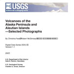
Neal, Christina, and McGimsey, R. G., 1997, Volcanoes of the Alaska Peninsula and Aleutian Islands selected photographs: U.S. Geological Survey Digital Data Series DDS 0040, 1 CD-ROM.

Stratigraphic framework of the Alaska Peninsula, 1996

Detterman, R. L., Case, J. E., Miller, J. W., Wilson, F. H., and Yount, M. E., 1996, Stratigraphic framework of the Alaska Peninsula: U.S. Geological Survey Bulletin 1969-A, 74 p.
full-text PDF 2.7 MB

Geologic map of the Port Moller, Stepovak Bay, and Simeonof Island quadrangles, Alaska Peninsula, Alaska, 1995

Wilson, F. H., Detterman, R. L., Miller, J. W., and Case, J. E., 1995, Geologic map of the Port Moller, Stepovak Bay, and Simeonof Island quadrangles, Alaska Peninsula, Alaska: U.S. Geological Survey Miscellaneous Investigations Series Map I 2272, unpaged, 2 sheets, scale 1:24,000.

Sample locality map and analytical data for potassium-argon ages in the Port Moller, Stepovak Bay, and Simeonof Island quadrangles, Alaska Peninsula, 1994

Wilson, F. H., Shew, Nora, DuBois, G. D., and Bie, S. W., 1994, Sample locality map and analytical data for potassium-argon ages in the Port Moller, Stepovak Bay, and Simeonof Island quadrangles, Alaska Peninsula: U.S. Geological Survey Miscellaneous Field Studies Map MF 2155-E, 18 p., 1 plate, scale 1:250,000.

Volcanoes of the world [2nd edition], 1994

Simkin, Tom, and Siebert, Lee, 1994, Volcanoes of the world [2nd edition]: Tucson, Arizona, Geoscience Press, 349 p.
Hard Copy held by AVO at FBKS - CEC shelf

Geothermal resources of the Aleutian Arc, 1993

Motyka, R. J., Liss, S. A., Nye, C. J., and Moorman, M. A., 1993, Geothermal resources of the Aleutian Arc: Alaska Division of Geological & Geophysical Surveys Professional Report PR 0114, 17 p., 4 sheets, scale 1:1,000,000.
Hard Copy held by AVO at FBKS - CEC shelf

Holocene volcanoes of the Aleutian Arc, Alaska, 1993

March, G. D., 1993, Holocene volcanoes of the Aleutian Arc, Alaska: Alaska Division of Geological & Geophysical Surveys Public-Data File PDF 93-85, unpaged, 1 sheet, scale 1:2,000,000.

Generalized geologic map of the Port Moller, Stepovak Bay, and Simeonof Island quadrangles, Alaska Peninsula, Alaska, 1991

Wilson, F. H., Detterman, R. L., and Harris, E. E., 1991, Generalized geologic map of the Port Moller, Stepovak Bay, and Simeonof Island quadrangles, Alaska Peninsula, Alaska: U.S. Geological Survey Miscellaneous Field Studies Map MF 2155-A, unpaged, 1 plate, scale 1:250,000.

Volcanoes of North America: United States and Canada, 1990

Wood, C. A., and Kienle, Juergen, (eds.), 1990, Volcanoes of North America: United States and Canada: New York, Cambridge University Press, 354 p.
Hard Copy held by AVO at FBKS - CEC shelf

Potassium-argon age determinations from the Port Moller and Stepovak Bay quadrangles, Alaska Peninsula, 1987

DuBois, G. D., Wilson, F. H., and Shew, N. B., 1987, Potassium-argon age determinations from the Port Moller and Stepovak Bay quadrangles, Alaska Peninsula: U.S. Geological Survey Open-File Report 87-0191, unpaged, 1 sheet, scale 1:250,000.

Map showing distribution, composition, and age of Late Cenozoic volcanic centers in Alaska, 1986

Luedke, R. G., and Smith, R. L., 1986, Map showing distribution, composition, and age of Late Cenozoic volcanic centers in Alaska: U.S. Geological Survey Miscellaneous Investigations Series Map I 1091-F, unpaged, 3 sheets, scale 1:1,000,000.

Newly discovered Holocene volcanic vents. Port Moller and Stepovak Bay quadrangles, Alaska Peninsula, 1985

Yount, M. E., Wilson, F. H., and Miller, J. W., 1985, Newly discovered Holocene volcanic vents. Port Moller and Stepovak Bay quadrangles, Alaska Peninsula: in Bartsch-Winkler, Susan and Reed, K. M., (eds.), The United States Geological Survey in Alaska: accomplishments during 1983, U.S. Geological Survey Circular C 0945, p. 60-62.
Hard Copy held by AVO at FBKS - CEC file cabinet

Late Quaternary glaciation of the Pavlof Bay and Port Moller areas, Alaska Peninsula, 1985

Weber, F. R., 1985, Late Quaternary glaciation of the Pavlof Bay and Port Moller areas, Alaska Peninsula: in Bartsch-Winkler, Susan, (ed.), The United States Geological Survey in Alaska: accomplishments during 1984, U.S. Geological Survey Circular C 0967, p. 42-44.

The Aleutians, 1982

Marsh, B. D., 1982, The Aleutians: in Thorpe, R. S., (ed.), Andesites: orogenic andesites and related rocks, Chichester, United Kingdom, John Wiley & Sons, p. 99-114.
Hard Copy held by AVO at FBKS - CEC file cabinet

Volcanoes of the world, 1981

Simkin, Tom, Siebert, Lee, McClelland, Lindsay, Bridge, David, Newhall, Christopher, and Latter, J. H., 1981, Volcanoes of the world: Stroudsburg, PA, Hutchinson Publishing Company, 233 p.

Water in some hypersthenic magmas, 1979

Anderson, A.T., 1979, Water in some hypersthenic magmas: The Journal of Geology, v. 87, n. 5, p. 509-531.

Comprehensive tables giving physical data and thermal energy estimates for young igneous systems of the United States, 1978

Smith, R. L., Shaw, H. R., Luedke, R. G., and Russell, S. L., 1978, Comprehensive tables giving physical data and thermal energy estimates for young igneous systems of the United States: U.S. Geological Survey Open-File Report 78-0925, p. 1-25.
Hard Copy held by AVO at FBKS - CEC shelf

Glaciers of the Aleutian Range and Kodiak Island, 1975

Denton, G. H., and Field, W. O., 1975, Glaciers of the Aleutian Range and Kodiak Island: in Field, W. O., (ed.), Mountain glaciers of the Northern Hemisphere, v. 2, Hanover, NH, Cold Regions Research and Engineering Laboratory, p. 621-638.

Account of a voyage of discovery to the north-east of Siberia, the frozen ocean, and the north-east sea, 1969

Sarychev, G.A., translated from Russian in 1806 and 1807, republished 1969, Account of a voyage of discovery to the north-east of Siberia, the frozen ocean, and the north-east sea: New York, Da Capo Press, 110 p.

Alaska Peninsula-Aleutian Islands, 1958

Powers, H. A., 1958, Alaska Peninsula-Aleutian Islands: in Williams, H., (ed.), Landscapes of Alaska, Los Angeles, CA, University of California Press, p. 61-75.

Volcanic activity in the Aleutian Arc, 1950

Coats, R. R., 1950, Volcanic activity in the Aleutian Arc: U.S. Geological Survey Bulletin 0974-B, p. 35-49, 1 sheet, scale 1:5,000,000.
plate 1 PDF 819 KB
full-text PDF 783 KB
Hard Copy held by AVO at FBKS - CEC shelf

Past volcanic activity in the Aleutian arc,

Coats, R. R., Past volcanic activity in the Aleutian arc: U.S. Geological Survey Volcano Investigations Report 1, 18 p.
full-text PDF 22.3 MB
Hard Copy held by AVO at FBKS - CEC file cabinet