Takawangha

MarkerMarkerMarkerMarkerMarkerMarkerMarkerMarkerMarkerMarkerMarkerMarkerMarkerMarkerMarkerMarkerMarkerMarkerMarkerMarkerMarkerMarkerMarkerMarkerMarkerMarkerMarkerMarkerMarkerMarkerMarkerMarkerMarkerMarkerMarkerMarkerMarkerMarkerMarkerMarkerMarkerMarkerMarkerMarkerMarkerMarkerMarkerMarkerMarkerMarkerMarkerMarkerMarkerMarkerMarkerMarkerMarkerMarkerMarkerMarkerMarkerMarkerMarkerMarkerMarkerMarkerMarkerMarkerMarkerMarkerMarkerMarkerMarkerMarkerMarkerMarkerMarkerMarkerMarkerMarkerMarkerMarkerMarkerMarkerMarkerMarkerMarkerMarkerMarkerMarkerMarkerMarkerMarkerMarkerMarkerMarkerMarkerMarkerMarkerMarkerMarkerMarkerMarkerMarkerMarkerMarkerMarkerMarkerMarkerMarkerMarkerMarkerMarkerMarkerMarkerMarkerMarkerMarkerMarkerMarkerMarkerMarkerMarkerMarkerMarkerMarkerMarkerMarkerMarkerMarkerMarkerMarkerMarkerMarkerMarkerMarkerMarkerMarkerMarkerMarkerMarkerMarkerMarkerMarkerMarkerMarkerMarkerMarkerMarkerMarkerMarkerMarkerMarkerMarkerMarkerMarkerMarkerMarkerMarkerMarkerMarkerMarkerMarkerMarkerMarkerMarkerMarkerMarkerMarkerMarkerMarkerMarkerMarkerMarkerMarkerMarkerMarkerMarkerMarkerMarkerMarkerMarkerMarkerMarkerMarkerMarkerMarkerMarkerMarkerMarkerMarkerMarkerMarkerMarkerMarkerMarkerMarkerMarkerMarkerMarkerMarkerMarkerMarkerMarkerMarkerMarkerMarkerMarkerMarkerMarkerMarker
Legend
Red (Warning)
Orange (Watch)
Yellow (Advisory)
Green (Normal)
Uninstrumented
Community
Webcam
Instrument
Earthquake Magnitude
0 7+
Earthquake Age
Last 2 Hours
Last 2 Days
Last 1 Week


Facts


  • Seismically Monitored: Yes
  • Color Code: GREEN
  • Alert Level: NORMAL
  • Elevation: 1449m (4753ft)
  • Latitude: 51.867
  • Longitude: -178.027
  • Smithsonian VNum: 311090
  • Nearby Towns:
    • Adak 60 mi (96 km) NE
    • Atka 164 mi (264 km) NE
    • Shemya Station 337 mi (543 km) NW
    • Attu Station 375 mi (604 km) NW
    • Nikolski 393 mi (632 km) NE

    Distance from Anchorage: 1237 mi (1990 km)

Description

From Smithsonian Institution, Global Volcanism Program online database, accessed December 8, 2003: "Takawangha is a 1449-m-high, youthful volcano with an ice-filled caldera on northern Tanaga Island, near the western end of the Andreanof Islands. Takawangha lies across a saddle from historically active Tanaga volcano to the west; older, deeply eroded volcanoes lie adjacent to Takawangha on the east. Numerous small post-caldera tephra cones are located within the caldera and on its rim and flanks. The youngest cones are some of those inside the caldera of the basaltic-to-dacitic volcano. No historical eruptions are known from Takawangha."

Name Origin

Takawangha is an alternate name for Tanaga Island, and unofficially used to describe the youthful volcano on northern Tanaga Island, east from Tanaga Volcano.


Current Activity

No new updates for Takawangha volcano since January 29, 2024, 2:13 pm.

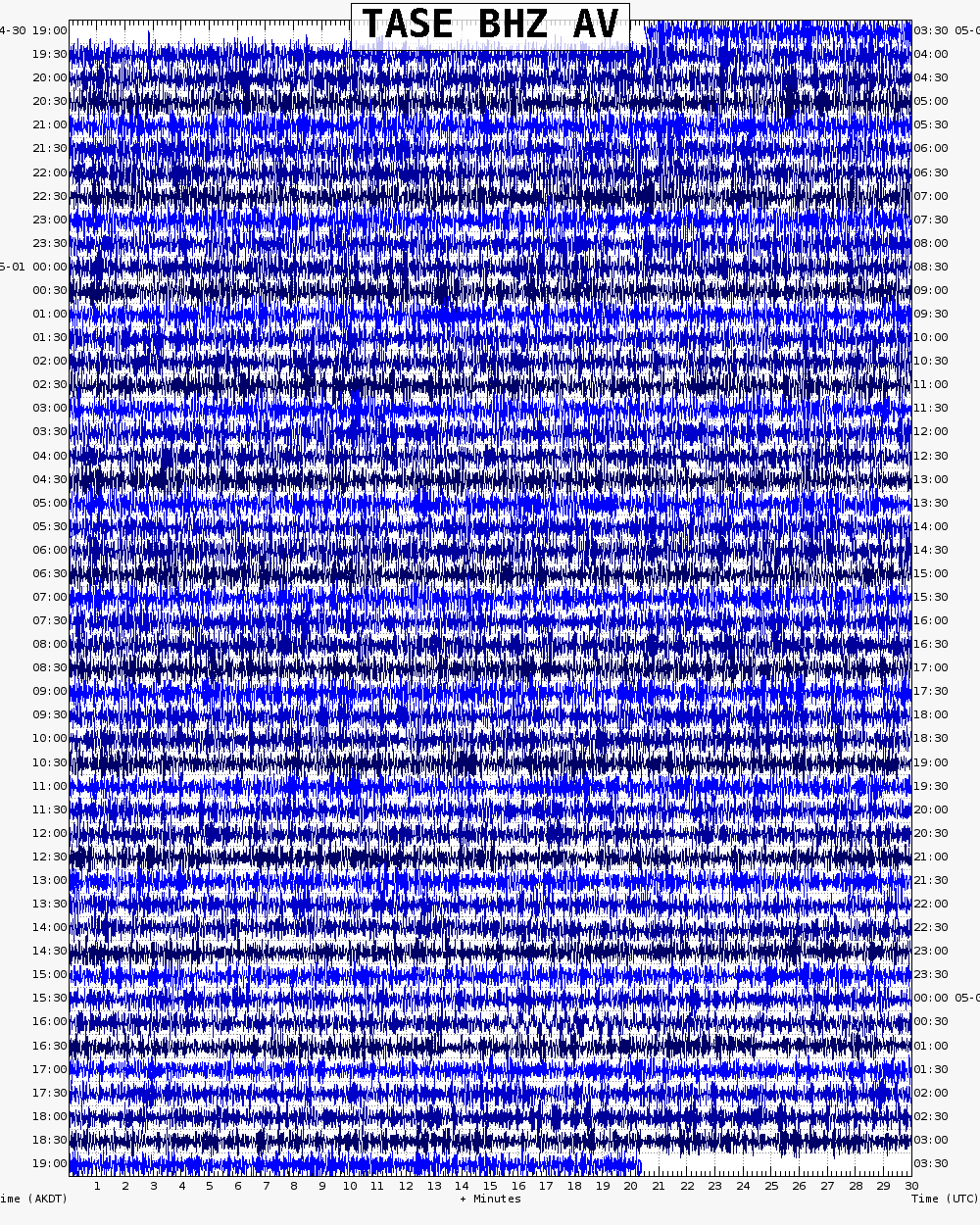
Webicorder

Color Code Timeline

Reported Activity

Modern Eruptions

Takawangha

Takawangha Eruption Timeline

On January 23, 2017, after an energetic earthquake swarm was detected on Tanaga Island, the Alaska Volcano Observatory raised the aviation color code to YELLOW and the alert level to Advisory.  As of January 26, earthquakes continue to be located within 6 to 7 km of Takawangha volcano.   No activity has been detected at the volcano in satellite data.
Image courtesy of the AVO/ADGGS.
On January 23, 2017, after an energetic earthquake swarm was detected on Tanaga Island, the Alaska Volcano Observatory raised the aviation color code to YELLOW and the alert level to Advisory. As of January 26, earthquakes continue to be located within 6 to 7 km of Takawangha volcano. No activity has been detected at the volcano in satellite data.

Takawangha 2017/1

January 23, 2017

On January 24, 2017, citing an energetic earthquake swarm, AVO raised the Aviation Color Code and Volcano Alert Level at Takawangha from UNASSIGNED to YELLOW/ADVISORY. The earthquake swarm began January 23. The earthquakes located 6-7 km ESE of Takawangha Voclano. This activity could have been due to brittle failure in the surrounding rock caused by magma movement. No eruptive activity was detected in satellite imagery or other data.
Following a significant decline in the energetic earthquake swarm, with seismicity returning to near background levels, AVO lowered the Aviation Color Code to GREEN and Alert Level to NORMAL for Takawangha volcano on February 8, 2017.

On January 23, 2017, after an energetic earthquake swarm was detected on Tanaga Island, the Alaska Volcano Observatory raised the aviation color code to YELLOW and the alert level to Advisory.  As of January 26, earthquakes continue to be located within 6 to 7 km of Takawangha volcano.   No activity has been detected at the volcano in satellite data.
Image courtesy of the AVO/ADGGS.
On January 23, 2017, after an energetic earthquake swarm was detected on Tanaga Island, the Alaska Volcano Observatory raised the aviation color code to YELLOW and the alert level to Advisory. As of January 26, earthquakes continue to be located within 6 to 7 km of Takawangha volcano. No activity has been detected at the volcano in satellite data.

Takawangha unrest 2023

November 18, 2022

On November 18, 2022, AVO raised the Aviation Color Code and Volcano Alert Level at Takawangha to YELLOW/ADIVSORY, citing "The number of small earthquakes detected near Takawangha volcano has increased over the past few days and has intensified over the past 24 hours. The earthquakes, the largest with magnitudes between 2 and 3, have preliminary depths of about 2 to 4 miles (3 to 6 km) below sea level. This activity may be due to the movement of magma beneath the volcano." This seismicity marks a departure from background activity."
On March 9, 2023, AVO raised Takawangha to ORANGE/wATCH, stating "Over the past 48 hours, earthquake activity near Takawangha volcano has been elevated and continues. This sustained activity indicates an increased potential for eruption at the volcano. Therefore AVO is raising the Aviation Color Code to ORANGE and the Volcano Alert Level to WATCH. Seismic activity is also elevated at Tanaga Volcano, which is about 8 km (5 mi) west of Takawangha on Tanaga Island. If an eruption were to occur, it is uncertain at this stage if it would come from Takawangha or Tanaga."

Hypocenter plot for Tanaga Volcano and Takawangha volcano showing earthquakes located over the past 2 weeks. Plot generated at 4:15 pm AKST on March 9, 2023.
Image courtesy of AVO/USGS.
Hypocenter plot for Tanaga Volcano and Takawangha volcano showing earthquakes located over the past 2 weeks. Plot generated at 4:15 pm AKST on March 9, 2023.

Takawangha 2017/1

Takawangha unrest 2023

1999
2000
2001
2002
2003
2004
2005
2006
2007
2008
2009
2010
2011
2012
2013
2014
2015
2016
2017
2018
2019
2020
2021
2022
2023
2024
2025
2026
2027
2028
2029
2030
2031
2032
2033
2034
2035
2036
2037
2038
2039
2040
Aug.
Sept.
Oct.
Nov.
Dec.
Feb.
March
April
May
June
July
Aug.
Sept.
Oct.
Nov.
Dec.
March
April
May
May
June
July
Aug.
Sept.
Oct.
Nov.
Dec.
Feb.
March
April
May
June
July
Aug.
Sept.
Oct.
Nov.
Dec.
Feb.
March
April
May
June
July
Aug.
Sept.
Oct.
Nov.
Dec.
Feb.
March
April
May
June
July
Aug.
Sept.
Oct.
Nov.
Dec.
Feb.
March
April
May
June
July
Aug.
Sept.
Oct.
Nov.
Dec.
Feb.
March
April
May
June
July
Aug.
Sept.
Oct.
Nov.
Dec.
Dec.
March
March
April
May
June
July
Aug.
Sept.
Oct.
Nov.
Dec.
Feb.
March
April

2 Event Date(s)

Past Activity Legend:
Eruption
Questionable eruption
Non-eruptive activity


Showing 1 - 20 of 53

Map Images


Map References


Digital data for the reconnaissance geologic map of the western Aleutian islands, Alaska, 2006

Wilson, F.H., Mohadjer, Solmaz, Labay, K.A., Shew, Nora, and Grey, D.M., 2006, Digital data for the reconnaissance geologic map of the western Aleutian islands, Alaska: U.S. Geological Survey Open-File Report 2006-1302, 1 p., available online at http://pubs.usgs.gov/of/2006/1302/

Volcanoes of Alaska, 1998

Nye, C. J., Queen, Katherine, and McCarthy, A. M., 1998, Volcanoes of Alaska: Alaska Division of Geological & Geophysical Surveys Information Circular IC 0038, unpaged, 1 sheet, scale 1:4,000,000, available at http://www.dggs.dnr.state.ak.us/pubs/pubs?reqtype=citation&ID=7043 .
Hard Copy held by AVO at FBKS - CEC shelf

Volcanoes of Alaska, 1995

Alaska Division of Geological & Geophysical Surveys, 1995, Volcanoes of Alaska: Alaska Division of Geological & Geophysical Surveys Information Circular IC 0038, unpaged, 1 sheet, scale 1:4,000,000.

Geothermal resources of the Aleutian Arc, 1993

Motyka, R. J., Liss, S. A., Nye, C. J., and Moorman, M. A., 1993, Geothermal resources of the Aleutian Arc: Alaska Division of Geological & Geophysical Surveys Professional Report PR 0114, 17 p., 4 sheets, scale 1:1,000,000.
Hard Copy held by AVO at FBKS - CEC shelf

Holocene volcanoes of the Aleutian Arc, Alaska, 1993

March, G. D., 1993, Holocene volcanoes of the Aleutian Arc, Alaska: Alaska Division of Geological & Geophysical Surveys Public-Data File PDF 93-85, unpaged, 1 sheet, scale 1:2,000,000.

Map showing distribution, composition, and age of Late Cenozoic volcanic centers in Alaska, 1986

Luedke, R. G., and Smith, R. L., 1986, Map showing distribution, composition, and age of Late Cenozoic volcanic centers in Alaska: U.S. Geological Survey Miscellaneous Investigations Series Map I 1091-F, unpaged, 3 sheets, scale 1:1,000,000.

Geothermal energy resources of Alaska, 1980

Turner, D. L., Forbes, R. B., Albanese, Mary, Macbeth, Joyce, Lockhart, A. B., and Seed, S. M., 1980, Geothermal energy resources of Alaska: University of Alaska Fairbanks Geophysical Institute Report UAG-R 279, 19 p., 3 sheets, scale 1 at 1:2,500,000.

References

2022 Volcanic activity in Alaska and the Northern Mariana Islands—Summary of events and response of the Alaska Volcano Observatory, 2025

Orr, T.R., Dietterich, H.R., Grapenthin, R., Haney, M.M., Loewen, M.W., Saunders-Schultz, P., Tan, D., Waythomas, C.F., and Wech, A.G., 2025, 2022 Volcanic activity in Alaska and the Northern Mariana Islands-Summary of events and response of the Alaska Volcano Observatory: U.S. Geological Survey Scientific Investigations Report 2024-5108, 46 p. https://doi.org/ 10.3133/sir20245108
Full-text PDF 12.8 MB

Volcanic and tectonic sources of seismicity near the Tanaga Volcanic Cluster, Alaska, 2023

Lally, K.F., Caplan-Auerbach, J., and Power, J.A., 2023, Volcanic and Tectonic Sources of Seismicity Near the Tanaga Volcanic Cluster, Alaska: Geochemistry, Geophysics, Geosystems v. 24, article no. e2023GC010891, 19 p. https://doi.org/10.1029/2023GC010891.

Geologic database of information on volcanoes in Alaska (GeoDIVA), 2022

Cameron, C.E., Crass, S.W., and AVO Staff, eds, 2022, Geologic database of information on volcanoes in Alaska (GeoDIVA): Alaska Division of Geologic and Geophysical Surveys Digital Data Series 20, https://doi.org/10.14509/geodiva, https://doi.org/10.14509/30901.

2017 Volcanic activity in Alaska-Summary of events and response of the Alaska Volcano Observatory, 2020

Dixon, J.P., Cameron, C.E., Iezzi, A.M., Power, J.A., Wallace, K., and Waythomas, C.F., 2020, 2017 Volcanic activity in Alaska-Summary of events and response of the Alaska Volcano Observatory: U.S. Geological Survey Scientific Investigations Report 2020-5102, 61 p., https://doi.org/10.3133/sir20205102.

2018 update to the U.S. Geological Survey national volcanic threat assessment, 2018

Ewert, J.W., Diefenbach, A.K., and Ramsey, D.W., 2018, 2018 update to the U.S. Geological Survey national volcanic threat assessment: U.S. Geological Survey Scientific Investigations Report 2018-5140, 40 p., https://pubs.usgs.gov/sir/2018/5140/sir20185140.pdf.

Alaska Volcano Observatory image database, 2016

Cameron, C.E., and Snedigar, S.F., 2016, Alaska Volcano Observatory image database: Alaska Division of Geological & Geophysical Surveys Digital Data Series 13, https://www.avo.alaska.edu/images/. https://doi.org/10.14509/29689.

Regional controls on volcano seismicity along the Aleutian Arc, 2014

Buurman, Helena, Nye, C.J., West, M.E., and Cameron, Cheryl, 2014, Regional controls on volcano seismicity along the Aleutian Arc: Geochemistry, Geophysics, Geosystems, doi:10.1002/2013GC005101

Preliminary database of Quaternary vents in Alaska, 2014

Cameron, C.E., and Nye, C.J., 2014, Preliminary database of Quaternary vents in Alaska: Alaska Division of Geological & Geophysical Surveys Miscellaneous Publication 153, 11 p., doi:10.14509/27357 .

Preliminary spreadsheet of eruption source parameters for volcanoes of the world, 2009

Mastin, L.G., Guffanti, Marianne, Ewert, J.E., and Spiegel, Jessica, 2009, Preliminary spreadsheet of eruption source parameters for volcanoes of the world: U.S. Geological Survey Open-File Report 2009-1133, v. 1.2, 25 p., available at http://pubs.usgs.gov/of/2009/1133/ .

Preliminary volcano-hazard assessment for the Tanaga Volcanic Cluster, Tanaga Island, Alaska, 2007

Coombs, M.L., McGimsey, R.G., and Browne, B.L., 2007, Preliminary volcano-hazard assessment for the Tanaga Volcanic Cluster, Tanaga Island, Alaska: U.S. Geological Survey Scientific Investigations Report 2007-5094, 36 p., available online at: http://pubs.usgs.gov/sir/2007/5094/ .

System for ranking relative threats of U.S. volcanoes, 2007

Ewert, John, 2007, System for ranking relative threats of U.S. volcanoes: Natural Hazards Review, v. 8, n. 4, p. 112-124.

Digital data for the reconnaissance geologic map of the western Aleutian islands, Alaska, 2006

Wilson, F.H., Mohadjer, Solmaz, Labay, K.A., Shew, Nora, and Grey, D.M., 2006, Digital data for the reconnaissance geologic map of the western Aleutian islands, Alaska: U.S. Geological Survey Open-File Report 2006-1302, 1 p., available online at http://pubs.usgs.gov/of/2006/1302/

Preliminary geology of the Tanaga Island volcanic cluster, western Aleutians (Alaska), 2004

Coombs, M. L., Browne, B. L., and Larsen, J. F., 2004, Preliminary geology of the Tanaga Island volcanic cluster, western Aleutians (Alaska) [abs.]: Eos, AGU Fall Meeting Supplement, v. 85, n. 47, p. V43E-1457.

Volcanoes of the world: an illustrated catalog of Holocene volcanoes and their eruptions, 2003

Siebert, L., and Simkin, T., 2002-, Volcanoes of the world: an illustrated catalog of Holocene volcanoes and their eruptions: Smithsonian Institution, Global Volcanism Program Digital Information Series GVP-3, http://volcano.si.edu/search_volcano.cfm, unpaged internet resource.

Bibliography of information on Alaska volcanoes, 2003

Cameron, C. E., Triplehorn, J. H., and Robar, C. L., 2003, Bibliography of information on Alaska volcanoes: Alaska Division of Geological & Geophysical Surveys Miscellaneous Publication MP 131, 1 CD-ROM.
Hard Copy held by AVO at FBKS - CEC file cabinet

Volcanoes of Alaska, 1998

Nye, C. J., Queen, Katherine, and McCarthy, A. M., 1998, Volcanoes of Alaska: Alaska Division of Geological & Geophysical Surveys Information Circular IC 0038, unpaged, 1 sheet, scale 1:4,000,000, available at http://www.dggs.dnr.state.ak.us/pubs/pubs?reqtype=citation&ID=7043 .
Hard Copy held by AVO at FBKS - CEC shelf

Volcanoes of Alaska, 1995

Alaska Division of Geological & Geophysical Surveys, 1995, Volcanoes of Alaska: Alaska Division of Geological & Geophysical Surveys Information Circular IC 0038, unpaged, 1 sheet, scale 1:4,000,000.

Volcanoes of the world [2nd edition], 1994

Simkin, Tom, and Siebert, Lee, 1994, Volcanoes of the world [2nd edition]: Tucson, Arizona, Geoscience Press, 349 p.
Hard Copy held by AVO at FBKS - CEC shelf

Geothermal resources of Alaska, 1994

Miller, T. P., 1994, Geothermal resources of Alaska: in Plafker, George and Berg, H. C., (eds.), The Geology of Alaska, Geological Society of America The Geology of North America series v. G-1, p. 979-987.
Hard Copy held by AVO at FBKS - CEC file cabinet Hard Copy held by AVO at FBKS - CEC shelf

Aleut dictionary, Unangam Tunudgusii, an unabridged lexicon of the Aleutian, Pribilof, and Commander Islands Aleut language, 1994

Bergsland, Knut, comp., 1994, Aleut dictionary, Unangam Tunudgusii, an unabridged lexicon of the Aleutian, Pribilof, and Commander Islands Aleut language: University of Alaska Fairbanks, Alaska Native Language Center, 739 p.

Geothermal resources of the Aleutian Arc, 1993

Motyka, R. J., Liss, S. A., Nye, C. J., and Moorman, M. A., 1993, Geothermal resources of the Aleutian Arc: Alaska Division of Geological & Geophysical Surveys Professional Report PR 0114, 17 p., 4 sheets, scale 1:1,000,000.
Hard Copy held by AVO at FBKS - CEC shelf

Holocene volcanoes of the Aleutian Arc, Alaska, 1993

March, G. D., 1993, Holocene volcanoes of the Aleutian Arc, Alaska: Alaska Division of Geological & Geophysical Surveys Public-Data File PDF 93-85, unpaged, 1 sheet, scale 1:2,000,000.

Map showing distribution, composition, and age of Late Cenozoic volcanic centers in Alaska, 1986

Luedke, R. G., and Smith, R. L., 1986, Map showing distribution, composition, and age of Late Cenozoic volcanic centers in Alaska: U.S. Geological Survey Miscellaneous Investigations Series Map I 1091-F, unpaged, 3 sheets, scale 1:1,000,000.

Reconnaissance geology and petrology of northern Tanaga, Aleutian Islands, Alaska, 1984

Coats, R. R., and Marsh, B. D., 1984, Reconnaissance geology and petrology of northern Tanaga, Aleutian Islands, Alaska [abs.]: Abstracts with Programs - Geological Society of America, v. 16, n. 6, p. 474.

Volcanoes of the world, 1981

Simkin, Tom, Siebert, Lee, McClelland, Lindsay, Bridge, David, Newhall, Christopher, and Latter, J. H., 1981, Volcanoes of the world: Stroudsburg, PA, Hutchinson Publishing Company, 233 p.

Geothermal energy resources of Alaska, 1980

Turner, D. L., Forbes, R. B., Albanese, Mary, Macbeth, Joyce, Lockhart, A. B., and Seed, S. M., 1980, Geothermal energy resources of Alaska: University of Alaska Fairbanks Geophysical Institute Report UAG-R 279, 19 p., 3 sheets, scale 1 at 1:2,500,000.

Igneous-related geothermal systems, 1979

Smith, R. L., and Shaw, H. R., 1979, Igneous-related geothermal systems: in Muffler, L. J. P., (ed.), Assessment of geothermal resources of the United States 1978, U.S. Geological Survey Circular C 790, p. 12-17.

Assessment of geothermal resources of the United States--1978, 1979

Muffler, L. J. P., 1979, Assessment of geothermal resources of the United States--1978: U.S. Geological Survey Circular C 0790, 163 p.
Hard Copy held by AVO at FBKS - CEC shelf

Comprehensive tables giving physical data and thermal energy estimates for young igneous systems of the United States, 1978

Smith, R. L., Shaw, H. R., Luedke, R. G., and Russell, S. L., 1978, Comprehensive tables giving physical data and thermal energy estimates for young igneous systems of the United States: U.S. Geological Survey Open-File Report 78-0925, p. 1-25.
Hard Copy held by AVO at FBKS - CEC shelf

Alaska Peninsula-Aleutian Islands, 1958

Powers, H. A., 1958, Alaska Peninsula-Aleutian Islands: in Williams, H., (ed.), Landscapes of Alaska, Los Angeles, CA, University of California Press, p. 61-75.

Ash Forecasting

Mathematical models developed by the USGS forecast various aspects of how a volcanic ash plume will interact with wind—where, how high, and how fast ash particles will be transported in the atmosphere, as well as where ash will fall out and accumulate on the ground. AVO runs these models when a volcano is restless by assuming a reasonable hypothetical eruption, to provide a pre-eruptive forecast of areas likely to be affected. During an ongoing eruption, AVO will update the forecast with actual observations (eruption start time and duration, plume height) as they become available.

View the current airborne ash cloud models for Takawangha

Ashfall thickness forecast

The Ash3d model was developed by the USGS to forecast how a volcanic ash plume will interact with wind and where ash will fall out and accumulate on the ground. AVO runs these models twice daily when a volcano is restless by assuming a reasonable hypothetical eruption altitude and duration. The map shows the model results of ashfall thickness for areas that are likely to be affected, if one were to occur. During an ongoing eruption, AVO will update the forecast with actual observations (eruption start time and duration, plume height) as they become available, and these plots will be automatically updated. The National Weather Service Anchorage Forecast Office will issue the official ashfall warning product and post them at weather.gov/afc

THESE PRODUCTS MAY NOT BE CURRENT.

During an actual eruption, see National Weather Service forecasts of ashfall:https://weather.gov/afc.
Ashfall Forecast

Click on the X on the graphic (upper right) to expand the map to show the map legend.

Ashfall Start Time

This map shows the modeled estimate of the time it would take for ashfall to begin following an eruption. It corresponds to the ashfall thickness forecast map shown above. This map uses the start time of either the twice-daily hypothetical model runs (time shown in the legend) or the actual eruption start time (if one were to occur). In the case of an actual eruption, the National Weather Service Anchorage Forecast Office will issue the official ashfall warning product that includes the ashfall start time and post them at weather.gov/afc

THESE PRODUCTS MAY NOT BE CURRENT.

During an actual eruption, see National Weather Service forecasts of ashfall:https://weather.gov/afc.

Ashfall Start Times Forecast

Click on the X on the graphic (upper right) to expand the map to show the map legend.
×

×