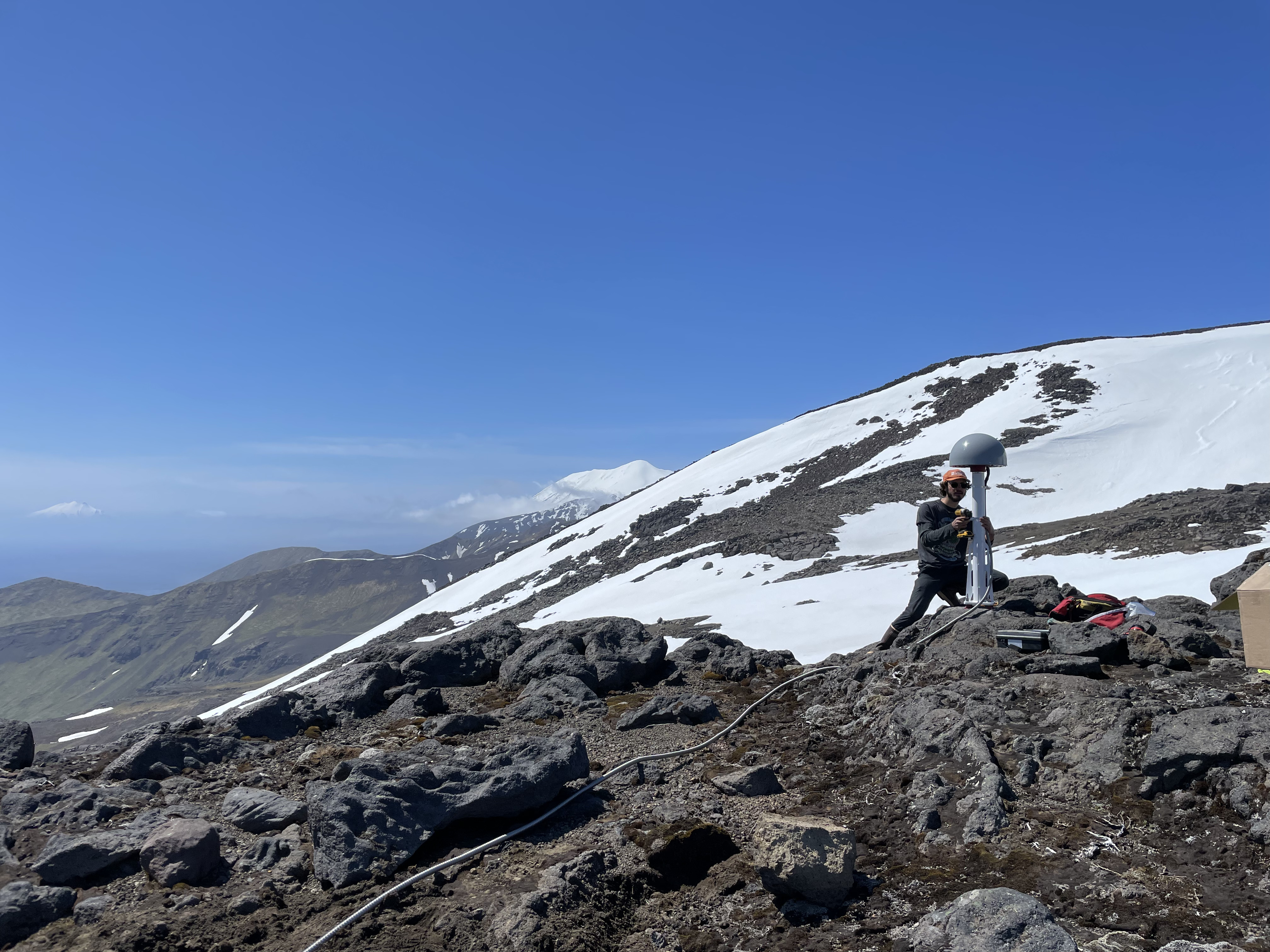
AVO field team installed a new GPS monument at site TASE on the south slope of Takawangha Volcano, to monitor potential volcanic or tectonic movement in the area. The summit of Tanaga is visible in the center background, and Gareloi Volcano in the distance on the left side of the image.
Date: Jun 17th, 2023
Volcano(es): Gareloi Takawangha Tanaga
Photographer: Boyce, Ellie
URL: avo.alaska.edu/image/view/194504
Credit: Image courtesy of the AVO/UAF-GI.
Use Restriction: Please cite the photographer and the Alaska Volcano Observatory / University of Alaska Fairbanks, Geophysical Institute when using this image.
Full Resolution.
Volcano(es): Gareloi Takawangha Tanaga
Photographer: Boyce, Ellie
URL: avo.alaska.edu/image/view/194504
Location:
Latitude: 51.834938888889
Longitude: -178.03689444444
Tanaga Island
Use Restriction: Please cite the photographer and the Alaska Volcano Observatory / University of Alaska Fairbanks, Geophysical Institute when using this image.
Full Resolution.
×
![Instrument data]()