References
Orr, T.R., Dietterich, H.R., Grapenthin, R., Haney, M.M., Loewen, M.W., Saunders-Schultz, P., Tan, D., Waythomas, C.F., and Wech, A.G., 2025, 2022 Volcanic activity in Alaska and the Northern Mariana Islands-Summary of events and response of the Alaska Volcano Observatory: U.S. Geological Survey Scientific Investigations Report 2024-5108, 46 p. https://doi.org/ 10.3133/sir20245108
Mallalieu, J., Barr, I.D., Spagnolo, M., Mullan, D.J., Symeonakis, E., Edwards, B.R., and Martin, M.D., 2024, Proximity to active volcanoes enhances glacier velocity: Communications Earth & Environment v. 5, 679. https://doi.org/10.1038/s43247-024-01826-5
Cameron, C.E., Bull, K.F., and Macpherson, A.E., 2023, Recently active volcanoes of Alaska: Alaska Division of Geological & Geophysical Surveys Miscellaneous Publication 133 v. 6, 2 sheets. https://doi.org/10.14509/31086.
Koulakov, I., Izbekov, P., Eichelberger, J., Al Arifi, N., and Qaysi, S.I., 2023, Interconnection of magma sources beneath the Katmai volcanic system inferred from seismic tomography and petrology: Journal of Volcanology and Geothermal Research v. 434, 107744. https://doi.org/10.1016/j.jvolgeores.2023.107744.
Bartz, K.K., Hannam, M.P., Wilson, T.L., Lepak, R.F., Ogorek, J.M., Young, D.B., Eagles-Smith, C.A., and Krabbenhoft, D.P., 2023, Understanding drivers of mercury in lake trout (Salvelinus namaycush), a top-predator fish in southwest Alaska's parklands: Environmental Pollution v. 330, 121678. https://doi.org/10.1016/j.envpol.2023.121678
Alaska Volcano Observatory, National Oceanic and Atmospheric Administration, National Weather Service, Federal Aviation Administration, Department of Defense, United States Coast Guard, Division of Homeland Security and Emergency Management, Alaska Department of Environmental Conservation, and Alaska Department of Health and Social Services (participating agencies), 2022, Alaska interagency operating plan for volcanic ash episodes, 85 p.
Cameron, C.E., Crass, S.W., and AVO Staff, eds, 2022, Geologic database of information on volcanoes in Alaska (GeoDIVA): Alaska Division of Geologic and Geophysical Surveys Digital Data Series 20, https://doi.org/10.14509/geodiva, https://doi.org/10.14509/30901.
Bai, Tong, Nayak, Avinash, Thurber, Clifford, Zeng, Xiangfang, and Haney, Mathew, 2021, Ambient noise tomography of the Katmai volcanic area, Alaska: Journal of Volcanology and Geothermal Research, v. 419, article no. 107373, 10 p., doi:10.1016/j.jvolgeores.2021.107373.
Cameron, C.E., Schaefer, J.R., and Ekberg, P.G., 2020, Historically active volcanoes of Alaska: Alaska Division of Geological & Geophysical Surveys Miscellaneous Publication 133 v. 4, 2 sheets. Http://doi.org/10.14509/30426
Dixon, J.P., Stihler S.D., Haney, M.M., Lyons, J.J., Ketner, D.M., Mulliken, K.M., Parker, T., and Power, J.A., 2019, Catalog of earthquake parameters and description of seismograph and infrasound stations at Alaskan volcanoes - January 1, 2013, through December 31, 2017: U.S. Geological Survey Data Series 1115, 92 p., https://doi.org/10.3133/ds1115.
Power, J.A., Friberg, P.A., Haney, M.M., Parker, T., Stihler, S.D., and Dixon, J.P., 2019, A unified catalog of earthquake hypocenters and magnitudes at volcanoes in Alaska—1989 to 2018: U.S. Geological Survey Scientific Investigations Report 2019–5037, 17 p., https://doi.org/10.3133/sir20195037.
Ewert, J.W., Diefenbach, A.K., and Ramsey, D.W., 2018, 2018 update to the U.S. Geological Survey national volcanic threat assessment: U.S. Geological Survey Scientific Investigations Report 2018-5140, 40 p., https://pubs.usgs.gov/sir/2018/5140/sir20185140.pdf.
Cameron, C.E., Schaefer, J.R., and Mulliken, K.M., 2018, Historically active volcanoes of Alaska: Alaska Division of Geological & Geophysical Surveys Miscellaneous Publication 133 v. 3, 2 sheets. Http://doi.org/10.14509/30142
Barr, I.D., Lynch, C.M., Mullan, Donal, De Siena, Luca, and Spagnolo, Matteo, 2018, Volcanic impacts on modern glaciers: a global synthesis: Earth-Science Reviews, v. 182, p. 186-203, doi: http://dx.doi.org/10.1016/j.earscirev.2018.04.008.
Lopez, T., Fazzi, F., Aiuppa, A., Galle, B., Rizzo, A.L., Fiebig, J., Capecchiacci, F., Giudice, G., Caliro, S., Tamburello, G., 2017, Geochemical constraints on volatile sources and subsurface conditions at Mount Martin, Mount Mageik, and Trident Volcanoes, Katmai Volcanic Cluster, Alaska: Journal of Volcanology and Geothermal Research,v. 347, p. 64-81, https://doi.org/10.1016/j.jvolgeores.2017.09.001.
Cameron, C.E., and Schaefer, J.R., 2016, Historically active volcanoes of Alaska: Alaska Division of Geological & Geophysical Surveys Miscellaneous Publication 133 v. 2, 1 sheet, scale 1:3,000,000. http://doi.org/10.14509/20181
Cameron, C.E., and Snedigar, S.F., 2016, Alaska Volcano Observatory image database: Alaska Division of Geological & Geophysical Surveys Digital Data Series 13, https://www.avo.alaska.edu/images/. https://doi.org/10.14509/29689.
Schaefer, J.R., Cameron, C.E., and Nye, C.J., 2014, Historically active volcanoes of Alaska: Alaska Division of Geological & Geophysical Surveys Miscellaneous Publication 133 v. 1.2, 1 sheet, scale 1:3,000,000.
This publication has been superseded. Newest version available at http://www.dggs.alaska.gov/pubs/id/20181 .
Buurman, Helena, Nye, C.J., West, M.E., and Cameron, Cheryl, 2014, Regional controls on volcano seismicity along the Aleutian Arc: Geochemistry, Geophysics, Geosystems, doi:10.1002/2013GC005101
Murphy, Rachel, Thurber, Clifford, Prejean, Stephanie, and Bennington, Ninfa, 2014, Three-dimensional seismic velocity structure and earthquake relocations at Katmai, Alaska: Journal of Volcanology and Geothermal Research, v. 276, p. 121-131, doi:10.1016/j.jvolgeores.2014.02.22
Cameron, C.E., and Nye, C.J., 2014, Preliminary database of Quaternary vents in Alaska: Alaska Division of Geological & Geophysical Surveys Miscellaneous Publication 153, 11 p., doi:10.14509/27357 .
Lu, Zhong, and Dzurisin, Daniel, 2014, InSAR imaging of Aleutian volcanoes: Chichester, UK, Springer-Praxis, 390 p.
Fee, David, and Matoza, R.S., 2013, An overview of volcano infrasound: from hawaiian to plinian, local to global: Journal of Volcanology and Geothermal Research, v. 249, p. 123-139, doi: 10.1016/j.jvolgeores.2012.09.002 .
Dixon, J.P., Stihler, S.D, Power, J.A., Haney, Matt, Parker, Tom, Searcy, C.K., and Prejean, Stephanie, 2013, Catalog of earthquake hypocenters at Alaskan volcanoes: January 1 through December 31, 2012: U.S. Geological Survey Data Series 789, 84 p., available at http://pubs.usgs.gov/ds/789/ .
Winfree, Robert, with contributions from Bacon, C.R., Bennett, A.J., Bennington, Ninfa, Berg, E.E., Brooks, Margi, Coletti, H.A., Coombs, M.L., Fierstein, Judy, Freeburg, Gary, Frost, G.V., Haney, Matthew, Jorgenson, M.T., Miller, A.E., Moran, Seth, Murphy, Rachel, Partnow, Patricia, Paskievitch, John, Stevens, D.P., Powell, Lee, Power, John, Prejean, S.G., Schaaf, Jeanne, Sherriff, R.L., Thurber, Clifford, and Welchman, R.A., 2012, Katmai science studies: Alaska Park Science Journal, v. 11, n. 1, 96 p., available online at http://www.nps.gov/akso/nature/science/ak_park_science/volume_11_issue_1.cfm .
Fierstein, Judy, 2012, Katmai National Park volcanoes: in Winfree, Robert (project lead), Katmai Science Studies: Alaska Park Science Journal, v. 11, n. 1, p. 14-21, available online at http://www.nps.gov/akso/nature/science/ak_park_science/volume_11_issue_1.cfm .
Hard Copy held by AVO at FBKS - CEC shelf
Coombs, M.L., and Bacon, C.R., 2012, Using rocks to reveal the inner workings of magma chambers below volcanoes in Alaska's National Parks: in Alaska: in Winfree, Robert (project lead), Katmai Science Studies: Alaska Park Science Journal, v. 11, n. 1, p. 26-33, available online at http://www.nps.gov/akso/nature/science/ak_park_science/volume_11_issue_1.cfm .
Hard Copy held by AVO at FBKS - CEC shelf
Thurber, Clifford, Murphy, Rachel, Prejean, Stephanie, Haney, Matthew, Bennington, Ninfa, Powell, Lee, and Paskievitch, John, 2012: Earthquake studies reveal the magmatic plumbing system of the Katmai volcanoes: in Winfree, Robert (project lead), Katmai Science Studies: Alaska Park Science Journal, v. 11, n. 1, p. 34-39, available online at http://www.nps.gov/akso/nature/science/ak_park_science/volume_11_issue_1.cfm .
Hard Copy held by AVO at FBKS - CEC shelf
Prejean, Stephanie, Moran, Seth, and Power, John, 2012, Volcanic earthquakes in Alaska's National Parks: in Winfree, Robert (project lead), Katmai Science Studies: Alaska Park Science Journal, v. 11, n. 1, p. 40-45, available online at http://www.nps.gov/akso/nature/science/ak_park_science/volume_11_issue_1.cfm .
Hard Copy held by AVO at FBKS - CEC shelf
Fierstein, J., 2012, Concluding thoughts: Can another great volcanic eruption happen in Alaska?: in Winfree, Robert (project lead), Katmai Science Studies: Alaska Park Science Journal, v. 11, n. 1, p. 88-93, available online at http://www.nps.gov/akso/nature/science/ak_park_science/volume_11_issue_1.cfm .
Hard Copy held by AVO at FBKS - CEC shelf
Dixon, J.P., Stihler, S.D., Power, J.A., and Searcy, C.K., 2012, Catalog of earthquake hypocenters at Alaskan volcanoes: January 1 through December 31, 2011: U.S. Geological Survey Data Series 730, 82 p., available online at http://pubs.usgs.gov/ds/730/pdf/ds730.pdf .
Prejean, S., Murphy, R., Thurber, C., McNutt, S., Stihler, S., and Syracuse, E., 2011, The 2008 earthquake swarm at Trident and Novarupta volcanoes: a case of fluid triggered seismicity? [abs.]: Seismological Research Letters, v. 82, n. 2, p. 278.
Dixon, J.P., Stihler, S.D., Power, J.A., and Searcy, C.K., 2011, Catalog of earthquake hypocenters at Alaskan volcanoes: January 1 through December 31, 2010: U.S. Geological Survey Data Series 645, 82 p., available online at http://pubs.usgs.gov/ds/645/
Dixon, J.P., Stihler, S.D., Power, J.A., and Searcy, C.K., 2010, Catalog of earthquake hypocenters at Alaskan volcanoes: January 1 through December 31, 2009: U.S. Geological Survey Data Series 531, 84 p., available online at http://pubs.usgs.gov/ds/531/ .
Berlo, Kim, and Turner, Simon, 2010, 210Pb-226Ra disequilibria in volcanic rocks: Earth and Planetary Science Letters, v. 296, p. 155-164, doi:10.1016/j.epsl.2010.05.023
Dixon, J.P., and Stihler, S.D., 2009, Catalog of earthquake hypocenters at Alaskan volcanoes: January 1 through December 31, 2008: U.S. Geological Survey Data Series 467, 88 p., available at http://pubs.usgs.gov/ds/467/ .
Mastin, L.G., Guffanti, Marianne, Ewert, J.E., and Spiegel, Jessica, 2009, Preliminary spreadsheet of eruption source parameters for volcanoes of the world: U.S. Geological Survey Open-File Report 2009-1133, v. 1.2, 25 p., available at http://pubs.usgs.gov/of/2009/1133/ .
Snedigar, S.F., and Cameron, C.C., 2009, Historically active volcanoes of Alaska reference deck: Alaska Division of Geological & Geophysical Surveys Information Circular 59, 52 p, available to order from http://www.dggs.dnr.state.ak.us/pubs/pubs?reqtype=citation&ID=20401 .
McGimsey, R.G., Neal, C.A., Dixon, J.P., and Ushakov, Sergey, 2008, 2005 Volcanic activity in Alaska, Kamchatka, and the Kurile Islands: Summary of events and response of the Alaska Volcano Observatory: U.S. Geological Survey Scientific Investigations Report 2007-5269, 94 p., available at http://pubs.usgs.gov/sir/2007/5269/ .
Dixon, J.P., Stihler, S.D., Power, J.A., and Searcy, Cheryl, 2008, Catalog of earthquake hypocenters at Alaskan volcanoes: January 1 through December 31, 2006: U.S. Geological Survey Data Series 326, 79 p., available at http://pubs.usgs.gov/ds/326/ .
Schaefer, J.R., and Nye, Chris, 2008, The Alaska Volcano Observatory - 20 years of volcano research, monitoring, and eruption response: Alaska Division of Geological & Geophysical Surveys, Alaska GeoSurvey News, NL 2008-001, v. 11, n. 1, p. 1-9, available at http://wwwdggs.dnr.state.ak.us/pubs/pubs?reqtype=citation&ID=16061 .
Dixon, J.P., Stihler, S.D. and Power, J.A., 2008, Catalog of earthquake hypocenters at Alaskan volcanoes: January 1 through December 31, 2007: U.S. Geological Survey Data Series 367, 82 p., available online at http://pubs.usgs.gov/ds/367/ .
Jolly, A.D., Moran, S.C., McNutt, S.R., and Stone, D.B., 2007, Three-dimensional P-wave velocity structure derived from local earthquakes at the Katmai group of volcanoes, Alaska: Journal of Volcanology and Geothermal Research, v. 159, p. 326-342, doi:10.1016/j.jvolgeores.2006.06.022.
Fierstein, Judy, 2007, Explosive eruptive record in the Katmai region, Alaska Peninsula: an overview: Bulletin of Volcanology, v. 69, n. 5, p. 469-509, doi:10.1007/s00445-006-0097-y.
Ewert, John, 2007, System for ranking relative threats of U.S. volcanoes: Natural Hazards Review, v. 8, n. 4, p. 112-124.
Dixon, J.P., Stihler, S.D., Power, J.A., Tytgat, Guy, Estes, Steve, and McNutt, S.R., 2006, Catalog of earthquake hypocenters at Alaskan volcanoes: January 1 through December 31, 2005: U.S. Geological Survey Open-File Report 2006-1264, 78 p., available at http://pubs.usgs.gov/of/2006/1264/ .
Eichelberger, J., 2006, The Valley of Ten Thousand Smokes, Alaska, including Katmai, Trident, and Novarupta Volcanoes, Katmai National Park, Geology Field Guide: The Alaska Volcano Observatory, Geophysical Institute, University of Alaska Fairbanks, 59 p.
Hard Copy held by AVO at FBKS - CEC shelf
Alaska Volcano Observatory, 2005, March-April 2004: Alaska Volcano Observatory Bimonthly Report, v.16, n. 2, unpaged.
Alaska Volcano Observatory, 2005, May-June 2004: Alaska Volcano Observatory Bimonthly Report, v. 16, n. 3, unpaged.
Alaska Volcano Observatory, 2005, July-August 2004: Alaska Volcano Observatory Bimonthly Report, v. 16, n. 4, unpaged.
Alaska Volcano Observatory, 2005, September-October 2004: Alaska Volcano Observatory Bimonthly Report, v. 16, n. 5, unpaged.
Ewert, J.W., Guffanti, Marianne, and Murray, T.L., 2005, An assessment of volcanic threat and monitoring capabilities in the United States: framework for a National Volcano Early Warning System NVEWS: U.S. Geological Survey Open-File Report 2005-1164, 62 p.
Papp, K.P., Dean, K.G., and Dehn, J., 2005, Predicting regions susceptible to high concentrations of airborne volcanic ash in the North Pacific region: Journal of Volcanology and Geothermal Research, v. 148, no. 3-4, p. 295-314, doi: 10.1016/j.jvolgeores.2005.04.020.
Dixon, J.P., Stihler, S.D., Power, J.A., Tytgat, Guy, Estes, Steve, Prejean, Stephanie, Sanchez, J.J., Sanches, Rebecca, McNutt, S.R., and Paskievitch, John, 2005, Catalog of earthquake hypocenters at Alaskan volcanoes: January 1 through December 31, 2004: U.S. Geological Survey Open-File Report 2005-1312, 74 p., available online at http://pubs.usgs.gov/of/2005/1312/.
Lu, Z., Wicks, C., Dzurisin, D., and Power, J., 2005, InSAR studies of Alaska volcanoes: Korean Journal of Remote Sensing v. 21, no. 1, pg. 59-72. https://doi.org/10.7780/kjrs.2005.21.1.59
Alaska Volcano Observatory, 2004, July-August 2001: Alaska Volcano Observatory Bimonthly Report, v. 13, n. 4, unpaged.
Alaska Volcano Observatory, 2004, September-October 2001: Alaska Volcano Observatory Bimonthly Report, v. 13, n. 5, unpaged.
Alaska Volcano Observatory, 2004, November-December 2001: Alaska Volcano Observatory Bimonthly Report, v. 13, n. 6, unpaged.
Alaska Volcano Observatory, 2004, January-February 2002: Alaska Volcano Observatory Bimonthly Report, v. 14, n. 1, unpaged.
Alaska Volcano Observatory, 2004, March-April 2002: Alaska Volcano Observatory Bimonthly Report, v. 14, n. 2, unpaged.
Alaska Volcano Observatory, 2004, May-June 2002: Alaska Volcano Observatory Bimonthly Report, v. 14, n. 3, unpaged.
Alaska Volcano Observatory, 2004, July-August 2002: Alaska Volcano Observatory Bimonthly Report, v. 14, n. 4, unpaged.
Alaska Volcano Observatory, 2004, September-October 2002: Alaska Volcano Observatory Bimonthly Report, v. 14, n. 5, unpaged.
Alaska Volcano Observatory, 2004, November-December 2002: Alaska Volcano Observatory Bimonthly Report, v. 14, n. 6, unpaged.
Alaska Volcano Observatory, 2004, January-February 2003: Alaska Volcano Observatory Bimonthly Report, v. 15, n. 1, unpaged.
Alaska Volcano Observatory, 2004, March-April 2003: Alaska Volcano Observatory Bimonthly Report, v. 15, n. 2, unpaged.
Alaska Volcano Observatory, 2004, May-June 2003: Alaska Volcano Observatory Bimonthly Report, v. 15, n. 3, unpaged.
Alaska Volcano Observatory, 2004, July-August 2003: Alaska Volcano Observatory Bimonthly Report, v. 15, n. 4, unpaged.
Alaska Volcano Observatory, 2004, September-October 2003: Alaska Volcano Observatory Bimonthly Report, v. 15, n. 5, unpaged.
Dixon, J. P., Stihler, S. D., Power, J. A., Tytgat, Guy, Moran, S. C., Sanchez, J. J., McNutt, S. R., Estes, Steve, and Paskievitch, John, 2004, Catalog of earthquake hypocenters at Alaskan volcanoes: January 1 through December 31, 2003: U.S. Geological Survey Open-File Report 2004-1234, 69 p.
Brantley, S. R., McGimsey, R. G., and Neal, C. A., 2004, The Alaska Volcano Observatory - Expanded monitoring of volcanoes yields results: U.S. Geological Survey Fact Sheet FS 2004-3084, 2 p.
Alaska Volcano Observatory, 2004, January-February 2004: Alaska Volcano Observatory Bimonthly Report, v. 16, n. 1, unpaged.
Alaska Volcano Observatory, 2004, November-December 2003: Alaska Volcano Observatory Bimonthly Report, v. 15, n. 6, unpaged.
Turner, Simon, Black, Stuart, and Berlo, Kim, 2004, 210Pb-226Ra and 228Ra-232Th systematics in young arc lavas: implications for magma degassing and ascent rates: Earth and Planetary Science Letters, v. 227, n. 1-2, p. 1-16, doi: 10.1016/j.epsl.2004.08.017
Siebert, L., and Simkin, T., 2002-, Volcanoes of the world: an illustrated catalog of Holocene volcanoes and their eruptions: Smithsonian Institution, Global Volcanism Program Digital Information Series GVP-3, http://volcano.si.edu/search_volcano.cfm, unpaged internet resource.
Cameron, C. E., Triplehorn, J. H., and Robar, C. L., 2003, Bibliography of information on Alaska volcanoes: Alaska Division of Geological & Geophysical Surveys Miscellaneous Publication MP 131, 1 CD-ROM.
Hard Copy held by AVO at FBKS - CEC file cabinet
Dixon, J. P., Stihler, S. D., Power, J. A., Tytgat, Guy, Moran, S. C., Sanchez, John, Estes, Steve, McNutt, S. R., and Paskievitch, John, 2003, Catalog of earthquake hypocenters at Alaskan volcanoes: January 1 through December 31, 2002: U.S. Geological Survey Open-File Report 03-0267, 58 p.
Hildreth, Wes, Lanphere, M. A., and Fierstein, Judy, 2003, Geochronology and eruptive history of the Katmai volcanic cluster, Alaska Peninsula: Earth and Planetary Science Letters, v. 214, n. 1-2, p. 93-114.
Hard Copy held by AVO at FBKS - CEC file cabinet
Hildreth, Wes, Fierstein, Judy, Lanphere, M. A., and Siems, D. F., 2003, Trident Volcano: four contiguous stratocones adjacent to Katmai Pass, Alaska Peninsula: in Galloway, J. P., (ed.), Studies by the U.S. Geological Survey in Alaska, 2001, U.S. Geological Survey Professional Paper PP 1678, p. 153-180.
Hard Copy held by AVO at FBKS - CEC file cabinet
Hildreth, Wes, and Fierstein, Judy, 2003, Geologic map of the Katmai volcanic cluster, Katmai National Park, Alaska: U.S. Geological Survey Miscellaneous Investigation Series Map I 2778, unpaged, 1 sheet, scale 1:63,360.
Hard Copy held by AVO at FBKS - CEC file cabinet
Moran, S. C., 2003, Multiple seismogenic processes for high-frequency earthquakes at Katmai National Park, Alaska; evidence from stress tensor inversions of fault-plane solutions: Bulletin of the Seismological Society of America, v. 93, n. 1, p. 94-108.
Coombs, M. L., Eichelberger, J. C., and Rutherford, M. J., 2003, Experimental and textural constraints on mafic enclave formation in volcanic rocks: Journal of Volcanology and Geothermal Research, v. 119, n. 1-4, p. 125-144.
Hard Copy held by AVO at FBKS - CEC file cabinet
Dixon, J. P., Stihler, S. D., Power, J. A., Tytgat, Guy, Estes, Steve, Moran, S. C., Paskievitch, John, and McNutt, S. R., 2002, Catalog of earthquake hypocenters at Alaskan volcanoes: January 1, 2000 through December 31, 2001: U.S. Geological Survey Open-File Report 02-0342, 56 p.
Hard Copy held by AVO at FBKS - CEC file cabinet
Adleman, Jennifer, 2002, The great eruption of 1912: National Park Service Alaska Park Science Winter 2002, Anchorage, AK, http://www.arlis.org/docs/vol1/52558645/52558645v1no1.pdf , p. 4-11.
Hard Copy held by AVO at FBKS - CEC file cabinet
Schaefer, Janet, and Nye, C. J., 2002, Historically active volcanoes of the Aleutian Arc: Alaska Division of Geological & Geophysical Surveys Miscellaneous Publication MP 0123, unpaged, 1 sheet, scale 1:3,000,000. Superceded by Miscellaneous Publication 133: http://www.dggs.dnr.state.ak.us/pubs/pubs?reqtype=citation&ID=20181
Riehle, Jim, 2002, Katmai geology guide: Publication Consultants, 112 p.
Coombs, M. L., 2001, Experimental and petrologic constraints on magma movement, storage, and interactions at two volcanoes in Katmai National Park, Alaska: University of Alaska Fairbanks unpublished Ph.D. dissertation, Fairbanks, Alaska, 214 p.
Hard Copy held by AVO at FBKS - CEC file cabinet
Power, J. A., Moran, S. C., McNutt, S. R., Stihler, S. D., and Sanchez, J. J., 2001, Seismic response of the Katmai Volcanoes to the 6 December 1999 magnitude 7.0 Karluk Lake Earthquake, Alaska: Bulletin of the Seismological Society of America, v. 91, n. 1, p. 57-63.
Hard Copy held by AVO at FBKS - CEC file cabinet
Fierstein, Judy, and Hildreth, Wes, 2001, Preliminary volcano-hazard assessment for the Katmai volcanic cluster, Alaska: U.S. Geological Survey Open-File Report 00-0489, 50 p., 1 plate, scale not applicable.
Hard Copy held by AVO at FBKS - CEC shelf
deSilva, Shanaka, Eichelberger, J. C., Chertkoff, D. G., Dreher, S. T., and Nye, C. J., 2001, Magmas in collision: rethinking chemical zonation in silicic magmas: discussion and reply: Geology, v. 29, n. 11, Boulder, CO, Geological Society of America, p. 1063-1064.
Jolly, A. D., Stihler, S. D., Power, J. A., Lahr, J. C., Paskievitch, John, Tytgat, Guy, Estes, Steve, Lockheart, A. D., Moran, S. C., McNutt, S. R., and Hammond, W. R., 2001, Catalog of earthquake hypocenters at Alaskan volcanoes: January 1, 1994 through December 31, 1999: U.S. Geological Survey Open-File Report 01-0189, 22 p.
Hard Copy held by AVO at FBKS - CEC file cabinet
Eichelberger, John, 2001, Field trip to Valley of Ten Thousand Smokes, Alaska, including Katmai, Trident, and Novarupta volcanoes, Katmai National Park: Fairbanks, AK, University of Alaska Fairbanks, 47 p.
Decker, R. W., and Decker, Barbara, 2001, Volcanoes in America's national parks: New York, Odyssey Publications, 256 p.
Coombs, M. L., Eichelberger, J. C., and Rutherford, M. J., 2000, Magma storage and mixing conditions for the 1953-1974 eruptions of Southwest Trident volcano, Katmai National Park, Alaska: Contributions to Mineralogy and Petrology, v. 140, n. 1, p. 99-118, 1 sheet, scale unknown.
Hard Copy held by AVO at FBKS - CEC file cabinet
Hildreth, Wes, and Fierstein, Judy, 2000, Katmai volcanic cluster and the great eruption of 1912: Geological Society of America Bulletin, v. 112, n. 10, p. 1594-1620, 6 sheets, scale unknown.
Hard Copy held by AVO at FBKS - CEC file cabinet
Jolly, A. D., 2000, Subsurface structure of the volcanoes in Katmai National Park, Alaska: University of Alaska Fairbanks unpublished Ph.D. dissertation, Fairbanks, Alaska, 169 p.
Wallace, K. L., McGimsey, R. G., and Miller, T. P., 2000, Historically active volcanoes in Alaska, a quick reference: U.S. Geological Survey Fact Sheet FS 0118-00, 2 p.
Hard Copy held by AVO at FBKS - CEC file cabinet
Coombs, M. L., Eichelberger, J. C., and Rutherford, M. J., 2000, Magma storage and mixing conditions for the 1953-74 eruption of southwest Trident Volcano, Katmai National Park, Alaska [abs.]: in Arctic Forum 2000, Abstracts from the Arctic Forum, Washington, DC, May 16-20, 2000, Fairbanks, AK, Arctic Research Consortium of the U.S. (ARCUS), p. 20.
Hard Copy held by AVO at FBKS - CEC file cabinet
Riehle, J. R., Dumond, D. E., Meyer, C. E., and Schaaf, J. M., 2000, Tephrochronology of the Brooks River Archaeological District, Katmai National Park and Preserve, Alaska: what can and cannot be done with tephra deposits: in McGuire, W. J., Griffiths, D. R., Hancock, P. L., and Stewart, I. S., (eds.), The archaeology of geological catastrophes, Geological Society, London Special Publication 171, p. 245-266.
Sigurdsson, Haraldur, (ed.), 2000, Encyclopedia of volcanoes: San Diego, CA, Academic Press, 1417 p.
Alaska Volcano Observatory, 2000, January-February 2000: Alaska Volcano Observatory Bimonthly Report, v. 12, n. 1, 28 p.
Power, J. A., Moran, S. C., McNutt, S. R., Stihler, S. D., and Sanchez, J. J., 2000, Triggered seismicity beneath the Katmai volcanoes following the December 6, 1999 magnitude 7.0 Karluk Lake earthquake, Alaska [abs.]: Eos, v. 81, n. 48, p. 917.
Jolly, A. D., and McNutt, S. R., 2000, Three-dimensional attenuation structure at the volcanoes of Katmai National Park, Alaska Peninsula, Alaska [abs.]: Eos, v. 81, n. 48, p. 1375.
Moran, S. C., 2000, Volcano-tectonic earthquakes at Katmai National Park, Alaska: evidence for more than one source process [abs.]: Eos, v. 81, n. 48, p. 1375.
Jolly, A. D., and McNutt, S. R., 1999, Seismicity at the volcanoes of Katmai National Park, Alaska: July 1995-December 1997: Journal of Volcanology and Geothermal Research, v. 93, n. 3, p. 173-190.
Hard Copy held by AVO at FBKS - CEC file cabinet
Coombs, M. L., Eichelberger, J. C., and Rutherford, M. J., 1999, Experimental constraints on mafic enclave formation in volcanic rocks [abs.]: Eos, v. 80, n. 46, p. 1165.
George, R. M., Turner, Simon, Hawkesworth, Chris, and Nye, C. J., 1999, Along-arc U-Th-Ra systematics in the Aleutians [abs.]: Eos, v. 80, n. 46, p. 1202.
Brantley, S. R., 1999, Volcanoes of the United States: U.S. Geological Survey General Interest Publication 44 p.
Alaska Volcano Observatory, 1999, September-December 1999: Alaska Volcano Observatory Bimonthly Report, v. 11, n. 5 and 6, 51 p.
Lu, Z., and Freymueller, J. T., 1998, Synthetic aperture radar interferometry coherence analysis over Katmai volcano group, Alaska: Journal of Geophysical Research, v. 103, n. B12, p. 29,887-29,894.
Nye, C. J., Queen, Katherine, and McCarthy, A. M., 1998, Volcanoes of Alaska: Alaska Division of Geological & Geophysical Surveys Information Circular IC 0038, unpaged, 1 sheet, scale 1:4,000,000, available at http://www.dggs.dnr.state.ak.us/pubs/pubs?reqtype=citation&ID=7043 .
Hard Copy held by AVO at FBKS - CEC shelf
Miller, T. P., McGimsey, R. G., Richter, D. H., Riehle, J. R., Nye, C. J., Yount, M. E., and Dumoulin, J. A., 1998, Catalog of the historically active volcanoes of Alaska: U.S. Geological Survey Open-File Report 98-0582, 104 p.
Hard Copy held by AVO at FBKS - CEC shelf
Alaska Volcano Observatory, 1998, January-April 1998: Alaska Volcano Observatory Bimonthly Report, v. 10, n. 1 and 2, 35 p.
Lu, Z., Fatland, R., Wyss, M., Li, S., Eichelberger, J., Dean, K., and Freymueller, J. T., 1997, Deformation of New Trident volcano measured by ERS 1 SAR interferometry, Katmai National Park, Alaska: Geophysical Research Letters, v. 24, n. 6, p. 695-698.
Hard Copy held by AVO at FBKS - CEC file cabinet
Brantley, S. R., 1997, Volcanoes of the United States: The Earth Scientist, v. 14, n. 4, p. 3-13.
Coombs, M. L., Chertkoff, D. G., and Eichelberger, J. C., 1997, Mafic enclave formation and effusive eruption at two Aleutian arc volcanoes [abs.]: Eos, v. 78, n. 46, p. 828.
Hard Copy held by AVO at FBKS - CEC file cabinet
Jolly, A. D., McNutt, S. R., Coombs, M. L., Stihler, S. D., and Paskievitch, J. F., 1997, Seismicity in the vicinity of the Katmai Group of volcanoes, Katmai National Park, Alaska: July 1995-March 1997 [abs.]: Eos, v. 78, n. 46, p. 442.
Neal, Christina, and McGimsey, R. G., 1997, Volcanoes of the Alaska Peninsula and Aleutian Islands selected photographs: U.S. Geological Survey Digital Data Series DDS 0040, 1 CD-ROM.
Alaska Volcano Observatory, 1997, July-August 1997: Alaska Volcano Observatory Bimonthly Report, v. 9, n. 4, 31 p.
Lu, Zhong, 1996, Stress and surface deformation due to earthquakes and volcanoes in Alaska: University of Alaska Fairbanks unpublished Ph.D. dissertation, Fairbanks, Alaska, 151 p.
Coombs, M. L., 1996, The mysterious and alluring cognate xenoliths of the New Trident andesite flows, Katmai National Park, Alaska [abs.]: Eos, v. 77, n. 46, p. 770.
Hard Copy held by AVO at FBKS - CEC file cabinet
Lu, Z., Freymueller, J., Eichelberger, J., and Fatland, R., 1996, ERS-1 and ERS-2 satellite interferometry at Katmai National Park, Alaska [abs.]: Eos, v. 77, n. 46, p. F50.
Detterman, R. L., Case, J. E., Miller, J. W., Wilson, F. H., and Yount, M. E., 1996, Stratigraphic framework of the Alaska Peninsula: U.S. Geological Survey Bulletin 1969-A, 74 p.
Keith, T. E. C., 1995, Geochemical data of fumarolically altered rocks, Valley of Ten Thousand Smokes, Alaska: U.S. Geological Survey Open-File Report 95-0047, 20 p.
McGimsey, R. G., and Miller, T. P., 1995, Quick reference to Alaska's active volcanoes and listing of historical eruptions, 1760-1994: U.S. Geological Survey Open-File Report 95-0520, 13 p.
Hard Copy held by AVO at FBKS - CEC file cabinet
McNutt, S. R., 1995, Seismological evidence concerning Aleutian Arc magma systems [abs.]: Abstracts with Programs - Geological Society of America, v. 27, n. 5, p. 64.
Wiesneth, D. W., and Eichelberger, J. C., 1995, Novarupta Dome, Katmai National Park, Alaska: I, Syneruptive inside-out crystallization in response to decompression [abs.]: Eos, v. 76, n. 46, p. 666.
Alaska Division of Geological & Geophysical Surveys, 1995, Volcanoes of Alaska: Alaska Division of Geological & Geophysical Surveys Information Circular IC 0038, unpaged, 1 sheet, scale 1:4,000,000.
Miller, J.W., Elder, W.P., and Detterman, R.L., 1995, Mesozoic macrofossil locality map, checklists, and pre-Quaternary stratigraphic section of the Mt. Katmai and adjacent parts of the Afognak and Naknek quadrangles, Alaska Peninsula, Alaska: U.S. Geological Survey Miscellaneous Field Studies Map 2021-G, 3 sheets. https://doi.org/10.3133/mf2021G
Fournelle, J. H., Marsh, B. D., and Myers, J. D., 1994, Age, character, and significance of Aleutian arc volcanism: in Plafker, George and Berg, H. C., (eds.), The Geology of Alaska, Geological Society of America The Geology of North America Series v. G-1, p. 723-758.
Miller, T. P., and Richter, D. H., 1994, Quaternary volcanism in the Alaska Peninsula and Wrangell Mountains, Alaska: in Plafker, George, Jones, D. L., and Berg, H. C., (eds.), The Geology of Alaska, Geological Society of America The Geology of North America series v. G-1, p. 759-779.
Hard Copy held by AVO at FBKS - CEC file cabinet
Nokleberg, W. J., and Plafker, George, 1994, Geology of south-central Alaska: in Plafker, George and Berg, H. C., (eds.), The Geology of Alaska, Geological Society of America The Geology of North America series v. G-1, p. 311-366.
Riehle, J. R., Church, S. E., Detterman, R. L., and Miller, J. W., 1994, Mineral-resource assessments in Alaska: background information to accompany maps and reports about geology and undiscovered-mineral-resource potential of the Mount Katmai quadrangle and adjacent parts of the Naknek and Afognak quadrangles, Alaska Peninsula: U.S. Geological Survey Circular C 1106, 13 p.
Simkin, Tom, and Siebert, Lee, 1994, Volcanoes of the world [2nd edition]: Tucson, Arizona, Geoscience Press, 349 p.
Hard Copy held by AVO at FBKS - CEC shelf
Nye, C. J., 1994, Aleutian arc volcanoes: Alaska Division of Geological & Geophysical Surveys Public-Data File PDF 94-54, unpaged, 1 sheet, scale 1:2,126,841.
Motyka, R. J., Liss, S. A., Nye, C. J., and Moorman, M. A., 1993, Geothermal resources of the Aleutian Arc: Alaska Division of Geological & Geophysical Surveys Professional Report PR 0114, 17 p., 4 sheets, scale 1:1,000,000.
Hard Copy held by AVO at FBKS - CEC shelf
Sheppard, D. S., Janik, C. J., and Keith, T. E. C., 1993, Gas compositions from fumaroles in Katmai National Park volcanoes and in the 1912 ash flow sheet [abs.]: in Duggan, M. B. and Knutson, Jan, (comps.), Ancient volcanism & modern analogues, 1993 IAVCEI general assembly, Abstracts, Canberra, Australia, Sept. 25-Oct. 1, 1993, p. 99.
Papike, J. J., Spilde, M. N., and Brearley, A. J., 1993, Fumarolic systems in the Valley of Ten Thousand Smokes, Katmai, Alaska: macro- and micro- chemical systematics [abs.]: in Duggan, M. B. and Knutson, Jan, (comps.), Ancient volcanism & modern analogues, 1993 IAVCEI general assembly, Abstracts, Canberra, Australia, Sept. 25-Oct. 1, 1993, p. 84.
Riehle, J. R., and Detterman, R. L., 1993, Quaternary geologic map of the Mount Katmai quadrangle and adjacent parts of the Naknek and Afognak quadrangles, Alaska: U.S. Geological Survey Miscellaneous Investigations Series Map I 2032, unpaged, 1 sheet, scale 1:250,000.
March, G. D., 1993, Holocene volcanoes of the Aleutian Arc, Alaska: Alaska Division of Geological & Geophysical Surveys Public-Data File PDF 93-85, unpaged, 1 sheet, scale 1:2,000,000.
Keith, T. E. C., Thompson, J. M., Hutchinson, R. A., and White, L. D., 1992, Geochemistry of waters in the Valley of Ten Thousand Smokes region, Alaska: Journal of Volcanology and Geothermal Research, v. 49, n. 3/4, p. 209-231.
Sheppard, D. S., Janik, C. J., and Keith, T. E. C., 1992, A comparison of gas geochemistry of fumaroles in the 1912 ash-flow sheet and on active stratovolcanoes, Katmai National Park, Alaska: Journal of Volcanology and Geothermal Research, v. 53, n. 1, p. 185-198.
Hard Copy held by AVO at FBKS - CEC file cabinet
Manley, C. R., 1992, Extended cooling and viscous flow of large, hot rhyolite lavas: implications of numerical modeling results: Journal of Volcanology and Geothermal Research, v. 53, p. 27-46.
Shew, Nora, and Lanphere, M. A., 1992, Map showing potassium-argon ages from the Mount Katmai and adjacent parts of the Naknek and Afognak quadrangles, Alaska Peninsula, Alaska: U.S. Geological Survey Miscellaneous Field Studies Map MF 2021-E, unpaged, 1sheet, scale 1:250,000.
Wallman, P. C., 1991, Structure and subsurface vent geometry of the Novarupta basin, Valley of Ten Thousand Smokes, Katmai National Park, Alaska: Stanford University Ph.D. dissertation, 211 p.
Ward, P. L., Pitt, A. M., and Endo, E., 1991, Seismic evidence for magma in the vicinity of Mt. Katmai, Alaska: Geophysical Research Letters, v. 18, n. 8, p. 1537-1540.
Hard Copy held by AVO at FBKS - CEC shelf
Spilde, M. N., Brearley, A. J., and Papike, J. J., 1991, Vapor phase and hydrothermal alteration of plagioclase and pyroxene phenocrysts in fumarolic deposits, Valley of Ten Thousand Smokes, Alaska [abs.]: Abstracts with Programs - Geological Society of America, v. 23, n. 5, p. A452.
Lowenstern, J. B., Wallmann, P. C., and Pollard, D. D., 1991, The west Mageik Lake sill complex as an analogue for magma transport during the 1912 eruption at the Valley of Ten Thousand Smokes, Alaska: Geophysical Research Letters, v. 18, n. 8, p. 1569-1572.
Hard Copy held by AVO at FBKS - CEC file cabinet
Hard Copy held by AVO at FBKS - CEC shelf
Riehle, J. R., Church, S. E., and Magoon, L. B., 1991, Resource assessment of the Mount Katmai 1x2 deg quadrangle and adjacent parts of the Naknek and Afognak quadrangles, Alaska Peninsula [abs.]: in Good, E. G., Slack, J. F., and Kotra, R. K., (eds.), USGS Research on Mineral Resources-1991 Program and Abstracts, U.S. Geological Survey Circular C 1062, p. 65-66.
Wallmann, P. C., Pollard, D. D., Hildreth, W., and Eichelberger, J. C., 1990, New structural limits on magma chamber locations at the Valley of Ten Thousand Smokes, Katmai National Park, Alaska: Geology, v. 18, n. 12, p. 1240-1243.
Wallman, P. C., and Pollard, D. D., 1990, Numerical modeling of structures in the Novarupta Basin, Valley of Ten Thousand Smokes, Katmai National Park, Alaska [abs.]: Eos, v. 71, n. 43, p. 1691.
Ward, P. L., and Pitt, A. M., 1990, A P and S travel-time delay under Trident Volcano, Katmai National Park, Alaska [abs.]: Eos, v. 71, n. 43, p. 1691.
Hildreth, Wes, 1990, The Katmai eruption of 1912: was the magma stored beneath Novarupta, Trident, or Mount Katmai? Petrochemical and temporal evidence [abs.]: Eos, v. 71, n. 43, p. 1691.
Goodliffe, A. M., Stone, D. B., and Kienle, J., 1990, Gravity and magnetic data from the vicinity of Novarupta, Valley of Ten Thousand Smokes, Katmai, Alaska [abs.]: Eos, v. 71, n. 17, p. 647.
Keith, T. E. C., Thompson, J. M., Hutchinson, R. A., White, L. D., and Nathenson, Manuel, 1990, Geochemistry of streams and springs, Valley of Ten Thousand Smokes, Katmai National Park, Alaska [abs.]: Eos, v. 71, n. 43, p. 1691.
Stephens, C. D., Evenson, E. B., and Detra, D. E., 1990, A geochemical sampling technique for use in areas of active alpine glaciation: an application from the central Alaska Range: Journal of Geochemical Exploration, v. 37, n. 3, p. 301-321.
Wood, C. A., and Kienle, Juergen, (eds.), 1990, Volcanoes of North America: United States and Canada: New York, Cambridge University Press, 354 p.
Hard Copy held by AVO at FBKS - CEC shelf
Wallmann, P. C., and Pollard, D. D., 1989, New insights on the structure of the Novarupta Basin, Valley of Ten Thousand Smokes, Katmai National Park, Alaska [abs.]: Eos, v. 70, n. 43, p. 1412.
Rennick, Penny, 1989, Katmai country: Alaska Geographic, v. 16, n. 1, 95 p., 1 sheet, scale unknown.
Lowenstern, J. B., and Wallmann, P. C., 1989, The West Mageik Lakes Sill: analogue for the feeder of the 1912 eruption at the Valley of Ten Thousand Smokes? [abs.]: in Continental magmatism: abstracts, New Mexico Bureau of Mines and Mineral Resources Bulletin 0131, p. 169.
Kodosky, L. G., 1989, Surface mercury geochemistry as a guide to volcanic vent structure and zones of high heat flow in the Valley of Ten Thousand Smokes, Katmai National Park, Alaska: Journal of Volcanology and Geothermal Research, v. 38, n. 3-4, p. 227-242.
Riehle, J. R., Bailey, R. A., and Church, S. E., 1989, Sample locality maps, analytical data, and statistical summary of analyses of rock samples from the Mount Katmai quadrangle and adjacent portions of the Naknek and Afognak quadrangles, Alaska: U.S. Geological Survey Open-File Report 89-0570, 136 p.
Goldfarb, R. J., Gray, J. E., and Tripp, R. B., 1988, Geochemical anomalies in the eastern Katmai region of the Alaska Peninsula: in Galloway, J. P. and Hamilton, T. D., (eds.), Geologic studies in Alaska by the U.S. Geological Survey during 1987, U.S. Geological Survey Circular C 1016, p. 132-135.
Hildreth, Wes, 1987, New perspectives on the eruption on 1912 in the Valley of Ten Thousand Smokes, Katmai National Park, Alaska: Bulletin of Volcanology, v. 49, n. 5, p. 680-693.
Hard Copy held by AVO at FBKS - CEC file cabinet
Kodosky, L. G., and Keskinen, Mary, 1987, Mercury distribution within the Valley of Ten Thousand Smokes, Katmai National Park, Alaska [abs.]: Eos, v. 68, n. 44, p. 1537.
Hildreth, W., and Fierstein, J., 1987, The Valley of Ten Thousand Smokes, Katmai National Park, Alaska: in Cordilleran Section of the Geological Society of America Centennial Field Guide, v. 1, Boulder, CO, Geological Society of America, p. 425-423.
Riehle, J. R., Detterman, R. L., Yount, M. E., and Miller, J. W., 1987, Preliminary geologic map of the Mt. Katmai quadrangle and portions of the Afognak and Naknek quadrangles, Alaska: U.S. Geological Survey Open-File Report 87-0593, unpaged, 1 sheet, scale 1:250,000.
Hard Copy held by AVO at FBKS - CEC shelf
Luedke, R. G., and Smith, R. L., 1986, Map showing distribution, composition, and age of Late Cenozoic volcanic centers in Alaska: U.S. Geological Survey Miscellaneous Investigations Series Map I 1091-F, unpaged, 3 sheets, scale 1:1,000,000.
Rubenstone, J. L., Langmuir, C. H., and Hildreth, Wes, 1985, Isotope and trace element data bearing on the sources and evolution of magmas in the Katmai region, Alaska: Abstracts with Programs - Geological Society of America, v. 17, n. 7, p. 704.
Morris, D., 1985, Katmai National Park and Preserve, Draft general management plan: U.S. Department of the Interior, National Park Service, 158 p.
Fierstein, Judy, 1984, The Valley of Ten Thousand Smokes: Anchorage, AK, Alaska Natural History Association, 16 p.
Malin, M. C., 1983, Planetary geomorphology field studies: Washington and Alaska [abs.]: in Holt, H. E., (comp.), Reports of Planetary Geology Program, U.S. National Aeronautics and Space Administration Technical Memorandum 86246, p. 194-195.
Kienle, J., Swanson, S. E., and Pulpan, H., 1983, Magmatism and subduction in the eastern Aleutian Arc: in Shimozuru, D. and Yokoyama, I., (eds.), Arc volcanism: physics and tectonics, IAVCEI symposium, Proceedings, Tokyo and Hakone, Japan, Aug. 3l -Sept. 5, 1981, Tokyo, Terra Scientific Publishing Co., p. 191-224.
Hard Copy held by AVO at FBKS - CEC file cabinet
Newhall, C. G., and Melson, W. G., 1983, Explosive activity associated with the growth of volcanic domes: Journal of Volcanology and Geothermal Research, v. 17, n. 1/4, p. 111-131.
Hard Copy held by AVO at FBKS - CEC file cabinet
Kienle, Juergen, and Swanson, S. E., 1983, Volcanism in the eastern Aleutian Arc: late Quaternary and Holocene centers, tectonic setting and petrology: Journal of Volcanology and Geothermal Research, v. 17, n. 1-4, p. 393-432.
Hard Copy held by AVO at FBKS - CEC file cabinet
Swanson, S. E., and Kienle, Juergen, 1982, Plate subduction and volcanism in the eastern Aleutian Arc: 2, Petrology [abs.]: Abstracts with Programs - Geological Society of America, v. 14, n. 7, p. 628.
Kosco, D. G., 1981, Part I: The Mt. Edgecumbe volcanic field, Alaska: an example of tholeiitic and calc-alkaline volcanism, Part II: Characteristics of andesitic to dacitic volcanism at Katmai National Park, Alaska: University of California, Berkeley unpublished Ph.D. dissertation, 249 p.
Kosco, D. G., 1981, Characteristics of andesitic to dacitic volcanism at Katmai National Park, Alaska [abs.]: Abstracts with Programs - Geological Society of America, v. 13, n. 7, p. 490.
Kienle, Juergen, Swanson, S. E., and Pulpan, Hans, 1981, Volcanic centers in the Katmai area, Alaska [abs.]: Eos, v. 62, n. 17, p. 430.
Simkin, Tom, Siebert, Lee, McClelland, Lindsay, Bridge, David, Newhall, Christopher, and Latter, J. H., 1981, Volcanoes of the world: Stroudsburg, PA, Hutchinson Publishing Company, 233 p.
Staff, 1980, Trident: in Annual report of the world volcanic eruptions in 1978, Bulletin of Volcanic Eruptions, v. 18, p. 85.
Hard Copy held by AVO at FBKS - CEC file cabinet
Richter-McBride Productions, Alaska Natural History Association, and National Park Service, 1979, Katmai: the forge of Vulcan: 1 videocassette.
Johnston, D. A., 1979, Volcanic gas studies at Alaskan volcanoes: in Johnson, K. M. and Williams, J. R., (eds.), The United States Geological Survey in Alaska: accomplishments during 1978, U.S. Geological Survey Circular C 0804-B, p. B83-B84.
Hard Copy held by AVO at FBKS - CEC shelf
Hudson, Travis, 1979, Calc-alkaline plutonism along the Pacific rim of southern Alaska: U.S. Geological Survey Open-File Report 79-0953, 31 p.
Smith, R. L., Shaw, H. R., Luedke, R. G., and Russell, S. L., 1978, Comprehensive tables giving physical data and thermal energy estimates for young igneous systems of the United States: U.S. Geological Survey Open-File Report 78-0925, p. 1-25.
Hard Copy held by AVO at FBKS - CEC shelf
Miller, T. P., and Barnes, Ivan, 1976, Potential for geothermal energy development in Alaska - summary: in Halbouty, M. T., Maher, J. C., and Lian, H. M., (eds.), Circum-Pacific energy and mineral resources, American Association of Petroleum Geologists Memoir 0025, p. 149-153.
Shackelford, D. C., 1976, Trident: in Annual report of the world volcanic eruptions in 1974 with supplements to the previous issues, Bulletin of Volcanic Eruptions, v. 14, p. 66.
Hard Copy held by AVO at FBKS - CEC file cabinet
Alaska Travel Publications, 1974, Exploring Katmai National Monument and the Valley of Ten Thousand Smokes: Anchorage, AK, Alaska Travel Publications, p. 49-69, 71-75, 85-98.
Miller, T. P., and Barnes, Ivan, 1974, Potential for geothermal energy development in Alaska [abs.]: American Association of Petroleum Geologists Bulletin, v. 58, n. 7, p. 1450.
Kienle, Juergen, 1973, Seismic surveillance and tilt observations on Trident, Okmok and Augustine volcanoes, Alaska: Fairbanks, AK, University of Alaska Fairbanks Geophysical Institute, variously paged.
Hussey, J. A., 1971, Embattled Katmai: a history of Katmai National Monument: San Francisco, CA, U.S. Office of History and Historic Architecture, 457 p.
Kienle, J., 1971, Petrology of pre-1912 pyroclastic deposits in the Valley of 10,000 Smokes, Alaska [abs.]: in International Union of Geodesy and Geophysics - International Association for Volcanology and Chemistry of the Earth's Interior, 15, Proceedings, Moscow, USSR, August 1971, Symposium on Acid Volcanism, variably paged.
Stone, D. B., Anma, Kei, and Trible, M. C., 1971, Magnetic anomalies in the Valley of Ten Thousand Smokes [abs.]: Eos, v. 52, n. 11, p. 925.
Hard Copy held by AVO at FBKS - CEC shelf
Matumoto, T., 1971, Seismic body waves observed in the vicinity of Mt. Katmai, Alaska, and evidence for the existence of molten chambers [abs.]: Geological Society of America Bulletin, v. 82, p. 2905-2920.
Kienle, J., 1970, Gravity traverses in the Valley of Ten Thousand Smokes, Katmai National Monument, Alaska: Journal of Geophysical Research, v. 75, n. 32, p. 6641-6649.
Hard Copy held by AVO at FBKS - CEC file cabinet
Staff, 1970, Alaska: Bulletin of Volcanic Eruptions, v. 10, p. 10-11.
Hard Copy held by AVO at FBKS - CEC file cabinet
Wilson, C. R., and Forbes, R. B., 1969, Infrasonic waves from Alaskan volcanic eruptions: Journal of Geophysical Research, v. 74, n. 18, p. 4511-4522.
Hard Copy held by AVO at FBKS - CEC file cabinet
Wilson, C. R., and Forbes, R. B., 1969, Infrasonic waves from Alaskan volcanic eruptions [abs.]: Eos, v. 50, n. 4, p. 341.
Kienle, J., 1969, Gravity traverses in the Valley of Ten Thousand Smokes, Katmai National Monument, Alaska [abs.]: Eos, v. 50, n. 4, p. 340.
Forbes, R.B., Ray, D.K., Katsura, T., Matsumoto, H., Haramura, H. and Furst, M.J., 1969, The comparative chemical composition of continental vs. island arc andesites in Alaska, in McBirney, AR (ed.): Proceedings of the Andesite Conference, State of Oregon Department of Geology and Mineral Industries Bulletin, v. 65, p. 111-120.
Hard Copy held by AVO at FBKS - CEC shelf
Kienle, Juergen, 1968, Gravity survey in the general area of the Katmai National Monument, Alaska: University of Alaska Fairbanks Ph.D. dissertation, 151 p.
Smithsonian Institution, 1968, Trident: Center for Short-Lived Phenomena Event Notification Card 0276-0277, v. 61, n. 68, unpaged.
Smithsonian Institution, 1968, Trident: Center for Short-Lived Phenomena Event Notification Card 0295-0296, v. 61, n. 68, unpaged.
Berg, E., Kubota, S., and Kienle, J., 1967, Seismic and gravity studies on the Alaska Peninsula: University of Alaska Fairbanks Geophysical Institute Annual Report 1966-67, p. 78-79.
Hard Copy held by AVO at FBKS - CEC file cabinet
Berg, E., Kienle, J., and Kubota, S., 1967, Preliminary determination of crustal structure in the Katmai National Monument, Alaska: Bulletin of the Seismological Society of America, v. 57, n. 6, p. 1367-1392.
Hard Copy held by AVO at FBKS - CEC file cabinet
Ward, P. L., and Matumoto, T., 1967, A summary of volcanic and seismic activity in Katmai National Monument, Alaska: Bulletin Volcanologique, v. 31, p.107-129.
Hard Copy held by AVO at FBKS - CEC file cabinet
Decker, R. W., 1967, Investigations at active volcanoes: Adams, L. H. and Schairer, J. F., (eds.), Eos, v. 48, n. 2, p. 639-647.
Hard Copy held by AVO at FBKS - CEC file cabinet
Ray, D. K., 1967, Geochemistry and petrology of the Mt. Trident andesites, Katmai National Monument, Alaska: University of Alaska Fairbanks unpublished Ph.D. dissertation, 198 p.
Hard Copy held by AVO at FBKS - CEC file cabinet
Ward, P. L., 1967, Volcanic and seismic activity in Katmai National Monument, Alaska: Columbia University unpublished M.S. thesis, 78 p.
Matumoto, Tosimatu, and Ward, P. L., 1967, Microearthquake study of Mount Katmai and vicinity, Alaska: Journal of Geophysical Research, v. 72, n. 10, p. 2557-2568.
Kubota, S., and Berg, E., 1967, Evidence for magma in the Katmai volcanic range: Bulletin Volcanologique, v. 31, p. 175-214.
Hard Copy held by AVO at FBKS - CEC file cabinet
Ward, Peter, and Ward, Sandra, 1966, Volcanic activity in Katmai National Monument, in early August, 1965: Earthquake Notes, v. 37, n. 3, p. 19-34.
Hantke, G., 1965, Alaska: Bulletin of Volcanic Eruptions, v. 5, p. 3-4.
Hard Copy held by AVO at FBKS - CEC file cabinet
Decker, R. W., 1964, Geophysical investigations in Katmai National Monument, Alaska [abs.]: Eos, v. 45, n. 1, p. 124.
Hard Copy held by AVO at FBKS - CEC file cabinet
Gruening, Ernest, 1963, Lonely wonders of Katmai: National Geographic Magazine, v. 123, n. 6, p. 800-831.
Hard Copy held by AVO at FBKS - CEC file cabinet
Bordet, P., Marinelli, G., Mittempergher, M., and Tazieff, H., 1963, Contributions a l'etude volcanologique du Katmai et de la Vallee des Dix Mille Fumees (Alaska): Societe Geologique de Belgique Memoires IN 8 (7), Brussels, Belgium, 70 p.
Coats, R. R., 1963, Aleutian Islands and Alaska: Bulletin of Volcanic Eruptions, v. 3, p. 3.
Hard Copy held by AVO at FBKS - CEC file cabinet
UPI, 1963, 2 Volcanoes erupt in Alaska: Pacific Stars and Stripes, November 20, 1963, p. 8.
Hard Copy held by AVO at FBKS - CEC file cabinet
Wilcox, R. E., 1959, Some effects of recent volcanic ash falls with special reference to Alaska: in Investigations of Alaskan volcanoes, U.S. Geological Survey Bulletin 1028-N, p. 409-476, 5 sheets, scale unknown.
Hard Copy held by AVO at FBKS - CEC shelf
Keller, A. S., and Reiser, H. N., 1959, Geology of the Mount Katmai area, Alaska: U.S. Geological Survey Bulletin 1058-G, p. 261-298, 2 sheets, scale 1:250,000.
Hard Copy held by AVO at FBKS - CEC shelf
Powers, H. A., 1958, Alaska Peninsula-Aleutian Islands: in Williams, H., (ed.), Landscapes of Alaska, Los Angeles, CA, University of California Press, p. 61-75.
Eicher, G. J., and Rounsefell, G. A., 1957, Effects of lake fertilization by volcanic activity on abundance of salmon: Limnology and Oceanography, v. 2, no. 2, p. 70-76.
Snodgrass, J. M., and Richards, A. F., 1956, Observations of underwater volcanic acoustics at Barcena Volcano, San Benedicto Island, Mexico, and in Shelikof Strait, Alaska: Eos, v. 37, n. 1, p. 97-104.
Keller, A. S., 1955, General geology of the Katmai area, Alaska [abs.]: Geological Society of America Bulletin, v. 66, n. 12, p. 1703.
Snyder, G. L., 1954, Eruption of Trident Volcano, Katmai National Monument, Alaska, Feb.-June 1953: U.S. Geological Survey Circular C 0318, 7 p., 2 sheets, scale unknown.
Hard Copy held by AVO at FBKS - CEC file cabinet
Snyder, G. L., and Luntey, R. S., 1954, Trident Volcano observations: in Luntey, R. S., (comp.), Interim report on Katmai Project, Washington D.C., U.S. National Park Service, p. 72-74.
Powers, H. A., 1954, Activity of Alaskan volcanoes, 1949-1953 [abs.]: in Pacific Science Congress, 8, Proceedings, Philippines, 1953, p. 12-14.
Lucke, J. B., 1954, Preliminary summary report on the shorelines, glaciation and non-volcanic rocks of Katmai National Monument: in Luntey, R. S., (comp.), Interim report on Katmai Project, Katmai National Monument, Alaska, p. 50-54.
Muller, E. H., Juhle, R. W., and Coulter, H. W., 1954, Current volcanic activity in Katmai National Monument (Alaska): Science, v. 119, n. 3088, p. 319-321.
Unknown, 1954, Volcano observations: Unpublished volcano observation sheets filled out by U.S. military and stored on file at the Geophyiscal Institute, University of Alaska Fairbanks, unpaged.
Hard Copy held by AVO at FBKS - CEC file cabinet
Williams, Howel, 1954, Preliminary notes on geological work done on Mount Katmai and in the Valley of Ten Thousand Smokes, Alaska: in Luntey, R. S., (comp.), Interim report on Katmai project, Washington D.C., U.S. National Park Service, p. 55-61.
Muller, E. H., Juhle, R. W., and Coulter, H. W., 1954, Current volcanic activity in Katmai National Monument: in Luntey, R. S., Interim report on Katmai Project, Washington D.C., U.S. National Park Service, p. 62-66.
Hard Copy held by AVO at FBKS - CEC file cabinet
MacDonald, G. A., 1953, Activity of Trident Volcano: The Volcano Letter, v. 520, p. 5-6.
Hard Copy held by AVO at FBKS - CEC file cabinet
MacDonald, G. A., 1953, Eruption of Trident Volcano, Alaska: The Volcano Letter, v. 519, p. 7.
Hard Copy held by AVO at FBKS - CEC file cabinet
Powers, H. A., 1953, Current activity of Aleutian volcanoes: The Volcano Letter, v. 522, p. 6.
Hard Copy held by AVO at FBKS - CEC file cabinet
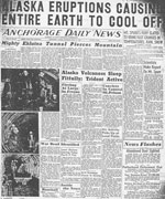
Unknown, 1953, Alaska eruptions causing entire earth to cool off: Anchorage Daily News v. VI, n. 59, front page, p. 12, July 11, 1953.
Hard Copy held by AVO at FBKS - CEC file cabinet
Unknown, 1953, Spurr eruption creates lake: Anchorage Daily News, v. VI, n. 61, July 14, 1953.
Hard Copy held by AVO at FBKS - CEC file cabinet
Unknown, 1953, Mount Trident stirring: Anchorage Daily Times v. July 11, 1953, p. 1, 12.
Hard Copy held by AVO at FBKS - CEC file cabinet
Unknown, 1953, Mount Spurr erupts again: Anchorage Daily Times, July 13, 1953, p. 1.
Hard Copy held by AVO at FBKS - CEC file cabinet
Unknown, 1953, Eruptions blanket area: Anchorage Daily Times, July 14, 1953, p. 1, 4.
Hard Copy held by AVO at FBKS - CEC file cabinet
Unknown, 1953, Wilcox says Trident outrivals Spurr for violence: Anchorage Daily News, July 16, 1953, p. 1.
Hard Copy held by AVO at FBKS - CEC file cabinet
Associated Press, 1953, More mountains erupt near Katmai National Monument, Pilot watches 6 or 8 new volcanoes start spouting: Daily Sitka Sentinel, Wednesday, February 18, 1953, p. 1, 3.
Hard Copy held by AVO at FBKS - CEC file cabinet
MacGregor, A. G., 1952, Eruptive mechanisms: Mount Pelee, the Soufriere of Saint Vincent [West Indies] and the Valley of Ten Thousand Smokes [Alaska]: Bulletin Volcanologique, v. 2, n. 12, p. 49-74.
Sumner, Lowell, 1952, Magnificent Katmai: Sierra Club Bulletin, v. 37, n. 10, p. 29-51.
Hard Copy held by AVO at FBKS - CEC file cabinet
Coats, R. R., 1950, Volcanic activity in the Aleutian Arc: U.S. Geological Survey Bulletin 0974-B, p. 35-49, 1 sheet, scale 1:5,000,000.
Hard Copy held by AVO at FBKS - CEC shelf
Unknown, 1950, Alaska briefs, Tuesday July 11, 1950: Sitka Sentinel, Sitka, AK, July 11, 1950, p. 3.
Hard Copy held by AVO at FBKS - CEC file cabinet
Hubbard, B. R., 1935, Cradle of the storms: New York, Dodd, Mead, 285 p.
Reck, H., 1930, Das Tal der Zehntausende Dampfe: Zeitschrift Vulkanologie, v. 13, n. 1, p. 61-65.
Fenner, C. N., 1926, The Katmai magmatic province: Journal of Geology, v. 34, n. 7, p. 673-772.
Hard Copy held by AVO at FBKS - CEC file cabinet
Finch, R. H., 1925, Earthquakes at Katmai: The Volcano Letter, v. 23, p. 1.
Hard Copy held by AVO at FBKS - CEC file cabinet
Smith, W. R., 1925, The Cold Bay Katmai District: in Brooks, A. H., (ed.), Mineral resources of Alaska - Report on progress of investigations in 1923, U.S. Geological Survey Bulletin 0773, p. 183-213.
Fenner, C. N., 1924, Moving pictures of the Valley of Ten Thousand Smokes, Alaska [abs.]: Geological Society of America Bulletin, v. 35, n. 1, p. 112.
Zies, E. G., 1924, The fumarolic incrustations in the Valley of Ten Thousand Smokes: National Geographic Society Contributed Technical Papers, Katmai Series 0003, p. 157-179.
Hard Copy held by AVO at FBKS - CEC file cabinet
Smith, W. R., and Baker, A. A., 1924, The Cold Bay-Chignik District, Alaska: U.S. Geological Survey Bulletin 0755-D, p. 151-222, 5 plates, scale 4 at 1:250,000 and 1 unknown.
Unknown, 1924, Odd changes occurring on Alaskan coast: Modesto Evening News, Modesto, CA, v. LXXIV, n. 126, May 27, 1924, p. 1.
Cole, G. A. James., 1923, The floor of the Valley of Ten Thousand Smokes: Nature, v. 112, p. 251.
Griggs, R. F., 1922, The Valley of Ten Thousand Smokes: Washington, DC, National Geographic Society, 340 p., 3 sheets, scale unknown.
Griggs, R. F., 1921, Our greatest national monument: The National Geographic Society completes its explorations in the Valley of Ten Thousand Smokes: National Geographic Magazine, v. 40, n. 3, p. 219-292.
Hard Copy held by AVO at FBKS - CEC file cabinet
Sosman, R. B., 1919, The temperature inversions in the fumaroles of the Valley of Ten Thousand Smokes, Alaska Peninsula: Journal of the Washington Academy of Sciences, v. 9, n. 10, p. 292-293.
Griggs, R. F., and National Geographic Society Washington, DC, 1919, Photographs, 1913-1919: Washington, D.C., National Geographic Society, unpaged.
Shipley, J. W., 1919, The Valley of Ten Thousand Smokes: Fort Hays Studies New Series, Science Series 0049, p. 589-591.
Hard Copy held by AVO at FBKS - CEC file cabinet
Shipley, J. W., 1919, Valley of Ten Thousand Smokes: Science, v. 49, n. 1277, p. 489-491.
Spurr, J. E., 1899, A reconnaissance in southwestern Alaska in 1898: in Explorations in Alaska in 1898, U.S. Geological Survey Annual Report v. 20, n. 7, p. 31-264.
Coats, R. R., Past volcanic activity in the Aleutian arc: U.S. Geological Survey Volcano Investigations Report 1, 18 p.
Hard Copy held by AVO at FBKS - CEC file cabinet
Kienle, Juergen (comp.), Volcano observations: Notes about volcanoes and volcanic eruptions collected, made, and stored by Juergen Kienle, on file at University of Alaska Fairbanks, Geophysical Institute, unpublished, unpaged.