About AVO

Primary Objectives
Provide timely and accurate warning of volcanic activity in Alaska to local, state, and federal officials and the public.
Assess volcanic hazards associated with anticipated activity, including kinds of events, their effects, and areas at risk.
Conduct scientific investigations to understand the timing, likelihood, and processes leading to volcanic eruptions and associated hazards.
Volcano Hazard Assessments
AVO is responsible for assessing the full range of potential hazards at Alaska volcanoes to increase public awareness of volcanic activity and support the development of emergency response plans and public land-use plans. This effort involves studying a volcano to determine the magnitude, style and frequency of past eruptions, and potential impacts of future activity. Hazard assessments include descriptions of the history of a given volcano, explanations of likely eruption scenarios, and determination of the probable impact zones for expected hazards. Published hazard assessments are available here: https://www.avo.alaska.edu/explore/search/hazards
Volcano Hazard Research Program
Alaska’s active volcanoes offer superb opportunities to conduct scientific investigations of volcanic processes and hazards. An important component of AVO’s program is to conduct research at targeted volcanic centers, with the ultimate goal of providing rapid, accurate forecasts of future eruptions. The scope of this research includes:
Geological mapping to determine eruptive histories of active volcanoes.
Investigations of hydrologic hazards such as lahars and floods associated with eruptions of snow- and ice-clad volcanoes.
Characterization and analysis of eruptive processes, and their impacts.
Geophysical and geochemical exploration of the interiors of volcanoes and mechanisms of eruption.
Development of new instrumentation, analytical tools, and models to aid in interpretation of volcanic unrest and eruption and hazard detection and forecasting.
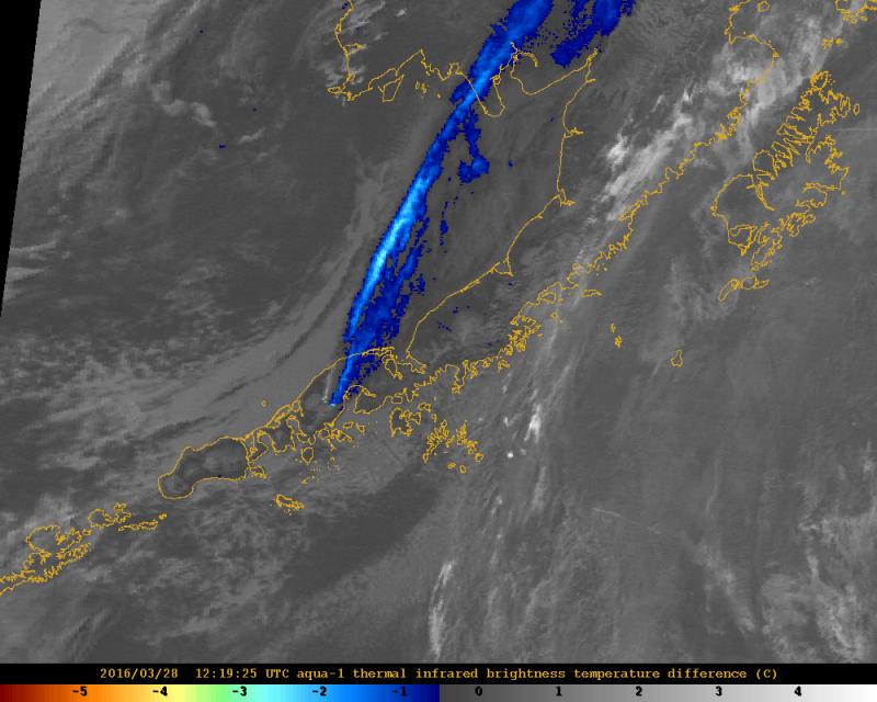
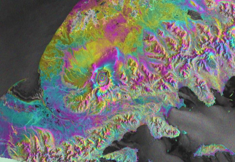
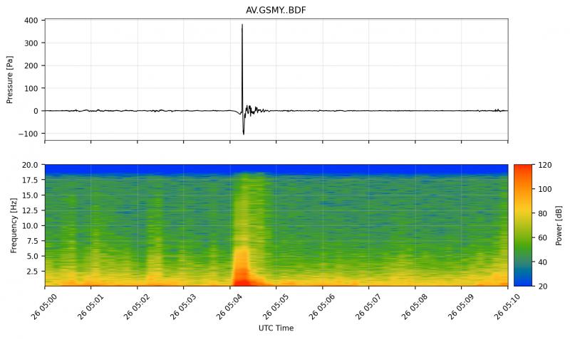
Volcano Monitoring
AVO utilizes a variety of instrumentation and techniques to detect and interpret signs of volcanic unrest or eruption. Instruments and techniques include seismicity, infrasound, ground deformation, satellite imagery and data, lightning data, gas emissions, webcams and direct visual observations, including local and pilot reports. Volcano monitoring helps AVO provide timely warnings of volcanic activity and better characterize volcanic hazards. Prompt warnings of specific volcanic activity and hazards can help mitigate impacts associated with volcanic eruptions.