Mageik

MarkerMarkerMarkerMarkerMarkerMarkerMarkerMarkerMarkerMarkerMarkerMarkerMarkerMarkerMarkerMarkerMarkerMarkerMarkerMarkerMarkerMarkerMarkerMarkerMarkerMarkerMarkerMarkerMarkerMarkerMarkerMarkerMarkerMarkerMarkerMarkerMarkerMarkerMarkerMarkerMarkerMarkerMarkerMarkerMarkerMarkerMarkerMarkerMarkerMarkerMarkerMarkerMarkerMarkerMarkerMarkerMarkerMarkerMarkerMarkerMarkerMarkerMarkerMarkerMarkerMarkerMarkerMarkerMarkerMarkerMarkerMarkerMarkerMarkerMarkerMarkerMarkerMarkerMarkerMarkerMarkerMarkerMarkerMarkerMarkerMarkerMarkerMarkerMarkerMarkerMarkerMarkerMarkerMarkerMarkerMarkerMarkerMarkerMarkerMarkerMarkerMarkerMarkerMarkerMarkerMarkerMarkerMarkerMarkerMarkerMarkerMarkerMarkerMarkerMarkerMarkerMarkerMarkerMarkerMarkerMarkerMarkerMarkerMarkerMarkerMarkerMarkerMarkerMarkerMarkerMarkerMarkerMarkerMarkerMarkerMarkerMarkerMarkerMarkerMarkerMarkerMarkerMarkerMarkerMarkerMarkerMarkerMarkerMarkerMarkerMarkerMarkerMarkerMarkerMarkerMarkerMarkerMarkerMarkerMarkerMarkerMarkerMarkerMarkerMarkerMarkerMarkerMarkerMarkerMarkerMarkerMarkerMarkerMarkerMarkerMarkerMarkerMarkerMarkerMarkerMarkerMarkerMarkerMarkerMarkerMarkerMarkerMarkerMarkerMarkerMarkerMarkerMarkerMarkerMarkerMarkerMarkerMarkerMarkerMarkerMarkerMarkerMarkerMarkerMarkerMarkerMarkerMarkerMarkerMarkerMarker
Legend
Red (Warning)
Orange (Watch)
Yellow (Advisory)
Green (Normal)
Uninstrumented
Community
Webcam
Instrument
Earthquake Magnitude
0 7+
Earthquake Age
Last 2 Hours
Last 2 Days
Last 1 Week


Facts


  • Official Name: Mount Mageik
  • Seismically Monitored: Yes
  • Color Code: GREEN
  • Alert Level: NORMAL
  • Elevation: 2165m (7103ft)
  • Latitude: 58.1946
  • Longitude: -155.2544
  • Smithsonian VNum: 312150
  • Pronunciation:
  • Nearby Towns:
    • Karluk 52 mi (84 km) SE
    • Kanatak 52 mi (84 km) SW
    • King Salmon 61 mi (99 km) NW
    • Larsen Bay 65 mi (105 km) SE
    • Bristol Bay Borough 73 mi (117 km) NW

    Distance from Anchorage: 280 mi (451 km)

Description

From Miller and others (1998) [1] : "Mount Mageik is a broad cone-shaped volcano that rests on a basement of Jurassic sedimentary rocks at the northeast end of a 12-km-long basement ridge shared by neighboring Mount Martin. The summit area, which is largely ice-covered, consists of a central high peak (elevation 2165 m) and three smaller topographic highs, each a separate vent-cone. A small (<1 km in diameter) phreatic crater on the northeast side of the central peak contains a crater lake and supports vigorous fumarolic activity accompanied by sulfur deposition. The slopes of the volcano are moderately dissected by glacial ice, except the young lava flows of the east side. Two small debris avalanches, including the Mageik landslide - one of which occurred during the 1912 Katmai eruption [2] originated from areas high and low on the south flank. The 1912 avalanches, containing boulders as big as 3 to 5 m, traveled 6 km down the broad valley of Martin Creek, south and east of Mount Mageik."

Name Origin

"Mount Mageik" is reported in 1917 by R.F. Griggs as a Native name, and "Mageik Volcano" on his map and "Mount Mageik" in his text (Orth, 1971).


References Cited

[1] Catalog of the historically active volcanoes of Alaska, 1998

Miller, T. P., McGimsey, R. G., Richter, D. H., Riehle, J. R., Nye, C. J., Yount, M. E., and Dumoulin, J. A., 1998, Catalog of the historically active volcanoes of Alaska: U.S. Geological Survey Open-File Report 98-0582, 104 p.

[2] The Valley of Ten Thousand Smokes, 1922

Griggs, R. F., 1922, The Valley of Ten Thousand Smokes: Washington, DC, National Geographic Society, 340 p., 3 sheets, scale unknown.

Current Activity

No new updates for Mageik volcano since January 11, 2023, 2:08 pm.

Color Code Timeline

Reported Activity

Modern Eruptions

Mageik

Mageik Eruption Timeline

Mount Mageik experienced a large landslide during the 1912 eruption of Novarupta and Mount Katmai. That deposit is described by Hildreth and others (2000) as follows: "The youngest of the three [debris avalanches] was emplaced in Martin Creek on 6 June 1912 during the eruption at Novarupta, presumably triggered by the seismicity accompanying caldera collapse at Mount Katmai (Hildreth, 1991). The deposit is overlain by most of the 1912 fallout but not by the earliest layers (Fierstein and Hildreth, 1992). Described in detail by Griggs (1920, 1922), who called it 'the Mageik Landslide', the 1912 avalanche deposit extends 6 km southeast of its headwall and overruns the medial part of the more subdued larger deposit [see fig. 2 in original text]. Consisting predominantly of angular blocks of fresh dacite, it broke loose from a steep face glacially carved into a stack of dacite lava flows that make up the southeast planeze of the Southwest Summit edifice, leaving behind a 120-m-high scarp with a rim at the 3,000-ft level. The deposit has millions of angular blocks larger than 1 m (mostly dacite, plus sparse basement sandstone), contains dacite slabs as long as 20 m, and supports hummocks as high as 20 m. It locally left superelevated trimlines and ponded drainages along its abrupt margins. About 800 m wide proximally, the deposit spreads out to 1.5 km medially and covers about 6 square km. Griggs (1920) estimated its area as more than 10 square km, but this included parts of the subjacent older deposit. Although thickness (5-30 m) is hard to average, the volume is probably in the range 0.05-0.1 cubic km." While impressive, this landslide does not represent a volcanic eruption.
Powers (1958) erroneously (see note by Fierstein and Hildreth, 2001, below) reported an ash eruption at Mount Mageik in 1912.
From Fierstein and Hildreth (2001): "Not a single one of the 20th century tephra eruptions of Mageik listed in Simkin and Siebert's (1994) "Volcanoes of the World" seems plausible. Configuration of the crater has not changed since it was first photographed in 1923; there are no juvenile ejecta in the crater or around its rim (except a scattering of 1912 pumice clasts from Novarupta); and the only late Holocene fall deposits on the or near the lower flanks of Mageik are the Novarupta pumice falls of 1912 and the black Trident ash of 1953."

Griggs (1922) reported a "thin column of steam" from Mount Mageik in 1915.
Fierstein and Hildreth (2001) discount this account as an eruption: "Not a single one of the 20th century tephra eruptions of Mageik listed in Simkin and Siebert's (1994) "Volcanoes of the World" seems plausible. Configuration of the crater has not changed since it was first photographed in 1923; there are no juvenile ejecta in the crater or around its rim (except a scattering of 1912 pumice clasts from Novarupta); and the only late Holocene fall deposits on the or near the lower flanks of Mageik are the Novarupta pumice falls of 1912 and the black Trident ash of 1953."

From Hubbard (1931): "The day [in 1922] was unusually clear, and Martin, Mageik, and Kukak volcanoes were sending graceful columns of smoke high into the air." This activity does not constitute a volcanic eruption.

Fenner (1930) reported a constant heavy roar and steam at Mount Mageik in 1923, stating that "rocks and ash on rim of crater suggest recent eruption."
Fierstein and Hildreth (2001) discount this account as an eruption: "Not a single one of the 20th century tephra eruptions of Mageik listed in Simkin and Siebert's (1994) "Volcanoes of the World" seems plausible. Configuration of the crater has not changed since it was first photographed in 1923; there are no juvenile ejecta in the crater or around its rim (except a scattering of 1912 pumice clasts from Novarupta); and the only late Holocene fall deposits on the or near the lower flanks of Mageik are the Novarupta pumice falls of 1912 and the black Trident ash of 1953."

Mageik 1927/8

August 1927

Jaggar (1927) reports on an event in 1927: "The Seattle 'News-Tribune' carries an Associated Press dispatch of the date September 30 stating that Mageik Volcano of the Katmai group erupted explosively 'late in August (1927.)' The authority quoted is Captain Harry W. Crosby, President of the Crosby Fisheries, who spent the summer aboard his schooner-cannery 'Salmon King' in the northeast arm of Uganik Bay on the northwest side of Kodiak Island. Mageik and Martin were two volcanoes seen by Dr. Jaggar to be steaming, looking northwest from Shelikof Strait on May 18, 1927. Both took part in the great Katmai eruptions of 1912. Mageik is forty nautical miles from the middle of Shelikof Strait, and sixty miles from the Crosby anchorage in Uganik Bay. NEW PARA "Thousands of tons of pumice stone and ashes were reported by Crosby as showered over an area 50 miles square. The article quotes him:
"'We were about 50 miles off the Alaskan Peninsula in clear weather, when suddenly we noticed a gigantic puff at the top of Mageik. Soon the air was filled with volcano ash, and it began to rain pumice stone. After the explosion, the volcano smoked like a factory chimney. A short distance from the ship we found large quantities of pumice stone, some pieces as big as your fist, floating on the ocean.
"'We scooped up a bushel or more of the stones and brought them to Seattle. For five days the eruption continued, and the mountain was still smoking when we left for Seattle.
"'Each morning while we were off the Alaskan Peninsula, the decks and rigging of the ship would be covered with the fine powdered volcanic ash, some of it so white that it resembled snow. The first duty of the crew in the mornings would be to sweep the decks clear and to dust off the rigging.
"'The eruption followed a period of unusual weather, a great calm with scarcely a breath of air, and a depressing atmosphere. The air was full of white volcanic ash for a week, and thousands of tons of pumice stone fell around us.'
"No dates or ship's positions appear in this article, but apparently the vessel did not sail until five days after the major explosion. Captain Crosby is a reliable commercial man, navigator, and fisherman of many years' experience in Alaskan waters."
Fierstein and Hildreth (2001) provide clarification that this account does not describe a volcanic eruption at Mount Mageik: "Although fumarolic 'puffs' are common, there is no evidence of a post-1912 plinian pumice-fall deposit anywhere between Mount Mageik and Shelikof Strait. The [Jaggar] report also mentioned fine white ash falling on the decks, but fine white ash still falls occasionally today during spells of dry summer weather when windstorms loft ash from the barren surface of the Valley of Ten Thousand Smokes to altitudes of many kilometers."
Fierstein and Hildreth (2001) also firmly state: "Not a single one of the 20th century tephra eruptions of Mageik listed in Simkin and Siebert's (1994) "Volcanoes of the World" seems plausible. Configuration of the crater has not changed since it was first photographed in 1923; there are no juvenile ejecta in the crater or around its rim (except a scattering of 1912 pumice clasts from Novarupta); and the only late Holocene fall deposits on the or near the lower flanks of Mageik are the Novarupta pumice falls of 1912 and the black Trident ash of 1953."
Hildreth (1983) also states: "In particular, a pumice shower said by a fisherman to have issued from Mt. Mageik in August 1927 (Jaggar, 1927) cannot be corroborated by detectable deposits in the volcano's crater or on its flanks."

Jaggar (1929) states that Martin and Mageik were steaming throughout 1929. Miller and others (1998) write that a report of an eruption at Mageik in December, 1929, was possibly based on a newspaper account of "unusual activity" and from reports of a ship's crew - "the crew probably was no closer than 25 km to the volcano." The Fairbanks Daily News of December 7, 1929 states that passengers of the steamer Starr viewed "great white smoke clouds" "belching forth" from Mount Mageik, and that the smoke was "plainly visible from the decks of the Starr, which was 20 miles at sea."
Fierstein and Hildreth (2001) also state: "Not a single one of the 20th century tephra eruptions of Mageik listed in Simkin and Siebert's (1994) "Volcanoes of the World" seems plausible. Configuration of the crater has not changed since it was first photographed in 1923; there are no juvenile ejecta in the crater or around its rim (except a scattering of 1912 pumice clasts from Novarupta); and the only late Holocene fall deposits on the or near the lower flanks of Mageik are the Novarupta pumice falls of 1912 and the black Trident ash of 1953."

Mageik 1936/7

July 4, 1936 — July 5, 1936

From Fierstein and Hildreth (2001): "The supposed eruption of Mount Mageik listed for 1936 appears to be based wholly on a romantic travel book (Hutchison, 1937) that mentions a brief call by the SS Star at Halibut Bay on the southwest corner of Kodiak Island, 95 km south of Mount Mageik. Although the writer did not land, the captain 'brought back some interesting specimens of pumice stone with which the water of the were sprinkled as well as the shore. It had been vomited from the crater of the giant Mageik * * * on the 4th and 5th of July, a week previous to our visit.' The floating pumice was, of course, that of 1912, which lines the beaches of Shelikof Strait to this day."
They also state: "Not a single one of the 20th century tephra eruptions of Mageik listed in Simkin and Siebert's (1994) "Volcanoes of the World" seems plausible. Configuration of the crater has not changed since it was first photographed in 1923; there are no juvenile ejecta in the crater or around its rim (except a scattering of 1912 pumice clasts from Novarupta); and the only late Holocene fall deposits on the or near the lower flanks of Mageik are the Novarupta pumice falls of 1912 and the black Trident ash of 1953."

Coats (1950) lists a questionable explosive eruption at Mount Mageik in 1946. Fierstein and Hildreth (2001) doubt the validity of this report, stating: "Not a single one of the 20th century tephra eruptions of Mageik listed in Simkin and Siebert's (1994) "Volcanoes of the World" seems plausible. Configuration of the crater has not changed since it was first photographed in 1923; there are no juvenile ejecta in the crater or around its rim (except a scattering of 1912 pumice clasts from Novarupta); and the only late Holocene fall deposits on the or near the lower flanks of Mageik are the Novarupta pumice falls of 1912 and the black Trident ash of 1953."

Mageik 1951/7

July 22, 1951

Muller and others (1954) state that the ash that fell on Kukak Bay on July 22, 1951, was probably from an eruption of Mount Martin, rather than Mount Mageik.
However, Sumner (1952), who flew over Mount Mageik in June, 1951, does not mention any eruptive activity at Mageik. Fierstein and Hildreth (2001) state that there was no eruption in 1951, and that any ashfall witnessed was simply remobilized ash from the 1912 eruption of Novarupta: "Not a single one of the 20th century tephra eruptions of Mageik listed in 'Volcanoes of the World' (Simkin and Siebert, 1994) seems plausible. Configuration of the crater has not changed since it was first photographed in 1923; there are no juvenile ejecta in the crater or around its rim (except a scattering of 1912 pumice lapilli); and the only late Holocene fall deposits on or near the lower flanks of Mageik are the Novarupta pumice falls of 1912 and the black Trident ash of 1953-74."

Mageik 1953/2

February 21, 1953

MacDonald (1953) reports that on February 21, 1953, the Kodiak Mirror reported that Mount Mageik had erupted. Addiontal reports of activity at Mageik ("steaming and smoking badly") are found in the July 13 and 14 editions of the Anchorage Daily News. Fierstein and Hildreth (2001) doubt the validity of these reports, stating: "Not a single one of the 20th century tephra eruptions of Mageik listed in Simkin and Siebert's (1994) "Volcanoes of the World" seems plausible. Configuration of the crater has not changed since it was first photographed in 1923; there are no juvenile ejecta in the crater or around its rim (except a scattering of 1912 pumice clasts from Novarupta); and the only late Holocene fall deposits on the or near the lower flanks of Mageik are the Novarupta pumice falls of 1912 and the black Trident ash of 1953." Many other accounts report that Mount Mageik was steaming during 1953 (MacDonald, 1953; Military observers, 1953; Muller and others, 1954; Snyder, 1954). Such steam does not constitute a volcanic eruption.

Mount Mageik steamed intermittently during 1954. Such steaming does not constitute a volcanic eruption. A summary of reports given by military observers (on file at the University of Alaska Fairbanks Geophysical Institute) is as follows:
-20 Jan: steam and light grey smoke bubbling actively from a small peak crater. There is some likelihood of fire within this crater. This was originally thought to be Mt. Cerberus but subsequent observations establish this to be Mageik which had at an earlier date been reported with a single whisp of steam.
-16 February 1954: steam rising from hole in peak to be blown eastward down slope. No smoke, no odor.
-25 June: Quantities of white smoke and steam. Molten sulphur pool in crater. Smoke rising approx. 1000ft. Dispersing to the west. 5 August: Light steam rising 500 feet.
-1 Oct: Small amount of steam coming out of two different vents: one at tip of peak with the other on east shoulder of peak about 500' from top.

The Bulletin of Volcanic Eruptions (1980) notes that in 1978: "Mageik also steams profusely from its crater." (Communications from D.C. Shackelford)." This steaming does not constitute a volcanic eruption.

Mageik 1992/3

March 3, 1992

From McGimsey and others (1995): "On March 3 [1992], a plume-like cloud seemingly originating from Mount Mageik appeared on two successive National Oceanographic and Atmospheric Administration (NOAA) satellite images prompting the Federal Aviation Administration to issue a warning to aircraft of a possible eruption. AVO responded by compiling pilot reports, analyzing the satellite imagery, obtaining seismic information from the research seismic net in Katmai, issuing an information release, and then dispatching staff on an observation flight to assess the situation; AVO did not, however, confirm an eruption. Pilots reported smelling sulfur dioxide but detected no gas or ash plume. The seismic data indicated no unusual seismicity had occurred in the Katmai volcanic group. Airborne AVO observers found no evidence of eruptive activity at Mt. Mageik or in the areas downwind from the volcano. AVO then issued an update announcing that no eruption had occurred. The incident was deemed useful in exercising AVO's response to a potential eruption in a remote area."

From McGimsey and Wallace (1999): "On Thursday, February 19, 1997, AVO received multiple pilot reports (PIREPs) of ash and steam rising to 5,000 ft (~1,500 m) above either Martin or Mageik volcanoes. No anomalous seismic activity was recorded on the Katmai seismic network, and no indication of eruptive activity was detected on satellite imagery.
"* * * Another observation of unusual steaming at Martin and Mageik was reported to AVO on December 11, 1997, via the Alaska Tsunami Warning Center, who received the report from a resident of Karluk Village on Kodiak Island. Using a spotting scope, the village resident had observed the peaks for the previous three weeks - noting no unusual activity - when on the morning of the 11th he witnessed a sudden increase in steam activity and watched as white, towering steam clouds billowed from Martin, subsided, and then rose again to about 600-700 ft (~200 m) above the vent, forming a large mushroomed top before dissipating. A second white, billowing steam plume then rose from adjacent Mageik. Local pilots also noticed the unusually vigorous activity." This steaming does not constitute a volcanic eruption.

Mageik 2002/12

December 11, 2002

From Neal and others (2005): "On December 11, 2002, the National Weather Service office in King Salmon reported a 'large steam plume' emanating from mountains east of King Salmon and extending up into the cloud deck. No discoloration was noted in the cloud. AVO staff examined the real-time seismic data from the Katmai area network and saw no evidence of anomalous behavior. No cloud or thermal anomaly was detected in Advanced Very High Resolution Radiometer (AVHRR) images. This information was relayed back to NWS in King Salmon.
"About 45 minutes later, the NWS at the Anchorage Air Route Traffic Control Center issued an urgent pirep (UUA) based on a pilot report of a ‘strange plume' from Martin or Mageik that extended into cloud deck at about 7,000-10,000 ft. AVO concluded that this was the same observation reported earlier from King Salmon and took no further action.
"Mageik and Martin are adjacent, mostly ice-covered stratovolcanoes within Katmai National Park and Preserve on the Alaska Peninsula. Other than fumarolic activity from summit craters, there are no credible reports of historical eruptive activity at either volcano (Fierstein and Hildreth, 2000). Steam from the 500-meter-wide (1,640 ft) summit crater of Martin is vigorous and nearly continuous, with plumes occasionally rising 600 m (2,000 ft) or more above the vent and extending downwind for up to 20 km (12 mi). Steam plumes rising from the summit crater of Mageik are also common. This activity at both volcanoes results in frequent telephone calls to AVO."

Mageik 2003/2

February 15, 2003 — April 8, 2003

From McGimsey and others (2005): "AVO received a PIREP of steaming in the Katmai area -- specifically at coordinates 58°16', 154°50' -- that was rising to an estimated 17,000 ft. ASL on February 15, 2003. The AAWU called to consult as to whether or not to issue a Significant Meteorological Information Statement (SIGMET). A check of the webicorders and spectrograms revealed no unusual seismicity at any of the Katmai Group volcanoes and no advisory was forthcoming. Based on the coordinates reported and the past reports of steaming, the most likely source was Mageik [see fig. 9 in original text]. Nearby Martin also typically issues a vigorous steam plume.
"An observer in the town of Naknek (about 110 km [70 mi.] from Mageik) called on April 8, 2003 to report two 'significant' steam plumes coming from 2 mountains in the VTTS the previous evening. Having lived in the area for 40 years, he stated that he had never seen anything as large as these plumes, although he estimated the plumes to be about 3,000 ft above the mountaintops. AVO staff checked the webicorders and spectrograms of the greater Katmai network and found nothing out of the ordinary. The observer was advised that he was likely seeing vigorous steam plumes emanating from Martin and Mageik, a common occurrence in the Katmai area."

Mageik 2005/2

February 26, 2005

From McGimsey and others (2007): "On February 26 [2005], AVO received from the Center Weather Service Unit (CWSU) several pilot reports of a steam cloud rising to 12,000 ft (3,360 m) from Katmai. An inspection of the webicorders, spectrograms, and satellite logs revealed nothing unusual. Because Katmai Volcano does not have active fumaroles, the reported activity was attributed to nearby Mounts Mageik or Martin, both of which have active fumaroles that frequently produce noticeable steam plumes. Nonvolcanic meterological phenomena that commonly are mistaken for volcanic activity also are common in this area."

Mageik 1912

Mageik 1915

Mageik 1922

Mageik 1923

Mageik 1927/8

Mageik 1929

Mageik 1936/7

Mageik 1946

Mageik 1951/7

Mageik 1953/2

Mageik 1954

Mageik 1978

Mageik 1992/3

Mageik 1997

Mageik 2002/12

Mageik 2003/2

Mageik 2005/2

1670
1680
1690
1700
1710
1720
1730
1740
1750
1760
1770
1780
1790
1800
1810
1820
1830
1840
1850
1860
1870
1880
1890
1900
1910
1920
1930
1940
1950
1960
1970
1980
1990
2000
2010
2020
2030
2040
2050
2060
2070
2080
2090
2100
2110
2120
2130
2140
2150
2160
2170
2180
2190
2200
2210
2220
1888
1889
1891
1892
1893
1894
1895
1896
1897
1898
1899
1901
1902
1903
1904
1905
1906
1907
1908
1909
1911
1912
1913
1914
1915
1916
1917
1918
1919
1921
1922
1923
1924
1925
1926
1927
1928
1929
1931
1932
1933
1934
1935
1936
1937
1938
1939
1941
1942
1943
1944
1945
1946
1947
1948
1949
1951
1952
1953
1954
1955
1956
1957
1958
1959
1961
1962
1963
1964
1965
1966
1967
1968
1969
1971
1972
1973
1974
1975
1976
1977
1978
1979
1981
1982
1983
1984
1985
1986
1987
1988
1989
1991
1992
1993
1994
1995
1996
1997
1998
1999
2001
2002
2003
2004
2005
2006
2007
2008
2009
2011
2012
2013
2014
2015
2016
2017
2018
2019
2021
2022
2023
2024
2025
2026
2027

25 Event Date(s)

Past Activity Legend:
Eruption
Questionable eruption
Non-eruptive activity


Showing 1 - 20 of 63

Map Images


Map References


Recently active volcanoes of Alaska, 2023

Cameron, C.E., Bull, K.F., and Macpherson, A.E., 2023, Recently active volcanoes of Alaska: Alaska Division of Geological & Geophysical Surveys Miscellaneous Publication 133 v. 6, 2 sheets. https://doi.org/10.14509/31086.

Tephra occurrence in Alaska: a map-based compilation of stratigraphic tephra data, 2018

Worden, A.K., Schaefer, J.R., and Mulliken, K.M., 2018, Tephra occurrence in Alaska: a map-based compilation of stratigraphic tephra data: Alaska Division of Geological and Geophysical Surveys Miscellaneous Publication 165, 19 p., http://doi.org/10.14509/30059

Historically active volcanoes of Alaska, v. 3, 2018

Cameron, C.E., Schaefer, J.R., and Mulliken, K.M., 2018, Historically active volcanoes of Alaska: Alaska Division of Geological & Geophysical Surveys Miscellaneous Publication 133 v. 3, 2 sheets. Http://doi.org/10.14509/30142

Historically active volcanoes of Alaska, 2014

Schaefer, J.R., Cameron, C.E., and Nye, C.J., 2014, Historically active volcanoes of Alaska: Alaska Division of Geological & Geophysical Surveys Miscellaneous Publication 133 v. 1.2, 1 sheet, scale 1:3,000,000. This publication has been superseded. Newest version available at http://www.dggs.alaska.gov/pubs/id/20181 .

Geologic map of the Katmai volcanic cluster, Katmai National Park, Alaska, 2003

Hildreth, Wes, and Fierstein, Judy, 2003, Geologic map of the Katmai volcanic cluster, Katmai National Park, Alaska: U.S. Geological Survey Miscellaneous Investigation Series Map I 2778, unpaged, 1 sheet, scale 1:63,360.
full-text PDF 23.9 MB
Hard Copy held by AVO at FBKS - CEC file cabinet

Historically active volcanoes of the Aleutian Arc, 2002

Schaefer, Janet, and Nye, C. J., 2002, Historically active volcanoes of the Aleutian Arc: Alaska Division of Geological & Geophysical Surveys Miscellaneous Publication MP 0123, unpaged, 1 sheet, scale 1:3,000,000. Superceded by Miscellaneous Publication 133: http://www.dggs.dnr.state.ak.us/pubs/pubs?reqtype=citation&ID=20181

Preliminary volcano-hazard assessment for the Katmai volcanic cluster, Alaska, 2001

Fierstein, Judy, and Hildreth, Wes, 2001, Preliminary volcano-hazard assessment for the Katmai volcanic cluster, Alaska: U.S. Geological Survey Open-File Report 00-0489, 50 p., 1 plate, scale not applicable.
full-text PDF 28.8 MB
Hard Copy held by AVO at FBKS - CEC shelf

Volcanoes of Alaska, 1998

Nye, C. J., Queen, Katherine, and McCarthy, A. M., 1998, Volcanoes of Alaska: Alaska Division of Geological & Geophysical Surveys Information Circular IC 0038, unpaged, 1 sheet, scale 1:4,000,000, available at http://www.dggs.dnr.state.ak.us/pubs/pubs?reqtype=citation&ID=7043 .
Hard Copy held by AVO at FBKS - CEC shelf

Volcanoes of Alaska, 1995

Alaska Division of Geological & Geophysical Surveys, 1995, Volcanoes of Alaska: Alaska Division of Geological & Geophysical Surveys Information Circular IC 0038, unpaged, 1 sheet, scale 1:4,000,000.

Geologic map of the Mount Katmai quadrangle and adjacent parts of the Naknek and Afognak quadrangles, Alaska, 1994

Riehle, J. R., Detterman, R. L., Yount, M. E., and Miller, J. W., 1994, Geologic map of the Mount Katmai quadrangle and adjacent parts of the Naknek and Afognak quadrangles, Alaska: U.S. Geological Survey Miscellaneous Investigations Series Map I 2204, unpaged, 1 plate, scale 1:250,000.

Geothermal resources of the Aleutian Arc, 1993

Motyka, R. J., Liss, S. A., Nye, C. J., and Moorman, M. A., 1993, Geothermal resources of the Aleutian Arc: Alaska Division of Geological & Geophysical Surveys Professional Report PR 0114, 17 p., 4 sheets, scale 1:1,000,000.
Hard Copy held by AVO at FBKS - CEC shelf

Quaternary geologic map of the Mount Katmai quadrangle and adjacent parts of the Naknek and Afognak quadrangles, Alaska, 1993

Riehle, J. R., and Detterman, R. L., 1993, Quaternary geologic map of the Mount Katmai quadrangle and adjacent parts of the Naknek and Afognak quadrangles, Alaska: U.S. Geological Survey Miscellaneous Investigations Series Map I 2032, unpaged, 1 sheet, scale 1:250,000.

Holocene volcanoes of the Aleutian Arc, Alaska, 1993

March, G. D., 1993, Holocene volcanoes of the Aleutian Arc, Alaska: Alaska Division of Geological & Geophysical Surveys Public-Data File PDF 93-85, unpaged, 1 sheet, scale 1:2,000,000.

Map showing potassium-argon ages from the Mount Katmai and adjacent parts of the Naknek and Afognak quadrangles, Alaska Peninsula, Alaska, 1992

Shew, Nora, and Lanphere, M. A., 1992, Map showing potassium-argon ages from the Mount Katmai and adjacent parts of the Naknek and Afognak quadrangles, Alaska Peninsula, Alaska: U.S. Geological Survey Miscellaneous Field Studies Map MF 2021-E, unpaged, 1sheet, scale 1:250,000.

Preliminary geologic map of the Mt. Katmai quadrangle and portions of the Afognak and Naknek quadrangles, Alaska, 1987

Riehle, J. R., Detterman, R. L., Yount, M. E., and Miller, J. W., 1987, Preliminary geologic map of the Mt. Katmai quadrangle and portions of the Afognak and Naknek quadrangles, Alaska: U.S. Geological Survey Open-File Report 87-0593, unpaged, 1 sheet, scale 1:250,000.
Hard Copy held by AVO at FBKS - CEC shelf

Map showing distribution, composition, and age of Late Cenozoic volcanic centers in Alaska, 1986

Luedke, R. G., and Smith, R. L., 1986, Map showing distribution, composition, and age of Late Cenozoic volcanic centers in Alaska: U.S. Geological Survey Miscellaneous Investigations Series Map I 1091-F, unpaged, 3 sheets, scale 1:1,000,000.

Eruption of Trident Volcano, Katmai National Monument, Alaska, Feb.-June 1953, 1954

Snyder, G. L., 1954, Eruption of Trident Volcano, Katmai National Monument, Alaska, Feb.-June 1953: U.S. Geological Survey Circular C 0318, 7 p., 2 sheets, scale unknown.
Hard Copy held by AVO at FBKS - CEC file cabinet

Volcanic activity in the Aleutian Arc, 1950

Coats, R. R., 1950, Volcanic activity in the Aleutian Arc: U.S. Geological Survey Bulletin 0974-B, p. 35-49, 1 sheet, scale 1:5,000,000.
plate 1 PDF 819 KB
full-text PDF 783 KB
Hard Copy held by AVO at FBKS - CEC shelf

References

Proximity to active volcanoes enhances glacier velocity, 2024

Mallalieu, J., Barr, I.D., Spagnolo, M., Mullan, D.J., Symeonakis, E., Edwards, B.R., and Martin, M.D., 2024, Proximity to active volcanoes enhances glacier velocity: Communications Earth & Environment v. 5, 679. https://doi.org/10.1038/s43247-024-01826-5
Full-text PDF 1.3 MB

Recently active volcanoes of Alaska, 2023

Cameron, C.E., Bull, K.F., and Macpherson, A.E., 2023, Recently active volcanoes of Alaska: Alaska Division of Geological & Geophysical Surveys Miscellaneous Publication 133 v. 6, 2 sheets. https://doi.org/10.14509/31086.

Interconnection of magma sources beneath the Katmai volcanic system inferred from seismic tomography and petrology, 2023

Koulakov, I., Izbekov, P., Eichelberger, J., Al Arifi, N., and Qaysi, S.I., 2023, Interconnection of magma sources beneath the Katmai volcanic system inferred from seismic tomography and petrology: Journal of Volcanology and Geothermal Research v. 434, 107744. https://doi.org/10.1016/j.jvolgeores.2023.107744.

Weak degassing from remote Alaska volcanoes characterized with a new airborne imaging DOAS instrument and a suite of in situ sensors, 2023

Kern, C., and Kelly, P.J., 2023, Weak degassing from remote Alaska volcanoes characterized with a new airborne imaging DOAS instrument and a suite of in situ sensors: Fronteirs in Earth Science v. 11, 1088056. https://doi.org/10.3389/feart.2023.1088056.

Understanding drivers of mercury in lake trout (Salvelinus namaycush), a top-predator fish in southwest Alaska's parklands, 2023

Bartz, K.K., Hannam, M.P., Wilson, T.L., Lepak, R.F., Ogorek, J.M., Young, D.B., Eagles-Smith, C.A., and Krabbenhoft, D.P., 2023, Understanding drivers of mercury in lake trout (Salvelinus namaycush), a top-predator fish in southwest Alaska's parklands: Environmental Pollution v. 330, 121678. https://doi.org/10.1016/j.envpol.2023.121678
Full-text PDF 3.8 MB

Alaska interagency operating plan for volcanic ash episodes, 2022

Alaska Volcano Observatory, National Oceanic and Atmospheric Administration, National Weather Service, Federal Aviation Administration, Department of Defense, United States Coast Guard, Division of Homeland Security and Emergency Management, Alaska Department of Environmental Conservation, and Alaska Department of Health and Social Services (participating agencies), 2022, Alaska interagency operating plan for volcanic ash episodes, 85 p.

Selected crater and small caldera lakes in Alaska: Characteristics and hazards, 2022

Waythomas, C.F., 2022, Selected crater and small caldera lakes in Alaska: Characteristics and hazards: Frontiers in Earth Science, v. 9, p. 23, doi:10.3389/feart.2021.751216.

Geologic database of information on volcanoes in Alaska (GeoDIVA), 2022

Cameron, C.E., Crass, S.W., and AVO Staff, eds, 2022, Geologic database of information on volcanoes in Alaska (GeoDIVA): Alaska Division of Geologic and Geophysical Surveys Digital Data Series 20, https://doi.org/10.14509/geodiva, https://doi.org/10.14509/30901.

Ambient noise tomography of the Katmai volcanic area, Alaska, 2021

Bai, Tong, Nayak, Avinash, Thurber, Clifford, Zeng, Xiangfang, and Haney, Mathew, 2021, Ambient noise tomography of the Katmai volcanic area, Alaska: Journal of Volcanology and Geothermal Research, v. 419, article no. 107373, 10 p., doi:10.1016/j.jvolgeores.2021.107373.

Goals and development of the Alaska Volcano Observatory seismic network and application to forecasting and detecting volcanic eruptions, 2020

Power, J.A., Haney, M.M., Botnick, S.M., Dixon, J.P., Fee, David, Kaufman, A.M., Ketner, D.M., Lyons, J.J., Parker, Tom, Paskievitch, J.F., Read, C.W., Searcy, Cheryl, Stihler, S.D., Tepp, Gabrielle, and Wech, A.G., 2020, Goals and development of the Alaska Volcano Observatory seismic network and application to forecasting and detecting volcanic eruptions: Seismological Research Letters, doi: 10.1785/0220190216 .

Historically active volcanoes of Alaska, v. 4, 2020

Cameron, C.E., Schaefer, J.R., and Ekberg, P.G., 2020, Historically active volcanoes of Alaska: Alaska Division of Geological & Geophysical Surveys Miscellaneous Publication 133 v. 4, 2 sheets. Http://doi.org/10.14509/30426

Catalog of earthquake parameters and description of seismograph and infrasound stations at Alaskan volcanoes - January 1, 2013, through December 31, 2017, 2019

Dixon, J.P., Stihler S.D., Haney, M.M., Lyons, J.J., Ketner, D.M., Mulliken, K.M., Parker, T., and Power, J.A., 2019, Catalog of earthquake parameters and description of seismograph and infrasound stations at Alaskan volcanoes - January 1, 2013, through December 31, 2017: U.S. Geological Survey Data Series 1115, 92 p., https://doi.org/10.3133/ds1115.

A unified catalog of earthquake hypocenters and magnitudes at volcanoes in Alaska: 1989 to 2018, 2019

Power, J.A., Friberg, P.A., Haney, M.M., Parker, T., Stihler, S.D., and Dixon, J.P., 2019, A unified catalog of earthquake hypocenters and magnitudes at volcanoes in Alaska—1989 to 2018: U.S. Geological Survey Scientific Investigations Report 2019–5037, 17 p., https://doi.org/10.3133/sir20195037.

Geospatial distribution of tephra fall in Alaska: a geodatabase compilation of published tephra fall occurrences from the Pleistocene to the present, 2018

Mulliken, K.M., Schaefer, J.R., and Cameron, C.E., 2018, Geospatial distribution of tephra fall in Alaska: a geodatabase compilation of published tephra fall occurrences from the Pleistocene to the present: Alaska Division of Geological & Geophysical Surveys Miscellaneous Publication 164, 46 p. http://doi.org/10.14509/29847

Tephra occurrence in Alaska: a map-based compilation of stratigraphic tephra data, 2018

Worden, A.K., Schaefer, J.R., and Mulliken, K.M., 2018, Tephra occurrence in Alaska: a map-based compilation of stratigraphic tephra data: Alaska Division of Geological and Geophysical Surveys Miscellaneous Publication 165, 19 p., http://doi.org/10.14509/30059

2018 update to the U.S. Geological Survey national volcanic threat assessment, 2018

Ewert, J.W., Diefenbach, A.K., and Ramsey, D.W., 2018, 2018 update to the U.S. Geological Survey national volcanic threat assessment: U.S. Geological Survey Scientific Investigations Report 2018-5140, 40 p., https://pubs.usgs.gov/sir/2018/5140/sir20185140.pdf.

Historically active volcanoes of Alaska, v. 3, 2018

Cameron, C.E., Schaefer, J.R., and Mulliken, K.M., 2018, Historically active volcanoes of Alaska: Alaska Division of Geological & Geophysical Surveys Miscellaneous Publication 133 v. 3, 2 sheets. Http://doi.org/10.14509/30142

Geochemical constraints on volatile sources and subsurface conditions at Mount Martin, Mount Mageik, and Trident Volcanoes, Katmai Volcanic Cluster, Alaska, 2017

Lopez, T., Fazzi, F., Aiuppa, A., Galle, B., Rizzo, A.L., Fiebig, J., Capecchiacci, F., Giudice, G., Caliro, S., Tamburello, G., 2017, Geochemical constraints on volatile sources and subsurface conditions at Mount Martin, Mount Mageik, and Trident Volcanoes, Katmai Volcanic Cluster, Alaska: Journal of Volcanology and Geothermal Research,v. 347, p. 64-81, https://doi.org/10.1016/j.jvolgeores.2017.09.001.

Historically active volcanoes of Alaska, 2016

Cameron, C.E., and Schaefer, J.R., 2016, Historically active volcanoes of Alaska: Alaska Division of Geological & Geophysical Surveys Miscellaneous Publication 133 v. 2, 1 sheet, scale 1:3,000,000. http://doi.org/10.14509/20181

Alaska Volcano Observatory image database, 2016

Cameron, C.E., and Snedigar, S.F., 2016, Alaska Volcano Observatory image database: Alaska Division of Geological & Geophysical Surveys Digital Data Series 13, https://www.avo.alaska.edu/images/. https://doi.org/10.14509/29689.

Historically active volcanoes of Alaska, 2014

Schaefer, J.R., Cameron, C.E., and Nye, C.J., 2014, Historically active volcanoes of Alaska: Alaska Division of Geological & Geophysical Surveys Miscellaneous Publication 133 v. 1.2, 1 sheet, scale 1:3,000,000. This publication has been superseded. Newest version available at http://www.dggs.alaska.gov/pubs/id/20181 .

Regional controls on volcano seismicity along the Aleutian Arc, 2014

Buurman, Helena, Nye, C.J., West, M.E., and Cameron, Cheryl, 2014, Regional controls on volcano seismicity along the Aleutian Arc: Geochemistry, Geophysics, Geosystems, doi:10.1002/2013GC005101

Three-dimensional seismic velocity structure and earthquake relocations at Katmai, Alaska, 2014

Murphy, Rachel, Thurber, Clifford, Prejean, Stephanie, and Bennington, Ninfa, 2014, Three-dimensional seismic velocity structure and earthquake relocations at Katmai, Alaska: Journal of Volcanology and Geothermal Research, v. 276, p. 121-131, doi:10.1016/j.jvolgeores.2014.02.22

Preliminary database of Quaternary vents in Alaska, 2014

Cameron, C.E., and Nye, C.J., 2014, Preliminary database of Quaternary vents in Alaska: Alaska Division of Geological & Geophysical Surveys Miscellaneous Publication 153, 11 p., doi:10.14509/27357 .

InSAR imaging of Aleutian volcanoes, 2014

Lu, Zhong, and Dzurisin, Daniel, 2014, InSAR imaging of Aleutian volcanoes: Chichester, UK, Springer-Praxis, 390 p.

Catalog of earthquake hypocenters at Alaskan volcanoes: January 1 through December 31, 2012, 2013

Dixon, J.P., Stihler, S.D, Power, J.A., Haney, Matt, Parker, Tom, Searcy, C.K., and Prejean, Stephanie, 2013, Catalog of earthquake hypocenters at Alaskan volcanoes: January 1 through December 31, 2012: U.S. Geological Survey Data Series 789, 84 p., available at http://pubs.usgs.gov/ds/789/ .
full-text pdf 6.5 MB

Katmai scientific studies, 2012

Winfree, Robert, with contributions from Bacon, C.R., Bennett, A.J., Bennington, Ninfa, Berg, E.E., Brooks, Margi, Coletti, H.A., Coombs, M.L., Fierstein, Judy, Freeburg, Gary, Frost, G.V., Haney, Matthew, Jorgenson, M.T., Miller, A.E., Moran, Seth, Murphy, Rachel, Partnow, Patricia, Paskievitch, John, Stevens, D.P., Powell, Lee, Power, John, Prejean, S.G., Schaaf, Jeanne, Sherriff, R.L., Thurber, Clifford, and Welchman, R.A., 2012, Katmai science studies: Alaska Park Science Journal, v. 11, n. 1, 96 p., available online at http://www.nps.gov/akso/nature/science/ak_park_science/volume_11_issue_1.cfm .

Katmai National Park volcanoes, 2012

Fierstein, Judy, 2012, Katmai National Park volcanoes: in Winfree, Robert (project lead), Katmai Science Studies: Alaska Park Science Journal, v. 11, n. 1, p. 14-21, available online at http://www.nps.gov/akso/nature/science/ak_park_science/volume_11_issue_1.cfm .
Hard Copy held by AVO at FBKS - CEC shelf

Earthquake studies reveal the magmatic plumbing system of the Katmai volcanoes, 2012

Thurber, Clifford, Murphy, Rachel, Prejean, Stephanie, Haney, Matthew, Bennington, Ninfa, Powell, Lee, and Paskievitch, John, 2012: Earthquake studies reveal the magmatic plumbing system of the Katmai volcanoes: in Winfree, Robert (project lead), Katmai Science Studies: Alaska Park Science Journal, v. 11, n. 1, p. 34-39, available online at http://www.nps.gov/akso/nature/science/ak_park_science/volume_11_issue_1.cfm .
Hard Copy held by AVO at FBKS - CEC shelf

Volcanic earthquakes in Alaska's National Parks, 2012

Prejean, Stephanie, Moran, Seth, and Power, John, 2012, Volcanic earthquakes in Alaska's National Parks: in Winfree, Robert (project lead), Katmai Science Studies: Alaska Park Science Journal, v. 11, n. 1, p. 40-45, available online at http://www.nps.gov/akso/nature/science/ak_park_science/volume_11_issue_1.cfm .
Hard Copy held by AVO at FBKS - CEC shelf

Catalog of earthquake hypocenters at Alaskan volcanoes: January 1 through December 31, 2011, 2012

Dixon, J.P., Stihler, S.D., Power, J.A., and Searcy, C.K., 2012, Catalog of earthquake hypocenters at Alaskan volcanoes: January 1 through December 31, 2011: U.S. Geological Survey Data Series 730, 82 p., available online at http://pubs.usgs.gov/ds/730/pdf/ds730.pdf .

Catalog of earthquake hypocenters at Alaskan volcanoes: January 1 through December 31, 2010, 2011

Dixon, J.P., Stihler, S.D., Power, J.A., and Searcy, C.K., 2011, Catalog of earthquake hypocenters at Alaskan volcanoes: January 1 through December 31, 2010: U.S. Geological Survey Data Series 645, 82 p., available online at http://pubs.usgs.gov/ds/645/

Catalog of earthquake hypocenters at Alaskan volcanoes: January 1 through December 31, 2009, 2010

Dixon, J.P., Stihler, S.D., Power, J.A., and Searcy, C.K., 2010, Catalog of earthquake hypocenters at Alaskan volcanoes: January 1 through December 31, 2009: U.S. Geological Survey Data Series 531, 84 p., available online at http://pubs.usgs.gov/ds/531/ .

Geothermometry and cathodluminescence of quartz reveal crystallization histories of Katmai magmas, 2010

Payne, A.L., 2010, Geothermometry and cathodluminescence of quartz reveal crystallization histories of Katmai magmas: University of Alaska Fairbanks M.S. thesis, 196 p.

Catalog of earthquake hypocenters at Alaskan volcanoes: January 1 through December 31, 2008, 2009

Dixon, J.P., and Stihler, S.D., 2009, Catalog of earthquake hypocenters at Alaskan volcanoes: January 1 through December 31, 2008: U.S. Geological Survey Data Series 467, 88 p., available at http://pubs.usgs.gov/ds/467/ .

Preliminary spreadsheet of eruption source parameters for volcanoes of the world, 2009

Mastin, L.G., Guffanti, Marianne, Ewert, J.E., and Spiegel, Jessica, 2009, Preliminary spreadsheet of eruption source parameters for volcanoes of the world: U.S. Geological Survey Open-File Report 2009-1133, v. 1.2, 25 p., available at http://pubs.usgs.gov/of/2009/1133/ .

Historically active volcanoes of Alaska reference deck, 2009

Snedigar, S.F., and Cameron, C.C., 2009, Historically active volcanoes of Alaska reference deck: Alaska Division of Geological & Geophysical Surveys Information Circular 59, 52 p, available to order from http://www.dggs.dnr.state.ak.us/pubs/pubs?reqtype=citation&ID=20401 .

2005 Volcanic activity in Alaska, Kamchatka, and the Kurile Islands: Summary of events and response of the Alaska Volcano Observatory, 2008

McGimsey, R.G., Neal, C.A., Dixon, J.P., and Ushakov, Sergey, 2008, 2005 Volcanic activity in Alaska, Kamchatka, and the Kurile Islands: Summary of events and response of the Alaska Volcano Observatory: U.S. Geological Survey Scientific Investigations Report 2007-5269, 94 p., available at http://pubs.usgs.gov/sir/2007/5269/ .

Catalog of earthquake hypocenters at Alaskan volcanoes: January 1 through December 31, 2006, 2008

Dixon, J.P., Stihler, S.D., Power, J.A., and Searcy, Cheryl, 2008, Catalog of earthquake hypocenters at Alaskan volcanoes: January 1 through December 31, 2006: U.S. Geological Survey Data Series 326, 79 p., available at http://pubs.usgs.gov/ds/326/ .

The Alaska Volcano Observatory - 20 years of volcano research, monitoring, and eruption response, 2008

Schaefer, J.R., and Nye, Chris, 2008, The Alaska Volcano Observatory - 20 years of volcano research, monitoring, and eruption response: Alaska Division of Geological & Geophysical Surveys, Alaska GeoSurvey News, NL 2008-001, v. 11, n. 1, p. 1-9, available at http://wwwdggs.dnr.state.ak.us/pubs/pubs?reqtype=citation&ID=16061 .

Catalog of earthquake hypocenters at Alaskan volcanoes: January 1 through December 31, 2007, 2008

Dixon, J.P., Stihler, S.D. and Power, J.A., 2008, Catalog of earthquake hypocenters at Alaskan volcanoes: January 1 through December 31, 2007: U.S. Geological Survey Data Series 367, 82 p., available online at http://pubs.usgs.gov/ds/367/ .

Three-dimensional P-wave velocity structure derived from local earthquakes at the Katmai group of volcanoes, Alaska, 2007

Jolly, A.D., Moran, S.C., McNutt, S.R., and Stone, D.B., 2007, Three-dimensional P-wave velocity structure derived from local earthquakes at the Katmai group of volcanoes, Alaska: Journal of Volcanology and Geothermal Research, v. 159, p. 326-342, doi:10.1016/j.jvolgeores.2006.06.022.

Explosive eruptive record in the Katmai region, Alaska Peninsula: an overview, 2007

Fierstein, Judy, 2007, Explosive eruptive record in the Katmai region, Alaska Peninsula: an overview: Bulletin of Volcanology, v. 69, n. 5, p. 469-509, doi:10.1007/s00445-006-0097-y.

System for ranking relative threats of U.S. volcanoes, 2007

Ewert, John, 2007, System for ranking relative threats of U.S. volcanoes: Natural Hazards Review, v. 8, n. 4, p. 112-124.

A compilation of gas emission-rate data from volcanoes of Cook Inlet (Spurr, Crater Peak, Redoubt, Iliamna, and Augustine) and Alaska Peninsula (Douglas, Fourpeaked, Griggs, Mageik, Martin, Peulik, Ukinrek Maars, and Veniaminof), Alaska, from 1995-2006, 2007

Doukas, M.P., and McGee, K.A., 2007, A compilation of gas emission-rate data from volcanoes of Cook Inlet (Spurr, Crater Peak, Redoubt, Iliamna, and Augustine) and Alaska Peninsula (Douglas, Fourpeaked, Griggs, Mageik, Martin, Peulik, Ukinrek Maars, and Veniaminof), Alaska, from 1995-2006: U.S. Geological Survey Open-File Report 2007-1400, 13 p., available at http://pubs.usgs.gov/of/2007/1400/ .

Catalog of earthquake hypocenters at Alaskan volcanoes: January 1 through December 31, 2005, 2006

Dixon, J.P., Stihler, S.D., Power, J.A., Tytgat, Guy, Estes, Steve, and McNutt, S.R., 2006, Catalog of earthquake hypocenters at Alaskan volcanoes: January 1 through December 31, 2005: U.S. Geological Survey Open-File Report 2006-1264, 78 p., available at http://pubs.usgs.gov/of/2006/1264/ .

March-April 2004, 2005

Alaska Volcano Observatory, 2005, March-April 2004: Alaska Volcano Observatory Bimonthly Report, v.16, n. 2, unpaged.

May-June 2004, 2005

Alaska Volcano Observatory, 2005, May-June 2004: Alaska Volcano Observatory Bimonthly Report, v. 16, n. 3, unpaged.

July-August 2004, 2005

Alaska Volcano Observatory, 2005, July-August 2004: Alaska Volcano Observatory Bimonthly Report, v. 16, n. 4, unpaged.

September-October 2004, 2005

Alaska Volcano Observatory, 2005, September-October 2004: Alaska Volcano Observatory Bimonthly Report, v. 16, n. 5, unpaged.

An assessment of volcanic threat and monitoring capabilities in the United States: framework for a National Volcano Early Warning System NVEWS, 2005

Ewert, J.W., Guffanti, Marianne, and Murray, T.L., 2005, An assessment of volcanic threat and monitoring capabilities in the United States: framework for a National Volcano Early Warning System NVEWS: U.S. Geological Survey Open-File Report 2005-1164, 62 p.
full-text PDF 2.90 MB

2002 Volcanic activity in Alaska and Kamchatka: Summary of events and response of the Alaska Volcano Observatory, 2005

Neal, C.A., McGimsey, R.G., and Girina, Olga, 2005, 2002 Volcanic activity in Alaska and Kamchatka: Summary of events and response of the Alaska Volcano Observatory: U.S. Geological Survey Open-File Report 2004-1058, 55 p., available online at http://pubs.usgs.gov/of/2004/1058/.
full-text PDF 5.15 MB

2003 volcanic activity in Alaska and Kamchatka: Summary of events and response of the Alaska Volcano Observatory, 2005

McGimsey, Robert G., Neal, Christina A., and Girina, Olga, 2005, 2003 volcanic activity in Alaska and Kamchatka: Summary of events and response of the Alaska Volcano Observatory: U.S. Geological Survey Open-File Report 2005-1310, 62 p., http://pubs.usgs.gov/of/2005/1310/.
full-text PDF 3.54 MB

Catalog of earthquake hypocenters at Alaskan volcanoes: January 1 through December 31, 2004, 2005

Dixon, J.P., Stihler, S.D., Power, J.A., Tytgat, Guy, Estes, Steve, Prejean, Stephanie, Sanchez, J.J., Sanches, Rebecca, McNutt, S.R., and Paskievitch, John, 2005, Catalog of earthquake hypocenters at Alaskan volcanoes: January 1 through December 31, 2004: U.S. Geological Survey Open-File Report 2005-1312, 74 p., available online at http://pubs.usgs.gov/of/2005/1312/.

July-August 2001, 2004

Alaska Volcano Observatory, 2004, July-August 2001: Alaska Volcano Observatory Bimonthly Report, v. 13, n. 4, unpaged.

September-October 2001, 2004

Alaska Volcano Observatory, 2004, September-October 2001: Alaska Volcano Observatory Bimonthly Report, v. 13, n. 5, unpaged.

November-December 2001, 2004

Alaska Volcano Observatory, 2004, November-December 2001: Alaska Volcano Observatory Bimonthly Report, v. 13, n. 6, unpaged.

January-February 2002, 2004

Alaska Volcano Observatory, 2004, January-February 2002: Alaska Volcano Observatory Bimonthly Report, v. 14, n. 1, unpaged.

March-April 2002, 2004

Alaska Volcano Observatory, 2004, March-April 2002: Alaska Volcano Observatory Bimonthly Report, v. 14, n. 2, unpaged.

May-June 2002, 2004

Alaska Volcano Observatory, 2004, May-June 2002: Alaska Volcano Observatory Bimonthly Report, v. 14, n. 3, unpaged.

July-August 2002, 2004

Alaska Volcano Observatory, 2004, July-August 2002: Alaska Volcano Observatory Bimonthly Report, v. 14, n. 4, unpaged.

September-October 2002, 2004

Alaska Volcano Observatory, 2004, September-October 2002: Alaska Volcano Observatory Bimonthly Report, v. 14, n. 5, unpaged.

November-December 2002, 2004

Alaska Volcano Observatory, 2004, November-December 2002: Alaska Volcano Observatory Bimonthly Report, v. 14, n. 6, unpaged.

January-February 2003, 2004

Alaska Volcano Observatory, 2004, January-February 2003: Alaska Volcano Observatory Bimonthly Report, v. 15, n. 1, unpaged.

March-April 2003, 2004

Alaska Volcano Observatory, 2004, March-April 2003: Alaska Volcano Observatory Bimonthly Report, v. 15, n. 2, unpaged.

May-June 2003, 2004

Alaska Volcano Observatory, 2004, May-June 2003: Alaska Volcano Observatory Bimonthly Report, v. 15, n. 3, unpaged.

July-August 2003, 2004

Alaska Volcano Observatory, 2004, July-August 2003: Alaska Volcano Observatory Bimonthly Report, v. 15, n. 4, unpaged.

September-October 2003, 2004

Alaska Volcano Observatory, 2004, September-October 2003: Alaska Volcano Observatory Bimonthly Report, v. 15, n. 5, unpaged.

Catalog of earthquake hypocenters at Alaskan volcanoes: January 1 through December 31, 2003, 2004

Dixon, J. P., Stihler, S. D., Power, J. A., Tytgat, Guy, Moran, S. C., Sanchez, J. J., McNutt, S. R., Estes, Steve, and Paskievitch, John, 2004, Catalog of earthquake hypocenters at Alaskan volcanoes: January 1 through December 31, 2003: U.S. Geological Survey Open-File Report 2004-1234, 69 p.
full-text PDF 12.3 MB

The Alaska Volcano Observatory - Expanded monitoring of volcanoes yields results, 2004

Brantley, S. R., McGimsey, R. G., and Neal, C. A., 2004, The Alaska Volcano Observatory - Expanded monitoring of volcanoes yields results: U.S. Geological Survey Fact Sheet FS 2004-3084, 2 p.
full-text PDF 520 KB

Observations of deep long-period (DLP) seismic events beneath Aleutian Arc volcanoes: 1989-2002, 2004

Power, J.A, Stihler, S.D., White, R.A., and Moran, S.C., 2004, Observations of deep long-period (DLP) seismic events beneath Aleutian Arc volcanoes: 1989-2002: Journal of Volcanology and Geothermal Research, v. 138, p. 243-266.

January-February 2004, 2004

Alaska Volcano Observatory, 2004, January-February 2004: Alaska Volcano Observatory Bimonthly Report, v. 16, n. 1, unpaged.

November-December 2003, 2004

Alaska Volcano Observatory, 2004, November-December 2003: Alaska Volcano Observatory Bimonthly Report, v. 15, n. 6, unpaged.

Simultaneous earthquake swarms and eruption in Alaska, fall 1996: Statistical significance and inference of a large aseismic slip event, 2004

McNutt, S.R., and Marzocchi, W., 2005, Simultaneous earthquake swarms and eruption in Alaska, fall 1996: Statistical significance and inference of a large aseismic slip event: Bulletin of the Seismological Society of America, v. 94, n. 5, p. 1831-1841.

Volcanoes of the world: an illustrated catalog of Holocene volcanoes and their eruptions, 2003

Siebert, L., and Simkin, T., 2002-, Volcanoes of the world: an illustrated catalog of Holocene volcanoes and their eruptions: Smithsonian Institution, Global Volcanism Program Digital Information Series GVP-3, http://volcano.si.edu/search_volcano.cfm, unpaged internet resource.

Bibliography of information on Alaska volcanoes, 2003

Cameron, C. E., Triplehorn, J. H., and Robar, C. L., 2003, Bibliography of information on Alaska volcanoes: Alaska Division of Geological & Geophysical Surveys Miscellaneous Publication MP 131, 1 CD-ROM.
Hard Copy held by AVO at FBKS - CEC file cabinet

Catalog of earthquake hypocenters at Alaskan volcanoes: January 1 through December 31, 2002, 2003

Dixon, J. P., Stihler, S. D., Power, J. A., Tytgat, Guy, Moran, S. C., Sanchez, John, Estes, Steve, McNutt, S. R., and Paskievitch, John, 2003, Catalog of earthquake hypocenters at Alaskan volcanoes: January 1 through December 31, 2002: U.S. Geological Survey Open-File Report 03-0267, 58 p.
full-text PDF 7.3 MB

Geochronology and eruptive history of the Katmai volcanic cluster, Alaska Peninsula, 2003

Hildreth, Wes, Lanphere, M. A., and Fierstein, Judy, 2003, Geochronology and eruptive history of the Katmai volcanic cluster, Alaska Peninsula: Earth and Planetary Science Letters, v. 214, n. 1-2, p. 93-114.
Hard Copy held by AVO at FBKS - CEC file cabinet

Geologic map of the Katmai volcanic cluster, Katmai National Park, Alaska, 2003

Hildreth, Wes, and Fierstein, Judy, 2003, Geologic map of the Katmai volcanic cluster, Katmai National Park, Alaska: U.S. Geological Survey Miscellaneous Investigation Series Map I 2778, unpaged, 1 sheet, scale 1:63,360.
full-text PDF 23.9 MB
Hard Copy held by AVO at FBKS - CEC file cabinet

Station corrections for the Katmai Region Seismic Network, 2003

Searcy, C. K., 2003, Station corrections for the Katmai Region Seismic Network: U.S. Geological Survey Open-File Report 03-0403, 14 p.
full-text PDF 1.5 MB

Multiple seismogenic processes for high-frequency earthquakes at Katmai National Park, Alaska; evidence from stress tensor inversions of fault-plane solutions, 2003

Moran, S. C., 2003, Multiple seismogenic processes for high-frequency earthquakes at Katmai National Park, Alaska; evidence from stress tensor inversions of fault-plane solutions: Bulletin of the Seismological Society of America, v. 93, n. 1, p. 94-108.

Catalog of earthquake hypocenters at Alaskan volcanoes: January 1, 2000 through December 31, 2001, 2002

Dixon, J. P., Stihler, S. D., Power, J. A., Tytgat, Guy, Estes, Steve, Moran, S. C., Paskievitch, John, and McNutt, S. R., 2002, Catalog of earthquake hypocenters at Alaskan volcanoes: January 1, 2000 through December 31, 2001: U.S. Geological Survey Open-File Report 02-0342, 56 p.
Hard Copy held by AVO at FBKS - CEC file cabinet

The great eruption of 1912, 2002

Adleman, Jennifer, 2002, The great eruption of 1912: National Park Service Alaska Park Science Winter 2002, Anchorage, AK, http://www.arlis.org/docs/vol1/52558645/52558645v1no1.pdf , p. 4-11.
full-text PDF 1.6 MB
Hard Copy held by AVO at FBKS - CEC file cabinet

Historically active volcanoes of the Aleutian Arc, 2002

Schaefer, Janet, and Nye, C. J., 2002, Historically active volcanoes of the Aleutian Arc: Alaska Division of Geological & Geophysical Surveys Miscellaneous Publication MP 0123, unpaged, 1 sheet, scale 1:3,000,000. Superceded by Miscellaneous Publication 133: http://www.dggs.dnr.state.ak.us/pubs/pubs?reqtype=citation&ID=20181

Katmai geology guide, 2002

Riehle, Jim, 2002, Katmai geology guide: Publication Consultants, 112 p.

Seismic response of the Katmai Volcanoes to the 6 December 1999 magnitude 7.0 Karluk Lake Earthquake, Alaska, 2001

Power, J. A., Moran, S. C., McNutt, S. R., Stihler, S. D., and Sanchez, J. J., 2001, Seismic response of the Katmai Volcanoes to the 6 December 1999 magnitude 7.0 Karluk Lake Earthquake, Alaska: Bulletin of the Seismological Society of America, v. 91, n. 1, p. 57-63.
Hard Copy held by AVO at FBKS - CEC file cabinet

Preliminary volcano-hazard assessment for the Katmai volcanic cluster, Alaska, 2001

Fierstein, Judy, and Hildreth, Wes, 2001, Preliminary volcano-hazard assessment for the Katmai volcanic cluster, Alaska: U.S. Geological Survey Open-File Report 00-0489, 50 p., 1 plate, scale not applicable.
full-text PDF 28.8 MB
Hard Copy held by AVO at FBKS - CEC shelf

Catalog of earthquake hypocenters at Alaskan volcanoes: January 1, 1994 through December 31, 1999, 2001

Jolly, A. D., Stihler, S. D., Power, J. A., Lahr, J. C., Paskievitch, John, Tytgat, Guy, Estes, Steve, Lockheart, A. D., Moran, S. C., McNutt, S. R., and Hammond, W. R., 2001, Catalog of earthquake hypocenters at Alaskan volcanoes: January 1, 1994 through December 31, 1999: U.S. Geological Survey Open-File Report 01-0189, 22 p.
full-text PDF 552 KB
Hard Copy held by AVO at FBKS - CEC file cabinet

Volcanoes in America's national parks, 2001

Decker, R. W., and Decker, Barbara, 2001, Volcanoes in America's national parks: New York, Odyssey Publications, 256 p.

Subsurface structure of the volcanoes in Katmai National Park, Alaska, 2000

Jolly, A. D., 2000, Subsurface structure of the volcanoes in Katmai National Park, Alaska: University of Alaska Fairbanks unpublished Ph.D. dissertation, Fairbanks, Alaska, 169 p.

Katmai volcanic cluster and the great eruption of 1912, 2000

Hildreth, Wes, and Fierstein, Judy, 2000, Katmai volcanic cluster and the great eruption of 1912: Geological Society of America Bulletin, v. 112, n. 10, p. 1594-1620, 6 sheets, scale unknown.
Hard Copy held by AVO at FBKS - CEC file cabinet

Mount Mageik: A compound stratovolcano in Katmai National Park, 2000

Hildreth, Wes, Fierstein, Judy, Lanphere, M. A., and Siems, D. F., 2000, Mount Mageik: A compound stratovolcano in Katmai National Park: in Kelley, K. D. and Gough, L. P., (eds.), Geologic studies in Alaska by the U.S. Geological Survey, 1998, U.S. Geological Survey Professional Paper PP 1615, p. 23-41.
full-text PDF 5.1 MB
Hard Copy held by AVO at FBKS - CEC file cabinet

Historically active volcanoes in Alaska, a quick reference, 2000

Wallace, K. L., McGimsey, R. G., and Miller, T. P., 2000, Historically active volcanoes in Alaska, a quick reference: U.S. Geological Survey Fact Sheet FS 0118-00, 2 p.
full-text PDF 162 KB
Hard Copy held by AVO at FBKS - CEC file cabinet

Tephrochronology of the Brooks River Archaeological District, Katmai National Park and Preserve, Alaska: what can and cannot be done with tephra deposits, 2000

Riehle, J. R., Dumond, D. E., Meyer, C. E., and Schaaf, J. M., 2000, Tephrochronology of the Brooks River Archaeological District, Katmai National Park and Preserve, Alaska: what can and cannot be done with tephra deposits: in McGuire, W. J., Griffiths, D. R., Hancock, P. L., and Stewart, I. S., (eds.), The archaeology of geological catastrophes, Geological Society, London Special Publication 171, p. 245-266.

Encyclopedia of volcanoes, 2000

Sigurdsson, Haraldur, (ed.), 2000, Encyclopedia of volcanoes: San Diego, CA, Academic Press, 1417 p.

January-February 2000, 2000

Alaska Volcano Observatory, 2000, January-February 2000: Alaska Volcano Observatory Bimonthly Report, v. 12, n. 1, 28 p.
Part 1 PDF 239 KB
Part 2 PDF 916 KB
Part 3 PDF 469 KB

Triggered seismicity beneath the Katmai volcanoes following the December 6, 1999 magnitude 7.0 Karluk Lake earthquake, Alaska, 2000

Power, J. A., Moran, S. C., McNutt, S. R., Stihler, S. D., and Sanchez, J. J., 2000, Triggered seismicity beneath the Katmai volcanoes following the December 6, 1999 magnitude 7.0 Karluk Lake earthquake, Alaska [abs.]: Eos, v. 81, n. 48, p. 917.

Three-dimensional attenuation structure at the volcanoes of Katmai National Park, Alaska Peninsula, Alaska, 2000

Jolly, A. D., and McNutt, S. R., 2000, Three-dimensional attenuation structure at the volcanoes of Katmai National Park, Alaska Peninsula, Alaska [abs.]: Eos, v. 81, n. 48, p. 1375.

Volcano-tectonic earthquakes at Katmai National Park, Alaska: evidence for more than one source process, 2000

Moran, S. C., 2000, Volcano-tectonic earthquakes at Katmai National Park, Alaska: evidence for more than one source process [abs.]: Eos, v. 81, n. 48, p. 1375.

Seismicity at the volcanoes of Katmai National Park, Alaska: July 1995-December 1997, 1999

Jolly, A. D., and McNutt, S. R., 1999, Seismicity at the volcanoes of Katmai National Park, Alaska: July 1995-December 1997: Journal of Volcanology and Geothermal Research, v. 93, n. 3, p. 173-190.
Hard Copy held by AVO at FBKS - CEC file cabinet

1997 volcanic activity in Alaska and Kamchatka: Summary of events and response of the Alaska Volcano Observatory, 1999

McGimsey, R. G., and Wallace, K. L., 1999, 1997 volcanic activity in Alaska and Kamchatka: Summary of events and response of the Alaska Volcano Observatory: U.S. Geological Survey Open-File Report 99-0448, 42 p.
Hard Copy held by AVO at FBKS - CEC file cabinet

September-December 1999, 1999

Alaska Volcano Observatory, 1999, September-December 1999: Alaska Volcano Observatory Bimonthly Report, v. 11, n. 5 and 6, 51 p.
Part 1 PDF 425 KB
Part 2 PDF 1.7 MB
Part 3 PDF 549 KB

Synthetic aperture radar interferometry coherence analysis over Katmai volcano group, Alaska, 1998

Lu, Z., and Freymueller, J. T., 1998, Synthetic aperture radar interferometry coherence analysis over Katmai volcano group, Alaska: Journal of Geophysical Research, v. 103, n. B12, p. 29,887-29,894.

Volcanoes of Alaska, 1998

Nye, C. J., Queen, Katherine, and McCarthy, A. M., 1998, Volcanoes of Alaska: Alaska Division of Geological & Geophysical Surveys Information Circular IC 0038, unpaged, 1 sheet, scale 1:4,000,000, available at http://www.dggs.dnr.state.ak.us/pubs/pubs?reqtype=citation&ID=7043 .
Hard Copy held by AVO at FBKS - CEC shelf

Catalog of the historically active volcanoes of Alaska, 1998

Miller, T. P., McGimsey, R. G., Richter, D. H., Riehle, J. R., Nye, C. J., Yount, M. E., and Dumoulin, J. A., 1998, Catalog of the historically active volcanoes of Alaska: U.S. Geological Survey Open-File Report 98-0582, 104 p.
Hard Copy held by AVO at FBKS - CEC shelf

January-April 1998, 1998

Alaska Volcano Observatory, 1998, January-April 1998: Alaska Volcano Observatory Bimonthly Report, v. 10, n. 1 and 2, 35 p.
Part 1 PDF 147 KB
Part 2 382 KB
Part 3 PDF 375 KB

September-December 1998, 1998

Alaska Volcano Observatory, 1998, September-December 1998: Alaska Volcano Observatory Bimonthly Report, v. 10, n. 5 and 6, 51 p.
Part 1 PDF 330 KB
Part 2 PDF 919 KB
Part 3 PDF 780 KB
Part 4 PDF 276 KB
Part 5 PDF 1.5 MB

Seismicity in the vicinity of the Katmai Group of volcanoes, Katmai National Park, Alaska: July 1995-March 1997, 1997

Jolly, A. D., McNutt, S. R., Coombs, M. L., Stihler, S. D., and Paskievitch, J. F., 1997, Seismicity in the vicinity of the Katmai Group of volcanoes, Katmai National Park, Alaska: July 1995-March 1997 [abs.]: Eos, v. 78, n. 46, p. 442.

Volcanoes of the Alaska Peninsula and Aleutian Islands selected photographs, 1997

Neal, Christina, and McGimsey, R. G., 1997, Volcanoes of the Alaska Peninsula and Aleutian Islands selected photographs: U.S. Geological Survey Digital Data Series DDS 0040, 1 CD-ROM.

January-April 1997, 1997

Alaska Volcano Observatory, 1997, January-April 1997: Alaska Volcano Observatory Bimonthly Report, v. 9, n. 1 and 2, 51 p.
Part 1 PDF 252 KB
Part 2 PDF 2.8 MB
Part 3 PDF 649 KB

July-August 1997, 1997

Alaska Volcano Observatory, 1997, July-August 1997: Alaska Volcano Observatory Bimonthly Report, v. 9, n. 4, 31 p.
Part 1 PDF 446 KB
Part 2 PDF 435 KB
Part 3 PDF 2 MB

September-December 1997, 1997

Alaska Volcano Observatory, 1997, September-December 1997: Alaska Volcano Observatory Bimonthly Report, v. 9, n. 5 and 6, 17 p.
Part 1 PDF 399 KB
Part 2 PDF 531 KB

ERS-1 and ERS-2 satellite interferometry at Katmai National Park, Alaska, 1996

Lu, Z., Freymueller, J., Eichelberger, J., and Fatland, R., 1996, ERS-1 and ERS-2 satellite interferometry at Katmai National Park, Alaska [abs.]: Eos, v. 77, n. 46, p. F50.

Stratigraphic framework of the Alaska Peninsula, 1996

Detterman, R. L., Case, J. E., Miller, J. W., Wilson, F. H., and Yount, M. E., 1996, Stratigraphic framework of the Alaska Peninsula: U.S. Geological Survey Bulletin 1969-A, 74 p.
full-text PDF 2.7 MB

Volcanic activity in Alaska: Summary of events and response of the Alaska Volcano Observatory 1992, 1995

McGimsey, R. G., Neal, C. A., and Doukas, M. P., 1995, Volcanic activity in Alaska: Summary of events and response of the Alaska Volcano Observatory 1992: U.S. Geological Survey Open-File Report 95-83, 26 p.
Hard Copy held by AVO at FBKS - CEC shelf

Seismological evidence concerning Aleutian Arc magma systems, 1995

McNutt, S. R., 1995, Seismological evidence concerning Aleutian Arc magma systems [abs.]: Abstracts with Programs - Geological Society of America, v. 27, n. 5, p. 64.

Quick reference to Alaska's active volcanoes and listing of historical eruptions, 1760-1994, 1995

McGimsey, R. G., and Miller, T. P., 1995, Quick reference to Alaska's active volcanoes and listing of historical eruptions, 1760-1994: U.S. Geological Survey Open-File Report 95-0520, 13 p.
Hard Copy held by AVO at FBKS - CEC file cabinet

Volcanoes of Alaska, 1995

Alaska Division of Geological & Geophysical Surveys, 1995, Volcanoes of Alaska: Alaska Division of Geological & Geophysical Surveys Information Circular IC 0038, unpaged, 1 sheet, scale 1:4,000,000.

Mesozoic macrofossil locality map, checklists, and pre-Quaternary stratigraphic section of the Mt. Katmai and adjacent parts of the Afognak and Naknek quadrangles, Alaska Peninsula, Alaska, 1995

Miller, J.W., Elder, W.P., and Detterman, R.L., 1995, Mesozoic macrofossil locality map, checklists, and pre-Quaternary stratigraphic section of the Mt. Katmai and adjacent parts of the Afognak and Naknek quadrangles, Alaska Peninsula, Alaska: U.S. Geological Survey Miscellaneous Field Studies Map 2021-G, 3 sheets. https://doi.org/10.3133/mf2021G

Tephrochronology of Late Quaternary glacial moraines in the Valley of Ten Thousand Smokes, Katmai, Alaska, 1994

Beget, J. E., and Pinney, DeAnne, 1994, Tephrochronology of Late Quaternary glacial moraines in the Valley of Ten Thousand Smokes, Katmai, Alaska [abs.]: Abstracts with Programs - Geological Society of America, v. 26, n. 7, p. A513.

Geologic map of the Mount Katmai quadrangle and adjacent parts of the Naknek and Afognak quadrangles, Alaska, 1994

Riehle, J. R., Detterman, R. L., Yount, M. E., and Miller, J. W., 1994, Geologic map of the Mount Katmai quadrangle and adjacent parts of the Naknek and Afognak quadrangles, Alaska: U.S. Geological Survey Miscellaneous Investigations Series Map I 2204, unpaged, 1 plate, scale 1:250,000.

Mineral-resource assessments in Alaska: background information to accompany maps and reports about geology and undiscovered-mineral-resource potential of the Mount Katmai quadrangle and adjacent parts of the Naknek and Afognak quadrangles, Alaska Peninsula, 1994

Riehle, J. R., Church, S. E., Detterman, R. L., and Miller, J. W., 1994, Mineral-resource assessments in Alaska: background information to accompany maps and reports about geology and undiscovered-mineral-resource potential of the Mount Katmai quadrangle and adjacent parts of the Naknek and Afognak quadrangles, Alaska Peninsula: U.S. Geological Survey Circular C 1106, 13 p.

Volcanoes of the world [2nd edition], 1994

Simkin, Tom, and Siebert, Lee, 1994, Volcanoes of the world [2nd edition]: Tucson, Arizona, Geoscience Press, 349 p.
Hard Copy held by AVO at FBKS - CEC shelf

Quaternary volcanism in the Alaska Peninsula and Wrangell Mountains, Alaska, 1994

Miller, T. P., and Richter, D. H., 1994, Quaternary volcanism in the Alaska Peninsula and Wrangell Mountains, Alaska: in Plafker, George, Jones, D. L., and Berg, H. C., (eds.), The Geology of Alaska, Geological Society of America The Geology of North America series v. G-1, p. 759-779.
Hard Copy held by AVO at FBKS - CEC file cabinet

Geothermal resources of the Aleutian Arc, 1993

Motyka, R. J., Liss, S. A., Nye, C. J., and Moorman, M. A., 1993, Geothermal resources of the Aleutian Arc: Alaska Division of Geological & Geophysical Surveys Professional Report PR 0114, 17 p., 4 sheets, scale 1:1,000,000.
Hard Copy held by AVO at FBKS - CEC shelf

Gas compositions from fumaroles in Katmai National Park volcanoes and in the 1912 ash flow sheet, 1993

Sheppard, D. S., Janik, C. J., and Keith, T. E. C., 1993, Gas compositions from fumaroles in Katmai National Park volcanoes and in the 1912 ash flow sheet [abs.]: in Duggan, M. B. and Knutson, Jan, (comps.), Ancient volcanism & modern analogues, 1993 IAVCEI general assembly, Abstracts, Canberra, Australia, Sept. 25-Oct. 1, 1993, p. 99.

Quaternary geologic map of the Mount Katmai quadrangle and adjacent parts of the Naknek and Afognak quadrangles, Alaska, 1993

Riehle, J. R., and Detterman, R. L., 1993, Quaternary geologic map of the Mount Katmai quadrangle and adjacent parts of the Naknek and Afognak quadrangles, Alaska: U.S. Geological Survey Miscellaneous Investigations Series Map I 2032, unpaged, 1 sheet, scale 1:250,000.

Evidence for a copper-bearing fluid in magma erupted at the Valley of Ten Thousand Smokes, Alaska, 1993

Lowenstern, J. B., 1993, Evidence for a copper-bearing fluid in magma erupted at the Valley of Ten Thousand Smokes, Alaska: Contributions to Mineralogy and Petrology, v. 114, n. 3, p. 409-421.

Holocene volcanoes of the Aleutian Arc, Alaska, 1993

March, G. D., 1993, Holocene volcanoes of the Aleutian Arc, Alaska: Alaska Division of Geological & Geophysical Surveys Public-Data File PDF 93-85, unpaged, 1 sheet, scale 1:2,000,000.

The plinian eruptions of 1912 at Novarupta, Katmai National Park, Alaska, 1992

Fierstein, Judy, and Hildreth, Wes, 1992, The plinian eruptions of 1912 at Novarupta, Katmai National Park, Alaska: Bulletin of Volcanology, v. 54, n. 8, p. 646-684.
Hard Copy held by AVO at FBKS - CEC file cabinet

A comparison of gas geochemistry of fumaroles in the 1912 ash-flow sheet and on active stratovolcanoes, Katmai National Park, Alaska, 1992

Sheppard, D. S., Janik, C. J., and Keith, T. E. C., 1992, A comparison of gas geochemistry of fumaroles in the 1912 ash-flow sheet and on active stratovolcanoes, Katmai National Park, Alaska: Journal of Volcanology and Geothermal Research, v. 53, n. 1, p. 185-198.
Hard Copy held by AVO at FBKS - CEC file cabinet

Map showing potassium-argon ages from the Mount Katmai and adjacent parts of the Naknek and Afognak quadrangles, Alaska Peninsula, Alaska, 1992

Shew, Nora, and Lanphere, M. A., 1992, Map showing potassium-argon ages from the Mount Katmai and adjacent parts of the Naknek and Afognak quadrangles, Alaska Peninsula, Alaska: U.S. Geological Survey Miscellaneous Field Studies Map MF 2021-E, unpaged, 1sheet, scale 1:250,000.

Seismic evidence for magma in the vicinity of Mt. Katmai, Alaska, 1991

Ward, P. L., Pitt, A. M., and Endo, E., 1991, Seismic evidence for magma in the vicinity of Mt. Katmai, Alaska: Geophysical Research Letters, v. 18, n. 8, p. 1537-1540.
Hard Copy held by AVO at FBKS - CEC shelf

The west Mageik Lake sill complex as an analogue for magma transport during the 1912 eruption at the Valley of Ten Thousand Smokes, Alaska, 1991

Lowenstern, J. B., Wallmann, P. C., and Pollard, D. D., 1991, The west Mageik Lake sill complex as an analogue for magma transport during the 1912 eruption at the Valley of Ten Thousand Smokes, Alaska: Geophysical Research Letters, v. 18, n. 8, p. 1569-1572.
Hard Copy held by AVO at FBKS - CEC file cabinet Hard Copy held by AVO at FBKS - CEC shelf

Petrogenesis of high-silica rhyolite on the Alaska Peninsula, 1991

Lowenstern, J. B., and Mahood, G. A., 1991, Petrogenesis of high-silica rhyolite on the Alaska Peninsula: Geophysical Research Letters, v. 18, n. 8, p. 1565-1568.
Hard Copy held by AVO at FBKS - CEC shelf

Resource assessment of the Mount Katmai 1x2 deg quadrangle and adjacent parts of the Naknek and Afognak quadrangles, Alaska Peninsula, 1991

Riehle, J. R., Church, S. E., and Magoon, L. B., 1991, Resource assessment of the Mount Katmai 1x2 deg quadrangle and adjacent parts of the Naknek and Afognak quadrangles, Alaska Peninsula [abs.]: in Good, E. G., Slack, J. F., and Kotra, R. K., (eds.), USGS Research on Mineral Resources-1991 Program and Abstracts, U.S. Geological Survey Circular C 1062, p. 65-66.

Volcanoes of North America: United States and Canada, 1990

Wood, C. A., and Kienle, Juergen, (eds.), 1990, Volcanoes of North America: United States and Canada: New York, Cambridge University Press, 354 p.
Hard Copy held by AVO at FBKS - CEC shelf

Katmai country, 1989

Rennick, Penny, 1989, Katmai country: Alaska Geographic, v. 16, n. 1, 95 p., 1 sheet, scale unknown.

Sample locality maps, analytical data, and statistical summary of analyses of rock samples from the Mount Katmai quadrangle and adjacent portions of the Naknek and Afognak quadrangles, Alaska, 1989

Riehle, J. R., Bailey, R. A., and Church, S. E., 1989, Sample locality maps, analytical data, and statistical summary of analyses of rock samples from the Mount Katmai quadrangle and adjacent portions of the Naknek and Afognak quadrangles, Alaska: U.S. Geological Survey Open-File Report 89-0570, 136 p.

Preliminary geologic map of the Mt. Katmai quadrangle and portions of the Afognak and Naknek quadrangles, Alaska, 1987

Riehle, J. R., Detterman, R. L., Yount, M. E., and Miller, J. W., 1987, Preliminary geologic map of the Mt. Katmai quadrangle and portions of the Afognak and Naknek quadrangles, Alaska: U.S. Geological Survey Open-File Report 87-0593, unpaged, 1 sheet, scale 1:250,000.
Hard Copy held by AVO at FBKS - CEC shelf

Map showing distribution, composition, and age of Late Cenozoic volcanic centers in Alaska, 1986

Luedke, R. G., and Smith, R. L., 1986, Map showing distribution, composition, and age of Late Cenozoic volcanic centers in Alaska: U.S. Geological Survey Miscellaneous Investigations Series Map I 1091-F, unpaged, 3 sheets, scale 1:1,000,000.

Volcanism in the eastern Aleutian Arc: late Quaternary and Holocene centers, tectonic setting and petrology, 1983

Kienle, Juergen, and Swanson, S. E., 1983, Volcanism in the eastern Aleutian Arc: late Quaternary and Holocene centers, tectonic setting and petrology: Journal of Volcanology and Geothermal Research, v. 17, n. 1-4, p. 393-432.
Hard Copy held by AVO at FBKS - CEC file cabinet

Plate subduction and volcanism in the eastern Aleutian Arc: 2, Petrology, 1982

Swanson, S. E., and Kienle, Juergen, 1982, Plate subduction and volcanism in the eastern Aleutian Arc: 2, Petrology [abs.]: Abstracts with Programs - Geological Society of America, v. 14, n. 7, p. 628.

The Aleutians, 1982

Marsh, B. D., 1982, The Aleutians: in Thorpe, R. S., (ed.), Andesites: orogenic andesites and related rocks, Chichester, United Kingdom, John Wiley & Sons, p. 99-114.
Hard Copy held by AVO at FBKS - CEC file cabinet

Part I: The Mt. Edgecumbe volcanic field, Alaska: an example of tholeiitic and calc-alkaline volcanism, Part II: Characteristics of andesitic to dacitic volcanism at Katmai National Park, Alaska, 1981

Kosco, D. G., 1981, Part I: The Mt. Edgecumbe volcanic field, Alaska: an example of tholeiitic and calc-alkaline volcanism, Part II: Characteristics of andesitic to dacitic volcanism at Katmai National Park, Alaska: University of California, Berkeley unpublished Ph.D. dissertation, 249 p.

Characteristics of andesitic to dacitic volcanism at Katmai National Park, Alaska, 1981

Kosco, D. G., 1981, Characteristics of andesitic to dacitic volcanism at Katmai National Park, Alaska [abs.]: Abstracts with Programs - Geological Society of America, v. 13, n. 7, p. 490.

Volcanic centers in the Katmai area, Alaska, 1981

Kienle, Juergen, Swanson, S. E., and Pulpan, Hans, 1981, Volcanic centers in the Katmai area, Alaska [abs.]: Eos, v. 62, n. 17, p. 430.

Volcanoes of the world, 1981

Simkin, Tom, Siebert, Lee, McClelland, Lindsay, Bridge, David, Newhall, Christopher, and Latter, J. H., 1981, Volcanoes of the world: Stroudsburg, PA, Hutchinson Publishing Company, 233 p.

Mageik, 1980

Staff, 1980, Mageik: in Annual report of the world volcanic eruptions in 1978, Bulletin of Volcanic Eruptions, v. 18, p. 85.
Hard Copy held by AVO at FBKS - CEC file cabinet

Katmai: the forge of Vulcan, 1979

Richter-McBride Productions, Alaska Natural History Association, and National Park Service, 1979, Katmai: the forge of Vulcan: 1 videocassette.

Volcanic gas studies at Alaskan volcanoes, 1979

Johnston, D. A., 1979, Volcanic gas studies at Alaskan volcanoes: in Johnson, K. M. and Williams, J. R., (eds.), The United States Geological Survey in Alaska: accomplishments during 1978, U.S. Geological Survey Circular C 0804-B, p. B83-B84.
Hard Copy held by AVO at FBKS - CEC shelf

Airborne particle and gas measurements in the emissions from six volcanoes, 1978

Stith, J. L., Hobbs, P. V., and Radke, L. F., 1978, Airborne particle and gas measurements in the emissions from six volcanoes: Journal of Geophysical Research, C, v. 83, n. 8, p. 4009-4017.

Comprehensive tables giving physical data and thermal energy estimates for young igneous systems of the United States, 1978

Smith, R. L., Shaw, H. R., Luedke, R. G., and Russell, S. L., 1978, Comprehensive tables giving physical data and thermal energy estimates for young igneous systems of the United States: U.S. Geological Survey Open-File Report 78-0925, p. 1-25.
Hard Copy held by AVO at FBKS - CEC shelf

Glaciers of the Aleutian Range and Kodiak Island, 1975

Denton, G. H., and Field, W. O., 1975, Glaciers of the Aleutian Range and Kodiak Island: in Field, W. O., (ed.), Mountain glaciers of the Northern Hemisphere, v. 2, Hanover, NH, Cold Regions Research and Engineering Laboratory, p. 621-638.

Exploring Katmai National Monument and the Valley of Ten Thousand Smokes, 1974

Alaska Travel Publications, 1974, Exploring Katmai National Monument and the Valley of Ten Thousand Smokes: Anchorage, AK, Alaska Travel Publications, p. 49-69, 71-75, 85-98.

Geomorphic role of snow and ice during the Katmai 1912 eruption, 1973

Hamilton, T. D., 1973, Geomorphic role of snow and ice during the Katmai 1912 eruption [abs.]: Abstracts with Programs - Geological Society of America, v. 5, n. 1, p. 48-49.
Hard Copy held by AVO at FBKS - CEC file cabinet

Embattled Katmai: a history of Katmai National Monument, 1971

Hussey, J. A., 1971, Embattled Katmai: a history of Katmai National Monument: San Francisco, CA, U.S. Office of History and Historic Architecture, 457 p.

Geomorphic reconnaissance, Katmai National Monument, 1971

Hamilton, T.D., 1971, Geomorphic reconnaissance, Katmai National Monument: Fairbanks, Alaska, University of Alaska, 49 p.

Gravity traverses in the Valley of Ten Thousand Smokes, Katmai National Monument, Alaska, 1970

Kienle, J., 1970, Gravity traverses in the Valley of Ten Thousand Smokes, Katmai National Monument, Alaska: Journal of Geophysical Research, v. 75, n. 32, p. 6641-6649.
Hard Copy held by AVO at FBKS - CEC file cabinet

Gravity traverses in the Valley of Ten Thousand Smokes, Katmai National Monument, Alaska, 1969

Kienle, J., 1969, Gravity traverses in the Valley of Ten Thousand Smokes, Katmai National Monument, Alaska [abs.]: Eos, v. 50, n. 4, p. 340.

Gravity survey in the general area of the Katmai National Monument, Alaska, 1968

Kienle, Juergen, 1968, Gravity survey in the general area of the Katmai National Monument, Alaska: University of Alaska Fairbanks Ph.D. dissertation, 151 p.

Seismic and gravity studies on the Alaska Peninsula, 1967

Berg, E., Kubota, S., and Kienle, J., 1967, Seismic and gravity studies on the Alaska Peninsula: University of Alaska Fairbanks Geophysical Institute Annual Report 1966-67, p. 78-79.
Hard Copy held by AVO at FBKS - CEC file cabinet

Preliminary determination of crustal structure in the Katmai National Monument, Alaska, 1967

Berg, E., Kienle, J., and Kubota, S., 1967, Preliminary determination of crustal structure in the Katmai National Monument, Alaska: Bulletin of the Seismological Society of America, v. 57, n. 6, p. 1367-1392.
Hard Copy held by AVO at FBKS - CEC file cabinet

A summary of volcanic and seismic activity in Katmai National Monument, Alaska, 1967

Ward, P. L., and Matumoto, T., 1967, A summary of volcanic and seismic activity in Katmai National Monument, Alaska: Bulletin Volcanologique, v. 31, p.107-129.
Hard Copy held by AVO at FBKS - CEC file cabinet

Volcanic and seismic activity in Katmai National Monument, Alaska, 1967

Ward, P. L., 1967, Volcanic and seismic activity in Katmai National Monument, Alaska: Columbia University unpublished M.S. thesis, 78 p.

Microearthquake study of Mount Katmai and vicinity, Alaska, 1967

Matumoto, Tosimatu, and Ward, P. L., 1967, Microearthquake study of Mount Katmai and vicinity, Alaska: Journal of Geophysical Research, v. 72, n. 10, p. 2557-2568.

Evidence for magma in the Katmai volcanic range, 1967

Kubota, S., and Berg, E., 1967, Evidence for magma in the Katmai volcanic range: Bulletin Volcanologique, v. 31, p. 175-214.
Hard Copy held by AVO at FBKS - CEC file cabinet

Volcanic activity in Katmai National Monument, in early August, 1965, 1966

Ward, Peter, and Ward, Sandra, 1966, Volcanic activity in Katmai National Monument, in early August, 1965: Earthquake Notes, v. 37, n. 3, p. 19-34.

Seismic and gravity studies at Katmai, 1966

Berg, E., Kubota, S., and Kienle, J., 1966, Seismic and gravity studies at Katmai: University of Alaska Geophysical Institute Annual Report, 1965-66, p. 64-65.
Hard Copy held by AVO at FBKS - CEC file cabinet

Geology of the Mount Katmai area, Alaska, 1959

Keller, A. S., and Reiser, H. N., 1959, Geology of the Mount Katmai area, Alaska: U.S. Geological Survey Bulletin 1058-G, p. 261-298, 2 sheets, scale 1:250,000.
plate 29 PDF 32 MB
Hard Copy held by AVO at FBKS - CEC shelf

Alaska Peninsula-Aleutian Islands, 1958

Powers, H. A., 1958, Alaska Peninsula-Aleutian Islands: in Williams, H., (ed.), Landscapes of Alaska, Los Angeles, CA, University of California Press, p. 61-75.

Preliminary summary report on the shorelines, glaciation and non-volcanic rocks of Katmai National Monument, 1954

Lucke, J. B., 1954, Preliminary summary report on the shorelines, glaciation and non-volcanic rocks of Katmai National Monument: in Luntey, R. S., (comp.), Interim report on Katmai Project, Katmai National Monument, Alaska, p. 50-54.

Volcano observations, 1954

Unknown, 1954, Volcano observations: Unpublished volcano observation sheets filled out by U.S. military and stored on file at the Geophyiscal Institute, University of Alaska Fairbanks, unpaged.
Hard Copy held by AVO at FBKS - CEC file cabinet

Current volcanic activity in Katmai National Monument, 1954

Muller, E. H., Juhle, R. W., and Coulter, H. W., 1954, Current volcanic activity in Katmai National Monument: in Luntey, R. S., Interim report on Katmai Project, Washington D.C., U.S. National Park Service, p. 62-66.
Hard Copy held by AVO at FBKS - CEC file cabinet

Eruption of Trident Volcano, Katmai National Monument, Alaska, Feb.-June 1953, 1954

Snyder, G. L., 1954, Eruption of Trident Volcano, Katmai National Monument, Alaska, Feb.-June 1953: U.S. Geological Survey Circular C 0318, 7 p., 2 sheets, scale unknown.
Hard Copy held by AVO at FBKS - CEC file cabinet

Activity of Trident Volcano, 1953

MacDonald, G. A., 1953, Activity of Trident Volcano: The Volcano Letter, v. 520, p. 5-6.
full-text PDF 558 KB
Hard Copy held by AVO at FBKS - CEC file cabinet

Eruption of Trident Volcano, Alaska, 1953

MacDonald, G. A., 1953, Eruption of Trident Volcano, Alaska: The Volcano Letter, v. 519, p. 7.
full-text PDF 271 KB
Hard Copy held by AVO at FBKS - CEC file cabinet

Spurr eruption creates lake, 1953

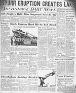
Unknown, 1953, Spurr eruption creates lake: Anchorage Daily News, v. VI, n. 61, July 14, 1953.
Hard Copy held by AVO at FBKS - CEC file cabinet

Mount Spurr erupts again, 1953

Unknown, 1953, Mount Spurr erupts again: Anchorage Daily Times, July 13, 1953, p. 1.
Hard Copy held by AVO at FBKS - CEC file cabinet

Magnificent Katmai, 1952

Sumner, Lowell, 1952, Magnificent Katmai: Sierra Club Bulletin, v. 37, n. 10, p. 29-51.
Hard Copy held by AVO at FBKS - CEC file cabinet

Volcanic activity in the Aleutian Arc, 1950

Coats, R. R., 1950, Volcanic activity in the Aleutian Arc: U.S. Geological Survey Bulletin 0974-B, p. 35-49, 1 sheet, scale 1:5,000,000.
plate 1 PDF 819 KB
full-text PDF 783 KB
Hard Copy held by AVO at FBKS - CEC shelf

United States coast pilot, Alaska Part 2, Yakutat Bay to Arctic Ocean, 1947

U.S. Department of Commerce, and Coast and Geodetic Survey, 1947, United States coast pilot, Alaska Part 2, Yakutat Bay to Arctic Ocean: Washington DC, United States Government Printing Office, 659 p.

Alaska and the Aleutian belt, 1946

Coleman, S. N., 1946, Alaska and the Aleutian belt: chapter 16 of Volcanoes, New and Old, New York, The John Day Company, p. 155-165.
Hard Copy held by AVO at FBKS - CEC file cabinet

Stepping stones from Alaska to Asia, 1937

Hutchison, I. W., 1937, Stepping stones from Alaska to Asia: London and Glasgow, Blackie and Son, 246 p.

Cradle of the storms, 1935

Hubbard, B. R., 1935, Cradle of the storms: New York, Dodd, Mead, 285 p.

A world inside a mountain: Aniakchak, the new volcanic wonderland of the Alaska Peninsula, is explored, 1931

Hubbard, B. R., 1931, A world inside a mountain: Aniakchak, the new volcanic wonderland of the Alaska Peninsula, is explored: National Geographic Magazine, v. 60, n. 3, p. 319-345.
Hard Copy held by AVO at FBKS - CEC file cabinet

Mount Katmai and Mount Mageik, 1930

Fenner, C. N., 1930, Mount Katmai and Mount Mageik: Zeitschrift fuer Vulkanologie, v. 13, n. 1, p. 1-24, 16 plates, scale unknown.
Hard Copy held by AVO at FBKS - CEC file cabinet

Aleutian notes, 1929

Jaggar, T. A., 1929, Aleutian notes: The Volcano Letter, v. 246, p. 1.
full-text PDF 360 KB
Hard Copy held by AVO at FBKS - CEC file cabinet

Volcanoes in Aleutian area again active, 1929

Associated Press, 1929, Volcanoes in Aleutian area again active: The Greeley Daily Tribune, Greeley CO, Saturday December 14, 1929, p. 1.
Hard Copy held by AVO at FBKS - CEC file cabinet

Alaska volcanic peak is smoking; smoke visible from far out at sea - westward regions are hit by heavy storms, 1929

Unknown, 1929, Alaska volcanic peak is smoking; smoke visible from far out at sea - westward regions are hit by heavy storms: Fairbanks Daily News Miner, December 7, 1929, p. 1.
Hard Copy held by AVO at FBKS - CEC file cabinet

Volcano research of the United States Geological Survey, 1928

Jaggar, T. A., 1928, Volcano research of the United States Geological Survey: Journal of the Washington Academy of Sciences, v. 18, n. 19, p. 512-515.
Hard Copy held by AVO at FBKS - CEC file cabinet

Eruption of Mageik in Alaska, 1927

Jaggar, T. A., 1927, Eruption of Mageik in Alaska: The Volcano Letter, v. 147, p. 1.
full-text PDF 390 KB
Hard Copy held by AVO at FBKS - CEC file cabinet

Aleutian volcanology, 1927

Jaggar, T. A., 1927, Aleutian volcanology: The Volcano Letter, v. 147, p. 1.
full-text PDF 390 KB
Hard Copy held by AVO at FBKS - CEC file cabinet

A chemical study of the fumaroles of the Katmai region, 1923

Allen, E. T., and Zies, E. G., 1923, A chemical study of the fumaroles of the Katmai region: National Geographic Society Contributed Technical Papers, Katmai Series 0002, p. 75-155.

Our greatest national monument: The National Geographic Society completes its explorations in the Valley of Ten Thousand Smokes, 1921

Griggs, R. F., 1921, Our greatest national monument: The National Geographic Society completes its explorations in the Valley of Ten Thousand Smokes: National Geographic Magazine, v. 40, n. 3, p. 219-292.
Hard Copy held by AVO at FBKS - CEC file cabinet

The great Mageik landslide, 1920

Griggs, R. F., 1920, The great Mageik landslide: The Ohio Journal of Science, v. 20, n. 8, p. 325-354.
Hard Copy held by AVO at FBKS - CEC file cabinet

Photographs, 1913-1919, 1919

Griggs, R. F., and National Geographic Society Washington, DC, 1919, Photographs, 1913-1919: Washington, D.C., National Geographic Society, unpaged.

Past volcanic activity in the Aleutian arc,

Coats, R. R., Past volcanic activity in the Aleutian arc: U.S. Geological Survey Volcano Investigations Report 1, 18 p.
full-text PDF 22.3 MB
Hard Copy held by AVO at FBKS - CEC file cabinet

Volcano observations,

Kienle, Juergen (comp.), Volcano observations: Notes about volcanoes and volcanic eruptions collected, made, and stored by Juergen Kienle, on file at University of Alaska Fairbanks, Geophysical Institute, unpublished, unpaged.

Ash Forecasting

Mathematical models developed by the USGS forecast various aspects of how a volcanic ash plume will interact with wind—where, how high, and how fast ash particles will be transported in the atmosphere, as well as where ash will fall out and accumulate on the ground. AVO runs these models when a volcano is restless by assuming a reasonable hypothetical eruption, to provide a pre-eruptive forecast of areas likely to be affected. During an ongoing eruption, AVO will update the forecast with actual observations (eruption start time and duration, plume height) as they become available.

View the current airborne ash cloud models for Mageik

Ashfall thickness forecast

The Ash3d model was developed by the USGS to forecast how a volcanic ash plume will interact with wind and where ash will fall out and accumulate on the ground. AVO runs these models twice daily when a volcano is restless by assuming a reasonable hypothetical eruption altitude and duration. The map shows the model results of ashfall thickness for areas that are likely to be affected, if one were to occur. During an ongoing eruption, AVO will update the forecast with actual observations (eruption start time and duration, plume height) as they become available, and these plots will be automatically updated. The National Weather Service Anchorage Forecast Office will issue the official ashfall warning product and post them at weather.gov/afc

THESE PRODUCTS MAY NOT BE CURRENT.

During an actual eruption, see National Weather Service forecasts of ashfall:https://weather.gov/afc.

Ashfall Forecast

Click on the X on the graphic (upper right) to expand the map to show the map legend.

Ashfall Start Time

This map shows the modeled estimate of the time it would take for ashfall to begin following an eruption. It corresponds to the ashfall thickness forecast map shown above. This map uses the start time of either the twice-daily hypothetical model runs (time shown in the legend) or the actual eruption start time (if one were to occur). In the case of an actual eruption, the National Weather Service Anchorage Forecast Office will issue the official ashfall warning product that includes the ashfall start time and post them at weather.gov/afc

THESE PRODUCTS MAY NOT BE CURRENT.

During an actual eruption, see National Weather Service forecasts of ashfall:https://weather.gov/afc.

Ashfall Start Times Forecast

Click on the X on the graphic (upper right) to expand the map to show the map legend.
×