Wrangell

MarkerMarkerMarkerMarkerMarkerMarkerMarkerMarkerMarkerMarkerMarkerMarkerMarkerMarkerMarkerMarkerMarkerMarkerMarkerMarkerMarkerMarkerMarkerMarkerMarkerMarkerMarkerMarkerMarkerMarkerMarkerMarkerMarkerMarkerMarkerMarkerMarkerMarkerMarkerMarkerMarkerMarkerMarkerMarkerMarkerMarkerMarkerMarkerMarkerMarkerMarkerMarkerMarkerMarkerMarkerMarkerMarkerMarkerMarkerMarkerMarkerMarkerMarkerMarkerMarkerMarkerMarkerMarkerMarkerMarkerMarkerMarkerMarkerMarkerMarkerMarkerMarkerMarkerMarkerMarkerMarkerMarkerMarkerMarkerMarkerMarkerMarkerMarkerMarkerMarkerMarkerMarkerMarkerMarkerMarkerMarkerMarkerMarkerMarkerMarkerMarkerMarkerMarkerMarkerMarkerMarkerMarkerMarkerMarkerMarkerMarkerMarkerMarkerMarkerMarkerMarkerMarkerMarkerMarkerMarkerMarkerMarkerMarkerMarkerMarkerMarkerMarkerMarkerMarkerMarkerMarkerMarkerMarkerMarkerMarkerMarkerMarkerMarkerMarkerMarkerMarkerMarkerMarkerMarkerMarkerMarkerMarkerMarkerMarkerMarkerMarkerMarkerMarkerMarkerMarkerMarkerMarkerMarkerMarkerMarkerMarkerMarkerMarkerMarkerMarkerMarkerMarkerMarkerMarkerMarkerMarkerMarkerMarkerMarkerMarkerMarkerMarkerMarkerMarkerMarkerMarkerMarkerMarkerMarkerMarkerMarkerMarkerMarkerMarkerMarkerMarkerMarkerMarkerMarkerMarkerMarkerMarkerMarkerMarkerMarkerMarkerMarkerMarkerMarkerMarkerMarkerMarkerMarkerMarkerMarkerMarker
Legend
Red (Warning)
Orange (Watch)
Yellow (Advisory)
Green (Normal)
Uninstrumented
Community
Webcam
Instrument
Earthquake Magnitude
0 7+
Earthquake Age
Last 2 Hours
Last 2 Days
Last 1 Week


Facts


  • Official Name: Mount Wrangell
  • Seismically Monitored: Yes
  • Color Code: GREEN
  • Alert Level: NORMAL
  • Elevation: 4317m (14163ft)
  • Latitude: 62.00572
  • Longitude: -144.01935
  • Smithsonian VNum: 315020
  • Pronunciation:
  • Nearby Towns:
    • Kenny Lake 35 mi (57 km) SW
    • Chitina 36 mi (59 km) SW
    • Willow Creek 41 mi (66 km) SW
    • Copper Center 42 mi (67 km) SW
    • Silver Springs 43 mi (69 km) NW

    Distance from Anchorage: 201 mi (323 km)

  • Subfeatures:
    • Chetaslina Vent
    • Zanetti, Mt
    • North Crater
    • East Crater
    • West Crater
    • Wrangell Caldera

Description

From Miller and others (1998) [1] : "Mount Wrangell is a large andesitic shield volcano with a volume of about 900 cubic kilometers (Nye, 1983). Its top is capped by a 4 by 6 km, ice-filled summit caldera whose depth may exceed 1 km [2] . The caldera is apparently of non-explosive origin [3] formed in response to the withdrawal of magma from high-level reservoirs beneath the summit area. Three small (<1 km in diameter) post-caldera craters, all geothermally active, occur along the west and north margin of the caldera. Mt. Zanetti (3965 m) a large (450 m high) steep-sided, relatively undissected cinder-spatter cone occurs high on the northwest flank of the shield and may be the source of some lava flows. Lavas on the southwest flank have flowed as much as 58 km from their source despite being phenocryst-rich andesite, a mobility attributed to a very high eruption rate [4] ."

Name Origin

Mount Wrangell was named by the Russians for Baron von Wrangell. This name was reported in 1885 by Lieutenant Allen, although it appears he named this mountain "Tillman" for Samuel Escue Tillman, professor at the U.S. Military Academy at West Point (Orth, 1971).


References Cited

[1] Catalog of the historically active volcanoes of Alaska, 1998

Miller, T. P., McGimsey, R. G., Richter, D. H., Riehle, J. R., Nye, C. J., Yount, M. E., and Dumoulin, J. A., 1998, Catalog of the historically active volcanoes of Alaska: U.S. Geological Survey Open-File Report 98-0582, 104 p.

[2] Glacier-volcano interactions on Mt. Wrangell, Alaska, 1979

Benson, C. S., and Motyka, R. J., 1979, Glacier-volcano interactions on Mt. Wrangell, Alaska: University of Alaska Geophysical Institute Annual Report 1977-78, p. 1-25.

[3] Shield volcanoes in the Wrangell Mountains, Alaska, 1984

Richter, D. H., Smith, J. G., Ratte, J. C., and Leeman, W. P., 1984, Shield volcanoes in the Wrangell Mountains, Alaska: in Reed, K. M. and Bartsch-Winkler, Susan, (eds.), The United States Geological Survey in Alaska: accomplishments during 1982, U.S. Geological Survey Circular C 0939, p. 71-75.

[4] Petrology and geochemistry of Okmok and Wrangell volcanoes, Alaska, 1983

Nye, C. J., 1983, Petrology and geochemistry of Okmok and Wrangell volcanoes, Alaska: University of California, Santa Cruz Ph.D. dissertation, 208 p.

Current Activity

No new updates for Wrangell volcano since October 1, 2024, 10:04 am.

Webcams

Webicorder

Color Code Timeline

Reported Activity

Modern Eruptions

Wrangell

Wrangell Eruption Timeline

The 1760 and 1784 eruptions of Wrangell are questionable, poorly documented, and may in fact refer to a volcano other than Mt. Wrangell. Dall (1870) says that "Chechitno" smoked in 1760, and again in July 1784.
These eruptions are first reported by Grewingk (1850, translated 2003 by Fritz Jaensch) as being from Chetchina, which he says is one of the Andreanof Islands. Petroff (1884), translating Grewingk, reports 1760 and 1784 eruptions from Chechina. Also derived from Grewingk, Dall (1870) and Becker (1898) report eruptions from Chechitno in 1760 and 1784. Becker (1898) states: "Mount Wrangell lies at a distance of about 134 miles from the head of Prince William Sound, and, according to Lieut. H. T. Allen, it reaches the great height of 17,500 feet. It was steaming at the date of his visit. It is the loftiest of a group of high mountains, one of which, named Mount Blackburn by Mr. Allen, is only 30 miles from the junction of the Copper River and the Tschichitna, Chechitna, or Chittyna River. I suppose this latter mountain to be that called by earlier writers the Chechitno volcano." Translation of Shmalev (found in Juergen Kienle's files) equates the Island of Chetkhina with Great Sitkin, which has historical accouts of eruptions in 1760 and 1784. According to the Smithsonian Institution Chechitno is a synonym of Wrangell. Additionally, according to Grewingk (1850, translated 2003 by Fritz Jaensch), Mt. Wrangell was not discovered until 1819.

The 1760 and 1784 eruptions of Wrangell are questionable, poorly documented, and may in fact refer to a volcano other than Mt. Wrangell. Dall (1870) says that "Chechitno" smoked in 1760, and erupted in July 1784.
These eruptions are first reported by Grewingk (1850, translated 2003 by Fritz Jaensch) as being from Chetchina, which he says is one of the Andreanof Islands. Petroff (1884), translating Grewingk, reports 1760 and 1784 eruptions from Chechina. Also derived from Grewingk, Dall (1870) and Becker (1898) report eruptions from Chechitno in 1760 and 1784. Becker (1898) states: "Mount Wrangell lies at a distance of about 134 miles from the head of Prince William Sound, and, according to Lieut. H. T. Allen, it reaches the great height of 17,500 feet. It was steaming at the date of his visit. It is the loftiest of a group of high mountains, one of which, named Mount Blackburn by Mr. Allen, is only 30 miles from the junction of the Copper River and the Tschichitna, Chechitna, or Chittyna River. I suppose this latter mountain to be that called by earlier writers the Chechitno volcano." Translation of Shmalev (found in Juergen Kienle's files) equates the Island of Chetkhina with Great Sitkin, which has reported eruptions in 1760 and 1784. According to the Smithsonian Institution Chechitno is a synonym of Wrangell. Additionally, according to Grewingk (1850, translated 2003 by Fritz Jaensch), Wrangell is not discovered until 1819.

Grewingk (1850, translated 2003 by Fritz Jaensch) writes that Klimovskii and Wrangell report that Wrangell volcano was discovered in 1819, "active, and several earthquakes annually."

Wrangell 1884/10

October 26, 1884 — February 4, 1885

The journal of John Bremner, a prospector who lived among the Copper River Indians, was found at Nuchuk in 1886 by Heywood Walter Seton-Karr, and published by Seton-Karr in Shores and alps of Alaska (1887) records an eruptive event at Mt. Wrangell. John Bremner's journal starts on September 1, 1884, but no metion is made of Wrangell until October 26: "Clear but verey cold the floor of my cabin is frose two foot from the fire and I thought I had made it almost air tight so you see I am in no danger of melting with the heat. I saw the Volcano smoking for the first time to-day it is the mountin laid down on the chart as Mt. Wrangle it dont look more than twenty-five or thirtey miles from here but the natives say it will take me three days to go thar I cant get one of them to go near it so I will have to go alone I sholl go as soon as the river is safe."
On February 3, 1885, Bremner describes a more robust eruption: "A beautifull day not a cloud in the sky I was treated to a sight to-day that I wish you could have seen the volcano has been verey quite (quiet) a good while but to-day it is sending out a vast column of smoke and hurling imense stones hundreds of feet high in the air the mases it is throwing up must be verey large to be seen here it is at least thirty milles in a air line from here to the mouth of the crater it has mde no loud reports onley a sort of rumbling noise."
He continues on February 4, 1885: "A little colder but pleasant the Volcano has stoped throwing stones ore making a noise but is still sending out an imense cloud of smoke it is verey beautifull not a breath of wind and the smoke ascends to a great hight in an imense colum before spreading out."
His next entry is not until February 5, which states that the weather is cloudy. The journal ends on February 7, with no further mentions of Wrangell.
Other reports of this eruption include: Becker (1898) recording that Wrangell "in eruption" in 1884, and Mendenhall (1903) reporting that Lieutenant Allen observed smoke from Wrangell in 1885. Although some steam from Wrangell in 1884/1885 seems probable, an eruption as robust as the one Bremner describes is questionable. It is doubtful that Bremner could have seen the sights he describes from a distance of ~30 miles.

AVO thanks LeEric Marvin for directing us to Seton-Karr's book.

Sapper (1917) reports a "silent eruption of fire" at Wrangell in 1890.

Wrangell 1899/9

September 3, 1899

From Motyka (1983): "An eruption of Mount Wrangell, during the Icy Bay earthquake (magnitude 8.3) of September 4, 1899 was recorded by the chief quartermaster, and by the head guide of an expedition mapping the Copper Center region (Abercrombie, 1900). Both men claimed they saw an eruptive plume over the summit and lava flowing down the northwest flank immediately following the earthquake. Icy Bay is located 260 km southeast of Mount Wrangell." The guide, A.M. Powell, reported that Mount Wrangell steamed profusely just after a great earthquake and continued to 'smoke with unusual animation for the rest of the season' (Abercrombie, 1900)."
Miller and others (1998) write that "Photographs of the ash covered summit of Mt. Wrangell that appear in the reports of Mendenhall and Schrader (1903) and Mendenhall (1905) may reflect an increase in activity following the September 3, 1899 Yakutat earthquake."

An article in the June 10, 1902 edition of the Galveston Daily News states "In June, 1900, I observed a black patch several miles in extent on the southern slope of the mountain, extending from the summit down to perhaps 11,000 feet elevation. As it was covered with snow when the mountain was next seen, about the last of September, it seems probable that the bare area was due to material thrown out by the volcano." This report may not constitue a volcanic eruption, however, as a well-known fumarole patch on the southwestern flank of the volcano often appears as bare ground.
Richter and others (1995) report eruptive activity at Mt. Wrangell in 1900.

From Motyka (1983): "Mendenhall (1905) reported sighting at least a dozen fumarole plumes along the western caldera rim of Mount Wrangell during the summer of 1902. A photo in Mendenhall's report, taken in late May or early June 1902, shows a vapor plume over the West Crater and the snow around it covered with ash. An article in the July 1, 1902 edition of the Valdez Prospector stated that large black clouds were billowing above Mount Wrangell's summit, and volcanic debris was floating down the local streams."
An article in the June 10, 1902 editon of the Galveston Daily News reported that Mount Blackburn was "in active eruption." The unlisted author of the article states that volcanic activity at Blackburn is "improbable" and focuses instead on Mount Wrangell.

Loading

Wrangell 1907/4

April 1, 1907

From Crosby (1907): "To the editor of Science: Mr. Arthur P. Porter, civil engineer and graduate of the Massachusetts Institute of Technology, writing from Elliott Creek, Alaska, under date of May 24, 1907, communicates the following interesting observations:
"On and about April 5, several mountains of the Wrangell range in Alaska were active volcanically, sending up great clouds of steam and causing a flood in the Kotsina River that, on April 6, came down past our camp at the mouth of the Kotsina, cut us off from our supply train and prevented our going up the Kotsina on the ice.
"To go more into detail, the first we heard about it was on April 1, when we were mushing down the Tonsino River. We stopped for dinner at the camp of some freighters hauling in supplies for the Hubbard-Elliott mine; and Mr. Hubbard said that they could plainly see the smoke (?) rising from Mt. Wrangell. That afternoon and the following day, as we proceeded down the Tonsino and then down the Copper River, we caught occasional distant views of the mountains, but I noted nothing remarkable. (A photograph taken April 2 shows the mountains clear.) On April 5 and 6 we saw great white clouds which always rolled away from the mountains, yet never left them clear; and with the field glasses steam was seen issuing from the sides of the mountains below the tops. We were at the mouth of the Kotsina, about forty miles from the mountains, and could not positively identify the peaks. Apparently, however, Mts. Wrangell, Blackburn, and Sanford were all sending up steam.
"The next day, April 6, a sudden flood came down the Kotsina on top of the ice and underneath it. There had been no warm weather and no rain (28 degrees below zero instead). The flood lasted two days and then went down. The enclosed photograph [not published] shows the head of the flood advancing down the river and spreading over the snow as it came. I stepped on an ice hummock to take the picture; and by the time I could focus my camera, the flood had passed me on both sides and nearly cut me off. The toe of the flood advanced at the rate of fifty feet a minute, actual timing, eating its way through the snow as if the water were warm.
"May 28, the mountains seem to be steaming again (Mt. Drum or Mt. Sanford), and others noted the same two days ago."

From Motyka (1983): "Mount Wrangell was climbed in July 1908 by R. Dunn and W. Soule. Dunn (1909) reported considerable venting of vapor from the depths of the West Crater with plumes rising from 2 to 3 km above the crater. All that was visible of the North Crater were the peaks located on the west rim, the remainder of the crater apparently being snow covered."

Wrangell 1911/4

April 28, 1911 — September 15, 1912

From Motyka (1983): "[T]he Chitina Leader (January 28, 1911) reported that natives had observed an increase in the size of the vapor plume issuing from the summit of Mount Wrangell. This increase followed two minor tremors on the morning of January 21, 1911. The following headline account of an eruption from Mount Wrangell appeared in the April 15, 1911, edition of the Chitina Leader: 'Last night about 9:20 p.m. a flash which was at first mistaken for lightning, was observed at the summit of Mount Wrangell. This was followed in a minute or so by another, which was recognized then as a tongue of flame issuing from the crater of the mountain. In about five minutes, an immense volume of fire swept up into the sky * * * Height of the column was judged by the known height of the mountain to have been from two to three thousand feet. This was succeeded by a couple of flashes similar to the first seen after which the giant mountain relapsed into comparative quiet, although clouds of unusually black smoke continued to pour from the main crater for some time afterwards.'
"Reports of eruptive activity continued into mid-November, 1911.
"The Valdez Weekly Miner (April 28, 1912) carried an account from Tonsina ' * * * large clouds of smoke and vapor pouring out of a crater and ascending high into the air.' A prospector from Kotsina reported very strong sulphur fumes on the south-southwest flank and claimed that Mount Wrangell had 'broken out in several different places, all low down on the mountain and a considerable distance from the big crater' (Valdez Daily Prospector, September 13, 1912). The latter may be a reference to the cluster of fumaroles that perforate the glacier ice at about 3660 m (12,000 ft) elevation on the west-southwest flank of the mountain. Another account, appearing in the September 15, 1912, Valdez Weekly Miner claimed that 'lava was flowing down the west flank of the volcano and that great columns of smoke were rising from the mountain top.'"

Wrangell 1921/7

July 3, 1921

From Motyka (1983): "Local inhabitants reported a small eruption on July 3, 1921. The plume was seen from Chitina, located southeast of volcano, towering well above Mount Wrangell with the source somewhere on the north flank of the mountain (fig. 7 [a photograph of the event]). This plume was also observed by Wm. Cameron from near Sourdough, which is located northwest of the volcano."

Wrangell 1930/3

March 26, 1930 — April 6, 1930

Activity at Mount Blackburn was reported in an Associated Press article published March 26, 1930, but this activity is probably attributable to Mount Wrangell rather than Mount Blackburn. From the article: "Mount Blackburn is erupting again. Chitina residents report that the eruption is spectacular, not to mention huge columns of black smoke."
From Motyka (1983): "Another short eruption is reported to have occurred on April 6, 1930. Again documented by photographs from Chitina, billowy white plumes were observed rising high above the West Crater [see figure 8 in original text for photograph of plume].

Wrangell 1996/1

January 18, 1996

From Neal and McGimsey (1997): "A pilot report of a suspicious cloud rising 5,000 feet near Wrangell Volcano prompted satellite analysis and phone calls on January 18, 1996. National Weather Service (NWS) contract observers in Glennallen subsequently confirmed that a robust steam plume had been visible over Wrangell for several weeks. Wrangell has several active fumarolic areas in its summit caldera. These fumaroles frequently produce steam plumes that are mistaken for eruptive activity."

From McGimsey and Wallace (1999): "On June 3, 1997, AVO received a pilot report of steam rising from the summit of Wrangell Volcano. Three weeks later, on June 24, another report described a steam plume rising up to 700 ft (~213 m) above the summit. No sign of activity was observed on satellite imagery and no mention was made in the AVO weekly update. Several active fumaroles in the summit caldera frequently produce steam plumes that are mistaken for eruptive activity."

Wrangell 1999/5

May 14, 1999

From McGimsey and others (2004): "On the morning of May 14, 1999, a NWS observer in Gulkana reported anomalous steam - with minor ash - emission at Wrangell Volcano. At approximately 9:30 AM ADT, a sudden, rapidly billowing, grayish and white cloud rose to about 3,000 feet above the north summit crater. The weather was clear with calm winds out of the south. The observer stated that at this time of year, on clear days, a small, wispy, steam plume is usually visible above Wrangell in the early morning, and dissipates by early afternoon. On this day, the plume developed quickly, was abnormally voluminous, and had a grayish color.
"We learned from interviewing a local pilot (Lin Ellis), flying a routine mail run, that he had also observed the activity at Wrangell while passing by the south-southwest flank at 10,000 feet ASL. Additionally, he noticed that more 'dirt' surrounded the north crater than usual, and, that on the upper part of the Chestnina Glacier - high on the southwest flank - blocks of ice were chaotically
jumbled (higher relief between blocks) and that the glacier surface was much more crevassed than he had ever previously seen. He also observed that of two known fumaroles located at about the 11,000-foot level (3,350 m) on the south flank that typically issue steam through ice holes, one was now surrounded by a sizeable patch of bare rock. This, too, was a new development since his
last recent flight over the area. Ellis further reported that he had seen no sign of flowage or melting events (high on flank), but that he had not flown over the lower reaches of the glacier.
"As of 5 PM, the NWS observer in Gulkana could still see a small steam plume and with binoculars could see that the snow around the summit area appeared to be light gray and that this was a definite color contrast and not an effect from shadows. AVO conducted follow-up phone calls to confirm that activity had returned to 'normal'.

Wrangell 2000/3

March 18, 2000

From Neal and others (2004): "AVO received word from a Trans Alaska Pipeline worker of an unusually strong, white steam
plume from Wrangell between 0500 and 0600 AST on March 18, 2000. Later that day, a National Park Service employee in Kenny Lake reported robust steaming over the past month from multiple sources on the southwest flank of the volcano, between approximately 2,000-5,000 feet (600-1,500 m) below the summit. AVO found no anomalies in satellite imagery related in time to either report and concluded that no significant unrest had occurred."

Wrangell 2002/8

August 1, 2002 — August 2, 2002

From Neal and others (2005): "On August 1, 2002, a spectacular, clear day in south-central Alaska, AVO received several calls reporting an eruption of Mount Wrangell. Callers reported a dark cloud drifting downwind from the general summit area and a dark deposit high on the snow-covered flank of the volcano.
"AVO seismologists checked data from the Wrangell seismic network and, based on a lack of correlative seismicity, concluded that no eruption or explosion had occurred. AVO also consulted with Wrangell St. Elias National Park Geologist Danny Rosenkrantz, who suggested that high winds had lofted fine-grained material exposed in the area near the summit fumaroles. On August 4, an AVO geologist traveling in the area verifed that a diffuse, light gray stripe extended a short distance down the flank of the volcano, emanating from the western rim of the caldera.
"Subsequently, AVO received a video from Copper Center resident Brad Henspeter who witnessed the event on August 1. The tape is just a few minutes long and shows the waning portion of the event at approximately 1:15 pm ADT. In a written accompaniment to the videotape, Henspeter added his own commentary and recollections of the most significant portion of activity. Notable excerpts from his words follow: ‘..ash was dark black . . and billowing . . . multiple billows (puffing) coming one after the next, nearly touching each other. The wind where we were standing was still, however at the top of the mountain the wind was directly from the east . . .the billows were not rising above the top of the mountain.' By the time he and his son returned to a good vantage point to film, about 10-12 minutes later, the billowing had stopped and the 'puffs' had 'turned a more grayish color.'
"In the video, there are indeed discrete, light gray 'puffs' that moved downwind and retained their individual.integrity. There are no other weather clouds in the vicinity. A.light gray, relatively motionless and irregular-shaped cloud sits in the vicinity of the caldera rim. There is a good breeze at ground level (indicated by motion in the trees) but at altitude, clouds are not shearing rapidly. High on the snow-covered flank, a gray-colored swath extends from a high point that we identify as the west caldera rim near Mount Wrangell Crater. The end of the video footage shows two distinct dark areas on the rim that is normally snow-covered. Henspeter's son reported a similar but more vigorous event on August 2, 2002 at about the same time of the day, but AVO received no further inquiries or reports.
"AVO concluded that no volcanic process of significance was involved and no formal information releases were issued. However, these observations remain enigmatic: lack of any seismicity would seem to preclude a phreatic or magmatic eruption and yet the pulsatory, 'puffing' nature of the dirty clouds is difficult to reconcile with a wind phenomenon."

Wrangell 2003/6

June 11, 2003 — September 18, 2003

From McGimsey and others (2005): "Danny Rosenkrans, geologist for the Wrangell-St. Elias National Park and Preserve, contacted AVO on June 13, 2003 with photographs taken by a local resident on June 11, 2003 showing an unusual, towering, cloud over the summit area of Mt. Wrangell (fig. 4). Although the cloud might simply have been a common cumulus cloud fortuitously located at or near the summit, the lack of other cumulus clouds in the area over nearby Mts. Drum and Sanford suggest that instead, calm weather conditions permitted steam emissions from the known summit fumaroles to coalesce and form the plume-like cloud over Wrangell. AVO receives several reports per year from pilots and local residents who observe what they consider to be larger than normal steam clouds situated over the summit."
"On September 18, 2003 the Center Weather Service Unit (CWSU) called at 12:50 pm ADT with a Pilot Weather Report (PIREP) of a '2,000-to 2,300-foot-high steam plume' over Mt. Wrangell. The pilot reported no ash or sulfur smell. AVO scientists checked satellite imagery and seismograms and found nothing unusual."

Wrangell 2007/2

February 7, 2007 — June 20, 2007

From McGimsey and others, 2011: "On January 13, 2007, at 0423 UTC (1923 AKST January 12), a M8.2 earthquake in the Kurile Islands likely triggered seismicity at several Alaska volcanoes including Wrangell, Katmai, and possibly Korovin, as the low frequency, large magnitude wavetrain rolled through these areas (Stephanie Prejean, AVO/USGS, written commun., 2007). There were no reports of anomalous steaming at Wrangell immediately following this event; however, on February 7, a fairly large local earthquake was recorded on the Wrangell network (Katrina Jacobs, AVO/UAFGI, written commun., 2007), that was followed 2 weeks later by reports of steaming from the summit. The report came from staff at Wrangell-St. Elias National Park and Preserve in Copper Center, and was presented during a local newscast (KTUU 5 p.m. report, February 20, 2007). This was the first report of Wrangell steaming in several years.
"Local residents reported more episodes of steaming in March [see figs. 4 and 5 in original text]. On the evening of March 25, a strong sulfur odor was reported by a resident living about 50 air miles north of the summit of Wrangell, who also stated that this occurrence was rare in his 15 years living in the area. Earlier in the day, several multi-station seismic events were recorded on the Wrangell network (Katrina Jacobs, AVO/UAFGI, written commun., 2007). A few months later local residents sent AVO photographs taken on June 20 of steaming from Wrangell and a deposit of ash extending from the west crater several thousand feet down the southwest flank [see fig. 6 in original text]. This ash was likely redistributed from the summit craters by strong winds. No anomalous seismic activity was observed."

Loading

Wrangell 2010/11

November 2, 2010

From Neal and others (2014): "No eruptive activity or significant unrest occurred at Wrangell in 2010. However, AVO received an interesting new image of the summit region as well as a report of possible vapor emission from the summit area.
"In May 2010, a single lidar swath over the summit of Wrangell was flown by UAFGI glaciologists Paul Claus and Chris Larsen. The resulting processed image depicts the topography of North Crater, a long-known fumarolic source on the northwestern rim of the ice-filled summit caldera. The characteristic higher northern and lower southeastern rim of the crater is clear in a cross-section of the lidar-derived topography. Within North Crater, there are several secondary depressions including a complex, kidney-bean shaped pit about 20 m (65 ft) deep and 200 m (660 ft) across, located in the center of the crater. This result is broadly consistent with previously recorded surveys of North Crater using photogrammetric techniques (Benson and others, 2007).
"In early November, a long-time resident from the Copper River valley called AVO to report 'more activity at the Mount Wrangell summit than he had ever seen before.' He sent AVO several images of the volcano taken on November 2. The observer reported that when the activity in question began, there had been no weather clouds in the area. He noted about ten 'bursts' from the summit and said this was unusual compared to the typical steady emissions often seen above the volcano. AVO reviewed available seismic and satellite data and, finding no evidence of volcanic signals, concluded that the phenomenon was most likely weather related."

Wrangell 2012/3

March 2012

From Herrick and others (2014): "On March 11 [2012], observers in Glennallen noted 'puffs of steam' and called the State of Alaska Department of Homeland Security and Emergency Management office with their concerns. AVO was also contacted and analysts were able to see small plumes above known fumaroles in satellite images.
"On March 20, a citizen noticed unusually rigorous steaming at Wrangell while driving towards to volcano from Valdez. Steam rose from the summit as well as a location on the southwestern flank at about 3,000 m (10,000 ft) ASL and the citizen described the volcano as looking like 'a pressure cooker shot through with nails'. There also were calls to the observatory on June 21 due to concerns about substantial plumes visible from various vantage points in the Copper River basin. No other evidence of significant volcanic unrest was detected, thus AVO concluded these events were likely generated by normal fumarolic activity. No further response activities were required."

Wrangell 1760

Wrangell 1784/6

Wrangell 1819

Wrangell 1884/10

Wrangell 1890

Wrangell 1899/9

Wrangell 1900

Wrangell 1902/6

Wrangell 1907/4

Wrangell 1908/7

Wrangell 1911/4

Wrangell 1921/7

Wrangell 1930/3

Wrangell 1996/1

Wrangell 1997/6

Wrangell 1999/5

Wrangell 2000/3

Wrangell 2002/8

Wrangell 2003/6

Wrangell 2007/2

Wrangell 2010/11

Wrangell 2012/3

1100
1200
1300
1400
1500
1600
1700
1800
1900
2000
2100
2200
2300
2400
2500
2600
1690
1710
1720
1730
1740
1750
1760
1770
1780
1790
1810
1820
1830
1840
1850
1860
1870
1880
1890
1910
1920
1930
1940
1950
1960
1970
1980
1990
2010
2020
2030
2040
2050
2060

26 Event Date(s)

Past Activity Legend:
Eruption
Questionable eruption
Non-eruptive activity


Showing 1 - 20 of 50

Map Images


Map References


Recently active volcanoes of Alaska, 2023

Cameron, C.E., Bull, K.F., and Macpherson, A.E., 2023, Recently active volcanoes of Alaska: Alaska Division of Geological & Geophysical Surveys Miscellaneous Publication 133 v. 6, 2 sheets. https://doi.org/10.14509/31086.

Historically active volcanoes of Alaska, v. 3, 2018

Cameron, C.E., Schaefer, J.R., and Mulliken, K.M., 2018, Historically active volcanoes of Alaska: Alaska Division of Geological & Geophysical Surveys Miscellaneous Publication 133 v. 3, 2 sheets. Http://doi.org/10.14509/30142

Geologic map of the Valdez D-1 and D-2 quadrangles (Mount Wrangell Volcano), Alaska, 2016

Richter, D.H., McGimsey, R.G., Labay, K.A., Lanphere, M.A., Moore, R.B., Nye, C.J., Rosenkrans, D.S., and Winkler, G.R., 2016, Geologic map of the Valdez D-1 and D-2 quadrangles (Mount Wrangell Volcano), Alaska: U.S. Geological Survey Scientific Investigations Map 3351, 20 p., scale 1:63,360, http://dx.doi.org/10.3133/sim3351.

Historically active volcanoes of Alaska, 2014

Schaefer, J.R., Cameron, C.E., and Nye, C.J., 2014, Historically active volcanoes of Alaska: Alaska Division of Geological & Geophysical Surveys Miscellaneous Publication 133 v. 1.2, 1 sheet, scale 1:3,000,000. This publication has been superseded. Newest version available at http://www.dggs.alaska.gov/pubs/id/20181 .

Geologic map of the Wrangell-Saint Elias National Park and Preserve, Alaska, 2006

Richter, D.H., Preller, C.C., Labay, K.A., and Shew, N.B., compilers, 2006, Geologic map of the Wrangell-Saint Elias National Park and Preserve, Alaska: U.S. Geological Survey Scientific Investigations Map 2877, 15 p., 1 plate, scale 1:350,000, available at http://pubs.usgs.gov/sim/2006/2877/ .

Volcanoes of Alaska, 1998

Nye, C. J., Queen, Katherine, and McCarthy, A. M., 1998, Volcanoes of Alaska: Alaska Division of Geological & Geophysical Surveys Information Circular IC 0038, unpaged, 1 sheet, scale 1:4,000,000, available at http://www.dggs.dnr.state.ak.us/pubs/pubs?reqtype=citation&ID=7043 .
Hard Copy held by AVO at FBKS - CEC shelf

Volcanoes of Alaska, 1995

Alaska Division of Geological & Geophysical Surveys, 1995, Volcanoes of Alaska: Alaska Division of Geological & Geophysical Surveys Information Circular IC 0038, unpaged, 1 sheet, scale 1:4,000,000.

Geologic map of the Gulkana A-1 Quadrangle, south-central Alaska, 1994

Richter, D. H., Duffield, W. A., Sawyer, D. A., Schmoll, H. R., and Ratte, J. C., 1994, Geologic map of the Gulkana A-1 Quadrangle, south-central Alaska: U.S. Geological Survey Geological Quadrangle Map GQ 1728, unpaged, 1 sheet, scale 1:63,360.
Hard Copy held by AVO at FBKS - CEC shelf

Geologic map of the Nabesna B-6 Quadrangle, south-central Alaska, 1993

Richter, D. H., Smith, J. G., Schmoll, H. R., and Smith, R. L., 1993, Geologic map of the Nabesna B-6 Quadrangle, south-central Alaska: U.S. Geological Survey Geological Quadrangle Map GQ 1688, unpaged, 1 sheet, scale 1:63,360.

Map showing distribution, composition, and age of Late Cenozoic volcanic centers in Alaska, 1986

Luedke, R. G., and Smith, R. L., 1986, Map showing distribution, composition, and age of Late Cenozoic volcanic centers in Alaska: U.S. Geological Survey Miscellaneous Investigations Series Map I 1091-F, unpaged, 3 sheets, scale 1:1,000,000.

Preliminary report on the investigation of the geothermal energy resource potential of the eastern Copper River basin, Alaska, 1985

Wescott, E. M., and Turner, D. L., 1985, Preliminary report on the investigation of the geothermal energy resource potential of the eastern Copper River basin, Alaska: Alaska Division of Geological & Geophysical Surveys Public-Data File PDF 85-31, 113 p., 4 sheets, scale 1:63,360.

Geologic map of the Nabesna B-5 Quadrangle, Alaska, 1982

Lowe, P.C., Richter, D.H., Smith, R.L., and Schmoll, H.R., 1982, Geologic map of the Nabesna B-5 Quadrangle, Alaska: US Geological Survey Geologic Quadrangle Maps 1566, 1 sheet, scale 1:63,360, available at http://www.dggs.dnr.state.ak.us/pubs/pubs?reqtype=citation&ID=13055 .

Geothermal energy resources of Alaska, 1980

Turner, D. L., Forbes, R. B., Albanese, Mary, Macbeth, Joyce, Lockhart, A. B., and Seed, S. M., 1980, Geothermal energy resources of Alaska: University of Alaska Fairbanks Geophysical Institute Report UAG-R 279, 19 p., 3 sheets, scale 1 at 1:2,500,000.

Reconnaissance map and description of the Chetaslina volcanic debris flow (new name), southeastern Copper River basin and adjacent areas, South-central Alaska, 1980

Yehle, L. A., and Nichols, D. R., 1980, Reconnaissance map and description of the Chetaslina volcanic debris flow (new name), southeastern Copper River basin and adjacent areas, South-central Alaska: U.S. Geological Survey Miscellaneous Field Studies Map MF 1209, unpaged, 1 sheet, scale 1:250,000.
Hard Copy held by AVO at FBKS - CEC shelf

Map and description of late Tertiary and Quaternary deposits, Valdez quadrangle, Alaska, 1980

Williams, J. R., and Johnson, K. M., 1980, Map and description of late Tertiary and Quaternary deposits, Valdez quadrangle, Alaska: U.S. Geological Survey Open-File Report 80-0892C, unpaged, 2 plates, scale 1:250,000.

Geologic map of the McCarthy quadrangle, Alaska, 1978

MacKevett, E. M. Jr., 1978, Geologic map of the McCarthy quadrangle, Alaska: U.S. Geological Survey Miscellaneous Investigations Series Map I 1032, unpaged, 1 plate, scale 1:250,000.

Geologic map of the Nabesna quadrangle, Alaska, 1976

Richter, D. H., 1976, Geologic map of the Nabesna quadrangle, Alaska: U.S. Geological Survey Miscellaneous Investigations Series Map I 0932, unpaged, 1 plate, scale 1:250,000.

Geologic map of the Nabesna A-5 quadrangle, Alaska, 1976

Richter, D.H., and Smith, R.L., 1976, Geologic map of the Nabesna A-5 quadrangle, Alaska: US Geological Survey Geologic Quadrangle Map 1292, 1 sheet, available at http://www.dggs.dnr.state.ak.us/pubs/pubs?reqtype=citation&ID=13027 .

Geologic map of the Nabesna Quadrangle, Alaska, 1975

Richter, D.H., 1975, Geologic map of the Nabesna Quadrangle, Alaska: US Geological Survey Miscellaneous Field Studies 655-A, 1 sheet, scale 1:250,000, available at http://www.dggs.dnr.state.ak.us/pubs/pubs?reqtype=citation&ID=13261 .

Reconnaissance geologic map of the Nabesna A-3 quadrangle, Alaska, 1971

Richter, D.H., 1971, Reconnaissance geologic map and section of the Nabesna A-3 quadrangle, Alaska: US Geological Survey Miscellaneous Investigations 655, 1 sheet, scale 1:63,360, available at http://www.dggs.dnr.state.ak.us/pubs/pubs?reqtype=citation&ID=13629 .

Geology of the central Copper River region, Alaska, 1905

Mendenhall, W. C., 1905, Geology of the central Copper River region, Alaska: U.S. Geological Survey Professional Paper PP 0041, 133 p., 1 plate, scale 1:63,360.
plate 4 PDF 28.5 MB
plate 11 PDF 16 MB
plate 19 PDF 17.4 MB
plate 20 PDF 2.4 MB
Hard Copy held by AVO at FBKS - CEC shelf

Reconnaissance of the gold fields of southern Alaska with some notes on general geology, 1898

Becker, G. F., 1898, Reconnaissance of the gold fields of southern Alaska with some notes on general geology: U.S. Geological Survey Annual Report 0018, p. 1-86, 6 sheets, scale unknown.
full-text PDF 1.5 MB
Hard Copy held by AVO at FBKS - CEC file cabinet

References

Proximity to active volcanoes enhances glacier velocity, 2024

Mallalieu, J., Barr, I.D., Spagnolo, M., Mullan, D.J., Symeonakis, E., Edwards, B.R., and Martin, M.D., 2024, Proximity to active volcanoes enhances glacier velocity: Communications Earth & Environment v. 5, 679. https://doi.org/10.1038/s43247-024-01826-5
Full-text PDF 1.3 MB

Pleistocene to Holocene Volcanism in the Canadian Cordillera, 2023

Russell, J.K., Edwards, B.R., Williams-Jones, G., and Hickson, C., 2023, Pleistocene to Holocene Volcanism in the Canadian Cordillera: Canadian Journal of Earth Sciences in press. Https://doi.org/10.1139/cjes-2023-0065.

Recently active volcanoes of Alaska, 2023

Cameron, C.E., Bull, K.F., and Macpherson, A.E., 2023, Recently active volcanoes of Alaska: Alaska Division of Geological & Geophysical Surveys Miscellaneous Publication 133 v. 6, 2 sheets. https://doi.org/10.14509/31086.

Alaska interagency operating plan for volcanic ash episodes, 2022

Alaska Volcano Observatory, National Oceanic and Atmospheric Administration, National Weather Service, Federal Aviation Administration, Department of Defense, United States Coast Guard, Division of Homeland Security and Emergency Management, Alaska Department of Environmental Conservation, and Alaska Department of Health and Social Services (participating agencies), 2022, Alaska interagency operating plan for volcanic ash episodes, 85 p.

Geologic database of information on volcanoes in Alaska (GeoDIVA), 2022

Cameron, C.E., Crass, S.W., and AVO Staff, eds, 2022, Geologic database of information on volcanoes in Alaska (GeoDIVA): Alaska Division of Geologic and Geophysical Surveys Digital Data Series 20, https://doi.org/10.14509/geodiva, https://doi.org/10.14509/30901.

Goals and development of the Alaska Volcano Observatory seismic network and application to forecasting and detecting volcanic eruptions, 2020

Power, J.A., Haney, M.M., Botnick, S.M., Dixon, J.P., Fee, David, Kaufman, A.M., Ketner, D.M., Lyons, J.J., Parker, Tom, Paskievitch, J.F., Read, C.W., Searcy, Cheryl, Stihler, S.D., Tepp, Gabrielle, and Wech, A.G., 2020, Goals and development of the Alaska Volcano Observatory seismic network and application to forecasting and detecting volcanic eruptions: Seismological Research Letters, doi: 10.1785/0220190216 .

Historically active volcanoes of Alaska, v. 4, 2020

Cameron, C.E., Schaefer, J.R., and Ekberg, P.G., 2020, Historically active volcanoes of Alaska: Alaska Division of Geological & Geophysical Surveys Miscellaneous Publication 133 v. 4, 2 sheets. Http://doi.org/10.14509/30426

2016 Volcanic activity in Alaska - Summary of events and response of the Alaska Volcano Observatory, 2020

Cameron, C.E., Dixon, J.P., Waythomas, C.F., Iezzi, A.M., Wallace, K.L., McGimsey, R.G., and Bull, K.F., 2020, 2016 Volcanic activity in Alaska-Summary of events and response of the Alaska Volcano Observatory: U.S. Geological Survey Scientific Investigations Report 2020-5125, 63 p., https://doi.org/10.3133/sir20205125.

Segmentation of the Aleutian-Alaska subduction zone revealed by full-wave ambient noise tomography: implications for the along-strike variation of volcanism, 2020

Yang Xiaotao, and Gao Haiying, 2020, Segmentation of the Aleutian-Alaska subduction zone revealed by full-wave ambient noise tomography: implications for the along-strike variation of volcanism: Journal of Geophysical Research: Solid Earth, v. 125, no. 11, p. 25. doi.org/10.1029/2020JB019677.

Catalog of earthquake parameters and description of seismograph and infrasound stations at Alaskan volcanoes - January 1, 2013, through December 31, 2017, 2019

Dixon, J.P., Stihler S.D., Haney, M.M., Lyons, J.J., Ketner, D.M., Mulliken, K.M., Parker, T., and Power, J.A., 2019, Catalog of earthquake parameters and description of seismograph and infrasound stations at Alaskan volcanoes - January 1, 2013, through December 31, 2017: U.S. Geological Survey Data Series 1115, 92 p., https://doi.org/10.3133/ds1115.

Geochemical and geochronological records of tectonic changes along a flat-slab arc-transform junction: circa 30 Ma to 19 Ma Sonya Creek volcanic field, Wrangell Arc, Alaska, 2019

Berkelhammer, S.E., Brueseke, M.E., Benowitz, J.A., Trop, J.M., Davis, K., Layer, P.W., and Weber, M., 2019, Geochemical and geochronological records of tectonic changes along a flat-slab arc-transform junction: Circa 30 Ma to ca. 19 Ma Sonya Creek volcanic field, Wrangell Arc, Alaska: Geosphere, v. 15, no. 5, p. 1508–1538, https://doi.org/10.1130/GES02114.1.

The role of variable slab dip in driving mantle flow at the eastern edge of the Alaskan subduction margin; insights from shear-wave splitting, 2019

Venereau, C.M., Martin-Short, Robert, Bastow, I.D., Allen, R.M., Kounoudis, R., 2019, The role of variable slab dip in driving mantle flow at the eastern edge of the Alaskan subduction margin; insights from shear-wave splitting: Geochemistry, Geophysics, Geosystems, v. 20, n. 5, p. 2433-2448, doi: http://dx.doi.org/10.1029/2018GC008170.

Aseismic deep slab and mantle flow beneath Alaska: insight from anisotropic tomography, 2019

Gou, Tao, Zhao, Dapeng, Huang Zhouchuan, and Wang Liangshu, 2019, Aseismic deep slab and mantle flow beneath Alaska: insight from anisotropic tomography: Journal of Geophysical Research, v. 124, n. 2, p. 1700-1724, doi:http://dx.doi.org/10.1029/2018JB016639.

A unified catalog of earthquake hypocenters and magnitudes at volcanoes in Alaska: 1989 to 2018, 2019

Power, J.A., Friberg, P.A., Haney, M.M., Parker, T., Stihler, S.D., and Dixon, J.P., 2019, A unified catalog of earthquake hypocenters and magnitudes at volcanoes in Alaska—1989 to 2018: U.S. Geological Survey Scientific Investigations Report 2019–5037, 17 p., https://doi.org/10.3133/sir20195037.

Geochemistry of some Quaternary lavas from the Aleutian Arc and Mt. Wrangell, 2018

Nye, C.J., Beget, J.E., Layer, P.W., Mangan, M.T., McConnell, V.S., McGimsey, R.G., Miller, T.P., Moore, R.B., and Stelling, P.L., 2018, Geochemistry of some quaternary lavas from the Aleutian Arc and Mt. Wrangell: Alaska Division of Geological & Geophysical Surveys Raw Data File 2018-1, 29 p. http://doi.org/10.14509/29843

2018 update to the U.S. Geological Survey national volcanic threat assessment, 2018

Ewert, J.W., Diefenbach, A.K., and Ramsey, D.W., 2018, 2018 update to the U.S. Geological Survey national volcanic threat assessment: U.S. Geological Survey Scientific Investigations Report 2018-5140, 40 p., https://pubs.usgs.gov/sir/2018/5140/sir20185140.pdf.

Historically active volcanoes of Alaska, v. 3, 2018

Cameron, C.E., Schaefer, J.R., and Mulliken, K.M., 2018, Historically active volcanoes of Alaska: Alaska Division of Geological & Geophysical Surveys Miscellaneous Publication 133 v. 3, 2 sheets. Http://doi.org/10.14509/30142

Seismic imaging of the Alaska subduction zone: implications for slab geometry and volcanism, 2018

Martin-Short, Robert, Allen, Richard, Bastow, I.D., Porritt, R.W., and Miller, MS., 2018, Seismic imaging of the Alaska subduction zone: implications for slab geometry and volcanism: Geochemistry, Geophysics, Geosystems - G3, v. 19, n. 11, p. 4541-4560, doi: http://dx.doi.org/10.1029/2018GC007962.

Volcanic impacts on modern glaciers: a global synthesis, 2018

Barr, I.D., Lynch, C.M., Mullan, Donal, De Siena, Luca, and Spagnolo, Matteo, 2018, Volcanic impacts on modern glaciers: a global synthesis: Earth-Science Reviews, v. 182, p. 186-203, doi: http://dx.doi.org/10.1016/j.earscirev.2018.04.008.

Geologic map of the Valdez D-1 and D-2 quadrangles (Mount Wrangell Volcano), Alaska, 2016

Richter, D.H., McGimsey, R.G., Labay, K.A., Lanphere, M.A., Moore, R.B., Nye, C.J., Rosenkrans, D.S., and Winkler, G.R., 2016, Geologic map of the Valdez D-1 and D-2 quadrangles (Mount Wrangell Volcano), Alaska: U.S. Geological Survey Scientific Investigations Map 3351, 20 p., scale 1:63,360, http://dx.doi.org/10.3133/sim3351.

Historically active volcanoes of Alaska, 2016

Cameron, C.E., and Schaefer, J.R., 2016, Historically active volcanoes of Alaska: Alaska Division of Geological & Geophysical Surveys Miscellaneous Publication 133 v. 2, 1 sheet, scale 1:3,000,000. http://doi.org/10.14509/20181

Impact of Source Region on the delta 18O Signal in Snow: A Case Study from Mount Wrangell, Alaska, 2016

Moore, G. W. K., Field, R. D., and Benson, C. S., 2016, Impact of Source Region on the delta 18O Signal in Snow: A Case Study from Mount Wrangell, Alaska: Journal of Hydrometeorology, v. 17, n. 1, p. 139-151.

Alaska Volcano Observatory image database, 2016

Cameron, C.E., and Snedigar, S.F., 2016, Alaska Volcano Observatory image database: Alaska Division of Geological & Geophysical Surveys Digital Data Series 13, https://www.avo.alaska.edu/images/. https://doi.org/10.14509/29689.

Historically active volcanoes of Alaska, 2014

Schaefer, J.R., Cameron, C.E., and Nye, C.J., 2014, Historically active volcanoes of Alaska: Alaska Division of Geological & Geophysical Surveys Miscellaneous Publication 133 v. 1.2, 1 sheet, scale 1:3,000,000. This publication has been superseded. Newest version available at http://www.dggs.alaska.gov/pubs/id/20181 .

2010 Volcanic activity in Alaska, Kamchatka, and the Kurile Islands - Summary of events and response of the Alaska Volcano Observatory, 2014

Neal, C.A., Herrick, J., Girina, O.,A., Chibisova, M., Rybin, A., McGimsey, R.G., and Dixon, J., 2014, 2010 Volcanic activity in Alaska, Kamchatka, and the Kurile Islands - Summary of events and response of the Alaska Volcano Observatory: U.S. Geological Survey Scientific Investigations Report 2014-5034, 76 p., http://dx.doi.org/10.3133/sir20145034 .

2012 Volcanic activity in Alaska: Summary of events and response of the Alaska Volcano Observatory, 2014

Herrick, J.A., Neal, C.A., Cameron, C.E., Dixon, J.P., and McGimsey, R.G., 2014, 2012 Volcanic activity in Alaska: Summary of events and response of the Alaska Volcano Observatory: U.S. Geological Survey Scientific Investigations Report 2014-5160, 82p., http://dx.doi.org/10.3133/sir20145160.

Preliminary database of Quaternary vents in Alaska, 2014

Cameron, C.E., and Nye, C.J., 2014, Preliminary database of Quaternary vents in Alaska: Alaska Division of Geological & Geophysical Surveys Miscellaneous Publication 153, 11 p., doi:10.14509/27357 .

InSAR imaging of Aleutian volcanoes, 2014

Lu, Zhong, and Dzurisin, Daniel, 2014, InSAR imaging of Aleutian volcanoes: Chichester, UK, Springer-Praxis, 390 p.

Catalog of earthquake hypocenters at Alaskan volcanoes: January 1 through December 31, 2012, 2013

Dixon, J.P., Stihler, S.D, Power, J.A., Haney, Matt, Parker, Tom, Searcy, C.K., and Prejean, Stephanie, 2013, Catalog of earthquake hypocenters at Alaskan volcanoes: January 1 through December 31, 2012: U.S. Geological Survey Data Series 789, 84 p., available at http://pubs.usgs.gov/ds/789/ .
full-text pdf 6.5 MB

Volcanic earthquakes in Alaska's National Parks, 2012

Prejean, Stephanie, Moran, Seth, and Power, John, 2012, Volcanic earthquakes in Alaska's National Parks: in Winfree, Robert (project lead), Katmai Science Studies: Alaska Park Science Journal, v. 11, n. 1, p. 40-45, available online at http://www.nps.gov/akso/nature/science/ak_park_science/volume_11_issue_1.cfm .
Hard Copy held by AVO at FBKS - CEC shelf

Catalog of earthquake hypocenters at Alaskan volcanoes: January 1 through December 31, 2011, 2012

Dixon, J.P., Stihler, S.D., Power, J.A., and Searcy, C.K., 2012, Catalog of earthquake hypocenters at Alaskan volcanoes: January 1 through December 31, 2011: U.S. Geological Survey Data Series 730, 82 p., available online at http://pubs.usgs.gov/ds/730/pdf/ds730.pdf .

Miocene basin development and volcanism along a strike-slip to flat-slab subduction transition: Stratigraphy, geochemistry, and geochronology of the central Wrangell volcanic belt, Yakutat-North America collision zone, 2012

Trop, J.M., Hart, W.K., Snyder, Darin, and Idleman, Bruce, 2012, Miocene basin development and volcanism along a strike-slip to flat-slab subduction transition: Stratigraphy, geochemistry, and geochronology of the central Wrangell volcanic belt, Yakutat-North America collision zone: Geosphere, v, 8, n. 4, p. 805-834, doi:10.1130/GES00762.1 .

2007 Volcanic activity in Alaska, Kamchatka, and the Kurile Islands: Summary of events and response of the Alaska Volcano Observatory, 2011

McGimsey, R.G., Neal, C.A., Dixon, J.P., Malik, Nataliya, and Chibisova, Marina, 2011, 2007 Volcanic activity in Alaska, Kamchatka, and the Kurile Islands: Summary of events and response of the Alaska Volcano Observatory: U.S. Geological Survey Scientific Investigations Report 2010-5242, 110 p. Available online at http://pubs.usgs.gov/sir/2010/5242/ .

Upper plate proxies for flat-slab subduction processes in southern Alaska, 2011

Finzel, E.S., Trop, J.M., Ridgway, K.D., and Enkelmann, Eva, 2011, Upper plate proxies for flat-slab subduction processes in southern Alaska: Earth and Planetary Science Letters, v. 303, n. 3-4, p. 348-360, doi:10.1016/j.epsl.2011.01.014 .

Catalog of earthquake hypocenters at Alaskan volcanoes: January 1 through December 31, 2010, 2011

Dixon, J.P., Stihler, S.D., Power, J.A., and Searcy, C.K., 2011, Catalog of earthquake hypocenters at Alaskan volcanoes: January 1 through December 31, 2010: U.S. Geological Survey Data Series 645, 82 p., available online at http://pubs.usgs.gov/ds/645/

Catalog of earthquake hypocenters at Alaskan volcanoes: January 1 through December 31, 2009, 2010

Dixon, J.P., Stihler, S.D., Power, J.A., and Searcy, C.K., 2010, Catalog of earthquake hypocenters at Alaskan volcanoes: January 1 through December 31, 2009: U.S. Geological Survey Data Series 531, 84 p., available online at http://pubs.usgs.gov/ds/531/ .

Catalog of earthquake hypocenters at Alaskan volcanoes: January 1 through December 31, 2008, 2009

Dixon, J.P., and Stihler, S.D., 2009, Catalog of earthquake hypocenters at Alaskan volcanoes: January 1 through December 31, 2008: U.S. Geological Survey Data Series 467, 88 p., available at http://pubs.usgs.gov/ds/467/ .

Historically active volcanoes of Alaska reference deck, 2009

Snedigar, S.F., and Cameron, C.C., 2009, Historically active volcanoes of Alaska reference deck: Alaska Division of Geological & Geophysical Surveys Information Circular 59, 52 p, available to order from http://www.dggs.dnr.state.ak.us/pubs/pubs?reqtype=citation&ID=20401 .

Preliminary spreadsheet of eruption source parameters for volcanoes of the world, 2009

Mastin, L.G., Guffanti, Marianne, Ewert, J.E., and Spiegel, Jessica, 2009, Preliminary spreadsheet of eruption source parameters for volcanoes of the world: U.S. Geological Survey Open-File Report 2009-1133, v. 1.2, 25 p., available at http://pubs.usgs.gov/of/2009/1133/ .

Gold Run Tephra: a middle Pleistocene stratigraphic and paleoenvironmental marker across west-central Yukon Territory, Canada, 2009

Westgate, J.A., Preece, S.J., Froese, D.G., Telka, A.M., Storer, J.E., Pearce, N.J.G., Enkin, R.J., Jackson, L.E. Jr., LeBarge, W., and Perkins, W.T., 2009, Gold Run Tephra: a middle Pleistocene stratigraphic and paleoenvironmental marker across west-central Yukon Territory, Canada: Canadian Journal of Earth Sciences, v. 46, n. 6, p. 465-478, doi:10.1139/E09-029.

Decadal scale climate variability during the last millenium as recorded by the Bona Churchill and Quelccaya ice cores, 2009

Urmann, David, 2009, Decadal scale climate variability during the last millenium as recorded by the Bona Churchill and Quelccaya ice cores: Ohio State University Ph.D. dissertation, 281 p.
Full-text PDF 7.9 MB

Catalog of earthquake hypocenters at Alaskan volcanoes: January 1 through December 31, 2006, 2008

Dixon, J.P., Stihler, S.D., Power, J.A., and Searcy, Cheryl, 2008, Catalog of earthquake hypocenters at Alaskan volcanoes: January 1 through December 31, 2006: U.S. Geological Survey Data Series 326, 79 p., available at http://pubs.usgs.gov/ds/326/ .

The Alaska Volcano Observatory - 20 years of volcano research, monitoring, and eruption response, 2008

Schaefer, J.R., and Nye, Chris, 2008, The Alaska Volcano Observatory - 20 years of volcano research, monitoring, and eruption response: Alaska Division of Geological & Geophysical Surveys, Alaska GeoSurvey News, NL 2008-001, v. 11, n. 1, p. 1-9, available at http://wwwdggs.dnr.state.ak.us/pubs/pubs?reqtype=citation&ID=16061 .

Catalog of earthquake hypocenters at Alaskan volcanoes: January 1 through December 31, 2007, 2008

Dixon, J.P., Stihler, S.D. and Power, J.A., 2008, Catalog of earthquake hypocenters at Alaskan volcanoes: January 1 through December 31, 2007: U.S. Geological Survey Data Series 367, 82 p., available online at http://pubs.usgs.gov/ds/367/ .

An extensive middle to late Pleistocene tephrochronologic record from east-central Alaska, 2008

Jensen, B.J.L., Froese, D.L., Preece, S.J., Westgate, J.A., and Stachel, Thomas, 2008, An extensive middle to late Pleistocene tephrochronologic record from east-central Alaska: Quaternary Science Reviews, v. 27, p. 411-427, doi:10.1016/j.quascirev.2007.10.010 .

Motion patterns of Nabesna Glacier (Alaska) revealed by interferometric SAR techniques, 2008

Li, Shusun, Benson, Carl, Gens, Rudi, and Lingle, Craig, 2008, Motion patterns of Nabesna Glacier (Alaska) revealed by interferometric SAR techniques: Remote Sensing of Environment, v. 112, n. 9, p. 3628-2628, doi:10.1016/j.rse.2008.05.015 .

System for ranking relative threats of U.S. volcanoes, 2007

Ewert, John, 2007, System for ranking relative threats of U.S. volcanoes: Natural Hazards Review, v. 8, n. 4, p. 112-124.

Glacier-volcano interactions in the north crater of Mt. Wrangell, Alaska, 2007

Benson, Carl, Motyka, Roman, McNutt, Stephen, Luethi, Martin, and Truffer, Martin, 2007, Glacier-volcano interactions in the north crater of Mt. Wrangell, Alaska: Annals of Glaciology, v. 45, p. 48-57.

Satellite measurement of glaciers on volcanoes in Alaska: building an inventory of ice extent and hazards, 2007

Wessels, Rick, Neal, C.A., Waythomas, Christopher, Huggel, Christian, and Dean, Ken, 2007, Satellite measurement of glaciers on volcanoes in Alaska: building an inventory of ice extent and hazards [abs.]: Geological Society of America - Abstracts with Programs, v. 39, n. 4, p. 20.

Testing the plume theory, 2007

Campbell, I.H., 2007, Testing the plume theory: Chemical Geology, v. 241, n. 3-4, p. 153-176, doi:10.1016/j.chemgeo.2007.01.024 .

Catalog of earthquake hypocenters at Alaskan volcanoes: January 1 through December 31, 2005, 2006

Dixon, J.P., Stihler, S.D., Power, J.A., Tytgat, Guy, Estes, Steve, and McNutt, S.R., 2006, Catalog of earthquake hypocenters at Alaskan volcanoes: January 1 through December 31, 2005: U.S. Geological Survey Open-File Report 2006-1264, 78 p., available at http://pubs.usgs.gov/of/2006/1264/ .

The National Volcano Early Warning System (NVEWS), 2006

Ewert, John, Guffanti, Marianne, Cervelli, Peter, and Quick, James, 2006, The National Volcano Early Warning System (NVEWS): U.S. Geological Survey Fact Sheet FS 2006-3142, 2 p., available at http://pubs.usgs.gov/fs/2006/3142 .

Heat flow and geothermal resources of the Alaskan interior, 2006

Williams, C.F., Galanis, S.P., Grubb, F.V., and Sass, J.H., 2006, Heat flow and geothermal resources of the Alaskan interior [abs.]: Abstracts with Programs - Geological Society of America, v. 38, n. 5, p. 14-15.

USGS-NoGaDat - A global dataset of noble gas concentrations and their isotopic ratios in volcanic systems, 2006

Abedini, A.A., Hurwitz, S., and Evans, W.C., 2006, USGS-NoGaDat - A global dataset of noble gas concentrations and their isotopic ratios in volcanic systems: U.S. Geological Survey Data Series 202, available at http://pubs.usgs.gov/ds/2006/202/ .

Geologic map of the Wrangell-Saint Elias National Park and Preserve, Alaska, 2006

Richter, D.H., Preller, C.C., Labay, K.A., and Shew, N.B., compilers, 2006, Geologic map of the Wrangell-Saint Elias National Park and Preserve, Alaska: U.S. Geological Survey Scientific Investigations Map 2877, 15 p., 1 plate, scale 1:350,000, available at http://pubs.usgs.gov/sim/2006/2877/ .

An extensive middle to late Pleistocene distal tephra record from East Central Alaska, 2006

Jensen, B.J., Froese, D.G., Preece, S.J., and Westgate, J.A., 2006, An extensive middle to late Pleistocene distal tephra record from East Central Alaska [abs.]: Eos, Joint Assembly Supplement, v. 87, abstract V33B-0662.

March-April 2004, 2005

Alaska Volcano Observatory, 2005, March-April 2004: Alaska Volcano Observatory Bimonthly Report, v.16, n. 2, unpaged.

May-June 2004, 2005

Alaska Volcano Observatory, 2005, May-June 2004: Alaska Volcano Observatory Bimonthly Report, v. 16, n. 3, unpaged.

July-August 2004, 2005

Alaska Volcano Observatory, 2005, July-August 2004: Alaska Volcano Observatory Bimonthly Report, v. 16, n. 4, unpaged.

September-October 2004, 2005

Alaska Volcano Observatory, 2005, September-October 2004: Alaska Volcano Observatory Bimonthly Report, v. 16, n. 5, unpaged.

November-December 2004, 2005

Alaska Volcano Observatory, 2005, November-December 2004: Alaska Volcano Observatory Bimonthly Report, v. 16, n. 6, unpaged.

Volcano seismology from around the world: Case studies from Mount Pinatubo (Philippines), Galeras (Colombia), and Mount Wrangell and Mount Veniaminof (Alaska), 2005

Sanchez, J. J., 2005, Volcano seismology from around the world: Case studies from Mount Pinatubo (Philippines), Galeras (Colombia), and Mount Wrangell and Mount Veniaminof (Alaska): University of Alaska Fairbanks Ph.D. thesis, 208 p.

Periodically triggered seismicity at Mount Wrangell, Alaska, after the Sumatra earthquake, 2005

West, M., Sanchez, J., and McNutt, S., 2005, Periodically triggered seismicity at Mount Wrangell, Alaska, after the Sumatra earthquake: Science, v. 308, p. 1144-1146.

An assessment of volcanic threat and monitoring capabilities in the United States: framework for a National Volcano Early Warning System NVEWS, 2005

Ewert, J.W., Guffanti, Marianne, and Murray, T.L., 2005, An assessment of volcanic threat and monitoring capabilities in the United States: framework for a National Volcano Early Warning System NVEWS: U.S. Geological Survey Open-File Report 2005-1164, 62 p.
full-text PDF 2.90 MB

2002 Volcanic activity in Alaska and Kamchatka: Summary of events and response of the Alaska Volcano Observatory, 2005

Neal, C.A., McGimsey, R.G., and Girina, Olga, 2005, 2002 Volcanic activity in Alaska and Kamchatka: Summary of events and response of the Alaska Volcano Observatory: U.S. Geological Survey Open-File Report 2004-1058, 55 p., available online at http://pubs.usgs.gov/of/2004/1058/.
full-text PDF 5.15 MB

2003 volcanic activity in Alaska and Kamchatka: Summary of events and response of the Alaska Volcano Observatory, 2005

McGimsey, Robert G., Neal, Christina A., and Girina, Olga, 2005, 2003 volcanic activity in Alaska and Kamchatka: Summary of events and response of the Alaska Volcano Observatory: U.S. Geological Survey Open-File Report 2005-1310, 62 p., http://pubs.usgs.gov/of/2005/1310/.
full-text PDF 3.54 MB

Catalog of earthquake hypocenters at Alaskan volcanoes: January 1 through December 31, 2004, 2005

Dixon, J.P., Stihler, S.D., Power, J.A., Tytgat, Guy, Estes, Steve, Prejean, Stephanie, Sanchez, J.J., Sanches, Rebecca, McNutt, S.R., and Paskievitch, John, 2005, Catalog of earthquake hypocenters at Alaskan volcanoes: January 1 through December 31, 2004: U.S. Geological Survey Open-File Report 2005-1312, 74 p., available online at http://pubs.usgs.gov/of/2005/1312/.

105 million years of igneous activity, Wrangell, Alaska, to Prince Rupert, British Columbia, 2005

Crawford, M.L., Crawford, W.A., and Lindline, Jennifer, 2005, 105 million years of igneous activity, Wrangell, Alaska, to Prince Rupert, British Columbia: in Cook, F.A., and Erdmer, P. (eds.), The lithoprobe Slave-NORthern cordillera lithospheric evolution (SNORCLE) transect - La geotraverse de l'evolution lithospheric de la Cordillere du Nord et de la province du lac des Esclaves (SNORCLE), Canadian Journal of Earth Sciences, v. 42, n. 6, p. 1097-1116.

July-August 2001, 2004

Alaska Volcano Observatory, 2004, July-August 2001: Alaska Volcano Observatory Bimonthly Report, v. 13, n. 4, unpaged.

September-October 2001, 2004

Alaska Volcano Observatory, 2004, September-October 2001: Alaska Volcano Observatory Bimonthly Report, v. 13, n. 5, unpaged.

November-December 2001, 2004

Alaska Volcano Observatory, 2004, November-December 2001: Alaska Volcano Observatory Bimonthly Report, v. 13, n. 6, unpaged.

January-February 2002, 2004

Alaska Volcano Observatory, 2004, January-February 2002: Alaska Volcano Observatory Bimonthly Report, v. 14, n. 1, unpaged.

March-April 2002, 2004

Alaska Volcano Observatory, 2004, March-April 2002: Alaska Volcano Observatory Bimonthly Report, v. 14, n. 2, unpaged.

May-June 2002, 2004

Alaska Volcano Observatory, 2004, May-June 2002: Alaska Volcano Observatory Bimonthly Report, v. 14, n. 3, unpaged.

July-August 2002, 2004

Alaska Volcano Observatory, 2004, July-August 2002: Alaska Volcano Observatory Bimonthly Report, v. 14, n. 4, unpaged.

September-October 2002, 2004

Alaska Volcano Observatory, 2004, September-October 2002: Alaska Volcano Observatory Bimonthly Report, v. 14, n. 5, unpaged.

November-December 2002, 2004

Alaska Volcano Observatory, 2004, November-December 2002: Alaska Volcano Observatory Bimonthly Report, v. 14, n. 6, unpaged.

January-February 2003, 2004

Alaska Volcano Observatory, 2004, January-February 2003: Alaska Volcano Observatory Bimonthly Report, v. 15, n. 1, unpaged.

March-April 2003, 2004

Alaska Volcano Observatory, 2004, March-April 2003: Alaska Volcano Observatory Bimonthly Report, v. 15, n. 2, unpaged.

May-June 2003, 2004

Alaska Volcano Observatory, 2004, May-June 2003: Alaska Volcano Observatory Bimonthly Report, v. 15, n. 3, unpaged.

July-August 2003, 2004

Alaska Volcano Observatory, 2004, July-August 2003: Alaska Volcano Observatory Bimonthly Report, v. 15, n. 4, unpaged.

September-October 2003, 2004

Alaska Volcano Observatory, 2004, September-October 2003: Alaska Volcano Observatory Bimonthly Report, v. 15, n. 5, unpaged.

Catalog of earthquake hypocenters at Alaskan volcanoes: January 1 through December 31, 2003, 2004

Dixon, J. P., Stihler, S. D., Power, J. A., Tytgat, Guy, Moran, S. C., Sanchez, J. J., McNutt, S. R., Estes, Steve, and Paskievitch, John, 2004, Catalog of earthquake hypocenters at Alaskan volcanoes: January 1 through December 31, 2003: U.S. Geological Survey Open-File Report 2004-1234, 69 p.
full-text PDF 12.3 MB

The Alaska Volcano Observatory - Expanded monitoring of volcanoes yields results, 2004

Brantley, S. R., McGimsey, R. G., and Neal, C. A., 2004, The Alaska Volcano Observatory - Expanded monitoring of volcanoes yields results: U.S. Geological Survey Fact Sheet FS 2004-3084, 2 p.
full-text PDF 520 KB

1999 Volcanic activity in Alaska and Kamchatka: Summary of events and response of the Alaska Volcano Observatory, 2004

McGimsey, R. G., Neal, C. A., and Girina, Olga, 2004: 1999 Volcanic activity in Alaska and Kamchatka: Summary of events and response of the Alaska Volcano Observatory: U.S. Geological Survey Open-File Report 2004-1033, 49 p.
full text PDF 2.5 MB

2000 Volcanic activity in Alaska and Kamchatka: Summary of events and response of the Alaska Volcano Observatory, 2004

Neal, C. A., McGimsey, R. G., and Chubarova, Olga, 2004: 2000 Volcanic activity in Alaska and Kamchatka: Summary of events and response of the Alaska Volcano Observatory: U.S. Geological Survey Open-File Report 2004-1034, 37 p.

Intermediate-term declines in seismicity at Mt. Wrangell and Mt. Veniaminof Volcanoes, Alaska, following the 3 November Mw 7.9 Denali Fault Earthquake, 2004

Sanchez, J. J., and McNutt, S. R., 2004, Intermediate-term declines in seismicity at Mt. Wrangell and Mt. Veniaminof Volcanoes, Alaska, following the 3 November Mw 7.9 Denali Fault Earthquake: Bulletin of the Seismological Society of America, v. 94, n. 6B, p. S370-S383.

January-February 2004, 2004

Alaska Volcano Observatory, 2004, January-February 2004: Alaska Volcano Observatory Bimonthly Report, v. 16, n. 1, unpaged.

November-December 2003, 2004

Alaska Volcano Observatory, 2004, November-December 2003: Alaska Volcano Observatory Bimonthly Report, v. 15, n. 6, unpaged.

Unexpected response of Mount Wrangell Volcano, Alaska, to the shaking from a large regional earthquake: A puzzle for intermediate-term earthquake-volcanoes interactions, 2004

Sanchez, J. J., and McNutt, S. R., 2004, Unexpected response of Mount Wrangell Volcano, Alaska, to the shaking from a large regional earthquake: A puzzle for intermediate-term earthquake-volcanoes interactions: Earth Sciences Research Journal, v. 8, n. 1, p. 34-44.

Geochemical variations in the <5 Ma Wrangell Volcanic Field, Alaska: implications for the magmatic and tectonic development of a complex continental arc system, 2004

Preece, S.J., and Hart, W.K., 2004, Geochemical variations in the <5 Ma Wrangell Volcanic Field, Alaska: implications for the magmatic and tectonic development of a complex continental arc system: Tectonophysics, v. 392, p. 165-191.

Shallow ice-core drilling at Mount Wrangell, Alaska, 2004

Shiraiwa, Takayuki, Kanamori, Syosaku, Benson, Carl S., Solie, Daniel, and Muravyev, Yaroslav D., 2004, Shallow ice-core drilling at Mount Wrangell, Alaska: Bulletin of Glaciological Research, v. 21, p. 71-77.

Fifty years of research on Mt. Wrangell, 2004

University of Alaska Fairbanks Geophysical Institute, 2004, Fifty years of research on Mt. Wrangell: Geophysical Institute Quarterly, v. 19, n. 2, p. 1.
full text PDF 2.93 MB

Volcanoes of the world: an illustrated catalog of Holocene volcanoes and their eruptions, 2003

Siebert, L., and Simkin, T., 2002-, Volcanoes of the world: an illustrated catalog of Holocene volcanoes and their eruptions: Smithsonian Institution, Global Volcanism Program Digital Information Series GVP-3, http://volcano.si.edu/search_volcano.cfm, unpaged internet resource.

Bibliography of information on Alaska volcanoes, 2003

Cameron, C. E., Triplehorn, J. H., and Robar, C. L., 2003, Bibliography of information on Alaska volcanoes: Alaska Division of Geological & Geophysical Surveys Miscellaneous Publication MP 131, 1 CD-ROM.
Hard Copy held by AVO at FBKS - CEC file cabinet

Catalog of earthquake hypocenters at Alaskan volcanoes: January 1 through December 31, 2002, 2003

Dixon, J. P., Stihler, S. D., Power, J. A., Tytgat, Guy, Moran, S. C., Sanchez, John, Estes, Steve, McNutt, S. R., and Paskievitch, John, 2003, Catalog of earthquake hypocenters at Alaskan volcanoes: January 1 through December 31, 2002: U.S. Geological Survey Open-File Report 03-0267, 58 p.
full-text PDF 7.3 MB

Geochemical architecture of the Wrangell volcanic field, Alaska, 2003

Hart, W. K., and Preece, S. J., 2003, Geochemical architecture of the Wrangell volcanic field, Alaska [abs.]: Abstracts with Programs - Geological Society of America, v. 35, n. 4, p. 57.

The vulnerability of Canada to volcanic hazards, 2003

Stasiuk, M.V., Hickson, C.J., and Mulder, Taimi, 2003, The vulnerability of Canada to volcanic hazards: Natural Hazards, v. 28, p. 563-589.

Flank collapse at Mount Wrangell, Alaska, recorded by volcanic mass-flow deposits in the Copper River lowland, 2002

Waythomas, C. F., and Wallace, K. L., 2002, Flank collapse at Mount Wrangell, Alaska, recorded by volcanic mass-flow deposits in the Copper River lowland: Canadian Journal of Earth Sciences, v. 39, n. 8, p. 1257-1279.
Hard Copy held by AVO at FBKS - CEC file cabinet

Catalog of earthquake hypocenters at Alaskan volcanoes: January 1, 2000 through December 31, 2001, 2002

Dixon, J. P., Stihler, S. D., Power, J. A., Tytgat, Guy, Estes, Steve, Moran, S. C., Paskievitch, John, and McNutt, S. R., 2002, Catalog of earthquake hypocenters at Alaskan volcanoes: January 1, 2000 through December 31, 2001: U.S. Geological Survey Open-File Report 02-0342, 56 p.
Hard Copy held by AVO at FBKS - CEC file cabinet

Volcanoes in America's national parks, 2001

Decker, R. W., and Decker, Barbara, 2001, Volcanoes in America's national parks: New York, Odyssey Publications, 256 p.

Historically active volcanoes in Alaska, a quick reference, 2000

Wallace, K. L., McGimsey, R. G., and Miller, T. P., 2000, Historically active volcanoes in Alaska, a quick reference: U.S. Geological Survey Fact Sheet FS 0118-00, 2 p.
full-text PDF 162 KB
Hard Copy held by AVO at FBKS - CEC file cabinet

A geologic guide to Wrangell-Saint Elias National Park and Preserve, Alaska: A tectonic collage of northbound terranes, 2000

Winkler, G. R., MacKevett, E. M. Jr., Plafker, George, Richter, D. H., Rosenkrans, D. S., and Schmoll, H. R., 2000, A geologic guide to Wrangell-Saint Elias National Park and Preserve, Alaska: A tectonic collage of northbound terranes: U.S. Geological Survey Professional Paper PP 1616, 166 p.
full-text PDF 48.5 MB
Hard Copy held by AVO at FBKS - CEC shelf

Encyclopedia of volcanoes, 2000

Sigurdsson, Haraldur, (ed.), 2000, Encyclopedia of volcanoes: San Diego, CA, Academic Press, 1417 p.

Further investigation of geologic setting and characterization of a large volcanic debris avalanche deposit in the Copper River basin, Alaska, 2000

Wallace, K. L., and Waythomas, C. F., 2000, Further investigation of geologic setting and characterization of a large volcanic debris avalanche deposit in the Copper River basin, Alaska [abs.]: Eos, v. 81, n. 48, p. 1353.

1997 volcanic activity in Alaska and Kamchatka: Summary of events and response of the Alaska Volcano Observatory, 1999

McGimsey, R. G., and Wallace, K. L., 1999, 1997 volcanic activity in Alaska and Kamchatka: Summary of events and response of the Alaska Volcano Observatory: U.S. Geological Survey Open-File Report 99-0448, 42 p.
Hard Copy held by AVO at FBKS - CEC file cabinet

May-August 1999, 1999

Alaska Volcano Observatory, 1999, May-August 1999: Alaska Volcano Observatory Bimonthly Report, v. 11, n. 3 and 4, 39 p.
Part 1 PDF 399 KB
Part 2 PDF 831 KB
Part 3 PDF 736 KB
Part 4 PDF 41 KB
Part 5 PDF 91 KB

Volcanoes of Alaska, 1998

Nye, C. J., Queen, Katherine, and McCarthy, A. M., 1998, Volcanoes of Alaska: Alaska Division of Geological & Geophysical Surveys Information Circular IC 0038, unpaged, 1 sheet, scale 1:4,000,000, available at http://www.dggs.dnr.state.ak.us/pubs/pubs?reqtype=citation&ID=7043 .
Hard Copy held by AVO at FBKS - CEC shelf

Catalog of the historically active volcanoes of Alaska, 1998

Miller, T. P., McGimsey, R. G., Richter, D. H., Riehle, J. R., Nye, C. J., Yount, M. E., and Dumoulin, J. A., 1998, Catalog of the historically active volcanoes of Alaska: U.S. Geological Survey Open-File Report 98-0582, 104 p.
Hard Copy held by AVO at FBKS - CEC shelf

Geochemical variation in the less than 5 Ma Wrangell Volcanic Field, Alaska, with an emphasis on the Skookum Creek volcanic complex, 1997

Preece, S. J., 1997, Geochemical variation in the less than 5 Ma Wrangell Volcanic Field, Alaska, with an emphasis on the Skookum Creek volcanic complex: Miami University (Ohio) unpublished Ph.D. dissertation, 547 p.
Hard Copy held by AVO at FBKS - CEC shelf

Wrangell-St. Elias National Park and Preserve, 1997

Wilson, M. D., 1997, Wrangell-St. Elias National Park and Preserve: in Harris, A. G., Tuttle, E., and Tuttle, S., (eds.), Geology of national parks, Dubuque, IA, Kendall/Hunt Publishing Company, p. 392-406.

1996 volcanic activity in Alaska and Kamchatka: Summary of events and response of the Alaska Volcano Observatory, 1997

Neal, Christina, and McGimsey, R. G., 1997, 1996 volcanic activity in Alaska and Kamchatka: Summary of events and response of the Alaska Volcano Observatory: U.S. Geological Survey Open-File Report 97-0433, 34 p.
full-text PDF 795 KB
Hard Copy held by AVO at FBKS - CEC file cabinet

A reconnaissance study of mafic to intermediate intra-arc volcanism in the western Wrangell Volcanic Field, Alaska, 1997

Lunt, A.S., 1997, A reconnaissance study of mafic to intermediate intra-arc volcanism in the western Wrangell Volcanic Field, Alaska: Miami University Ph.D., 150 p.
Hard Copy held by AVO at FBKS - CEC shelf

Diversity of parental magmas in the western Wrangell volcanic field, Alaska, 1996

Hart, W. K., Preece, S. J., Lunt, A. S., and Siebert, T. M., 1996, Diversity of parental magmas in the western Wrangell volcanic field, Alaska [abs.]: Abstracts with Programs - Geological Society of America, v. 28, n. 7, p. 381.

Petrologic and geochemical investigation of Pleistocene intra-arc mafic volcanism, Wrangell volcanic field, Alaska, 1996

Lunt, A. S., and Hart, W. K., 1996, Petrologic and geochemical investigation of Pleistocene intra-arc mafic volcanism, Wrangell volcanic field, Alaska [abs.]: Abstracts with Programs - Geological Society of America, v. 28, n. 7, p. 503-504.

Volcanoes of the Wrangell Mountains and Cook Inlet Region, Alaska-selected photographs, 1996

Neal, Christina, and McGimsey, Robert, 1996, Volcanoes of the Wrangell Mountains and Cook Inlet Region, Alaska-selected photographs: U.S. Geological Survey Digital Data Series DDS 0039, 1 CD-ROM.

Silicic materials in the Wrangell volcanic field, Alaska and their significance for the origin of distal type II tephra beds in interior Alaska, 1996

Preece, S. J., Hart, W. K., and Westgate, J. A., 1996, Silicic materials in the Wrangell volcanic field, Alaska and their significance for the origin of distal type II tephra beds in interior Alaska [abs.]: Abstracts with Programs - Geological Society of America, v. 28, n. 7, p. 504.
Hard Copy held by AVO at FBKS - CEC file cabinet

Guide to the volcanoes of the western Wrangell Mountains, Alaska - Wrangell-St. Elias National Park and Preserve, 1995

Richter, D. H., Rosenkrans, D. S., and Steigerwald, M. J., 1995, Guide to the volcanoes of the western Wrangell Mountains, Alaska - Wrangell-St. Elias National Park and Preserve: U.S. Geological Survey Bulletin 2072, 31 p.
Hard Copy held by AVO at FBKS - CEC shelf

Short-period velocity fluctuations of two glaciers on Mt. Wrangell, Alaska, 1995

Sturm, Matthew, 1995, Short-period velocity fluctuations of two glaciers on Mt. Wrangell, Alaska: Physical Geography, v. 16, n. 1, p. 42-58.

Multiple Quaternary eruptive centers and widespread tephras in Alaska, 1995

Beget, J. E., 1995, Multiple Quaternary eruptive centers and widespread tephras in Alaska: Abstracts with Programs - Geological Society of America, v. 27, n. 5, p. 5.

Glacier-volcano interactions on Mt. Wrangell, Alaska, 1995

Benson, C. S., Bender, G., Motyka, R. J., and Follett, A. B., 1995, Glacier-volcano interactions on Mt. Wrangell, Alaska [abs.]: Eos, v. 76, p. 198-199.

Eruptive products and styles within the Skookum Creek volcanic center, Wrangell volcanic field, Alaska, 1995

Hart, W. K., Preece, S. J., Siebert, T. M., and Richter, D. H., 1995, Eruptive products and styles within the Skookum Creek volcanic center, Wrangell volcanic field, Alaska [abs.]: Abstracts with Programs - Geological Society of America, v. 27, n. 5, p. 25.

Geochemical characterization of the Skookum Creek volcanic center, Wrangell Volcanic Field, Alaska, 1995

Preece, S. J., Siebert, T. M., and Hart, W. K., 1995, Geochemical characterization of the Skookum Creek volcanic center, Wrangell Volcanic Field, Alaska [abs.]: Abstracts with Programs - Geological Society of America, v. 27, n. 5, p. 72.

Quick reference to Alaska's active volcanoes and listing of historical eruptions, 1760-1994, 1995

McGimsey, R. G., and Miller, T. P., 1995, Quick reference to Alaska's active volcanoes and listing of historical eruptions, 1760-1994: U.S. Geological Survey Open-File Report 95-0520, 13 p.
Hard Copy held by AVO at FBKS - CEC file cabinet

Volcanoes of Alaska, 1995

Alaska Division of Geological & Geophysical Surveys, 1995, Volcanoes of Alaska: Alaska Division of Geological & Geophysical Surveys Information Circular IC 0038, unpaged, 1 sheet, scale 1:4,000,000.

Geologic map of the Gulkana A-1 Quadrangle, south-central Alaska, 1994

Richter, D. H., Duffield, W. A., Sawyer, D. A., Schmoll, H. R., and Ratte, J. C., 1994, Geologic map of the Gulkana A-1 Quadrangle, south-central Alaska: U.S. Geological Survey Geological Quadrangle Map GQ 1728, unpaged, 1 sheet, scale 1:63,360.
Hard Copy held by AVO at FBKS - CEC shelf

Quaternary volcanism in the Alaska Peninsula and Wrangell Mountains, Alaska, 1994

Miller, T. P., and Richter, D. H., 1994, Quaternary volcanism in the Alaska Peninsula and Wrangell Mountains, Alaska: in Plafker, George, Jones, D. L., and Berg, H. C., (eds.), The Geology of Alaska, Geological Society of America The Geology of North America series v. G-1, p. 759-779.
Hard Copy held by AVO at FBKS - CEC file cabinet

Volcanism in the Canadian Cordillera: Canada's hazard response preparedness, 1994

Hickson, C. J., 1994, Volcanism in the Canadian Cordillera: Canada's hazard response preparedness: in Casadevall, T. J., (ed.), Volcanic ash and aviation safety: Proceedings of the first international symposium on volcanic ash and aviation safety, U.S. Geological Survey Bulletin 2047, p. 47-55.

Geology of south-central Alaska, 1994

Nokleberg, W. J., and Plafker, George, 1994, Geology of south-central Alaska: in Plafker, George and Berg, H. C., (eds.), The Geology of Alaska, Geological Society of America The Geology of North America series v. G-1, p. 311-366.

Geochemical variations within the Skookum Creek volcanic center, Wrangell volcanic field, Alaska, 1994

Preece, S. J., Siebert, T. M., and Hart, W. K., 1994, Geochemical variations within the Skookum Creek volcanic center, Wrangell volcanic field, Alaska [abs.]: Abstracts with Programs - Geological Society of America, v. 26, n. 7, p. 293.

Volcanoes of the world [2nd edition], 1994

Simkin, Tom, and Siebert, Lee, 1994, Volcanoes of the world [2nd edition]: Tucson, Arizona, Geoscience Press, 349 p.
Hard Copy held by AVO at FBKS - CEC shelf

Geothermal resources of Alaska, 1994

Miller, T. P., 1994, Geothermal resources of Alaska: in Plafker, George and Berg, H. C., (eds.), The Geology of Alaska, Geological Society of America The Geology of North America series v. G-1, p. 979-987.
Hard Copy held by AVO at FBKS - CEC file cabinet Hard Copy held by AVO at FBKS - CEC shelf

Geologic map of the Nabesna B-6 Quadrangle, south-central Alaska, 1993

Richter, D. H., Smith, J. G., Schmoll, H. R., and Smith, R. L., 1993, Geologic map of the Nabesna B-6 Quadrangle, south-central Alaska: U.S. Geological Survey Geological Quadrangle Map GQ 1688, unpaged, 1 sheet, scale 1:63,360.

Mapping seismic discontinuities under central Alaska by stacking receiver functions, 1992

Carroll, D. C., and Creager, J. S., 1992, Mapping seismic discontinuities under central Alaska by stacking receiver functions [abs.]: Seismological Research Letters, v. 63, p. 36.

Compositional variation and provenance of late Cenozoic distal tephra beds, Fairbanks area, Alaska, 1992

Preece, S. J., Westgate, J. A., and Gorton, M. P., 1992, Compositional variation and provenance of late Cenozoic distal tephra beds, Fairbanks area, Alaska: Quaternary International, v. 13/14, p. 97-101.
Hard Copy held by AVO at FBKS - CEC file cabinet

Glacier terminus fluctuations in the Wrangell and Chugach mountains resulting from non-climatic controls, 1991

Hall, D. K., Field, W. O., and Benson, C. S., 1991, Glacier terminus fluctuations in the Wrangell and Chugach mountains resulting from non-climatic controls: in Wilson, C. L., Weller, Gunter, Sturm, Matthew, and Severin, B. A. B., (eds.), International Conference on the Role of Polar Regions in Global Change, Proceedings, Fairbanks, AK, June 11-15, 1990, p. 519-523.

Tephrostratigraphy of the late Cenozoic Gold Hill loess, Fairbanks area, Alaska, 1991

Preece, S. J., 1991, Tephrostratigraphy of the late Cenozoic Gold Hill loess, Fairbanks area, Alaska: University of Toronto (Canada) M.S. thesis, 186 p.

Arc-transform magmatism in the Wrangell volcanic belt, 1991

Skulski, Thomas, Francis, Don, and Ludden, J. N., 1991, Arc-transform magmatism in the Wrangell volcanic belt: Geology, v. 19, n. 1, p. 11-14.

Non-climatic control of glacier-terminus fluctuations in the Wrangell and Chugach mountains, Alaska, U.S.A., 1991

Sturm, Matthew, Hall, D. K., Field, W. O., and Benson, C. S., 1991, Non-climatic control of glacier-terminus fluctuations in the Wrangell and Chugach mountains, Alaska, U.S.A.: Journal of Glaciology, v. 37, n. 127, p. 348-356.

Age and progression of volcanism, Wrangell volcanic field, Alaska, 1990

Richter, D. H., Smith, J. G., Lanphere, M. A., Dalrymple, G. B., Reed, B. L., and Shew, N., 1990, Age and progression of volcanism, Wrangell volcanic field, Alaska: Bulletin of Volcanology, v. 53, n. 1, p. 29-44.
Hard Copy held by AVO at FBKS - CEC file cabinet

Th isotope and U-series studies of subduction-related volcanic rocks, 1990

Gill, J. B., and Williams, R. W., 1990, Th isotope and U-series studies of subduction-related volcanic rocks: Geochimica et Cosmochimica Acta, v. 54, p. 1427-1442.

Can it happen here? A major volcanic eruption could occur in the Canadian Cordillera: it might significantly affect our environment, 1990

Hickson, C. J., 1990, Can it happen here? A major volcanic eruption could occur in the Canadian Cordillera: it might significantly affect our environment: Geos, v. 19, p. 1-7.

Magma genesis along an arc-transform transition zone, 1990

Skulski, Thomas, 1990, Magma genesis along an arc-transform transition zone: McGill University Ph.D. dissertation, 304 p.

Volcanoes of North America: United States and Canada, 1990

Wood, C. A., and Kienle, Juergen, (eds.), 1990, Volcanoes of North America: United States and Canada: New York, Cambridge University Press, 354 p.
Hard Copy held by AVO at FBKS - CEC shelf

Radar imaging of glaciovolcanic stratigraphy, Mount Wrangell caldera, Alaska: interpretation model and results., 1989

Cross, G. M., Clarke, G. K. C., and Benson, C. S., 1989, Radar imaging of glaciovolcanic stratigraphy, Mount Wrangell caldera, Alaska: interpretation model and results.: Journal of Geophysical Research, B, Solid Earth and Planets, v. 94, n. 6, p. 7237-7249.

Bedrock geology and tectonic evolution of the Wrangells, Peninsular, and Chugach terranes along the Trans-Alaska crustal transect in the Chugach Mountains and southern Copper River basin, Alaska, 1989

Plafker, George, Nokleberg, W. J., and Lull, J. S., 1989, Bedrock geology and tectonic evolution of the Wrangells, Peninsular, and Chugach terranes along the Trans-Alaska crustal transect in the Chugach Mountains and southern Copper River basin, Alaska: Journal of Geophysical Research, v. 94, n. B4, p. 4255-4295.

Mt. Wrangell, 1989

Staff, 1989, Mt. Wrangell: in Annual report of the world volcanic eruptions in 1986, Bulletin of Volcanic Eruptions, v. 26, p. 86st.
Hard Copy held by AVO at FBKS - CEC file cabinet

Historical unrest at large calderas of the world, 1988

Newhall, C.G., and Dzurisin, Daniel, 1988, Historical unrest at large calderas of the world: U.S. Geological Survey Bulletin 1855, v. 1-2, 1108 p.
Hard Copy held by AVO at FBKS - CEC shelf

Radar imaging glacio-volcanic stratigraphy, Mt. Wrangell, Alaska, 1987

Cross, G. M., 1987, Radar imaging glacio-volcanic stratigraphy, Mt. Wrangell, Alaska: University of British Columbia, Vancouver M.S. thesis, 86 p.

Airborne UHF radar measurements of caldera geometry and volcanic history, Mount Wrangell, Alaska, U.S.A., 1987

Cross, G. M., Clarke, G. K. C., and Benson, C. S., 1987, Airborne UHF radar measurements of caldera geometry and volcanic history, Mount Wrangell, Alaska, U.S.A. [abs.]: in Symposium on Remote Sensing in Glaciology, 2, Proceedings, University of Cambridge, United Kingdom, 8-9 and 11-12 September 1986, Cambridge, International Glaciological Society, p. 236-237.

Glacier-volcano interactions: with special consideration of Mt. Wrangell and Mt. Redoubt, Alaska, 1987

Benson, C. S., 1987, Glacier-volcano interactions: with special consideration of Mt. Wrangell and Mt. Redoubt, Alaska [abs.]: in Geologic Hazards Symposium, Alaska Geological Society Symposium Agenda and Abstracts, Anchorage, Alaska, May 12-15, 1987, unpaged.
Hard Copy held by AVO at FBKS - CEC file cabinet Hard Copy held by AVO at FBKS - CEC shelf

Application of photogrammetry to the study of volcano-glacier interactions on Mount Wrangell, Alaska, 1986

Benson, C. S., and Follett, A. B., 1986, Application of photogrammetry to the study of volcano-glacier interactions on Mount Wrangell, Alaska: Photogrammetric Engineering and Remote Sensing, v. 52, n. 6, p. 813-827.

Geochemistry, isotopic composition, and the origin of fluids emanating from mud volcanoes in the Copper River basin, Alaska, 1986

Motyka, R. J., Hawkins, D. B., Poreda, R. J., and Jeffries, A., 1986, Geochemistry, isotopic composition, and the origin of fluids emanating from mud volcanoes in the Copper River basin, Alaska: Alaska Division of Geological & Geophysical Surveys Public-Data File PDF 86-34, 87 p.
full-text PDF 1442 KB

Map showing distribution, composition, and age of Late Cenozoic volcanic centers in Alaska, 1986

Luedke, R. G., and Smith, R. L., 1986, Map showing distribution, composition, and age of Late Cenozoic volcanic centers in Alaska: U.S. Geological Survey Miscellaneous Investigations Series Map I 1091-F, unpaged, 3 sheets, scale 1:1,000,000.

Wrangell, 1986

Smithsonian Institution, 1986, Wrangell: Scientific Event Alert Network Bulletin v. 11, n. 04, unpaged.

Glaciological and volcanological studies on Mt. Wrangell volcano, Alaska [Gliatsiovulkanologicheskie issledovaniia na vulkane Vrangelia, Aliaska.], 1985

Benson, C. S., Motyka, R., Bingham, D. K., Wharton, G. B., MacKeith, P., and Sturm, M., 1985, Glaciological and volcanological studies on Mt. Wrangell volcano, Alaska [Gliatsiovulkanologicheskie issledovaniia na vulkane Vrangelia, Aliaska.]: Akademiia nauk SSSR Gliatsiologicheskie issledovaniia 0027, p. 114-133.

Preliminary report on the investigation of the geothermal energy resource potential of the eastern Copper River basin, Alaska, 1985

Wescott, E. M., and Turner, D. L., 1985, Preliminary report on the investigation of the geothermal energy resource potential of the eastern Copper River basin, Alaska: Alaska Division of Geological & Geophysical Surveys Public-Data File PDF 85-31, 113 p., 4 sheets, scale 1:63,360.

Volcano hazards program in the USA, 1984

Tilling, R. I., and Bailey, R. A., 1984, Volcano hazards program in the USA: in Fedotov, S. A., Galkin, I. N., Nikolaev, A. V., and Sedova, E. N., (eds.), Earthquakes and geological hazard prediction, International Geological Congress, 27, Report, v. 6, Moscow, USSR, August 4-14, 1984, p. 106-118.

Chemistry of thermal waters and fumarole gases from North Crater, Mt. Wrangell, Alaska, 1984

Motyka, R. J., 1984, Chemistry of thermal waters and fumarole gases from North Crater, Mt. Wrangell, Alaska [abs.]: Abstracts with Programs - Geological Society of America, v. 16, n. 5, p. 323.

The Wrangell WadBen zone, southern Alaska, 1984

Stephens, C. D., Fogleman, K. A., Lahr, J. C., and Page, R. A., 1984, The Wrangell WadBen zone, southern Alaska: Geology, v. 12, p. 373-376.

Increases and fluctuations in thermal activity at Mount Wrangell, Alaska, 1983

Motyka, R. J., 1983, Increases and fluctuations in thermal activity at Mount Wrangell, Alaska: University of Alaska Fairbanks unpublished Ph.D. dissertation, Fairbanks, Alaska, 368 p.

Petrology and geochemistry of Okmok and Wrangell volcanoes, Alaska, 1983

Nye, C. J., 1983, Petrology and geochemistry of Okmok and Wrangell volcanoes, Alaska: University of California, Santa Cruz Ph.D. dissertation, 208 p.

Fluctuations in heat flow from the North Crater, Mt. Wrangell, Alaska, 1983

Motyka, R. J., and Benson, C. S., 1983, Fluctuations in heat flow from the North Crater, Mt. Wrangell, Alaska [abs.]: Eos, v. 64, n. 9, p. 90.

Summary and evaluation of geological, geochemical, and geophysical data relevant to geothermal energy exploration in the eastern Copper River basin, Alaska, 1983

Turner, D. L., Wescott, E. M., Nye, C. J., and Motyka, R. J., 1983, Summary and evaluation of geological, geochemical, and geophysical data relevant to geothermal energy exploration in the eastern Copper River basin, Alaska: in Wescott, E. M. and Turner, D. L., (eds.), Final report of investigation of the geothermal energy potential of the eastern Copper River basin, Alaska: for Alaska Division of Geological & Geophysical Surveys, RSA 82-5X-67B, p. 1-49.

Final report on the investigation of the geothermal energy resource potential of the eastern Copper River Basin, Alaska, submitted to the Alaska Division of Geological & Geophysical Surveys RSA 82-5X-670, 1983

Wescott, E. M., and Turner, D. L., (eds.), 1983, Final report on the investigation of the geothermal energy resource potential of the eastern Copper River Basin, Alaska, submitted to the Alaska Division of Geological & Geophysical Surveys RSA 82-5X-670: Fairbanks, AK, University of Alaska Fairbanks Geophysical Institute, 123 p.

Some volcanoes, volcanic eruption, and earthquakes in the former Russian America. Peter Doroshin's account of volcanic activity and earthquakes between 1840 and 1866, 1983

Kisslinger, J.B., 1983, Some volcanoes, volcanic eruption, and earthquakes in the former Russian America. Peter Doroshin's account of volcanic activity and earthquakes between 1840 and 1866: Pacific Northwest Quarterly, v. 74, n. 2, p. 59-68.
Hard Copy held by AVO at FBKS - CEC file cabinet

Cyclic fluctuations in heat flow from the North Crater, Mt. Wrangell, Alaska, 1982

Motyka, R. J., and Benson, C. S., 1982, Cyclic fluctuations in heat flow from the North Crater, Mt. Wrangell, Alaska [abs.]: in Science in the North, Alaska Science Conference held in conjunction with the American Geophysical Union 29th Pacific Northwest Meeting, 33, Proceedings, Fairbanks, Alaska, Sept. 15-16, 1982, p. 124.
Hard Copy held by AVO at FBKS - CEC file cabinet Hard Copy held by AVO at FBKS - CEC shelf

Geologic map of the Nabesna B-5 Quadrangle, Alaska, 1982

Lowe, P.C., Richter, D.H., Smith, R.L., and Schmoll, H.R., 1982, Geologic map of the Nabesna B-5 Quadrangle, Alaska: US Geological Survey Geologic Quadrangle Maps 1566, 1 sheet, scale 1:63,360, available at http://www.dggs.dnr.state.ak.us/pubs/pubs?reqtype=citation&ID=13055 .

Volcanoes of the world, 1981

Simkin, Tom, Siebert, Lee, McClelland, Lindsay, Bridge, David, Newhall, Christopher, and Latter, J. H., 1981, Volcanoes of the world: Stroudsburg, PA, Hutchinson Publishing Company, 233 p.

Glacier-volcano interactions on Mt. Wrangell, Alaska, 1980

Benson, C. S., 1980, Glacier-volcano interactions on Mt. Wrangell, Alaska: University of Alaska Fairbanks Geophysical Institute Contribution Series A 541, unpaged.

Current volcano-glacier activity on Mt. Wrangell, Alaska, 1980

MacKeith, Peter, Motyka, Roman, and Benson, Carl, 1980, Current volcano-glacier activity on Mt. Wrangell, Alaska [abs.]: in Alaska Science Conference, 31, Proceedings, Anchorage, AK, Sept. 17-19, 1980, p. 72.

Mt. Wrangell caldera: utilization of glacier ice to measure heat flow and infer thermal regime, 1980

Motyka, R. J., MacKeith, P., and Benson, C. S., 1980, Mt. Wrangell caldera: utilization of glacier ice to measure heat flow and infer thermal regime [abs.]: Eos, v. 61, n. 6, p. 69.

Geothermal energy resources of Alaska, 1980

Turner, D. L., Forbes, R. B., Albanese, Mary, Macbeth, Joyce, Lockhart, A. B., and Seed, S. M., 1980, Geothermal energy resources of Alaska: University of Alaska Fairbanks Geophysical Institute Report UAG-R 279, 19 p., 3 sheets, scale 1 at 1:2,500,000.

Reconnaissance map and description of the Chetaslina volcanic debris flow (new name), southeastern Copper River basin and adjacent areas, South-central Alaska, 1980

Yehle, L. A., and Nichols, D. R., 1980, Reconnaissance map and description of the Chetaslina volcanic debris flow (new name), southeastern Copper River basin and adjacent areas, South-central Alaska: U.S. Geological Survey Miscellaneous Field Studies Map MF 1209, unpaged, 1 sheet, scale 1:250,000.
Hard Copy held by AVO at FBKS - CEC shelf

Map and description of late Tertiary and Quaternary deposits, Valdez quadrangle, Alaska, 1980

Williams, J. R., and Johnson, K. M., 1980, Map and description of late Tertiary and Quaternary deposits, Valdez quadrangle, Alaska: U.S. Geological Survey Open-File Report 80-0892C, unpaged, 2 plates, scale 1:250,000.

Igneous-related geothermal systems, 1979

Smith, R. L., and Shaw, H. R., 1979, Igneous-related geothermal systems: in Muffler, L. J. P., (ed.), Assessment of geothermal resources of the United States 1978, U.S. Geological Survey Circular C 790, p. 12-17.

Assessment of geothermal resources of the United States--1978, 1979

Muffler, L. J. P., 1979, Assessment of geothermal resources of the United States--1978: U.S. Geological Survey Circular C 0790, 163 p.
Hard Copy held by AVO at FBKS - CEC shelf

Glacier-volcano interactions on Mt. Wrangell, Alaska, 1979

Benson, C. S., and Motyka, R. J., 1979, Glacier-volcano interactions on Mt. Wrangell, Alaska: University of Alaska Geophysical Institute Annual Report 1977-78, p. 1-25.

Glacier-volcano interactions on Mt. Wrangell, Alaska, 1978

Benson, C. S., and Motyka, R. J., 1978, Glacier-volcano interactions on Mt. Wrangell, Alaska: in University of Alaska Fairbanks Geophysical Institute Annual Report AR 1977-78, p. 1-25.

Increased heating and geothermal heat flow at Mt. Wrangell Caldera, Alaska, 1978

Motyka, R. J., MacKeith, P., and Benson, C. S., 1978, Increased heating and geothermal heat flow at Mt. Wrangell Caldera, Alaska [abs.]: Eos, v. 59, n. 12, p. 1201.

Geologic map of the McCarthy quadrangle, Alaska, 1978

MacKevett, E. M. Jr., 1978, Geologic map of the McCarthy quadrangle, Alaska: U.S. Geological Survey Miscellaneous Investigations Series Map I 1032, unpaged, 1 plate, scale 1:250,000.

Comprehensive tables giving physical data and thermal energy estimates for young igneous systems of the United States, 1978

Smith, R. L., Shaw, H. R., Luedke, R. G., and Russell, S. L., 1978, Comprehensive tables giving physical data and thermal energy estimates for young igneous systems of the United States: U.S. Geological Survey Open-File Report 78-0925, p. 1-25.
Hard Copy held by AVO at FBKS - CEC shelf

Preliminary results of research at the active summit of Mt. Wrangell, Alaska, 1976

Benson, C. S., and Motyka, R. J., 1976, Preliminary results of research at the active summit of Mt. Wrangell, Alaska [abs.]: Eos, v. 57, n. 2, p. 88.

Ash flows associated with Wrangell Volcano, 1976

Miller, T. P., and Smith, R. L., 1976, Ash flows associated with Wrangell Volcano [abs.]: in Cobb, E. H., (ed.), The United States Geological Survey in Alaska: accomplishments during 1975, U.S. Geological Survey Circular C 0733, p. 52.

Geologic map of the Nabesna quadrangle, Alaska, 1976

Richter, D. H., 1976, Geologic map of the Nabesna quadrangle, Alaska: U.S. Geological Survey Miscellaneous Investigations Series Map I 0932, unpaged, 1 plate, scale 1:250,000.

Geologic map of the Nabesna A-5 quadrangle, Alaska, 1976

Richter, D.H., and Smith, R.L., 1976, Geologic map of the Nabesna A-5 quadrangle, Alaska: US Geological Survey Geologic Quadrangle Map 1292, 1 sheet, available at http://www.dggs.dnr.state.ak.us/pubs/pubs?reqtype=citation&ID=13027 .

Glaciological and volcanological studies at the summit of Mt. Wrangell, Alaska, 1975

Benson, C. S., Bingham, D. K., and Wharton, G. B., 1975, Glaciological and volcanological studies at the summit of Mt. Wrangell, Alaska: in Snow and Ice – Symposium -- Neiges et Glaces, Proceedings of the Moscow Symposium IAHS-AISH Publ. No. 104, Moscow, August 1971, United Kingdom, p. 95-98.

Recent glaciological and volcanological studies of the summit of Mt. Wrangell, Alaska, 1975

Benson, C. S., and Motyka, R. J., 1975, Recent glaciological and volcanological studies of the summit of Mt. Wrangell, Alaska [abs.]: Eos, v. 56, n. 12, p. 1073.

Geologic map of the Nabesna Quadrangle, Alaska, 1975

Richter, D.H., 1975, Geologic map of the Nabesna Quadrangle, Alaska: US Geological Survey Miscellaneous Field Studies 655-A, 1 sheet, scale 1:250,000, available at http://www.dggs.dnr.state.ak.us/pubs/pubs?reqtype=citation&ID=13261 .

Stratigraphy and general geology of the McCarthy C-5 Quadrangle, Alaska, 1971

MacKevett, E. M. Jr., 1971, Stratigraphy and general geology of the McCarthy C-5 Quadrangle, Alaska: U.S. Geological Survey Bulletin 1323, 35 p.
full-text PDF 2.6 MB

Reconnaissance geologic map of the Nabesna A-3 quadrangle, Alaska, 1971

Richter, D.H., 1971, Reconnaissance geologic map and section of the Nabesna A-3 quadrangle, Alaska: US Geological Survey Miscellaneous Investigations 655, 1 sheet, scale 1:63,360, available at http://www.dggs.dnr.state.ak.us/pubs/pubs?reqtype=citation&ID=13629 .

Copper River basin stratigraphic correlation section, 1970

Church, R. E., Crick, R. W., and Lian, E. B., 1970, Copper River basin stratigraphic correlation section: Alaska, Alaska Geological Society, unpaged, 2 plates, scale unknown.

Glaciological studies on Mount Wrangell, Alaska, 1961, 1968

Benson, C. S., 1968, Glaciological studies on Mount Wrangell, Alaska, 1961: Arctic, v. 21, n. 3, p. 127-152.

Ash temperature variations on Mount Wrangell, Alaska, 1968

Bingham, D. K., and Benson, C. S., 1968, Ash temperature variations on Mount Wrangell, Alaska: New Zealand Journal of Geology and Geophysics, v. 11, n. 3, Wellington, New Zealand, Department of Scientific and Industrial Research, p. 781-786.

The reconnaissance petrology of andesites from the Mount Wrangell Caldera, Alaska, 1968

Furst, M. J., 1968, The reconnaissance petrology of andesites from the Mount Wrangell Caldera, Alaska: University of Alaska Fairbanks unpublished M.S. thesis, 83 p.

Heat flow by conduction and latent heat in volcanic soil of Mount Wrangell, Alaska, 1967

Wendler, G., 1967, Heat flow by conduction and latent heat in volcanic soil of Mount Wrangell, Alaska: Pure and Applied Geophysics, v. 68, n. 3, p. 41-48.

Ice motion and heat flow studies, Mt. Wrangell, Alaska, 1967

Bingham, D. K., 1967, Ice motion and heat flow studies, Mt. Wrangell, Alaska: University of Alaska Fairbanks unpublished M.S. thesis, 117 p.

Glaciological studies on Mt. Wrangell, Alaska, Part II -Ice motion and heat flow studies, 1967

Bingham, D. K., and Benson, C. S., 1967, Glaciological studies on Mt. Wrangell, Alaska, Part II -Ice motion and heat flow studies: in Alaska Science Conference (never held), 18, Proceedings, unpaged.

Stratigraphy, paleontology and isotope ages of Upper Mesozoic rocks in the southwestern Wrangell Mountains, Alaska, 1966

Grantz, Arthur, Jones, D. L., and Lanphere, M. A., 1966, Stratigraphy, paleontology and isotope ages of Upper Mesozoic rocks in the southwestern Wrangell Mountains, Alaska: in Geological Survey research 1966, Chapter C, U.S. Geological Survey Professional Paper PP 0550-C, p. C39-C47.
full-text PDF 543 KB

Science in Alaska, 1965

Dahlgren, G., ed., 1965, Science in Alaska [abs.]: in Alaska Science Conference, 15, Proceedings, College, Alaska, Aug. 31-Sept. 4, 1964, 452 p.

Reconnaissance glaciological and volcanological studies: Mount Wrangell, Alaska, 1965

Benson, C. S., and Forbes, R. B., 1965, Reconnaissance glaciological and volcanological studies: Mount Wrangell, Alaska [abs.]: in Alaska Science Conference, 15, Proceedings, College, Alaska, 1964, p. 93-94.

Pleistocene volcanic mudflow in the Copper River basin, Alaska, 1958

Ferrians, O. J. Jr., Nichols, D. R., and Schmoll, H. R., 1958, Pleistocene volcanic mudflow in the Copper River basin, Alaska [abs.]: Geological Society of America Bulletin, v. 69, n. 12 Pt. 2, p. 1563.

Mt. Wrangell Expedition, 1953

Besier, Arthur, 1953, Mt. Wrangell Expedition: Physics Today, v. 6, n. 10, p. 10-14.

Alaska and the Aleutian belt, 1946

Coleman, S. N., 1946, Alaska and the Aleutian belt: chapter 16 of Volcanoes, New and Old, New York, The John Day Company, p. 155-165.
Hard Copy held by AVO at FBKS - CEC file cabinet

Mount Blackburn seen in eruption, 1930

Associated Press, 1930, Mount Blackburn seen in eruption: Fairbanks Daily News Miner, March 26, 1930, p. 1.
Hard Copy held by AVO at FBKS - CEC file cabinet

Reminiscences of Alaskan volcanoes, 1918

Dall, W. H., 1918, Reminiscences of Alaskan volcanoes: Scientific Monthly, v. 7, n. 1, p. 80-90.
Hard Copy held by AVO at FBKS - CEC file cabinet

Katalog der geschichtlichen vulkanausbruche, 1917

Sapper, Karl, 1917, Katalog der geschichtlichen vulkanausbruche: Strassburg, Germany, Karl J. Trubner, 358 p.
Hard Copy held by AVO at FBKS - CEC file cabinet

Chemical analyses of igneous rocks, published from 1884 to 1913, inclusive, with a critical discussion of the character and use of analyses; a revision and expansion of Professional Paper 14, 1917

Washington, H. S., 1917, Chemical analyses of igneous rocks, published from 1884 to 1913, inclusive, with a critical discussion of the character and use of analyses; a revision and expansion of Professional Paper 14: U.S. Geological Survey Professional Paper PP 0099, 1201 p.

Mt. Wrangell very active, 1912

Unknown, 1912, Mt. Wrangell very active: Valdez Weekly Miner, April 28, 1912, p. 2.
Hard Copy held by AVO at FBKS - CEC file cabinet

Volcano causes heavy rainfall, 1912

Unknown, 1912, Volcano causes heavy rainfall: Valdez Weekly Miner, September 15, 1912, p. 3.
Hard Copy held by AVO at FBKS - CEC file cabinet

Wrangell peaks smoking, 1911

Unknown, 1911, Wrangell peaks smoking: The Chitina Leader, January 28, 1911, p. 4.
Hard Copy held by AVO at FBKS - CEC file cabinet

Mount Wrangell now in active eruption, 1911

Unknown, 1911, Mount Wrangell now in active eruption: The Chitina Leader, Saturday, April 15, 1911, p. 1.
Hard Copy held by AVO at FBKS - CEC file cabinet

Mt. Wrangell in eruption, 1911

Unknown, 1911, Mt. Wrangell in eruption: The Chitina Leader, November 18, 1911, p. 1.
Hard Copy held by AVO at FBKS - CEC file cabinet

Volcanoes of North America, 1910

Russell, I. C., 1910, Volcanoes of North America: London, The Macmillan Company, 346 p.
Hard Copy held by AVO at FBKS - CEC file cabinet

Conquering our greatest volcano, 1909

Dunn, R., 1909, Conquering our greatest volcano: Harpers Monthly Magazine, v. 82, n. 3, p. 497-509.

Conquering our greatest volcano, 1909

Dunn, Robert, 1909, Conquering our greatest volcano: Harper's Magazine, v. 118, p. 497-509.

Geology of the central Copper River region, Alaska, 1905

Mendenhall, W. C., 1905, Geology of the central Copper River region, Alaska: U.S. Geological Survey Professional Paper PP 0041, 133 p., 1 plate, scale 1:63,360.
plate 4 PDF 28.5 MB
plate 11 PDF 16 MB
plate 19 PDF 17.4 MB
plate 20 PDF 2.4 MB
Hard Copy held by AVO at FBKS - CEC shelf

The Wrangell Mountains, Alaska, 1903

Mendenhall, W. C., 1903, The Wrangell Mountains, Alaska: National Geographic Magazine, v. 14, p. 395-407.
Hard Copy held by AVO at FBKS - CEC file cabinet

The mineral resources of the Mt. Wrangell district, Alaska, 1903

Mendenhall, W. C., and Schrader, F.C., 1903, The mineral resources of the Mt. Wrangell district, Alaska: U.S. Geological Survey Professional Paper PP 15, 71 p.
full-text PDF 2.9 MB

Alaskan volcanoes, 1902

Unknown, 1902, Alaskan volcanoes: The Galveston Daily News, Galveston, TX, June 10, 1902, p. 7.
Hard Copy held by AVO at FBKS - CEC file cabinet

The gold and mineral resources of a portion of the Copper River District, Alaska, 1901

Schrader, F.C., and Spencer, A.C., 1901, The gold and mineral resources of a portion of the Copper River District, Alaska: Washington, Government Printing Office, 94 p.
Full-text PDF 10.6 MB

Narratives of exploration in Alaska, 1900

Abercrombie, W. R., 1900, Narratives of exploration in Alaska: Quartermaster's report in U.S. Congress, Senate Committee on Military Affairs, U.S. Government Printing Office, Washington, D.C., p. 788-804.

A reconnaissance of the Chitina River and the Skolai Mountains, Alaska, 1900

Rohn, Oscar, 1900, A reconnaissance of the Chitna River and the Skolai Mountains, Alaska, in Walcott, C.D., Twenty-first annual report of the director of the United States Geological Survey, 1899-1900 - Part II - General geology, economic geology, Alaska: U.S. Geological Survey Annual Report 21-II, p. 393-440. https://doi.org/10.3133/ar21_2.

A reconnaissance of a part of Prince William Sound and the Copper River District, Alaska, in 1898, 1900

Schrader, F.C., 1900, A reconnaissance of a part of Prince William Sound and the Copper River District, Alaska, in 1898, in Walcott, C.D., Twentienth annual report of the United States Geological Survey, Part VII - Explorations in Alaska in 1898: U.S. Geological Survey Annual Report 20-VII, p. 341-424. https://doi.org/10.3133/ar20_7.

A reconnaissance from Pyramid Harbor to Eagle City, Alaska, including a description of the copper deposits of the upper White and Tanana rivers, 1900

Brooks, A.H., 1900, A reconnaissance from Pyramid Harbor to Eagle City, Alaska, including a description of the copper deposits of the upper White and Tanana rivers, in Walcott, C.D., Twenty-first annual report of the director of the United States Geological Survey, 1899-1900 - Part II - General geology, economic geology, Alaska: U.S. Geological Survey Annual Report 21-II, p. 331-392. https://doi.org/10.3133/ar21_2.

Reported volcanic eruptions in Alaska, Puget Sound, etc., 1690-1896, 1898

Plummer, F. G., 1898, Reported volcanic eruptions in Alaska, Puget Sound, etc., 1690-1896: in Holden, E. S., (ed.), A Catalogue of Earthquakes on the Pacific Coast 1769-1897, Smithsonian Institution Miscellaneous Collections 1087, City of Washington D.C., Smithsonian Institution, p. 24-27.
Hard Copy held by AVO at FBKS - CEC file cabinet

Reconnaissance of the gold fields of southern Alaska with some notes on general geology, 1898

Becker, G. F., 1898, Reconnaissance of the gold fields of southern Alaska with some notes on general geology: U.S. Geological Survey Annual Report 0018, p. 1-86, 6 sheets, scale unknown.
full-text PDF 1.5 MB
Hard Copy held by AVO at FBKS - CEC file cabinet

Shores and alps of Alaska, 1887

Seton-Karr, H.W., 1887, Shores and alps of Alaska: London, S. Low, Marston, Searle, & Rivington, 248 p.
Hard Copy held by AVO at FBKS - CEC file cabinet

The volcanic region of Alaska, 1884

Petroff, Ivan, 1884, The volcanic region of Alaska: in Population, Industries, and Resources of Alaska, Washington DC, Government Printing Office, p. 93-96.
full-text PDF 10.9 MB
Hard Copy held by AVO at FBKS - CEC file cabinet

Alaska and its resources, 1870

Dall, W. H., 1870, Alaska and its resources: Boston, Lee and Shepard, 627 p.
Hard Copy held by AVO at FBKS - CEC file cabinet

Documents sur les tremblements de terre et les phenomenes volcaniques des iles Aleutiennes, de la peninsule d'Aljaska et de la cote no. d'Amerique, Extrait des memoires de l'Academie des sciences, arts et belles-lettres de Dijon, 1865, 1866

Perrey, Alexis, 1866, Documents sur les tremblements de terre et les phenomenes volcaniques des iles Aleutiennes, de la peninsule d'Aljaska et de la cote no. d'Amerique, Extrait des memoires de l'Academie des sciences, arts et belles-lettres de Dijon, 1865: Dijon, J.E. Rabutut, 131 p.
Hard Copy held by AVO at FBKS - CEC file cabinet

Grewingk's geology of Alaska and the Northwest Coast of America [edited by Marvin W. Falk, translation by Fritz Jaensch published 2003], 1850

Grewingk, Constantine, 1850, Grewingk's geology of Alaska and the Northwest Coast of America [edited by Marvin W. Falk, translation by Fritz Jaensch published 2003]: Rasmuson Library Historical Translation Series 11, Fairbanks, AK, The University of Alaska Press, 242 p.
Hard Copy held by AVO at FBKS - CEC shelf

Volcano observations,

Kienle, Juergen (comp.), Volcano observations: Notes about volcanoes and volcanic eruptions collected, made, and stored by Juergen Kienle, on file at University of Alaska Fairbanks, Geophysical Institute, unpublished, unpaged.

Ash Forecasting

Mathematical models developed by the USGS forecast various aspects of how a volcanic ash plume will interact with wind—where, how high, and how fast ash particles will be transported in the atmosphere, as well as where ash will fall out and accumulate on the ground. AVO runs these models when a volcano is restless by assuming a reasonable hypothetical eruption, to provide a pre-eruptive forecast of areas likely to be affected. During an ongoing eruption, AVO will update the forecast with actual observations (eruption start time and duration, plume height) as they become available.

View the current airborne ash cloud models for Wrangell

Ashfall thickness forecast

The Ash3d model was developed by the USGS to forecast how a volcanic ash plume will interact with wind and where ash will fall out and accumulate on the ground. AVO runs these models twice daily when a volcano is restless by assuming a reasonable hypothetical eruption altitude and duration. The map shows the model results of ashfall thickness for areas that are likely to be affected, if one were to occur. During an ongoing eruption, AVO will update the forecast with actual observations (eruption start time and duration, plume height) as they become available, and these plots will be automatically updated. The National Weather Service Anchorage Forecast Office will issue the official ashfall warning product and post them at weather.gov/afc

THESE PRODUCTS MAY NOT BE CURRENT.

During an actual eruption, see National Weather Service forecasts of ashfall:https://weather.gov/afc.
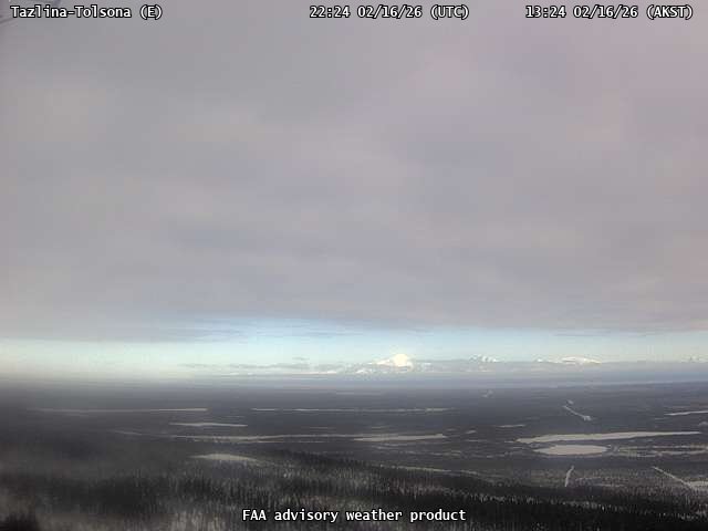
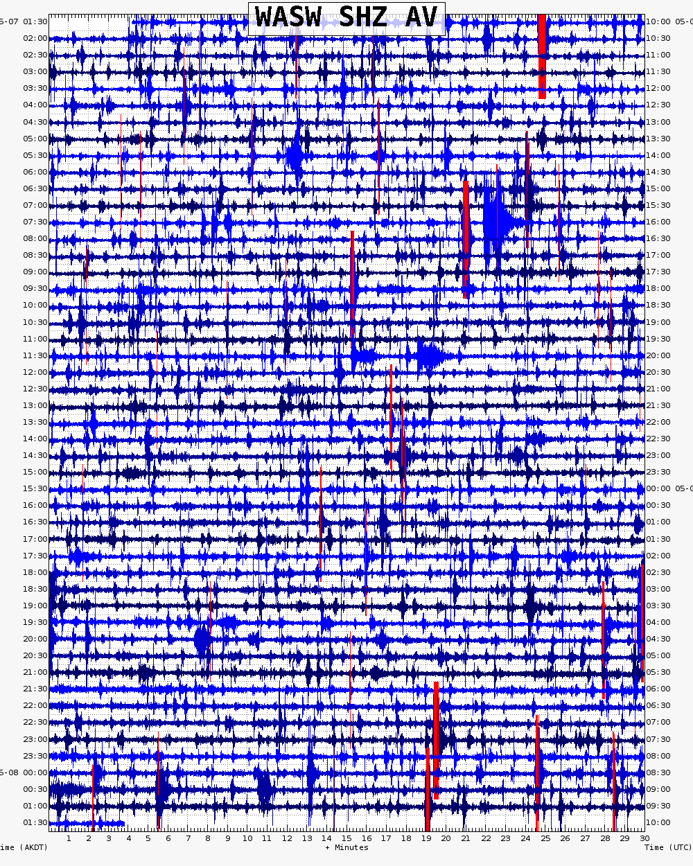
Ashfall Forecast

Click on the X on the graphic (upper right) to expand the map to show the map legend.

Ashfall Start Time

This map shows the modeled estimate of the time it would take for ashfall to begin following an eruption. It corresponds to the ashfall thickness forecast map shown above. This map uses the start time of either the twice-daily hypothetical model runs (time shown in the legend) or the actual eruption start time (if one were to occur). In the case of an actual eruption, the National Weather Service Anchorage Forecast Office will issue the official ashfall warning product that includes the ashfall start time and post them at weather.gov/afc

THESE PRODUCTS MAY NOT BE CURRENT.

During an actual eruption, see National Weather Service forecasts of ashfall:https://weather.gov/afc.

Ashfall Start Times Forecast

Click on the X on the graphic (upper right) to expand the map to show the map legend.
×