Augustine Kamishak Creek Tephra
Start: 3850 yBP ± 100 Years [1]
Stop: 3660 yBP ± 100 Years [1]
Event Type: Explosive
- Tephrafall [2]
Description: From Waitt and Beget (2009): "Along Kamishak Creek 70 km southwest of Augustine (fig. 1A [in original text]), a fall tephra of Augustine provenance dates between about 3,850 and 3,660 yr B.P. (table 2 [in original text]) (Riehle and others, 1998, fig. 8 [in original text])."
References Cited
[1] Volcanic processes and geology of Augustine Volcano, Alaska, 2009
Waitt, R.B., and Beget, J.E., 2009, Volcanic processes and geology of Augustine Volcano, Alaska: U.S. Geological Survey Professional Paper 1762, 78 p., 2 plates, scale 1:25,000, available at http://pubs.usgs.gov/pp/1762/ .[2] Geology of Great Sitkin Island, 1947
Simons, F. S., and Mathewson, D. E., 1947, Geology of Great Sitkin Island: U.S. Geological Survey Alaskan Volcano Investigations Report 0002, p. 55-67.Complete Eruption References
Volcanoes of the World, 2013
Global Volcanism Program, 2013, Volcanoes of the World, v. 4.5.3. Venzke, E (ed.): Smithsonian Institution. Downloaded 2017. http://dx.doi.org/10.5479/si.GVP.VOTW4-2013
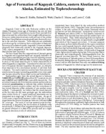
Age of formation of Kaguyak Caldera, eastern Aleutian Arc, Alaska, estimated by tephrochronology, 1998
Riehle, J. R., Waitt, R. B., Meyer, C. E., and Calk, L. C., 1998, Age of formation of Kaguyak Caldera, eastern Aleutian Arc, Alaska, estimated by tephrochronology: in Gray, J. E. and Riehle, J. R., (eds.), Geologic studies in Alaska by the U.S. Geological Survey, 1996, U.S. Geological Survey Professional Paper PP 1595, p. 161-168.
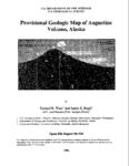
Provisional geologic map of Augustine Volcano, Alaska, 1996
Waitt, R. B., and Beget, J. E., 1996, Provisional geologic map of Augustine Volcano, Alaska: U.S. Geological Survey Open-File Report 96-0516, 44 p., 1 plate, scale 1:25,000.