References
McGimsey, R.G., Muffler, L.J.P., Neal, C.A., Miller, M.L., Nelson, S.W., and Dumoulin, J.A., 2024, Memorial to Thomas Patrick Miller: Geological Society of America Memorials v. 53, p. 3-6.
Wang, J., 2024, Deformation mapping and modeling of the Aleutian volcanoes with InSAR and numerical models: University Park, Tex., Southern Methodist University, Ph.D. dissertation, 143 p.
Cameron, C.E., Bull, K.F., and Macpherson, A.E., 2023, Recently active volcanoes of Alaska: Alaska Division of Geological & Geophysical Surveys Miscellaneous Publication 133 v. 6, 2 sheets. https://doi.org/10.14509/31086.
Lubbers, J., Loewen, M., Wallace, K., Coombs, M., and Addison, J., 2023, Probabilistic source classification of large tephra producing eruptions using supervised machine learning - an example from the Alaska-Aleutian Arc: Geochemistry, Geophysics, Geosystems v. 24, no. 11, e2023GC011037. https://doi.org/10.1029/2023GC011037.
Wang, J., Lu, Z., Bekaert, D., Marshak, C., Govorcin, M., Sangha, S., Kennedy, J., and Gregg, P., 2023, Along-arc volcanism in the western and central Aleutian from 2015 to 2021 revealed by cloud-based InSAR processing: Geophysical Research Letters v. 50, no. 23, e2023GL106323. https://doi.org/10.1029/2023GL106323
Alaska Volcano Observatory, National Oceanic and Atmospheric Administration, National Weather Service, Federal Aviation Administration, Department of Defense, United States Coast Guard, Division of Homeland Security and Emergency Management, Alaska Department of Environmental Conservation, and Alaska Department of Health and Social Services (participating agencies), 2022, Alaska interagency operating plan for volcanic ash episodes, 85 p.
Cameron, C.E., Crass, S.W., and AVO Staff, eds, 2022, Geologic database of information on volcanoes in Alaska (GeoDIVA): Alaska Division of Geologic and Geophysical Surveys Digital Data Series 20, https://doi.org/10.14509/geodiva, https://doi.org/10.14509/30901.
Power, J.A., Haney, M.M., Botnick, S.M., Dixon, J.P., Fee, David, Kaufman, A.M., Ketner, D.M., Lyons, J.J., Parker, Tom, Paskievitch, J.F., Read, C.W., Searcy, Cheryl, Stihler, S.D., Tepp, Gabrielle, and Wech, A.G., 2020, Goals and development of the Alaska Volcano Observatory seismic network and application to forecasting and detecting volcanic eruptions: Seismological Research Letters, doi: 10.1785/0220190216 .
Bolton, M.S.M., Jensen, B.J.L., Wallace, Kristi, Praet, Nore, Fortin, David, Kaufman, Darrell, and De Batist, Marc, 2020, Machine learning classifiers for attributing tephra to source volcanoes: an evalution of methods for Alaska tephras: Journal of Quaternary Science, v. 35, n. 1-2, p. 81-92, doi:10.1002/jqs.3170.
Cameron, C.E., Schaefer, J.R., and Ekberg, P.G., 2020, Historically active volcanoes of Alaska: Alaska Division of Geological & Geophysical Surveys Miscellaneous Publication 133 v. 4, 2 sheets. Http://doi.org/10.14509/30426
Werner, Cynthia, Kern, Christoph, and Kelly, P.J., 2020, Chemical evaluation of water and gases collected from hydrothermal systems located in the central Aleutian arc, August 2015: U.S. Geological Survey Scientific Investigations Report 2020-1029, 35 p., https://doi.org/10.3133/sir20201029.
Plank, T., Rasmussen, D., Stelling, P., and Roman, D., 2020, Field report for the collection of mafic tephra from the Aleutian Islands between Unimak and the Islands of Four Mountains (Alaska, USA), version 1.0: Interdisciplinary Earth Data Alliance (IEDA), https://doi.org/10.26022/IEDA/111584. Accessed 2020-06-25.
Lerner, A.H., O'Hara, D., Karlstrom, L., Ebmeier, S.K., Anderson, K.R., and Hurwitz, S., 2020, The prevalence and significance of offset magma reservoirs at arc volcanoes: Geophysical Research Letters, v. 47, doi:10.1029/2020GL087856.
Lerner, A.H., 2020, The depths and locations of magma reservoirs and their consequences for the behavior of sulfur and volcanic degassing: University of Oregon Ph.D. thesis, 378 p. Available at https://search.proquest.com/openview/cec1ff16af338dce2495b5a1a491aa88/1?pq-origsite=gscholar&cbl=44156.
Plank, T., Rasmussen, D. J., Stelling, P., and Roman, D. C., 2020, Field report for the collection of mafic tephra from the Aleutians Islands between Unimak and the Island of Four Mountains (Alaska, USA), version 1.0: Interdisciplinary Earth Data Alliance (IEDA). https://doi.org/10.26022/IEDA/111584
Dixon, J.P., Stihler S.D., Haney, M.M., Lyons, J.J., Ketner, D.M., Mulliken, K.M., Parker, T., and Power, J.A., 2019, Catalog of earthquake parameters and description of seismograph and infrasound stations at Alaskan volcanoes - January 1, 2013, through December 31, 2017: U.S. Geological Survey Data Series 1115, 92 p., https://doi.org/10.3133/ds1115.
Power, J.A., Friberg, P.A., Haney, M.M., Parker, T., Stihler, S.D., and Dixon, J.P., 2019, A unified catalog of earthquake hypocenters and magnitudes at volcanoes in Alaska—1989 to 2018: U.S. Geological Survey Scientific Investigations Report 2019–5037, 17 p., https://doi.org/10.3133/sir20195037.
Rasmussen, D.J., and Plank, T.A., 2019, Bulk rock data for the central-eastern Aleutian volcanoes, version 1.0: Interdisciplinary Earth Data Alliance (IEDA). https://doi.org/10.26022/IEDA/111870
Mulliken, K.M., Schaefer, J.R., and Cameron, C.E., 2018, Geospatial distribution of tephra fall in Alaska: a geodatabase compilation of published tephra fall occurrences from the Pleistocene to the present: Alaska Division of Geological & Geophysical Surveys Miscellaneous Publication 164, 46 p. http://doi.org/10.14509/29847
Worden, A.K., Schaefer, J.R., and Mulliken, K.M., 2018, Tephra occurrence in Alaska: a map-based compilation of stratigraphic tephra data: Alaska Division of Geological and Geophysical Surveys Miscellaneous Publication 165, 19 p., http://doi.org/10.14509/30059
Ewert, J.W., Diefenbach, A.K., and Ramsey, D.W., 2018, 2018 update to the U.S. Geological Survey national volcanic threat assessment: U.S. Geological Survey Scientific Investigations Report 2018-5140, 40 p., https://pubs.usgs.gov/sir/2018/5140/sir20185140.pdf.
Cameron, C.E., Schaefer, J.R., and Mulliken, K.M., 2018, Historically active volcanoes of Alaska: Alaska Division of Geological & Geophysical Surveys Miscellaneous Publication 133 v. 3, 2 sheets. Http://doi.org/10.14509/30142
Gong, W., Lu, Z., Meyer, F., 2017, Uncertainties in estimating magma source parameters from InSAR observation: Natural Hazard Uncertainty Assessment: Modeling and Decision Support, Geophysical Monograph 223, p. 89-104.
Cameron, C.E., and Schaefer, J.R., 2016, Historically active volcanoes of Alaska: Alaska Division of Geological & Geophysical Surveys Miscellaneous Publication 133 v. 2, 1 sheet, scale 1:3,000,000. http://doi.org/10.14509/20181
Cameron, C.E., and Snedigar, S.F., 2016, Alaska Volcano Observatory image database: Alaska Division of Geological & Geophysical Surveys Digital Data Series 13, https://www.avo.alaska.edu/images/. https://doi.org/10.14509/29689.
Waythomas, C.F., 2015, Geomorphic consequences of volcanic eruptions in Alaska: A review: Geomorphology, v. 246, p. 123-145, doi: 10.1016/j.geomorph.2015.06.004
Gong, W., Meyer, F. J., Lee, C. W., Lu, Z., and Freymueller, J., 2015, Measurement and interpretation of subtle deformation signals at Unimak Island from 2003 to 2010 using weather model‐assisted time series InSAR: Journal of Geophysical Research: Solid Earth, v. 120, n. 2, p. 1175-1194.
Schaefer, J.R., Cameron, C.E., and Nye, C.J., 2014, Historically active volcanoes of Alaska: Alaska Division of Geological & Geophysical Surveys Miscellaneous Publication 133 v. 1.2, 1 sheet, scale 1:3,000,000.
This publication has been superseded. Newest version available at http://www.dggs.alaska.gov/pubs/id/20181 .
Buurman, Helena, Nye, C.J., West, M.E., and Cameron, Cheryl, 2014, Regional controls on volcano seismicity along the Aleutian Arc: Geochemistry, Geophysics, Geosystems, doi:10.1002/2013GC005101
Cameron, C.E., and Nye, C.J., 2014, Preliminary database of Quaternary vents in Alaska: Alaska Division of Geological & Geophysical Surveys Miscellaneous Publication 153, 11 p., doi:10.14509/27357 .
Stelling, P.L., Beget, J.E., Gardner, J.E., and Schaefer, J.R., 2014, Preliminary volcano-hazard assessment for Fisher volcano, Unimak Island, Alaska: Alaska Division of Geological & Geophysical Surveys Report of Investigation 2014-5, 32 p., 1 sheet, scale 1:500,000. doi:10.14509/29146 .
Lu, Zhong, and Dzurisin, Daniel, 2014, InSAR imaging of Aleutian volcanoes: Chichester, UK, Springer-Praxis, 390 p.
Dixon, J.P., Stihler, S.D, Power, J.A., Haney, Matt, Parker, Tom, Searcy, C.K., and Prejean, Stephanie, 2013, Catalog of earthquake hypocenters at Alaskan volcanoes: January 1 through December 31, 2012: U.S. Geological Survey Data Series 789, 84 p., available at http://pubs.usgs.gov/ds/789/ .
Dixon, J.P., Stihler, S.D., Power, J.A., and Searcy, C.K., 2012, Catalog of earthquake hypocenters at Alaskan volcanoes: January 1 through December 31, 2011: U.S. Geological Survey Data Series 730, 82 p., available online at http://pubs.usgs.gov/ds/730/pdf/ds730.pdf .
Oppenheimer, Clive, 2011, Eruptions that shook the world: New York, Cambridge University Press, 392 p.
Dixon, J.P., Stihler, S.D., Power, J.A., and Searcy, C.K., 2011, Catalog of earthquake hypocenters at Alaskan volcanoes: January 1 through December 31, 2010: U.S. Geological Survey Data Series 645, 82 p., available online at http://pubs.usgs.gov/ds/645/
Dixon, J.P., Stihler, S.D., Power, J.A., and Searcy, C.K., 2010, Catalog of earthquake hypocenters at Alaskan volcanoes: January 1 through December 31, 2009: U.S. Geological Survey Data Series 531, 84 p., available online at http://pubs.usgs.gov/ds/531/ .
Manville, V., 2010, An overview of break-out floods from intracaldera lakes: Global and Planetary Change, v. 70, p. 14-23, doi:10.1016/j.gloplacha.2009.11.004.
Dixon, J.P., and Stihler, S.D., 2009, Catalog of earthquake hypocenters at Alaskan volcanoes: January 1 through December 31, 2008: U.S. Geological Survey Data Series 467, 88 p., available at http://pubs.usgs.gov/ds/467/ .
Snedigar, S.F., and Cameron, C.C., 2009, Historically active volcanoes of Alaska reference deck: Alaska Division of Geological & Geophysical Surveys Information Circular 59, 52 p, available to order from http://www.dggs.dnr.state.ak.us/pubs/pubs?reqtype=citation&ID=20401 .
Mastin, L.G., Guffanti, Marianne, Ewert, J.E., and Spiegel, Jessica, 2009, Preliminary spreadsheet of eruption source parameters for volcanoes of the world: U.S. Geological Survey Open-File Report 2009-1133, v. 1.2, 25 p., available at http://pubs.usgs.gov/of/2009/1133/ .
Dixon, J.P., Stihler, S.D., Power, J.A., and Searcy, Cheryl, 2008, Catalog of earthquake hypocenters at Alaskan volcanoes: January 1 through December 31, 2006: U.S. Geological Survey Data Series 326, 79 p., available at http://pubs.usgs.gov/ds/326/ .
Schaefer, J.R., and Nye, Chris, 2008, The Alaska Volcano Observatory - 20 years of volcano research, monitoring, and eruption response: Alaska Division of Geological & Geophysical Surveys, Alaska GeoSurvey News, NL 2008-001, v. 11, n. 1, p. 1-9, available at http://wwwdggs.dnr.state.ak.us/pubs/pubs?reqtype=citation&ID=16061 .
Dixon, J.P., Stihler, S.D. and Power, J.A., 2008, Catalog of earthquake hypocenters at Alaskan volcanoes: January 1 through December 31, 2007: U.S. Geological Survey Data Series 367, 82 p., available online at http://pubs.usgs.gov/ds/367/ .
Stelling, Pete, 2008, written communication.
Gardner, J.E., Burgisser, Alain, and Stelling, Pete, 2007, Eruption and deposition of the Fisher Tuff (Alaska): evidence for the evolution of pyroclastic flows: Journal of Geology, v. 115, p. 417-435.
Ewert, John, 2007, System for ranking relative threats of U.S. volcanoes: Natural Hazards Review, v. 8, n. 4, p. 112-124.
Dixon, J.P., Stihler, S.D., Power, J.A., Tytgat, Guy, Estes, Steve, and McNutt, S.R., 2006, Catalog of earthquake hypocenters at Alaskan volcanoes: January 1 through December 31, 2005: U.S. Geological Survey Open-File Report 2006-1264, 78 p., available at http://pubs.usgs.gov/of/2006/1264/ .
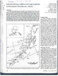
Stelling, P., Gardner, J. E., and Beget, J., 2005, Eruptive history of Fisher Caldera, Alaska, USA: Journal of Volcanology and Geothermal Research, v. 139, no. 3-4, p. 163-183.
Ewert, J.W., Guffanti, Marianne, and Murray, T.L., 2005, An assessment of volcanic threat and monitoring capabilities in the United States: framework for a National Volcano Early Warning System NVEWS: U.S. Geological Survey Open-File Report 2005-1164, 62 p.
Dixon, J.P., Stihler, S.D., Power, J.A., Tytgat, Guy, Estes, Steve, Prejean, Stephanie, Sanchez, J.J., Sanches, Rebecca, McNutt, S.R., and Paskievitch, John, 2005, Catalog of earthquake hypocenters at Alaskan volcanoes: January 1 through December 31, 2004: U.S. Geological Survey Open-File Report 2005-1312, 74 p., available online at http://pubs.usgs.gov/of/2005/1312/.
Odorczuk, Diana, Finney, Bruce, and Beget, James, 2005, Holocene tephrochronology of Sanak Island, Alaska [abs.]: Abstracts with Programs - Geological Society of America, v. 37, n. 7, p. 38.
Dixon, J. P., Stihler, S. D., Power, J. A., Tytgat, Guy, Moran, S. C., Sanchez, J. J., McNutt, S. R., Estes, Steve, and Paskievitch, John, 2004, Catalog of earthquake hypocenters at Alaskan volcanoes: January 1 through December 31, 2003: U.S. Geological Survey Open-File Report 2004-1234, 69 p.
Brantley, S. R., McGimsey, R. G., and Neal, C. A., 2004, The Alaska Volcano Observatory - Expanded monitoring of volcanoes yields results: U.S. Geological Survey Fact Sheet FS 2004-3084, 2 p.
Siebert, L., and Simkin, T., 2002-, Volcanoes of the world: an illustrated catalog of Holocene volcanoes and their eruptions: Smithsonian Institution, Global Volcanism Program Digital Information Series GVP-3, http://volcano.si.edu/search_volcano.cfm, unpaged internet resource.
Cameron, C. E., Triplehorn, J. H., and Robar, C. L., 2003, Bibliography of information on Alaska volcanoes: Alaska Division of Geological & Geophysical Surveys Miscellaneous Publication MP 131, 1 CD-ROM.
Hard Copy held by AVO at FBKS - CEC file cabinet
Dixon, J. P., Stihler, S. D., Power, J. A., Tytgat, Guy, Moran, S. C., Sanchez, John, Estes, Steve, McNutt, S. R., and Paskievitch, John, 2003, Catalog of earthquake hypocenters at Alaskan volcanoes: January 1 through December 31, 2002: U.S. Geological Survey Open-File Report 03-0267, 58 p.
Stelling, P. L., 2003, Volcanism on Unimak Island, Alaska, USA: a special focus on Shishaldin and Fisher volcanoes: University of Alaska Fairbanks unpublished Ph.D. dissertation, 193 p. and one CD-ROM.
Mann, Dorte, and Freymueller, J., 2003, Volcanic and tectonic deformation on Unimak Island in the Aleutian Arc, Alaska: Journal of Geophysical Research, v. 108, n. 2, p. 1-12.
Dixon, J. P., Stihler, S. D., Power, J. A., Tytgat, Guy, Estes, Steve, Moran, S. C., Paskievitch, John, and McNutt, S. R., 2002, Catalog of earthquake hypocenters at Alaskan volcanoes: January 1, 2000 through December 31, 2001: U.S. Geological Survey Open-File Report 02-0342, 56 p.
Hard Copy held by AVO at FBKS - CEC file cabinet
Carson, E. C., Fournelle, J. H., Miller, T. P., and Mickelson, D. M., 2002, Holocene tephrochronology of the Cold Bay area, southwest Alaska Peninsula: Quaternary Science Reviews, v. 21, n. 20-22, p. 2213-2228.
Hard Copy held by AVO at FBKS - CEC file cabinet
Mann, Dorte, 2002, Deformation of Alaskan volcanoes measured using SAR interferometry and GPS: University of Alaska Fairbanks unpublished Ph.D. dissertation, 122 p.
Schaefer, Janet, and Nye, C. J., 2002, Historically active volcanoes of the Aleutian Arc: Alaska Division of Geological & Geophysical Surveys Miscellaneous Publication MP 0123, unpaged, 1 sheet, scale 1:3,000,000. Superceded by Miscellaneous Publication 133: http://www.dggs.dnr.state.ak.us/pubs/pubs?reqtype=citation&ID=20181
Bindeman, I. N., Fournelle, J. H., and Valley, J. W., 2001, Low-delta (super 18) O tephra from a compositionally zoned magma body: Fisher Caldera, Unimak Island, Aleutians: Journal of Volcanology and Geothermal Research, v. 111, n. 1-4, Amsterdam, Netherlands, Elsevier, p. 35-53.
Jolly, A. D., Stihler, S. D., Power, J. A., Lahr, J. C., Paskievitch, John, Tytgat, Guy, Estes, Steve, Lockheart, A. D., Moran, S. C., McNutt, S. R., and Hammond, W. R., 2001, Catalog of earthquake hypocenters at Alaskan volcanoes: January 1, 1994 through December 31, 1999: U.S. Geological Survey Open-File Report 01-0189, 22 p.
Hard Copy held by AVO at FBKS - CEC file cabinet
Wallace, K. L., McGimsey, R. G., and Miller, T. P., 2000, Historically active volcanoes in Alaska, a quick reference: U.S. Geological Survey Fact Sheet FS 0118-00, 2 p.
Hard Copy held by AVO at FBKS - CEC file cabinet
Sigurdsson, Haraldur, (ed.), 2000, Encyclopedia of volcanoes: San Diego, CA, Academic Press, 1417 p.
Fournelle, J. H., Bindeman, I. N., and Valley, J. W., 2000, Fisher Caldera, Unimak Island, Aleutians: oxygen isotope geochemistry and regional tephrochronology [abs.]: Eos, v. 81, n. 48, p. 1376.
Stelling, P. L., and Gardner, J. E., 2000, Evolution of Fisher Caldera, Alaska, USA [abs.]: Eos, v. 81, n. 48, p. 1352.
Alaska Volcano Observatory, 1999, May-August 1999: Alaska Volcano Observatory Bimonthly Report, v. 11, n. 3 and 4, 39 p.
Alaska Volcano Observatory, 1999, September-December 1999: Alaska Volcano Observatory Bimonthly Report, v. 11, n. 5 and 6, 51 p.
Hoffman, B.W., 1999, Agayadan Village: Household archaeology on Unimak Island, Alaska: Journal of Field Archaeology, v. 26, no. 2, p. 147-167, https://doi.org/10.1179/jfa.1999.26.2.147.
Nye, C. J., Queen, Katherine, and McCarthy, A. M., 1998, Volcanoes of Alaska: Alaska Division of Geological & Geophysical Surveys Information Circular IC 0038, unpaged, 1 sheet, scale 1:4,000,000, available at http://www.dggs.dnr.state.ak.us/pubs/pubs?reqtype=citation&ID=7043 .
Hard Copy held by AVO at FBKS - CEC shelf
Miller, T. P., McGimsey, R. G., Richter, D. H., Riehle, J. R., Nye, C. J., Yount, M. E., and Dumoulin, J. A., 1998, Catalog of the historically active volcanoes of Alaska: U.S. Geological Survey Open-File Report 98-0582, 104 p.
Hard Copy held by AVO at FBKS - CEC shelf
Carson, E. C., 1998, Holocene tephrochronology of the Cold Bay area, Southwest Alaska Peninsula: University of Wisconsin-Madison unpublished M.S. thesis, 178 p.
Carson, E. C., and Fournelle, John, 1998, Holocene tephrochronology of the Cold Bay area, Southwest Alaska Peninsula: Abstracts with Programs - Geological Society of America, v. 30, n. 2, p. 9.
Hard Copy held by AVO at FBKS - CEC file cabinet
Carson, E. C., 1998, Evidence for co-existing mafic and silicic magmas for the 9100-bp Fisher Caldera eruption, Unimak Island, Alaska Peninsula: Abstracts with Programs - Geological Society of America, v. 30, n. 7, p. 388-389.
Neal, Christina, and McGimsey, R. G., 1997, Volcanoes of the Alaska Peninsula and Aleutian Islands selected photographs: U.S. Geological Survey Digital Data Series DDS 0040, 1 CD-ROM.
Alaska Volcano Observatory, 1997, July-August 1997: Alaska Volcano Observatory Bimonthly Report, v. 9, n. 4, 31 p.
Tannenbaum, T.G., 1996, Holocene tephra stratigraphy on northern Kodiak Island, Alaska: University of Alaska Fairbanks M.S. thesis, 165 p.
Doukas, M. P., McGimsey, R. G., and Dorava, J. M., 1995, A video of 10 years of volcanic activity in Alaska: 1983 to 1992 [abs.]: Abstracts with Programs - Geological Society of America, v. 27, n. 5, p. 15.
Hard Copy held by AVO at FBKS - CEC file cabinet
McGimsey, R. G., and Miller, T. P., 1995, Quick reference to Alaska's active volcanoes and listing of historical eruptions, 1760-1994: U.S. Geological Survey Open-File Report 95-0520, 13 p.
Hard Copy held by AVO at FBKS - CEC file cabinet
McGimsey, R. G., Neal, C. A., and Doukas, M. P., 1995, Volcanic activity in Alaska: Summary of events and response of the Alaska Volcano Observatory 1992: U.S. Geological Survey Open-File Report 95-83, 26 p.
Hard Copy held by AVO at FBKS - CEC shelf
Alaska Division of Geological & Geophysical Surveys, 1995, Volcanoes of Alaska: Alaska Division of Geological & Geophysical Surveys Information Circular IC 0038, unpaged, 1 sheet, scale 1:4,000,000.
Miller, T. P., and Richter, D. H., 1994, Quaternary volcanism in the Alaska Peninsula and Wrangell Mountains, Alaska: in Plafker, George, Jones, D. L., and Berg, H. C., (eds.), The Geology of Alaska, Geological Society of America The Geology of North America series v. G-1, p. 759-779.
Hard Copy held by AVO at FBKS - CEC file cabinet
Simkin, Tom, and Siebert, Lee, 1994, Volcanoes of the world [2nd edition]: Tucson, Arizona, Geoscience Press, 349 p.
Hard Copy held by AVO at FBKS - CEC shelf
Miller, T. P., 1994, Geothermal resources of Alaska: in Plafker, George and Berg, H. C., (eds.), The Geology of Alaska, Geological Society of America The Geology of North America series v. G-1, p. 979-987.
Hard Copy held by AVO at FBKS - CEC file cabinet
Hard Copy held by AVO at FBKS - CEC shelf
Myers, J. D., 1994, The geology, geochemistry and petrology of the recent magmatic phase of the central and western Aleutian Arc: unpublished manuscript unpaged.
Hard Copy held by AVO at FBKS - CEC shelf
Fournelle, J. H., Marsh, B. D., and Myers, J. D., 1994, Age, character, and significance of Aleutian arc volcanism: in Plafker, George and Berg, H. C., (eds.), The Geology of Alaska, Geological Society of America The Geology of North America Series v. G-1, p. 723-758.
Khlebnikov, K. T., 1994, Notes on Russian America, Parts II-V: Kad'iak, Unalashka, Atkha, the Pribylovs (translated by Marina Ramsay): Liapunova, R. G. and Fedorova, S. G., (comps.), Kingston, Ontario and Fairbanks, Alaska, The Limestone Press, 424 p.
Hard Copy held by AVO at FBKS - CEC file cabinet
Motyka, R. J., Liss, S. A., Nye, C. J., and Moorman, M. A., 1993, Geothermal resources of the Aleutian Arc: Alaska Division of Geological & Geophysical Surveys Professional Report PR 0114, 17 p., 4 sheets, scale 1:1,000,000.
Hard Copy held by AVO at FBKS - CEC shelf
Reeder, J. W., McNutt, S. R., Abers, G. A., and Miller, T. P., 1993, Annual report of the world volcanic eruptions in 1990: Bulletin of Volcanology, v. 55, n. 30, p. 60-70.
March, G. D., 1993, Holocene volcanoes of the Aleutian Arc, Alaska: Alaska Division of Geological & Geophysical Surveys Public-Data File PDF 93-85, unpaged, 1 sheet, scale 1:2,000,000.
Singer, B. S., O'Neil, J. R., and Brophy, J. G., 1992, Oxygen isotope constraints on the petrogenesis of Aleutian arc magmas: Geology, v. 20, n. 4, p. 367-370.
Mouginis-Mark, P. J., Rowland, S. K., and Smith, G. A., 1992, ERS-1 radar data for Aleutian and Alaskan volcanoes [abs.]: Eos, v. 73, n. 43, p. 613-614.
Romick, J. D., 1991, The igneous petrology and geochemistry of northern Akutan Island, Alaska: Alaska Division of Geological & Geophysical Surveys Report of Investigation 90-3, 53 p.
Hard Copy held by AVO at FBKS - CEC file cabinet
Fournelle, John, 1990, Geology and geochemistry of Fisher Caldera, Unimak Island, Aleutians: initial results [abs.]: Eos, v. 71, n. 43, p. 1698-1699.
Wood, C. A., and Kienle, Juergen, (eds.), 1990, Volcanoes of North America: United States and Canada: New York, Cambridge University Press, 354 p.
Hard Copy held by AVO at FBKS - CEC shelf
Major, J. J., and Newhall, C. G., 1989, Snow and ice perturbation during historical volcanic eruptions and the formation of lahars and floods: Bulletin of Volcanology, v. 52, p. 1-27.
Hard Copy held by AVO at FBKS - CEC file cabinet
Motyka, R. J., Moorman, M. A., and Poreda, R. J., 1988, Geochemistry of thermal springs and fumaroles, Hot Springs Bay valley, Akutan Island, AK: in Motyka, R. J. and Nye, C. J., (eds.), A geological, geochemical, and geophysical survey of the geothermal resources at Hot Springs Bay valley, Akutan, Island, AK, Alaska Division of Geological & Geophysical Surveys Report of Investigation 88-03, p. 77-104, 2 sheets, scale 1:20,000 and 1:4,000.
Motyka, R. J., Wescott, E. M., Turner, D. L., Swanson, S. E., Allely, R. D., and Larsen, Mark, 1988, Introduction and summary of geothermal investigations in Hot Springs Bay, Akutan, AK: in Motyka, R. J. and Nye, C. J., (eds.), A geological, geochemical, and geophysical survey of the geothermal resources at Hot Springs Bay Valley, Akutan Island, Alaska, Alaska Division of Geological & Geophysical Surveys Report of Investigation 88-03, p. 1-10, 2 sheets, scale 1:20,000 and 1:4,000.
Newhall, C.G., and Dzurisin, Daniel, 1988, Historical unrest at large calderas of the world: U.S. Geological Survey Bulletin 1855, v. 1-2, 1108 p.
Hard Copy held by AVO at FBKS - CEC shelf
Miller, T. P., and Smith, R. L., 1987, Late Quaternary caldera-forming eruptions in the eastern Aleutian arc, Alaska: Geology, v. 15, n. 5, p. 434-438.
Hard Copy held by AVO at FBKS - CEC file cabinet
Lister, C. R. B., 1987, Geothermal resources: in Scholl, D. W., Grantz, Arthur, and Vedder, J. G., (eds.), Geology and resource potential of the continental margin of western North America and adjacent ocean basins - Beaufort Sea to Baja California, v. 6, Houston Texas, Circum-Pacific council for energy and mineral resources, Earth Science Series, p. 739-751.
Miller, T. P., 1987, Three volcanoes erupt in Alaska: Earthquakes and Volcanoes, v. 19, n. 6, p. 192-198.
Hard Copy held by AVO at FBKS - CEC file cabinet
Motyka, R. J., and Nye, C. J., 1986, Geothermal resources in the state of Alaska: The interstate oil compact commission committee bulletin, v. 28, n. 1, p. 43-45.
Romick, J. D., 1986, The igneous petrology and geochemistry of northern Akutan Island, Alaska: Alaska Division of Geological & Geophysical Surveys Public-Data File PDF 86-52, 84 p.
Luedke, R. G., and Smith, R. L., 1986, Map showing distribution, composition, and age of Late Cenozoic volcanic centers in Alaska: U.S. Geological Survey Miscellaneous Investigations Series Map I 1091-F, unpaged, 3 sheets, scale 1:1,000,000.
Swanson, S. E., and Blum, J. D., 1984, Evolution of volcanic centers in the oceanic-continental transition of the Aleutian Arc [abs.]: Abstracts with Programs - Geological Society of America, v. 16, n. 6, p. 671.
Reeder, J. W., 1983, Preliminary dating of the caldera forming Holocene volcanic events for the eastern Aleutian Islands [abs.]: Abstracts with Programs - Geological Society of America, v. 15, n. 6, p. 668.
Hard Copy held by AVO at FBKS - CEC file cabinet
Motyka, R. J., 1983, High-temperature hydrothermal resources in the Aleutian arc: in Proceedings of Alaska Geological Society Symposium on western Alaska geology and resource potential, Journal of Alaska Geological Society, v. 3, p. 87-99.
Neal, R. J., and Swanson, S. E., 1983, Petrology and geochemistry of Westdahl and Pogromni volcanoes, Unimak Island, Alaska [abs.]: Eos, v. 64, n. 45, p. 893.
Hard Copy held by AVO at FBKS - CEC file cabinet
Romick, J. D., 1983, Igneous petrology and geochemistry of northern Akutan Island, Alaska [abs.]: Eos, v. 64, n. 9, p. 90.
Romick, J. D., and Swanson, S. E., 1983, The petrology and fractionation of lavas from Akutan Island, Alaska [abs.]: Eos, v. 64, n. 45, p. 892-893.
Romick, J. D., 1982, The igneous petrology and geochemistry of northern Akutan Island, Alaska: University of Alaska Fairbanks unpublished M.S. thesis, 151 p.
Hard Copy held by AVO at FBKS - CEC file cabinet
Hard Copy held by AVO at FBKS - CEC shelf
Wescott, E. M., Turner, D. L., Witte, W., and Petzinger, B., 1982, A geophysical survey of Hot Springs Bay Valley, Akutan Island, Alaska: in Geothermal Resources Council Transactions, v. 6, p. 185-188.
Simkin, Tom, Siebert, Lee, McClelland, Lindsay, Bridge, David, Newhall, Christopher, and Latter, J. H., 1981, Volcanoes of the world: Stroudsburg, PA, Hutchinson Publishing Company, 233 p.
Turner, D. L., Forbes, R. B., Albanese, Mary, Macbeth, Joyce, Lockhart, A. B., and Seed, S. M., 1980, Geothermal energy resources of Alaska: University of Alaska Fairbanks Geophysical Institute Report UAG-R 279, 19 p., 3 sheets, scale 1 at 1:2,500,000.
Smith, R. L., and Shaw, H. R., 1979, Igneous-related geothermal systems: in Muffler, L. J. P., (ed.), Assessment of geothermal resources of the United States 1978, U.S. Geological Survey Circular C 790, p. 12-17.
Muffler, L. J. P., 1979, Assessment of geothermal resources of the United States--1978: U.S. Geological Survey Circular C 0790, 163 p.
Hard Copy held by AVO at FBKS - CEC shelf
Smith, R. L., Shaw, H. R., Luedke, R. G., and Russell, S. L., 1978, Comprehensive tables giving physical data and thermal energy estimates for young igneous systems of the United States: U.S. Geological Survey Open-File Report 78-0925, p. 1-25.
Hard Copy held by AVO at FBKS - CEC shelf
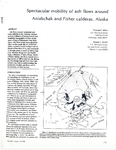
Miller, T. P., and Smith, R. L., 1977, Spectacular mobility of ash flows around Aniakchak and Fisher calderas, Alaska: Geology, v. 5, n. 3, p. 173-176.
Hard Copy held by AVO at FBKS - CEC file cabinet
Miller, T. P., and Barnes, Ivan, 1976, Potential for geothermal energy development in Alaska - summary: in Halbouty, M. T., Maher, J. C., and Lian, H. M., (eds.), Circum-Pacific energy and mineral resources, American Association of Petroleum Geologists Memoir 0025, p. 149-153.
Smith, R. L., and Shaw, H. R., 1975, Igneous-related geothermal systems: in White, D. E. and Williams, D. L., (eds.), Assessment of geothermal resources of the United States, 1975, U.S. Geological Survey Circular C 0726, p. 58-83.
Miller, T. P., and Barnes, Ivan, 1974, Potential for geothermal energy development in Alaska [abs.]: American Association of Petroleum Geologists Bulletin, v. 58, n. 7, p. 1450.
Veniaminov, Ivan, 1968, Notes on the islands of the Unalashka district; and, Notes on the Atkhan Aleuts and the Kolosh [translated from Russian by Richard Henry Geogheghan]: Martin, Fredericka, (ed.), Unpublished manuscript, Fairbanks, AK, 944 p.
Powers, H. A., 1958, Alaska Peninsula-Aleutian Islands: in Williams, H., (ed.), Landscapes of Alaska, Los Angeles, CA, University of California Press, p. 61-75.
Coats, R. R., 1950, Volcanic activity in the Aleutian Arc: U.S. Geological Survey Bulletin 0974-B, p. 35-49, 1 sheet, scale 1:5,000,000.
Hard Copy held by AVO at FBKS - CEC shelf
Byers, F. M. Jr., and Barth, T. F. W., 1948, Geology of Akutan Island, unpublished geologic map and field notes: Menlo Park, CA, U.S. Geological Survey Archives, unpaged.
Robinson, G. D., 1948, Exploring Aleutian volcanoes: National Geographic Magazine, v. 94, n. 4, p. 509-528.
Hard Copy held by AVO at FBKS - CEC file cabinet
Coats, R. R., 1947, Reconnaissance geology of some western Aleutian Islands: U.S. Geological Survey Alaskan Volcano Investigations Report 0002, p. 95-105.
Hard Copy held by AVO at FBKS - CEC shelf
Hrdlicka, Ales, 1945, The Aleutian and Commander Islands and their inhabitants: Philadelphia, PA, Wistar Institute of Anatomy and Biology, 630 p.
Hard Copy held by AVO at FBKS - CEC file cabinet
Nutchuk, S. O., and Hatch, Alden, 1941, Son of the smoky sea: New York, NY, Julian Messner, Inc., 245 p.
Hard Copy held by AVO at FBKS - CEC file cabinet
Hubbard, B. R., 1935, Cradle of the storms: New York, Dodd, Mead, 285 p.
Westdahl, F., 1903, Mountains on Unimak Island, Alaska: National Geographic Magazine, v. 14, n. 3, p. 91-99.
Hard Copy held by AVO at FBKS - CEC file cabinet
Veniaminov, Ivan, 1840, Notes on the islands of the Unalaska district [translated from Russian by Lydia T. Black and R.H. Geoghegan in 1984]: Pierce, R. A., (ed.), Kingston, Ontario, Limestone Press, 511 p.
Hard Copy held by AVO at FBKS - CEC file cabinet
Veniaminov, I., 1840, Notes on the islands of the Unalashka district [Zapiski ob ostravakh Unalashkinskogo otdela]: v. 1-3, St. Petersburg, Russiisko-Amerikanskoi Kompanii, unknown.


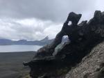
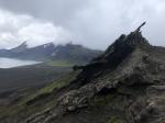
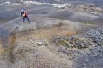
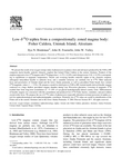
, near Cold Bay, Alaska. This deposit is from the caldera-forming eruption of Fisher, ca 9100 BP.")