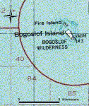
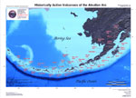
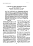
Bogoslof

MarkerMarkerMarkerMarkerMarkerMarkerMarkerMarkerMarkerMarkerMarkerMarkerMarkerMarkerMarkerMarkerMarkerMarkerMarkerMarkerMarkerMarkerMarkerMarkerMarkerMarkerMarkerMarkerMarkerMarkerMarkerMarkerMarkerMarkerMarkerMarkerMarkerMarkerMarkerMarkerMarkerMarkerMarkerMarkerMarkerMarkerMarkerMarkerMarkerMarkerMarkerMarkerMarkerMarkerMarkerMarkerMarkerMarkerMarkerMarkerMarkerMarkerMarkerMarkerMarkerMarkerMarkerMarkerMarkerMarkerMarkerMarkerMarkerMarkerMarkerMarkerMarkerMarkerMarkerMarkerMarkerMarkerMarkerMarkerMarkerMarkerMarkerMarkerMarkerMarkerMarkerMarkerMarkerMarkerMarkerMarkerMarkerMarkerMarkerMarkerMarkerMarkerMarkerMarkerMarkerMarkerMarkerMarkerMarkerMarkerMarkerMarkerMarkerMarkerMarkerMarkerMarkerMarkerMarkerMarkerMarkerMarkerMarkerMarkerMarkerMarkerMarkerMarkerMarkerMarkerMarkerMarkerMarkerMarkerMarkerMarkerMarkerMarkerMarkerMarkerMarkerMarkerMarkerMarkerMarkerMarkerMarkerMarkerMarkerMarkerMarkerMarkerMarkerMarkerMarkerMarkerMarkerMarkerMarkerMarkerMarkerMarkerMarkerMarkerMarkerMarkerMarkerMarkerMarkerMarkerMarkerMarkerMarkerMarkerMarkerMarkerMarkerMarkerMarkerMarkerMarkerMarkerMarkerMarkerMarkerMarkerMarkerMarkerMarkerMarkerMarkerMarkerMarkerMarkerMarkerMarkerMarkerMarkerMarkerMarkerMarkerMarkerMarkerMarkerMarkerMarkerMarkerMarkerMarkerMarkerMarker
2
Legend
Red (Warning)
Orange (Watch)
Yellow (Advisory)
Green (Normal)
Uninstrumented
Community
Webcam
Instrument
Earthquake Magnitude
0 7+
Earthquake Age
Last 2 Hours
Last 2 Days
Last 1 Week


Facts


  • Official Name: Bogoslof Island
  • Seismically Monitored: No
  • Color Code: UNASSIGNED
  • Alert Level: UNASSIGNED
  • Elevation: 150m (492ft)
  • Latitude: 53.9272
  • Longitude: -168.0344
  • Smithsonian VNum: 311300
  • Pronunciation:
  • Nearby Towns:
    • Unalaska 61 mi (98 km) SE
    • Nikolski 76 mi (123 km) SW
    • Akutan 93 mi (149 km) NE
    • Saint George 194 mi (312 km) NW
    • False Pass 197 mi (317 km) NE

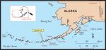
    Distance from Anchorage: 835 mi (1344 km)

  • Subfeatures:
    • Fire Island
    • Metcalf Domes
    • McCulloch Peak
    • Tahoma Peak
    • Ship Rock
    • Castle Rock

Description

Bogoslof Island is the largest of a cluster of small, low-lying islands comprising the emergent summit of a large submarine stratovolcano. This stratovolcano rises about 6000 ft (1800 m) from the Bering Sea floor, but is only about 300 ft (100 m) above sea level at its highest point [1] . Bogoslof volcano is unusual in its location. It is slightly north of the main Aleutian volcanic front, and is interpreted as a back-arc feature. This volcano is frequently altered by both eruptions and erosion, and has undergone dramatic changes in historical time.There are currently two islands of this volcano above sea level: Fire Island and Bogoslof Island. Fire Island lies about 2000 ft (610 m) northwest of Bogoslof and is a tiny sea stack. The current-day Fire Island is what remains of a volcano dome extruded in 1883. Bogoslof is triangular in shape, and about 1.2 mi (2 km) by 0.5 mi (0.75 km). On the southwest side of Bogoslof are steep-sided twin pinnacles called Castle Rock - this is what remains of a dome erupted in 1796. On the north end of Bogoslof Island is a small, 500 ft (150 m) by 900 ft (275 m) dome that was erupted in 1992. Other domes erupted at Bogoslof, (which has had confirmed eruptions in 1796-1804, 1806-1823, 1883-1895, 1906, 1907, 1909-1910, 1926-1928, and 1992) have been lost to explosions or erosion [2] [3] [1] .

Name Origin

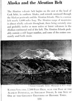
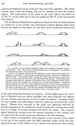
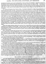
Quote from Orth (1971): "Bogoslof Island" is a Russian name meaning "theologian," given because the island "rose from the sea May 18, 1796, St. John's Day" (Baker, 1906). The name "O[strov] Ioanna Bogoslova," or "John the Theologian's Island," was published by Lt. Sarichev (1826). Captain Tebenkov (1852) published the name "O[strov] Bogoslova" or "theologian's island".


References Cited

[1] Geology of Umnak and Bogoslof Islands, Aleutian Islands, Alaska, 1959

Byers, F. M. Jr., 1959, Geology of Umnak and Bogoslof Islands, Aleutian Islands, Alaska: in Investigations of Alaskan volcanoes, U.S. Geological Survey Bulletin 1028-L, p. 267-369, 5 sheets, scale 1 at 1:63,360, 1 at 1:96,000, and 1 at 1:300,000.
full-text PDF 3.5 MB
plate 39 PDF 2.2 MB
plate 40 PDF 3.9 MB
plate 41 PDF 5.6 MB
plate 48 PDF 85 KB
table 3 PDF 149 KB

[2] Volcanoes of North America: United States and Canada, 1990

Wood, C. A., and Kienle, Juergen, (eds.), 1990, Volcanoes of North America: United States and Canada: New York, Cambridge University Press, 354 p.

[3] Catalog of the historically active volcanoes of Alaska, 1998

Miller, T. P., McGimsey, R. G., Richter, D. H., Riehle, J. R., Nye, C. J., Yount, M. E., and Dumoulin, J. A., 1998, Catalog of the historically active volcanoes of Alaska: U.S. Geological Survey Open-File Report 98-0582, 104 p.

Current Activity

No new updates for Bogoslof volcano since November 24, 2023, 12:00 pm.

Webicorder

Color Code Timeline

Reported Activity

Modern Eruptions

Bogoslof

Bogoslof Eruption Timeline

Bogoslof 1796/5

May 18, 1796 — 1804

From Miller and others (1998): "A small rocky prominence, called Ship Island or Ship Rock, was observed in 1768 by Russian explorers at the approximate site of Bogoslof Island; it disappeared through marine erosion by the end of the 19th century and little is known concerning its composition and origin (Byers, 1959). An explosive eruption of debris in 1796, followed by extrusion of viscous lava, built a second island by 1804, about 0.6 km south of Ship Rock. The second island was known successively as Ioann Bogoslof, Old Bogoslof, and Castle Rock. The vent agglomerate and hornblende andesite of Castle Rock, exposed on the southwest end of modern Bogoslof Island, represent early and late products, respectively, of this eruption (Byers, 1959)."
There is some discrepancy concerning the start date of this eruption. Grewingk (1850, translated 2003 by Fritz Jaensch) and Dall (1870, 1884) report Baranov writing that this eruption began on the first of May, 1796. Grewingk (1850, translated 2003 by Fritz Jaensch) writes that Kotzebue reported the eruption on the 7th of May (18th new style [Julian vs. Gregorian calendars]). Regardless of the specific date, it seems clear that the eruption did begin in early May,1796.
Grewingk (1850, translated 2003 by Fritz Jaensch) summarizes Baranov's report as follows: "According to Baranov's report there suddenly arose a storm from the north on the first day of May 1796; and the sky grew dark, which lasted the whole day. During the following night the storm increased. On this and the following day a muffled din could be heard, and a far-off crashing sound, which resembled thunder. At the break of the third day the storm abated and the sky cleared. And now a flame was observed between Unalaska and Umnak, and north of the last-named island. It arose from the sea. And soon there was smoke, which lasted ten consecutive days. After that time something white, of rounded shape, was observed rising above the surface of the sea; and it grew very rapidly in size." Grewingk (1850, translated 2003 by Fritz Jaensch) quotes Kotezebue's account of the eruption as follows: "On the 7th (18th New Style) of May 1796, an agent of the Russian American Company, Mr. Kriukov, was on the northernmost point of Umnak. Storm from NW had obscured the view toward the sea. On the 8th, the sky cleared up; and now a column of smoke could be observed rising from the sea a few miles off shore. Toward evening there was something black, which arose beneath the column of smoke just a little above the surface of the water. During the night, fire spouted upward from that location. At times this was so strong, and the amount so large, that on this 10-mile-distant island (25 versts, according to Veniaminov, I., p. 156) all objects could easily be discerned. Now an earthquake shook the island, and a horrible din echoed back from the mountains in the south. The emerging island threw boulders all the way to Umnak. With sunrise the earthquakes abated, the fire diminished. And now the newly emerged island could be seen in the shape of a pointed hat. One month later Mr. Kriukov found the island significantly taller. It had in the meantime continued to expel fire. Since then it has continued to grow in circumference and elevation; but the flames have abated, and only steam and smoke remain to be seen continuously."
Grewingk (1850, translated 2003 by Fritz Jaensch) further summarizes eruption details: "Four years later no more smoke was seen; and eight years later (1804) hunters visited the island. They found that the water was warm; and the ground was still so hot that in many places it could not be walked on. Even a long time thereafter the island continued to grow in circumference and size. A Russian of very healthy judgment reported that the circumference amounted to 2.5 miles; the elevation to 350 feet. In the surrounding 3 miles the sea is covered with rocks. From the middle of the island to the point, he found that it was warm. And the steam, which arose from the crater, had a pleasant odor, probably from the mountain oil." "The elevation of St. J. Bogoslof is probably judged too low, according to Buch. At such a circumference the elevation should easily have been several thousand feet. Langsdorff's expression points up the same thing, when from his own perspective he calls the elevation a medium one. When he got his first view of the island on August 18, 1806, there were four conical mountains visible on the NW side. They rose by steps to a medium and highest elevation. The latter seemed to rise on all sides vertically like a column." Grewingk (1850, translated 2003 by Fritz Jaensch) also writes that Langsdorff report the island to be 10-15 versts in circumference.
Reports of this eruption's impact on human or animal populations is generally not available, although Ransom (1948) writes that "* * * natives huddled in abject terror before their sod houses while fear crawled icily along their spines" and "Whole villages were wiped out as volcanic ash filled the sky and floated like wind-spume on the ocean. There it mixed with millions of bellied-up fish, cooked to a seething pulp by the boiling sea. Then came deluges of drenching rain greater than anything ever before known in those proverbially rainy, stormy regions." Ransom's descriptions are not found in any other historical reference and seem to owe more to imagination than to historical fact.
Newhall and Melson (1983) estimate the size of 1796 lava dome to be about 10x10^6 cubic meters. Based on Sapper's (1927) classification scheme, the Smithsonian Institution's online database of global volcanism estimates a tephra volume of 5.5 +/- 5 x 10^8 cubic meters.

Bogoslof 1806

1806 — 1823

Dall (1884) writes: "In 1806 fissures appeared, lined with crystals of sulphur. According to Langsdorff, who saw it in this year, it did not exhibit any special activity, though steam and smoke arose more or less constantly. In this year three baidarkas visited the island. On the north side soft lava flowed into the sea, and it was too hot to approach closely; but on the southern end a landing was effected. The peak was too sharp and rugged to be ascended, and the rock was very hot. A piece of seal meat suspended in a crevice was thoroughly cooked in a short time. There was no soil or fresh water." Langsdorff reported the size of the island in 1806 as 10-15 versts in circumference, and 2,500 feet in elevation.
Grewingk (1850, translated 2003 by Fritz Jaensch) reports that Baranov reported the following in 1814 (possibly 1804?): "On the first of June, 1814, a baidarka was launched to observe the phenomenon from a closer proximity. When its occupants had approached to a distance of five versts, a violent current was observed between the pointed blind cliffs. In spite of this it was possible to go ashore at a very low point, where sea lions had occupied the rocks in large numbers. It appeared that the island consists entirely of precipices, covered with small rocks, which are continuously expelled from the crater. They obscure the view and nearly cover the entire surface of the island. Therefore it was impossible to make investigations on land. It was instead decided to sail around it. Nowhere could sweet water be found. In the year 1815 (1805?) a second expedition was sent to the island. This time the island was found to be much lower in elevation than in the previous year. The bad weather forced the people to remain there for six days. A very strong current flowed continuously around the island. The physiognomy of the island had changed completely. There were ravines filled with masses of rock, which continuously collapsed, whereupon new precipices opened up."
In 1816 and 1817, Grewingk (1850, translated 2003 by Fritz Jaensch) writes that Eschscholtz reported no activity at Bogoslof. Grewingk (1850, translated 2003 by Fritz Jaensch) also reports that Dr. Stein reported smoking at Bogoslof in 1820: "And from the highest point of the mountain - which I call Kruzenstern Volcano - there arose, probably from the crater, columns of smoke (not fire). From a crevice at the foot of the mountain, a spring sprouted up in an arch like a waterfall. The entire island is a bare and barren rock; and only in a few places was there still snow, covered, it seemed, with volcanic ash. On the sketch there appears on the right sides Cook's "Ship Rock," which is much favored by the birds. And the island St. J. Bogoslof presents the spectre of deep fissures and lava streams (ispeshchren), traversing its surface. Its circumference amounted to 4 Italian miles (7 versts), and the elevation 500 ft., Engl., above sea level."
Veniaminov (1840, translated 1984) writes that "At last in 1823 it noticeably ceased either to grow or to erode. From the time of its appearance and until it ceased to increase in size, it was so hot that steam always rose from it and, at first, even the sea water around it was warm."
Newhall and Melson (1983) estimate the size of this lava dome to be about 10x10^6 cubic meters.

Bogoslof 1883/8

August 17, 1883 — 1895

The first indicator of this eruption was from residents of Unalaska, who first noticed steam rising from the ocean somewhat north of Ship Rock in 1882 (Merriam, 1901). In the fall of 1883, the eruption of Bogoslof was evident. The new island created by this eruption was called New Bogoslof or Grewingk, and is now called Fire Island (Miller and others, 1998). Miller and others summarizes as follows: "In 1884 the cone (presumably the dome was destroyed) had a diameter of 1 km, a craggy profile, and pinnacles that reached an altitude of about 150 m (Byers, 1959). In May of that year, officers of the revenue Marine steamer Corwin examined the Bogoslof group. They found Ship Rock, Old Bogoslof, and New Bogoslof connected into a single land mass by bars of volcanic debris and sand-bouldered beaches. Second Lieutenant J.C. Cantwell observed 15 separate vents on the upper third of New Bogoslof cone issuing jets of steam with great force and regularity; thick sulfur deposits surrounded most of the vents, and the temperature in a crack near the summit was estimated to exceed 260 degrees C. Great quantities of fine ash coated the slopes, but little coarse ejecta of flow lava was encountered (Henning and others, 1976). In 1895, New Bogoslof was still steaming vigorously, and was a flat-topped structure about 90 m high, separated by several hundred meters of open water from Old Bogoslof. By 1897 New Bogoslof had cooled (Byers, 1959).
Further details about the eruption are available from many sources; some of the most prominent accounts are summarized below.
Merriam (1901) wrote: "At the time of its discovery, September 27, 1883, by Captain Anderson of the schooner "Matthew Turner", it was in active eruption, throwing out large masses of heated rock and great volumes of smoke, steam, and ashes, which came from the apex and from numerous fissures on the sides and base, some of which were under the water-line. Large boulders were shot high in the air, which descending and striking the water, sent forth steam and a hissing sound. After nightfall fire was observed on the island. A month later Captain Hague of the schooner "Dora" approached it within a mile. He is quoted as saying that black smoke, like that from burning tar, was issuing from it, that it threw out flame, smoke, and red-hot rocks; and that, among the sea-lions observed near by were a number which had been scalded so that the hair had come off. He thinks many were killed. From the descriptions given him by Captain Anderson and Captain Hague, Professor George Davidson, of San Francisco, made a drawing, reproduced on page 206 of this article, representing the new volcano in the fall of 1883. Its height was estimated at from 800 to 1,200 feet. On October 20th of the same year the inhabitants of Unalaska were startled by an ominous black cloud, which appeared in the north and grew rapidly until it overspread the entire heavens and cut off the light of the sun. It then settled down very low and the air became dark like night. It finally broke and disappeared in a shower of ashes, which covered the ground and the houses, and adhered to the windows so that it was impossible to see through them. The first landing on New Bogoslof was made by the officers of the Revenue steamer Corwin (Captain M.A. Healy) on May 21, 1884, nine months after its discovery. Its altitude was found to be about 500 feet. No crater was discovered, but there was a 'great fissure,' the interior of which could not be seen owning to the steam, fumes of sulphur, and heat, which rendered entrance into it extremely dangerous if not impossible."
Merrill (1889) reports that the composition of the ashes which fell on Unalaska and the composition of volcanic samples collected from this eruption are so similar as to definitively state that the October 20, 1883 Unalaska ash came from Bogoslof.
Byers summarizes the remaining years of this eruption as follows: "In 1891, Merriam (1901, p. 313) visited the Bogoslof Islands and found steam and sulfur fumes escaping with a roaring noise from the principal fissure of New Bogoslof. An open channel separated Old and New Bogoslof. In 1895 when Becker and Dall (Becker, 1989, p. 26; Merriam, 1901, p. 317) visited the Bogoslof Islands, New Bogoslof was still steaming 'vigorously, though not violently' and had also been changed to a flat-topped island about 300 feet in altitude. Later reports in 1897 and 1899 by passing mariners indicate that New Bogoslof or Grewingk Island had finally cooled (Merriam, 1901, p. 319-320)."
Newhall and Melson (1983) estimate the volume of the lava dome produced in these eruptions to be about 40x10^6 cubic meters.

Loading

Bogoslof 1906/3

March 1906 — January 1907

The Smithsonian Volcanoes of the World book and the Global Volcanism Program online database considers the time period between March, 1906, and September, 1907, to be one eruption at Bogoslof. However, the GeoDIVA database has separated the formation and destruction of Metcalf Cone (March, 1906-January, 1907) as one eruption, and the formation and destruction of McCulloch Peak (January 1907-September 1907) is treated as a separate eruption.
From Miller and others, 1998: "In 1906, a dome bearing a broken spire at its summit appeared midway between Old and New Bogoslof. This structure, called Metcalf Cone, exploded in late 1906 or early 1907, destroying its southern extent." Lieutenant-Commander Garrett first saw Metcalf Cone, and proposed for it the name Metcalf Cone.
On July 10, the USRCS Thetis "reconnoitered Bogoslof" and reported "* * * observed that a new island had sprung up between the two old ones, about 1/3 of the distance from the first one (which came up in 1801) to the second (1881) and connected to the first one by a ridge of land; a long spit runs out form the Southern end of the new island, just as one runs from each of the others. A crater pouring, firth vapor, is opened on the North side about 3/4 of the way up, and all around the island, vapor is spurting up through fissures, and the vapor is so thick over the surface of the island that it looks like bank of snow. There is no indication of boiling water, reported by Dirks, around the island. Sounded in 175 fms of water, within in three miles of the island, showing no general upheaval, but the water appears to be shoaler between the islands than it formerly were." These logbook pages are viewable at oldweather.s3.amazonaws.com/ow… and oldweather.s3.amazonaws.com/ow… .
Later, members of the S.S. Perry saw the same structure, and, not knowing of Garrett's previous name for it, called it Perry Peak." Logbooks from the US Revenue Cutter Service Perry are available at www.oldweather.org/ships/523c9…. The July 29, 1906 sighting is recorded on this page: oldweather.s3.amazonaws.com/ow… .
Jaggar (1908) states that the activity began in March, 1906, and summarizes various accounts and articles of this eruption as follows: "Lieutenant-Commander Garrett, U.S.N., reported that the Albatross reached the Bogoslof Islands May 29, 1906, and found a steaming new cone midway between the two older islands. It was connected with Grewingk by a low flat ridge, but separated by a channel from Castle Rock. This channel was later sounded by officers of the Revenue S.S. Perry, and seven fathoms were reported. Garrett wrote: 'The new land is conical in appearance, and consists of a mass of eruptive rocks, among which traces of sulphur are plainly visible. It possesses no distinct crater, but numerous vents among the rocks, from which volumes of steam issued.' The summit showed a broken horn bending to the northeast, 'as though the mass had been forced up through an aperture while in a plastic condition, the sides being quite smooth.' This horn proved a remarkable feature, and the key to the whole structure.
" * * * Garrett's suggestion of a rising plastic mass was correct. He proposed for the new hill the name 'Metcalf Cone' in honour of Secretary Metcalf.
"Mr. Robert Dunn visited the new cone in a schooner in July, 1906, and climbed the new peak. He saw that the pudding-like cone had a solid rock core, and that the salt-water lagoon which half encircled it on the north had a temperature varying from seventy to ninety degrees. There was no noise. The pinnacle on the summit was like a great parrot's beak, rounded and smooth on the west, but making an overhanging cliff forty feet high on the east. The steam-vents gave temperatures varying from 94 to 212 degrees, and the hottest vent, at the foot of the parrot cliff, was adjacent to rock practically incandescent, for here a piece of paper burst into flame. The top of the spine was about 390 feet above sea-level by pocket barometer."
Jaggar (1930) states that "at the beginning of 1907 Metcalf Cone was broken in two, while the channel between it and Castle Rock had filled itself with a new steaming heap of lava."
Newhall and Melson (1983) estimate that the volume of the Metcalf, McCullogh, and Tahoma Peak lava domes (1906-1910) was about 5x10^6 cubic meters. Simkin and Siebert (2002-) estimate a tephra volume of 5.1 +/- 5.0 x 10^8 cubic meters, based on Sapper's (1927) classification.

Loading

Bogoslof 1907/1

January 1907 — September 1, 1907

The Smithsonian Volcanoes of the World book and Global Volcanism Program online database considers the time period between March, 1906, and September, 1907, to be one eruption at Bogoslof. However, the GeoDIVA database considers the formation and destruction of Metcalf Cone (March, 1906-January, 1907) one eruption, and the formation and destruction of McCulloch Peak (January 1907-September 1907) is treated as a separate eruption.
Miller and others (1998) summarizes this eruption, which began in early 1907, as follows: "[A]nother dome emerged, joining Metcalf Cone and Old Bogoslof (Byers, 1959). This dome, McCulloch Peak, was subsequently obliterated in a violent explosion on September 1, 1907 that showered Unalaska Village with 0.5 cm of ash and mantled the remaining Bogoslof Islands with debris." The Perry likely saw McCulloch Peak on June 21, 1907, as they recorded in their logbook "Some unfamiliar pinnacle rocks between Castle and Perry Islands" (see logbook entry on Old Weather website: oldweather.s3.amazonaws.com/ow….
Jaggar (1908) reports: "In the spring of 1907 Captain Dirks, a local trader, brought word that a still newer peak had risen beside Metcalf Cone. The Cutter McCulloch visited the scene in July, 1907, and reported that this was indeed true, and moreover, Metcalf Cone had half collapsed, and the channel between it and Castle Rock was filled up with the new steaming heap, "McCulloch Peak," and a wide stretch of gravel wash. Such was substantially the state of affairs when the Technology Expedition arrived August 7, 1907. A day was spent in exploring, photographing, and collecting specimens. The landing was made in dories in the midst of a herd of roaring sea-lions.
"* * * As a land mass above tidewater it was a continuous island about two miles long, with the new steaming cones in the middle 400 to 500 feet high. Grewingk, flat-topped and cliff-encompassed, guards the north end of the island, while Castle Rock, pinnacled and jagged, rises on the south. The intervening spaces were filled with sand, gravel, and volcanic bombs, making wave-washed bars ten or twelve feet above sea-level. It was unbelievable that only sixteen months ago there was nothing there, between the north and south islets, but open water, and some ten fathoms of that!
"* * * All the pinnacles of Castle Rock were sharpened between 1906 and 1907 - probably by the bombardment of falling stones and sand at the midwinter season when a violent explosion broke Metcalf Cone in twain. There are marks of flood-waves and bombs and pumice on the flats, which give good reason for the belief that the moment which ended the life of Metcalf Cone and began that of McCulloch Peak, in the winter of 1906-07, was explosive."
Jaggar (1908) estimates that old Castle Rock rose about twenty-five feet during the past eight months, and McCulloch Peak was over 400 feet high with a base of nearly 2000 feet across at sea-level. While Jaggar was at Bogoslof (August, 1907) the volcano was nearly enclosed by a lagoon of 90 degree salt water. McCulloch peak was steaming, and larger vents were coated in sulfur. Metcalf Cone was a sheer face of rock descending to the waters of the hot lagoon on the McCulloch side, and was about 400 feet wide with a 360 foot-wide base.
Jaggar (1908) further reports: "On September 1, twenty-four days after the Technology Expedition left Bogoslof, the natives, traders and revenue officers who live at Iliuliuk saw toward the west a dense black cloud rising and the air was full of sulfur fumes. About five o'clock in the afternoon ash and sand began to fall, followed by rain and distant rumbling. A quarter-inch layer from this snowstorm of sand settled on roofs and shipping and grassy landscape, making all appear wan and drooping with a monotonous gray mantle.
"The Cutter McCulloch * * * visited Bogoslof [in October] and [found] McCulloch Peak absolutely gone, a steaming lagoon in its place, and the rest of the island piled high with fallen debris. The half of Metcalf Cone was still 'standing in grim silence as a headstone at the grave of the departed peak.' The north slope of Metcalf showed the smooth cone curve, concave in profile upward, so characteristic of cinder-cones like Fuji or Vesuvius, and this marked for Bogoslof one more step in the cone-building process."
Newhall and Melson (1983) estimate that the volume of the Metcalf, McCullogh, and Tahoma Peak lava domes (1906-1910) was about 5x10^6 cubic meters.

Bogoslof 1908/1

January 1908

In July, 1908, observers on the vessel McCulloch reported that Metcalf Cone of the Bogoslof Islands was completely gone (Jaggar, 1930). This observation suggests that there was an explosive eruption during the winter of 1907-08. Possible evidence of this eruption was witnessed by observers on the Albatross early in the year of 1908.
From Hunnicutt (1943): "The crew of the U.S.S. Albatross in 1908, while traveling off the islands, witnessed an uprising of a subterranean volcano which doubtless later added to the bulk of Bogosloff. The surface of the ocean rose in a gigantic, dome-like swelling, suggestive of a colossal soap bubble, then receded. This occurred several times and before each subsidence there was a tremendous escape of gas. Gigantic clouds of smoke and steam issued from where the water had humped itself."

Bogoslof 1909/9

September 1909 — September 19, 1910

Miller and others (1998) summarizes the September 1909-1910 eruption of Bogoslof as follows: "Yet another conical islet, Tahoma Peak, was formed during the winter of 1909-1910 in the bay created by the destruction of McCulloch Peak. Explosions in September of 1910 produced a deep crater at its summit (Byers, 1959); this was apparently the first documented crater in a Bogoslof dome (Jaggar, 1930)."
Powers (1916) relates the following detailed information: "Renewed activity in the bay between Old Bogoslof and Fire Island is reported in September, 1909. The bay had closed to form a lagoon, in which two small islands had risen, once of which gave off steam. The water in the lagoon was also constantly steaming. The two small islands were apparently just beginning to rise as new rocky spines, for on June 16, 1910, they are reported to have united and risen to a height of 178 feet above the lake level. Old Bogoslof, Fire Island, and the southwest shore of the lagoon remained the same as in the preceding year, but the new spines had become connected with the northeast shore of the lagoon, and a portion of the shore on that side had risen ten feet. Although the temperature of the salt lagoon ranged from 62 degrees to 100 degrees F., there was little activity in the new rock-masses and water was boiling up from only a few places near the lagoon.
"A survey of Bogoslof Island was made on September 10, 1910, under the direction of Captain J.H. Quinan of the U.S. Revenue Cutter Tahoma, showing that the island was about one and a half statute miles long and three-quarters of a mile wide, as shown in Figure 2. The elevations of the peaks were: Fire Island, 175 feet, Castle Rock (Old Bogoslof), 289 feet; the higher of the two central peaks, 178 feet; the lower, 100 feet. The lower of the central peaks is given the name Tahoma Peak by Captain Quinan in his report, and the higher is called Perry Peak in spite of the fact that the remaining portions of Perry Peak were reported to have disappeared by July , 1908. [There is some discrepancy about when Perry Peak disappeared; Powers says by July, 1908, while other sources say it disappeared by September, 1908] In view of the records given above, it seems probable that Captain Quinan saw a new peak which rose in 1909-10 in the same place that Perry Peak occupied from 1906-08. No name is suggested for this new peak.
"Steam issued from the base and sides of the new peaks at the time of the visit, and steam was issuing from the salt lagoon shown on the map. Between the new peaks and Fire Island, in the mud-covered area near the small lagoon, an area of several hundred yards was in violent agitation. Boiling water was being ejected through the mud, and in two pools, each about four feet in diameter, water was being thrown to a height of five feet by the rapidly escaping steam. Another seat of activity was on the northeast side of Tahoma Peak, at the edge of the main lagoon. Explosions had recently taken place here, according to Captain Quinan's report, and a group of steaming conical rocks had risen since the explosion. The water around these rocks was boiling, but not so violently as near the smaller lagoon.
"* * * [F]ortunately Captain Quinan sailed back toward the island on September 18, and when about twenty-five miles away in the early morning witnessed an eruption. Forked lightning in the direction of Bogoslof was seen before daylight, and when Bogoslof was sighted the new central peak was seen to be in a state of eruption. Immense clouds of vapor, smoke, and ashes issued from the peak and enveloped the entire island. Flames were reported at the peak, and lightning followed by thunder appeared in the cauliflower cloud of smoke and volcanic dust which rose to a height of several thousand feet above the island. The eruption lasted during the several hours the steamer remained in the vicinity, and two days later the central peak was observed to be still steaming.
"The eruption of September, 1910, seems to have opened a true crater in the top of the central peak - the first important crater which has been reported on any of the masses of very viscous rock which have been slowly pushed out from the top of the submarine volcano to form the "rocks' and "peaks" of the last hundred and fifty years."
Hunnicutt (1943) reports more colorfully on the experiences of Captain Quinan and his crew, stating "the Tahoma experienced a violent electrical storm. Saw molten lava, rock, steam, and smoke shooting into the air from the center of a salt lagoon that had been formed on one spur of the island. The wind created by the disturbance could be felt for several miles. Red-hot lava literally covered the Tahoma with volcanic sand and pumice, and the ship made for the leeward of the island, about six miles, where the temperature was uncomfortably warm. So much lava fell on the ship it had to be hosed down. (September 1910). The Tacoma returned several weeks later, and found a land of hot ashes and baked mud, and from the center a great column of scalding water spouted. There was still a loud rumbling form beneath the surface and it was so loud the men, when standing only a few feet apart, had to shout at each other to be heard. There was pitiful evidence of the terrific heat, for bird skeletons were found in great numbers lying about the island where they had been veritably roasted alive. The heat and the fumes had been so potent that the tiny skeletons disintegrated into fine powder when an attempt was made to pick them up."
Powers (1916) states that there are no reports on Bogoslof for 1911 or 1912.
Newhall and Melson (1983) estimate that the volume of the Metcalf, McCullogh, and Tahoma Peak lava domes (1906-1910) was about 5x10^6 cubic meters.

Loading

Powers (1916) gives the following information on this eruption: "[I]n July, 1913, a brief statement refers to the crater [of Tahoma Peak] as being plainly visible with steam and smoke slowly issuing from it. Activity apparently ceased during this year, for the commanding officer of the steamer Patterson, which passed Bogoslof on its way to pick up survivors of the Tahoma [The Tahoma struck a reef on the 20th of September, 1914], reports that 'the Bogoslof Islands showed three peaks in 1914, none of which was smoking.'"
Jaggar (1930) relates similar information: "In July, 1913, this crater had steam and smoke slowly issuing from it, but the following year all smoking had ceased. During the next eight years Tahoma Peak, as the new hill of 1910 was called, was eroded away, and a channel was again opened between Castle Rock and Grewingk so that a boat could sail between the two older islands. Grewingk had greatly diminished in size, and Castle Rock was now two rocky horns with a big accumulation of sand and gravel heaps piled against them, especially on the northern and eastern sides, these trailing off into a long sand spit at the north, and the whole of this larger island was surrounded by sand beaches."

Bogoslof 1926/7

July 17, 1926 — June 1928

Miller and others (1998) summarizes this eruption: "Renewed submarine explosions between the two islands [Castle Rock and Fire Island] in 1926 produced another conical dome by early 1927. A tephra ring, located about 3 m above high tide, surrounded the new dome and connected it to Fire Island and Castle Rock, thus forming a single elongate island. By July, 1927, the circular dome was 60 m high and 300 m across and was circled by a shallow lagoon of warm water."
Jaggar (1930) records the start of this eruption as follows: "The new activity had started in July of 1926 when there was open water between the two older rocks [Castle Rock and Fire Island]. An explosive eruption was then seen by a whaler, and the natives reported explosions July 17 as seen from nearby islands. The water was greatly muddied and the whaler on August 12 saw black smoke with darkness accompanied by thunder and lightning, ending with a cloud of white steam and 'fire' about 2 p.m. There was also an explosion in December, 1926, and it is probable that the lava dome of 1927 emerged thereafter. Probably the eruption began with a series of lava pulsations, alternating with explosion."
Jaggar visited the Bogoslof Islands in June, 1927 (Jaggar, 1930), and reports the following: "The writer visited Bogoslof for the second time July 6, 1927, and found a new period of moderate lava activity inaugurated, with a pile of steaming lava rising from a warm lagoon in the midst of sand banks, and again these banks joined all of Bogoslof into one island with a complete ring-shaped salt water lagoon, surrounded in turn by a complete ring of sand permitting no connection with the sea except by seepage. The lagoon was at 70 degrees F., there were the usual herds of sea lions and myriads of birds, the bottom sand and pebbles of the lagoon were all coated with orange colored ochre, the lagoon was everywhere only two or three feet deep, there were numerous skeletons of dead birds on the beach, and in the sand were impact craters made by newly fallen bombs having rough aa surfaces. There were blocks of pumice one to two feet in diameter. The central lava heap was about 200 feet high and 1,000 feet wide. Its crest consisted of uniform aa clinker, steaming much more heavily than in this picture of a year later. It made no noise, and it is characteristic of Bogoslof that during most of the visits reported noise has been absent."
Jaggar (1930) ends with "A landing party on Bogoslof July 27, 1929 reported all quiet."
Newhall and Melson (1983) estimate the total volume of the lava dome produced during this event to be about 1x10^6 cubic meters.

Bogoslof 1931/10

October 31, 1931

Jaggar (1932) reports: ""Captain Nelson saw fire issuing from Bogoslof October 31, 1931, and found quantities of pumice near Umnak Island south of it. This observer believed Bogoslof to be continually smoking, according to his experience, but the 'fire' was unusual."
In 1934, further mention is made of Bogoslof. Hunnicutt (1943) reports that "In 1934 Bogosloff was visited by a scientific party form the Coast Guard vessel Chelan. When the men went on shore they feared the island would explode beneath their feet, but the scientist with them explained that the only live part of the island, volcanically speaking, was one peak named McCullock Peak which smoked continually at that time, and beyond this peak, on the opposite shore of the island, was a fissure visible at low tide. When the tide came in, steam and gas would rise out of this crevice and bubble and steam on the surface of the sea."

Bogoslof 1951/9

September 21, 1951

Jones (1952) describes this possible eruption as follows: "Lieutenant Sinclair, of the ship TAKL 36, reported running through muddy water for 2 miles 3.7 miles off the coast of Bogoslof on September 21 [1951]. G.R. MacCarthy visited Bogoslof early in November and reported that there were no signs of activity for many years past." This muddy water could be evidence of an eruption or submarine landslide at Bogoslof (Byers, 1959).

Bogoslof 1992/7

July 6, 1992 — July 24, 1992

McGimsey and others (1995) summarize this eruption as follows: "The recent eruption began in early July, 1992. At about 3:00 pm ADT on July 6, an eruption cloud rising to 3 km above Bogoslof Island was identified on NOAA satellite imagery. A few hours later pilots visually confirmed the steam and ash plume.
"Satellite imagery showed intermittent small plumes through July 13. Continuous emission occurred during the next two days with the steam and ash plume rising up to 5.5 km and extending 100 km to the SE. At 4:23 pm ADT on July 17 pilots reported a rapidly rising mushroom-shaped plume up to 4.5 km altitude. Inclement weather prevented direct observation of the island. The activity remained intermittent with an episode of vigorous steam and ash emission beginning about 5:00 pm ADT on July 20 that produced a plume as high as 8 km by 1725. A profusely steaming new lava dome at the north end of the island adjacent to the 1927 dome was first sighted on July 21 and confirmed by U.S. Coast Guard observations and photography on July 24. The last report of steaming and minor ash emission was July 24, and except for residual steaming of the dome, activity had subsided by late July, 1992.
"AVO responded to the eruption by compiling pilot reports, monitoring satellite imagery for ash plumes, collecting photographs and video footage of the activity, and disseminating information to government agencies and the media.
"U.S. Fish and Wildlife Service (USFWS) scientists who approached the island by ship several times later in the summer to assess the impact on sea mammals and birds photographed the new dome. During the summer of 1994, an AVO scientist spent a day examining the island and collecting samples of the new lava dome (Harbin, 1994)."
"The dome, measuring 150 m x 275 m across and approximately 150 m high, has a steep-sided central spire surrounded by prismatically jointed, block debris that originally formed more gentle slopes [see figure 11 in original text]. By the summer of 1994, the northern and northwestern sides of the dome had been reduced to sheer sea cliffs. The dome is composed principally of gray to black porphyritic hornblende-andesite (Harbin, 1994)."
Reeder and McGimsey (1995) report an approximate dome volume for this eruption as 1.6x10^6 cubic meters.

Bogoslof 2016/12

December 12, 2016 — August 30, 2017

From Coombs and others (2019): "Without a local seismic network, precursory seismicity was only recognized retrospectively. Wech et al. (2018) show that seismicity first occurred in September in the form of volcano-tectonic earthquakes, mostly on September 28-29 (swarm S1of Tepp et al. 2019). Wech et al. (2018) interpret these events as likely caused by magmatic intrusion into the middle to upper crust. A smaller earthquake swarm occurred in early October, with sporadic earthquakes continuing until the eruption in December (Tepp et al. 2019).
"From December 12 through March 13, explosions occurred at a mean rate of once every 58 h (2.4 days). Many of the explosions during this period were preceded by repeating earthquakes that accelerated into an explosion, characterized by increasing magnitude and becoming closer together in time, described by Wech et al. (2018) as 'slow-clap' seismicity and also described in Tepp et al. (2019) and Tepp and Haney (2019). On the basis of T-phase character, Wech et al. (2018) interpret these as occurring in the shallow crust.
"Seismicity remained at fairly low levels in October and November. In early December, days before the first detected infrasound, earthquakes with weak T-phases again suggested mid- to shallow-crustal magma movement (Wech et al. 2018). On December 12, the first infrasound signal from Bogoslof marked the beginning of the eruption. The signal, later recognized as event 1, was accompanied by a weak seismic signal, but no cloud was observed in satellite images. Infrasound for event 2, later the same day, has a relatively high frequency index (FI; ratio of high-frequency to low-frequency infrasound), suggesting a subaerial vent (Fee et al. 2019). On December 14, AVO received an email report from St. George, 308 km north-northwest of Bogoslof, about intermittent sulfur smell, likely corresponding to activity at Bogoslof. A Sentinel-2 satellite image taken minutes after event 3 on December 14 captured intense steaming from a subaerial vent and new pyroclastic deposits on the island and suspended in the surrounding ocean (Fig. 4a). Events 4 and 5 occurred on December 16 and 19. These first five explosions were not detected in real time, only after retrospective analysis of data streams. Thus, we have no direct observations of the character of these explosions.
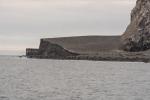
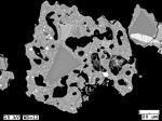
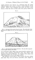
"Satellite imagery beginning December 14 shows that uplift of Bogoslof Island occurred and may have been associated with cryptodome emplacement. A Sentinel-2 satellite image from December 21 (Waythomas et al. 2019a) shows an approximately 300-m long oval-shaped raised mass just north of Castle Rock (a remnant lava dome from the 1796-1804 eruptive period; see Fig. 3). This feature was not present in a Sentinel-2 image from December 14 (Waythomas et al. 2019a; their Fig. 5a). Preliminary analysis of DEMs generated by stereo satellite pairs shows that this feature continued to grow throughout the eruption (A. Diefenbach, written comm. 2019).
"No elevated surface temperatures were seen in satellite monitoring checks at Bogoslof until January 19, and neither the uplifted block nor surrounding areas were visibly steaming in December or January in a way that would be consistent with lava effusion (Figs. 3 and 6). Samples of the material exposed along the steep, eastward face of the uplift (see Waythomas et al. 2019b) are trachyandesite lava with 58-60 wt% SiO2 and are a different composition than the dominant juvenile basalt magma erupted in 2016-2017 (Loewen et al. 2019). Given the lack of thermal signature, as well as the composition of this feature, we suggest that this uplifted feature is likely the roof above a shallow cryptodome.
"Several pilots observed a volcanic cloud in the vicinity of Bogoslof on December 21 (Fig. 4b), and were the first alert to AVO that Bogoslof had become active. A pilot later the same day reported seeing 'a new land mass' in the island cluster. This event, event 6, began a period of activity that lasted a little less than a month, with explosive events 6-22 occurring at a rate of about one every 40 h. They produced volcanic clouds of heights up to 11 km, with variable durations (2 to 102 min), and about half produced detected lightning (Table 1). Most (80 %) consisted of single seismic pulses.
"Some of the only direct observations of activity occurred during event 9 on December 23, when observers aboard a Coast Guard vessel in the area reported ash emissions, lightning, and the ejection of incandescent lava and fragmental material that lasted about an hour. The cloud from event 16 on January 5 rose to 11.8 km asl and was observed by numerous pilots and mariners (Fig. 4c).
"A Worldview-3 image from December 25 (Fig. 6b) shows a bilobate submarine vent area and new pyroclastic deposits enlarging the island and beginning to enclose a vent lagoon. On December 29, data derived from US National Imagery Systems indicated a nearly complete ring of pyroclastic deposits around a more circular, submerged, ~ 450-m-across vent area. On January 10, passengers on a helicopter that flew from Dutch Harbor to Bogoslof took photographs and video of the island that showed discolored and roiling water in the crescent-shaped vent area, and the area of uplift from December (Fig. 3b). A Worldview-3 image from January 11 (Fig. 6c) shows continued growth of the island, and abundant meter-scale ballistics on the north and south ends of the island (Waythomas et al. 2019a, their Fig. 7).
"Satellite images, pilot reports, and ground-based photos show that event 23 on January 18 was the first demonstrably ash-rich cloud of the eruption sequence. Previous explosions produced clouds that were white in color with almost no ash signal in satellite data (Schneider et al. 2019).
"Prior to event 23, as with many other explosions on the first half of the eruption, seismic stations on neighboring islands picked up precursory seismicity in the form of repeating earthquakes that became more closely spaced in time during the runup to the explosion (Tepp et al. 2019). These lasted for about 11 h. Infrasound data show that the explosion itself lasted about 80 min and was pulsatory (Lyons et al. 2019b), with seven discrete bursts of strong seismicity (Searcy and Power 2019). Despite the event’s duration, only modest lightning was produced (14 strokes; Van Eaton et al. 2019).
"Pilots reports, visual satellite images, and thewest-facing FAA web camera in Dutch Harbor (Fig. 4d) indicated that the explosion produced a dark-gray ash cloud. MODIS satellite images show the cloud rose as high as 8.5 kmasl before drifting northeast over the Alaska Peninsula. An ash signal in the brightness-temperature-difference (BTD) satellite retrieval was seen along the leading cloud edge, suggesting that the cloud interior may have been opaque (Schneider et al. 2019). This event produced 1.9 kt of SO2 and was the first since event 13 on December 31 to produce more than 0.2 kt SO2 (Lopez et al. 2019).
"A mid-infrared MODIS satellite image collected minutes after the explosion showed a possible "recovery pixel". These occur when the sensor encounters a very hot object and saturates, suggesting lava or hot tephra must have been present above the water surface (D. Schneider, written comm. 2017). These were the first elevated surface temperatures detected by satellite imagery of the eruption. Clouds moved in to obscure the volcano soon after, with no additional views prior to January 20. Because event 23 was not detected on the Okmok infrasound array, we do not have infrasound FI analysis for this event, which for other events provides information on subaerial versus submarine venting (Fee et al. 2019).
"In the week following event 23, five explosions (events 24-28) occurred with an average repose time of 42 h between them (Table 1, Fig. 8). These events had total infrasound durations of 3-15 min, produced modest lightning, observable volcanic clouds, and each up to 0.6 kt of SO2 (Table 1). None showed a clear ash signature in satellite data.
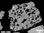
"A Worldview-2 image acquired about 10 h after event 26 shows the island with a lagoon, open to the east, with two circular craters. The one to the northwest had upwelling within it, suggesting it was above the vent for the event 26 explosion (Waythomas et al. 2019a, their Fig. 8).
"About 84 h after event 28, the longest sustained explosion of the eruptive sequence produced significant ash and resulted dramatic changes to Bogoslof Island. Event 29 comprised more than 10 short-duration explosions that were detected in seismic, infrasound, and lightning data, took place over several hours on January 31, and produced several discrete volcanic clouds.
"The event started with no detected precursors, and activity escalated from 08:40 to 09:30, as indicated by increased seismic tremor and high amplitude infrasound signals. At 09:00, a continuous volcanic plume extended for a distance of more than 200 km towards the east-southeast over Unalaska Island at an altitude of 5.9 km asl. Event 29 produced 190 lightning strokes (Table 1; Van Eaton et al. 2019) and the most significant SO2 emission since December 22, 2016 (3.6 kt; Lopez et al. 2019).
"Tephra accumulation at the vent produced a demonstrably dry volcanic edifice for the first time during event 29. Data derived from US National Imagery Systems shortly after the event showed light steaming from an apparently dry eruption crater about 400 m in diameter and as much as 100 m deep below the west crater rim. Whereas most previous explosive events in the sequence, with the possible exception of event 23 on January 18, issued from a vent in shallow seawater, freshly erupted tephra formed an almost 200-m-wide barrier separating the vent from the sea. A Worldview-3 image from about 15 h later the same day (Fig. 6d) shows that the crater had already begun to fill with seawater. As with several of the events, large ballistic blocks were visible along the island’s north southwest shoreline (Waythomas et al. 2019a, their Fig. 9).
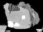
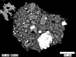
"Event 29 resulted in ashfall on Unalaska Island including trace (< 0.8 mm) amounts in the community of Dutch Harbor/ Unalaska. A sample of ash collected in Dutch Harbor comprises free crystals of plagioclase, clinopyroxene, amphibole, and rare biotite, as well as particles that display a range of groundmass textures from microlitic to glassy, and that vary from dense to vesicular (Loewen et al. 2019). The material is consistent with being a mixture of juvenile basalt scoria and non-juvenile lithics.
"Following event 29, a series of smaller explosive events occurred from February 3 to 20 (events 30-36; Table 1). During this period, the inter-event times became more variable, with some pauses of up to 9 days between events. Explosions during this time lasted minutes to a few tens of minutes, produced clouds that rose from 4.6 to 8.6 km asl (Schneider et al. 2019), 0-92 strokes of lightning (Van Eaton et al. 2019), and modest SO2 (0-1.4 kt; Lopez et al. 2019).
"A series of satellite images from January 31 through February 12 shows little change in the island’s morphology after event 29 (Fig. 6d-e; Waythomas et al. 2019a). Elevated surface temperatures detected in two MODIS images from February 6 likely reflected hot new deposits from event 31 on February 4. A high-resolution Worldview-2 satellite image from February 23 also shows little change except for the presence of ballistics particles ejected during events 32-36 (February 13-20) and distributed across the island (Waythomas et al. 2019a). A clear view from March 3 similarly shows only minor changes (Fig. 6f).
"The final event in this time interval, event 36 on February 20, was an excellent example of a Bogoslof explosion with a precursory seismic sequence (see Fig. 4 of Coombs et al. 2018). A classic sequence of coalescing earthquakes served as a prelude to the series of energetic eruptive signals that made up the event. Earthquakes were first detected at 20:42 on February 19. The sequence then maintained a relatively low rate until about 00:55 (February 20) when the rate suddenly increased to about 30 earthquakes per hour. The rate then progressively increased over the next hour almost merging to tremor by 2:00. Earthquakes ceased at 2:07 and after a1-min break transitioned to tremor. The eruptive signals consisted of about 9 blasts that were captured on multiple infrasound arrays resulting in a 40-min long explosion. The resulting plume reached 6.1 km asl and was elongated, stretching to the east-southeast over Unalaska Island. Pilots and observers on Unalaska Island at the time clearly observed the white, ice-rich cloud (Fig. 4e).
"After a 16-day pause, event 37 on March 8 lasted 200 min. It had the largest infrasound energy (Lyons et al. 2019a), seismic tremor magnitude (Tepp et al. 2019), most lightning (1437 strokes; Van Eaton et al. 2019), largest SO2 emission (21.5 kt; Lopez et al. 2019), and most significant ash cloud (Schneider et al. 2019) of any event in the eruptive sequence (though not the highest reduced displacement; Haney et al. 2019a). VIIRS satellite images showed the resulting cloud reached between 10.6 and 13.4 km asl and drifted east over Unalaska Island. Minor ashfall of a few millimeters was reported by a mariner near Cape Kovrizkha (northwest Unalaska Island; Fig. 1) who collected ash from his vessel. Like the ash sample from January 31, this ash contains particles of juvenile basaltic scoria and free crystals with minor amounts of what appear to be volcanic lithics (Loewen et al. 2019). A barely perceptible ashfall deposit was reported at Unalaska/Dutch Harbor.
"Event 37 also changed the shape of the island and temporarily dried out the vent area, as seen in a Landsat-8 image from March 8 (not shown). In infrasound data, event 37 shows a mix of low and high FI, consistent with an eruption from both submarine and subaerial vent(s) during this event (Fee et al. 2019).
"A March 11 WorldView-3 image (Fig. 6g) shows the west coast of the island grew significantly since March 3 (Fig 6f), with about 250m of new land west of the 1926-1927 dome. A new ~ 150-m wide vent was also observed on the north coast of the island, and ballistics ejecta clustered on the eastern side of the island (Waythomas et al. 2019a, their Fig. 11).
"On March 10 and 11, two multi-hour seismic swarms each produced hundreds of earthquakes as detected on station MAPS (Tepp et al. 2019), but neither led directly to an explosion. A few hours later, a precursory swarm (Tepp et al. 2019) began on March 11 and culminated on March 13 in event 38. This event produced a small cloud that reached as high as 4.1 km asl and drifted south-southwest.
"Following event 38 on March 13, there was a 9-week pause in explosive activity at Bogoslof. The only detected unrest observed during the hiatus was a swarm of volcano-tectonic earthquakes on April 15. The swarm lasted for several hours, comprised 118 detected earthquakes (catalog of Wech et al. 2018) with magnitudes between ~ 0.8 and 2.2, and is interpreted to reflect magmatic intrusion in the mid to upper crust because of the earthquakes’ weak T-phases (Wech et al. 2018).
"Satellite images from this period show the rapid surface reworking and erosion of new volcanic deposits on Bogoslof Island and coastline erosion by wave action (Waythomas et al. 2019a). Photos (Fig. 5a) and a Worldview-3 image from May 11 (Fig. 6h) show that the vent lagoon remained hot throughout the hiatus, evidenced by steam rising from the crater lagoon.
"From May 16 through August 30, AVO detected 32 explosive events at the volcano. In contrast to the events of December 2016-March 2017, few of the explosions in the later phase were preceded by detectable seismic precursors, inhibiting AVO’s ability to forecast eruptive activity (Coombs et al. 2018), though retrospective analysis of hydrophone data showed that weaker precursors were still often present (Tepp et al. 2019). Fewer events produced detectable lightning after event 40 on May 28 (Van Eaton et al. 2019). This second phase also included effusion of two short-lived subaerial lava domes.
"After a nine-week hiatus, Bogoslof erupted without detectable geophysical precursors on May 17 (event 39). This explosion lasted 200 min and produced an ash cloud that reached as high as 10 km asl and drifted south along the edge of a mass ofweather clouds, as seen in GOES satellite imagery (Schneider et al. 2019) and reported by pilots. Trace ashfall (< 0.8mm) was reported in Nikolski, Alaska, 123 km southwest of Bogoslof
(Fig. 1). As with ash samples from the previous two events, this one contains about 40 % free crystals, though the remainder of this sample is richer in juvenile scoria (as opposed to lithic fragments) than previous ones (Loewen et al. 2019).
"Following event 39, an oblique photo showed that the crater lake was breached with a 550-m wide gap along the north shore and that the northeast shore was extended by another 300 m from new tephra deposits (Fig. 5b). Eleven days after event 39, explosive event 40 occurred on May 28, also with no detected precursors. This eruption produced an ash cloud that rose to 10.1 km asl as shown in MODIS satellite images
(Schneider et al. 2019). The cloud drifted to the northeast and was reported by numerous pilots, including a report of 'sulfur' smell in cockpit from a plane about 800 km from Bogoslof. A Worldview-3 satellite image collected about 18 min after the start of the event shows the initial development of the eruption cloud (Fig. 4f; Waythomas et al. 2019a).
"These two explosive events, which occurred just after the hiatus, are among the most energetic of the eruptive sequence. They both produced appreciable SO2 clouds as detected in satellite data (9.4 and 7.7 kt; Lopez et al. 2019) and generated among the highest number of lightning strokes (647 and 719; Van Eaton et al. 2019; Fig. 8). The remnant SO2 cloud from event 40 on May 28 was still detectable over Hudson Bay, over 4000 km east of Bogoslof, on June 2. Of the 25 events analyzed by Haney et al. (2019a), the co-eruptive tremor of these two events had the highest reduced displacement of any in the sequence-both yield values of about 50 cm2, which is comparable to values calculated for eruption tremor from the largest eruptions in Alaska over the past 20 years (e.g., Redoubt in 2009; McNutt et al. 2013).
"Cosmo SkyMed radar imagery from May 31 shows a large portion of the north side of the island was removed during May 28 explosive activity, leaving a crescent-shaped bay, open to the north. This configuration of the island remained essentially intact through June 12 (Fig. 6i).
"As seen previously from a March 8 Landsat image, sometime following May 28, intense steaming recommenced from an area just southwest of the vent lagoon. This region, about 300 m in diameter, remained hot and emitting steam throughout the eruption and afterwards (Fig. 6i-l), and may have been the site of shallow magma intrusion or a filled-in vent area.
"Early June brought a series of small explosions and growth of a lava dome that breached sea level on June 5, and was then destroyed on June 10.
"Several hours after a swarm of very small earthquakes on May 31, event 41 was a 5-min long explosion that produced a small, water-rich cloud that reached as high as 7.3 km asl. Following this, cloudy weather prevented clear views of the volcano through June 4. A Sentinel 1-B SAR image from June 4 shows no dome in the crater lagoon (Fig. 7a). Midday on June 5, data derived from US National Imagery Systems indicate that a small protrusion of lava had breached water level immediately between the 1926-1927 and 1992 lava domes in northern portion of vent lagoon. By June 6, low-resolution satellite images show distinctly elevated surface temperatures at Bogoslof, suggesting that hot lava was at the surface (Fig. 8). Sentinel-1 SAR images show the growth of the dome from June 7 through June 9 (Fig. 7b,c). On June 7, data derived from US National Imagery Systems showed that the new dome was about 110 m in diameter. The dome was also seen in a COSMO SkyMed radar image from June 8 (Waythomas et al. 2019a; their Figure 15).
"During the interval of lava effusion, several small explosive events (42-47) occurred that did not disrupt the growing dome as shown by Sentinel-1 SAR data from June 9, which confirmed that dome was still there after event 47 (Fig. 7c). Several of the events (44, 45, and 47) have infrasound frequencies consistent with a subaerial vent (Fee et al. 2019).
"The June 5 lava dome was short-lived, as it was completely destroyed during a long, pulsatory explosive event on June 10 (event 48). This event started with discrete explosions detected on the Okmok infrasound array as early as 8:27 but intensifying from 11:18 to 11:38. Starting at about 12:16, activity transitioned into nearly continuous seismic and infrasound tremor signals for about 40 min. Shorter bursts of tremor continued
until 14:51, for an envelope of activity that lasted several hours. VIIRS satellite images of the resulting cloud showed it reached as high as 9.5 km asl and drifted to the northwest. Satellite data also indicated that at least part of the volcanic cloud was more ash-rich than many of those seen
previously in the Bogoslof eruptive sequence to date, suggesting that the eruption may have fragmented and incorporated the lava dome that was emplaced earlier that week (Schneider et al. 2019). This event generated 31 detected lightning strokes (Van Eaton et al. 2019).
"A Worldview-3 image from June 10, acquired after event 48, shows that the June 5 dome was no longer present (Waythomas et al. 2019a). Another, clearer Worldview-3 image from June 12 (Fig. 6i) showed ballistic blocks distributed uniformly around the island with the highest concentrations in the southeast and southwest sectors-likely remnants of the June 5 dome (Waythomas et al. 2019a). The FI of infrasound
from this event gradually decreases in the last hour of the event, suggesting a change from subaerial to submarine venting after the destruction of the lava dome (Fee et al. 2019; their Fig. 8).
"On June 13, event 49 comprised a series of four explosions that started at 01:44 and ended at about 04:34. Each pulse lasted between 10 and 30 min and generated volcanic clouds that rose to a maximum height of 3.8 km asl and dissipated within about 30 min. Residents of Unalaska/Dutch Harbor reported smelling sulfur, and winds were consistent with a source at Bogoslof. An additional 2-min long explosion was detected in seismic and infrasound data later on 13 June (event 50), with no detected ash cloud.
"There was an 11-day pause in detected explosive activity from June 13-24. During an overflight on June 22, sediment-laden water was visible in the open vent lagoon area, and the area of persistent steaming was visible just east of the December uplift area (Fig. 5c).
"Twelve explosive events occurred from June 24 to July 11 (events 51-62). These were generally short-duration, detected in seismic and infrasound data, and produced little or no lightning (Table 1). Several of these events were closely spaced groups of smaller events. A photo taken on July 3 shows the area of persistent steaming visible from behind the December uplifted block, but no activity at other areas of the island (Fig. 5d).
"Following an almost month-long pause, explosive activity resumed on August 7, with a 2-h long sequence (event 63; Table 1). Detected in seismic, infrasound, satellite, and lightning data, event 63 was longer lived than many of the events in the eruptive sequence and satellite images showed that ash from the eruption formed a continuous cloud that was carried by strong winds south over Umnak Island and then out over
the Pacific Ocean reaching an altitude of 10-12 km asl (Schneider et al. 2019). Event 63 produced one of the largest SO2 masses of the eruption, 5.8 kt, as determined by IASI satellite (Lopez et al. 2019). It also yielded the highest number of lightning strokes during the second half of the eruption (117; Van Eaton et al. 2019).
"As shown in aWorldview-2 image from August 8 (Fig. 6j), event 63 produced significant proximal tephra that expanded Bogoslof Island’s northern coastline and closed off the northfacing lagoon to create a crater lake in the vent region, perhaps even leading to a subaerial vent for some portion of this explosive event. This image also shows a large number of new ballistic blocks, primarily in the east-southeast sector of the island (Waythomas et al. 2019a, their Fig. 18). In infrasound data, event 63 shows a progression from low to high FI, consistent with a shift from submarine to subaerial venting (Fee et al. 2019).
"The final 2 weeks of the eruption were marked by mostly short-duration explosions and concurrent growth of a lava dome. Events 64 through 70 were mostly short-lived (6 min or less, except event 70 which lasted 59 min; Table 1), produced little or no lightning (Van Eaton et al. 2019), and modest SO2 (up to1.2 kt; Lopez et al. 2019). Volcanic clouds from the explosions rose to high altitudes (up to 8.7 km asl; Schneider et al. 2019) despite their short durations.
"A high-resolution Worldview-3 image on August 13 shows a vent region filled with seawater and no lava dome was apparent (Fig. 6k). On August 15, repeating low-frequency seismic events from Bogoslof were detected on Okmok and Makushin networks for about 8 h (Tepp et al. 2019). A photo from an overflight of the volcano on August 15 shows the area of persistent steaming visible since late May, but nothing at the site of the dome that would appear days later in the vent lagoon (Fig. 5e). If the August 15 seismicity was related to magma ascent, it had not yet risen shallowly enough to impact the vent lagoon area.
"A new lava dome was observed in data derived from US National Imagery Systems in the enclosed, water-filled crater on August 18 and grew to about 160 m in diameter and 20 m tall by August 22. A Sentinel SAR view shows the dome on August 20 (Fig. 7d). An oblique aerial photo taken on August 26 shows a vigorous steam plume that likely was generated as hot dome rock interacted with seawater in the vent lagoon area (Fig. 5f).
"SAR images from Sentinel-1 (Fig. 7e) and Cosmos SkyMed (Fig. 7f) on August 27, after event 66, suggest that most of this dome had been removed, with only some northern dome edge remnants remaining. The low-frequency infrasound associated with events 66-69 suggest that the vent was below water (Fee et al. 2019).
"Following the last explosive activity on August 30, there were a few earthquakes detected in seismic and hydrophone data (G. Tepp, written comm. 2019), but seismic activity quieted soon after. In August 2018, AVO added a telemetered seismometer on Bogoslof Island, which has recorded little activity of note.
"Weakly elevated surface temperatures were consistently observed at Bogoslof in low-resolution satellite images through November 2017. High-resolution satellite images from the fall of 2017 show steaming and discoloration on the island (e.g., Fig. 6l). As of 2019, continued erosion has changed the shape of the island (Waythomas et al. 2019b), similar to what occurred following previous eruptions."

Satellite image, with a red arrow pointing to the detached eruption cloud from Bogoslof, 4:15 pm December 20 AKST (01:15 am December 21 UTC). Bogoslof is the small dot circled in orange, in upper-center of the image. Yellow circle in lower-left surrounds Cleveland volcano. Thermal infra-red GOES satellite image.
Image courtesy of AVO/USGS.
Satellite image, with a red arrow pointing to the detached eruption cloud from Bogoslof, 4:15 pm December 20 AKST (01:15 am December 21 UTC). Bogoslof is the small dot circled in orange, in upper-center of the image. Yellow circle in lower-left surrounds Cleveland volcano. Thermal infra-red GOES satellite image.

Bogoslof unrest 2023

October 24, 2023 — November 24, 2023

On October 24, 2023, AVO raised the Aviation Color Code and Volcano Alert Level for Bogoslof to YELLOW/ADVISORY, stating:
"Over the past three days, over 90 earthquakes have been detected in the vicinity of Bogoslof volcano. This marks a change in behavior and the Aviation Color Code and Volcano Alert Level is being increased to YELLOW/ADVISORY. Increases in seismic activity typically precede eruptions, but many volcanoes have exhibited similar behavior that did not result in eruptions. There have been no other signs of unrest observed in satellite data over the past several days."
Seismicity levels at Bogoslof gradually declined over the next month, and no other signs of unrest were observed. On November 24, 2024, AVO returned the alert levels to UNASSIGNED, stating that activity had returned to background levels.

Bogoslof 1796/5

Bogoslof 1806

Bogoslof 1883/8

Bogoslof 1906/3

Bogoslof 1907/1

Bogoslof 1908/1

Bogoslof 1909/9

Bogoslof 1913/7

Bogoslof 1926/7

Bogoslof 1931/10

Bogoslof 1951/9

Bogoslof 1992/7

Bogoslof 2016/12

Bogoslof unrest 2023

1200
1300
1400
1500
1600
1700
1800
1900
2000
2100
2200
2300
2400
2500
1730
1740
1750
1760
1770
1780
1790
1810
1820
1830
1840
1850
1860
1870
1880
1890
1910
1920
1930
1940
1950
1960
1970
1980
1990
2010
2020
2030
2040
2050
2060
2070

14 Event Date(s)

Past Activity Legend:
Eruption
Questionable eruption
Non-eruptive activity


Showing 1 - 20 of 691

Map Images


Map References


Recently active volcanoes of Alaska, 2023

Cameron, C.E., Bull, K.F., and Macpherson, A.E., 2023, Recently active volcanoes of Alaska: Alaska Division of Geological & Geophysical Surveys Miscellaneous Publication 133 v. 6, 2 sheets. https://doi.org/10.14509/31086.

Historically active volcanoes of Alaska, v. 3, 2018

Cameron, C.E., Schaefer, J.R., and Mulliken, K.M., 2018, Historically active volcanoes of Alaska: Alaska Division of Geological & Geophysical Surveys Miscellaneous Publication 133 v. 3, 2 sheets. Http://doi.org/10.14509/30142

Historically active volcanoes of Alaska, 2014

Schaefer, J.R., Cameron, C.E., and Nye, C.J., 2014, Historically active volcanoes of Alaska: Alaska Division of Geological & Geophysical Surveys Miscellaneous Publication 133 v. 1.2, 1 sheet, scale 1:3,000,000. This publication has been superseded. Newest version available at http://www.dggs.alaska.gov/pubs/id/20181 .

Historically active volcanoes of the Aleutian Arc, 2002

Schaefer, Janet, and Nye, C. J., 2002, Historically active volcanoes of the Aleutian Arc: Alaska Division of Geological & Geophysical Surveys Miscellaneous Publication MP 0123, unpaged, 1 sheet, scale 1:3,000,000. Superceded by Miscellaneous Publication 133: http://www.dggs.dnr.state.ak.us/pubs/pubs?reqtype=citation&ID=20181

Volcanoes of Alaska, 1998

Nye, C. J., Queen, Katherine, and McCarthy, A. M., 1998, Volcanoes of Alaska: Alaska Division of Geological & Geophysical Surveys Information Circular IC 0038, unpaged, 1 sheet, scale 1:4,000,000, available at http://www.dggs.dnr.state.ak.us/pubs/pubs?reqtype=citation&ID=7043 .
Hard Copy held by AVO at FBKS - CEC shelf

Volcanoes of Alaska, 1995

Alaska Division of Geological & Geophysical Surveys, 1995, Volcanoes of Alaska: Alaska Division of Geological & Geophysical Surveys Information Circular IC 0038, unpaged, 1 sheet, scale 1:4,000,000.

Aleutian arc volcanoes, 1994

Nye, C. J., 1994, Aleutian arc volcanoes: Alaska Division of Geological & Geophysical Surveys Public-Data File PDF 94-54, unpaged, 1 sheet, scale 1:2,126,841.

Geothermal resources of the Aleutian Arc, 1993

Motyka, R. J., Liss, S. A., Nye, C. J., and Moorman, M. A., 1993, Geothermal resources of the Aleutian Arc: Alaska Division of Geological & Geophysical Surveys Professional Report PR 0114, 17 p., 4 sheets, scale 1:1,000,000.
Hard Copy held by AVO at FBKS - CEC shelf

Holocene volcanoes of the Aleutian Arc, Alaska, 1993

March, G. D., 1993, Holocene volcanoes of the Aleutian Arc, Alaska: Alaska Division of Geological & Geophysical Surveys Public-Data File PDF 93-85, unpaged, 1 sheet, scale 1:2,000,000.

Map showing distribution, composition, and age of Late Cenozoic volcanic centers in Alaska, 1986

Luedke, R. G., and Smith, R. L., 1986, Map showing distribution, composition, and age of Late Cenozoic volcanic centers in Alaska: U.S. Geological Survey Miscellaneous Investigations Series Map I 1091-F, unpaged, 3 sheets, scale 1:1,000,000.

Geology of Umnak and Bogoslof Islands, Aleutian Islands, Alaska, 1959

Byers, F. M. Jr., 1959, Geology of Umnak and Bogoslof Islands, Aleutian Islands, Alaska: in Investigations of Alaskan volcanoes, U.S. Geological Survey Bulletin 1028-L, p. 267-369, 5 sheets, scale 1 at 1:63,360, 1 at 1:96,000, and 1 at 1:300,000.
full-text PDF 3.5 MB
plate 39 PDF 2.2 MB
plate 40 PDF 3.9 MB
plate 41 PDF 5.6 MB
plate 48 PDF 85 KB
table 3 PDF 149 KB
Hard Copy held by AVO at FBKS - CEC shelf

Volcanic activity in the Aleutian Arc, 1950

Coats, R. R., 1950, Volcanic activity in the Aleutian Arc: U.S. Geological Survey Bulletin 0974-B, p. 35-49, 1 sheet, scale 1:5,000,000.
plate 1 PDF 819 KB
full-text PDF 783 KB
Hard Copy held by AVO at FBKS - CEC shelf

The submarine topography of Bogoslof, 1937

Smith, P. A., 1937, The submarine topography of Bogoslof: Geographical Review, v. 27, p. 630-636, 1 sheet, scale unknown.

Reconnaissance of the gold fields of southern Alaska with some notes on general geology, 1898

Becker, G. F., 1898, Reconnaissance of the gold fields of southern Alaska with some notes on general geology: U.S. Geological Survey Annual Report 0018, p. 1-86, 6 sheets, scale unknown.
full-text PDF 1.5 MB
Hard Copy held by AVO at FBKS - CEC file cabinet

References

Automatic identification and quantification of volcanic hotspots in Alaska using HotLINK: the hotspot learning and identification network, 2024

Saunders-Schultz, P., Lopez, T., Dietterich, H., and Girona, T., 2024, Automatic identification and quantification of volcanic hotspots in Alaska using HotLINK - the hotspot learning and identification network: Frontiers in Earth Science v. 12, 1345104. https://doi.org/10.3389/feart.2024.1345104
Full-text PDF 46.1 MB

Deep learning detection and quantification of volcanic thermal signals in infrared satellite data, 2024

Sanders-Schultz, P., 2024, Deep learning detection and quantification of volcanic thermal signals in infrared satellite data: Fairbanks, Alaska, University of Alaska Fairbanks, M.S. thesis, 64 p.
Full-text PDF 2.9 MB

From field station to forecast: managing data at the Alaska Volcano Observatory, 2024

Coombs, M.L., Cameron, C.E., Dietterich, H.R., Boyce, E.S., Wech, A.G., Grapenthin, R., Wallace, K.L., Parker, T., Lopez, T., Crass, S., Fee, D., Haney, M.M., Ketner, D., Loewen, M.W., Lyons, J.J., Nakai, J.S., Power, J.A., Botnick, S., Brewster, I., Enders, M.L., Harmon, D., Kelly, P.J., and Randall, M., 2024, From field station to forecast: managing data at the Alaska Volcano Observatory: Bulletin of Volcanology v. 86, 79. https://doi.org/10.1007/s00445-024-01766-0

Dating individual zones in phenocrysts from the 2016–2017 eruption of Bogoslof volcano provides constraints on timescales of magmatic processes, 2023

Moshrefzadeh, J., Izbekov, P., Loewen, M., Larsen, J., and Regan, S., 2023, Dating individual zones in phenocrysts from the 2016–2017 eruption of Bogoslof volcano provides constraints on timescales of magmatic processes: Journal of Volcanology and Geothermal Research v. 435, article no. 107741, 16 p. https://doi.org/10.1016/j.jvolgeores.2022.107741.

Recently active volcanoes of Alaska, 2023

Cameron, C.E., Bull, K.F., and Macpherson, A.E., 2023, Recently active volcanoes of Alaska: Alaska Division of Geological & Geophysical Surveys Miscellaneous Publication 133 v. 6, 2 sheets. https://doi.org/10.14509/31086.

Along-arc volcanism in the western and central Aleutian from 2015 to 2021 revealed by cloud-based InSAR processing, 2023

Wang, J., Lu, Z., Bekaert, D., Marshak, C., Govorcin, M., Sangha, S., Kennedy, J., and Gregg, P., 2023, Along-arc volcanism in the western and central Aleutian from 2015 to 2021 revealed by cloud-based InSAR processing: Geophysical Research Letters v. 50, no. 23, e2023GL106323. https://doi.org/10.1029/2023GL106323
Full-text PDF 3.9 MB

Infrasound single-channel noise reduction: application to detection and localization of explosive volcanism in Alaska using backprojection and array processing, 2023

Sanderson, R.W., Matoza, R.S., Fee, D., Haney, M.M., and Lyons, J.J., 2023, Infrasound single-channel noise reduction: application to detection and localization of explosive volcanism in Alaska using backprojection and array processing: Geophysical Journal International v. 232, no. 2, p. 1684-1712. https://doi.org/10.1093/gji/ggac182

Phases in fine volcanic ash, 2023

Hornby, A., Gazel, E., Bush, C., Dayton, K., and Mahowald, N., 2023, Phases in fine volcanic ash: Scientific Reports v. 13, 15728. https://doi.org/10.1038/s41598-023-41412-x
Full-text PDF 3.7 MB

Alaska interagency operating plan for volcanic ash episodes, 2022

Alaska Volcano Observatory, National Oceanic and Atmospheric Administration, National Weather Service, Federal Aviation Administration, Department of Defense, United States Coast Guard, Division of Homeland Security and Emergency Management, Alaska Department of Environmental Conservation, and Alaska Department of Health and Social Services (participating agencies), 2022, Alaska interagency operating plan for volcanic ash episodes, 85 p.

Geologic database of information on volcanoes in Alaska (GeoDIVA), 2022

Cameron, C.E., Crass, S.W., and AVO Staff, eds, 2022, Geologic database of information on volcanoes in Alaska (GeoDIVA): Alaska Division of Geologic and Geophysical Surveys Digital Data Series 20, https://doi.org/10.14509/geodiva, https://doi.org/10.14509/30901.

Quantifying eruptive and background seismicity, deformation, degassing, and thermal emissions at volcanoes in the United States during 1978-2020, 2021

Reath, K., Pritchard, M.E., Roman, D.C., Lopez, T., Carn, S., Fischer, T.P., Lu, Z., Poland, M.P., Vaughan, R.G., Wessels, R., Wike, L.L., and Tran, H.K., 2021, Quantifying eruptive and background seismicity, deformation, degassing, and thermal emissions at volcanoes in the United States during 1978-2020: Journal of Geophysical Research: Solid Earth, v. 126, e2021JB021684, doi: 10.1029/2021JB021684.

Seismo-acoustic evidence for vent drying during shallow submarine eruptions at Bogoslof volcano, Alaska, 2020

Fee, David, Lyons, John, Haney, Matthew, Wech, Aaron, Waythomas, Christopher, Diefenbach, A.K., Lopez, Taryn, Van Eaton, Alexa, and Schneider, David, 2020, Seismo-acoustic evidence for vent drying during shallow submarine eruptions at Bogoslof volcano, Alaska: Bulletin of Volcanology, v. 82, n. 2, 14 p.,doi:10.1007/s00445-019-1326-5.

Historically active volcanoes of Alaska, v. 4, 2020

Cameron, C.E., Schaefer, J.R., and Ekberg, P.G., 2020, Historically active volcanoes of Alaska: Alaska Division of Geological & Geophysical Surveys Miscellaneous Publication 133 v. 4, 2 sheets. Http://doi.org/10.14509/30426

Evolving infrasound detections from Bogoslof volcano, Alaska: insights from atmospheric propagation modeling, 2020

Schwaiger, H.F., Lyons, J.J., Iezzi, A.M., Fee, David, and Haney, M.M., 2020, Evolving infrasound detections from Bogoslof volcano, Alaska: insights from atmospheric propagation modeling: Bulletin of Volcanology, v. 82, n. 27, doi:10.1007/s00445-020-1360-3.

Geology and eruptive history of Bogoslof volcano, 2020

Waythomas, C.F., Loewen, M., Wallace, K.L., Cameron, C.E., and Larsen, J.F., 2020, Geology and eruptive history of Bogoslof volcano: Bulletin of Volcanology, v. 82, doi: https://doi.org/10.1007/s00445-019-1352-3.

Infrasound generated by the 2016-2017 shallow submarine eruption of Bogoslof volcano, Alaska, 2020

Lyons, J.J., Iezzi, A.M., Fee, David, Schwaiger, H.F., Wech, A.G., and Haney, M.M., 2020, Infrasound generated by the 2016-2017 shallow submarine eruption of Bogoslof volcano, Alaska: Bulletin of Volcanology, n. 82, doi: https://doi.org/10.1007/s00445-019-1355-0.

Seismic character and progression of explosive activity during the 2016-2017 eruption of Bogoslof volcano, Alaska, 2020

Searcy, Cheryl, and Power, J.A., 2020, Seismic character and progression of explosive activity during the 2016-2017 eruption of Bogoslof volcano, Alaska: Bulletin of Volcanology, n. 82, doi: https://doi.org/10.1007/s00445-019-1343-4.

Constraints on eruption processes and event masses for the 2016-2017 eruption of Bogoslof volcano, Alaska, through evalution of IASI satellite SO2 masses and complementary datasets, 2020

Lopez, Taryn, Lieven, Clarisse, Schwaiger, Hans, Van Eaton, Alexa, Loewen, Matthew, Fee, David, Lyons, John, Wallace, Kristi, Searcy, Cheryl, Wech, Aaron, Haney, Matthew, Schnieder, David, and Graham, Nathan, 2020, Constraints on eruption processes and event masses for the 2016-2017 eruption of Bogoslof volcano, Alaska, through evalution of IASI satellite SO2 masses and complementary datasets: Bulletin of Volcanology, v. 82, doi: https://doi.org/10.1007/s00445-019-1348-z.

Seismic and hydroacoustic observations of the 2016-17 Bogoslof eruption, 2020

Tepp, Gabrielle, Dziak, R.P., Haney, M.M., Lyons, J.J., Searcy, Cheryl, Matsumoto, Haru, and Haxel, Joseph, 2020, Seismic and hydroacoustic observations of the 2016-17 Bogoslof eruption: Bulletin of Volcanology, v. 82, doi: https://doi.org/10.1007/s00445-019-1344-3.

Characteristics of thunder and electromagnetic pulses from volcanic lightning at Bogoslof volcano, Alaska, 2020

Haney, M.M., Van Eaton, A.R., Lyons, J.J., Kramer, R.L., Fee, David, Iezzi, A.M., Dziak, R.P., Anderson, Jacob, Johnson, J.B., Lapierre, J.L., and Stock, Michael, 2020, Characteristics of thunder and electromagnetic pulses from volcanic lightning at Bogoslof volcano, Alaska: Bulletin of Volcanology v. 82, doi: https://doi.org/10.1007/s00445-019-1349-y.

Mechanisms for ballistic block ejection during the 2016-2017 shallow submarine eruption of Bogoslof volcano, Alaska, 2020

Waythomas, C.F., and Mastin, L.G., 2020, Mechanisms for ballistic block ejection during the 2016-2017 shallow submarine eruption of Bogoslof volcano, Alaska: Bulletin of Volcanology, v. 82, doi: https://doi.org/10.1007/s00445-019-1351-4.

Co-eruptive tremor from Bogoslof volcano: seismic wavefield composition at regional distances, 2020

Haney, M.M., Fee, David, McKee, K.F., Lyons, J.J., Matoza, R.S., Wech, A.G., Tepp, Gabrielle, Searcy, Cheryl, and Mikesell, T.D., 2020, Co-eruptive tremor from Bogoslof volcano: seismic wavefield composition at regional distances: Bulletin of Volcanology, v. 82, doi: https://doi.org/10.1007/s00445-019-1347-0.

Satellite observations of the 2016-2017 eruption of Bogoslof volcano: aviation and ash fallout hazard implications from a water-rich eruption, 2020

Schneider, D.J., Van Eaton, A.R., and Wallace, K.L., 2020, Satellite observations of the 2016-2017 eruption of Bogoslof volcano: aviation and ash fallout hazard implications from a water-rich eruption: Bulletin of Volcanology, v, 82, doi: https://doi.org/10.1007/s00445-020-1361-2.

Remote detection and location of explosive volcanism in Alaska with the EarthScope Transportable Array, 2020

Sanderson, R.W., Matoza, R.S., Fee, David, Haney, M.M., and Lyons, J.J., 2020, Remote detection and location of explosive volcanism in Alaska with the EarthScope Transportable Array: Journal of Geophysical Research: Solid Earth, v. 125, 23 p., doi: https://doi.org/10.1029/2019JB018347

Forecasting, detecting, and tracking volcanic eruptions from space, 2020

Poland, M.P., Lopez, Taryn, Wright, Robert, and Pavolonis, M.J., 2020, Forecasting, detecting, and tracking volcanic eruptions from space: Remote Sensing in Earth Systems Science, 40 p., https://doi.org/10.1007/s41976-020-00034-x

2016 Volcanic activity in Alaska - Summary of events and response of the Alaska Volcano Observatory, 2020

Cameron, C.E., Dixon, J.P., Waythomas, C.F., Iezzi, A.M., Wallace, K.L., McGimsey, R.G., and Bull, K.F., 2020, 2016 Volcanic activity in Alaska-Summary of events and response of the Alaska Volcano Observatory: U.S. Geological Survey Scientific Investigations Report 2020-5125, 63 p., https://doi.org/10.3133/sir20205125.

2017 Volcanic activity in Alaska-Summary of events and response of the Alaska Volcano Observatory, 2020

Dixon, J.P., Cameron, C.E., Iezzi, A.M., Power, J.A., Wallace, K., and Waythomas, C.F., 2020, 2017 Volcanic activity in Alaska-Summary of events and response of the Alaska Volcano Observatory: U.S. Geological Survey Scientific Investigations Report 2020-5102, 61 p., https://doi.org/10.3133/sir20205102.

AVO-G2S: A modified, open-source Ground-to-Space atmospheric specification for infrasound modeling, 2019

Schwaiger, H.F., Iezzi, A.M., and Fee, David, 2019, AVO-G2S: A modified, open-source Ground-to-Space atmospheric specification for infrasound modeling: Computers and Geosciences, v. 125, p. 90-97, doi:10.1016/j.cageo.2018.12.013.

Catalog of earthquake parameters and description of seismograph and infrasound stations at Alaskan volcanoes - January 1, 2013, through December 31, 2017, 2019

Dixon, J.P., Stihler S.D., Haney, M.M., Lyons, J.J., Ketner, D.M., Mulliken, K.M., Parker, T., and Power, J.A., 2019, Catalog of earthquake parameters and description of seismograph and infrasound stations at Alaskan volcanoes - January 1, 2013, through December 31, 2017: U.S. Geological Survey Data Series 1115, 92 p., https://doi.org/10.3133/ds1115.

Infrasound from giant bubbles during explosive submarine eruptions, 2019

Lyons, J.J., Haney, M.M., Fee, David, Wech, A.G., and Waythomas, C.F., 2019, Infrasound from giant bubbles during explosive submarine eruptions: Nature Geoscience, v. 12, p. 952-958, doi:10.1038/s41561-019-0461-0.

Overview, chronology, and impacts of the 2016-2017 eruption of Bogoslof volcano, Alaska, 2019

Coombs, Michelle, Wallace, Kristi, Cameron, Cheryl, Lyons, John, Wech, Aaron, Angeli, Kim, and Cervelli, Peter, 2019, Overview, chronology, and impacts of the 2016-2017 eruption of Bogoslof volcano, Alaska: Bulletin of Volcanology, v, 81, n. 62, doi:10.1007/s00445-019-1322-9.

Comparison of short-term seismic precursors and explosion parameters during the 2016-2017 Bogoslof eruption, 2019

Tepp, Gabrielle, and Haney, Matthew, 2019, Comparison of short-term seismic precursors and explosion parameters during the 2016-2017 Bogoslof eruption: Bulletin of Volcanology, v. 81, n. 63, doi:10.1007/s00445-019-1323-8.

The 2016-2017 eruption of Bogoslof volcano, Alaska: preface to the special issue, 2019

Waythomas, C.F., Lyons, J.J., Fee, David, and Wallace, K.L., 2019, The 2016-2017 eruption of Bogoslof volcano, Alaska: preface to the special issue: Bulletin of Volcanology, v. 81, n. 48, doi:10.1007/s00445-019-1301-1.

Petrology of the 2016-2017 eruption of Bogoslof Island, Alaska, 2019

Loewen, M.L., Izbekov, Pavel, Moshrefzadeh, Jamshid, Coombs, Michelle, Larsen, Jessica, Graham, Nathan, Harbin, Michelle, Waythomas, Christopher, and Wallace, Kristi, 2019, Petrology of the 2016-2017 eruption of Bogoslof Island, Alaska: Bulletin of Volcanology v. 81, n. 72, 20 p., doi:10.1007/s00445-019-1333-6.

2016-17 evolution of the submarine-subaerial edifice of Bogoslof volcano, Alaska, based on analysis of satellite imagery, 2019

Waythomas, C.F., Angeli, K., Wessels, R., and Schneider, D, 2020, 2016-17 evolution of the submarine-subaerial edifice of Bogoslof volcano, Alaska, based on analysis of satellite imagery: Bulletin of Volcanology v. 82, doi:https://doi.org/10.1007/s00445-020-1363-0.

Scientists Capture Sounds of Volcanic Thunder, 2018

Associated Press, 2018, Scientists Capture Sounds of Volcanic Thunder: American Geophysical Union press release published online March 13, 2018, available at https://news.agu.org/press-release/scientists-capture-sounds-of-volcanic-thunder/

Volcanic thunder from explosive eruptions at Bogoslof volcano, Alaska, 2018

Haney, M.M., Van Eaton, A.R., Lyon, J.J., Kramer, R.L., Fee, David, Iexxi, A.M., 2018, Volcanic thunder from explosive eruptions at Bogoslof volcano, Alaska: Geophysical Research Letters, v. 45, n. 8, doi: 10.1002/2017/GL076911.

The inaudible rumble of volcanic eruptions, 2018

Matoza, R.S., and Fee, David, 2018, The inaudible rumble of volcanic eruptions: Acoustics Today, v. 14, n. 1, p. 17-25.

The Alaska Volcano Observatory: 30 years of protecting Alaskans from the effects of volcanic activity (1988-2018), 2018

Mulliken, K.M., 2018, The Alaska Volcano Observatory: 30 years of protecting Alaskans from the effects of volcanic activity (1988-2018): Alaska Division of Geological & Geophysical Surveys Information Circular 67, 2 p. http://doi.org/10.14509/30032

Short-term forecasting and detection of explosions during the 2016-2017 eruption of Bogoslof Volcano, Alaska, 2018

Coombs, M.L., Wech, A.G., Haney, M.M., Lyons, J.J., Schneider, D.J., Schwaiger, H.F., Wallace, K.L., Fee, David, Freymueller, J.T., Schaefer, J.R., and Tepp, Gabrielle, 2018, Short-term forecasting and detection of explosions during the 2016-2017 eruption of Bogoslof Volcano, Alaska: Frontiers in Earth Science, v. 6, article 122, doi: 10.3389/feart.2018.00122 .

Historical eruptions and hazards at Bogoslof volcano, Alaska, 2018

Waythomas, C.F., and Cameron, C.E., 2018, Historical eruptions and hazards at Bogoslof volcano, Alaska: U.S. Geological Survey Scientific Investigations Report 2018-5085, 42 p., https://doi.org/10.3133/sir20185085.

2018 update to the U.S. Geological Survey national volcanic threat assessment, 2018

Ewert, J.W., Diefenbach, A.K., and Ramsey, D.W., 2018, 2018 update to the U.S. Geological Survey national volcanic threat assessment: U.S. Geological Survey Scientific Investigations Report 2018-5140, 40 p., https://pubs.usgs.gov/sir/2018/5140/sir20185140.pdf.

A repeating event sequence alarm for monitoring volcanoes, 2018

Tepp, Gabrielle, 2018, A repeating event sequence alarm for monitoring volcanoes: Seismological Research Letters, v, 89, n. 5, p. 1863-1876, doi:10.1785/0220170263

Volcanology at DGGS, 2018

Mulliken, K.M., 2018, Volcanology at DGGS: Alaska Division of Geological & Geophysical Surveys Information Circular 74, 2 p., http://doi.org/10.14509/30118

Using earthquakes, T waves, and infrasound to investigate the eruption of Bogoslof Volcano, Alaska, 2018

Wech, A., Tepp, G., Lyons, J., and Haney, M., 2018, Using earthquakes, T waves, and infrasound to investigate the eruption of Bogoslof volcano, Alaska: Geophysical Research Letters, v. 45, no. 14, p. 6918-6925.

Historically active volcanoes of Alaska, v. 3, 2018

Cameron, C.E., Schaefer, J.R., and Mulliken, K.M., 2018, Historically active volcanoes of Alaska: Alaska Division of Geological & Geophysical Surveys Miscellaneous Publication 133 v. 3, 2 sheets. Http://doi.org/10.14509/30142

Another Bogoslof eruption sends ash over Alaska Peninsula, Kodiak Island, 2017

Associated Press, 2017, Another Bogoslof eruption sends ash over Alaska Peninsula, Kodiak Island: Anchorage Daily News article published online January 19, 2017, available at https://www.adn.com/alaska-news/aviation/2017/01/19/another-bogoslof-eruption-sends-ash-over-alaska-peninsula-kodiak-island/

Ash falls in Unalaska after Bogoslof eruption, 2017

Associated Press, 2017, Ash falls in Unalaska after Bogoslof eruption: Alaska Dispatch News article published online January 31, 2017, available at https://www.adn.com/alaska-news/environment/2017/01/31/unalaska-receives-ashfall-after-bogoslof-eruption/

Alaska volcano erupts; ash trace reaches city, 2017

Associated Press, 2017, Alaska volcano erupts; ash trace reaches city: Fox News article published online January 31, 2017, available at http://www.foxnews.com/us/2017/01/31/alaska-volcano-erupts-ash-trace-reaches-city.html

Volcanic ash falls on unalaska in Bogoslof's longest eruption yet, 2017

Associated Press, 2017, Volcanic ash falls on unalaska in Bogoslof's longest eruption yet: KUBC KIAL Unalaska Community Broadcasting article published online January 31, 2017, available at http://kucb.org/post/volcanic-ash-falls-unalaska-bogoslofs-longest-eruption-yet

2 Alaska volcanoes erupt just hours apart, 2017

Associated Press, 2017, 2 Alaska volcanoes erupt just hours apart: Anchorage Daily News article published online May 17, 2017, available at https://www.adn.com/alaska-news/science/2017/05/17/2-alaska-volcanoes-erupt-just-hours-apart/

Volcanic Explosions Rock an Alaskan Island as Etna Rumbles, 2017

Klemetti, E., 2017, Volcanic Explosions Rock an Alaskan Island as Etna Rumbles: Wired article published online May 19, 2017, available at https://www.wired.com/2017/05/volcanic-explosions-rock-alaskan-island-etna-rumbles/

‘Unpredictable’ Bogoslof Volcano erupts - again, 2017

Associated Press, 2017, ‘Unpredictable’ Bogoslof Volcano erupts - again: KTVA Alaska article published online May 16, 2017, available at http://www.ktva.com/gallery-unpredictable-bogoslof-volcano-captured-camera-340/

Three Alaska Peninsula volcanoes are restless, 2017

Lill, A., 2017, Three Alaska Peninsula volcanoes are restless: KDLG Dillingham, Alaska article published online June 9, 2017, available at http://kdlg.org/post/three-alaska-peninsula-volcanoes-are-restless#stream/0

Alaskan volcano spews plumes of ash into the Bering Sea in breathtaking new image captured by NASA satellite, 2017

Liberator, S., 2017, Alaskan volcano spews plumes of ash into the Bering Sea in breathtaking new image captured by NASA satellite: Daily Mail article published online June 9, 2017, available at http://www.dailymail.co.uk/sciencetech/article-4590148/NASA-releases-image-volcano-plume-seen-space.html

Alaska volcano erupts again, forcing new aviation alert, 2017

Associated Press, 2017, Alaska volcano erupts again, forcing new aviation alert: CBS News article published online May 30, 2017, available at http://www.cbsnews.com/news/alaska-volcano-bogoslof-erupts-again-aviation-alert-raised/

Story Time w/ Aunt Phil: Bogoslof Volcano, 2017

Bill, L. D., 2017, Story Time w/ Aunt Phil: Bogoslof Volcano: KTVA Alaska article published online June 12, 2017, available at http://www.ktva.com/story-time-w-aunt-phil-bogoslof-volcano-495/

Ask the Experts: Alaska’s Bogoslof Volcano Erupted Again-Why Was It So Hard to Predict?, 2017

Harris, M., 2017, Ask the Experts: Alaska’s Bogoslof Volcano Erupted Again-Why Was It So Hard to Predict?: Scientific American article published online May 31, 2017, available at https://www.scientificamerican.com/article/ask-the-experts-alaska-rsquo-s-bogoslof-volcano-erupted-again-mdash-why-was-it-so-hard-to-predict/

Island-Altering Eruption of Alaska's Bogoslof Volcano Seen in Images from Space, 2017

Breslin, S., 2017, Island-Altering Eruption of Alaska's Bogoslof Volcano Seen in Images from Space: The Weather Channel article published online June 8, 2017, available at https://weather.com/news/news/bogoslof-volcano-eruption-photos-digitalglobe-alaska

Alaska's Bogoslof Volcano Sees Pulses of Short Eruptions, 2017

Associated Press, 2017, Alaska's Bogoslof Volcano Sees Pulses of Short Eruptions: U.S. News & World Report article published online June 13, 2017, available at https://www.usnews.com/news/best-states/alaska/articles/2017-06-13/alaskas-bogoslof-volcano-sees-pulses-of-short-eruptions

Bogoslof volcano news & activity updates: Bogoslof volcano (Aleutian Islands): new series of larger explosions, 2017

Unknown, 2017, Bogoslof volcano news & activity updates: Bogoslof volcano (Aleutian Islands): new series of larger explosions: Volcano Discovery article published online June 13, 2017, available at https://www.volcanodiscovery.com/bogoslof/news/63661/Bogoslof-volcano-Aleutian-Islands-new-series-of-larger-explosions.html

Lightning network helps confirm volcanic eruption, 2017

Frey, M., 2017, Lightning network helps confirm volcanic eruption: KTVA article published online May 30, 2017, available at http://www.ktva.com/lightning-network-helps-confirm-volcanic-eruption-243/

Pretty Volcanic Plume Seen in Space Image, 2017

Pappas, S., 2017, Pretty Volcanic Plume Seen in Space Image: Live Science article published online June 9, 2017, available at https://www.livescience.com/59425-bogoslof-volcanic-plume-space-image.html

Scientist says Bogoslof has history of eruptive sequences, 2017

Associated Press, 2017, Scientist says Bogoslof has history of eruptive sequences: KTUU article published online May 21, 2017, available at http://www.ktuu.com/content/news/Sc-423570894.html

NASA Shares Beautiful Image Of Volcanic Eruption Aftermath As Seen From Space, 2017

Associated Press, 2017, NASA Shares Beautiful Image Of Volcanic Eruption Aftermath As Seen From Space: IFL Science article published online June 5, 2017, available at http://www.iflscience.com/environment/nasa-shares-beautiful-image-of-volcanic-eruption-aftermath-as-seen-from-space/

Photographs show how Alaska volcano's eruptions have changed island, 2017

Associated Press, 2017, Photographs show how Alaska volcano's eruptions have changed island: CBS News article published online January 12, 2017, available at http://www.cbsnews.com/news/bogoslof-island-alaska-eruptions-photographs/

With Bogoslof volcano's continuing eruptions, island has tripled in size, 2017

Andrews, L., 2017, With Bogoslof volcano's continuing eruptions, island has tripled in size: ADN article published online February 18, 2017, available at https://www.adn.com/alaska-news/2017/02/18/with-bogoslof-volcanos-continuing-eruptions-island-has-tripled-in-size/

Blowing its top: an explanation of Bogoslof Volcano's eruptions, latest on Thursday, 2017

Winkle, K., 2017, Blowing its top: an explanation of Bogoslof Volcano's eruptions, latest on Thursday: KTUU article published online January 5, 2017, available at http://www.ktuu.com/content/news/Bogoslof-Volcano-erupts-a-409836685.html

Bogoslof Volcano In Alaska Erupts Spewing Ash Clouds, 2017

Gordon, A., 2017, Bogoslof Volcano In Alaska Erupts Spewing Ash Clouds: Tech Times article published online March 14, 2017, available at http://www.techtimes.com/articles/201539/20170314/bogoslof-volcano-in-alaska-erupts-spewing-ash-clouds.htm

Bogoslof volcano settles down after sending ash over Alaska Peninsula, Kodiak Island, 2017

Klint, C., 2017, Bogoslof volcano settles down after sending ash over Alaska Peninsula, Kodiak Island: ADN article published online January 19, 2017, available at https://www.adn.com/alaska-news/aviation/2017/01/19/another-bogoslof-eruption-sends-ash-over-alaska-peninsula-kodiak-island/

Explosion at Bogoslof Volcano prompts ninth aviation warning during weeks-long eruption, 2017

Mackintosh, C., 2017, Explosion at Bogoslof Volcano prompts ninth aviation warning during weeks-long eruption: KTUU article published online January 18, 2017, available at http://www.ktuu.com/content/news/Explosion-at-Bogoslof-Volcano-prompts-ninth-aviation-warning-since-eruption-began-411143435.html

No high-altitude ash from latest Bogoslof eruption, scientists say, 2017

Klint, C., 2017, No high-altitude ash from latest Bogoslof eruption, scientists say: ADN article published online February 13, 2017, available at https://www.adn.com/alaska-news/environment/2017/02/13/bogoslof-eruption-with-ash-cloud-likely-puts-scientists-on-alert/

Is Bogoslof Volcano done erupting?, 2017

Kraegel, L., 2017, Is Bogoslof Volcano done erupting?: Alaska Public Media article published online April 6, 2017, available at http://www.alaskapublic.org/2017/04/06/is-bogoslof-volcano-done-erupting/

Highest aviation alert level issued after Alaskan volcano erupts, 2017

McKirdy, E., and Sutton, J., 2017, Highest aviation alert level issued after Alaskan volcano erupts: CNN article published online May 29, 2017, available at http://www.cnn.com/2017/05/29/us/alaska-bogoslof-volcano-eruption/index.html

Alaska’s Bogoslof volcano explodes, 2017

Associated Press, 2017, Alaska’s Bogoslof volcano explodes: South China Morning Post article published online March 9, 2017, available at http://www.scmp.com/news/world/united-states-canada/article/2077271/alaskas-bogoslof-volcano-explodes

No major explosions at Bogoslof in over a month, researchers say, 2017

Mackintosh, C., 2017, No major explosions at Bogoslof in over a month, researchers say: KTUU article published online April 14, 2017, available at http://www.ktuu.com/content/news/No-major-explosions-at-Bogoslof-in-over-a-month-researchers-say-419514723.html

‘Explosive events’ rock Pacific Ocean, 2017

Palin, M., 2017, ‘Explosive events’ rock Pacific Ocean: News.com article published online March 20, 2017, available at http://www.news.com.au/technology/environment/natural-wonders/explosive-events-rock-pacific-ocean/news-story/618b9ee04ece0d80e69c02ebe5c92d94

Not All Eruptions Are Equal For Submarine Bogoslof Volcano, 2017

Kraegel, L., 2017, Not All Eruptions Are Equal For Submarine Bogoslof Volcano: KUCB article published online February 7, 2017, available at http://kucb.org/post/not-all-eruptions-are-equal-submarine-bogoslof-volcano

New equipment helps scientists keep tabs on Bogoslof now and study it later, 2017

Sobel, Z., 2017, New equipment helps scientists keep tabs on Bogoslof now and study it later: Alaska Public Media article published online June 19, 2017, available at http://www.alaskapublic.org/2017/06/19/new-equipment-helps-scientists-keep-tabs-on-bogoslof-now-and-study-it-later/

2 Bogoslof eruptions send ash clouds miles above Aleutians, 2017

Hollander, Z., 2017, 2 Bogoslof eruptions send ash clouds miles above Aleutians: Alaska Dispatch News article published online June 27, 2017, available at https://www.adn.com/alaska-news/environment/2017/06/27/bogoslof-erupts-yet-again-with-more-to-come-soon/

Ash cloud restricts Asia-US airfreight, 2017

Cheshire, L., 2017, Ash cloud restricts Asia-US airfreight: Asia Fruit article published online June 27, 2017, available at http://www.fruitnet.com/asiafruit/article/172636/volcanic-ash

Air freight shippers hit as volcanic ash plume hits transpacific capacity, 2017

Lennane, A., 2017, Air freight shippers hit as volcanic ash plume hits transpacific capacity: Loadstar article published online June 26, 2017, available at https://theloadstar.co.uk/air-freight-shippers-hit-volcanic-ash-plume-hits-transpacific-capacity/

Alaska’s tiny Bogoslof volcano erupts again, sending an ash cloud miles above the Aleutians, 2017

Hanlon, T., 2017, Alaska’s tiny Bogoslof volcano erupts again, sending an ash cloud miles above the Aleutians: Anchorage Daily News article published online August 7, 2017, available at https://www.adn.com/alaska-news/2017/08/07/alaskas-tiny-bogoslof-volcano-erupts-again-sending-an-ash-cloud-miles-above-the-aleutians/.

Bogoslof Volcano in 'Unpredictable Condition' After Eruption Sends Ash 30,000 Feet into the Air, 2017

Glum. J., 2017, Bogoslof Volcano in 'Unpredictable Condition' After Eruption Sends Ash 30,000 Feet into the Air: Newsweek article published online July 10, 2017, available at http://www.newsweek.com/bogoslof-volcano-eruption-alaska-flights-634298.

Historically active volcanoes of Alaska, 2016

Cameron, C.E., and Schaefer, J.R., 2016, Historically active volcanoes of Alaska: Alaska Division of Geological & Geophysical Surveys Miscellaneous Publication 133 v. 2, 1 sheet, scale 1:3,000,000. http://doi.org/10.14509/20181

An Alaskan Volcano Erupts, Largely Out of View, 2016

Fountain, H., 2017, An Alaskan Volcano Erupts, Largely Out of View: The New York Times article published online December 30, 2016, available at https://www.nytimes.com/2016/12/30/science/an-alaskan-volcano-bogoslof-erupts-largely-out-of-view.html?_r=0

Bogoslof volcano just erupted again, 2016

Zak, A., 2017, Bogoslof volcano just erupted again: ADN article published online December 31, 2016, available at https://www.adn.com/alaska-news/science/2016/12/31/aviators-in-the-aleutians-be-on-alert-bogoslof-volcano-just-erupted-again/

Bogoslof Volcano in Alaska Unexpectedly Erupts, 2016

Klemetti, E., 2017, Bogoslof Volcano in Alaska Unexpectedly Erupts: Wired article published online December 21, 2016, available at https://www.wired.com/2016/12/bogoslof-volcano-alaska-unexpectedly-erupts/

Bogoslof volcano erupts again, sends up another ash plume, 2016

Klint, C., 2017, Bogoslof volcano erupts again, sends up another ash plume: ADN article published online December 23, 2016, available at https://www.adn.com/alaska-news/science/2016/12/23/bogoslof-volcano-erupts-again-sends-up-30000-foot-ash-plume/

Alaska Volcano Observatory image database, 2016

Cameron, C.E., and Snedigar, S.F., 2016, Alaska Volcano Observatory image database: Alaska Division of Geological & Geophysical Surveys Digital Data Series 13, https://www.avo.alaska.edu/images/. https://doi.org/10.14509/29689.

Historically active volcanoes of Alaska, 2014

Schaefer, J.R., Cameron, C.E., and Nye, C.J., 2014, Historically active volcanoes of Alaska: Alaska Division of Geological & Geophysical Surveys Miscellaneous Publication 133 v. 1.2, 1 sheet, scale 1:3,000,000. This publication has been superseded. Newest version available at http://www.dggs.alaska.gov/pubs/id/20181 .

Preliminary database of Quaternary vents in Alaska, 2014

Cameron, C.E., and Nye, C.J., 2014, Preliminary database of Quaternary vents in Alaska: Alaska Division of Geological & Geophysical Surveys Miscellaneous Publication 153, 11 p., doi:10.14509/27357 .

InSAR imaging of Aleutian volcanoes, 2014

Lu, Zhong, and Dzurisin, Daniel, 2014, InSAR imaging of Aleutian volcanoes: Chichester, UK, Springer-Praxis, 390 p.

Avian mortality associated with a volcanic gas seep at Kiska Island, Aleutian Islands, Alaska, 2012

Bond, A.L., Evans, W.C., and Jones, I.L., 2012, Avian mortality associated with a volcanic gas seep at Kiska Island, Aleutian Islands, Alaska: The Wilson Journal of Ornithology, v. 124, n. 1, p. 146-151.

Katmai scientific studies, 2012

Winfree, Robert, with contributions from Bacon, C.R., Bennett, A.J., Bennington, Ninfa, Berg, E.E., Brooks, Margi, Coletti, H.A., Coombs, M.L., Fierstein, Judy, Freeburg, Gary, Frost, G.V., Haney, Matthew, Jorgenson, M.T., Miller, A.E., Moran, Seth, Murphy, Rachel, Partnow, Patricia, Paskievitch, John, Stevens, D.P., Powell, Lee, Power, John, Prejean, S.G., Schaaf, Jeanne, Sherriff, R.L., Thurber, Clifford, and Welchman, R.A., 2012, Katmai science studies: Alaska Park Science Journal, v. 11, n. 1, 96 p., available online at http://www.nps.gov/akso/nature/science/ak_park_science/volume_11_issue_1.cfm .

Volcanic National Natural Landmarks in Alaska, 2012

Brooks, Margi, 2012, Volcanic National Natural Landmarks in Alaska: in Winfree, Robert (project lead), Katmai Science Studies: Alaska Park Science Journal, v. 11, n. 1, p. 22-25, available online at http://www.nps.gov/akso/nature/science/ak_park_science/volume_11_issue_1.cfm .
Hard Copy held by AVO at FBKS - CEC shelf

Subduction controls of Hf and Nd isotopes in lavas of the Aleutian island arc, 2010

Yogodzinski, G.M., Vervoort, J.D., Brown, S.T., and Gerseny, M., 2010. Subduction controls of Hf and Nd isotopes in lavas of the Aleutian island arc: Earth and Planetary Science Letters, v. 300, p. 226-238, doi: 10.1016/j.epsl.2010.09.035 .

Historically active volcanoes of Alaska reference deck, 2009

Snedigar, S.F., and Cameron, C.C., 2009, Historically active volcanoes of Alaska reference deck: Alaska Division of Geological & Geophysical Surveys Information Circular 59, 52 p, available to order from http://www.dggs.dnr.state.ak.us/pubs/pubs?reqtype=citation&ID=20401 .

Chronology and references of volcanic eruptions and selected unrest in the United States, 1980-2008, 2009

Diefenbach, A.K., Guffanti, Marianne, and Ewert, J.W., 2009, Chronology and references of volcanic eruptions and selected unrest in the United States, 1980-2008: U.S. Geological Survey Open-File Report 2009-1118, 85 p., available at http://pubs.usgs.gov/of/2009/1118/ .

Preliminary spreadsheet of eruption source parameters for volcanoes of the world, 2009

Mastin, L.G., Guffanti, Marianne, Ewert, J.E., and Spiegel, Jessica, 2009, Preliminary spreadsheet of eruption source parameters for volcanoes of the world: U.S. Geological Survey Open-File Report 2009-1133, v. 1.2, 25 p., available at http://pubs.usgs.gov/of/2009/1133/ .

The Alaska Volcano Observatory - 20 years of volcano research, monitoring, and eruption response, 2008

Schaefer, J.R., and Nye, Chris, 2008, The Alaska Volcano Observatory - 20 years of volcano research, monitoring, and eruption response: Alaska Division of Geological & Geophysical Surveys, Alaska GeoSurvey News, NL 2008-001, v. 11, n. 1, p. 1-9, available at http://wwwdggs.dnr.state.ak.us/pubs/pubs?reqtype=citation&ID=16061 .

20th anniversary of the Alaska Volcano Observatory, 2008

University of Alaska Fairbanks Geophysical Institute, 2008, 20th anniversary of the Alaska Volcano Observatory: University of Alaska Geophysical Institute pamphlet, 2 p.

The face of Alaska: A look at land cover and the potential drivers of change, 2008

Jones, B.M., 2008, The face of Alaska: A look at land cover and the potential drivers of change: U.S. Geological Survey Open-File Report 2008-1161, 39 p., available at http://pubs.usgs.gov/of/2008/1161/ .

System for ranking relative threats of U.S. volcanoes, 2007

Ewert, John, 2007, System for ranking relative threats of U.S. volcanoes: Natural Hazards Review, v. 8, n. 4, p. 112-124.

Along-strike trace element and isotopic variation in Aleutian Island arc basalt: subduction melts sediments and dehydrates serpentine, 2007

Singer, B.S., Jicha, B.R., Leeman, W.P., Rogers, N.W., Thirlwall, M.F., Ryan, Jeff, and Nicolaysen, K.E., 2007, Along-strike trace element and isotopic variation in Aleutian Island arc basalt: subduction melts sediments and dehydrates serpentine: Journal of Geophysical Research, v. 112, n. B6, 26 p., doi: 10.1029/2006JB004897 .

Catalog of earthquake hypocenters at Alaskan volcanoes: January 1 through December 31, 2005, 2006

Dixon, J.P., Stihler, S.D., Power, J.A., Tytgat, Guy, Estes, Steve, and McNutt, S.R., 2006, Catalog of earthquake hypocenters at Alaskan volcanoes: January 1 through December 31, 2005: U.S. Geological Survey Open-File Report 2006-1264, 78 p., available at http://pubs.usgs.gov/of/2006/1264/ .

The National Volcano Early Warning System (NVEWS), 2006

Ewert, John, Guffanti, Marianne, Cervelli, Peter, and Quick, James, 2006, The National Volcano Early Warning System (NVEWS): U.S. Geological Survey Fact Sheet FS 2006-3142, 2 p., available at http://pubs.usgs.gov/fs/2006/3142 .

An assessment of volcanic threat and monitoring capabilities in the United States: framework for a National Volcano Early Warning System NVEWS, 2005

Ewert, J.W., Guffanti, Marianne, and Murray, T.L., 2005, An assessment of volcanic threat and monitoring capabilities in the United States: framework for a National Volcano Early Warning System NVEWS: U.S. Geological Survey Open-File Report 2005-1164, 62 p.
full-text PDF 2.90 MB

Slab contributions in the Aleutian arc; a Hf isotopic perspective, 2005

Brown, S.T., Yogodzinski, G.M., Gerseny, M.G., and Vervoort, J.D., 2005, Slab contributions in the Aleutian arc; a Hf isotopic perspective [abs.]: in Abstracts of the 15th annual V.M. Goldschmidt conference, Geochemica et Cosmochemica Acta, v. 69, n. 10 (supplementary), p. 635.

Volcanoes of the world: an illustrated catalog of Holocene volcanoes and their eruptions, 2003

Siebert, L., and Simkin, T., 2002-, Volcanoes of the world: an illustrated catalog of Holocene volcanoes and their eruptions: Smithsonian Institution, Global Volcanism Program Digital Information Series GVP-3, http://volcano.si.edu/search_volcano.cfm, unpaged internet resource.

Bibliography of information on Alaska volcanoes, 2003

Cameron, C. E., Triplehorn, J. H., and Robar, C. L., 2003, Bibliography of information on Alaska volcanoes: Alaska Division of Geological & Geophysical Surveys Miscellaneous Publication MP 131, 1 CD-ROM.
Hard Copy held by AVO at FBKS - CEC file cabinet

Along-strike variation in the Aleutian Island Arc: Genesis of high Mg# andesite and implications for continental crust, 2003

Kelemen, P.B., Yogodzinski, G.M., and Scholl, D.M., 2003, Along-strike variation in the Aleutian Island Arc: Genesis of high Mg# andesite and implications for continental crust, in Eiler, J., ed., Inside the Subduction Factory: AGU Monograph 138, p. 223-276.

Historically active volcanoes of the Aleutian Arc, 2002

Schaefer, Janet, and Nye, C. J., 2002, Historically active volcanoes of the Aleutian Arc: Alaska Division of Geological & Geophysical Surveys Miscellaneous Publication MP 0123, unpaged, 1 sheet, scale 1:3,000,000. Superceded by Miscellaneous Publication 133: http://www.dggs.dnr.state.ak.us/pubs/pubs?reqtype=citation&ID=20181

Historically active volcanoes in Alaska, a quick reference, 2000

Wallace, K. L., McGimsey, R. G., and Miller, T. P., 2000, Historically active volcanoes in Alaska, a quick reference: U.S. Geological Survey Fact Sheet FS 0118-00, 2 p.
full-text PDF 162 KB
Hard Copy held by AVO at FBKS - CEC file cabinet

Encyclopedia of volcanoes, 2000

Sigurdsson, Haraldur, (ed.), 2000, Encyclopedia of volcanoes: San Diego, CA, Academic Press, 1417 p.

Volcanoes of Alaska, 1998

Nye, C. J., Queen, Katherine, and McCarthy, A. M., 1998, Volcanoes of Alaska: Alaska Division of Geological & Geophysical Surveys Information Circular IC 0038, unpaged, 1 sheet, scale 1:4,000,000, available at http://www.dggs.dnr.state.ak.us/pubs/pubs?reqtype=citation&ID=7043 .
Hard Copy held by AVO at FBKS - CEC shelf

Catalog of the historically active volcanoes of Alaska, 1998

Miller, T. P., McGimsey, R. G., Richter, D. H., Riehle, J. R., Nye, C. J., Yount, M. E., and Dumoulin, J. A., 1998, Catalog of the historically active volcanoes of Alaska: U.S. Geological Survey Open-File Report 98-0582, 104 p.
Hard Copy held by AVO at FBKS - CEC shelf

Shishaldin Volcano, Aleutians: 1975 eruption and FeTi basalts, 1997

Fournelle, J. H., Simkin, Tom, Marsh, B. D., and Blaustein, M. K., 1997, Shishaldin Volcano, Aleutians: 1975 eruption and FeTi basalts [abs.]: Eos, v. 78, n. 46, p. 794.

Volcanoes of the Alaska Peninsula and Aleutian Islands selected photographs, 1997

Neal, Christina, and McGimsey, R. G., 1997, Volcanoes of the Alaska Peninsula and Aleutian Islands selected photographs: U.S. Geological Survey Digital Data Series DDS 0040, 1 CD-ROM.

The role of hydrothermal fluids in the production of subduction zone magmas: evidence from siderophile and chalcophile trace elements and boron, 1996

Noll, P.D., Newsom, H.E., Leeman, W.P., and Ryan, J.G., 1996, The role of hydrothermal fluids in the production of subduction zone magmas: evidence from siderophile and chalcophile trace elements and boron: Geochimica et Cosmochimica Acta, v. 60, n. 4, p. 587-611.

10 years of volcanic activity in Alaska: 1983-1992: A video (Pyre Peak, Akutan, Bogoslof, Westdahl, Veniaminof, Augustine, Redoubt, and Spurr volcanoes), 1995

Doukas, M. P., McGimsey, R. G., and Dorava, J. M., 1995, 10 years of volcanic activity in Alaska: 1983-1992: A video (Pyre Peak, Akutan, Bogoslof, Westdahl, Veniaminof, Augustine, Redoubt, and Spurr volcanoes): U.S. Geological Survey Open-File Report 95-0061-A, Anchorage, AK, KAKM Video, 1 videocassette.
Hard Copy held by AVO at FBKS - CEC shelf

10 years of volcanic activity in Alaska: 1983 to 1992: a video, 1995

Doukas, M. P., McGimsey, R. G., and Dorava, J. M., 1995, 10 years of volcanic activity in Alaska: 1983 to 1992: a video: U.S. Geological Survey Open-File Report 95-61-B, 12 p.
Hard Copy held by AVO at FBKS - CEC file cabinet Hard Copy held by AVO at FBKS - CEC shelf

Volcanic activity in Alaska: Summary of events and response of the Alaska Volcano Observatory 1992, 1995

McGimsey, R. G., Neal, C. A., and Doukas, M. P., 1995, Volcanic activity in Alaska: Summary of events and response of the Alaska Volcano Observatory 1992: U.S. Geological Survey Open-File Report 95-83, 26 p.
Hard Copy held by AVO at FBKS - CEC shelf

Petrology of some recent eruptions in the Aleutian Arc, Alaska, 1995

Harbin, M. L., and Nye, C. J., 1995, Petrology of some recent eruptions in the Aleutian Arc, Alaska [abs.]: Abstracts with Programs - Geological Society of America, v. 27, n. 5, p. 24.

A video of 10 years of volcanic activity in Alaska: 1983 to 1992, 1995

Doukas, M. P., McGimsey, R. G., and Dorava, J. M., 1995, A video of 10 years of volcanic activity in Alaska: 1983 to 1992 [abs.]: Abstracts with Programs - Geological Society of America, v. 27, n. 5, p. 15.
Hard Copy held by AVO at FBKS - CEC file cabinet

Quick reference to Alaska's active volcanoes and listing of historical eruptions, 1760-1994, 1995

McGimsey, R. G., and Miller, T. P., 1995, Quick reference to Alaska's active volcanoes and listing of historical eruptions, 1760-1994: U.S. Geological Survey Open-File Report 95-0520, 13 p.
Hard Copy held by AVO at FBKS - CEC file cabinet

Volcanoes of Alaska, 1995

Alaska Division of Geological & Geophysical Surveys, 1995, Volcanoes of Alaska: Alaska Division of Geological & Geophysical Surveys Information Circular IC 0038, unpaged, 1 sheet, scale 1:4,000,000.

Bogoslof, 1995

Reeder, J. W., and McGimsey, R. G., 1995, Bogoslof: in Annual report of the world volcanic eruptions in 1992, Bulletin of Volcanic Eruptions, v. 32, p. 88-91.
Hard Copy held by AVO at FBKS - CEC file cabinet

Observations of the 1992 lava dome, Bogoslof Island, eastern Aleutian Arc, Alaska, 1994

Harbin, M. L., 1994, Observations of the 1992 lava dome, Bogoslof Island, eastern Aleutian Arc, Alaska [abs.]: Eos, v. 75, n. 44, p. 737.

Aleutian magmas in space and time, 1994

Kay, S. M., and Kay, R. W., 1994, Aleutian magmas in space and time: in Plafker, George and Berg, H. C., (eds.), The Geology of Alaska, Geological Society of America The Geology of North America series v. G-1, p. 687-722.
Hard Copy held by AVO at FBKS - CEC file cabinet

Volcanoes of the world [2nd edition], 1994

Simkin, Tom, and Siebert, Lee, 1994, Volcanoes of the world [2nd edition]: Tucson, Arizona, Geoscience Press, 349 p.
Hard Copy held by AVO at FBKS - CEC shelf

The geology, geochemistry and petrology of the recent magmatic phase of the central and western Aleutian Arc, 1994

Myers, J. D., 1994, The geology, geochemistry and petrology of the recent magmatic phase of the central and western Aleutian Arc: unpublished manuscript unpaged.
Hard Copy held by AVO at FBKS - CEC shelf

Age, character, and significance of Aleutian arc volcanism, 1994

Fournelle, J. H., Marsh, B. D., and Myers, J. D., 1994, Age, character, and significance of Aleutian arc volcanism: in Plafker, George and Berg, H. C., (eds.), The Geology of Alaska, Geological Society of America The Geology of North America Series v. G-1, p. 723-758.

Notes on Russian America, Parts II-V: Kad'iak, Unalashka, Atkha, the Pribylovs (translated by Marina Ramsay), 1994

Khlebnikov, K. T., 1994, Notes on Russian America, Parts II-V: Kad'iak, Unalashka, Atkha, the Pribylovs (translated by Marina Ramsay): Liapunova, R. G. and Fedorova, S. G., (comps.), Kingston, Ontario and Fairbanks, Alaska, The Limestone Press, 424 p.
Hard Copy held by AVO at FBKS - CEC file cabinet

Aleutian arc volcanoes, 1994

Nye, C. J., 1994, Aleutian arc volcanoes: Alaska Division of Geological & Geophysical Surveys Public-Data File PDF 94-54, unpaged, 1 sheet, scale 1:2,126,841.

Aleut dictionary, Unangam Tunudgusii, an unabridged lexicon of the Aleutian, Pribilof, and Commander Islands Aleut language, 1994

Bergsland, Knut, comp., 1994, Aleut dictionary, Unangam Tunudgusii, an unabridged lexicon of the Aleutian, Pribilof, and Commander Islands Aleut language: University of Alaska Fairbanks, Alaska Native Language Center, 739 p.

Geothermal resources of the Aleutian Arc, 1993

Motyka, R. J., Liss, S. A., Nye, C. J., and Moorman, M. A., 1993, Geothermal resources of the Aleutian Arc: Alaska Division of Geological & Geophysical Surveys Professional Report PR 0114, 17 p., 4 sheets, scale 1:1,000,000.
Hard Copy held by AVO at FBKS - CEC shelf

Holocene volcanoes of the Aleutian Arc, Alaska, 1993

March, G. D., 1993, Holocene volcanoes of the Aleutian Arc, Alaska: Alaska Division of Geological & Geophysical Surveys Public-Data File PDF 93-85, unpaged, 1 sheet, scale 1:2,000,000.

The dome-forming July 1992 eruption of Bogoslof Island, Alaska, 1992

Shaishnikoff, L., Reeder, J. W., and Mowatt, T. C., 1992, The dome-forming July 1992 eruption of Bogoslof Island, Alaska [abs.]: Eos, v. 73, n. 43, p. 636.
Hard Copy held by AVO at FBKS - CEC file cabinet

Bogoslof, 1992

Smithsonian Institution, 1992, Bogoslof: Global Volcanism Network Bulletin v. 17, n. 06, unpaged.

Bogoslof, 1992

Smithsonian Institution, 1992, Bogoslof: Global Volcanism Network Bulletin v. 17, n. 07, unpaged.

Alaska's volcanoes, 1991

Rennick, Penny, (ed.), 1991, Alaska's volcanoes: Alaska Geographic, v. 18, n. 2, 80 p.
Hard Copy held by AVO at FBKS - CEC file cabinet

Bogoslof Island, 1991

Unknown, 1991, Bogoslof Island: in Rennick, Penny, (ed.), Alaska's volcanoes, Alaska Geographic, v. 18, n. 2, p. 49-57.

Th isotope and U-series studies of subduction-related volcanic rocks, 1990

Gill, J. B., and Williams, R. W., 1990, Th isotope and U-series studies of subduction-related volcanic rocks: Geochimica et Cosmochimica Acta, v. 54, p. 1427-1442.

Calc-alkaline plutonism in the intra-oceanic Aleutian arc, Alaska, 1990

Perfit, M. R., Kay, S. M., Kay, R. W., and Citron, G. P., 1990, Calc-alkaline plutonism in the intra-oceanic Aleutian arc, Alaska [abs.]: in Kay, S. M. and Rarela, C. W., (ed.), Plutonism from Antarctica to Alaska, Geological Society of America Special Paper SPE 0241, Boulder, CO, Geological Society of America, p. 233-255.

Volcanoes of North America: United States and Canada, 1990

Wood, C. A., and Kienle, Juergen, (eds.), 1990, Volcanoes of North America: United States and Canada: New York, Cambridge University Press, 354 p.
Hard Copy held by AVO at FBKS - CEC shelf

The subducted component in island arc lavas: constraints from Be isotopes and B-Be systematics, 1990

Morris, J.D., Leeman, W.P., and Tera, F., 1990, The subducted component in island arc lavas: constraints from Be isotopes and B-Be systematics: Nature, v. 344, p. 31-36.

Geothermal resources, 1987

Lister, C. R. B., 1987, Geothermal resources: in Scholl, D. W., Grantz, Arthur, and Vedder, J. G., (eds.), Geology and resource potential of the continental margin of western North America and adjacent ocean basins - Beaufort Sea to Baja California, v. 6, Houston Texas, Circum-Pacific council for energy and mineral resources, Earth Science Series, p. 739-751.

The systematics of lithium abundances in young volcanic rocks, 1987

Ryan, J.G., and Langmuir, C.H., 1987, The systematics of lithium abundances in young volcanic rocks: Geochimica et Cosmochimica Acta, v. 51, p. 1727-1741.

Map showing distribution, composition, and age of Late Cenozoic volcanic centers in Alaska, 1986

Luedke, R. G., and Smith, R. L., 1986, Map showing distribution, composition, and age of Late Cenozoic volcanic centers in Alaska: U.S. Geological Survey Miscellaneous Investigations Series Map I 1091-F, unpaged, 3 sheets, scale 1:1,000,000.

Nd and Sr isotopes in the Aleutians: multicomponent parenthood of island-arc magmas, 1986

von Drach, V., Marsh, B. D., and Wasserburg, G. J., 1986, Nd and Sr isotopes in the Aleutians: multicomponent parenthood of island-arc magmas: Contributions to Mineralogy and Petrology, v. 92, n. 1, p. 13-34.
Hard Copy held by AVO at FBKS - CEC file cabinet

Alaska, the Harriman expedition, 1899, 1986

Burroughs, John, and Muir, John, 1986, Alaska, the Harriman expedition, 1899: New York, Dover Publications, Inc., 383 p.
Hard Copy held by AVO at FBKS - CEC file cabinet

Isotopic studies of continental and marine sediments and igneous rocks of the Aleutian Island Arc, 1986

Goldstein, S.L., 1986, Isotopic studies of continental and marine sediments and igneous rocks of the Aleutian Island Arc: Columbia University Ph.D. dissertation, 357 p.
Hard Copy held by AVO at FBKS - CEC file cabinet

Sediment incorporation in island-arc magmas: inferences from 10Be, 1986

Tera, Fouad, Brown, Louis, Morris, Julie, and Sacks, I.S., 1986, Sediment incorporation in island-arc magmas: inferences from 10Be: Geochimica et Cosmochimica Acta, v. 50, p. 535-550.

Explosive activity associated with the growth of volcanic domes, 1983

Newhall, C. G., and Melson, W. G., 1983, Explosive activity associated with the growth of volcanic domes: Journal of Volcanology and Geothermal Research, v. 17, n. 1/4, p. 111-131.
Hard Copy held by AVO at FBKS - CEC file cabinet

The Aleutians, 1982

Marsh, B. D., 1982, The Aleutians: in Thorpe, R. S., (ed.), Andesites: orogenic andesites and related rocks, Chichester, United Kingdom, John Wiley & Sons, p. 99-114.
Hard Copy held by AVO at FBKS - CEC file cabinet

Volcanoes of the world, 1981

Simkin, Tom, Siebert, Lee, McClelland, Lindsay, Bridge, David, Newhall, Christopher, and Latter, J. H., 1981, Volcanoes of the world: Stroudsburg, PA, Hutchinson Publishing Company, 233 p.

Assessment of thermal springs sites, Aleutian arc, Atka Island to Becharof Lake-preliminary results and evaluation, 1981

Motyka, R. J., Moorman, M. A., and Liss, S. A., 1981, Assessment of thermal springs sites, Aleutian arc, Atka Island to Becharof Lake-preliminary results and evaluation: Alaska Division of Geological & Geophysical Surveys Open-File Report AOF 0144, 173 p.
Hard Copy held by AVO at FBKS - CEC shelf

(super 143) Nd/ (super 144) Nd, (super 87) Sr/ (super 86) Sr and trace element constraints on the petrogenesis of Aleutian island arc magmas, 1981

McCulloch, M. T., and Perfit, M. R., 1981, (super 143) Nd/ (super 144) Nd, (super 87) Sr/ (super 86) Sr and trace element constraints on the petrogenesis of Aleutian island arc magmas: Earth and Planetary Science Letters, v. 56, p. 167-179.
Hard Copy held by AVO at FBKS - CEC file cabinet

Volcanism as a factor in human ecology: The Aleutian case, 1981

Black, L. T., 1981, Volcanism as a factor in human ecology: The Aleutian case: Ethnohistory, v. 28, n. 4, p. 313-339.

Changes in marine bird and mammal populations on an active volcano in Alaska, 1980

Byrd, G. V., Divoky, G. J., and Bailey, E. P., 1980, Changes in marine bird and mammal populations on an active volcano in Alaska: Murrelet, v. 61, n. 2, p. 50-62.
Hard Copy held by AVO at FBKS - CEC file cabinet

Island-arc volcanism, 1979

Marsh, B. D., 1979, Island-arc volcanism: American Scientist, v. 67, n. 2, p. 161-172.

Geology of Amak Island, Aleutian Islands, Alaska, 1979

Marsh, B. D., and Leitz, R. E., 1979, Geology of Amak Island, Aleutian Islands, Alaska: Journal of Geology, v. 87, n. 6, p. 715-723.
Hard Copy held by AVO at FBKS - CEC file cabinet

Comprehensive tables giving physical data and thermal energy estimates for young igneous systems of the United States, 1978

Smith, R. L., Shaw, H. R., Luedke, R. G., and Russell, S. L., 1978, Comprehensive tables giving physical data and thermal energy estimates for young igneous systems of the United States: U.S. Geological Survey Open-File Report 78-0925, p. 1-25.
Hard Copy held by AVO at FBKS - CEC shelf

Pb and Sr isotopes in volcanic rocks from the Aleutian Islands and Pribilof Islands, Alaska, 1978

Kay, R. W., Sun, S. S., and Lee-Hu, C. N., 1978, Pb and Sr isotopes in volcanic rocks from the Aleutian Islands and Pribilof Islands, Alaska: Geochimica et Cosmochimica Acta, v. 42, p. 263-274.
Hard Copy held by AVO at FBKS - CEC file cabinet

The alkalic rock suite of Bogoslof Island, eastern Aleutian Arc, Alaska, 1977

Arculus, R. J., DeLong, S. E., Kay, R., Brooks, C., and Sun, S. S., 1977, The alkalic rock suite of Bogoslof Island, eastern Aleutian Arc, Alaska: Journal of Geology, v. 85, n. 2, p. 177-186.
Hard Copy held by AVO at FBKS - CEC file cabinet

Alaska's volcanoes: northern link in the ring of fire, 1976

Henning, R. A., Rosenthal, C. H., Olds, Barbara, and Reading, Ed, 1976, Alaska's volcanoes: northern link in the ring of fire: Alaska Geographic, v. 4, n. 1, 88 p.
Hard Copy held by AVO at FBKS - CEC file cabinet

Bogoslof Island, 1976

Unknown, 1976, Bogoslof Island: in Henning, R. A., Rosenthal, C. H., Olds, Barbara, and Reading, Ed, (eds.), Alaska's volcanoes, northern link in the ring of fire, Alaska Geographic, v. 4, n. 1, p. 45-56.

Geochemical constraints on the origin of Aleutian magmas, 1974

Kay, Robert, and Sun, S. S., 1974, Geochemical constraints on the origin of Aleutian magmas [abs.]: Abstracts with Programs - Geological Society of America, v. 6, n. 7, p. 816-817.
Hard Copy held by AVO at FBKS - CEC file cabinet

A catalogue of tsunamis on the western shore of the Pacific Ocean, 1974

Soloviev, S.L., and Go, Ch. N., 1974, A catalogue of tsunamis on the western shore of the Pacific Ocean: Nauka Publishing House, Moscow, USSR, 310 p. Translated from Russian in 1984, Canadian Translation of Fisheries and Aquatic Sciences 5077.
Hard Copy held by AVO at FBKS - CEC file cabinet

Lead isotope studies of young volcanic rocks from oceanic islands, mid-ocean ridges, and island arcs, 1974

Sun, S. S., 1974, Lead isotope studies of young volcanic rocks from oceanic islands, mid-ocean ridges, and island arcs: Columbia University Ph.D. dissertaion, 139 p.

Notes on the islands of the Unalashka district; and, Notes on the Atkhan Aleuts and the Kolosh [translated from Russian by Richard Henry Geogheghan], 1968

Veniaminov, Ivan, 1968, Notes on the islands of the Unalashka district; and, Notes on the Atkhan Aleuts and the Kolosh [translated from Russian by Richard Henry Geogheghan]: Martin, Fredericka, (ed.), Unpublished manuscript, Fairbanks, AK, 944 p.

Petrology of three volcanic suites, Umnak and Bogoslof Islands, Aleutian Islands, Alaska, 1961

Byers, F. M., 1961, Petrology of three volcanic suites, Umnak and Bogoslof Islands, Aleutian Islands, Alaska: Geological Society of America Bulletin, v. 72, n. 1, p. 93-128.
Hard Copy held by AVO at FBKS - CEC file cabinet

Geology of Umnak and Bogoslof Islands, Aleutian Islands, Alaska, 1959

Byers, F. M. Jr., 1959, Geology of Umnak and Bogoslof Islands, Aleutian Islands, Alaska: in Investigations of Alaskan volcanoes, U.S. Geological Survey Bulletin 1028-L, p. 267-369, 5 sheets, scale 1 at 1:63,360, 1 at 1:96,000, and 1 at 1:300,000.
full-text PDF 3.5 MB
plate 39 PDF 2.2 MB
plate 40 PDF 3.9 MB
plate 41 PDF 5.6 MB
plate 48 PDF 85 KB
table 3 PDF 149 KB
Hard Copy held by AVO at FBKS - CEC shelf

Alaska Peninsula-Aleutian Islands, 1958

Powers, H. A., 1958, Alaska Peninsula-Aleutian Islands: in Williams, H., (ed.), Landscapes of Alaska, Los Angeles, CA, University of California Press, p. 61-75.

The petrology of Umnak and Bogoslof islands, Alaska, 1955

Byers, F. M., 1955, The petrology of Umnak and Bogoslof islands, Alaska: University of Chicago unpublished Ph.D. dissertation, 189 p.

Aleutian volcanoes, 1952

Jones, A. E., 1952, Aleutian volcanoes: The Volcano Letter, v. 516, p. 8-9.
full-text PDF 2.4 MB
Hard Copy held by AVO at FBKS - CEC file cabinet

Volcanic activity in the Aleutian Arc, 1950

Coats, R. R., 1950, Volcanic activity in the Aleutian Arc: U.S. Geological Survey Bulletin 0974-B, p. 35-49, 1 sheet, scale 1:5,000,000.
plate 1 PDF 819 KB
full-text PDF 783 KB
Hard Copy held by AVO at FBKS - CEC shelf

The Bogoslof Islands, 1948

Ransom, J. E., 1948, The Bogoslof Islands: Alaska Life, v. 11, n. 8, p. 12-14.
Hard Copy held by AVO at FBKS - CEC file cabinet

Exploring Aleutian volcanoes, 1948

Robinson, G. D., 1948, Exploring Aleutian volcanoes: National Geographic Magazine, v. 94, n. 4, p. 509-528.
Hard Copy held by AVO at FBKS - CEC file cabinet

United States coast pilot, Alaska Part 2, Yakutat Bay to Arctic Ocean, 1947

U.S. Department of Commerce, and Coast and Geodetic Survey, 1947, United States coast pilot, Alaska Part 2, Yakutat Bay to Arctic Ocean: Washington DC, United States Government Printing Office, 659 p.

The Bogoslof Islands, Alaska, 1946

Ransom, J. E., 1946, The Bogoslof Islands, Alaska: Mineralogist, v. 14, n. 3, Portland, OR, Oregon Agate and Mineral Society, p. 118-121.

Alaska and the Aleutian belt, 1946

Coleman, S. N., 1946, Alaska and the Aleutian belt: chapter 16 of Volcanoes, New and Old, New York, The John Day Company, p. 155-165.
Hard Copy held by AVO at FBKS - CEC file cabinet

Angry Earth, 1946

Lowney, P. B., 1946, Angry Earth: Alaska Life: the Territorial Magazine, v. 9, n. 4, p. 2.
Hard Copy held by AVO at FBKS - CEC file cabinet

Volcanoes declare war: logistics and strategy of Pacific volcano science, 1945

Jaggar, T. A., 1945, Volcanoes declare war: logistics and strategy of Pacific volcano science: Honolulu, Paradise of the Pacific, Ltd, 166 p.

The Aleutian and Commander Islands and their inhabitants, 1945

Hrdlicka, Ales, 1945, The Aleutian and Commander Islands and their inhabitants: Philadelphia, PA, Wistar Institute of Anatomy and Biology, 630 p.
Hard Copy held by AVO at FBKS - CEC file cabinet

Bogoslof the moving island, 1943

Hunnicutt, E. W., 1943, Bogoslof the moving island: Alaska Life, v. 6, n. 4, p. 55-58.
Hard Copy held by AVO at FBKS - CEC file cabinet

The submarine topography of Bogoslof, 1937

Smith, P. A., 1937, The submarine topography of Bogoslof: Geographical Review, v. 27, p. 630-636, 1 sheet, scale unknown.

Bogoslof volcano, 1936

Lukens, R. R., 1936, Bogoslof volcano: The Military Engineer, v. 28, n. 159, p. 205-206.
Hard Copy held by AVO at FBKS - CEC file cabinet

Aleutian eruptions 1930-1932, 1932

Jaggar, T. A., 1932, Aleutian eruptions 1930-1932: The Volcano Letter, v. 375, p. 1-4.
full-text PDF 1232 KB
Hard Copy held by AVO at FBKS - CEC file cabinet

Evolution of Bogoslof volcano, 1931

Jaggar, T. A., 1931, Evolution of Bogoslof volcano: The Volcano Letter, v. 322, p. 1-3.
full-text PDF 771 KB
Hard Copy held by AVO at FBKS - CEC file cabinet

Recent activity of Bogoslof Volcano, 1930

Jaggar, T. A., 1930, Recent activity of Bogoslof Volcano: The Volcano Letter, v. 275, p. 1-3.
full-text PDF 789 KB
Hard Copy held by AVO at FBKS - CEC file cabinet

Aleutian notes, 1929

Jaggar, T. A., 1929, Aleutian notes: The Volcano Letter, v. 246, p. 1.
full-text PDF 360 KB
Hard Copy held by AVO at FBKS - CEC file cabinet

Volcano research of the United States Geological Survey, 1928

Jaggar, T. A., 1928, Volcano research of the United States Geological Survey: Journal of the Washington Academy of Sciences, v. 18, n. 19, p. 512-515.
Hard Copy held by AVO at FBKS - CEC file cabinet

Some Aleutian volcanoes, 1927

Wilson, R. M., 1927, Some Aleutian volcanoes: The Volcano Letter, v. 134, p. 1.
full-text PDF 374 KB
Hard Copy held by AVO at FBKS - CEC file cabinet

Aleutian volcanology, 1927

Jaggar, T. A., 1927, Aleutian volcanology: The Volcano Letter, v. 147, p. 1.
full-text PDF 390 KB
Hard Copy held by AVO at FBKS - CEC file cabinet

The Aleutian Islands, 1927

Jaggar, T. A., 1927, The Aleutian Islands: The Volcano Letter, v. 116, p. 1.
full-text PDF 376 KB
Hard Copy held by AVO at FBKS - CEC file cabinet

The Katmai magmatic province, 1926

Fenner, C. N., 1926, The Katmai magmatic province: Journal of Geology, v. 34, n. 7, p. 673-772.
Hard Copy held by AVO at FBKS - CEC file cabinet

Submarine volcanoes, 1926

Finch, R. H., 1926, Submarine volcanoes: The Volcano Letter, v. 79, p. 1.
full-text PDF 315 KB
Hard Copy held by AVO at FBKS - CEC file cabinet

Magmatic problems of the Aleutians, 1926

Fenner, C. N., 1926, Magmatic problems of the Aleutians: National Research Council Bulletin 56, n. 11, p. 124-127.
Hard Copy held by AVO at FBKS - CEC file cabinet

Pacific volcano is active, 1923

Associated Press, 1923, Pacific volcano is active: The Lincoln State Journal, Illinois, June 26, 1923, p. 10.
Hard Copy held by AVO at FBKS - CEC file cabinet

Reminiscences of Alaskan volcanoes, 1918

Dall, W. H., 1918, Reminiscences of Alaskan volcanoes: Scientific Monthly, v. 7, n. 1, p. 80-90.
Hard Copy held by AVO at FBKS - CEC file cabinet

Katalog der geschichtlichen vulkanausbruche, 1917

Sapper, Karl, 1917, Katalog der geschichtlichen vulkanausbruche: Strassburg, Germany, Karl J. Trubner, 358 p.
Hard Copy held by AVO at FBKS - CEC file cabinet

Chemical analyses of igneous rocks, published from 1884 to 1913, inclusive, with a critical discussion of the character and use of analyses; a revision and expansion of Professional Paper 14, 1917

Washington, H. S., 1917, Chemical analyses of igneous rocks, published from 1884 to 1913, inclusive, with a critical discussion of the character and use of analyses; a revision and expansion of Professional Paper 14: U.S. Geological Survey Professional Paper PP 0099, 1201 p.

Bird life on a sea volcano, 1917

Townsend, C.H., 1917, Bird life on a sea volcano: Zoological Society Bulletin, v. XX, n. 6, p. 1541-1544.
full-text PDF 370 kb

Recent changes in Bogoslof volcano, 1916

Powers, Sidney, 1916, Recent changes in Bogoslof volcano: Geographical Review, v. 2, n. 3, p. 218-221.
Hard Copy held by AVO at FBKS - CEC file cabinet

Volcanic domes in the Pacific, 1916

Powers, Sidney, 1916, Volcanic domes in the Pacific: American Journal of Science, v. 42, p. 261-274.
Hard Copy held by AVO at FBKS - CEC file cabinet

Nature turned sorceress, 1911

Prosser, W.T., 1911, Nature turned sorceress: The Technical World Magazine, v. XV, no. 1, p. 64-68.

History, geography and resources, 1910

Washburn, M. L., Merriam, C. H., Keeler, Charles, Grinnell, G. B., Gannett, Henry, Fernow, B. E., Dall, W. H., and Brewer, W. H., 1910, History, geography and resources: Smithsonian Institution Harriman Alaska Series v. 2, p. 185-393.

Volcanoes of North America, 1910

Russell, I. C., 1910, Volcanoes of North America: London, The Macmillan Company, 346 p.
Hard Copy held by AVO at FBKS - CEC file cabinet

The volcanoes of Alaska, 1910

Cordeiro, F. J. B., 1910, The volcanoes of Alaska: Appalachia, v. 12, p. 130-135.
Hard Copy held by AVO at FBKS - CEC file cabinet

The evolution of Bogoslof volcano, 1908

Jaggar, T. A., 1908, The evolution of Bogoslof volcano: Bulletin of the American Geographical Society of New York, v. 40, p. 385-400.
Hard Copy held by AVO at FBKS - CEC file cabinet

Recent volcanic eruptions in the Bering Sea, 1908

Eakle, A. S., 1908, Recent volcanic eruptions in the Bering Sea: Mining and Scientific Press, v. 96, p. 353.
Hard Copy held by AVO at FBKS - CEC file cabinet

A theory of ore deposition. Discussion of a review by F. L. Ransome, of paper by J. E. Spurr, 1908

Jaggar, T. A., 1908, A theory of ore deposition. Discussion of a review by F. L. Ransome, of paper by J. E. Spurr: Economic Geology, v. 3, p. 529-532.

Notes on recent changes in the Bogoslof Islands, 1908

Smith, P. S., 1908, Notes on recent changes in the Bogoslof Islands: Science, v. 27, n. 696, p. 695.
Hard Copy held by AVO at FBKS - CEC file cabinet

The evolution of Bogoslof, 1908

Jaggar, T. A., 1908, The evolution of Bogoslof [abs.]: Science, v. 28, p. 575.

Journal of the technology expedition to the Aleutian Islands, 1907, 1908

Jaggar, T. A., 1908, Journal of the technology expedition to the Aleutian Islands, 1907: The Technology Review, v. 10, n. 1, p. 1-37.
Hard Copy held by AVO at FBKS - CEC file cabinet

On the chase for volcanoes, 1908

Dunn, Robert, 1908, On the chase for volcanoes: The Outing Magazine, v. 51, p. 540-550.
Hard Copy held by AVO at FBKS - CEC file cabinet

An island rises from the sea to annex itself, 1906

Dunn, Robert, 1906, An island rises from the sea to annex itself: The Washington Post, Washington, D.C., October 14, 1906, p. 44.
Hard Copy held by AVO at FBKS - CEC file cabinet

Logbooks of the U.S. Revenue Cutter Service Perry, 1906

Logbooks of the U.S. Revenue Cutter Service Perry, 1906. Transcripts available at http://www.oldweather.org/ships/523c928e68f4b82a89000002 .

Bogoslof volcanoes, 1902

Merriam, C. H., 1902, Bogoslof volcanoes: Smithsonian Institution Annual Report 1901, p. 367-375.

Bogoslof, our newest volcano, 1901

Merriam, C. H., 1901, Bogoslof, our newest volcano: in Harriman Alaska expedition, 1899. Harriman Alaska series, v. 2, New York, Publisher unknown, p. 291-336.

The birth of an American volcano, Bogoslof in Bering Sea, 1901

Merriam, C. H., 1901, The birth of an American volcano, Bogoslof in Bering Sea: Everybodys Magazine, v. 5, p. 293-301.
Hard Copy held by AVO at FBKS - CEC file cabinet

Appleton's guide-book to Alaska and the northwest coast, including the shores of Washington, British Columbia, southeastern Alaska, the Aleutian and Seal Islands, the Bering and the Arctic coasts, 1899

Scidmore, E. R., 1899, Appleton's guide-book to Alaska and the northwest coast, including the shores of Washington, British Columbia, southeastern Alaska, the Aleutian and Seal Islands, the Bering and the Arctic coasts: New York, D. Appleton and Co., 167 p.

Reconnaissance of the gold fields of southern Alaska with some notes on general geology, 1898

Becker, G. F., 1898, Reconnaissance of the gold fields of southern Alaska with some notes on general geology: U.S. Geological Survey Annual Report 0018, p. 1-86, 6 sheets, scale unknown.
full-text PDF 1.5 MB
Hard Copy held by AVO at FBKS - CEC file cabinet

Reported volcanic eruptions in Alaska, Puget Sound, etc., 1690-1896, 1898

Plummer, F. G., 1898, Reported volcanic eruptions in Alaska, Puget Sound, etc., 1690-1896: in Holden, E. S., (ed.), A Catalogue of Earthquakes on the Pacific Coast 1769-1897, Smithsonian Institution Miscellaneous Collections 1087, City of Washington D.C., Smithsonian Institution, p. 24-27.
Hard Copy held by AVO at FBKS - CEC file cabinet

Sealing in south seas. A promising business no longer to be overlooked by hunters. Disastrous Alaskan season. Yukon gold fields and their profits. Volcanoes and harbors of the north., 1895

Sealing in south seas. A promising business no longer to be overlooked by hunters. Disastrous Alaskan season. Yukon gold fields and their profits. Volcanoes and harbors of the north, August 30, 1895, The San Francisco Call, p. 9. http://chroniclingamerica.loc.gov/lccn/sn85066387/1895-08-30/ed-1/seq-9.pdf

Our youngest volcano, 1893

Diller, J. S., 1893, Our youngest volcano: National Geographic Magazine, v. 5, p. 93-96.
Hard Copy held by AVO at FBKS - CEC file cabinet

Eruption of Bogoslov, 1891

Hooper, C. L., 1891, Eruption of Bogoslov: Bulletin of the American Geographical Society, v. 23, n. 4, p. 582-583.
Hard Copy held by AVO at FBKS - CEC file cabinet

Volcanic eruption in the Bering Sea, 1890

Davidson, George, 1890, Volcanic eruption in the Bering Sea: Journal of the American Geographical Society of New York, v. 22, p. 267-272.
Hard Copy held by AVO at FBKS - CEC file cabinet

Descriptions of Bogoslov Island and the new volcano in Bering Sea, 1889

Cantwell, J. C., and Yemans, H. W., 1889, Descriptions of Bogoslov Island and the new volcano in Bering Sea: in Report of the cruise of the revenue marine steamer Corwin in the Arctic Ocean in the year 1884, Washington: Government Printing Office, p. 39-44.
full-text PDF 37,711 KB
Hard Copy held by AVO at FBKS - CEC file cabinet

Report of the cruise of the revenue marine steamer Corwin in the Arctic Ocean in the year 1884, 1889

Healy, M. A., Cantwell, J. C., McLenegan, S. B., and Yemans, H. W., (ed.), 1889, Report of the cruise of the revenue marine steamer Corwin in the Arctic Ocean in the year 1884: Washington D.C., U.S. Government Printing Office, 128 p.

On hornblende andesites from the new volcano on Bogoslov Island in Bering Sea, 1889

Merrill, G. P., 1889, On hornblende andesites from the new volcano on Bogoslov Island in Bering Sea: in Report of the cruise of the revenue marine steamer Corwin in the Arctic Ocean in the year 1884, Washington: Government Printing Office, p. 45-46.
full-text PDF 3.2 MB
Hard Copy held by AVO at FBKS - CEC file cabinet

On the volcanic eruptions near Alaska, 1883 [Om de vulkaniska utbrotten vid Alaska 1883], 1885

Svedmark, Eugene, 1885, On the volcanic eruptions near Alaska, 1883 [Om de vulkaniska utbrotten vid Alaska 1883]: Ymer. Aarg, v. 5, p. 129-134.

Lava from the new volcano on Bogosloff Island, 1885

Diller, J. S., 1885, Lava from the new volcano on Bogosloff Island: Science, v. 5, n. 103, p. 66-67.
Hard Copy held by AVO at FBKS - CEC file cabinet

On hornblende andesites from the new volcano on Bogosloff Island in Bering Sea, 1885

Merrill, G. P., 1885, On hornblende andesites from the new volcano on Bogosloff Island in Bering Sea: United States National Museum Proceedings 0008, Washington, DC, Smithsonian Institution, p. 31-33.
full-text PDF 5.3 MB
Hard Copy held by AVO at FBKS - CEC file cabinet

Further notes on Bogoslof island, 1885

Dall, W. H., 1885, Further notes on Bogoslof island: Science, v. 5, n. 101, p. 32-33.
Hard Copy held by AVO at FBKS - CEC file cabinet

A new volcano island in Alaska, 1884

Dall, W. H., 1884, A new volcano island in Alaska: Science, v. 3, n. 51, p. 89-93.
Hard Copy held by AVO at FBKS - CEC file cabinet

The new Bogosloff volcano in Bering Sea, 1884

Davidson, George, 1884, The new Bogosloff volcano in Bering Sea: Science, v. 3, n. 57, p. 282-286.
Hard Copy held by AVO at FBKS - CEC file cabinet

Hornblende andesite from the new Bogosloff volcano, 1884

Merrill, G. P., 1884, Hornblende andesite from the new Bogosloff volcano: Science, v. 4, n. 97, p. 524.
Hard Copy held by AVO at FBKS - CEC file cabinet

The new Bogosloff Volcano, 1884

Unknown, 1884, The new Bogosloff Volcano: Science, v. 4, n. 80, p. 138-139.
Hard Copy held by AVO at FBKS - CEC file cabinet

The new volcano of the Bering Sea [Bogosloff Island and Hague Volcano], 1884

Stoney, G. M., 1884, The new volcano of the Bering Sea [Bogosloff Island and Hague Volcano]: Science, v. 4, n. 92, p. 432-434.
Hard Copy held by AVO at FBKS - CEC file cabinet

The volcanic region of Alaska, 1884

Petroff, Ivan, 1884, The volcanic region of Alaska: in Population, Industries, and Resources of Alaska, Washington DC, Government Printing Office, p. 93-96.
full-text PDF 10.9 MB
Hard Copy held by AVO at FBKS - CEC file cabinet

The first ascent of the Volcano Makushin, 1884

Davidson, G., 1884, The first ascent of the Volcano Makushin: Appalachia, v. 4, n. 1, p. 1-11.
Hard Copy held by AVO at FBKS - CEC file cabinet

Alaska and its resources, 1870

Dall, W. H., 1870, Alaska and its resources: Boston, Lee and Shepard, 627 p.
Hard Copy held by AVO at FBKS - CEC file cabinet

Documents sur les tremblements de terre et les phenomenes volcaniques des iles Aleutiennes, de la peninsule d'Aljaska et de la cote no. d'Amerique, Extrait des memoires de l'Academie des sciences, arts et belles-lettres de Dijon, 1865, 1866

Perrey, Alexis, 1866, Documents sur les tremblements de terre et les phenomenes volcaniques des iles Aleutiennes, de la peninsule d'Aljaska et de la cote no. d'Amerique, Extrait des memoires de l'Academie des sciences, arts et belles-lettres de Dijon, 1865: Dijon, J.E. Rabutut, 131 p.
Hard Copy held by AVO at FBKS - CEC file cabinet

Grewingk's geology of Alaska and the Northwest Coast of America [edited by Marvin W. Falk, translation by Fritz Jaensch published 2003], 1850

Grewingk, Constantine, 1850, Grewingk's geology of Alaska and the Northwest Coast of America [edited by Marvin W. Falk, translation by Fritz Jaensch published 2003]: Rasmuson Library Historical Translation Series 11, Fairbanks, AK, The University of Alaska Press, 242 p.
Hard Copy held by AVO at FBKS - CEC shelf

Notes on the islands of the Unalaska district [translated from Russian by Lydia T. Black and R.H. Geoghegan in 1984], 1840

Veniaminov, Ivan, 1840, Notes on the islands of the Unalaska district [translated from Russian by Lydia T. Black and R.H. Geoghegan in 1984]: Pierce, R. A., (ed.), Kingston, Ontario, Limestone Press, 511 p.
Hard Copy held by AVO at FBKS - CEC file cabinet

Notes on the islands of the Unalashka district [Zapiski ob ostravakh Unalashkinskogo otdela], 1840

Veniaminov, I., 1840, Notes on the islands of the Unalashka district [Zapiski ob ostravakh Unalashkinskogo otdela]: v. 1-3, St. Petersburg, Russiisko-Amerikanskoi Kompanii, unknown.

A voyage around the world 1803-1807 (two volumes in one, translated by Victoria Joan Moessner, 1993), 1812

Langsdorff, G. H., 1812, A voyage around the world 1803-1807 (two volumes in one, translated by Victoria Joan Moessner, 1993): Pierce, R. A., (ed.), Kingston, Ontario, Limestone Press, 281 p.
Hard Copy held by AVO at FBKS - CEC file cabinet

Past volcanic activity in the Aleutian arc,

Coats, R. R., Past volcanic activity in the Aleutian arc: U.S. Geological Survey Volcano Investigations Report 1, 18 p.
full-text PDF 22.3 MB
Hard Copy held by AVO at FBKS - CEC file cabinet

Volcano observations,

Kienle, Juergen (comp.), Volcano observations: Notes about volcanoes and volcanic eruptions collected, made, and stored by Juergen Kienle, on file at University of Alaska Fairbanks, Geophysical Institute, unpublished, unpaged.

The U.S. Geological Survey Volcano Science Center's Response Plan for Significant Volcanic Events,

Moran, S.C., Neal, C.A., and Murray, T.L., The U.S. Geological Survey Volcano Science Center’s Response Plan for Significant Volcanic Events: U.S. Geological Survey Circular 1518, 65 p. https://doi.org/10.3133/ cir1518
Full-text PDF 11.7 MB

Ash Forecasting

Mathematical models developed by the USGS forecast various aspects of how a volcanic ash plume will interact with wind—where, how high, and how fast ash particles will be transported in the atmosphere, as well as where ash will fall out and accumulate on the ground. AVO runs these models when a volcano is restless by assuming a reasonable hypothetical eruption, to provide a pre-eruptive forecast of areas likely to be affected. During an ongoing eruption, AVO will update the forecast with actual observations (eruption start time and duration, plume height) as they become available.

View the current airborne ash cloud models for Bogoslof

Ashfall thickness forecast

The Ash3d model was developed by the USGS to forecast how a volcanic ash plume will interact with wind and where ash will fall out and accumulate on the ground. AVO runs these models twice daily when a volcano is restless by assuming a reasonable hypothetical eruption altitude and duration. The map shows the model results of ashfall thickness for areas that are likely to be affected, if one were to occur. During an ongoing eruption, AVO will update the forecast with actual observations (eruption start time and duration, plume height) as they become available, and these plots will be automatically updated. The National Weather Service Anchorage Forecast Office will issue the official ashfall warning product and post them at weather.gov/afc

THESE PRODUCTS MAY NOT BE CURRENT.

During an actual eruption, see National Weather Service forecasts of ashfall:https://weather.gov/afc.

Ashfall Forecast

Click on the X on the graphic (upper right) to expand the map to show the map legend.

Ashfall Start Time

This map shows the modeled estimate of the time it would take for ashfall to begin following an eruption. It corresponds to the ashfall thickness forecast map shown above. This map uses the start time of either the twice-daily hypothetical model runs (time shown in the legend) or the actual eruption start time (if one were to occur). In the case of an actual eruption, the National Weather Service Anchorage Forecast Office will issue the official ashfall warning product that includes the ashfall start time and post them at weather.gov/afc

THESE PRODUCTS MAY NOT BE CURRENT.

During an actual eruption, see National Weather Service forecasts of ashfall:https://weather.gov/afc.

Ashfall Start Times Forecast

Click on the X on the graphic (upper right) to expand the map to show the map legend.
×