Cleveland

MarkerMarkerMarkerMarkerMarkerMarkerMarkerMarkerMarkerMarkerMarkerMarkerMarkerMarkerMarkerMarkerMarkerMarkerMarkerMarkerMarkerMarkerMarkerMarkerMarkerMarkerMarkerMarkerMarkerMarkerMarkerMarkerMarkerMarkerMarkerMarkerMarkerMarkerMarkerMarkerMarkerMarkerMarkerMarkerMarkerMarkerMarkerMarkerMarkerMarkerMarkerMarkerMarkerMarkerMarkerMarkerMarkerMarkerMarkerMarkerMarkerMarkerMarkerMarkerMarkerMarkerMarkerMarkerMarkerMarkerMarkerMarkerMarkerMarkerMarkerMarkerMarkerMarkerMarkerMarkerMarkerMarkerMarkerMarkerMarkerMarkerMarkerMarkerMarkerMarkerMarkerMarkerMarkerMarkerMarkerMarkerMarkerMarkerMarkerMarkerMarkerMarkerMarkerMarkerMarkerMarkerMarkerMarkerMarkerMarkerMarkerMarkerMarkerMarkerMarkerMarkerMarkerMarkerMarkerMarkerMarkerMarkerMarkerMarkerMarkerMarkerMarkerMarkerMarkerMarkerMarkerMarkerMarkerMarkerMarkerMarkerMarkerMarkerMarkerMarkerMarkerMarkerMarkerMarkerMarkerMarkerMarkerMarkerMarkerMarkerMarkerMarkerMarkerMarkerMarkerMarkerMarkerMarkerMarkerMarkerMarkerMarkerMarkerMarkerMarkerMarkerMarkerMarkerMarkerMarkerMarkerMarkerMarkerMarkerMarkerMarkerMarkerMarkerMarkerMarkerMarkerMarkerMarkerMarkerMarkerMarkerMarkerMarkerMarkerMarkerMarkerMarkerMarkerMarkerMarkerMarkerMarkerMarkerMarkerMarkerMarkerMarkerMarkerMarkerMarkerMarkerMarkerMarkerMarkerMarkerMarker
2
Marker
Legend
Red (Warning)
Orange (Watch)
Yellow (Advisory)
Green (Normal)
Uninstrumented
Community
Webcam
Instrument
Earthquake Magnitude
0 7+
Earthquake Age
Last 2 Hours
Last 2 Days
Last 1 Week


Facts


  • Official Name: Mount Cleveland
  • Seismically Monitored: Yes
  • Color Code: GREEN
  • Alert Level: NORMAL
  • Elevation: 1730m (5675ft)
  • Latitude: 52.8222
  • Longitude: -169.945
  • Smithsonian VNum: 311240
  • Pronunciation:
  • Nearby Towns:
    • Nikolski 46 mi (73 km) NE
    • Unalaska 158 mi (255 km) NE
    • Atka 184 mi (296 km) SW
    • Akutan 194 mi (312 km) NE
    • Saint George 262 mi (421 km) NE

    Distance from Anchorage: 945 mi (1521 km)

Description

From Miller and others (1998) [1] : "Mt. Cleveland is a stratovolcano that comprises the entire western half of Chuginadak Island, 40 km west of Umnak. Distinctively conical and symmetrical in form, Cleveland is about 8.5 km in diameter and is joined to the rugged, though lower, eastern half of the island by a low, narrow strip of land. Sekora (1973) [2] reports that this strip is dotted with "lava flow, cinder, and ash patches, and conical hills."
"Although it is the tallest member of the Four Mountains group, Mt. Cleveland is reported to lose snow more rapidly than neighboring peaks presumably from anomalous heat generation (Sekora, 1973 [2] , p. 27). Hot springs were noted at the base of a volcano on Chuginadak Island in the 1800's [3] .
"Like many other Aleutian volcanoes, the lower flanks of Mt. Cleveland up to about the 300 m elevation are more irregular and dissected than the upper flanks. The cones on the eastern half of Chuginadak Island are dissected by broad valleys presumably eroded in part by glaciers; in contrast, the upper cone of Mt. Cleveland is virtually undissected."

Name Origin

Mount Cleveland was named in 1898 by John A. Flemer, U.S. Coast and Geodetic Survey, possibly after Stephen Grover Cleveland, the 22nd and 24th President of the United States (Orth, 1971).


References Cited

[1] Catalog of the historically active volcanoes of Alaska, 1998

Miller, T. P., McGimsey, R. G., Richter, D. H., Riehle, J. R., Nye, C. J., Yount, M. E., and Dumoulin, J. A., 1998, Catalog of the historically active volcanoes of Alaska: U.S. Geological Survey Open-File Report 98-0582, 104 p.

[2] Aleutian Islands National Wildlife Refuge, Wilderness Study Report, 1973

Sekora, P., 1973, Aleutian Islands National Wildlife Refuge, Wilderness Study Report: U.S. Department of the Interior, Fish and Wildlife Service, Bureau of Sport Fisheries and Wildlife.

[3] Thermal springs of the United States and other countries of the world - a summary, 1965

Waring, G. A., 1965, Thermal springs of the United States and other countries of the world - a summary: U.S. Geological Survey Professional Paper PP 0492, 383 p.

Current Activity

No new updates for Cleveland volcano since July 8, 2024, 1:06 pm.

Webcams

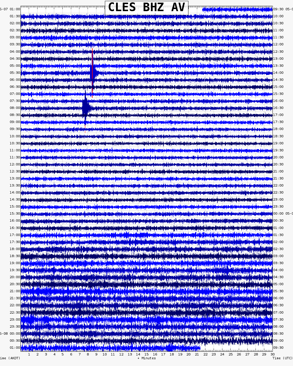
Webicorder

Color Code Timeline

Loading Past Activity...

Loading Images...

Loading Maps...

Loading Bibliography...

Ash Forecasting

Mathematical models developed by the USGS forecast various aspects of how a volcanic ash plume will interact with wind—where, how high, and how fast ash particles will be transported in the atmosphere, as well as where ash will fall out and accumulate on the ground. AVO runs these models when a volcano is restless by assuming a reasonable hypothetical eruption, to provide a pre-eruptive forecast of areas likely to be affected. During an ongoing eruption, AVO will update the forecast with actual observations (eruption start time and duration, plume height) as they become available.

View the current airborne ash cloud models for Cleveland

Ashfall thickness forecast

The Ash3d model was developed by the USGS to forecast how a volcanic ash plume will interact with wind and where ash will fall out and accumulate on the ground. AVO runs these models twice daily when a volcano is restless by assuming a reasonable hypothetical eruption altitude and duration. The map shows the model results of ashfall thickness for areas that are likely to be affected, if one were to occur. During an ongoing eruption, AVO will update the forecast with actual observations (eruption start time and duration, plume height) as they become available, and these plots will be automatically updated. The National Weather Service Anchorage Forecast Office will issue the official ashfall warning product and post them at weather.gov/afc

THESE PRODUCTS MAY NOT BE CURRENT.

During an actual eruption, see National Weather Service forecasts of ashfall:https://weather.gov/afc.
Ashfall Forecast

Click on the X on the graphic (upper right) to expand the map to show the map legend.

Ashfall Start Time

This map shows the modeled estimate of the time it would take for ashfall to begin following an eruption. It corresponds to the ashfall thickness forecast map shown above. This map uses the start time of either the twice-daily hypothetical model runs (time shown in the legend) or the actual eruption start time (if one were to occur). In the case of an actual eruption, the National Weather Service Anchorage Forecast Office will issue the official ashfall warning product that includes the ashfall start time and post them at weather.gov/afc

THESE PRODUCTS MAY NOT BE CURRENT.

During an actual eruption, see National Weather Service forecasts of ashfall:https://weather.gov/afc.

Ashfall Start Times Forecast

Click on the X on the graphic (upper right) to expand the map to show the map legend.
×