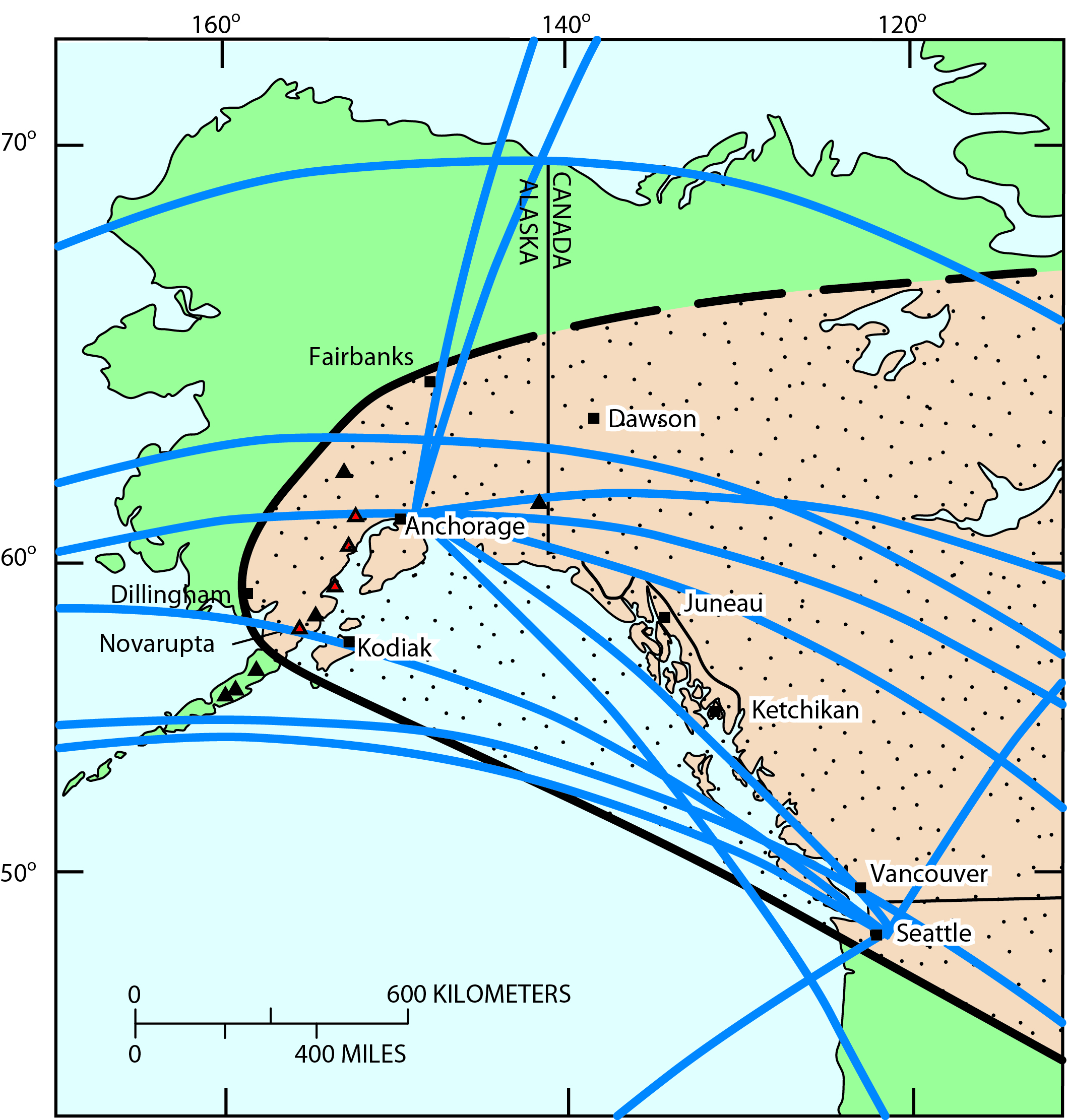
Figure showing major air traffic routes (blue lines) Novarupta, and Novarupta's 1912 ash plume area (tan section.) Figure from Fierstein, Judy, and Hildreth, Wes, 2001, Preliminary volcano-hazard assessment for the Katmai volcanic cluster, Alaska: U.S. Geological Survey Open-File Report OF 00-0489, 50 p., 1 plate.
Date: 2001
Volcano(es): Katmai Novarupta
Photographer: Fierstein, J. E.
URL: avo.alaska.edu/image/view/42541
Credit: Image courtesy of AVO/USGS.Volcano(es): Katmai Novarupta
Photographer: Fierstein, J. E.
URL: avo.alaska.edu/image/view/42541
Use Restriction: Please cite the photographer and the Alaska Volcano Observatory / U.S. Geological Survey when using this image.
Full Resolution.