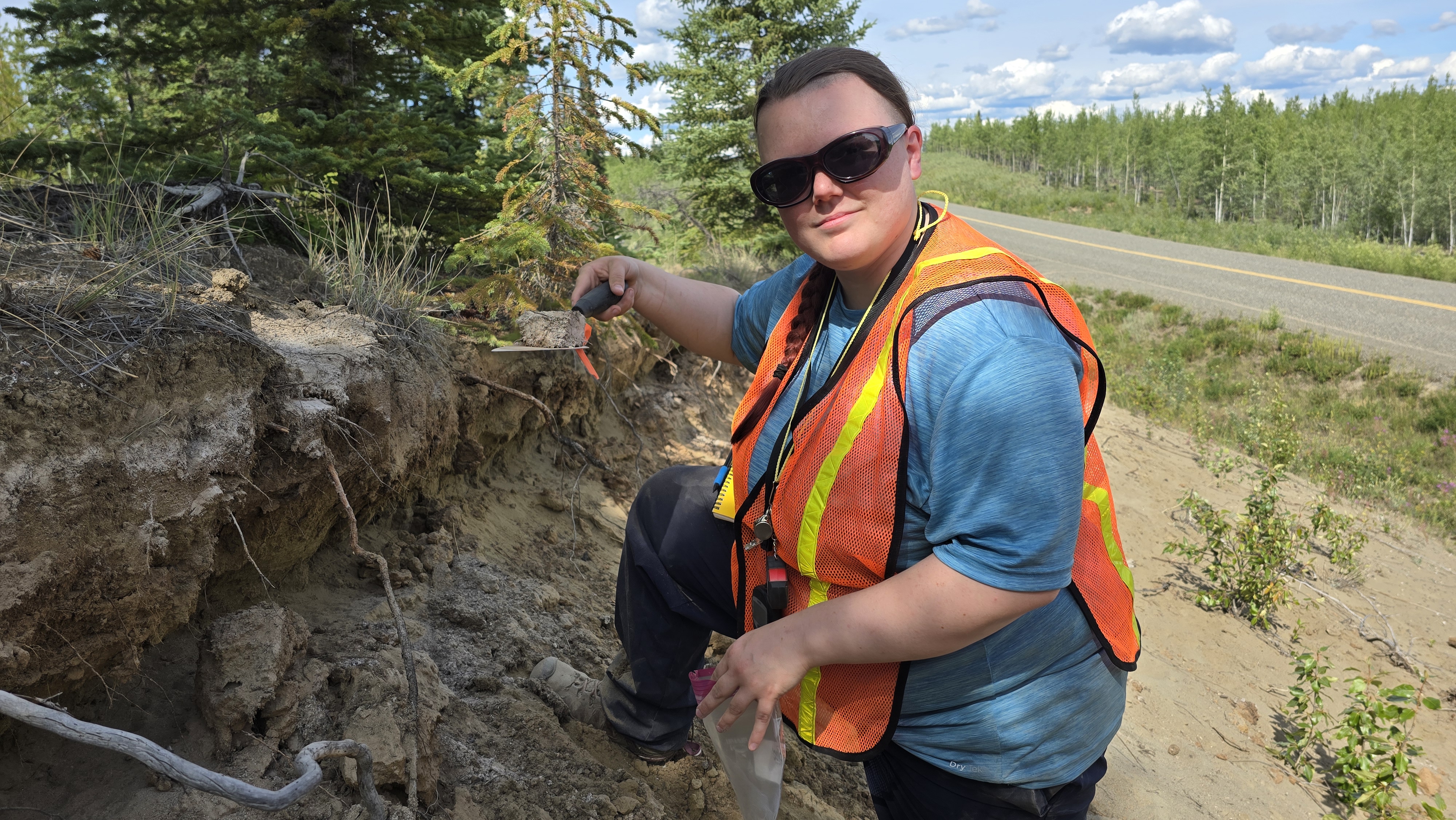
AVO personnel sample a roadside outcrop of White River Ash-East (a volcanic ash left by an extremely large eruption of Mt. Churchill) south of Pelly Crossing, Yukon Territory. The ash is visible as a light gray layer underneath the modern vegetation and soil.
Volcano(es): Churchill, Mt
Photographer: Hofmann, Florian
URL: avo.alaska.edu/image/view/196001
Mt Churchill White River North Lobe
From Preece and others (2014): "The White River Ash (WRA) is an important Holocene chronostratigraphic marker through-out eastern Alaska (USA) and in Yukon and western Northwest Territories (Canada) (Lerbekmo and Campbell, 1969; Pewe, 1975), and provides age control for peat studies (Harris and Schmidt, 1994; Robinson and Moore, 1999, 2000), glacial fluctuations (Denton and Karlen, 1977), paleoecological studies (Slater, 1985), and archaeological and anthropological studies (Workman, 1979; Moodie and others, 1992) (Fig. 1 [in original text]). WRA has been defined by its geographic distribution and its stratigraphic position, combined with radiocarbon dating, with less emphasis on its petrographic and geochemical features. The northern lobe erupted between A.D. 150 and 500 (Jensen and Froese, 2006) or ca. 1900 yr B.P. (Lerbekmo and others, 1975), while the eastern lobe erupted A.D. 803 or 1147 cal. yr B.P. (Clague and others, 1995)."
"The exact vent area of the WRA has been disputed, and two possible locations have been suggested. Lerbekmo and Campbell (1969) postulated that the WRA vent was located on the floor of a deep valley beneath the Klutlan Glacier near what they identified as a large pumice mound (4 in Fig. 2 [of original text]). McGimsey and others (1992) and Richter and others (1995) questioned the likelihood of a vent located at the floor of a valley lacking an edifice or nearby volcano, and proposed that Mount Churchill was the vent. Lerbekmo (2008) questioned whether Mount Churchill was a volcano, and reiterated that the vent for WRA was underneath the Klutlan Glacier."
"The WRA consists of a single light colored tephra layer in most distal exposures, but in a few places both the northern and eastern lobes are preserved in stratigraphic succession."
From Richter and others (1995): "The White River Ash is a bilobate Plinian fallout deposit covering more than 340,000 km square and containing an estimated 25-50 km cubed of tephra (bulk volume) (Bostock 1952; Berger 1960) (Fig. 1 [in original text])."
From Lerbekmo and others (1975): "A northern lobe and an eastern lobe have axis lengths in excess of 500 and 1000 km respectively."
From Preece and others (2014): "Unfortunately, glass compositions are similar in the northern and eastern lobes of the WRA tephra, and published analyses cover a significant range, making it difficult to assign a particular tephra sample to a specific lobe (Addison and others, 2010; Payne and others, 2008; Lakeman and others, 2008; Froese and Jensen, 2005; Richter and others, 1995; Beget and others, 1992; Downes, 1985)."
"Tephra samples of the WRA contain phenocrysts of plagioclase, amphibole, magnetite, ilmenite, and trace amounts of orthopyroxene and apatite within highly vesicular, frothy color-less glass (Table S8 in the Supplemental File [see footnote 1] [of original text])...Biotite was not found in any of the northern lobe samples, although two samples contained trace amounts of reddish-brown phenocrysts tentatively identified as oxyhornblende (Table S8 in the Supplemental File [see footnote 1] [of original text])."
"Previous studies have demonstrated that the eastern and northern lobes of the WRA have different ilmenite compositional ranges (Lerbekmo and others, 1975; Downes, 1985; Richter and others, 1995) and this distinction has been used to define geochemical groups WRA-E and WRA-N."
"WRA deposits can be assigned to WRA-E or WRA-N, and are best identified using ilmenite compositions. Within WRA-N there are two distinctive compositions, WRA-Na and WRA-Nb. In the proximal area, ca. 1900 yr B.P. (Lerbekmo and others, 1975) WRA-Na displays increasing silica content accompanied by systematic changes in trace element compositions, Fe-Ti oxide compositions, and temperature-fugacity estimates. WRA-Nb may represent either a restricted phase of the WRA-Na or a separate eruption from the Mount Churchill magmatic system."
The Global database on large magnitude explosive volcanic eruptions (LaMEVE; 2017) reports a magnitude of 6.2 bulk eruptive volume of 25 cubic km and a dense rock equivalent eruptive volume of 10.42 cubic km for the eruption.
Latitude: 62.612473799722
Longitude: -136.8475127
Credit: Image courtesy of the AVO/UAF-GI.
Use Restriction: Please cite the photographer and the Alaska Volcano Observatory / University of Alaska Fairbanks, Geophysical Institute when using this image.
Full Resolution.