Bogoslof 1796/5
Start: May 18, 1796 ± 10 Days [1]
Stop: 1804 ± 6 Months [1]
Event Type: Explosive
Max VEI: 3 [2]
- "Fire", "Glowing", or incandescence [1]
Description: From Miller and others (1998): "A small rocky prominence, called Ship Island or Ship Rock, was observed in 1768 by Russian explorers at the approximate site of Bogoslof Island; it disappeared through marine erosion by the end of the 19th century and little is known concerning its composition and origin (Byers, 1959). An explosive eruption of debris in 1796, followed by extrusion of viscous lava, built a second island by 1804, about 0.6 km south of Ship Rock. The second island was known successively as Ioann Bogoslof, Old Bogoslof, and Castle Rock. The vent agglomerate and hornblende andesite of Castle Rock, exposed on the southwest end of modern Bogoslof Island, represent early and late products, respectively, of this eruption (Byers, 1959)."
There is some discrepancy concerning the start date of this eruption. Grewingk (1850, translated 2003 by Fritz Jaensch) and Dall (1870, 1884) report Baranov writing that this eruption began on the first of May, 1796. Grewingk (1850, translated 2003 by Fritz Jaensch) writes that Kotzebue reported the eruption on the 7th of May (18th new style [Julian vs. Gregorian calendars]). Regardless of the specific date, it seems clear that the eruption did begin in early May,1796.
Grewingk (1850, translated 2003 by Fritz Jaensch) summarizes Baranov's report as follows: "According to Baranov's report there suddenly arose a storm from the north on the first day of May 1796; and the sky grew dark, which lasted the whole day. During the following night the storm increased. On this and the following day a muffled din could be heard, and a far-off crashing sound, which resembled thunder. At the break of the third day the storm abated and the sky cleared. And now a flame was observed between Unalaska and Umnak, and north of the last-named island. It arose from the sea. And soon there was smoke, which lasted ten consecutive days. After that time something white, of rounded shape, was observed rising above the surface of the sea; and it grew very rapidly in size." Grewingk (1850, translated 2003 by Fritz Jaensch) quotes Kotezebue's account of the eruption as follows: "On the 7th (18th New Style) of May 1796, an agent of the Russian American Company, Mr. Kriukov, was on the northernmost point of Umnak. Storm from NW had obscured the view toward the sea. On the 8th, the sky cleared up; and now a column of smoke could be observed rising from the sea a few miles off shore. Toward evening there was something black, which arose beneath the column of smoke just a little above the surface of the water. During the night, fire spouted upward from that location. At times this was so strong, and the amount so large, that on this 10-mile-distant island (25 versts, according to Veniaminov, I., p. 156) all objects could easily be discerned. Now an earthquake shook the island, and a horrible din echoed back from the mountains in the south. The emerging island threw boulders all the way to Umnak. With sunrise the earthquakes abated, the fire diminished. And now the newly emerged island could be seen in the shape of a pointed hat. One month later Mr. Kriukov found the island significantly taller. It had in the meantime continued to expel fire. Since then it has continued to grow in circumference and elevation; but the flames have abated, and only steam and smoke remain to be seen continuously."
Grewingk (1850, translated 2003 by Fritz Jaensch) further summarizes eruption details: "Four years later no more smoke was seen; and eight years later (1804) hunters visited the island. They found that the water was warm; and the ground was still so hot that in many places it could not be walked on. Even a long time thereafter the island continued to grow in circumference and size. A Russian of very healthy judgment reported that the circumference amounted to 2.5 miles; the elevation to 350 feet. In the surrounding 3 miles the sea is covered with rocks. From the middle of the island to the point, he found that it was warm. And the steam, which arose from the crater, had a pleasant odor, probably from the mountain oil." "The elevation of St. J. Bogoslof is probably judged too low, according to Buch. At such a circumference the elevation should easily have been several thousand feet. Langsdorff's expression points up the same thing, when from his own perspective he calls the elevation a medium one. When he got his first view of the island on August 18, 1806, there were four conical mountains visible on the NW side. They rose by steps to a medium and highest elevation. The latter seemed to rise on all sides vertically like a column." Grewingk (1850, translated 2003 by Fritz Jaensch) also writes that Langsdorff report the island to be 10-15 versts in circumference.
Reports of this eruption's impact on human or animal populations is generally not available, although Ransom (1948) writes that "* * * natives huddled in abject terror before their sod houses while fear crawled icily along their spines" and "Whole villages were wiped out as volcanic ash filled the sky and floated like wind-spume on the ocean. There it mixed with millions of bellied-up fish, cooked to a seething pulp by the boiling sea. Then came deluges of drenching rain greater than anything ever before known in those proverbially rainy, stormy regions." Ransom's descriptions are not found in any other historical reference and seem to owe more to imagination than to historical fact.
Newhall and Melson (1983) estimate the size of 1796 lava dome to be about 10x10^6 cubic meters. Based on Sapper's (1927) classification scheme, the Smithsonian Institution's online database of global volcanism estimates a tephra volume of 5.5 +/- 5 x 10^8 cubic meters.
References Cited
[1] Grewingk's geology of Alaska and the Northwest Coast of America [edited by Marvin W. Falk, translation by Fritz Jaensch published 2003], 1850
Grewingk, Constantine, 1850, Grewingk's geology of Alaska and the Northwest Coast of America [edited by Marvin W. Falk, translation by Fritz Jaensch published 2003]: Rasmuson Library Historical Translation Series 11, Fairbanks, AK, The University of Alaska Press, 242 p.[2] Volcanoes of the world [2nd edition], 1994
Simkin, Tom, and Siebert, Lee, 1994, Volcanoes of the world [2nd edition]: Tucson, Arizona, Geoscience Press, 349 p.[3] Volcanic eruption in the Bering Sea, 1890
Davidson, George, 1890, Volcanic eruption in the Bering Sea: Journal of the American Geographical Society of New York, v. 22, p. 267-272.[4] Geology of Umnak and Bogoslof Islands, Aleutian Islands, Alaska, 1959
Byers, F. M. Jr., 1959, Geology of Umnak and Bogoslof Islands, Aleutian Islands, Alaska: in Investigations of Alaskan volcanoes, U.S. Geological Survey Bulletin 1028-L, p. 267-369, 5 sheets, scale 1 at 1:63,360, 1 at 1:96,000, and 1 at 1:300,000.[5] Recent changes in Bogoslof volcano, 1916
Powers, Sidney, 1916, Recent changes in Bogoslof volcano: Geographical Review, v. 2, n. 3, p. 218-221.[6] The evolution of Bogoslof volcano, 1908
Jaggar, T. A., 1908, The evolution of Bogoslof volcano: Bulletin of the American Geographical Society of New York, v. 40, p. 385-400.[7] Bogoslof, our newest volcano, 1901
Merriam, C. H., 1901, Bogoslof, our newest volcano: in Harriman Alaska expedition, 1899. Harriman Alaska series, v. 2, New York, Publisher unknown, p. 291-336.[8] Recent activity of Bogoslof Volcano, 1930
Jaggar, T. A., 1930, Recent activity of Bogoslof Volcano: The Volcano Letter, v. 275, p. 1-3.[9] Recent volcanic eruptions in the Bering Sea, 1908
Eakle, A. S., 1908, Recent volcanic eruptions in the Bering Sea: Mining and Scientific Press, v. 96, p. 353.[10] A new volcano island in Alaska, 1884
Dall, W. H., 1884, A new volcano island in Alaska: Science, v. 3, n. 51, p. 89-93.[11] Evolution of Bogoslof volcano, 1931
Jaggar, T. A., 1931, Evolution of Bogoslof volcano: The Volcano Letter, v. 322, p. 1-3.[12] The birth of an American volcano, Bogoslof in Bering Sea, 1901
Merriam, C. H., 1901, The birth of an American volcano, Bogoslof in Bering Sea: Everybodys Magazine, v. 5, p. 293-301.[13] The volcanic region of Alaska, 1884
Petroff, Ivan, 1884, The volcanic region of Alaska: in Population, Industries, and Resources of Alaska, Washington DC, Government Printing Office, p. 93-96.[14] Notes on the islands of the Unalaska district [translated from Russian by Lydia T. Black and R.H. Geoghegan in 1984], 1840
Veniaminov, Ivan, 1840, Notes on the islands of the Unalaska district [translated from Russian by Lydia T. Black and R.H. Geoghegan in 1984]: Pierce, R. A., (ed.), Kingston, Ontario, Limestone Press, 511 p.[15] On the volcanic eruptions near Alaska, 1883 [Om de vulkaniska utbrotten vid Alaska 1883], 1885
Svedmark, Eugene, 1885, On the volcanic eruptions near Alaska, 1883 [Om de vulkaniska utbrotten vid Alaska 1883]: Ymer. Aarg, v. 5, p. 129-134.[16] Volcanic domes in the Pacific, 1916
Powers, Sidney, 1916, Volcanic domes in the Pacific: American Journal of Science, v. 42, p. 261-274.[17] Alaska and its resources, 1870
Dall, W. H., 1870, Alaska and its resources: Boston, Lee and Shepard, 627 p.Complete Eruption References
Catalog of the historically active volcanoes of Alaska, 1998
Miller, T. P., McGimsey, R. G., Richter, D. H., Riehle, J. R., Nye, C. J., Yount, M. E., and Dumoulin, J. A., 1998, Catalog of the historically active volcanoes of Alaska: U.S. Geological Survey Open-File Report 98-0582, 104 p.
Volcanoes of the world [2nd edition], 1994
Simkin, Tom, and Siebert, Lee, 1994, Volcanoes of the world [2nd edition]: Tucson, Arizona, Geoscience Press, 349 p.
Notes on Russian America, Parts II-V: Kad'iak, Unalashka, Atkha, the Pribylovs (translated by Marina Ramsay), 1994
Khlebnikov, K. T., 1994, Notes on Russian America, Parts II-V: Kad'iak, Unalashka, Atkha, the Pribylovs (translated by Marina Ramsay): Liapunova, R. G. and Fedorova, S. G., (comps.), Kingston, Ontario and Fairbanks, Alaska, The Limestone Press, 424 p.
Explosive activity associated with the growth of volcanic domes, 1983
Newhall, C. G., and Melson, W. G., 1983, Explosive activity associated with the growth of volcanic domes: Journal of Volcanology and Geothermal Research, v. 17, n. 1/4, p. 111-131.
The alkalic rock suite of Bogoslof Island, eastern Aleutian Arc, Alaska, 1977
Arculus, R. J., DeLong, S. E., Kay, R., Brooks, C., and Sun, S. S., 1977, The alkalic rock suite of Bogoslof Island, eastern Aleutian Arc, Alaska: Journal of Geology, v. 85, n. 2, p. 177-186.

Geology of Umnak and Bogoslof Islands, Aleutian Islands, Alaska, 1959
Byers, F. M. Jr., 1959, Geology of Umnak and Bogoslof Islands, Aleutian Islands, Alaska: in Investigations of Alaskan volcanoes, U.S. Geological Survey Bulletin 1028-L, p. 267-369, 5 sheets, scale 1 at 1:63,360, 1 at 1:96,000, and 1 at 1:300,000.

The Bogoslof Islands, 1948
Ransom, J. E., 1948, The Bogoslof Islands: Alaska Life, v. 11, n. 8, p. 12-14.
Bogoslof the moving island, 1943
Hunnicutt, E. W., 1943, Bogoslof the moving island: Alaska Life, v. 6, n. 4, p. 55-58.

Evolution of Bogoslof volcano, 1931
Jaggar, T. A., 1931, Evolution of Bogoslof volcano: The Volcano Letter, v. 322, p. 1-3.

Recent activity of Bogoslof Volcano, 1930
Jaggar, T. A., 1930, Recent activity of Bogoslof Volcano: The Volcano Letter, v. 275, p. 1-3.

Vulkankunde, 1927
Sapper, Karl, 1927, Vulkankunde: Stuttgart, Germany, Englehorn Verlag, 424 p.
Recent changes in Bogoslof volcano, 1916
Powers, Sidney, 1916, Recent changes in Bogoslof volcano: Geographical Review, v. 2, n. 3, p. 218-221.
Volcanic domes in the Pacific, 1916
Powers, Sidney, 1916, Volcanic domes in the Pacific: American Journal of Science, v. 42, p. 261-274.
Recent volcanic eruptions in the Bering Sea, 1908
Eakle, A. S., 1908, Recent volcanic eruptions in the Bering Sea: Mining and Scientific Press, v. 96, p. 353.
The evolution of Bogoslof volcano, 1908
Jaggar, T. A., 1908, The evolution of Bogoslof volcano: Bulletin of the American Geographical Society of New York, v. 40, p. 385-400.

Bogoslof, our newest volcano, 1901
Merriam, C. H., 1901, Bogoslof, our newest volcano: in Harriman Alaska expedition, 1899. Harriman Alaska series, v. 2, New York, Publisher unknown, p. 291-336.

The birth of an American volcano, Bogoslof in Bering Sea, 1901
Merriam, C. H., 1901, The birth of an American volcano, Bogoslof in Bering Sea: Everybodys Magazine, v. 5, p. 293-301.

Volcanic eruption in the Bering Sea, 1890
Davidson, George, 1890, Volcanic eruption in the Bering Sea: Journal of the American Geographical Society of New York, v. 22, p. 267-272.
On the volcanic eruptions near Alaska, 1883 [Om de vulkaniska utbrotten vid Alaska 1883], 1885
Svedmark, Eugene, 1885, On the volcanic eruptions near Alaska, 1883 [Om de vulkaniska utbrotten vid Alaska 1883]: Ymer. Aarg, v. 5, p. 129-134.
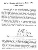
A new volcano island in Alaska, 1884
Dall, W. H., 1884, A new volcano island in Alaska: Science, v. 3, n. 51, p. 89-93.

The volcanic region of Alaska, 1884
Petroff, Ivan, 1884, The volcanic region of Alaska: in Population, Industries, and Resources of Alaska, Washington DC, Government Printing Office, p. 93-96.
Alaska and its resources, 1870
Dall, W. H., 1870, Alaska and its resources: Boston, Lee and Shepard, 627 p.
Grewingk's geology of Alaska and the Northwest Coast of America [edited by Marvin W. Falk, translation by Fritz Jaensch published 2003], 1850
Grewingk, Constantine, 1850, Grewingk's geology of Alaska and the Northwest Coast of America [edited by Marvin W. Falk, translation by Fritz Jaensch published 2003]: Rasmuson Library Historical Translation Series 11, Fairbanks, AK, The University of Alaska Press, 242 p.
Notes on the islands of the Unalaska district [translated from Russian by Lydia T. Black and R.H. Geoghegan in 1984], 1840
Veniaminov, Ivan, 1840, Notes on the islands of the Unalaska district [translated from Russian by Lydia T. Black and R.H. Geoghegan in 1984]: Pierce, R. A., (ed.), Kingston, Ontario, Limestone Press, 511 p.
A voyage around the world 1803-1807 (two volumes in one, translated by Victoria Joan Moessner, 1993), 1812
Langsdorff, G. H., 1812, A voyage around the world 1803-1807 (two volumes in one, translated by Victoria Joan Moessner, 1993): Pierce, R. A., (ed.), Kingston, Ontario, Limestone Press, 281 p.