Akutan CFE/Akutan Tephra
Start: 1611 yBP [1]
Event Type: Explosive
Max VEI: 5 [2]
Description: From Miller and Smith (1987): "A 2-km-diameter summit caldera on neighboring Akutan Island (Fig. 1 [in original text]) has been the source for small-volume pyroclastic flows of andesitic composition on the north side of the volcano. Reeder (1983), on the basis of 3 dates, reported a 1C age of 5200+/-200 yr on organic material directly beneath the pyroclastic-flow deposit. This is a maximum date for the climactic eruption which, like that of Makushin, is thought to be relatively small."
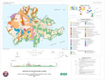
From Waythomas and others (1998): "A widespread, 1-to-2-meter-thick, coarse-grained volcanic ash deposit (tephra) and associated pyroclastic-flow and lahar deposits in Long Valley and Broad Bight (fig. 3 [in original text]) are correlated with the eruption that formed the present caldera about 1600 years ago. This eruption spread black, scoria-rich, lapilli tephra overmost of Akutan Island, especially east of the volcano. Volcanic bombs, 7 to 10 centimeters in diameter, were found in the Akutan Harbor area and were probably ejected from the vent during the caldera-forming eruption. The caldera-forming eruption is the largest known eruption of Akutan Volcano in the past 8000 years."
From Richter and others (1998): "Evidence from tephra and lahar stratigraphy and from tephra, bomb, and lava composition suggests that the modern caldera formed about 1611 year B.P. during a major Strombolian and sub-Plinian eruption."
From Waythomas (1999): "The previously unrecognized and widespread Akutan tephra and the pyroclastic-flow and lahar deposits in Long valley, Flat Bight valley, and Broad Bight valley that conformably overlie the tephra are correlated with a major eruption of Akutan Volcano approximately 1611 years B.P. The age of this eruption is based on radiocarbon-dated soils just beneath the Akutan tephra (Table 1 [in original text]). The Akutan tephra is the thickest, most extensive, and physically prominent of all known tephra deposits on Akutan Island. The direct stratigraphic association of the tephra with noncohesive lahar and pyroclastic- flow deposits in multiple valleys on the volcano is evidence for a relatively large plinian(?) eruption. With the exception of the deposits exposed at Reef Bight (sections 61 and 76, Fig. 8 [in original text]), the volcaniclastic deposits associated with the Akutan tephra are the only known deposits that record a significant eruption of Akutan Volcano. A possible explanation for the origin of the tephra and associated volcaniclastic deposits is that they formed during the eruption that produced the present summit caldera. If this explanation is correct, the most recent caldera-forming eruption of Akutan Volcano occurred approximately 1611 years B.P. This new age estimate for the formation of Akutan caldera would revise a previous date on caldera formation of 5200 years B.P. (Reeder 1983; Miller and Smith 1987). According to the results presented in this paper, few if any deposits on Akutan Island can be correlated with confidence to an eruption that dates to approximately 5200 years B.P. (Fig. 19 [in original text]). Noncohesive lahar deposits in Flat Bight are younger than approximately 6000 years B.P., but older than the Akutan tephra. A single noncohesive lahar deposit at Reef Bight (Fig. 19 [in original text]) is younger than approximately 8500 years B.P. These lahar deposits are not associated with tephra or other volcaniclastic deposits, as would be expected if they were part of an eruption sequence associated with caldera formation. Thus, it seems logical that the thick, aerially extensive sequences of Akutan tephra, lahar, and pyroclastic-flow deposits most likely record the most recent caldera-forming eruption at Akutan Volcano."
From Waythomas (1999): "A black, scoria-bearing, lapilli tephra, informally named the "Akutan tephra," is up to 2 m thick and is found over most of the island, primarily east of the volcano summit. Six radiocarbon ages on the humic fraction of soil A-horizons beneath the tephra indicate that the Akutan tephra was erupted approximately 1611 years B.P. At several locations the Akutan tephra is within a conformable stratigraphic sequence of pyroclastic-flow and lahar deposits that are all part of the same eruptive sequence. The thickness, widespread distribution. And conformable stratigraphic association with overlying pyroclastic-flow and lahar deposits indicate that the Akutan tephra likely records a major eruption of Akutan Volcano that may have formed the present summit caldera."
"A black-to-orange-brown, scoria-rich, lapilli tephra that is as much as 2-m-thick is found in at least 12 stratigraphic sections in a 180 degree sector southeast of the caldera (Fig. 3 [in original text]). This tephra (hereafter called the Akutan tephra) is present in Long valley, Flat Bight valley, Broad Bight valley, along the coast in Hot Springs Bay, and in various exposures around Akutan Harbor (Fig. 3 [in original text]). The Akutan tephra is the thickest tephra recognized on Akutan Island. In general, it consists of three components (in stratigraphic order): a 0.5- to 1-m-thick, black, scoria-rich zone, with crude inverse grading and large bombs (both lithic and juvenile); an orange-brown lithic-rich lapilli zone, 0.2-0.5 m thick; and a 0.2- to 0.5- 143 m-thick, gray-brown silty ash which is 80-90% accretionary lapilli (Fig. 4 [in original text]). In a few sections a 0.2- to 0.4- m-thick bed of orange-brown, lithic-rich lapilli tephra makes up a fourth component. Juvenile clasts in the tephra are mostly scoriaceous, porphyritic, two-pyroxene andesite. The three-component sequence is similar in all locations where the tephra is ~ l m thick. Volcanic bombs in the scoria-bearing zone of the tephra are up to 20 cm in diameter (maximum clast dimension) and generally decrease in size with increasing distance from the caldera (Fig. 3 [in original text])."
"The tephra rests on a thin A/Cox soil at six of the 12 known outcrops. Radiocarbon dates on the humic fraction of soil A-horizons (Cherkinsky and Brovkin 1993) from these six sites (Table 1 [in original text]) indicate that the Akutan tephra was deposited approximately 1723+/-36 radiocarbon years B.P., which is a mean weighted age of six ages. Using the calibration routine of Stuiver and Reimer (1993), the calibrated age of this date is 1611 years B.P. or A.D. 339."
"The thickness of the Akutan tephra exhibits a distinct decrease with increasing distance away from the caldera (Fig. 3 [in original text]). In Long valley and in Broad Bight valley, the Akutan tephra is directly overlain by lahar and pyroclastic-flow deposits that contain clasts of juvenile scoriaceous andesite similar to the scoriaceous bombs in the tephra. Contact relations between the tephra and the overlying lahar and pyroclastic-flow deposits are gradational, indicating a continuous depositional sequence. Where the Akutan tephra is overlain by lahar and pyroclastic-flow deposits, it is unweathered and exhibits no soil development, indicating that it was not exposed subaerially. The widespread distribution of the Akutan tephra and its conformable stratigraphic relation with overlying lahar and pyroclastic-flow deposits are evidence for a major eruption that could have been the most recent caldera-forming eruption of the volcano. The tephra is mineralogically similar to historical Akutan tephras and is a good stratigraphic marker on Akutan Island, but it has not yet been identified on nearby Unalaska. Akun or Unimak Islands."
"Lahar and pyroclastic-flow deposits in Long valley overlie, and are younger than, the Akutan tephra (Fig. 6 [in original text]). The direct stratigraphic association of the tephra with lahar deposits at sections 78 and 85 (Fig. 6 [in original text]) indicates a genetic relationship among the deposits that records a major eruption, possibly the most recent caldera-forming eruption of Akutan Volcano."
"At least two thick, compact, indurated, noncohesive lahars are present in the upper part of Broad Bight valley (section 50, Fig. 12 [in original text]). These deposits are more than 50 m thick and extend downstream for several kilometers. The lahar deposits contain angular to subangular lithic clasts of andesite and basaltic andesite and are matrix supported and massive. The age of these deposits is unknown, but they record a significant eruption that may have been the most recent caldera-forming eruption at Akutan Volcano. Lahar deposits exposed downstream of section 50 at section 42 (Fig. 12 [in original text]) are thinner, finer grained, and better sorted than those in the upper part of the valley, a contrast that indicates downstream flow transformation."
The Global database on large magnitude explosive volcanic eruptions (LaMEVE; 2016) reports a magnitude of 5.0, bulk eruptive volume of 1 cubic km and a dense rock equivalent eruptive volume of 0.4 cubic km for the eruption.
References Cited
[1] Stratigraphic framework of Holocene volcaniclastic deposits, Akutan Volcano, east-central Aleutian Islands, Alaska, 1999
Waythomas, C. F., 1999, Stratigraphic framework of Holocene volcaniclastic deposits, Akutan Volcano, east-central Aleutian Islands, Alaska: Bulletin of Volcanology, v. 61, n. 3, p. 141-161.[2] Volcanoes of the World, 2013
Global Volcanism Program, 2013, Volcanoes of the World, v. 4.5.3. Venzke, E (ed.): Smithsonian Institution. Downloaded 2017. http://dx.doi.org/10.5479/si.GVP.VOTW4-2013[3] Late Quaternary caldera-forming eruptions in the eastern Aleutian arc, Alaska, 1987
Miller, T. P., and Smith, R. L., 1987, Late Quaternary caldera-forming eruptions in the eastern Aleutian arc, Alaska: Geology, v. 15, n. 5, p. 434-438.[4] Geology of Akutan Island, Alaska, 1998
Richter, D. H., Waythomas, C. F., McGimsey, R. G., and Stelling, P. L., 1998, Geology of Akutan Island, Alaska: U.S. Geological Survey Open-File Report 98-0135, 22 p., 1 sheet, scale 1:48,000.[5] Volcanic activity on Akun and Akutan Islands, 1953
Byers, F. M., and Barth, T. F. W., 1953, Volcanic activity on Akun and Akutan Islands: in Pacific Science Congress, 7, Proceedings, v. 2, New Zealand, 1949, Geology, p. 382-397.[6] Catalog of the historically active volcanoes of Alaska, 1998
Miller, T. P., McGimsey, R. G., Richter, D. H., Riehle, J. R., Nye, C. J., Yount, M. E., and Dumoulin, J. A., 1998, Catalog of the historically active volcanoes of Alaska: U.S. Geological Survey Open-File Report 98-0582, 104 p.[7] Global database on large magnitude explosive volcanic eruptions (LaMEVE), 2012
Crosweller H.S., Arora, B., Brown, S.K., Cottrell, E., Deligne, N.I., Guerrero, N.O., Hobbs, L., Kiyosugi, K., Loughlin, S.C., Lowndes, J., Nayembil, M., 2012, Global database on large magnitude explosive volcanic eruptions (LaMEVE): Journal of Applied Volcanology, v. 1, n. 4, unpaged.[8] Geomorphic consequences of volcanic eruptions in Alaska: A review, 2015
Waythomas, C.F., 2015, Geomorphic consequences of volcanic eruptions in Alaska: A review: Geomorphology, v. 246, p. 123-145, doi: 10.1016/j.geomorph.2015.06.004[9] Preliminary volcano-hazard assessment for Akutan Volcano east-central Aleutian Islands, Alaska, 1998
Waythomas, C. F., Power, J. A., Richter, D. H., and McGimsey, R. G., 1998, Preliminary volcano-hazard assessment for Akutan Volcano east-central Aleutian Islands, Alaska: U.S. Geological Survey Open-File Report 98-0360, 36 p., 1 plate, scale unknown.[10] Akutan volcano, 1935
Finch, R. H., 1935, Akutan volcano: Zeitschrift fuer Vulkanologie, v. 16, n. 3, p. 155-160, 4 plates, scale unknown.Complete Eruption References
Makushin Volcano ash hazards, 2025
Dietterich, H.R., Schaefer, J.R., Larsen, J.F., Vallance, J.W., Van Eaton, A.R., and Wallace, K.L., 2025, Makushin Volcano ash hazards: Alaska Division of Geological & Geophysical Surveys Information Circular 86 v. 2, 2 p. https://doi.org/10.14509/31684
Geomorphic consequences of volcanic eruptions in Alaska: A review, 2015
Waythomas, C.F., 2015, Geomorphic consequences of volcanic eruptions in Alaska: A review: Geomorphology, v. 246, p. 123-145, doi: 10.1016/j.geomorph.2015.06.004

Stratigraphic framework of Holocene volcaniclastic deposits, Akutan Volcano, east-central Aleutian Islands, Alaska, 1999
Waythomas, C. F., 1999, Stratigraphic framework of Holocene volcaniclastic deposits, Akutan Volcano, east-central Aleutian Islands, Alaska: Bulletin of Volcanology, v. 61, n. 3, p. 141-161.

Geology of Akutan Island, Alaska, 1998
Richter, D. H., Waythomas, C. F., McGimsey, R. G., and Stelling, P. L., 1998, Geology of Akutan Island, Alaska: U.S. Geological Survey Open-File Report 98-0135, 22 p., 1 sheet, scale 1:48,000.

Preliminary volcano-hazard assessment for Akutan Volcano east-central Aleutian Islands, Alaska, 1998
Waythomas, C. F., Power, J. A., Richter, D. H., and McGimsey, R. G., 1998, Preliminary volcano-hazard assessment for Akutan Volcano east-central Aleutian Islands, Alaska: U.S. Geological Survey Open-File Report 98-0360, 36 p., 1 plate, scale unknown.

Late Quaternary caldera-forming eruptions in the eastern Aleutian arc, Alaska, 1987
Miller, T. P., and Smith, R. L., 1987, Late Quaternary caldera-forming eruptions in the eastern Aleutian arc, Alaska: Geology, v. 15, n. 5, p. 434-438.

Volcanic activity on Akun and Akutan Islands, 1953
Byers, F. M., and Barth, T. F. W., 1953, Volcanic activity on Akun and Akutan Islands: in Pacific Science Congress, 7, Proceedings, v. 2, New Zealand, 1949, Geology, p. 382-397.
