References
Russell, J.K., Edwards, B.R., Williams-Jones, G., and Hickson, C., 2023, Pleistocene to Holocene Volcanism in the Canadian Cordillera: Canadian Journal of Earth Sciences in press. Https://doi.org/10.1139/cjes-2023-0065.
Cameron, C.E., Crass, S.W., and AVO Staff, eds, 2022, Geologic database of information on volcanoes in Alaska (GeoDIVA): Alaska Division of Geologic and Geophysical Surveys Digital Data Series 20, https://doi.org/10.14509/geodiva, https://doi.org/10.14509/30901.
Cameron, C.E., and Snedigar, S.F., 2016, Alaska Volcano Observatory image database: Alaska Division of Geological & Geophysical Surveys Digital Data Series 13, https://www.avo.alaska.edu/images/. https://doi.org/10.14509/29689.
Neal, C.A., Herrick, J., Girina, O.,A., Chibisova, M., Rybin, A., McGimsey, R.G., and Dixon, J., 2014, 2010 Volcanic activity in Alaska, Kamchatka, and the Kurile Islands - Summary of events and response of the Alaska Volcano Observatory: U.S. Geological Survey Scientific Investigations Report 2014-5034, 76 p., http://dx.doi.org/10.3133/sir20145034 .
Cameron, C.E., and Nye, C.J., 2014, Preliminary database of Quaternary vents in Alaska: Alaska Division of Geological & Geophysical Surveys Miscellaneous Publication 153, 11 p., doi:10.14509/27357 .
Mastin, L.G., Guffanti, Marianne, Ewert, J.E., and Spiegel, Jessica, 2009, Preliminary spreadsheet of eruption source parameters for volcanoes of the world: U.S. Geological Survey Open-File Report 2009-1133, v. 1.2, 25 p., available at http://pubs.usgs.gov/of/2009/1133/ .
Ewert, John, 2007, System for ranking relative threats of U.S. volcanoes: Natural Hazards Review, v. 8, n. 4, p. 112-124.
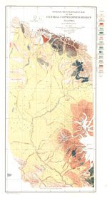
Richter, D.H., Preller, C.C., Labay, K.A., and Shew, N.B., compilers, 2006, Geologic map of the Wrangell-Saint Elias National Park and Preserve, Alaska: U.S. Geological Survey Scientific Investigations Map 2877, 15 p., 1 plate, scale 1:350,000, available at http://pubs.usgs.gov/sim/2006/2877/ .
Ewert, J.W., Guffanti, Marianne, and Murray, T.L., 2005, An assessment of volcanic threat and monitoring capabilities in the United States: framework for a National Volcano Early Warning System NVEWS: U.S. Geological Survey Open-File Report 2005-1164, 62 p.
Siebert, L., and Simkin, T., 2002-, Volcanoes of the world: an illustrated catalog of Holocene volcanoes and their eruptions: Smithsonian Institution, Global Volcanism Program Digital Information Series GVP-3, http://volcano.si.edu/search_volcano.cfm, unpaged internet resource.
Cameron, C. E., Triplehorn, J. H., and Robar, C. L., 2003, Bibliography of information on Alaska volcanoes: Alaska Division of Geological & Geophysical Surveys Miscellaneous Publication MP 131, 1 CD-ROM.
Hard Copy held by AVO at FBKS - CEC file cabinet
Winkler, G. R., MacKevett, E. M. Jr., Plafker, George, Richter, D. H., Rosenkrans, D. S., and Schmoll, H. R., 2000, A geologic guide to Wrangell-Saint Elias National Park and Preserve, Alaska: A tectonic collage of northbound terranes: U.S. Geological Survey Professional Paper PP 1616, 166 p.
Hard Copy held by AVO at FBKS - CEC shelf
McGimsey, R. G., and Wallace, K. L., 1999, 1997 volcanic activity in Alaska and Kamchatka: Summary of events and response of the Alaska Volcano Observatory: U.S. Geological Survey Open-File Report 99-0448, 42 p.
Hard Copy held by AVO at FBKS - CEC file cabinet
Nye, C. J., Queen, Katherine, and McCarthy, A. M., 1998, Volcanoes of Alaska: Alaska Division of Geological & Geophysical Surveys Information Circular IC 0038, unpaged, 1 sheet, scale 1:4,000,000, available at http://www.dggs.dnr.state.ak.us/pubs/pubs?reqtype=citation&ID=7043 .
Hard Copy held by AVO at FBKS - CEC shelf
Wilson, M. D., 1997, Wrangell-St. Elias National Park and Preserve: in Harris, A. G., Tuttle, E., and Tuttle, S., (eds.), Geology of national parks, Dubuque, IA, Kendall/Hunt Publishing Company, p. 392-406.
Neal, Christina, and McGimsey, Robert, 1996, Volcanoes of the Wrangell Mountains and Cook Inlet Region, Alaska-selected photographs: U.S. Geological Survey Digital Data Series DDS 0039, 1 CD-ROM.
Neal, C. A., McGimsey, R. G., and Doukas, M. P., 1996, 1993 volcanic activity in Alaska: summary of events and response of the Alaska Volcano Observatory: U.S. Geological Survey Open-File Report 96-0024, 21 p.
Hard Copy held by AVO at FBKS - CEC shelf
Richter, D. H., Rosenkrans, D. S., and Steigerwald, M. J., 1995, Guide to the volcanoes of the western Wrangell Mountains, Alaska - Wrangell-St. Elias National Park and Preserve: U.S. Geological Survey Bulletin 2072, 31 p.
Hard Copy held by AVO at FBKS - CEC shelf
Neal, C. A., Doukas, M. P., and McGimsey, R. G., 1995, 1994 volcanic activity in Alaska: summary of events and response of the Alaska Volcano Observatory: U.S. Geological Survey Open-File Report 95-0271, 18 p.
Hard Copy held by AVO at FBKS - CEC file cabinet
Alaska Division of Geological & Geophysical Surveys, 1995, Volcanoes of Alaska: Alaska Division of Geological & Geophysical Surveys Information Circular IC 0038, unpaged, 1 sheet, scale 1:4,000,000.
Richter, D. H., Duffield, W. A., Sawyer, D. A., Schmoll, H. R., and Ratte, J. C., 1994, Geologic map of the Gulkana A-1 Quadrangle, south-central Alaska: U.S. Geological Survey Geological Quadrangle Map GQ 1728, unpaged, 1 sheet, scale 1:63,360.
Hard Copy held by AVO at FBKS - CEC shelf
Miller, T. P., and Richter, D. H., 1994, Quaternary volcanism in the Alaska Peninsula and Wrangell Mountains, Alaska: in Plafker, George, Jones, D. L., and Berg, H. C., (eds.), The Geology of Alaska, Geological Society of America The Geology of North America series v. G-1, p. 759-779.
Hard Copy held by AVO at FBKS - CEC file cabinet
Hickson, C. J., 1994, Volcanism in the Canadian Cordillera: Canada's hazard response preparedness: in Casadevall, T. J., (ed.), Volcanic ash and aviation safety: Proceedings of the first international symposium on volcanic ash and aviation safety, U.S. Geological Survey Bulletin 2047, p. 47-55.
Simkin, Tom, and Siebert, Lee, 1994, Volcanoes of the world [2nd edition]: Tucson, Arizona, Geoscience Press, 349 p.
Hard Copy held by AVO at FBKS - CEC shelf
Richter, D. H., Smith, J. G., Schmoll, H. R., and Smith, R. L., 1993, Geologic map of the Nabesna B-6 Quadrangle, south-central Alaska: U.S. Geological Survey Geological Quadrangle Map GQ 1688, unpaged, 1 sheet, scale 1:63,360.
Hickson, C. J., 1990, Can it happen here? A major volcanic eruption could occur in the Canadian Cordillera: it might significantly affect our environment: Geos, v. 19, p. 1-7.
Richter, D. H., Smith, J. G., Lanphere, M. A., Dalrymple, G. B., Reed, B. L., and Shew, N., 1990, Age and progression of volcanism, Wrangell volcanic field, Alaska: Bulletin of Volcanology, v. 53, n. 1, p. 29-44.
Hard Copy held by AVO at FBKS - CEC file cabinet
Wood, C. A., and Kienle, Juergen, (eds.), 1990, Volcanoes of North America: United States and Canada: New York, Cambridge University Press, 354 p.
Hard Copy held by AVO at FBKS - CEC shelf
Richter, D. H., Ratte, J. C., Schmoll, H. R., Leeman, W. P., Smith, J. G., and Yehle, L. A., 1989, Geologic map of the Gulkana B-1 quadrangle, south-central Alaska: U.S. Geological Survey Geological Quadrangle Map GQ 1655, 1 p., 1 sheet, scale 1:63,360.
Richter, D. H., Schmoll, H. R., and Bove, D. J., 1988, Source of the Sanford volcanic debris flow, south-central Alaska: in Geologic studies in Alaska by the U.S. Geological Survey during 1987, U.S. Geological Survey Circular C 1016, p. 114-116.
Luedke, R. G., and Smith, R. L., 1986, Map showing distribution, composition, and age of Late Cenozoic volcanic centers in Alaska: U.S. Geological Survey Miscellaneous Investigations Series Map I 1091-F, unpaged, 3 sheets, scale 1:1,000,000.
Stephens, C. D., Fogleman, K. A., Lahr, J. C., and Page, R. A., 1984, The Wrangell WadBen zone, southern Alaska: Geology, v. 12, p. 373-376.
Associated Press, 1981, News in brief: The Nation [A massive landslide on Mt. Sanford]: LA Times, April 13, 1981, p. 2, part 1.
Hard Copy held by AVO at FBKS - CEC file cabinet
Smith, R. L., Shaw, H. R., Luedke, R. G., and Russell, S. L., 1978, Comprehensive tables giving physical data and thermal energy estimates for young igneous systems of the United States: U.S. Geological Survey Open-File Report 78-0925, p. 1-25.
Hard Copy held by AVO at FBKS - CEC shelf
Richter, D. H., 1976, Geologic map of the Nabesna quadrangle, Alaska: U.S. Geological Survey Miscellaneous Investigations Series Map I 0932, unpaged, 1 plate, scale 1:250,000.
Black, R. F., 1958, Wrangell mountains: in Landscapes of Alaska, their geologic evolution, v. 1, Berkeley and Los Angeles, University of California Press, p. 30-33.
Hard Copy held by AVO at FBKS - CEC file cabinet
Sapper, Karl, 1917, Katalog der geschichtlichen vulkanausbruche: Strassburg, Germany, Karl J. Trubner, 358 p.
Hard Copy held by AVO at FBKS - CEC file cabinet
Washington, H. S., 1917, Chemical analyses of igneous rocks, published from 1884 to 1913, inclusive, with a critical discussion of the character and use of analyses; a revision and expansion of Professional Paper 14: U.S. Geological Survey Professional Paper PP 0099, 1201 p.
Dunn, Robert, 1909, Conquering our greatest volcano: Harper's Magazine, v. 118, p. 497-509.
Mendenhall, W. C., 1905, Geology of the central Copper River region, Alaska: U.S. Geological Survey Professional Paper PP 0041, 133 p., 1 plate, scale 1:63,360.
Hard Copy held by AVO at FBKS - CEC shelf
Schrader, F.C., and Spencer, A.C., 1901, The gold and mineral resources of a portion of the Copper River District, Alaska: Washington, Government Printing Office, 94 p.
Rohn, Oscar, 1900, A reconnaissance of the Chitna River and the Skolai Mountains, Alaska, in Walcott, C.D., Twenty-first annual report of the director of the United States Geological Survey, 1899-1900 - Part II - General geology, economic geology, Alaska: U.S. Geological Survey Annual Report 21-II, p. 393-440. https://doi.org/10.3133/ar21_2.