Gordon
Spurr
Great Sitkin
Akutan
Aniakchak
Atka volcanic complex
Augustine
Cleveland
Dutton
Edgecumbe
Fisher
Gareloi
Great Sitkin
Griggs
Iliamna
Isanotski
Kanaga
Katmai
Little Sitkin
Mageik
Makushin
Martin
Novarupta
Pavlof
Redoubt
Semisopochnoi
Shishaldin
Snowy
Spurr
Takawangha
Tanaga
Trident
Ugashik-Peulik
Ukinrek Maars
Veniaminof
Westdahl
Wrangell
Legend
✕
| Red (Warning) | |
| Orange (Watch) | |
| Yellow (Advisory) | |
| Green (Normal) | |
| Uninstrumented | |
| Community | |
| Webcam | |
| Instrument | |
| Earthquake Magnitude | |
|
0
| |
| Earthquake Age | |
| Last 2 Hours | |
| Last 2 Days | |
| Last 1 Week | |
Facts
- Official Name: Mount Gordon
- Seismically Monitored: No
- Color Code: UNASSIGNED
- Alert Level: UNASSIGNED
- Elevation: 2755m (9038ft)
- Latitude: 62.1312
- Longitude: -143.0883
- Smithsonian VNum: 315021
- Pronunciation:
-
Nearby Towns:
- Chisana 34 mi (55 km) SE
- Slana 49 mi (78 km) NW
- McCarthy 49 mi (78 km) SE
- Chistochina 59 mi (95 km) NW
- Mentasta Lake 60 mi (96 km) NW
Distance from Anchorage: 232 mi (373 km)
-
Subfeatures:
- Horseshoe Mesa
Description
From Miller and Richter (1994) [1] : "This is the largest of the young (<1.5 Ma) basalt-basaltic andesite cinder cones that are common in the northwestern part of the Wrangell volcanic field. The cone of Mt. Gordon, about 5 km in diameter and 600 m high above its base of older Wrangell lava, also erupted a significant volume of basaltic lava flows [2] ."Name Origin
Mount Gordon was named for a prospector who was in the area in 1899. F.C. Schrader, U.S. Geological Survey, reported the name in 1903 (Orth, 1971).
References Cited
[1] Quaternary volcanism in the Alaska Peninsula and Wrangell Mountains, Alaska, 1994
Miller, T. P., and Richter, D. H., 1994, Quaternary volcanism in the Alaska Peninsula and Wrangell Mountains, Alaska: in Plafker, George, Jones, D. L., and Berg, H. C., (eds.), The Geology of Alaska, Geological Society of America The Geology of North America series v. G-1, p. 759-779.[2] Geologic map of the Nabesna A-5 quadrangle, Alaska, 1976
Richter, D.H., and Smith, R.L., 1976, Geologic map of the Nabesna A-5 quadrangle, Alaska: US Geological Survey Geologic Quadrangle Map 1292, 1 sheet, available at http://www.dggs.dnr.state.ak.us/pubs/pubs?reqtype=citation&ID=13027 .Reported Activity
Modern Eruptions
0 Event Date(s)
Past Activity Legend:
| Eruption | |
| Questionable eruption | |
| Non-eruptive activity |
Showing 1 - 3 of 3
Map Images
Map References
Map showing distribution, composition, and age of Late Cenozoic volcanic centers in Alaska, 1986
Luedke, R. G., and Smith, R. L., 1986, Map showing distribution, composition, and age of Late Cenozoic volcanic centers in Alaska: U.S. Geological Survey Miscellaneous Investigations Series Map I 1091-F, unpaged, 3 sheets, scale 1:1,000,000.
Geologic map of the Nabesna quadrangle, Alaska, 1976
Richter, D. H., 1976, Geologic map of the Nabesna quadrangle, Alaska: U.S. Geological Survey Miscellaneous Investigations Series Map I 0932, unpaged, 1 plate, scale 1:250,000.
Geologic map of the Nabesna A-5 quadrangle, Alaska, 1976
Richter, D.H., and Smith, R.L., 1976, Geologic map of the Nabesna A-5 quadrangle, Alaska: US Geological Survey Geologic Quadrangle Map 1292, 1 sheet, available at http://www.dggs.dnr.state.ak.us/pubs/pubs?reqtype=citation&ID=13027 .
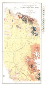
Geology of the central Copper River region, Alaska, 1905
Mendenhall, W. C., 1905, Geology of the central Copper River region, Alaska: U.S. Geological Survey Professional Paper PP 0041, 133 p., 1 plate, scale 1:63,360.

References
Pleistocene to Holocene Volcanism in the Canadian Cordillera, 2023
Russell, J.K., Edwards, B.R., Williams-Jones, G., and Hickson, C., 2023, Pleistocene to Holocene Volcanism in the Canadian Cordillera: Canadian Journal of Earth Sciences in press. Https://doi.org/10.1139/cjes-2023-0065.
Geologic database of information on volcanoes in Alaska (GeoDIVA), 2022
Cameron, C.E., Crass, S.W., and AVO Staff, eds, 2022, Geologic database of information on volcanoes in Alaska (GeoDIVA): Alaska Division of Geologic and Geophysical Surveys Digital Data Series 20, https://doi.org/10.14509/geodiva, https://doi.org/10.14509/30901.
Preliminary database of Quaternary vents in Alaska, 2014
Cameron, C.E., and Nye, C.J., 2014, Preliminary database of Quaternary vents in Alaska: Alaska Division of Geological & Geophysical Surveys Miscellaneous Publication 153, 11 p., doi:10.14509/27357 .
Preliminary spreadsheet of eruption source parameters for volcanoes of the world, 2009
Mastin, L.G., Guffanti, Marianne, Ewert, J.E., and Spiegel, Jessica, 2009, Preliminary spreadsheet of eruption source parameters for volcanoes of the world: U.S. Geological Survey Open-File Report 2009-1133, v. 1.2, 25 p., available at http://pubs.usgs.gov/of/2009/1133/ .
System for ranking relative threats of U.S. volcanoes, 2007
Ewert, John, 2007, System for ranking relative threats of U.S. volcanoes: Natural Hazards Review, v. 8, n. 4, p. 112-124.

Volcanoes of the world: an illustrated catalog of Holocene volcanoes and their eruptions, 2003
Siebert, L., and Simkin, T., 2002-, Volcanoes of the world: an illustrated catalog of Holocene volcanoes and their eruptions: Smithsonian Institution, Global Volcanism Program Digital Information Series GVP-3, http://volcano.si.edu/search_volcano.cfm, unpaged internet resource.
Bibliography of information on Alaska volcanoes, 2003
Cameron, C. E., Triplehorn, J. H., and Robar, C. L., 2003, Bibliography of information on Alaska volcanoes: Alaska Division of Geological & Geophysical Surveys Miscellaneous Publication MP 131, 1 CD-ROM.
Hard Copy held by AVO at FBKS - CEC file cabinet
Wrangell-St. Elias National Park and Preserve, 1997
Wilson, M. D., 1997, Wrangell-St. Elias National Park and Preserve: in Harris, A. G., Tuttle, E., and Tuttle, S., (eds.), Geology of national parks, Dubuque, IA, Kendall/Hunt Publishing Company, p. 392-406.
A reconnaissance study of mafic to intermediate intra-arc volcanism in the western Wrangell Volcanic Field, Alaska, 1997
Lunt, A.S., 1997, A reconnaissance study of mafic to intermediate intra-arc volcanism in the western Wrangell Volcanic Field, Alaska: Miami University Ph.D., 150 p.
Hard Copy held by AVO at FBKS - CEC shelf
Guide to the volcanoes of the western Wrangell Mountains, Alaska - Wrangell-St. Elias National Park and Preserve, 1995
Richter, D. H., Rosenkrans, D. S., and Steigerwald, M. J., 1995, Guide to the volcanoes of the western Wrangell Mountains, Alaska - Wrangell-St. Elias National Park and Preserve: U.S. Geological Survey Bulletin 2072, 31 p.

Quaternary volcanism in the Alaska Peninsula and Wrangell Mountains, Alaska, 1994
Miller, T. P., and Richter, D. H., 1994, Quaternary volcanism in the Alaska Peninsula and Wrangell Mountains, Alaska: in Plafker, George, Jones, D. L., and Berg, H. C., (eds.), The Geology of Alaska, Geological Society of America The Geology of North America series v. G-1, p. 759-779.
Hard Copy held by AVO at FBKS - CEC file cabinet
Volcanoes of the world [2nd edition], 1994
Simkin, Tom, and Siebert, Lee, 1994, Volcanoes of the world [2nd edition]: Tucson, Arizona, Geoscience Press, 349 p.
Hard Copy held by AVO at FBKS - CEC shelf
Can it happen here? A major volcanic eruption could occur in the Canadian Cordillera: it might significantly affect our environment, 1990
Hickson, C. J., 1990, Can it happen here? A major volcanic eruption could occur in the Canadian Cordillera: it might significantly affect our environment: Geos, v. 19, p. 1-7.
Map showing distribution, composition, and age of Late Cenozoic volcanic centers in Alaska, 1986
Luedke, R. G., and Smith, R. L., 1986, Map showing distribution, composition, and age of Late Cenozoic volcanic centers in Alaska: U.S. Geological Survey Miscellaneous Investigations Series Map I 1091-F, unpaged, 3 sheets, scale 1:1,000,000.
Geologic map of the Nabesna quadrangle, Alaska, 1976
Richter, D. H., 1976, Geologic map of the Nabesna quadrangle, Alaska: U.S. Geological Survey Miscellaneous Investigations Series Map I 0932, unpaged, 1 plate, scale 1:250,000.
Geologic map of the Nabesna A-5 quadrangle, Alaska, 1976
Richter, D.H., and Smith, R.L., 1976, Geologic map of the Nabesna A-5 quadrangle, Alaska: US Geological Survey Geologic Quadrangle Map 1292, 1 sheet, available at http://www.dggs.dnr.state.ak.us/pubs/pubs?reqtype=citation&ID=13027 .
Geology of the central Copper River region, Alaska, 1905
Mendenhall, W. C., 1905, Geology of the central Copper River region, Alaska: U.S. Geological Survey Professional Paper PP 0041, 133 p., 1 plate, scale 1:63,360.

A reconnaissance of the Chitina River and the Skolai Mountains, Alaska, 1900
Rohn, Oscar, 1900, A reconnaissance of the Chitna River and the Skolai Mountains, Alaska, in Walcott, C.D., Twenty-first annual report of the director of the United States Geological Survey, 1899-1900 - Part II - General geology, economic geology, Alaska: U.S. Geological Survey Annual Report 21-II, p. 393-440. https://doi.org/10.3133/ar21_2.
Before an eruption
Ashfall & Preparedness Information
- Ashfall impacts & preparedness (US Geological Survey)
- Volcanic health hazards & impacts (International Volcanic Health Hazards Network)
- Ash Alert! Pamphlet (AK Division of Homeland Security & Emergency Management)
- Volcanic Ashfall (AK Department of Environmental Conservation, Division of Air Quality)


