Ugashik-Peulik

MarkerMarkerMarkerMarkerMarkerMarkerMarkerMarkerMarkerMarkerMarkerMarkerMarkerMarkerMarkerMarkerMarkerMarkerMarkerMarkerMarkerMarkerMarkerMarkerMarkerMarkerMarkerMarkerMarkerMarkerMarkerMarkerMarkerMarkerMarkerMarkerMarkerMarkerMarkerMarkerMarkerMarkerMarkerMarkerMarkerMarkerMarkerMarkerMarkerMarkerMarkerMarkerMarkerMarkerMarkerMarkerMarkerMarkerMarkerMarkerMarkerMarkerMarkerMarkerMarkerMarkerMarkerMarkerMarkerMarkerMarkerMarkerMarkerMarkerMarkerMarkerMarkerMarkerMarkerMarkerMarkerMarkerMarkerMarkerMarkerMarkerMarkerMarkerMarkerMarkerMarkerMarkerMarkerMarkerMarkerMarkerMarkerMarkerMarkerMarkerMarkerMarkerMarkerMarkerMarkerMarker
Legend
Red (Warning)
Orange (Watch)
Yellow (Advisory)
Green (Normal)
Uninstrumented
Community
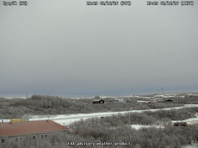
Webcam
Instrument
Earthquake Magnitude
0 7+
Earthquake Age
Last 2 Hours
Last 2 Days
Last 1 Week


Facts


  • Seismically Monitored: Yes
  • Color Code: GREEN
  • Alert Level: NORMAL
  • Elevation: 1474m (4835ft)
  • Latitude: 57.7503
  • Longitude: -156.37
  • Smithsonian VNum: 312130
  • Pronunciation:
  • Nearby Towns:
    • Kanatak 18 mi (29 km) SE
    • Ugashik 41 mi (67 km) SW
    • Pilot Point 47 mi (75 km) SW
    • Egegik 49 mi (79 km) NW
    • King Salmon 66 mi (106 km) NW

    Distance from Anchorage: 330 mi (531 km)

  • Subfeatures:
    • Ugashik caldera
    • Peulik
    • Mafic Knob 500

Description

From Miller and others (1998) [1] : "Mount Peulik volcano, a small truncated stratovolcano with a basal diameter of about 10 km, is located just north of the main axis of the Aleutian Range near Becharof Lake on the Alaska Peninsula. The volcano lies west of the axis of a northeast-striking syncline [2] and is built upon Jurassic sedimentary rocks. The volcano partially overlaps the north flank of Ugashik caldera, a small circular structure about 5 km in diameter and of probable late Pleistocene age. A summit crater, about 1.5 km in diameter, has been breached on the west side and is occupied by a dome about 0.5 km in diameter. This dome, and possibly earlier predecessors, were the source the a thick deposit of block-and-ash flows that underlie about 40 square km of the western flank of the volcano. A smaller dome occurs on the east flank at an elevation of 1200 m and was the source of a small block-and-ash flow. Avalanche deposits representing an earlier sector collapse (Miller, unpublished data) underlie an area of 75 square km northwest of the volcano. Flows from flank eruptions of Peulik cover about 8 square km north of the volcano extending as far as Becharof Lake."

Name Origin

"Ugashik-Peulik volcanic center" is an informal name. The principal peaks in the center are Mount Peulik and Mount Ugashik.


References Cited

[1] Catalog of the historically active volcanoes of Alaska, 1998

Miller, T. P., McGimsey, R. G., Richter, D. H., Riehle, J. R., Nye, C. J., Yount, M. E., and Dumoulin, J. A., 1998, Catalog of the historically active volcanoes of Alaska: U.S. Geological Survey Open-File Report 98-0582, 104 p.

[2] Geologic map of the Ugashik, Bristol Bay, and western part of Karluk quadrangle, Alaska, 1987

Detterman, R. L., Case, J. E., Wilson, F. H., and Yount, M. E., 1987, Geologic map of the Ugashik, Bristol Bay, and western part of Karluk quadrangle, Alaska: U.S. Geological Survey Miscellaneous Investigations Series Map I 1685, unpaged, 1 plate, scale 1:250,000.

Current Activity

No new updates for Ugashik-Peulik volcano since October 19, 2022, 3:05 pm.

Webcams

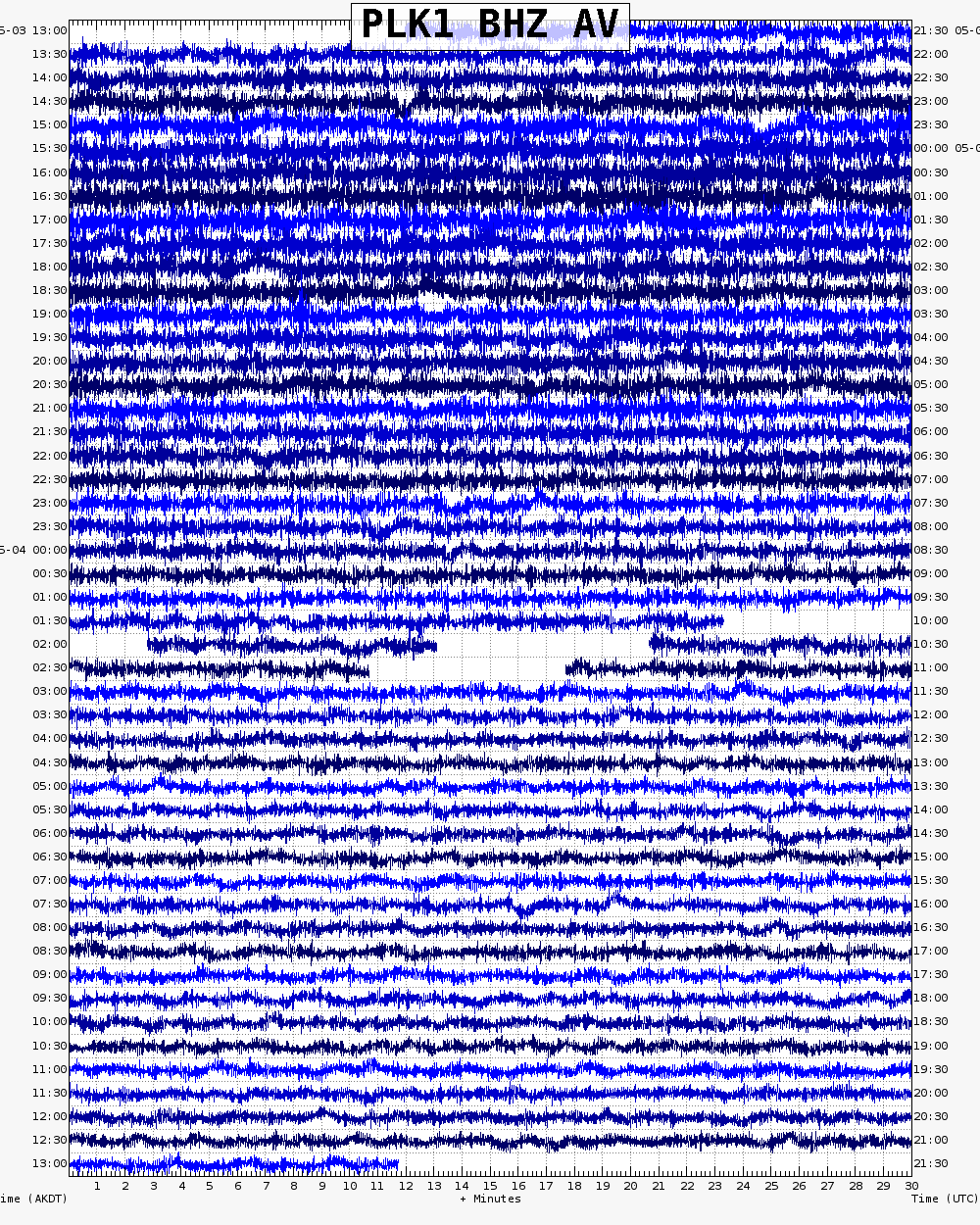
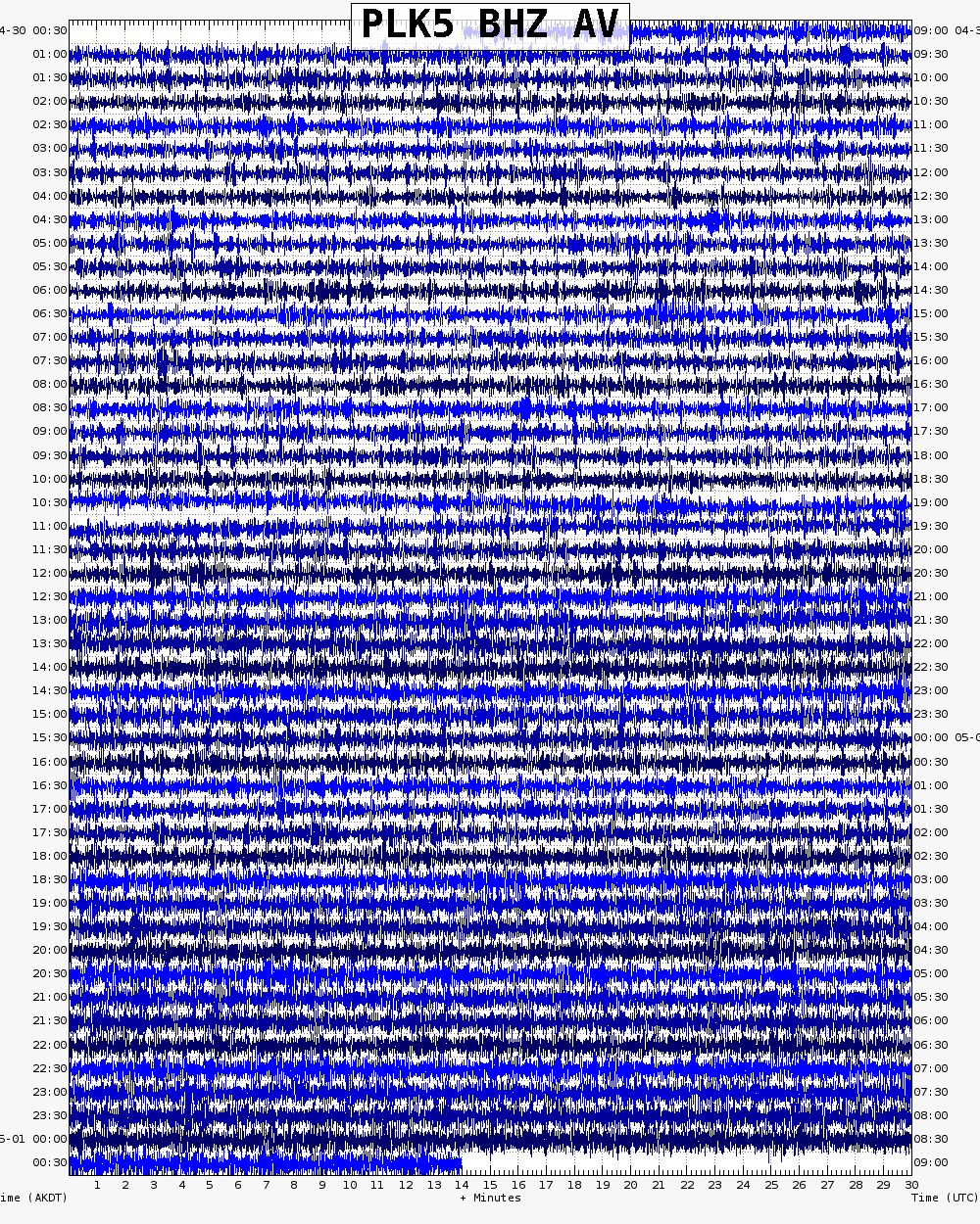
Webicorder

Color Code Timeline

Reported Activity

Modern Eruptions

Ugashik-Peulik

Ugashik-Peulik Eruption Timeline

Loading

From Kisslinger (1983), translating Doroshin (1870): "At the time of the Russian advent to these parts it emitted flame. Around 1814 its summit collapsed with a rumble, covering the base with enormous boulders. For about a week after this event, vapor rose from almost the entire surface of the mountain." Miller (2004) qualifies this report, stating: "Because Mount Peulik is separated from other prominent active volcanic edifices in the region [see fig. 1 in original text], these reports [of activity in 1814 and 1852] are credible and may represent the most recent eruptions at the center."

From Kisslinger (1983), translating Doroshin (1870): "In the summer of 1852, I proceeded from here on a southwesterly course along the eastern coast of the Alaskan Peninsula. At approximately 57 degrees 31 minutes latitude, 155 degrees 55 minutes longitude, I saw rising from behind a mountain the crater of Mt. Peulik. * * * I saw only smoke, coming from the south side of the crater. There are petroleum sources nearby. When portaging from Lake Iz'iagyk to the lake from which the Ugashik River flows [i.e., Upper Ugashik Lake], one must pass near this volcano. I would like to suggest that Mt. Peulik is identical with the mountain that is called 'Bocharov' on maps." Miller (2004) qualifies this report, stating: "Because Mount Peulik is separated from other prominent active volcanic edifices in the region [see fig. 1 in original text], these reports [of activity in 1814 and 1852] are credible and may represent the most recent eruptions at the center."

Peulik 2013/6

June 18, 2013 — July 12, 2013

From Dixon and others (2015): "On June 18, AVO received a pilot report of 'smoke or steaming emerging from Mount Peulik,' but no anomalous activity was noted at the time of the report. On August 12, AVO received a second observation of unusual activity from a long-time guide in the area, reporting 'sulfur smell and lack of fish.' No similar reports were received and AVO did not investigate further."

From Dixon and others, 2017: "On March 26 a ML=4.1 earthquake and aftershocks occurred close to the west shore of Becharof Lake in the same area as the 1998 Becharof swarm (McGimsey and others, 1999), 35 km (19 mi) west-northwest of Ukinrek Maars and 47 km (25 mi) west-northwest of Peulik. The earthquake series was short-lived as 17 earthquakes, 10 greater than ML=2.0, occurred within a 10-hour period, including the ML=4.1 and a ML=3.0 earthquake both of which occurred within the first 2 hours. These earthquakes formed a narrow east-west cluster 19 km (10 mi) in length at a depth of 7-9 km (3.7-4.9 mi). Nine additional earthquakes occurred in the same location in 2015-two in early March, five in mid-April, and two in late summer. The largest of these was a ML=3.2 on April 21, 2015.
"On July 15, an Alaska Department of Fish and Game (ADF&G) biologist reported that the water in Hot Springs Creek, flowing from Ugashik caldera into Ugashik Creek was 'frothy and orange.' The biologist also reported that salmon were not entering the stream where Ugashik Creek flows into Ugashik Lake as in past years (fig. 9 [original text]). Two days after the report, two water samples were collected from Hot Springs Creek at locations shown in figure 9 [original text]. Analysis (table7 [original text]) showed a pH (5.76 and 5.52) similar to previous water samples collected in June 2004 (pH=5.71) by Evans and other (2009) in a similar location. An aerial survey of the creek from the caldera to Upper Ugashik Lake detected no orange discoloration of the stream beyond the caldera. Outside the caldera, the stream was not running clear, but appeared heavily laden with sediment, rather than tinted orange as with waters inside the caldera. No unusual activity was observed and the discoloration likely was caused by a period of high runoff that intermixed the thermal waters with the clearer water in the stream causing a temporary flow of anomalously colored water
that delayed the reported movement of salmon upstream by ADF&G biologists. No volcanic unrest was apparent."

Loading

Peulik 1814

Peulik 1852

Peulik 2013/6

Ugashik-Peulik 2015

1310
1320
1330
1340
1350
1360
1370
1380
1390
1400
1410
1420
1430
1440
1450
1460
1470
1480
1490
1500
1510
1520
1530
1540
1550
1560
1570
1580
1590
1600
1610
1620
1630
1640
1650
1660
1670
1680
1690
1700
1710
1720
1730
1740
1750
1760
1770
1780
1790
1800
1810
1820
1830
1840
1850
1860
1870
1880
1890
1900
1910
1920
1930
1940
1950
1960
1970
1980
1990
2000
2010
2020
2030
2040
2050
2060
2070
2080
2090
2100
2110
2120
2130
2140
2150
2160
2170
2180
2190
2200
2210
2220
2230
2240
2250
2260
2270
2280
2290
2300
2310
2320
2330
2340
2350
2360
2370
2380
2390
2400
2410
2420
2430
2440
2450
2460
2470
2480
2490
2500
2510
1763
1764
1765
1766
1767
1768
1769
1771
1772
1773
1774
1775
1776
1777
1778
1779
1781
1782
1783
1784
1785
1786
1787
1788
1789
1791
1792
1793
1794
1795
1796
1797
1798
1799
1801
1802
1803
1804
1805
1806
1807
1808
1809
1811
1812
1813
1814
1815
1816
1817
1818
1819
1821
1822
1823
1824
1825
1826
1827
1828
1829
1831
1832
1833
1834
1835
1836
1837
1838
1839
1841
1842
1843
1844
1845
1846
1847
1848
1849
1851
1852
1853
1854
1855
1856
1857
1858
1859
1861
1862
1863
1864
1865
1866
1867
1868
1869
1871
1872
1873
1874
1875
1876
1877
1878
1879
1881
1882
1883
1884
1885
1886
1887
1888
1889
1891
1892
1893
1894
1895
1896
1897
1898
1899
1901
1902
1903
1904
1905
1906
1907
1908
1909
1911
1912
1913
1914
1915
1916
1917
1918
1919
1921
1922
1923
1924
1925
1926
1927
1928
1929
1931
1932
1933
1934
1935
1936
1937
1938
1939
1941
1942
1943
1944
1945
1946
1947
1948
1949
1951
1952
1953
1954
1955
1956
1957
1958
1959
1961
1962
1963
1964
1965
1966
1967
1968
1969
1971
1972
1973
1974
1975
1976
1977
1978
1979
1981
1982
1983
1984
1985
1986
1987
1988
1989
1991
1992
1993
1994
1995
1996
1997
1998
1999
2001
2002
2003
2004
2005
2006
2007
2008
2009
2011
2012
2013
2014
2015
2016
2017
2018
2019
2021
2022
2023
2024
2025
2026
2027
2028
2029
2031
2032
2033
2034
2035
2036
2037
2038
2039
2041
2042
2043
2044
2045
2046
2047
2048
2049
2051
2052
2053
2054
2055
2056
2057
2058
2059
2061
2062
2063
2064

10 Event Date(s)

Past Activity Legend:
Eruption
Questionable eruption
Non-eruptive activity


Showing 1 - 20 of 48

Map Images


Map References


Recently active volcanoes of Alaska, 2023

Cameron, C.E., Bull, K.F., and Macpherson, A.E., 2023, Recently active volcanoes of Alaska: Alaska Division of Geological & Geophysical Surveys Miscellaneous Publication 133 v. 6, 2 sheets. https://doi.org/10.14509/31086.

Historically active volcanoes of Alaska, v. 3, 2018

Cameron, C.E., Schaefer, J.R., and Mulliken, K.M., 2018, Historically active volcanoes of Alaska: Alaska Division of Geological & Geophysical Surveys Miscellaneous Publication 133 v. 3, 2 sheets. Http://doi.org/10.14509/30142

Historically active volcanoes of Alaska, 2014

Schaefer, J.R., Cameron, C.E., and Nye, C.J., 2014, Historically active volcanoes of Alaska: Alaska Division of Geological & Geophysical Surveys Miscellaneous Publication 133 v. 1.2, 1 sheet, scale 1:3,000,000. This publication has been superseded. Newest version available at http://www.dggs.alaska.gov/pubs/id/20181 .

Geology of the Ugashik-Mount Peulik volcanic center, Alaska, 2004

Miller, T. P., 2004, Geology of the Ugashik-Mount Peulik volcanic center, Alaska: U.S. Geological Survey Open-File Report 2004-1009, 19 p., 2 sheets, scale 1:63,360.
full-text PDF 1.7 MB
plate 1 PDF 660 KB
plate 2 PDF 142 KB
Hard Copy held by AVO at FBKS - CEC shelf

Historically active volcanoes of the Aleutian Arc, 2002

Schaefer, Janet, and Nye, C. J., 2002, Historically active volcanoes of the Aleutian Arc: Alaska Division of Geological & Geophysical Surveys Miscellaneous Publication MP 0123, unpaged, 1 sheet, scale 1:3,000,000. Superceded by Miscellaneous Publication 133: http://www.dggs.dnr.state.ak.us/pubs/pubs?reqtype=citation&ID=20181

Volcanoes of Alaska, 1998

Nye, C. J., Queen, Katherine, and McCarthy, A. M., 1998, Volcanoes of Alaska: Alaska Division of Geological & Geophysical Surveys Information Circular IC 0038, unpaged, 1 sheet, scale 1:4,000,000, available at http://www.dggs.dnr.state.ak.us/pubs/pubs?reqtype=citation&ID=7043 .
Hard Copy held by AVO at FBKS - CEC shelf

Volcanoes of Alaska, 1995

Alaska Division of Geological & Geophysical Surveys, 1995, Volcanoes of Alaska: Alaska Division of Geological & Geophysical Surveys Information Circular IC 0038, unpaged, 1 sheet, scale 1:4,000,000.

Geothermal resources of the Aleutian Arc, 1993

Motyka, R. J., Liss, S. A., Nye, C. J., and Moorman, M. A., 1993, Geothermal resources of the Aleutian Arc: Alaska Division of Geological & Geophysical Surveys Professional Report PR 0114, 17 p., 4 sheets, scale 1:1,000,000.
Hard Copy held by AVO at FBKS - CEC shelf

Holocene volcanoes of the Aleutian Arc, Alaska, 1993

March, G. D., 1993, Holocene volcanoes of the Aleutian Arc, Alaska: Alaska Division of Geological & Geophysical Surveys Public-Data File PDF 93-85, unpaged, 1 sheet, scale 1:2,000,000.

Map and tables showing geochronology and whole-rock geochemistry of selected samples, Ugashik and part of Karluk quadrangles, Alaska, 1992

Wilson, F.H., and Shew, Nora, 1992, Map and tables showing geochronology and whole-rock geochemistry of selected samples, Ugashik and part of Karluk quadrangles, Alaska: U.S. Geological Survey Miscellaneous Field Studies Map MF-1539-E, 34 p., 2 sheets, scale 1:250,000.
Hard Copy held by AVO at FBKS - CEC file cabinet

Mineral and energy resource assessment maps of the Ugashik, Bristol Bay and western Karluk quadrangles, Alaska, 1989

Church, S. E., Detterman, R. L., and Wilson, F. H., 1989, Mineral and energy resource assessment maps of the Ugashik, Bristol Bay and western Karluk quadrangles, Alaska: U.S. Geological Survey Miscellaneous Field Studies Map MF 1539-I, unpaged, 2 plates, scale 1:63,360.

Maps showing aeromagnetic survey and geologic interpretation of the Ugashik and part of the Karluk quadrangles, Alaska, 1988

Case, J. E., Detterman, R. L., Wilson, F. H., Chuchel, B. A., and Yount, M. E., 1988, Maps showing aeromagnetic survey and geologic interpretation of the Ugashik and part of the Karluk quadrangles, Alaska: U.S. Geological Survey Miscellaneous Field Studies Map MF 1539-D, 12 p., 2 plates, scale 1:250,000.

Quaternary geologic map of the Ugashik, Bristol Bay, and western part of Karluk quadrangles, Alaska, 1987

Detterman, R. L., Wilson, F. H., Yount, M. E., and Miller, T. P., 1987, Quaternary geologic map of the Ugashik, Bristol Bay, and western part of Karluk quadrangles, Alaska: U.S. Geological Survey Miscellaneous Investigations Series Map I 1801, unpaged, 1 sheet, scale 1:250,000, available online at http://www.dggs.dnr.state.ak.us/pubs/pubs?reqtype=citation&ID=12928 .

Geologic map of the Ugashik, Bristol Bay, and western part of Karluk quadrangle, Alaska, 1987

Detterman, R. L., Case, J. E., Wilson, F. H., and Yount, M. E., 1987, Geologic map of the Ugashik, Bristol Bay, and western part of Karluk quadrangle, Alaska: U.S. Geological Survey Miscellaneous Investigations Series Map I 1685, unpaged, 1 plate, scale 1:250,000.

Petrography, chemistry, and geologic history of Yantarni volcano, Aleutian volcanic arc, Alaska, 1987

Riehle, J. R., Yount, M. E., and Miller, T. P., 1987, Petrography, chemistry, and geologic history of Yantarni volcano, Aleutian volcanic arc, Alaska: U.S. Geological Survey Bulletin 1761, 27 p., 1 sheet, scale 1:63,360.
full-text PDF 2.2 MB
plate 1 PDF 429 KB
Hard Copy held by AVO at FBKS - CEC file cabinet

Map showing distribution, composition, and age of Late Cenozoic volcanic centers in Alaska, 1986

Luedke, R. G., and Smith, R. L., 1986, Map showing distribution, composition, and age of Late Cenozoic volcanic centers in Alaska: U.S. Geological Survey Miscellaneous Investigations Series Map I 1091-F, unpaged, 3 sheets, scale 1:1,000,000.

Generalized geologic map of the Ugashik, Bristol Bay, and part of the Karluk quadrangles, Alaska, 1983

Detterman, R. L., Case, J. E., Wilson, F. H., Yount, M. E., and Allaway, W. H. Jr., 1983, Generalized geologic map of the Ugashik, Bristol Bay, and part of the Karluk quadrangles, Alaska: U.S. Geological Survey Miscellaneous Field Studies Map MF 1539-A, unpaged, 1 sheet, scale 1:250,000.

Preliminary maps showing interpretation of Landsat imagery of the Ugashik and Karluk quadrangles, Alaska, 1981

LeCompte, J. R., 1981, Preliminary maps showing interpretation of Landsat imagery of the Ugashik and Karluk quadrangles, Alaska: U.S. Geological Survey Open-File Report 81-0776, unpaged, 2 plates, scale 1:250,000.

Geothermal energy resources of Alaska, 1980

Turner, D. L., Forbes, R. B., Albanese, Mary, Macbeth, Joyce, Lockhart, A. B., and Seed, S. M., 1980, Geothermal energy resources of Alaska: University of Alaska Fairbanks Geophysical Institute Report UAG-R 279, 19 p., 3 sheets, scale 1 at 1:2,500,000.

Volcanic activity in the Aleutian Arc, 1950

Coats, R. R., 1950, Volcanic activity in the Aleutian Arc: U.S. Geological Survey Bulletin 0974-B, p. 35-49, 1 sheet, scale 1:5,000,000.
plate 1 PDF 819 KB
full-text PDF 783 KB
Hard Copy held by AVO at FBKS - CEC shelf

The Cold Bay-Chignik District, Alaska, 1924

Smith, W. R., and Baker, A. A., 1924, The Cold Bay-Chignik District, Alaska: U.S. Geological Survey Bulletin 0755-D, p. 151-222, 5 plates, scale 4 at 1:250,000 and 1 unknown.
full-text PDF 4.9 MB
plate 8 PDF 1.6 MB

The Cold Bay district, 1923

Capps, S. R., 1923, The Cold Bay district: U.S. Geological Survey Bulletin 0739-C, p. 77-116, 1 sheet, scale 1:250,000.
full-text PDF 1.8 MB
plate PDF 1.3 MB

References

Recently active volcanoes of Alaska, 2023

Cameron, C.E., Bull, K.F., and Macpherson, A.E., 2023, Recently active volcanoes of Alaska: Alaska Division of Geological & Geophysical Surveys Miscellaneous Publication 133 v. 6, 2 sheets. https://doi.org/10.14509/31086.

Probabilistic source classification of large tephra producing eruptions using supervised machine learning - an example from the Alaska-Aleutian Arc, 2023

Lubbers, J., Loewen, M., Wallace, K., Coombs, M., and Addison, J., 2023, Probabilistic source classification of large tephra producing eruptions using supervised machine learning - an example from the Alaska-Aleutian Arc: Geochemistry, Geophysics, Geosystems v. 24, no. 11, e2023GC011037. https://doi.org/10.1029/2023GC011037.

Alaska interagency operating plan for volcanic ash episodes, 2022

Alaska Volcano Observatory, National Oceanic and Atmospheric Administration, National Weather Service, Federal Aviation Administration, Department of Defense, United States Coast Guard, Division of Homeland Security and Emergency Management, Alaska Department of Environmental Conservation, and Alaska Department of Health and Social Services (participating agencies), 2022, Alaska interagency operating plan for volcanic ash episodes, 85 p.

Goals and development of the Alaska Volcano Observatory seismic network and application to forecasting and detecting volcanic eruptions, 2020

Power, J.A., Haney, M.M., Botnick, S.M., Dixon, J.P., Fee, David, Kaufman, A.M., Ketner, D.M., Lyons, J.J., Parker, Tom, Paskievitch, J.F., Read, C.W., Searcy, Cheryl, Stihler, S.D., Tepp, Gabrielle, and Wech, A.G., 2020, Goals and development of the Alaska Volcano Observatory seismic network and application to forecasting and detecting volcanic eruptions: Seismological Research Letters, doi: 10.1785/0220190216 .

Historically active volcanoes of Alaska, v. 4, 2020

Cameron, C.E., Schaefer, J.R., and Ekberg, P.G., 2020, Historically active volcanoes of Alaska: Alaska Division of Geological & Geophysical Surveys Miscellaneous Publication 133 v. 4, 2 sheets. Http://doi.org/10.14509/30426

The prevalence and significance of offset magma reservoirs at arc volcanoes, 2020

Lerner, A.H., O'Hara, D., Karlstrom, L., Ebmeier, S.K., Anderson, K.R., and Hurwitz, S., 2020, The prevalence and significance of offset magma reservoirs at arc volcanoes: Geophysical Research Letters, v. 47, doi:10.1029/2020GL087856.

The depths and locations of magma reservoirs and their consequences for the behavior of sulfur and volcanic degassing, 2020

Lerner, A.H., 2020, The depths and locations of magma reservoirs and their consequences for the behavior of sulfur and volcanic degassing: University of Oregon Ph.D. thesis, 378 p. Available at https://search.proquest.com/openview/cec1ff16af338dce2495b5a1a491aa88/1?pq-origsite=gscholar&cbl=44156.

Catalog of earthquake parameters and description of seismograph and infrasound stations at Alaskan volcanoes - January 1, 2013, through December 31, 2017, 2019

Dixon, J.P., Stihler S.D., Haney, M.M., Lyons, J.J., Ketner, D.M., Mulliken, K.M., Parker, T., and Power, J.A., 2019, Catalog of earthquake parameters and description of seismograph and infrasound stations at Alaskan volcanoes - January 1, 2013, through December 31, 2017: U.S. Geological Survey Data Series 1115, 92 p., https://doi.org/10.3133/ds1115.

A unified catalog of earthquake hypocenters and magnitudes at volcanoes in Alaska: 1989 to 2018, 2019

Power, J.A., Friberg, P.A., Haney, M.M., Parker, T., Stihler, S.D., and Dixon, J.P., 2019, A unified catalog of earthquake hypocenters and magnitudes at volcanoes in Alaska—1989 to 2018: U.S. Geological Survey Scientific Investigations Report 2019–5037, 17 p., https://doi.org/10.3133/sir20195037.

2018 update to the U.S. Geological Survey national volcanic threat assessment, 2018

Ewert, J.W., Diefenbach, A.K., and Ramsey, D.W., 2018, 2018 update to the U.S. Geological Survey national volcanic threat assessment: U.S. Geological Survey Scientific Investigations Report 2018-5140, 40 p., https://pubs.usgs.gov/sir/2018/5140/sir20185140.pdf.

Historically active volcanoes of Alaska, v. 3, 2018

Cameron, C.E., Schaefer, J.R., and Mulliken, K.M., 2018, Historically active volcanoes of Alaska: Alaska Division of Geological & Geophysical Surveys Miscellaneous Publication 133 v. 3, 2 sheets. Http://doi.org/10.14509/30142

2015 Volcanic activity in Alaska - Summary of events and response of the Alaska Volcano Observatory, 2017

Dixon, J.P., Cameron, C.E., Iezzi, A.M., and Wallace, Kristi, 2017, 2015 Volcanic activity in Alaska-Summary of events and response of the Alaska Volcano Observatory: U.S. Geological Survey Scientific Investigations Report 2017-5104, 61 p., https://doi.org/10.3133/sir20175104.

Historically active volcanoes of Alaska, 2016

Cameron, C.E., and Schaefer, J.R., 2016, Historically active volcanoes of Alaska: Alaska Division of Geological & Geophysical Surveys Miscellaneous Publication 133 v. 2, 1 sheet, scale 1:3,000,000. http://doi.org/10.14509/20181

Alaska Volcano Observatory image database, 2016

Cameron, C.E., and Snedigar, S.F., 2016, Alaska Volcano Observatory image database: Alaska Division of Geological & Geophysical Surveys Digital Data Series 13, https://www.avo.alaska.edu/images/. https://doi.org/10.14509/29689.

2013 Volcanic activity in Alaska - summary of events and response of the Alaska Volcano Observatory, 2015

Dixon, J.P., Cameron, Cheryl, McGimsey, R.G., Neal, C.A., and Waythomas, Chris, 2015, 2013 Volcanic activity in Alaska - Summary of events and response of the Alaska Volcano Observatory: U.S. Geological Survey Scientific Investigations Report 2015-5110, 92 p., http://dx.doi.org/10.3133/sir20155110.

Historically active volcanoes of Alaska, 2014

Schaefer, J.R., Cameron, C.E., and Nye, C.J., 2014, Historically active volcanoes of Alaska: Alaska Division of Geological & Geophysical Surveys Miscellaneous Publication 133 v. 1.2, 1 sheet, scale 1:3,000,000. This publication has been superseded. Newest version available at http://www.dggs.alaska.gov/pubs/id/20181 .

Regional controls on volcano seismicity along the Aleutian Arc, 2014

Buurman, Helena, Nye, C.J., West, M.E., and Cameron, Cheryl, 2014, Regional controls on volcano seismicity along the Aleutian Arc: Geochemistry, Geophysics, Geosystems, doi:10.1002/2013GC005101

Preliminary database of Quaternary vents in Alaska, 2014

Cameron, C.E., and Nye, C.J., 2014, Preliminary database of Quaternary vents in Alaska: Alaska Division of Geological & Geophysical Surveys Miscellaneous Publication 153, 11 p., doi:10.14509/27357 .

InSAR imaging of Aleutian volcanoes, 2014

Lu, Zhong, and Dzurisin, Daniel, 2014, InSAR imaging of Aleutian volcanoes: Chichester, UK, Springer-Praxis, 390 p.

Catalog of earthquake hypocenters at Alaskan volcanoes: January 1 through December 31, 2012, 2013

Dixon, J.P., Stihler, S.D, Power, J.A., Haney, Matt, Parker, Tom, Searcy, C.K., and Prejean, Stephanie, 2013, Catalog of earthquake hypocenters at Alaskan volcanoes: January 1 through December 31, 2012: U.S. Geological Survey Data Series 789, 84 p., available at http://pubs.usgs.gov/ds/789/ .
full-text pdf 6.5 MB

Katmai scientific studies, 2012

Winfree, Robert, with contributions from Bacon, C.R., Bennett, A.J., Bennington, Ninfa, Berg, E.E., Brooks, Margi, Coletti, H.A., Coombs, M.L., Fierstein, Judy, Freeburg, Gary, Frost, G.V., Haney, Matthew, Jorgenson, M.T., Miller, A.E., Moran, Seth, Murphy, Rachel, Partnow, Patricia, Paskievitch, John, Stevens, D.P., Powell, Lee, Power, John, Prejean, S.G., Schaaf, Jeanne, Sherriff, R.L., Thurber, Clifford, and Welchman, R.A., 2012, Katmai science studies: Alaska Park Science Journal, v. 11, n. 1, 96 p., available online at http://www.nps.gov/akso/nature/science/ak_park_science/volume_11_issue_1.cfm .

Catalog of earthquake hypocenters at Alaskan volcanoes: January 1 through December 31, 2011, 2012

Dixon, J.P., Stihler, S.D., Power, J.A., and Searcy, C.K., 2012, Catalog of earthquake hypocenters at Alaskan volcanoes: January 1 through December 31, 2011: U.S. Geological Survey Data Series 730, 82 p., available online at http://pubs.usgs.gov/ds/730/pdf/ds730.pdf .

Catalog of earthquake hypocenters at Alaskan volcanoes: January 1 through December 31, 2010, 2011

Dixon, J.P., Stihler, S.D., Power, J.A., and Searcy, C.K., 2011, Catalog of earthquake hypocenters at Alaskan volcanoes: January 1 through December 31, 2010: U.S. Geological Survey Data Series 645, 82 p., available online at http://pubs.usgs.gov/ds/645/

Catalog of earthquake hypocenters at Alaskan volcanoes: January 1 through December 31, 2009, 2010

Dixon, J.P., Stihler, S.D., Power, J.A., and Searcy, C.K., 2010, Catalog of earthquake hypocenters at Alaskan volcanoes: January 1 through December 31, 2009: U.S. Geological Survey Data Series 531, 84 p., available online at http://pubs.usgs.gov/ds/531/ .

Catalog of earthquake hypocenters at Alaskan volcanoes: January 1 through December 31, 2008, 2009

Dixon, J.P., and Stihler, S.D., 2009, Catalog of earthquake hypocenters at Alaskan volcanoes: January 1 through December 31, 2008: U.S. Geological Survey Data Series 467, 88 p., available at http://pubs.usgs.gov/ds/467/ .

Historically active volcanoes of Alaska reference deck, 2009

Snedigar, S.F., and Cameron, C.C., 2009, Historically active volcanoes of Alaska reference deck: Alaska Division of Geological & Geophysical Surveys Information Circular 59, 52 p, available to order from http://www.dggs.dnr.state.ak.us/pubs/pubs?reqtype=citation&ID=20401 .

Chronology and references of volcanic eruptions and selected unrest in the United States, 1980-2008, 2009

Diefenbach, A.K., Guffanti, Marianne, and Ewert, J.W., 2009, Chronology and references of volcanic eruptions and selected unrest in the United States, 1980-2008: U.S. Geological Survey Open-File Report 2009-1118, 85 p., available at http://pubs.usgs.gov/of/2009/1118/ .

Preliminary spreadsheet of eruption source parameters for volcanoes of the world, 2009

Mastin, L.G., Guffanti, Marianne, Ewert, J.E., and Spiegel, Jessica, 2009, Preliminary spreadsheet of eruption source parameters for volcanoes of the world: U.S. Geological Survey Open-File Report 2009-1133, v. 1.2, 25 p., available at http://pubs.usgs.gov/of/2009/1133/ .

Catalog of earthquake hypocenters at Alaskan volcanoes: January 1 through December 31, 2006, 2008

Dixon, J.P., Stihler, S.D., Power, J.A., and Searcy, Cheryl, 2008, Catalog of earthquake hypocenters at Alaskan volcanoes: January 1 through December 31, 2006: U.S. Geological Survey Data Series 326, 79 p., available at http://pubs.usgs.gov/ds/326/ .

The Alaska Volcano Observatory - 20 years of volcano research, monitoring, and eruption response, 2008

Schaefer, J.R., and Nye, Chris, 2008, The Alaska Volcano Observatory - 20 years of volcano research, monitoring, and eruption response: Alaska Division of Geological & Geophysical Surveys, Alaska GeoSurvey News, NL 2008-001, v. 11, n. 1, p. 1-9, available at http://wwwdggs.dnr.state.ak.us/pubs/pubs?reqtype=citation&ID=16061 .

Catalog of earthquake hypocenters at Alaskan volcanoes: January 1 through December 31, 2007, 2008

Dixon, J.P., Stihler, S.D. and Power, J.A., 2008, Catalog of earthquake hypocenters at Alaskan volcanoes: January 1 through December 31, 2007: U.S. Geological Survey Data Series 367, 82 p., available online at http://pubs.usgs.gov/ds/367/ .

InSAR imaging of volcanic deformation over cloud-prone areas - Aleutian Islands, 2007

Lu, Zhong, 2007, InSAR imaging of volcanic deformation over cloud-prone areas - Aleutian Islands: Photogrammetric Engineering and Remote Sensing, v. 73, n. 3, p. 245-257.

System for ranking relative threats of U.S. volcanoes, 2007

Ewert, John, 2007, System for ranking relative threats of U.S. volcanoes: Natural Hazards Review, v. 8, n. 4, p. 112-124.

A compilation of gas emission-rate data from volcanoes of Cook Inlet (Spurr, Crater Peak, Redoubt, Iliamna, and Augustine) and Alaska Peninsula (Douglas, Fourpeaked, Griggs, Mageik, Martin, Peulik, Ukinrek Maars, and Veniaminof), Alaska, from 1995-2006, 2007

Doukas, M.P., and McGee, K.A., 2007, A compilation of gas emission-rate data from volcanoes of Cook Inlet (Spurr, Crater Peak, Redoubt, Iliamna, and Augustine) and Alaska Peninsula (Douglas, Fourpeaked, Griggs, Mageik, Martin, Peulik, Ukinrek Maars, and Veniaminof), Alaska, from 1995-2006: U.S. Geological Survey Open-File Report 2007-1400, 13 p., available at http://pubs.usgs.gov/of/2007/1400/ .

Blue Mountain and The Gas Rocks: rear-arc dome clusters on the Alaska Peninsula, 2007

Hildreth, Wes, Fierstein, Judy, and Calvert, A.T., 2007, Blue Mountain and The Gas Rocks; rear-arc dome clusters on the Alaska Peninsula: in Haeussler, P.J., and Galloway, J.P., eds., Studies by the U.S. Geological Survey in Alaska, U.S. Geological Survey Professional Paper 1739-A, 27 p., available at http://pubs.usgs.gov/pp/pp1739/a/ .
Hard Copy held by AVO at FBKS - CEC file cabinet

Catalog of earthquake hypocenters at Alaskan volcanoes: January 1 through December 31, 2005, 2006

Dixon, J.P., Stihler, S.D., Power, J.A., Tytgat, Guy, Estes, Steve, and McNutt, S.R., 2006, Catalog of earthquake hypocenters at Alaskan volcanoes: January 1 through December 31, 2005: U.S. Geological Survey Open-File Report 2006-1264, 78 p., available at http://pubs.usgs.gov/of/2006/1264/ .

September-October 2004, 2005

Alaska Volcano Observatory, 2005, September-October 2004: Alaska Volcano Observatory Bimonthly Report, v. 16, n. 5, unpaged.

An assessment of volcanic threat and monitoring capabilities in the United States: framework for a National Volcano Early Warning System NVEWS, 2005

Ewert, J.W., Guffanti, Marianne, and Murray, T.L., 2005, An assessment of volcanic threat and monitoring capabilities in the United States: framework for a National Volcano Early Warning System NVEWS: U.S. Geological Survey Open-File Report 2005-1164, 62 p.
full-text PDF 2.90 MB

March-April 2005, 2005

Alaska Volcano Observatory, 2005, March-April 2005: Alaska Volcano Observatory Bimonthly report, v. 17, n. 2, unpaged, http://www.avo.alaska.edu/avobm/avo_info.php?volume=17&number=2.

Catalog of earthquake hypocenters at Alaskan volcanoes: January 1 through December 31, 2004, 2005

Dixon, J.P., Stihler, S.D., Power, J.A., Tytgat, Guy, Estes, Steve, Prejean, Stephanie, Sanchez, J.J., Sanches, Rebecca, McNutt, S.R., and Paskievitch, John, 2005, Catalog of earthquake hypocenters at Alaskan volcanoes: January 1 through December 31, 2004: U.S. Geological Survey Open-File Report 2005-1312, 74 p., available online at http://pubs.usgs.gov/of/2005/1312/.

InSAR studies of Alaska volcanoes, 2005

Lu, Z., Wicks, C., Dzurisin, D., and Power, J., 2005, InSAR studies of Alaska volcanoes: Korean Journal of Remote Sensing v. 21, no. 1, pg. 59-72. https://doi.org/10.7780/kjrs.2005.21.1.59

Geology of the Ugashik-Mount Peulik volcanic center, Alaska, 2004

Miller, T. P., 2004, Geology of the Ugashik-Mount Peulik volcanic center, Alaska: U.S. Geological Survey Open-File Report 2004-1009, 19 p., 2 sheets, scale 1:63,360.
full-text PDF 1.7 MB
plate 1 PDF 660 KB
plate 2 PDF 142 KB
Hard Copy held by AVO at FBKS - CEC shelf

Simultaneous earthquake swarms and eruption in Alaska, fall 1996: Statistical significance and inference of a large aseismic slip event, 2004

McNutt, S.R., and Marzocchi, W., 2005, Simultaneous earthquake swarms and eruption in Alaska, fall 1996: Statistical significance and inference of a large aseismic slip event: Bulletin of the Seismological Society of America, v. 94, n. 5, p. 1831-1841.

Volcanoes of the world: an illustrated catalog of Holocene volcanoes and their eruptions, 2003

Siebert, L., and Simkin, T., 2002-, Volcanoes of the world: an illustrated catalog of Holocene volcanoes and their eruptions: Smithsonian Institution, Global Volcanism Program Digital Information Series GVP-3, http://volcano.si.edu/search_volcano.cfm, unpaged internet resource.

Bibliography of information on Alaska volcanoes, 2003

Cameron, C. E., Triplehorn, J. H., and Robar, C. L., 2003, Bibliography of information on Alaska volcanoes: Alaska Division of Geological & Geophysical Surveys Miscellaneous Publication MP 131, 1 CD-ROM.
Hard Copy held by AVO at FBKS - CEC file cabinet

1998 volcanic activity in Alaska and Kamchatka: Summary of events and response of the Alaska Volcano Observatory, 2003

McGimsey, R. G., Neal, C. A., and Girina, Olga, 2003, 1998 volcanic activity in Alaska and Kamchatka: Summary of events and response of the Alaska Volcano Observatory: U.S. Geological Survey Open-File Report 03-0423, 35 p.
full-text PDF 1.40 MB
Hard Copy held by AVO at FBKS - CEC file cabinet

Interferometric synthetic aperture radar studies of Alaska volcanoes, 2003

Lu, Zhong, Wicks, C. J., Dzurisin, Daniel, Power, John, Thatcher, Wayne, and Masterlark, Tim, 2003, Interferometric synthetic aperture radar studies of Alaska volcanoes: Earth Observation Magazine, v. 12, n. 3, p. 8-10.

Magmatic inflation at a dormant stratovolcano: 1996-1998 activity at Mount Peulik volcano, revealed by satellite radar interferometry, 2002

Lu, Z., Moran, S. C., Thatcher, Wayne, Wicks, C. J., Dzurisin, D., and Power, J. A., 2002, Magmatic inflation at a dormant stratovolcano: 1996-1998 activity at Mount Peulik volcano, revealed by satellite radar interferometry: Journal of Geophysical Research, v. 107, n. 7, p. 4-13.

Historically active volcanoes of the Aleutian Arc, 2002

Schaefer, Janet, and Nye, C. J., 2002, Historically active volcanoes of the Aleutian Arc: Alaska Division of Geological & Geophysical Surveys Miscellaneous Publication MP 0123, unpaged, 1 sheet, scale 1:3,000,000. Superceded by Miscellaneous Publication 133: http://www.dggs.dnr.state.ak.us/pubs/pubs?reqtype=citation&ID=20181

Historically active volcanoes in Alaska, a quick reference, 2000

Wallace, K. L., McGimsey, R. G., and Miller, T. P., 2000, Historically active volcanoes in Alaska, a quick reference: U.S. Geological Survey Fact Sheet FS 0118-00, 2 p.
full-text PDF 162 KB
Hard Copy held by AVO at FBKS - CEC file cabinet

Encyclopedia of volcanoes, 2000

Sigurdsson, Haraldur, (ed.), 2000, Encyclopedia of volcanoes: San Diego, CA, Academic Press, 1417 p.

Satellite radar interferometry detected surface deformation at a dormant Aleutian volcano, 2000

Lu, Zhong, Wicks, Charles, Dzurisin, Daniel, Power, J. A., and Thatcher, Wayne, 2000, Satellite radar interferometry detected surface deformation at a dormant Aleutian volcano [abs.]: Eos, v. 81, n. 48, p. 1354.

Up smoking mountain, 2000

Hall, Andy, 2000, Up smoking mountain: Alaska, v. 66, n. 4, p. 42-48.

Data on Holocene tephra (volcanic ash) deposits in the Alaska Peninsula and lower Cook Inlet region of the Aleutian volcanic arc, Alaska, 1999

Riehle, J. R., Meyer, C. E., and Miyaoka, R. T., 1999, Data on Holocene tephra (volcanic ash) deposits in the Alaska Peninsula and lower Cook Inlet region of the Aleutian volcanic arc, Alaska: U.S. Geological Survey Open-File Report 99-0135, 5 p.
Hard Copy held by AVO at FBKS - CEC file cabinet

Volcanoes of Alaska, 1998

Nye, C. J., Queen, Katherine, and McCarthy, A. M., 1998, Volcanoes of Alaska: Alaska Division of Geological & Geophysical Surveys Information Circular IC 0038, unpaged, 1 sheet, scale 1:4,000,000, available at http://www.dggs.dnr.state.ak.us/pubs/pubs?reqtype=citation&ID=7043 .
Hard Copy held by AVO at FBKS - CEC shelf

Catalog of the historically active volcanoes of Alaska, 1998

Miller, T. P., McGimsey, R. G., Richter, D. H., Riehle, J. R., Nye, C. J., Yount, M. E., and Dumoulin, J. A., 1998, Catalog of the historically active volcanoes of Alaska: U.S. Geological Survey Open-File Report 98-0582, 104 p.
Hard Copy held by AVO at FBKS - CEC shelf

Volcanoes of the Alaska Peninsula and Aleutian Islands selected photographs, 1997

Neal, Christina, and McGimsey, R. G., 1997, Volcanoes of the Alaska Peninsula and Aleutian Islands selected photographs: U.S. Geological Survey Digital Data Series DDS 0040, 1 CD-ROM.

Stratigraphic framework of the Alaska Peninsula, 1996

Detterman, R. L., Case, J. E., Miller, J. W., Wilson, F. H., and Yount, M. E., 1996, Stratigraphic framework of the Alaska Peninsula: U.S. Geological Survey Bulletin 1969-A, 74 p.
full-text PDF 2.7 MB

Quick reference to Alaska's active volcanoes and listing of historical eruptions, 1760-1994, 1995

McGimsey, R. G., and Miller, T. P., 1995, Quick reference to Alaska's active volcanoes and listing of historical eruptions, 1760-1994: U.S. Geological Survey Open-File Report 95-0520, 13 p.
Hard Copy held by AVO at FBKS - CEC file cabinet

Mechanics of magma/ water interaction, Ukinrek Maars, Alaska, 1995

Ort, M. H., Wohletz, K. H., Neal, C. A., and McConnell, V. S., 1995, Mechanics of magma/ water interaction, Ukinrek Maars, Alaska [abs.]: in International Union of Geodesy and Geophysics, General Assembly, 21, International Union of Geodesy and Geophysics: XXI general assembly; abstracts, Boulder, CO, July 2-14, 1995, Week A, p. 467.

Volcanoes of Alaska, 1995

Alaska Division of Geological & Geophysical Surveys, 1995, Volcanoes of Alaska: Alaska Division of Geological & Geophysical Surveys Information Circular IC 0038, unpaged, 1 sheet, scale 1:4,000,000.

Age, character, and significance of Aleutian arc volcanism, 1994

Fournelle, J. H., Marsh, B. D., and Myers, J. D., 1994, Age, character, and significance of Aleutian arc volcanism: in Plafker, George and Berg, H. C., (eds.), The Geology of Alaska, Geological Society of America The Geology of North America Series v. G-1, p. 723-758.

Complex interactions of ground water and basaltic magma during the eruption of the Ukinrek maars, Alaska, 1994

Ort, M. H., Wohletz, K. H., and Neal, C. A., 1994, Complex interactions of ground water and basaltic magma during the eruption of the Ukinrek maars, Alaska [abs.]: Abstracts with Programs - Geological Society of America, v. 26, n. 7, p. 378.

Overview of the geology and tectonic evolution of Alaska, 1994

Plafker, George, and Berg, H. C., 1994, Overview of the geology and tectonic evolution of Alaska: in Plafker, George and Berg, H. C., (eds.), The Geology of Alaska, Geological Society of America The Geology of North America series v. G-1, p. 989-1021.

Reconnaissance Holocene tephrochronology of the eastern Aleutian arc, Alaska, 1994

Riehle, J. R., and Meyer, C. E., 1994, Reconnaissance Holocene tephrochronology of the eastern Aleutian arc, Alaska [abs.]: Abstracts with Programs - Geological Society of America, v. 26, n. 7, p. A138.

Volcanoes of the world [2nd edition], 1994

Simkin, Tom, and Siebert, Lee, 1994, Volcanoes of the world [2nd edition]: Tucson, Arizona, Geoscience Press, 349 p.
Hard Copy held by AVO at FBKS - CEC shelf

Geothermal resources of Alaska, 1994

Miller, T. P., 1994, Geothermal resources of Alaska: in Plafker, George and Berg, H. C., (eds.), The Geology of Alaska, Geological Society of America The Geology of North America series v. G-1, p. 979-987.
Hard Copy held by AVO at FBKS - CEC file cabinet Hard Copy held by AVO at FBKS - CEC shelf

Quaternary volcanism in the Alaska Peninsula and Wrangell Mountains, Alaska, 1994

Miller, T. P., and Richter, D. H., 1994, Quaternary volcanism in the Alaska Peninsula and Wrangell Mountains, Alaska: in Plafker, George, Jones, D. L., and Berg, H. C., (eds.), The Geology of Alaska, Geological Society of America The Geology of North America series v. G-1, p. 759-779.
Hard Copy held by AVO at FBKS - CEC file cabinet

Geothermal resources of the Aleutian Arc, 1993

Motyka, R. J., Liss, S. A., Nye, C. J., and Moorman, M. A., 1993, Geothermal resources of the Aleutian Arc: Alaska Division of Geological & Geophysical Surveys Professional Report PR 0114, 17 p., 4 sheets, scale 1:1,000,000.
Hard Copy held by AVO at FBKS - CEC shelf

Explosive volcanic eruptions-VII. The ranges of pyroclasts ejected in transient volcanic explosions, 1993

Fagents, S. A., 1993, Explosive volcanic eruptions-VII. The ranges of pyroclasts ejected in transient volcanic explosions: Geophysical Journal International, v. 113, n. 2, p. 359-370.

Effects of prevailing wind on the distribution of surge and fallout deposits an Ukinrek Maars, Alaska, 1993

Ort, M. H., Neal, C. A., McConnell, V. S., Wohletz, K. H., Duffield, W. A., and Lescinsky, D. T., 1993, Effects of prevailing wind on the distribution of surge and fallout deposits an Ukinrek Maars, Alaska [abs.]: Eos, v. 74, n. 43, p. 639.

Holocene volcanoes of the Aleutian Arc, Alaska, 1993

March, G. D., 1993, Holocene volcanoes of the Aleutian Arc, Alaska: Alaska Division of Geological & Geophysical Surveys Public-Data File PDF 93-85, unpaged, 1 sheet, scale 1:2,000,000.

Map and tables showing geochronology and whole-rock geochemistry of selected samples, Ugashik and part of Karluk quadrangles, Alaska, 1992

Wilson, F.H., and Shew, Nora, 1992, Map and tables showing geochronology and whole-rock geochemistry of selected samples, Ugashik and part of Karluk quadrangles, Alaska: U.S. Geological Survey Miscellaneous Field Studies Map MF-1539-E, 34 p., 2 sheets, scale 1:250,000.
Hard Copy held by AVO at FBKS - CEC file cabinet

Magma emplacement in a convergent tectonic orogen, southern Revillagigedo Island, southeastern Alaska, 1991

Crawford, M. A., and Crawford, W. A., 1991, Magma emplacement in a convergent tectonic orogen, southern Revillagigedo Island, southeastern Alaska: Canadian Journal of Earth Sciences [Journal Canadien des Sciences de la Terre], v. 28, n. 6, p. 929-938.

The Alaska Mineral Resource Assessment Program: background information to accompany folio of geologic and resource maps of the Ugashik, Bristol Bay, and western Karluk quadrangles, Alaska, 1990

Detterman, R. L., Case, J. E., Church, S. E., Frisken, J. G., Wilson, F. H., and Yount, M. E., 1990, The Alaska Mineral Resource Assessment Program: background information to accompany folio of geologic and resource maps of the Ugashik, Bristol Bay, and western Karluk quadrangles, Alaska: U.S. Geological Survey Circular C 1046, 14 p.

Volcanoes of North America: United States and Canada, 1990

Wood, C. A., and Kienle, Juergen, (eds.), 1990, Volcanoes of North America: United States and Canada: New York, Cambridge University Press, 354 p.
Hard Copy held by AVO at FBKS - CEC shelf

Mineral and energy resource assessment maps of the Ugashik, Bristol Bay and western Karluk quadrangles, Alaska, 1989

Church, S. E., Detterman, R. L., and Wilson, F. H., 1989, Mineral and energy resource assessment maps of the Ugashik, Bristol Bay and western Karluk quadrangles, Alaska: U.S. Geological Survey Miscellaneous Field Studies Map MF 1539-I, unpaged, 2 plates, scale 1:63,360.

Helium isotope ratios in circum-Pacific volcanic arcs, 1989

Poreda, R. J., and Craig, H. A., 1989, Helium isotope ratios in circum-Pacific volcanic arcs: Nature, v. 338, p. 473-478.

Maps showing aeromagnetic survey and geologic interpretation of the Ugashik and part of the Karluk quadrangles, Alaska, 1988

Case, J. E., Detterman, R. L., Wilson, F. H., Chuchel, B. A., and Yount, M. E., 1988, Maps showing aeromagnetic survey and geologic interpretation of the Ugashik and part of the Karluk quadrangles, Alaska: U.S. Geological Survey Miscellaneous Field Studies Map MF 1539-D, 12 p., 2 plates, scale 1:250,000.

Historical unrest at large calderas of the world, 1988

Newhall, C.G., and Dzurisin, Daniel, 1988, Historical unrest at large calderas of the world: U.S. Geological Survey Bulletin 1855, v. 1-2, 1108 p.
Hard Copy held by AVO at FBKS - CEC shelf

Late Quaternary caldera-forming eruptions in the eastern Aleutian arc, Alaska, 1987

Miller, T. P., and Smith, R. L., 1987, Late Quaternary caldera-forming eruptions in the eastern Aleutian arc, Alaska: Geology, v. 15, n. 5, p. 434-438.
full-text PDF 2.5 MB
Hard Copy held by AVO at FBKS - CEC file cabinet

Quaternary geologic map of the Ugashik, Bristol Bay, and western part of Karluk quadrangles, Alaska, 1987

Detterman, R. L., Wilson, F. H., Yount, M. E., and Miller, T. P., 1987, Quaternary geologic map of the Ugashik, Bristol Bay, and western part of Karluk quadrangles, Alaska: U.S. Geological Survey Miscellaneous Investigations Series Map I 1801, unpaged, 1 sheet, scale 1:250,000, available online at http://www.dggs.dnr.state.ak.us/pubs/pubs?reqtype=citation&ID=12928 .

Geologic map of the Ugashik, Bristol Bay, and western part of Karluk quadrangle, Alaska, 1987

Detterman, R. L., Case, J. E., Wilson, F. H., and Yount, M. E., 1987, Geologic map of the Ugashik, Bristol Bay, and western part of Karluk quadrangle, Alaska: U.S. Geological Survey Miscellaneous Investigations Series Map I 1685, unpaged, 1 plate, scale 1:250,000.

The Aniakchak tephra deposit, a late Holocene marker horizon in western Alaska, 1987

Riehle, J. R., Meyer, C. E., Ager, T. A., Kaufman, D. S., and Ackerman, R. E., 1987, The Aniakchak tephra deposit, a late Holocene marker horizon in western Alaska: in Hamilton, T. D. and Galloway, J. P., (eds.), Geologic studies in Alaska by the U.S. Geological Survey during 1986, U.S. Geological Survey Circular C 0998, p. 19-22.
full-text pdf 5.5 mb
Hard Copy held by AVO at FBKS - CEC file cabinet Hard Copy held by AVO at FBKS - CEC shelf

Petrography, chemistry, and geologic history of Yantarni volcano, Aleutian volcanic arc, Alaska, 1987

Riehle, J. R., Yount, M. E., and Miller, T. P., 1987, Petrography, chemistry, and geologic history of Yantarni volcano, Aleutian volcanic arc, Alaska: U.S. Geological Survey Bulletin 1761, 27 p., 1 sheet, scale 1:63,360.
full-text PDF 2.2 MB
plate 1 PDF 429 KB
Hard Copy held by AVO at FBKS - CEC file cabinet

Seismicity, tectonics, and geohazards of the Gulf of Alaska, 1986

Jacob, K. H., 1986, Seismicity, tectonics, and geohazards of the Gulf of Alaska: in Hood, D. W. and Zimmerman, S. T., (eds.), The Gulf of Alaska: physical environment and biological recourses, Washington, DC, U.S. Department of Commerce & U.S. Department of the Interior, p. 145-184.

Map showing distribution, composition, and age of Late Cenozoic volcanic centers in Alaska, 1986

Luedke, R. G., and Smith, R. L., 1986, Map showing distribution, composition, and age of Late Cenozoic volcanic centers in Alaska: U.S. Geological Survey Miscellaneous Investigations Series Map I 1091-F, unpaged, 3 sheets, scale 1:1,000,000.

Megafossil locality map, checklists, and pre-Quaternary stratigraphic sections of Ugashik, Bristol Bay, and part of Karluk quadrangles, Alaska, 1985

Detterman, R.L., Miller, J.W., and Case, J.E., 1985, Megafossil locality map, checklists, and pre-Quaternary stratigraphic sections of Ugashik, Bristol Bay, and part of Karluk quadrangles, Alaska: U.S. Geological Survey Miscellaneous Field Studies Map 1539-B, 3 sheets.

Two-stage volcanism at the Ugashik-Peulik volcanic center, Alaska Peninsula, 1984

Miller, T. P., 1984, Two-stage volcanism at the Ugashik-Peulik volcanic center, Alaska Peninsula [abs.]: Abstracts with Programs - Geological Society of America, v. 16, p. 322.

Generalized geologic map of the Ugashik, Bristol Bay, and part of the Karluk quadrangles, Alaska, 1983

Detterman, R. L., Case, J. E., Wilson, F. H., Yount, M. E., and Allaway, W. H. Jr., 1983, Generalized geologic map of the Ugashik, Bristol Bay, and part of the Karluk quadrangles, Alaska: U.S. Geological Survey Miscellaneous Field Studies Map MF 1539-A, unpaged, 1 sheet, scale 1:250,000.

Magmatism and subduction in the eastern Aleutian Arc, 1983

Kienle, J., Swanson, S. E., and Pulpan, H., 1983, Magmatism and subduction in the eastern Aleutian Arc: in Shimozuru, D. and Yokoyama, I., (eds.), Arc volcanism: physics and tectonics, IAVCEI symposium, Proceedings, Tokyo and Hakone, Japan, Aug. 3l -Sept. 5, 1981, Tokyo, Terra Scientific Publishing Co., p. 191-224.
Hard Copy held by AVO at FBKS - CEC file cabinet

High-temperature hydrothermal resources in the Aleutian arc, 1983

Motyka, R. J., 1983, High-temperature hydrothermal resources in the Aleutian arc: in Proceedings of Alaska Geological Society Symposium on western Alaska geology and resource potential, Journal of Alaska Geological Society, v. 3, p. 87-99.

Selected data for low-temperature (less than 90 deg C) geothermal systems in the United States, 1983

Reed, M. J., Mariner, R. H., Brook, C. A., and Sorey, M. L., 1983, Selected data for low-temperature (less than 90 deg C) geothermal systems in the United States: U.S. Geological Survey Open-File Report 83-0250, 129 p.
Hard Copy held by AVO at FBKS - CEC shelf

Volcanism in the eastern Aleutian Arc: late Quaternary and Holocene centers, tectonic setting and petrology, 1983

Kienle, Juergen, and Swanson, S. E., 1983, Volcanism in the eastern Aleutian Arc: late Quaternary and Holocene centers, tectonic setting and petrology: Journal of Volcanology and Geothermal Research, v. 17, n. 1-4, p. 393-432.
Hard Copy held by AVO at FBKS - CEC file cabinet

Some volcanoes, volcanic eruption, and earthquakes in the former Russian America. Peter Doroshin's account of volcanic activity and earthquakes between 1840 and 1866, 1983

Kisslinger, J.B., 1983, Some volcanoes, volcanic eruption, and earthquakes in the former Russian America. Peter Doroshin's account of volcanic activity and earthquakes between 1840 and 1866: Pacific Northwest Quarterly, v. 74, n. 2, p. 59-68.
Hard Copy held by AVO at FBKS - CEC file cabinet

Preliminary results of potassium-argon age determinations from the Ugashik Quadrangle, Alaska Peninsula, 1982

Wilson, F. H., and Shew, Nora, 1982, Preliminary results of potassium-argon age determinations from the Ugashik Quadrangle, Alaska Peninsula: in Coonrad, W. L., (ed.), The United States Geological Survey in Alaska: accomplishments in 1980 U.S. Geological Survey Circular C 0844, p. 86-87.

The 1977 explosive eruptions of the Ukinrek Maars, Alaska, 1982

Lorenz, V., 1982, The 1977 explosive eruptions of the Ukinrek Maars, Alaska [abs.]: Terra Cognita, v. 2, n. 3, p. 205-206.
Hard Copy held by AVO at FBKS - CEC file cabinet

The Aleutians, 1982

Marsh, B. D., 1982, The Aleutians: in Thorpe, R. S., (ed.), Andesites: orogenic andesites and related rocks, Chichester, United Kingdom, John Wiley & Sons, p. 99-114.
Hard Copy held by AVO at FBKS - CEC file cabinet

Volcanoes of the world, 1981

Simkin, Tom, Siebert, Lee, McClelland, Lindsay, Bridge, David, Newhall, Christopher, and Latter, J. H., 1981, Volcanoes of the world: Stroudsburg, PA, Hutchinson Publishing Company, 233 p.

Preliminary maps showing interpretation of Landsat imagery of the Ugashik and Karluk quadrangles, Alaska, 1981

LeCompte, J. R., 1981, Preliminary maps showing interpretation of Landsat imagery of the Ugashik and Karluk quadrangles, Alaska: U.S. Geological Survey Open-File Report 81-0776, unpaged, 2 plates, scale 1:250,000.

Reconnaissance of thermal spring sites in the Aleutian Arc, Atka Island to Becharof Lake, 1981

Motyka, R. J., and Moorman, M. A., 1981, Reconnaissance of thermal spring sites in the Aleutian Arc, Atka Island to Becharof Lake: in Geothermal Resources Council Transactions, v. 5, p. 111-114.

Assessment of thermal springs sites, Aleutian arc, Atka Island to Becharof Lake-preliminary results and evaluation, 1981

Motyka, R. J., Moorman, M. A., and Liss, S. A., 1981, Assessment of thermal springs sites, Aleutian arc, Atka Island to Becharof Lake-preliminary results and evaluation: Alaska Division of Geological & Geophysical Surveys Open-File Report AOF 0144, 173 p.
Hard Copy held by AVO at FBKS - CEC shelf

Transverse tectonic boundaries near Kodiak Island, 1981

Fisher, M. A., Bruns, T. R., and vonHuene, Roland, 1981, Transverse tectonic boundaries near Kodiak Island: Geological Society of America Bulletin, v. 92, p. 10-18.

Ukinrek Maars, Alaska: I, April 1977 eruption sequence, petrology and tectonic setting, 1980

Kienle, Juergen, Kyle, P. R., Self, Stephen, Motyka, R. J., and Lorenz, Volker, 1980, Ukinrek Maars, Alaska: I, April 1977 eruption sequence, petrology and tectonic setting: Journal of Volcanology and Geothermal Research, v. 7, n. 1, p. 11-37.
Hard Copy held by AVO at FBKS - CEC file cabinet

Geothermal energy resources of Alaska, 1980

Turner, D. L., Forbes, R. B., Albanese, Mary, Macbeth, Joyce, Lockhart, A. B., and Seed, S. M., 1980, Geothermal energy resources of Alaska: University of Alaska Fairbanks Geophysical Institute Report UAG-R 279, 19 p., 3 sheets, scale 1 at 1:2,500,000.

Alaska Peninsula volcanoes, 1980

Unknown, 1980, Alaska Peninsula volcanoes [abs.]: in Geological Survey Research 1980, U.S. Geological Survey Professional Paper PP 1175, p. 60.

Ukinrek Maars, Alaska: II, Deposits and formation of the 1977 craters, 1980

Self, S., Kienle, J., and Huot, J. P., 1980, Ukinrek Maars, Alaska: II, Deposits and formation of the 1977 craters: Journal of Volcanology and Geothermal Research, v. 7, n. 1-2, p. 39-65.
Hard Copy held by AVO at FBKS - CEC file cabinet

Calc-alkaline plutonism along the Pacific rim of southern Alaska, 1979

Hudson, Travis, 1979, Calc-alkaline plutonism along the Pacific rim of southern Alaska: U.S. Geological Survey Open-File Report 79-0953, 31 p.

Igneous-related geothermal systems, 1979

Smith, R. L., and Shaw, H. R., 1979, Igneous-related geothermal systems: in Muffler, L. J. P., (ed.), Assessment of geothermal resources of the United States 1978, U.S. Geological Survey Circular C 790, p. 12-17.

Assessment of geothermal resources of the United States--1978, 1979

Muffler, L. J. P., 1979, Assessment of geothermal resources of the United States--1978: U.S. Geological Survey Circular C 0790, 163 p.
Hard Copy held by AVO at FBKS - CEC shelf

Mechanisms and deposits of the 1977 Ukinrek maar-forming eruption, Alaska Peninsula, 1978

Self, Stephen, Kienle, J., and Huot, J. P., 1978, Mechanisms and deposits of the 1977 Ukinrek maar-forming eruption, Alaska Peninsula [abs.]: Abstracts with Programs - Geological Society of America, v. 10, n. 7, p. 489.
Hard Copy held by AVO at FBKS - CEC file cabinet

Airborne particle and gas measurements in the emissions from six volcanoes, 1978

Stith, J. L., Hobbs, P. V., and Radke, L. F., 1978, Airborne particle and gas measurements in the emissions from six volcanoes: Journal of Geophysical Research, C, v. 83, n. 8, p. 4009-4017.

Formation of two maars behind the Aleutian volcanic arc, Alaska Peninsula, April 1977, preliminary results: field reconnaissance, geochemistry and seismicity, 1978

Kienle, J., Motyka, R. J., Lalla, D. J., Estes, S. A., and Huot, J. P., 1978, Formation of two maars behind the Aleutian volcanic arc, Alaska Peninsula, April 1977, preliminary results: field reconnaissance, geochemistry and seismicity: University of Alaska Fairbanks Geophysical Institute Report UAG-R 257, 26 p.

Formation of 2 maars behind the Aleutian volcanic arc, in April, 1977, 1978

Kienle, J., Self, S., Motyka, R. J., Huot, J. P., and Lalla, D. J., 1978, Formation of 2 maars behind the Aleutian volcanic arc, in April, 1977 [abs.]: Abstracts with Programs - Geological Society of America, v. 10, n. 3, p. 112.
Hard Copy held by AVO at FBKS - CEC file cabinet

Comprehensive tables giving physical data and thermal energy estimates for young igneous systems of the United States, 1978

Smith, R. L., Shaw, H. R., Luedke, R. G., and Russell, S. L., 1978, Comprehensive tables giving physical data and thermal energy estimates for young igneous systems of the United States: U.S. Geological Survey Open-File Report 78-0925, p. 1-25.
Hard Copy held by AVO at FBKS - CEC shelf

Alaska Peninsula-Aleutian Islands, 1958

Powers, H. A., 1958, Alaska Peninsula-Aleutian Islands: in Williams, H., (ed.), Landscapes of Alaska, Los Angeles, CA, University of California Press, p. 61-75.

Volcanic activity in the Aleutian Arc, 1950

Coats, R. R., 1950, Volcanic activity in the Aleutian Arc: U.S. Geological Survey Bulletin 0974-B, p. 35-49, 1 sheet, scale 1:5,000,000.
plate 1 PDF 819 KB
full-text PDF 783 KB
Hard Copy held by AVO at FBKS - CEC shelf

Aleutian eruptions 1930-1932, 1932

Jaggar, T. A., 1932, Aleutian eruptions 1930-1932: The Volcano Letter, v. 375, p. 1-4.
full-text PDF 1232 KB
Hard Copy held by AVO at FBKS - CEC file cabinet

The Cold Bay Katmai District, 1925

Smith, W. R., 1925, The Cold Bay Katmai District: in Brooks, A. H., (ed.), Mineral resources of Alaska - Report on progress of investigations in 1923, U.S. Geological Survey Bulletin 0773, p. 183-213.

The Cold Bay-Chignik District, Alaska, 1924

Smith, W. R., and Baker, A. A., 1924, The Cold Bay-Chignik District, Alaska: U.S. Geological Survey Bulletin 0755-D, p. 151-222, 5 plates, scale 4 at 1:250,000 and 1 unknown.
full-text PDF 4.9 MB
plate 8 PDF 1.6 MB

The Cold Bay district, 1923

Capps, S. R., 1923, The Cold Bay district: U.S. Geological Survey Bulletin 0739-C, p. 77-116, 1 sheet, scale 1:250,000.
full-text PDF 1.8 MB
plate PDF 1.3 MB

Katmai still emits smoke, 1913

UP, 1913, Katmai still emits smoke: Nevada State Journal, Reno, NV, June 15, 1913, p. 7.
Hard Copy held by AVO at FBKS - CEC file cabinet

Past volcanic activity in the Aleutian arc,

Coats, R. R., Past volcanic activity in the Aleutian arc: U.S. Geological Survey Volcano Investigations Report 1, 18 p.
full-text PDF 22.3 MB
Hard Copy held by AVO at FBKS - CEC file cabinet

Ash Forecasting

Mathematical models developed by the USGS forecast various aspects of how a volcanic ash plume will interact with wind—where, how high, and how fast ash particles will be transported in the atmosphere, as well as where ash will fall out and accumulate on the ground. AVO runs these models when a volcano is restless by assuming a reasonable hypothetical eruption, to provide a pre-eruptive forecast of areas likely to be affected. During an ongoing eruption, AVO will update the forecast with actual observations (eruption start time and duration, plume height) as they become available.

View the current airborne ash cloud models for Ugashik-Peulik

Ashfall thickness forecast

The Ash3d model was developed by the USGS to forecast how a volcanic ash plume will interact with wind and where ash will fall out and accumulate on the ground. AVO runs these models twice daily when a volcano is restless by assuming a reasonable hypothetical eruption altitude and duration. The map shows the model results of ashfall thickness for areas that are likely to be affected, if one were to occur. During an ongoing eruption, AVO will update the forecast with actual observations (eruption start time and duration, plume height) as they become available, and these plots will be automatically updated. The National Weather Service Anchorage Forecast Office will issue the official ashfall warning product and post them at weather.gov/afc

THESE PRODUCTS MAY NOT BE CURRENT.

During an actual eruption, see National Weather Service forecasts of ashfall:https://weather.gov/afc.
Ashfall Forecast

Click on the X on the graphic (upper right) to expand the map to show the map legend.

Ashfall Start Time

This map shows the modeled estimate of the time it would take for ashfall to begin following an eruption. It corresponds to the ashfall thickness forecast map shown above. This map uses the start time of either the twice-daily hypothetical model runs (time shown in the legend) or the actual eruption start time (if one were to occur). In the case of an actual eruption, the National Weather Service Anchorage Forecast Office will issue the official ashfall warning product that includes the ashfall start time and post them at weather.gov/afc

THESE PRODUCTS MAY NOT BE CURRENT.

During an actual eruption, see National Weather Service forecasts of ashfall:https://weather.gov/afc.
Ashfall Start Times Forecast

Click on the X on the graphic (upper right) to expand the map to show the map legend.
×