Katmai

MarkerMarkerMarkerMarkerMarkerMarkerMarkerMarkerMarkerMarkerMarkerMarkerMarkerMarkerMarkerMarkerMarkerMarkerMarkerMarkerMarkerMarkerMarkerMarkerMarkerMarkerMarkerMarkerMarkerMarkerMarkerMarkerMarkerMarkerMarkerMarkerMarkerMarkerMarkerMarkerMarkerMarkerMarkerMarkerMarkerMarkerMarkerMarkerMarkerMarkerMarkerMarkerMarkerMarkerMarkerMarkerMarkerMarkerMarkerMarkerMarkerMarkerMarkerMarkerMarkerMarkerMarkerMarkerMarkerMarkerMarkerMarkerMarkerMarkerMarkerMarkerMarkerMarkerMarkerMarkerMarkerMarkerMarkerMarkerMarkerMarkerMarkerMarkerMarkerMarkerMarkerMarkerMarkerMarkerMarkerMarkerMarkerMarkerMarkerMarkerMarkerMarkerMarkerMarkerMarkerMarkerMarkerMarkerMarkerMarkerMarkerMarkerMarkerMarkerMarkerMarkerMarkerMarkerMarkerMarkerMarkerMarkerMarkerMarkerMarkerMarkerMarkerMarkerMarkerMarkerMarkerMarkerMarkerMarkerMarkerMarkerMarkerMarkerMarkerMarkerMarkerMarkerMarkerMarkerMarkerMarkerMarkerMarkerMarkerMarkerMarkerMarkerMarkerMarkerMarkerMarkerMarkerMarkerMarkerMarkerMarkerMarkerMarkerMarkerMarkerMarkerMarkerMarkerMarkerMarkerMarkerMarkerMarkerMarkerMarkerMarkerMarkerMarkerMarkerMarkerMarkerMarkerMarkerMarkerMarkerMarkerMarkerMarkerMarkerMarkerMarkerMarkerMarkerMarkerMarkerMarkerMarkerMarkerMarkerMarkerMarkerMarkerMarkerMarkerMarkerMarkerMarkerMarkerMarkerMarkerMarker
Legend
Red (Warning)
Orange (Watch)
Yellow (Advisory)
Green (Normal)
Uninstrumented
Community
Webcam
Instrument
Earthquake Magnitude
0 7+
Earthquake Age
Last 2 Hours
Last 2 Days
Last 1 Week


Facts


  • Official Name: Mount Katmai
  • Seismically Monitored: Yes
  • Color Code: GREEN
  • Alert Level: NORMAL
  • Elevation: 2047m (6715ft)
  • Latitude: 58.279
  • Longitude: -154.9533
  • Smithsonian VNum: 312170
  • Pronunciation:
  • Nearby Towns:
    • Karluk 52 mi (84 km) SE
    • Larsen Bay 62 mi (100 km) SE
    • Kanatak 63 mi (102 km) SW
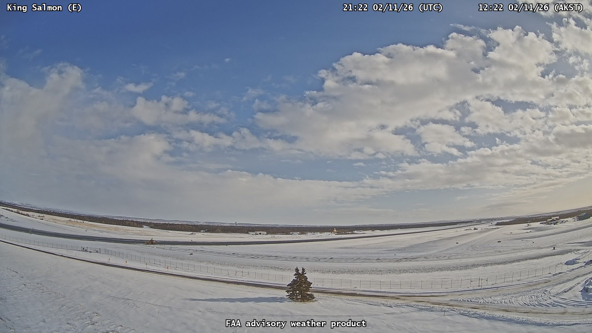
    • King Salmon 68 mi (109 km) NW
    • Aleneva 77 mi (124 km) SE

    Distance from Anchorage: 269 mi (432 km)

  • Subfeatures:
    • Horseshoe Island

Description

From Miller and others (1998) [1] : "Katmai volcano is a large stratovolcano about 10 km in diameter with a central lake-filled caldera whose rim is about 4.2 by 2.5 km in area. The caldera rim has a maximum elevation of 2047 m and in 1975 the lake surface was at an elevation of about 1236 m. The estimated elevation of the caldera floor is about 995 m.
"The volcano is one of five stratovolcanoes near the Novarupta dome, source of the voluminous pyroclastic flows erupted in 1912 [2] . It consists chiefly of lava flows, pyroclastic rocks, and non-welded to agglutinated air fall [3] [2] . The Quaternary volcanic rocks at Katmai and adjacent cones are less than 1500 m thick [2] . Much of the volcano is mantled by snow and ice and several valley glaciers radiate out from the flanks and three glaciers originating from the upper caldera walls descend into the crater to the lake [4] .
"Katmai volcano is built on the sedimentary rocks of the Naknek Formation of Late Jurassic age, which are exposed just west of the caldera rim at an elevation of about 1520 m, as well as north and southeast of the crater [5] [6] "

Name Origin

This locality was published as "Katmai Volcano" in 1910 by the U.S. Coast and Geodetic Survey, and as "Mount Katmai" by G.C. Martin in 1913. "Mount Katmai" is the current proper name (Orth, 1971).


References Cited

[1] Catalog of the historically active volcanoes of Alaska, 1998

Miller, T. P., McGimsey, R. G., Richter, D. H., Riehle, J. R., Nye, C. J., Yount, M. E., and Dumoulin, J. A., 1998, Catalog of the historically active volcanoes of Alaska: U.S. Geological Survey Open-File Report 98-0582, 104 p.

[2] The compositionally zoned eruption of 1912 in the Valley of Ten Thousand Smokes, Katmai National Park, Alaska, 1983

Hildreth, Wes, 1983, The compositionally zoned eruption of 1912 in the Valley of Ten Thousand Smokes, Katmai National Park, Alaska: Journal of Volcanology and Geothermal Research, v. 18, n. 1-4, p. 1-56.

[3] The Katmai region, Alaska, and the great eruption of 1912, 1920

Fenner, C. N., 1920, The Katmai region, Alaska, and the great eruption of 1912: Journal of Geology, v. 28, n. 7, p. 569-606.

[4] Recent investigations on the crater lake, Katmai Caldera, Alaska, 1975

Motyka, R.J., and Benson, C.S., 1975, Recent investigations on the crater lake, Katmai Caldera, Alaska [abs]: Transactions, American Geophysical Union, v. 56, no. 12, p. 1072-1973.

[5] The stratigraphy of the ejecta from the 1912 eruption of Mount Katmai and Novarupta, Alaska, 1968

Curtis, G. H., 1968, The stratigraphy of the ejecta from the 1912 eruption of Mount Katmai and Novarupta, Alaska: in Coats, R. R., Hay, R. L., and Anderson, C. A., (eds.), Studies in volcanology, Geological Society of America Memoir MWR 0116, p. 153-210.

[6] Preliminary geologic map of the Mt. Katmai quadrangle and portions of the Afognak and Naknek quadrangles, Alaska, 1987

Riehle, J. R., Detterman, R. L., Yount, M. E., and Miller, J. W., 1987, Preliminary geologic map of the Mt. Katmai quadrangle and portions of the Afognak and Naknek quadrangles, Alaska: U.S. Geological Survey Open-File Report 87-0593, unpaged, 1 sheet, scale 1:250,000.

Current Activity

March 31, 2025, 12:25 pm

Strong northwesterly winds in the vicinity of Katmai and the Valley of Ten Thousand Smokes have picked up loose volcanic ash erupted during the 1912 Novarupta-Katmai eruption and carried it to the southeast. The National Weather Service has issued a SIGMET for this low-level event and suggests that the maximum cloud height is 4,000 ft above sea level.

This phenomenon is not the result of recent volcanic activity and occurs during times of high winds and dry snow-free conditions in the Katmai area and other young volcanic areas of Alaska. No eruption is in progress.

Resuspended volcanic ash should be considered hazardous and could be damaging to aircraft and health. For more information on volcanic ash and human health, visit the following website: http://volcanoes.usgs.gov/ash/. Official warnings about these ash resuspension events are issued by the National Weather Service: https://www.weather.gov/afc/. Forecasts of airborne ash hazard to aircraft: https://www.weather.gov/aawu/. Volcanic Ash Advisories: https://www.weather.gov/vaac/. Forecasts of ash fall: http://www.weather.gov/afc. Air quality hazards and guidance from Alaska Department of Environmental Conservation, Division of Air Quality: http://dec.alaska.gov/Applications/Air/airtoolsweb/Advisories/Index

Webcams

Webicorder

Color Code Timeline

Reported Activity

Modern Eruptions

Veniaminof

Veniaminof Eruption Timeline

Veniaminof 1830

1830 — April 1839

Grewingk (1850, translated 2003 by Fritz Jaensch) writes that Mount Veniaminof was smoking during 1830-40, as reported by Father Veniaminov. Kisslinger (1983), translating Doroshin (1870): "On August 4 [August 16, Gregorian calendar], 1838, it erupted with a cracking sound and a loud rumble and began emitting flame and ash. The westerly wind blowing at the time carried the smoke along the Alaska Peninsula as far as Katmai. This smoke hid the mountain for the entire eruption. However, when the volcano finally became visible again, it only emitted smoke, from the same places as in 1852; there was no longer any fire. The eruption ceased in April 1839. The first vague reports of this volcano were given in I. Veniaminov, the present metropolitan of Moscow, in his Notes on the Islands of the Unalaska District. For this reason, Grewingk calls this volcano 'Veniaminov.'"

Kisslinger (1983), translating Doroshin (1870): Doroshin viewed Veniaminof smoking in 1852, and also a notation that 'there was no longer any fire."

From Dall (1918): "While surveying in Port Moller in 1874 for the Coast Survey, the western edge of Mt. Veniaminoff [sic] was visible from the sea with intermittent clouds of steam and blackish smoke puffing from the invisible crater at intervals."

Veniaminof 1892/8

August 27, 1892 — August 29, 1892

Mount Veniaminof erupted explosively from Saturday, August 27, 1892 through Monday, August 29, 1892.
From Davidson (1892): "From Captain Erskine, commanding the Alaska Commercial Company's steamer St. Paul, we learn that on Sunday, the 28th of August, 1892, when in latitude 53 degrees 05 minutes, longitude 155 degrees 52 minutes west, on his voyage to the Shumagin Islands, he passed through a black cloud of volcanic ash, so thick that it very nearly obscured the sun from 10 o'clock A.M. to 2 o'clock P.M.; the sea was grey with the fallen ashes, and his decks were covered during his passage of thirty-two miles through it. It had a strong sulphurous odor. * * * At noon the vessel was 223 nautical miles southeastward of the volcano; the wind was moderately light from the northwest, and the sea smooth. He estimated the cloud, as he saw it, to be about one hundred miles long, and from one-half to one mile high. He has furnished us with a bottle of the fine, dark grey dust, as it was gathered from the vessel's deck.
"Lieut. John C. Cantwell, of the U.S. revenue steamer Richard Rush, has given us the following memoranda, which he obtained from Captain Applegate, who has been many years in Alaskan waters, and whose vessel was, at the time of the eruption, anchored in the harbor of Ivanof.
"On Saturday, August 27, 1892, the schooner Everett Hays, engaged in hunting in the vicinity of the Shumagin Islands, entered Ivanof Harbor, on the southwestern extremity of the Alaska Peninsula, and only 25 miles southwestwardly from the volcano. Capt. J.S. Applegate, the owner, was on board, and states: 'About 10 o'clock Saturday night, the weather being calm and clear, a low, rumbling, intermittent sound was heard, and caused the crew to come on deck to ascertain the cause. There was no surf, and the cause was unknown. Between 11 and 12 o'clock, a dark cloud was observed in the sky, towards the northeast, and about 2 o'clock, A.M., this cloud had increased in volume and height until it covered the greater part of the northeast heavens.
"'The low, rumbling noise had become a continuous roar, like the blast from a great furnace, and by 3 o'clock lurid flames could be seen amidst the smoke, which was now rising high in tremendous volumes from a single point, being by compass about northeast. The vast column of smoke reached an estimated height of two miles, and then expanded like a great spreading oak. From the lower edge of this great volume, colored flames waved like banners, and vivid flashes of lightning were apparently discharged into the base of the column. This grand display continued, until daylight caused the flames to be somewhat dimmed, but masses of dense smoke continued to roll upward all Sunday. Toward noon a light northwest wind sprang up, and the clouds began to trend to the southeastward, covering the mainland and the adjacent islands with a thick layer of ashes and volcanic dust.
"'At the anchorage it was dead calm, and there was no perceptible movement of the sea on the beach, as would have occurred if there had been earthquake waves. The continuous lightning discharges were accompanied by deafening peals of thunder, that were plainly heard at the Metrufan village, 50 miles distant, and at Unga Island, 75 nautical miles distant.'
"Captain Applegate could not get the exact location of the volcano, on account of the high range of mountains, which here approach the sea. The Hays left Ivanof Bay on Sunday, and steered south to Pavlof Island, whence the ash cloud was plainly visible to the eastward until late on Monday, when it gradually disappeared in the southeast.
"Captain Bowles, of the fishing schooner Fremont, of San Francisco, reports that on Saturday, August 27th, and for seven days after, he was lying at anchor on Slime Bank, in the Bering Sea, in the vicinity of Port Moller, and 60 miles nearly west from the volcano. He observed at the first date what appeared to be a heavy black cloud in the southeast, which he thought foreboded a southeast storm, and took precautions to put his vessel out of its track. On Sunday morning before daybreak, however, he and his crew saw volumes of ruby red and yellow flames bursting forth with indescribable grandeur from the cloud, and heard plainly the reverberations of thunder. The display lasted with unabated energy until Monday morning, when it appeared to die slowly away."

In June, 1930, Father Hubbard (1931) witnessed ash explosions from the western intracaldera cone of Mount Veniaminof. He climbed Mount Veniaminof and recorded: "Here and there, at the base of the 2,000-foot cliffs on which we stood, the ice yawned away in impressive chasms, where the heat of the mountain melted the encroaching glacier. Strangest of all was the cone in the center, packed in ice and smoking on two sides of its upbuilt rim from slag heaps of lava, and now and then coughing out black ashes over the surrounding white snows."

Veniaminof 1939/5

May 29, 1939 — June 26, 1939

From Miller and others (1998): "On May 29, 1939, a series of explosions began that lasted until at least June 26, 1939; a U.S. Coast Guard cutter offshore reported an ash cloud to 6,100 m with 450 m high 'flames.' Ash from the eruption reportedly reached an average depth of 2-5 cm over a 84-km radius; most residents of Perryville, 35 km south of the volcano, were evacuated (Perryville was established in 1912 by relocation of the former residents of the village of Katmai.)"
Various newspaper articles, from May 29 through June 17 chronicle the eruption.
May 30, 1939 (UP): "today * * * Mt. Veniamin spewing hot ashes over nearby native settlements.
"Minor earth tremors throughout the peninsula accompanied the volcanic outbreak.
"The tiny settlement of Chignik reported that ashes had rached a depth of two feet and that the air was so filled that it was twilight most of the long near Summer day. * * * First reports of the eruption, whicih began last week, came from the captain of the lighthouse tender Cedar to the weather bureau here [Juneau]. * * * The captain said a thirty five mile wind was carrying heavy ash from the volcano far out to sea.
"Smoke began to stream from Mt. Veniamin last week and yesterday huge clouds of black smoke and ash billowed forth. * * * Several weeks ago earthquakes of great intensity were reported from the north Pacific regions, possibly in the Gulf of Alaska off the Alaskan peninsula. Experts believed the quakes were a prelude to the volcanic activity of Veniamin."
June 5, 1939 (AP): "A radio message today said Mount Veniaminof, an Alaskan peninsula volcano, was again erupting on a violent scale.
"The message came from Mr. and Mrs. A.D. Johnson, only white residents of Perryville, Alaska, near the volcano.
"Veniaminof's recent nine-day outburst frightened the Indians, so severely that all but one native family fled.
"Johnson's message said: 'Sky cleared this morning. Volcano could be seen plainly. Was belching fire to greater heights than any time during the eruption. More hot ashes falling.'"
June 8, 1939 (UP): "Perryville, Alaska. June 7. Fear and help reached this tiny fishing village in the shadow of smoking Mount Veniaminof simultaneously Wednesday.
"The fear arose from indications the wind was shifting, bringing a threat of deluging the village and its two remaining families, one white and the other native, with hot cinders and stifling fumes from the awakening volcano.
"Ashes blow to sea. So far the prevailing wind has been southerly, blowing the ashes and fumes into the Bering Sea to the north of this Alaska peninsula village. A shift to the northwest would bring the deluge, A.D. Johnson and his wife, village school teachers, feared.
"* * * The Coast Guard cutter Haida was standing off the village, ready to remove the two families if necessary. * * * There were increasing earth shocks Wednesday. Some were so violent they sent dishes crashing to the floor and turned around furniture in the Johnson home."
June 12, 1939 (AP): "A thick black sediment, believed by residents to be volcanic ash from erupting Mount Veniaminof, 1,000 miles away in Alaska, covered this section [Toledo, Oregon] of the Oregon coast at dawn Sunday.
"The ash was tracked into countless homes and sent hundreds of automobiles to wash racks. The mysterious 'dirt' was deposited by fog."
June 15, 1939 (AP): "A new eruption of Mount Veniaminof, mile-and-a-half high Aleutian peninsula volcano, spread volcanic ashes over a wide area of land and sea today.
"The motorship Fern, which gave a position offshore about 35 miles from the mountain, radioed at 11:15 pm last night the volcano was again in violent activity.
"Ash and sand was falling on the ship's decks, the message said, and visibility was cut down to about a mile.
"The volcano has been active since May 23 and A.D. Johnson, radio operator and government school teacher at Perryville, 20 miles to the south, has radioed frequently of its eruption."

Veniaminof 1939/11

November 1939

Coats (1950) reports a minor explosive eruption at Mount Veniaminof in November, 1939.

Loading

Veniaminof 1944/3

March 15, 1944

Coats (1950) reports a mild ash eruption at Mount Veniaminof on March 28, 1944.
A March 15, 1944 Associated Press article states "The volcano of Veniaminoff has erupted again, passengers aboard a boat arriving from Chignik village reported today. The resultant fireworks lighted the surrounding country, said those who had witnessed the phenomenon."

Loading

Veniaminof 1956/3

March 1956 — May 23, 1956

From Miller and others (1998): "Activity beginning in March 1956 culminated with ash explosions on May 19 and 23, 1956 which sent ash-rich eruption columns to approximately 6,100 m according to airline pilot reports." An Anchorage Daily News article from May 21, 1956, reads as follows:"Mount Veniaminof, an 8,200-foot volcano which as been active for the last two months, started 'spewing quite a bit of stuff' over the weekend, a Reeve Aleutian Airways pilot reported today.
"Bill Borland, chief pilot of the airline, said today he flew over the mountain, which is about 60 miles southwest of Port Heiden, and the eruptions were the severest he had seen since the volcano became active about two months ago."

Veniaminof 1983/6

June 2, 1983 — April 17, 1984

From Yount and others (1985): "The more prominent of the two visible intracaldera cones of Mount Veniaminof went into eruption in early June 1983 and continued until early April 1984.
"* * * In this recent eruption, Perryville residents first saw puffs of ash on June 2, 1983. Early manifestations of the Strombolian eruption included a 90-m-wide sector graben and a circular depression (400 m in diameter and approximately 30 m deep) in the glacial-ice surface directly south of the active cone. By June 9, the 300-m-deep crater of the cone had filled to overflowing with juvenile bombs, blocks, and rising magma, resulting in a lava flow from a low point on the southwest side. The lava flow and subglacial heating caused rapid melting of the glacial ice on the south side of the active cone. By July 13, a vertical-walled, bilobate pit measuring approximately 1,300 m in the east-west direction, 400-800 m in the north-south direction, and 60-100 m deep had formed in the ice. The pit contained a lake of unknown depth and a southward-building lava delta. A subglacial tunnel in the ice-wall at the east end of the lake indicated drainage eastward along the caldera floor. Another tunnel, less clearly observed, may have drained from the northwest end of the lake toward a breach of the caldera wall at Cone Glacier.
"Ash emission was almost continuous during June and July 1983; occasional plumes were estimated to have been as high as 7,800 m. During this time, ash blanketed the intracaldera glacier and steam plumes occurred nearly continuously. The eruption appeared to wane from mid-August to early October, through this may be partly a function of paucity of reports and observations.
"Renewed activity was reported in early October. By this time the ice-pit lake had diminished to a small pond located between the wall of the ice pit and a new lava flow lobe. The October 1983-March 1984 eruptive phase was characterized by less ash emission and more lava flow activity than the June-August 1983 phase. A succession of flows from the southwest side of the cone resulted in a continual increase in volume and height of new lava in the ice pit, and the pit enlarged slightly in plan, losing its bilobate shape. Each flow lobe cooled rapidly due to the 1,800-m elevation and winter winds; snow was observed on lobes approximately a month old. Perryville residents observed incandescent lava fountaining up to an estimated 100 m above the cone on January 23, February 6 and 13, and March 2 and 3, 1984. Fountaining was intermittent, lasting one-half to one hour and was followed by quiescent periods of at least 45 minutes. Incandescent glow was last observed March 16, 1984. From mid-March to late April, activity was limited to continual emission of small steam plumes and rare ash bursts lasting up to two hours. An observation flight on April 11 revealed that all lava-flow lobes in the pit were dusted with snow."
The Smithsonian Institution Scientific Event Alert Network Bulletin, volume 5, number 1 reports that USGS personnel estimated that approximately 45x10^6 cubic meters of lava filled the ice pit between June, 1983 and January, 1984.

Loading

Veniaminof 1984/11

November 29, 1984 — December 9, 1984

From Smithsonian Institution (1984): "Eruptive activity resumed on 29 November [1984]. At about 0400, Perryville residents were awakened by rumbling noises from the volcano. By 0800, a black ash cloud was rising to about 3.5-4 km altitude. At 1000, a second plume rose to about 4 km, followed by smaller bursts that were occurring at approximately 5-minute intervals as of about 1020. Pilots reported an ash plume to about 4.5 km altitude at 1045, very little activity at 1100, and another ash plume to about 5.4 km at 1115. No incandescent material was observed from Perryville or by the pilots.
"A pilot who flew over the volcano on the morning of 5 December reported a white vapor plume, containing only a small amount of ash, rising from two small pits on the E side of the previously active cone. One of the pits was steaming more vigorously than the other, and a brownish haze drifted downwind from the volcano. He observed no incandescent material or recent lava extrusions. On 6 December, Perryville residents observed large vapor plumes of varying intensity that contained very minor amounts of ash. They saw no incandescent material, and had heard no rumbling noises during the previous several days. On 7-8 December the volcano was obscured by weather clouds; however, small intermittent vapor plumes with no ash were observed from Perryville on the 9th. No incandescent material was seen. On the 10th and 11th, the volcano was not visible from Perryville."

Veniaminof 1987/3

March 19, 1987

From Reeder (1990): "At 1315LT (=GMT - 9 hours) 19 March 1987, Captain Wallace Niles observed from his Northern Air Cargo DC-6 steam and ash emissions from Mount Veniaminof. The ash plume with steam rose about 200 m above the top of the volcano, and the ash trailed to the SW for up to 40 km. Captain Edward Livingston earlier that day (about 0900LT) observed from his Reeve Aleutian Airways, Inc. YS-11 no ash and only minor steam emissions from the volcano."

Veniaminof 1993/7

July 30, 1993 — August 28, 1994

From Neal and others (1996): "Reports of activity at Veniaminof began in early 1993. Pilots reported a steam plume rising from the volcano on February 18, 1993. Confirmed magmatic activity was first sighted on July 30, 1993. Observers in Perryville reported black clouds rising over the summit beginning at 1430 ADT on July 30, 1993. A white steam cloud was present at other times. A small eruption plume was observed on satellite imagery by the NWS on July 30, but none were seen in the following days. On the morning of July 31, Perryville observers saw a gray cloud rising from the volcano and extending to the south. On August 2, commercial airline pilots observed intermittent venting of black ash clouds rising nearly 300 m (1,000 ft) above the active intracaldera cone. On August 3, U.S. Fish and Wildlife (USFWS) personnel reported a steaming pit in the snow at base of the west side of the intracaldera cinder cone. Pilot reports on August 3 described black ash and bombs erupting from the summit vent of the intracaldera cone at 30-60 second intervals to a height of 2,400 - 3,000 m (7,900-9,800 ft) above sea level (840 m [2,756 ft] above vent). A minor dusting of very fine ash occurred in Port Heiden after 2000 ADT on August 3, 1993. Residents of Perryville, Chignik, and Chignik Lake also heard a "rumbling noise" accompanied by a slight tremor at about 2200 that night. Flight restrictions around Veniaminof were put into effect August 4, 1993. On the morning of August 6, a resident of Port Heiden observed eruptions of ash and steam at 3-4 minute intervals; these plumes barely rose above the summit of the volcano. There were no reports of ashfall at other nearby villages. On August 12, a pilot reported ash venting 600-900 m (1,900 - 3,000 ft) above the crater with the ash cloud carried east-northeast.
"Poor weather precluded many observations during the fall. On October 1-2, residents of Port Heiden observed steam and ash emissions over Veniaminof. An Advanced Very High Resolution Radiometer (AVHRR) image from the late morning of October 2 -- the first clear satellite image in almost two months -- showed a faint northeast-directed plume and a thermal anomaly at the summit cinder cone. During the night of October 7, residents of Perryville observed bursts of incandescent material rising approximately 300 m (1,000 ft) above the summit. These bursts occurred about once every 10 minutes, were accompanied by loud rumbling sounds, and appeared to be similar in size to the eruptions in July and August. On October 14, residents of Perryville observed continued emission of a gray, steam and ash plume rising about 1 km (3,280 ft) above the summit. Though the summit was obscured by haze on October 22, observations from Perryville indicated a decrease in the level of activity relative to that earlier in the month.
"U.S. Coast Guard (USCG) pilots filmed eruptive activity and took photos of the intracaldera cinder cone on November 6, 1993. By then, a new pit (2.0 by 0.75 km [1.2 by 0.5 mi] wide) had formed in the ice adjacent to the cone on the east flank and contained an
active lava flow [See fig. 4 in original text]. Steam plumes rose from the outer margin of the lava where it came into contact with the ice walls of the pit. An ash-and-steam plume rose up to 2 km (6,560 ft) above the cinder cone, and a thin ash layer covered the ice-filled floor of the caldera.
"Activity continued intermittently for the remainder of 1993, (for post-1993 activity see Neal and others, 1995). During favorable wind and weather conditions, Port Heiden residents noted dark ash clouds above the volcano and deep rumbling was reported by residents in Port Heiden and Perryville."
From Neal and others (1995): "Reports of eruptive activity diminished in frequency with the onset of bad winter weather; however, reports of renewed, intermittent strombolian activity reached AVO in March 1994. On May 9, 1994, during the first AVO overflight, eruptive activity consisted of quiet lava effusion from the vicinity of the intracaldera cinder cone [see fig. 7 in original text]. This lava flow had melted an oval-shaped pit in the summit ice cap estimated to be about 1000 m (3,280 ft) by 800 m (2,625 ft) across and 30-50 m (100-160 ft) deep. Fractures in the ice surrounding the pit suggested subglacial melting. Unlike the 1983-84 eruption, no standing water was visible in the pit.
"On June 29, an especially vigorous eruption sent an ash cloud to a reported 4.8 - 5.5 km (16,000-18,000 ft) and the NWS issued a SIGMET (notice of SIGnificant METeorological events.) Additional reports of low ash bursts over the volcano or incandescent strombolian activity viewed at night were received through mid-August. Steam plumes, at times rising several hundred meters, were reported over the volcano until late September. Due to the remote nature of this volcano, the paucity of observations, and the frequently poor weather, we are uncertain of the history of declining eruptive activity in late 1994. However, on Advanced Very High Resolution Radiometer (AVHRR) satellite images unobscured by heavy cloud cover, thermal anomalies were detected in the area of the active intracaldera cinder cone of Mount Veniaminof into early 1995."
The Smithsonian Institution (Bulletin of Global Volcanism, volume 19, number 4) estimates the volume of the 1993-1994 lava field at 16-20 x 10^6 cubic meters.

Loading

Veniaminof 1995/4

April 17, 1995 — November 30, 1995

From McGimsey and Neal (1996): "In mid-April, 1995, reports from observers in Perryville and Port Heiden of small dark plumes over Veniaminof coincided with thermal anomalies near the active vent recorded on satellite images (Smithsonian Institution, 1995, v. 20, n. 3). This low-level activity was interpreted to result from interaction of lava with ice and snow causing occasional low-energy ash bursts and steam generation (Smithsonian Institution, 1995, v. 20, n. 4). Perryville residents heard rumblings and booms and witnessed minor ash emission on November 15, 1995, as reported in the last AVO weekly update that included Veniaminof (12-1-95). Summit hot spots were visible on satellite images of November 2, 8, and 17, 1995. No activity was reported in December."

Veniaminof 1999/7

July 30, 1999

From McGimsey and others (2004): "On July 30, 1999, AVO received a report from an Alaska Department of Fish and Game (ADF&G) biologist working at a fish weir on the Chignik River that the West Fork was unusually turbid. An ADF&G pilot also reported that an abnormal amount of water was discharging from the termini of the glaciers feeding this river, which originate on the east and northeast flanks of Veniaminof Volcano. The biologist and pilot -- both experienced in the area -- had never before seen this level of discharge and extreme turbidity in the river and were concerned about potential adverse effects on fish. They reported that no unusual steaming or other activity was visible form their camp. There were no further reports. AVO had no seismic instruments on this volcano in 1999."

Veniaminof 2002/9

September 28, 2002 — March 23, 2003

From Neal and others (2005): "On the basis of several days of increasingly frequent, emergent seismic events on multiple stations of the new Veniaminof network (Dixon and others, 2002), AVO announced Level of Concern Color Code YELLOW on September 11, 2002. Following established protocols, the Anchorage Volcanic Ash Advisory Center (VAAC) issued a one-time volcanic ash advisory [see fig. 4 in original text].
"Over subsequent weeks, seismicity was characterized by periods of above-background activity alternating with quiet intervals. Telephone calls to Perryville and other nearby communities[see fig. 5 in original text] turned up no unequivocal observations of unrest until September 24 when AVO received phone reports and digital photographs from the Perryville Native Council. These images showed small, faint gray clouds rising just above the intracaldera cone that has been the source of all known historical eruptions at Veniaminof (Miller and others, 1998). One observer described 'puffs' of mixed dark and white clouds approximately every 5 minutes. Another observer described the 'puffs' as solid white and emanating from the top of the cone.
"Perryville residents next reported 'plumes of smoke' between 8 and 10 pm on October 1. Others reported 'rumbling' during the evening, however no clearly correlative signals were noted on seismograms. One and one half minutes of video taken on October 2 or 3, about 2 pm, from the vantage of the Sandy River (~45 km [28 mi] west of the active cone) showed several small, dilute, gray-brown clouds rising about 300-600 ft above the intracaldera cone and drifting a short distance to the north. In the 1.5 minutes of tape, two distinct 'puffs', about 1 minute apart, rise from the cone and drift downwind. The cone was not unusually snow free, however, a dark covering of ash was visible on the caldera ice field at the base of the cone and extending generally north. On October 6, Sandy River Lodge [see fig. 5 in original text] reported black ash and 'smoke' rising 400-500 ft above the cone, explosions, and ground shaking.
"Cloud-free satellite images of the Veniaminof caldera revealed nothing unusual until October 2 when AVO acquired a Moderate Resolution Imaging Spectroradiometer (MODIS) image that captured a localized, gray deposit on the caldera ice field [see fig. 6 in original text]. The image shows a faint, fan-shaped deposit extending generally east from the cone to the caldera boundary and perhaps just beyond. When viewed in light of reports from Perryville and the video from Sandy River, the dark fan likely represents ash fall from low-level phreatic activity on October 1. No thermal anomalies were detected in satellite imagery throughout this period and no incandescence was reported. A compilation of reports from residents and other observers through the end of the year is presented in table 3. Seismicity and reports of discolored clouds over the intracaldera cone gradually declined through the fall.
"A re-invigorated hydrothermal system beneath the intracaldera cone may account for these intermittent ejections of diffuse, ash-bearing clouds. It seems unlikely that this was prompted by a new magmatic intrusion at depth based on the lack of volcano-tectonic earthquakes. Increased hydrothermal activity may have been related to what was, according to some long time residents of the area, one of the rainiest autumns in memory. Although precipitation falling at the elevation of the intracaldera cone would have been in the form of snow (C. Searcy, NOAA, oral.commun., 2003), precipitation in Cold Bay [see fig. 1 in original text] was approximately 80% above normal for the month of October, according to long term climate records maintained by NWS (National Oceanic and Atmospheric Administration: www.arh.noaa.gov/climate.php). King.Salmon, the other nearby long-term weather station, recorded approximately 45% and 60% more precipitation than normal in the months of September and October, respectively."
The 2002 activity continued into 2003. From McGimsey and others (2005): "On January 3, 2003, AVO belatedly received a report from the caretaker of a lodge located northwest of the volcano describing his observations from about mid-December, 2002, during clear weather, of distinct puffs of steam coming from the intracaldera cone. AVO upgraded the Level of Concern Color Code to YELLOW on Monday, January 6, 2003. Several weeks of poor weather conditions followed before clear views revealed that intermittent episodes of steam and diffuse ash emissions from the active cone continued [see fig. 15 in original text]. AVO seismologists detected the onset of small, volcano-tectonic earthquakes on Veniaminof seismic stations beginning on the morning of January 29, 2003 and a commensurate decline in amplitudes and numbers of low-frequency events (S. Moran, written communication). Elevated seismicity continued, and on March 11, a 4-hour period of continuous seismic tremor was observed followed by 17 hours of discrete seismic events and 3-4-minute-long tremor bursts. This culminated with another 4-hour period of continuous tremor on March 12, which was followed by a distinct decline in seismicity over the next several days. The last report of emissions from the active cone was from Mark Battaion in Perryville on March 23, 2003 [see fig. 16 in original text].
From Neal and others (2005): "In the summer of 2003, AVO geologists visited the summit caldera of Veniaminof and examined the intracaldera cone for evidence of the 2002 activity (K. Wallace, written.commun., 2003). Within 50 m (160 ft) of the east side of the cone, the ice surface was dusted with fine wind blown debris derived from the cone. A crevasse at the base of the cone revealed a prominent, 1-cm-thick (0.4 in), black, scoriaceous deposit 1 m (3 ft) beneath the surface [see fig. 7a, b, in original text]. Scoria fragments ranged from fine ash to medium lapilli (with a maximum diameter of 5 mm [0.2 in]). The base of the crevasse was not visible, however no other debris layers were recognized over a thickness of at least 10 m (33 ft) suggesting that this type of depositional event was not common (e.g. wind reworking of cone debris). In hand sample, the tephra consists of abundant black iridescent, glassy scoria; hydrothermally altered scoria (with native sulfur and secondary minerals); and rare individual crystals. Microscopic investigation showed all glass fragments to be devitrified. Wallace and co-workers concluded that this deposit represented recycled cone material ejected during low-level phreatic explosions in October 2002.
"In response to the 2002 unrest at Veniaminof, AVO staff conducted outreach to communities in the vicinity of the volcano and compiled contact phone lists of observers and others who would be helpful in tracking activity on our behalf. We were in frequent telephone contact with people in Perryville, regional airlines, and our colleagues at U.S. Fish and Wildlife Service (USFWS) and the Alaska State Troopers who were often flying in the area. At least one private lodge near the volcano contacted AVO for information on potential hazards. AVO posted a 'Frequently-Asked-Questions' about Veniaminof on our web site, a first in the history of AVO.
"Interestingly, the change in Level of Concern Color Code to YELLOW for Veniaminof occurred on September 11, 2002, during a time when the Department of Homeland Security had recently established a Threat Level of ORANGE. It is therefore possible that reaction to our initial information release on September 11 may have been more pronounced than usual, and confusion over the two color designations may explain why some residents of the Peninsula thought AVO had declared an 'imminent' eruption.
"From September 11 to November 18, 2002, AVO issued three special information release notices on the increased seismicity and its eventual decline at Veniaminof. The volcano was mentioned in weekly updates from September 13 through November 22. AVO reverted to color code GREEN on November 18. During the time of heightened activity, the AVO seismology and remote sensing groups increased the frequency of analysis of Veniaminof seismicity and relevant satellite imagery."

Veniaminof 2004/2

February 19, 2004 — September 2004

From Neal and others (2005): "In mid-February, residents of Perryville, located 35 km (22 mi) south of Veniaminof, reported small ash clouds rising several hundred feet above the intracaldera cinder cone of the volcano. At other times, vigorous, ash-free steam plumes were reported. On February 19, AVO received a pilot report of a small black ash cloud rising approximately 300 ft (90 m) above the cone and fresh ash on the snowfield east of the cone [see fig. 13 in original text]. A satellite image from the same day showed a dark deposit within the Veniaminof summit caldera. Seismic activity coincident with these reports was insignificant and AVO considered these small explosions to be typical of background activity at Veniaminof where ground water within the active cone occasionally flashes to steam producing a small explosion. The volcano had last produced such activity over a several month-period in late 2002 and early 2003 (Neal and others, 2005; McGimsey and others, 2005). On February 23, AVO described this activity in a special Information Release but remained at Level of Concern Color Code GREEN. AVO received no reports of activity over the next two weeks. Satellite imagery did not indicate increased surface temperatures or further ash deposits and seismicity remained low. AVO ceased special mention of Veniaminof in its weekly updates on March 5.
"In mid-April, seismicity beneath Veniaminof began to increase and several episodes of volcanic tremor and isolated volcano-tectonic earthquakes were recorded. Tremor pulses were several minutes in duration and the largest were recorded on most stations in the network. On April 19, residents of Perryville reported a steam emission from the intracaldera cone that had occurred on April 18, possibly containing a small amount of ash. This burst rose an estimated 2,000 ft (610 m) above the intracaldera cone. Based on this renewed activity and elevated seismicity, AVO elevated the Level of Concern Color Code for Mount Veniaminof to YELLOW. NWS issued a VAA and the FAA issued a temporary flight restriction from the surface to 14,000 ft ASL (4,270 m) within a 10 nautical mile (18.5 km) radius of the center of the volcano.
"Over the next few weeks, Perryville residents reported vigorous steam plumes (often described as mushroom-shaped clouds) over the intracaldera cone. AVO received few reports of small ash emissions until April 25 when, using a newly installed remote video camera, as many as 25 small steam and ash emissions were observed over an 8-hour period, most rising about 2,000 ft (610 m) above the active cone [see fig. 14 in original text].
"Through the remainder of spring and into summer, passing pilots, Perryville residents, personnel at Wildman Lake Lodge, and the AVO internet camera continued to record occasional steam plumes and steam and ash bursts, at times reaching as much as 915 m (3,000 ft) above the intracaldera cone and drifting as far as 16-32 km (10-20 mi). Poor weather obscured views of the volcano on many days, however bursts of tremor recorded on the seismic network likely reflected the continuation of small ash emissions, or 'puffs'. On May 5, a pilot spotted ash to 610 m (2,000 ft) above the cone and drifting east-southeast; on May 18, a pilot reported ash up to 3,000 ft (915 m) above the cone and drifting 32 km (20 mi) downwind. On May 26, satellite images of the volcano showed ash deposits on the north and southeast caldera floor.
"Aerial views on June 27 revealed that much of the caldera floor was covered by a thin, dark layer of ash. On July 10, an AVO crew flying inside the caldera on a clear, calm day witnessed one of these ash bursts and captured it on video. As the helicopter approached the cone, only a faint wisp of steam and volcanic gas emerged from the summit of the intracaldera cone that consists of a series of coalescing craters each several 10s to 100 m wide. Suddenly, two closely spaced (20-30 seconds apart) vigorous explosions of gray-tan ash emerged from one of the central craters. The discrete puffs were followed by at least 2.5 minutes of continuous roiling of ash from the crater. Ash rose several hundred m (700-1,000 ft) above the cone and drifted downwind; ballistics and incandescence are not visible in this video clip. On July 22, an AVO field crew within the Veniaminof caldera witnessed another typical ash burst rising a few hundred ms (less than 1,000 ft) above the summit of the cone (fig. 15). Fallout was largely confined to the area around the base of the cone.
"AVO geologists visited the ice field by helicopter in late July and reported a discontinuous, 1- to 2-mm thick ash blanket. They observed no large bombs or ballistics beyond the base of the cone, suggesting that recent ash emissions had not been accompanied by energetic explosions of large rock fragments. Further, they reported no changes in the ice field that would indicate subglacial melting. Additional observations of the cone were made in early August and photographs capture ash-poor puffs rising from one of several summit craters on the cone [see figs. 16, 17 in original text]. On August 7, geologists recorded 6-10 puffs over the course of about 10 minutes of focused observation. They reached about 150 m (500 ft) above the summit of the cone in fairly calm wind conditions.
"Steam and ash emissions and correlative tremor bursts continued sporadically through the summer of 2004 but with decreasing frequency and intensity. Cloudy weather precluded any visual observations for much of September and October, however seismic signals continued to record small tremor bursts similar to those correlated with confirmed ash emissions earlier in the year. At times, only weak steaming was visible above the intracaldera cone. The last ash emission with localized ash fall was noted on the web camera images in early September. The pilot of a small aircraft reported 'light to moderate smoke' from Veniaminof on September 13. On October 26, AVO lowered the level of concern color code to GREEN based on a decline in the level of activity and an accompanying decrease in seismicity.
"In response to the 2004 unrest at Veniaminof, AVO staff conducted outreach to communities in the vicinity of the volcano and revised existing contact phone lists of observers and others in the area. To track and document activity, a web-camera system was installed in Perryville in April (with assistance from the Perryville School and Perryville Village Council, gratefully acknowledged.) These images along with other graphical and text information were made available to the public via the AVO web site. AVO issued seven special Information Releases on the activity at Veniaminof."

Loading

Veniaminof 2005/1

January 4, 2005 — February 25, 2005

From McGimsey and others (2007): "After almost 4 quiet months, on January 4, 2005, AVO received a pilot report of small bursts of ash from the active cone rising a few hundred meters and drifting east, producing a narrow spoke-like deposit on snow within the caldera (see figs. 31 and 32 in original text). This activity seemingly correlated with a period of continuous tremor recorded on the local seismic network that day, and a weak thermal anomaly was detected in an AVHRR satellite image. AVO upgraded the Level of Concern Color Code for Veniaminof from Green to Yellow. AVO seismologists noticed that weak seismic tremor had begun on January 1 and increased over the subsequent week to levels last observed in May-June 2004. Steam and ash emissions continued from the next several days and residents of Perryville, located 35 km (22 mi) south of Veniaminof, reported incandescence; the caretaker a ta local hunting lodge located west-southwest of the volcano reported seeing intermittent bursts of steam and ash. Beginning on January 8, a persistent thermal anomaly began appearing in satellite images. Then, on January 10, following nearly 48 hours of minor but nearly continuous ash emissions - some bursts reaching to 13,000 ft (3,692 m) above sea level - AVO raised the Level of Concern from Yellow to Orange. The maximum amplitude of the seismicity had by then slightly exceeded that observed during the previous phase of unrest, which ended in September 2004. AVO launched an overflight on January 11. The crew observed nearly continuous low-level ash and steam emission from the central cone and much of the caldera was thinly covered in ash (see fig. 33 in original text).
"Seismic data, web camera views, and satellite images indicated that low-level ash emissions continued for the next 5 weeks. The seismicity was characterized by low-amplitude tremor with occasional larger bursts. Weather permitting, satellite views showed anomalous heat at the summit cone consistent with hot blocks and ash ejection from the vent. The web camera showed intermittent ash clouds with the highest reaching almost to 13,000 ft (4,000 m) ASL. Strombolian eruptive activity was visible to the residents of Perryville during the night of February 3. Then during the week of February 25, seismicity decreased substantially and only minor emissions of steam were observed. AVO reduced the Level of Concern from Orange to Yellow. By the end of the following week, volcanic tremor had subsided and seismic activity was deemed to be at background levels and the Level of Concern was reduced from Yellow to Green (see table 6 in original text).
Excerpts from AVO's information releases during this Veniaminof eruption are available online at: www.avo.alaska.edu/archives/ve…
The Smithsonian Institution's Global Volcanism Bulletin (v. 30, n. 2) summarizes the event as follows: "AVO raised the Concern Color Code at Veniaminof from Green to Yellow on 4 January because around that time several small ash emissions from the volcano's intracaldera cone were observed on the web camera in Perryville. Ash emissions were visible starting around 0938, but may have been obscured by meteorological clouds in previous images. The discrete ash emissions were small, rose hundreds of meters above the cone, and dissipated as they drifted E. Minor ash fall was probably confined to the summit caldera. Very weak seismic tremor was recorded beginning on 1 January, and increased slightly over the next 2 days. These seismic signals were similar to those recorded during steam-and-ash emissions in April to October 2004. However, there were no indications from seismic data that events significantly larger than those observed around 4 January were imminent.
"AVO raised the Concern Color Code at Veniaminof from Yellow to Orange on 10 January as ash emissions from the volcano's intracaldera cone reached heights of nearly 4 km during 8-10 January [see figure 11 in original online source]. Seismicity remained at elevated levels and satellite images showed a persistent thermal anomaly at the intracaldera cone. On 11 January, the Anchorage VAAC again reported emission of a thin ash cloud to ~ 3 km altitude visible on the Perryville web camera. On 12 January the Anchorage VAAC reported emission of a thin ash cloud, visible on the Perryville web camera, that rose to 3-4 km altitude, extended ENE, and dissipated within ~ 55 km of the volcano. On 14 January, a satellite image showed a thermal anomaly in the vicinity of the Veniaminof summit. Although the anomaly appeared less intense than when first detected on 8 January and volcanism seemed to have declined significantly since 12 January, activity still remained significantly higher than normal with occasional bursts of volcanic tremor.
"During the rest of the month of January, seismic data, web camera views, and satellite images indicated that low-level ash emissions continued at Veniaminof. Seismicity was similar to levels observed during the previous week, consisting of low-amplitude volcanic tremor with occasional larger bursts. During clear weather, satellite imagery showed anomalous heat at the summit cone, consistent with hot blocks and ash being ejected from the active vent. In addition, the web camera showed intermittent ash plumes reaching as high as 3 km altitude. Occasional stronger bursts of seismic tremor during 20-21 January and around 28 January may have indicated plumes to higher levels, but not above 4 km altitude. Veniaminof remained at Concern Color Code Orange.
"Activity during February 2005. On the evening of 3 February, Strombolian activity at Veniaminof was visible by residents of Perryville ~ 30 km from the volcano. Activity was also observed on web camera views and seen by satellite as an increase in radiated surface heat. An increase in seismicity suggested that Strombolian activity may have continued through 4 February while the volcano was obscured by clouds.
"During 28 January to 4 February, seismicity at Veniaminof was similar to levels for the previous week, with low-amplitude tremor and occasional larger bursts. During clear weather, satellite imagery showed anomalous heat at the summit cone, consistent with hot blocks and ash being ejected from the active vent. The web camera showed intermittent ash plumes reaching as high as 3 km altitude. Veniaminof remained at Concern Color Code Orange.
"Low-level Strombolian eruptive activity continued at Veniaminof during 4-11 February. On 9 February, an ash burst rose hundreds of meters above the intracaldera cone. Satellite images continued to show a thermal anomaly in the vicinity of the intracaldera cone, consistent with the presence of hot material at the vent. Seismicity remained above background levels at the volcano. On the morning of 10 February there was a distinct increase in the amplitude and frequency of earthquakes. The increase continued through 11 February. This activity was consistent with more energetic explosions from the active cone, but there were no indications that the bursts rose higher than 4 km altitude. Veniaminof remained at Concern Color Code Orange.
"During 11-18 February, it was likely that low-level Strombolian eruptive activity continued at Veniaminof based on seismic data and satellite imagery. Cloudy conditions obscured web camera views of the volcano, and no ash emissions were observed above the cloud cover. Seismicity remained above background levels at Veniaminof. The character of the seismicity changed slightly during the report period, with frequent periods of continuous banded volcanic tremor occurring, but the amplitudes of earthquakes did not increase. This activity was consistent with explosions from the active cone; however, there was no indication that these bursts rose more than 4 km altitude. Veniaminof remained at Concern Color Code Orange.
"Seismicity decreased substantially at Veniaminof during 18-25 February in comparison to previous weeks, leading AVO to decrease the Concern Color Code from Orange to Yellow. Periods of volcanic tremor diminished, and no discrete events associated with ash bursts had occurred for several days. Only minor steam emissions were seen. AVO received no reports of ash emissions from pilots or ground observers. AVO concluded that given the decline in seismicity, it appeared that the most recent episode of Strombolian eruptive activity at Veniaminof had ended.
"Activity during March 2005. A further reduction in activity at Veniaminof during 25 February to 4 March led AVO to reduce the Concern Color Code from Yellow to Green, the lowest level. For more than a week seismic activity was at background levels, periods of volcanic tremor had ceased, and there were no discrete events associated with ash bursts. Only minor emissions of steam were observed on the web camera and satellite imagery. AVO received no reports of ash emissions from pilots or observers on the ground. They concluded that given the decline in seismicity it appeared that the most recent episode of eruptive activity had ended at Veniaminof."

Loading

Veniaminof 2005/9

September 7, 2005 — November 4, 2005

From McGimsey and others (2007): "Veniaminof remained relatively quiet [since February, 2005] until early September when several minor bursts of ash were observed by Perryville residents and visible on the web camera (see fig. 34 in original text). This and an increase in seismicity prompted AVO to elevate the Level of Concern from Green to Yellow on September 7. The minor unrest continued only for a couple of weeks when seismicity once again decreased to background level and there were no observations of emissions. AVO reduced the Level of Concern from Yellow to Green on September 28.
"Then, on November 4, a low-level, minor ash emission visible in the webcam prompted AVO to raise the Level of Concern from Green to Yellow. Slightly elevated seismicity persisted for the next few weeks but poor weather conditions precluded visual observations. By mid-December, seismic levels were again down to background level, and on December 30, the Level of Concern was downgraded from Yellow to Green, the 8th Color Code change of the year for Veniaminof (see table 6 in original text)."
From the Smithsonian Institution (2006, v. 31, n. 3): "On 7 September 2005, the Alaska Volcano Observatory (AVO) noted several minor bursts of ash from the volcano during the afternoon. Ash bursts continued to occur through at least 9 September, with ash rising less than 3 km altitude, and with the ash confined to the caldera. Over the following 2 weeks, minor ash emission continued at a rate of 1-5 events per day based on interpretations of seismic data. AVO reported that it was likely that diffuse ash plumes rose to heights less than ~ 3 km and were confined to the summit caldera. Cloudy weather during 16-23 September prohibited web-camera and satellite observations of Veniaminof, but seismic data indicated diminishing activity. On 28 September seismicity had remained at background levels for over a week, and there was no evidence to suggest that minor ash explosions were continuing.
"On 4 November 2005, a low-level minor ash emission occurred from the intracaldera cone beginning at 0929. Ash rose a few hundred meters above the cone, drifted E, and dissipated rapidly. Minor ashfall was probably confined to the summit caldera. During the previous 2 weeks, occasional steaming from the intracaldera cone was observed. Very weak seismic tremor and a few small discrete seismic events were recorded at the station closest to the active cone. However, AVO reported that there were no indications from seismic data that a significantly larger eruption was imminent."
Execerpts from AVO's weekly updates and information releases for this time period can be found at this website: www.avo.alaska.edu/archives/Ve….

Loading

Veniaminof 2006/3

March 3, 2006 — November 2006

From the Smithsonian Institution (2006, v. 31, n. 3): "On the morning of 3 March 2006 ash again rose a few hundred meters above the intracaldera cone, drifted E, and dissipated rapidly. Ashfall was expected to be minor and confined to the summit caldera. Seismicity was again low and did not indicate that a significantly larger eruption was imminent. Over the week of 5-10 March, seismicity was low but slightly above background.
"On the morning of 10 March, AVO received a report from a pilot of low-level ash emission from the intracaldera cone. Clear web-camera views on 9 March showed small diffuse plumes of ash extending a short distance from the intracaldera cone. The Anchorage Volcanic Ash Advisory Center (VAAC) reported a steam/ash plume noted on web-cam and satellite on 13 March 2006 at 0500Z (12 March 2006 at 2000 hours local), moving NNW at 9.2 km/hr and falling to the land surface. Web-cam images on 22 March showed a very diffuse steam-and-ash plume that was confined to the summit caldera, and on 24 March showed a steam-and-ash plume drifting from the summit cone at a height of less than 2.3 km. This level of activity was similar to that on 23 March, but higher than activity on 21 and 22 March, when a very diffuse steam-and-ash plume was confined to the summit caldera.
"The flow of seismic data from Veniaminof stopped on the evening of 21 March 2006, and the problem was expected to continue until AVO staff could visit the site to repair the problem. Absent seismic data, the volcano could potentially still be monitored in other ways such as using web-camera and satellite images. Imagery was obscured by cloudy weather after 21 March. On 26 March 2006, a pilot reported a small ash plume rising above the volcano. Low-altitude ash emissions from Veniaminof were visible during 31 March to 7 April. On 6 April, a pilot reported an ash plume at a height of 3 km. AVO stated in its weekly report of 14 April 2006 that the seismicity at Veniaminof remained low but above background. Internet camera and satellite views had been obscured by cloudy weather, and AVO lacked new information about ash clouds or activity."
Continued activity was summarized by the Smithsonian Institution (2006, v. 31, n. 8): "Intermittent, very small-volume steam and ash bursts from the intra-caldera cone have been typical of this volcano intermittently over the past few years, and this pattern continued. The previous report mentions several minor bursts of ash, particularly on 13 June 2006 and 7 September, and minor white plumes through mid-September. This report discusses the interval 8 April through 15 September. Seismicity during this interval was nearly always low, although it often rose above background.
"Clouds obstructed visibility during 7-14 April. For the duration of April and June, activity remained low with few steam plumes containing minor amounts of ash. On 30 May a weak daytime thermal anomaly was recorded, possibly due to solar heating inside the dark intra-caldera cone. Intermittent clear weather on the week ending 9 June indicated weak steam plumes.
"On 13 June an ash emission rose to a height estimated at ~ 600 m above the summit area, as reported by a passing aircraft. Transient plumes were seen on satellite imagery during the week ending 21 July.
"During the week ending 28 July, an AVO field party flew over the summit and observed typical steaming from the intra-caldera cone with no signs of recent ash emissions. Satellite and web camera views during occasional clear periods showed no other signs of activity. Occasional satellite views during clear weather failed to disclose new ash emissions during 28 July through 15 September.
"AVO noted a slight increase in seismicity starting 2 August but in the subsequent weeks it again returned to low levels. Available satellite and camera views continued to reveal occasional small white plumes through 15 September."
Steam plumes without ash emission continue to be observed at Veniaminof, as of this writing (March 21, 2007).

McGimsey and others (2011) report that by January 2007, the intracaldera cinder and spatter cone was producing only minor, diffuse steam plumes that rose at most a few hundred meters above the vent. * * * Foloowing several weeks of cloudy weather, clear web camera views on the morning of February 16, 2007, revealed vigorous steaming from the intracaldera cone [see fig. 22 in original text]. Clouds and a short camera outage prevented observations for several days, and then on the morning of February 20, a clear view showed little to no steaming from the cone. Minor steaming was visible through February 24 when weather permitted, and by February 25, no signs of steam emissions were apparent in web camera images. Over the next couple of months, intermittent clear views of the volcano in either web camera images or in satellite images showed that occasionally minor steam plumes were issuing from the intracaldera cone. Seismicity had decreased to background levels several months prior, and the last ash-laden plume visible in web camera images was on November 2, 2006. The last thermal anomaly visible in satellite images was on July 5, 2006. Ground observers and pilots reported no unsual activity in recent months, and therefore on April 26, 2007, AVO lowered the Aviation Color Code/Volcano Alert Level to GREEN/NORMAL. Based on historic patterns of eruptive behavior, AVO anticipated continued steaming from the cone. Indeed, Veniaminof continued to steam intermittently throughout 2007."

For additional photographs and observations of this event, please see: Neal, C.A., McGimsey, R.G., Dixon, J.P., Manevich, Alexander, and Rybin, Alexander, 2009, 2006 Volcanic activity in Alaska, Kamchatka, and the Kurile Islands: Summary of events and response of the Alaska Volcano Observatory: U.S. Geological Survey Scientific Investigations Report 2008-5214, 102 p., available at pubs.usgs.gov/sir/2008/5214/.

Loading

Veniaminof 2008/2

February 22, 2008

From AVO's Volcanic Activity Notice on February 22, 2008: "On February 22, 2008, several minor bursts of ash from Veniaminof were observed on AVO webcam images and recorded in seismic data this morning. The bursts rose less than 9000 ft ASL (only a few hundred feet above the active intracaldera cinder cone), and were confined to the caldera." Since February 22, AVO has continued to note elevated seismicity at Veniaminof and to view steam and occassional ash in Veniaminof webcam images.

From Neal and others (2011): Intermittent low-level activity at Veniaminof continued in 2008 with minor phreatic ash emissions and periods of slightly elevated seismicity. Beginning in mid-February, seismicity (in the form of 1-2 minute tremor bursts with occasional harmonic banding) became slightly more energetic and AVO staff noted vapor plumes in web camera images from Perryville, 35 km (22 mi) south of the volcano.
"A weak ash emission event was captured on the AVO web camera on February 22, noted during routine analysis by AVO and reported via email by a watchful citizen, prompting AVO to issue a YELLOW/ADVISORY. Minor eruptions of ash occurred about once every 20-30 minutes over several hours, producing small plumes that rose at most about 300 m (1,000 ft) above the intracaldera cinder and spatter cone [fig. 8; imageid 14025]. Some of these small bursts could be correlated with a clear multi-station seismic event [see fig. 9 in original text]. Ash clouds dissipated rapidly and did not extend beyond the caldera rim; in between bursts, a white water vapor plume was common. These were similar to those seen during 2005 (McGimsey and others, 2007).
"On February 23, only a white vapor plume rose above the cone. Tremor bursts continued, increasing in intensity (both number of discrete volcano-tectonic earthquakes (VTs) and longer tremor episodes) on February 29. In response, AVO initiated additional checks of seismic data for the volcano and implemented a Real Time Seismic Amplitude (RSAM) alarm for Veniaminof (Murray and Endo, 1992). A pilot reported ash to 10,000 ft (3,050 m) on February 29 and the NWS issued a SIGMET. Perryville residents using a telescope reported seeing large blocks, orange in color, thrown out of the plume during daylight hours on February 28. The lack of a thermal anomaly or night time reports of incandescence suggests these ballistic objects probably were altered and oxidized lava bombs rather than fresh, hot (and thus, 'glowing') magmatic ejecta.
"In addition to more frequent analysis of seismicity, AVO initiated automatic ash dispersal runs using the PUFF model (Searcy and others, 1998) for hypothetical Veniaminof eruptions.
"Seismicity and emissions decreased in early March and AVO discontinued the heightened seismic watch. A March 4 ASTER image showed a small vapor plume emanating from the intracaldera cone but no anomalous temperatures indicative of significant activity (R.L. Wessels, USGS, written commun., 2008).
"On May 3, after several months of no further ash emission events, AVO downgraded Veniaminof to GREEN/NORMAL, where it remained for the rest of 2008 and into 2009."

Loading

Veniaminof 2009/1

January 8, 2009 — October 19, 2009

From McGimsey and others (2014): "On January 8, 2009, a pilot reported seeing a wispy, light-gray plume between 6,500 and 10,500 ft (1,980 and 3,200 m), and extending 28 km (15 mi) downwind from the volcano. A passenger in an aircraft took a photograph of the plume. The AVO/USGS web camera located at nearby Perryville also captured the plume that day.
"AVO remote sensing experts interpreted the 'gray tone' attributed to the plume to be backscatter shadow from the plume rather than ash content. Similar steaming was recorded in web camera images most of the previous week and again during the week of March 17. The web camera became inoperative on March 17 due to relocation of the village office hosting the camera. The camera would not come back online until May 27, 2009.
"In response to an increase in seismic activity across the entire network, AVO issued a VAN on May 7, 2009, elevating the Aviation Color Code/Volcanic Alert Level to YELLOW/ADVISORY. Because the web camera was inoperative, calls to local observers on May 9 produced reports of a 'steady stream of light steam, with occasional small puffs.' Low-level tremor was recorded the week of May 18, but the activity soon diminished, and with no further visual reports of activity, on May 26, 2009, AVO issued a VAN downgrading the volcano to GREEN/NORMAL. A few days later, on May 29, tremor returned and abruptly increased later in the day. The web camera was once again operating, but the view on this day was obscured by clouds. Nothing unusual was noted in satellite images. Tremor continued through May 30, 2009, but at a lower amplitude than previously recorded, and then diminished entirely. Thus, no change in status was forthcoming.
"On June 23-24, 2009, a small swarm of low-frequency earthquakes was recorded at Veniaminof, the last of the calendar year as the network began deteriorating. On the morning of October 19, 2009, a U.S. Coast Guard flight crew flying over Bristol Bay reported 'steady smoke and ash' coming from the center of Veniaminof. Web camera images at the time showed a voluminous, low-level steam plume over the volcano, but no indication of ash.
"On November 17, 2009, due to continued station outage, reducing the network to only a single station, AVO issued a VAN downgrading the volcano from Aviation Color Code/Volcano Alert Level GREEN/NORMAL to UNASSIGNED, and delisting it from the inventory of seismically monitored Alaska volcanoes. The volcano would remain at this status through the remainder of 2009."

Loading

Veniaminof 2013/6

June 13, 2013 — October 11, 2013

From Dixon and others (2015): "Mount Veniaminof Volcano is a frequently active volcano on the Alaska Peninsula. From 2002 through 2010, nearly continuous low-level eruptive activity waxed and waned, producing wispy plumes that were reported by pilots, recorded on satellite images, and observed in images from the Federal Aviation Administration (FAA) Web camera in Perryville, 35 km (22 mi) east of the volcano. Activity ceased during the first one-half of 2013. In early June 2013, a several-day period of abrupt and gradually increasing levels of seismic tremor heralded the onset of a largely effusive eruption from the intracaldera cinder cone (table 6 in original text). Over the next 5 months, ash emissions and Strombolian explosions accompanied by five lava flows poured down the flanks of the active cone and advanced onto the surrounding ice-filled caldera. This eruption constructed a new spatter cone within the summit crater of the main active cone (Waythomas, 2013).
"On June 7, 2013, gradually increasing, low-frequency tremor was recorded on two seismograph stations (VNWF and VNHG) as satellite images recorded elevated surface temperatures at the summit of the intracaldera cinder cone (fig. 10 in original text). The following day, June 8, in response to the continuing increase in seismic tremor, AVO upgraded the Aviation Color Code and Volcano Alert Level from GREEN/NORMAL to YELLOW/ADVISORY. Over the next several days, seismic tremor steadily increased. On June 13, seismicity levels and elevated surface temperatures at the summit of the cinder cone, as observed in satellite images indicated an eruption was likely underway. AVO issued a Volcanic Activity Notice (VAN) upgrading the Aviation Color Code and Volcano Alert Level from YELLOW/ADVISORY to ORANGE/WATCH. On June 14, ash deposits on the ice/snow-covered caldera floor were visible in satellite images, and the presence of lava on the cone was observed.
"Clear weather provided good views from the FAA Web camera, located in nearby Perryville, as the eruptive activity increased and produced minor ash clouds (fig. 11 in original text). Satellite views on June 18 confirmed the Strombolian eruption and effusion of a 100 m (330 ft) wide lava flow (Flow 1; flow numbers refer to those identified in figure 12 [in original text] down the southwestern flank of the main cinder cone). Interaction of the lava with the caldera snow and ice field at the base of the main cone generated water-rich, ashy plumes (fig. 13 in original text). Clear satellite views the following day showed active flow lobes advancing over the ice at the base of the cone (fig. 14 in original text).
"For the next couple of weeks, the activity continued with the southern flank flows (Flows 1 and 2) advancing and widening, with minor accumulations of ash on the caldera floor (figs. 15 and 25 in original text); Flow 2 descended east and adjacent to Flow 1, and Flow 3 advanced between and over the margins of Flows 1 and 2. The Strombolian eruption was visible in infrared satellite imagery, from the FAA Web camera in Perryville, and from several local lodges and remote camps (figs. 16 and 17 in original text).
"On July 16, AVO geologist Chris Waythomas visited the caldera by helicopter, making observations and taking the first close-up photographs documenting the lava flows and ice cauldron formation (figs. 18 and 19 in original text). These close-up images of the vent area showed a new cone of accumulated spatter nested within the summit crater of the main cone.
"By late July, the activity appeared to be waning as seismicity decreased, and reached a low level by August 2. In clear satellite views over this period, elevated surface temperatures were consistent with the still cooling, but no longer advancing, lava flow. On August 11, seismic tremor increased abruptly, and very high surface temperatures were observed in satellite images, suggesting that eruptive activity had resumed and lava again was flowing from the summit vent. Nighttime satellite images on August 12 confirmed lava erupting from the cone, and a clear morning view from the Perryville Web camera showed a minor ash column and cloud over the summit cone.
"On August 18, AVO geologist Game McGimsey accompanied Ben Edwards, Dickinson University, on a National Geographic Society-sponsored visit to the caldera to document the ongoing activity, particularly the interaction of lava flows and the surrounding ice field. The southern flank lava flows had coalesced and largely melted into the ice, enlarging the ice cauldrons documented in July by Chris Waythomas, USGS/AVO (fig. 20 in original text). Steam rose from the margins where the hottest parts of the flows were still in contact with ice and water.
"Strombolian explosions of incandescent lava and minor ash emissions were observed at the central active vent on August 18 (fig. 21 in original text). Two new lava flows issued either from tubes emerging from accumulations of spatter near the vent rim on the northeastern flank of the new cone, or from vents through the base of that cone. The flows descended to the ice field below, coalescing and forming another ice cauldron (fig. 22 in original text); forming Flow 4 (Waythomas, 2013). Voluminous steam generated by interactions of lava and ice/water obscured views into the cauldron. Forward Looking Infrared Radiometer (FLIR) images delineated the lava flows and hot spatter on the cone (fig. 22 in original text). As measured by the FLIR, maximum temperatures reached 700 to 800 degrees C.
"Elongated lobes of sediment extended from the southern side of the ice cauldron, forerunners to the fifth and final lava flow of the eruption (figs. 23 and 24 in original text). Eruptive activity continued unabated for the next 12 days, and on August 30, AVO issued a VAN to report the intense seismicity, lava fountaining, and ash emissions as high as 15,000-20,000 ft (4,570-6,100 m) ASL. This marked the strongest unrest and eruptive activity since the eruption began in June. Satellite images on September 6 indicated further development of the lava flows on the northeastern flank (Flow 4), expansion of the main ice cauldron at its base, and creation of a second ice cauldron. A new lobe of the lava flow (Flow 5) also appeared in the satellite images, advancing southward from the main cauldron of Flow 4. The flow was captured in aerial photographs the following day (fig. 24 in original text). This flow continued to advance for possibly another week, but, by September 19, no evidence of active lava flows was observed in satellite images. Seismicity had begun to decrease during the week and the eruption appeared to be waning.
"In response to the decrease in seismicity, and no evidence of eruptive activity in satellite and Web camera images, AVO issued a VAN on September 20 to downgrade the Aviation Color Code and Volcano Alert Level from ORANGE/WATCH to YELLOW/ADVISORY. An October 1 aerial image shows all five lava flows, partially snow covered, and only minor steam emissions from the summit vent (fig. 13 in original text).
"On October 6, an abrupt increase in seismic tremor and the observation of highly elevated surface temperature indicated a resumption of lava effusion, and AVO responded by upgrading the Aviation Color Code and Volcano Alert Level to ORANGE/WARNING. No ash emissions were observed, and within a few days, seismicity began decreasing in what would be a downward trend coincident with the final end of eruptive activity in 2013. The Aviation Color Code and Volcano Alert Level were downgraded on October 17 to YELLOW/ADVISORY. Throughout the remainder of 2013, occasional elevated surface temperatures were observed in satellite images consistent with the cooling lava flows, and steam emission from the summit vent was visible on clear days in Web camera images.
"The 2013 eruption of Veniaminof produced about 5 x 10⁵ m3 of erupted lava, comparable in size to the 1983 eruption (Waythomas, 2013). A real-time seismic amplitude (RSAM) time series (Endo and Murray, 1991) from seismic station VNWF (fig. 11 in original text) is shown in figure 25 for the 5-month-long eruption, including significant eruptive events and color code changes (Waythomas, 2013). Before- and after-eruption views of the intracaldera cinder cone and geomorphic changes produced by the 2013 eruption are shown in figures 26 and 27 [in original text]."
From Cameron and others, 2017: "The volcano gradually returned to a state of rest, and by early July 2014, seismicity had returned to normal background levels. AVO downgraded the Aviation Color Code and Volcano Alert Level to GREEN/NORMAL on July 9, 2014. Minor steam emissions and cooling of the lava flows continued intermittently for the remainder of the year. Several episodes of low-frequency events and tremor bursts occurred over the last one-half of the year (for example, July 15, October 8, December 18) as reported by AVO seismologists; however, these events were not associated with eruptive activity and are interpreted as continued degassing of the magmatic system."

Loading

Veniaminof 2015/10

October 1, 2015 — November 2015

From Dixon and others, 2017: "Mount Veniaminof had a 2-month-long period of increased seismic unrest in 2015. At the end of September, seismicity at Mount Veniaminof increased in the form of volcanic tremor and small low-frequency earthquakes. This type of activity was a known precursor to previous eruptions, most recently in 2009 (McGimsey and others, 2014) and 2013 (Dixon and others, 2015). On October 1, after the activity persisted for 1 day, the Aviation Color Code and Volcano Alert Level were raised to YELLOW/ADVISORY. Throughout October and early November, clear views from the Federal Aviation Administration (FAA) Perryville northwest web camera occasionally showed minor steam plumes issuing from the intracaldera cone (fig. 11[original text]). The intermittent, short bursts of seismic tremor persisted into November, indicating continued unrest. At the end of November, the seismic unrest at Veniaminof decreased to near background levels. On December 11, the Aviation Color Code and Volcano Alert Level was lowered to GREEN/NORMAL."

Loading

Veniaminof 2018/09

September 4, 2018 — April 30, 2019

From Cameron and others, 2023: "The 2018 eruption of Mount Veniaminof took place from early September to late December, ending a roughly 5-year repose since the end of its previous eruption in October 2013 (Dixon and others, 2015). Eruptive activity took place from a ~300-meter-high cone within the summit-defining, ice-filled caldera of Mount Veniaminof. All known historical eruptions have taken place at this cone, although only 5 of the 18 documented historical events produced lava flows.
"Seismic unrest at Mount Veniaminof began late on September 2, 2018. AVO responded on September 3 by raising the Aviation Color Code and Volcano Alert Level from GREEN and NORMAL to YELLOW and ADVISORY, and on September 4 raised them again to ORANGE and WATCH. Lava fountaining, which likely began as early as September 6, was underway by September 7. By September 14, a lava flow extended about 800 m [2600 ft] down the south flank of the summit cone. This flow eventually covered about 600,000 square meters (m2) [6.5 million square feet (ft2) or 0.23 square miles (mi2)], and intermittent ash emissions reached an altitude of 20,000 ft (6,000 m) ASL. Trace ashfall dusted nearby Perryville, Alaska, 35 km [22 mi] south of the volcano.
"More details of the 2018 eruption are published in Loewen and others (2022) and Waythomas and others (2022). Information about the 2018 eruption is derived from geophysical instrumentation on or near the volcano, including an 8-station seismic network, regional infrasound sensors, frequent satellite images of the eruption, occasional aerial photographs taken by passing pilots, and webcam images of the volcano from Perryville. Overall, eruptive activity consisted of occasional explosive emissions of ash and steam, episodes of lava fountaining, and the effusion of lava flows. Nearly continuous seismic tremor began at Mount Veniaminof late on September 2, and in response, AVO raised the Aviation Color Code from GREEN to YELLOW and the Volcano Alert Level from NORMAL to ADVISORY the next day. By the early afternoon of September 4, minor ash emissions were apparent in webcam images and were seen by observers in Perryville. This prompted AVO to raise the Aviation Color Code to ORANGE and the Volcano Alert Level to WATCH.
"Satellite imagery showed a trace amount of ashfall over the southwest sector of the caldera icefield. Webcam images obtained throughout the days of September 4-5 showed distinct, pulsatory ash emissions consistent with small Strombolian explosions. Diffuse ash emissions that reached an altitude of about 10,000-15,000 ft (3,000-4,600 m) ASL were observed by passing pilots on September 5. On September 7, incandescence was observed in early morning webcam images from Perryville, and mid-infrared satellite images showed strongly elevated surface temperatures at the intracaldera cone. These observations indicated that lava fountaining was underway by September 7, though initial lava effusion may have begun as early as September 6. Seismicity at the time was characterized by long-period events and pulsatory tremor bursts, the latter of which lasted as long as a few minutes, though it also included intermittent harmonic tremor (primarily on September 3). The tremor became more continuous around September 7.
"On September 11, a passing pilot observed and photographed several thin, ribbon-like lava flows, fed by low fountaining or spattering, on the south flank of Mount Veniaminof’s intracaldera cone and coalescing at the cone’s base. A WorldView-3 satellite image acquired on the same day showed lava erupting from as many as four small vents in the same area and feeding a lava flow covering about 50,600 m2 [545,000 ft2]. On September 16 and 18, Sentinel-2 satellite images showed definitive steam emissions associated with lava-ice interaction at the terminus of the lava flow, and on September 25, robust, vertically rising steam emissions associated with lava-ice interaction were evident in Perryville webcam images. Aerial photographs taken on September 26 confirmed that the lava flow had begun melting into the ice and snow on the south side of the intracaldera cone. Conspicuous concentric subsidence cracks grew around the periphery of the lava flow as the glacier responded to this melt-induced loss of mass.
"Sulfur dioxide emissions were detected near Mount Veniaminof on September 20, 24, and 25 by multiple satellite sensors. The volcano emitted about 500 metric tons (t) [~550 U.S. tons] of SO2 on September 25, whereas emissions detected on September 20 and 24 were barely above background levels. Regional seismic networks detected ground-coupled airwaves on September 25–27, indicating Strombolian explosions were taking place. On September 27, an infrasound array in Dillingham, Alaska (322 km [200 mi] north of the volcano), also recorded explosive signals from the volcano.
"Lava effusion characterized activity in early October and was associated with continuous tremor, nighttime incandescence, and persistent, strong thermal signals at the intracaldera cone. Measurements from the Ozone Monitoring Instruments (OMI) and the Infrared Atmospheric Sounding Interferometer (OMPS) detected sulfur dioxide emissions on October 4 and 10, but at amounts just above background levels (fig. 5). The total surface area of new lava flows by October 3, as determined from satellite data, was 184,000 m2 [about 2 million ft2].
"Visibility improved considerably on October 18 compared to the previous several weeks, allowing a webcam in Perryville to record a billowy, low-altitude ash cloud extending southeast from the intracaldera cone. Several satellites detected SO2 on October 17 and 18, with OMI measuring about 270 t [300 U.S. tons] of SO2 emitted near Mount Veniaminof on October 18. Ash emissions reached an altitude of about 20,000 ft (6,000 m) ASL on October 19, and on October 23, satellite imagery showed minor ash deposits in the summit crater. Trace ashfall was reported in Perryville on October 25. Satellite observations that day indicated that lava had covered a total area of about 385,000 m2 [about 0.15 sqaure miles (mi2)]. The volcano remained restless through the end of October, with continued lava effusion and intermittent minor ash emissions. Sulfur dioxide was again detected in satellite data on October 30 and 31, but in amounts just slightly above background levels.
"By about November 3, activity at Mount Veniaminof began transitioning to episodic emissions of more robust steam and ash clouds, which appeared in satellite and webcam data. Satellite imagery from the early morning of November 5 showed an eastdrifting ash cloud, confirmed by a pilot’s observation, extending at least 60 km [37 mi] beyond the vent and reaching a maximum altitude of about 14,000 ft (4,300 m) ASL. From November 6 to 19, satellite data and occasional webcam images showed a persistent volcanic cloud of steam and ash extending as far as about 64 km [40 mi] from the intracaldera cone at an altitude that varied from 8,000 to 12,000 ft (2,400 to 3,700 m) ASL. Satellite instruments also detected SO2 near the volcano throughout early to mid-November, though the seasonal decline in ultraviolet light made the detection and accurate estimation of atmospheric SO2 loading less certain.
"On November 19, volcanic tremor increased in amplitude to reach the highest levels that had been measured up to that point in the eruption. This increase in seismicity was accompanied by infrasound detections on an array in Dillingham, which continued for the next few days. Satellite data from November 19 indicated that lava and tephra from the eruption now covered 540,000 m2 [0.2 mi2].
"Conditions at the volcano escalated again on November 21, with increasing ash emissions and tremor amplitudes. An ash cloud detected in satellite imagery now extended more than 240 km [150 mi] southeast from the vent, reaching an altitude of at least 15,000 ft (4,600 m) ASL. This cloud was also observed from Perryville, where residents reported distinct "booming" sounds - likely explosions - coming from the direction of the volcano. The level of seismicity and the extent of the ash cloud prompted AVO to raise the Aviation Color Code and Volcano Alert Level to RED and WARNING.
"Mount Veniaminof emitted ash nearly continuously for much of November 21 as the ash cloud continued lengthening to the southeast, eventually reaching a distance of at least 400 km [250 mi] from the vent. Trace ashfall was again reported at Perryville on November 21 and 22. Activity began to decline by the late afternoon of November 21 (AKST), and on November 22, AVO lowered the Aviation Color Code and Volcano Alert Level to ORANGE and WATCH. Clear webcam views from Perryville on November 22 showed nearly continuous ash emissions extending as far as 100 km [62 mi] beyond the vent and reaching an altitude of about 10,000 ft (3,000 m) ASL. Unobstructed nighttime views showed incandescence at the summit.
"Coincident with a gradual decline in tremor amplitude, by November 25, ash emissions were no longer evident from the intracaldera cone. On November 27, however, the RSAM of volcanic tremor increased slightly, and AVO detected occasional infrasound pulses on arrays in the Alaskan cities of Dillingham, Sand Point, and Akutan. This slight increase in activity was associated with the appearance of minor ash emissions in satellite data. From November 30 to December 3, data transmission from the Mount Veniaminof remote seismic stations was interrupted, so AVO relied primarily on satellite observations and regional infrasound data to maintain surveillance. During this period, satellite data continued to show elevated surface temperatures, and small volcanic clouds were visible in some images.
"By December 6, the continuous tremor signal that had been characteristic of the eruption transitioned into frequent long-period (LP) earthquakes. This change likely indicated that lava effusion had paused or ended. Over the next several days, LP earthquakes and tremor bursts lasting as long as tens of seconds took place frequently, along with occasional harmonic tremor. A partly cloudy Sentinel-2 satellite image from December 10 showed that a light snow dusting covered parts of the intracaldera lava flows, and that only minor steam emissions continued. The weakening of seismic activity, absence of continuous tremor, and apparent cooling of the lava flows further indicated that eruptive activity had ceased.
"AVO detected many ground-coupled airwaves associated with LP earthquakes on December 11, but no other outward signs of unrest were observed in satellite or webcam imagery. This quiescence quickly changed as ash emissions from the intracaldera cone were again observed in Perryville webcam images on December 13 and 16. As cloud cover decreased over the volcano, satellite imagery again showed elevated surface temperatures, indicating a resumption in lava effusion, and also showed small volcanic clouds again extending from the intracaldera cone. This resumption of activity was accompanied by the return of the low-level, nearly continuous seismic tremor, which persisted until December 16, at which point the tremor signal ended and was replaced by many discrete, low-frequency events. Webcam images from Perryville showed minor ash emissions through December 17, after which the volcano was obscured by clouds. Satellite data confirmed that Mount Veniaminof emitted SO2 during the brief unrest in early to mid-December; additional SO2 emissions, possibly from the volcano, were also detected over the Seward Peninsula during this interval, about 966 km [600 mi] to the north.
"A Sentinel-2 satellite image acquired on December 20, 2018, showed no active lava effusion or additional advancement of the active lava flows. Slight fluctuations in seismic tremor amplitude took place from December 21 to 28, and on December 23, strong thermal signals again appeared in satellite data. From December 23 to 24, AVO observed lava-fountain-associated incandescence in webcam images. This activity was brief, however, and by December 27, all satellite, seismic, and webcam data indicated that active lava effusion had slowed, or perhaps stopped completely. From December 27, 2018, through the end of the year, the level of unrest at Mount Veniaminof gradually declined.
"By the end of the eruption, new lava flows covered 600,000 m2 [0.23 mi2] of land. This material came from a cluster of small vents on the upper south flank of a cinder cone within the ice-filled caldera. The flows melted into ice and snow, slowly creating melt depressions around their peripheries. However, no unusual water outflows were observed exiting the caldera through its main drainage, located northwest of the cone. The amount of lava and ash erupted from September 7 to December 27, 2018, resulted in the generation of about 1,200,000 cubic meters (m3 ) [42.4 million cubic feet (ft3)] of lava and 20,000-30,000 m3 [706,000-1,06,000 ft3] of ash, though no aircraft reported encountering ash throughout the eruptive period."
From Orr and others, 2023: "The activity at Mount Veniaminof during 2019 was mostly associated with a prior eruptive period that took place from early September to late December 2018 (Cameron and others, [2023]). Unrest at the volcano declined gradually after this period until it seemed likely that the eruption had paused or ended. On January 4, 2019, AVO lowered the Aviation Color Code and Volcano Alert Level from ORANGE and WATCH to YELLOW and ADVISORY.
"Satellite imagery showed slightly elevated surface temperatures on Mount Veniaminof throughout 2019, although cloud cover frequently impeded observations. The elevated surface temperatures were probably associated with the cooling of lava flows emplaced on the intracaldera cone in 2018 (Cameron and others, 2023). Minor steam emissions were occasionally visible in webcam views from nearby Perryville. Seismicity indicative of minor unrest - primarily low-amplitude tremor and discrete events - continued into April 2019 before finally declining to background levels. AVO lowered the Aviation Color Code and Volcano Alert Level to GREEN and NORMAL on April 30, 2019, after about four months with no significant unrest."

Loading

Veniaminof 2019 activity

August 1, 2019 — August 25, 2019

From Orr and others, 2023: "On August 1, 2019, AVO received a PIREP of steaming at Mount Veniaminof’s intracaldera cone, which coincided with a weak tremor signal. These observations marked a small but distinct departure from the background level of unrest at the volcano, and as a result, AVO raised the Aviation Color Code and Volcano Alert Level to YELLOW and ADVISORY. Weak seismicity and occasional long-period earthquakes continued intermittently throughout most of August, but by the end of the month, the volcano returned to its background activity level. AVO subsequently lowered the Aviation Color Code and Volcano Alert Level to GREEN and NORMAL on August 25, 2019. No additional unrest took place at Mount Veniaminof for the remainder of 2019."

Loading

Veniaminof 2020/6

June 16, 2020 — August 20, 2020

From Orr and others, 2024: "Mount Veniaminof did not erupt in 2020, but it did experience a period of elevated seismicity. Beginning on June 14, 2020, this seismicity was characterized by brief periods of continuous tremor (each lasting ~30 seconds to several minutes) and occasional earthquakes. Although no other signs of unrest were observed, this departure from the volcano’s background seismic activity prompted AVO to increase its Aviation Color Code and Volcano Alert Level to YELLOW and ADVISORY on June 18. The seismicity changed little until early August, when the level of tremor began to gradually decline. The decrease in seismic activity and the lack of evidence for surface change (no increased temperatures or gas emissions) indicated that activity at Mount Veniaminof had returned to background levels. As a result of these observations, AVO decreased the Aviation Color Code and Volcano Alert Level to GREEN and NORMAL on August 20."

Veniaminof 2021/2

February 28, 2021 — May 12, 2021

From Orr and others, 2024: "Mount Veniaminof showed no indication of activity at the start of 2021. In response to a prolonged local seismic network outage that started in December 2020, AVO changed the volcano’s Aviation Color Code and Volcano Alert Level from GREEN and NORMAL to UNASSIGNED on January 15, 2021, reflecting the observatory’s limited ability to detect volcanic activity there.
"On March 1, the TROPOspheric Monitoring Instrument (TROPOMI) onboard the Copernicus Sentinel-5 Precursor satellite identified unrest at Mount Veniaminof in the form of elevated sulfur dioxide (SO2) emissions. The TROPOMI sensor measures variations in the wavelength-dependent absorption of ultraviolet energy due to the presence of gases (such as ozone and SO2) and retrieves the amount of gas present in the total atmosphere to account for the observed absorption. On March 2, satellite imagery again showed SO2. Elevated surface temperatures began to appear in satellite imagery early on March 4, and then a few hours later, at 05:13 AKST (14:13 UTC), regional infrasound instruments detected an explosion. Satellite imagery recorded a corresponding ash plume shortly thereafter. An ashy plume from cone A was seen in webcam imagery after sunrise, confirming that an eruption was underway. AVO responded later that morning by increasing the Aviation Color Code and Volcano Alert Level to ORANGE and WATCH. A retrospective analysis of high-resolution satellite imagery identified ash deposition near cone A and melting of glacial ice ~1 km [0.6 mi] to its east on February 28, but no signs of activity on February 25, suggesting that the eruption began between those two dates. Figure 18 [in reference] shows a timeline of the activity observed at Mount Veniaminof in 2021.
"The eruption reached its climax on March 4-10, producing moderately to strongly elevated surface temperatures, ash emissions, and frequent explosions detected by infrasound. Several explosions on March 6 were heard and even felt in Perryville, ~35 km [22 mi] away. Webcam and satellite data from this period showed ash emissions from cone A and a steam plume from the growing melt pit east of the cone. Between March 6 and March 10, the ash plumes reached as high as ~15,000 ft (~4,600 m) ASL and traveled as far as 220 km [140 mi] from the volcano. Owing to the height and extent of these ash plumes, local flight restrictions were set in place on March 9. Tephra deposits from the ash plumes were mostly confined to the caldera, but some ash fell outside the caldera on March 8, reaching as far as 22 km [14 mi] from the vent. The ash during this interval was blown predominantly southeastward.
"Lava effusion from vents within the glacial melt pit on the east flank of cone A first appeared in satellite imagery on March 7. The sub-circular melt pit continued to widen as the lava spread away from the flank vents and encompassed an area of nearly 700,000 square meters (m^2) [0.2 square miles] by late March.
Less intense activity characterized the second half of March at Mount Veniaminof. Two seismic stations at the volcano came back online on March 12, allowing AVO geophysicists to detect tremor and LP earthquakes once again. Tremor was detected daily, whereas explosions and ash plumes were detected less frequently. Thermal anomalies from lava effusion were weaker in the second half of the month than in the first half. Lava effusion and minor ash emissions likely continued within the caldera throughout much of this time, although observations were limited to those on clear weather days. Ash plume altitudes remained lower than ~10,000 ft (~3,000 m) ASL. Although not reported, webcam imagery suggested that trace amounts of ash fell in Perryville on March 27, making it the only day during the eruption when a community may have been impacted by ash.
"On April 1, the eruption paused and the volcano showed only slightly elevated surface temperatures, which were probably related to cooling lava flows. The Aviation Color Code and Volcano Alert Level were lowered to YELLOW and ADVISORY on April 2 in response to this decreased activity. However, an ash plume on April 5 prompted AVO to raise the Aviation Color Code and Volcano Alert Level back to ORANGE and WATCH. A second ash plume was observed on April 6. No eruptive activity was observed thereafter, so the Aviation Color Code and Volcano Alert Level were lowered to YELLOW and ADVISORY on April 21, then back to UNASSIGNED on May 12. Elevated surface temperatures detected in the weeks after the pause were most likely related to a warm summit cone and cooling lava flows. Altogether, the three lava flows that erupted within the glacial melt pit covered a combined area of ~2.7×10^4 m^2 [2.9X10^5 sq ft] (Waythomas, 2021).
"AVO workers fully restored the Mount Veniaminof local seismic network during a field campaign in late June and early July. The Aviation Color Code and Volcano Alert Level were consequently changed to GREEN and NORMAL on July 8. Tremor, steam plumes, SO2 emissions, and thermal anomalies were detected in geophysical and remote sensing data shortly before and during the field campaign, which ran from June 28 to July 5. However, the field crew itself observed no noteworthy activity. No further unrest took place at Mount Veniaminof for the remainder of 2021.
"Tephra samples were collected from a snow pit ~2 km [~1.2 mi] east of cone A, adjacent to the melt pit, during the field campaign. Four distinct tephra layers were sampled; each consisted of black and red-oxidized grains intermixed with loose plagioclase crystals. Each layer had a modal grain size of 0.25–0.5 millimeter (mm) [0.01-0.02 in] and a maximum grain size of 2 mm [0.08 in]. One layer also had apparent accretionary lapilli. Petrographic analysis of the samples showed that the phenocrysts, like those sampled from the 2018 eruption (Loewen and others 2021), comprised normally zoned plagioclase, olivine, and rare clinopyroxene. The groundmass was a mixture of microlitic sideromelane, tachylyte, and lithic components. The glass composition was similar to that erupted in 2018, although with slightly lower silica concentrations (like the 2013 eruption glass)."

Mount Veniaminof with ashy eruption plume, March 4, 2021. Photo from the FAA Perryville NW webcamera.
Image courtesy of AVO/USGS.
Mount Veniaminof with ashy eruption plume, March 4, 2021. Photo from the FAA Perryville NW webcamera.

Veniaminof 1830

Veniaminof 1852

Veniaminof 1874/7

Veniaminof 1892/8

Veniaminof 1930/6

Veniaminof 1939/5

Veniaminof 1939/11

Veniaminof 1944/3

Veniaminof 1956/3

Veniaminof 1983/6

Veniaminof 1984/11

Veniaminof 1987/3

Veniaminof 1993/7

Veniaminof 1995/4

Veniaminof 1999/7

Veniaminof 2002/9

Veniaminof 2004/2

Veniaminof 2005/1

Veniaminof 2005/9

Veniaminof 2006/3

Veniaminof 2008/2

Veniaminof 2009/1

Veniaminof 2013/6

Veniaminof 2015/10

Veniaminof 2018/09

Veniaminof 2019 activity

Veniaminof 2020/6

Veniaminof 2021/2

1350
1360
1370
1380
1390
1400
1410
1420
1430
1440
1450
1460
1470
1480
1490
1500
1510
1520
1530
1540
1550
1560
1570
1580
1590
1600
1610
1620
1630
1640
1650
1660
1670
1680
1690
1700
1710
1720
1730
1740
1750
1760
1770
1780
1790
1800
1810
1820
1830
1840
1850
1860
1870
1880
1890
1900
1910
1920
1930
1940
1950
1960
1970
1980
1990
2000
2010
2020
2030
2040
2050
2060
2070
2080
2090
2100
2110
2120
2130
2140
2150
2160
2170
2180
2190
2200
2210
2220
2230
2240
2250
2260
2270
2280
2290
2300
2310
2320
2330
2340
2350
2360
2370
2380
2390
2400
2410
2420
2430
2440
2450
2460
2470
2480
2490
1782
1783
1784
1785
1786
1787
1788
1789
1791
1792
1793
1794
1795
1796
1797
1798
1799
1801
1802
1803
1804
1805
1806
1807
1808
1809
1811
1812
1813
1814
1815
1816
1817
1818
1819
1821
1822
1823
1824
1825
1826
1827
1828
1829
1831
1832
1833
1834
1835
1836
1837
1838
1839
1841
1842
1843
1844
1845
1846
1847
1848
1849
1851
1852
1853
1854
1855
1856
1857
1858
1859
1861
1862
1863
1864
1865
1866
1867
1868
1869
1871
1872
1873
1874
1875
1876
1877
1878
1879
1881
1882
1883
1884
1885
1886
1887
1888
1889
1891
1892
1893
1894
1895
1896
1897
1898
1899
1901
1902
1903
1904
1905
1906
1907
1908
1909
1911
1912
1913
1914
1915
1916
1917
1918
1919
1921
1922
1923
1924
1925
1926
1927
1928
1929
1931
1932
1933
1934
1935
1936
1937
1938
1939
1941
1942
1943
1944
1945
1946
1947
1948
1949
1951
1952
1953
1954
1955
1956
1957
1958
1959
1961
1962
1963
1964
1965
1966
1967
1968
1969
1971
1972
1973
1974
1975
1976
1977
1978
1979
1981
1982
1983
1984
1985
1986
1987
1988
1989
1991
1992
1993
1994
1995
1996
1997
1998
1999
2001
2002
2003
2004
2005
2006
2007
2008
2009
2011
2012
2013
2014
2015
2016
2017
2018
2019
2021
2022
2023
2024
2025
2026
2027
2028
2029
2031
2032
2033
2034
2035
2036
2037
2038
2039
2041
2042
2043
2044
2045
2046
2047
2048
2049
2051
2052
2053
2054
2055
2056
2057
2058
2059
2061
2062
2063
2064
2065
2066
2067
2068

11 Event Date(s)

Past Activity Legend:
Eruption
Questionable eruption
Non-eruptive activity


Showing 1 - 20 of 146

Map Images


Map References


Recently active volcanoes of Alaska, 2023

Cameron, C.E., Bull, K.F., and Macpherson, A.E., 2023, Recently active volcanoes of Alaska: Alaska Division of Geological & Geophysical Surveys Miscellaneous Publication 133 v. 6, 2 sheets. https://doi.org/10.14509/31086.

Tephra occurrence in Alaska: a map-based compilation of stratigraphic tephra data, 2018

Worden, A.K., Schaefer, J.R., and Mulliken, K.M., 2018, Tephra occurrence in Alaska: a map-based compilation of stratigraphic tephra data: Alaska Division of Geological and Geophysical Surveys Miscellaneous Publication 165, 19 p., http://doi.org/10.14509/30059

Historically active volcanoes of Alaska, v. 3, 2018

Cameron, C.E., Schaefer, J.R., and Mulliken, K.M., 2018, Historically active volcanoes of Alaska: Alaska Division of Geological & Geophysical Surveys Miscellaneous Publication 133 v. 3, 2 sheets. Http://doi.org/10.14509/30142

Historically active volcanoes of Alaska, 2014

Schaefer, J.R., Cameron, C.E., and Nye, C.J., 2014, Historically active volcanoes of Alaska: Alaska Division of Geological & Geophysical Surveys Miscellaneous Publication 133 v. 1.2, 1 sheet, scale 1:3,000,000. This publication has been superseded. Newest version available at http://www.dggs.alaska.gov/pubs/id/20181 .

Geologic map of the Katmai volcanic cluster, Katmai National Park, Alaska, 2003

Hildreth, Wes, and Fierstein, Judy, 2003, Geologic map of the Katmai volcanic cluster, Katmai National Park, Alaska: U.S. Geological Survey Miscellaneous Investigation Series Map I 2778, unpaged, 1 sheet, scale 1:63,360.
full-text PDF 23.9 MB
Hard Copy held by AVO at FBKS - CEC file cabinet

Historically active volcanoes of the Aleutian Arc, 2002

Schaefer, Janet, and Nye, C. J., 2002, Historically active volcanoes of the Aleutian Arc: Alaska Division of Geological & Geophysical Surveys Miscellaneous Publication MP 0123, unpaged, 1 sheet, scale 1:3,000,000. Superceded by Miscellaneous Publication 133: http://www.dggs.dnr.state.ak.us/pubs/pubs?reqtype=citation&ID=20181

Preliminary volcano-hazard assessment for the Katmai volcanic cluster, Alaska, 2001

Fierstein, Judy, and Hildreth, Wes, 2001, Preliminary volcano-hazard assessment for the Katmai volcanic cluster, Alaska: U.S. Geological Survey Open-File Report 00-0489, 50 p., 1 plate, scale not applicable.
full-text PDF 28.8 MB
Hard Copy held by AVO at FBKS - CEC shelf

Volcanoes of Alaska, 1998

Nye, C. J., Queen, Katherine, and McCarthy, A. M., 1998, Volcanoes of Alaska: Alaska Division of Geological & Geophysical Surveys Information Circular IC 0038, unpaged, 1 sheet, scale 1:4,000,000, available at http://www.dggs.dnr.state.ak.us/pubs/pubs?reqtype=citation&ID=7043 .
Hard Copy held by AVO at FBKS - CEC shelf

Catalog and initial analyses of geologic data related to middle and late Quaternary deposits, Cook Inlet region, Alaska, 1996

Reger, R. D., Pinney, D. S., Burke, R. M., and Wiltse, M. A., 1996, Catalog and initial analyses of geologic data related to middle and late Quaternary deposits, Cook Inlet region, Alaska: Alaska Division of Geological & Geophysical Surveys Report of Investigation 95-06, 188 p., 6 sheets, scale 1:250,000.
Hard Copy held by AVO at FBKS - CEC shelf

Volcanoes of Alaska, 1995

Alaska Division of Geological & Geophysical Surveys, 1995, Volcanoes of Alaska: Alaska Division of Geological & Geophysical Surveys Information Circular IC 0038, unpaged, 1 sheet, scale 1:4,000,000.

Geologic map of the Mount Katmai quadrangle and adjacent parts of the Naknek and Afognak quadrangles, Alaska, 1994

Riehle, J. R., Detterman, R. L., Yount, M. E., and Miller, J. W., 1994, Geologic map of the Mount Katmai quadrangle and adjacent parts of the Naknek and Afognak quadrangles, Alaska: U.S. Geological Survey Miscellaneous Investigations Series Map I 2204, unpaged, 1 plate, scale 1:250,000.

Interpretation of exploration geochemical data for the Mount Katmai quadrangle and adjacent parts of the Afognak and Naknek quadrangles, Alaska, 1994

Church, S. E., Riehle, J. R., and Goldfarb, R. J., 1994, Interpretation of exploration geochemical data for the Mount Katmai quadrangle and adjacent parts of the Afognak and Naknek quadrangles, Alaska: U.S. Geological Survey Bulletin 2020, 67 p., 3 plates, scale 1:250,000.
full-text PDF 3.6 MB
plate 1 PDF 32 MB
plate 2 PDF 34 MB
plate 3 PDF 32 MB

Aleutian arc volcanoes, 1994

Nye, C. J., 1994, Aleutian arc volcanoes: Alaska Division of Geological & Geophysical Surveys Public-Data File PDF 94-54, unpaged, 1 sheet, scale 1:2,126,841.

Geothermal resources of the Aleutian Arc, 1993

Motyka, R. J., Liss, S. A., Nye, C. J., and Moorman, M. A., 1993, Geothermal resources of the Aleutian Arc: Alaska Division of Geological & Geophysical Surveys Professional Report PR 0114, 17 p., 4 sheets, scale 1:1,000,000.
Hard Copy held by AVO at FBKS - CEC shelf

Quaternary geologic map of the Mount Katmai quadrangle and adjacent parts of the Naknek and Afognak quadrangles, Alaska, 1993

Riehle, J. R., and Detterman, R. L., 1993, Quaternary geologic map of the Mount Katmai quadrangle and adjacent parts of the Naknek and Afognak quadrangles, Alaska: U.S. Geological Survey Miscellaneous Investigations Series Map I 2032, unpaged, 1 sheet, scale 1:250,000.

Holocene volcanoes of the Aleutian Arc, Alaska, 1993

March, G. D., 1993, Holocene volcanoes of the Aleutian Arc, Alaska: Alaska Division of Geological & Geophysical Surveys Public-Data File PDF 93-85, unpaged, 1 sheet, scale 1:2,000,000.

Map showing potassium-argon ages from the Mount Katmai and adjacent parts of the Naknek and Afognak quadrangles, Alaska Peninsula, Alaska, 1992

Shew, Nora, and Lanphere, M. A., 1992, Map showing potassium-argon ages from the Mount Katmai and adjacent parts of the Naknek and Afognak quadrangles, Alaska Peninsula, Alaska: U.S. Geological Survey Miscellaneous Field Studies Map MF 2021-E, unpaged, 1sheet, scale 1:250,000.

Mineral and energy resource assessment maps of the Mount Katmai, Naknek, and western Afognak quadrangles, Alaska, 1992

Church, S. E., Riehle, J. R., Magoon, L. B., and Campbell, D. L., 1992, Mineral and energy resource assessment maps of the Mount Katmai, Naknek, and western Afognak quadrangles, Alaska: U.S. Geological Survey Miscellaneous Field Studies Map MF 2021-F, 22 p., 2 plates, scale 1:250,000.

Preliminary geologic map of the Mt. Katmai quadrangle and portions of the Afognak and Naknek quadrangles, Alaska, 1987

Riehle, J. R., Detterman, R. L., Yount, M. E., and Miller, J. W., 1987, Preliminary geologic map of the Mt. Katmai quadrangle and portions of the Afognak and Naknek quadrangles, Alaska: U.S. Geological Survey Open-File Report 87-0593, unpaged, 1 sheet, scale 1:250,000.
Hard Copy held by AVO at FBKS - CEC shelf

Map showing distribution, composition, and age of Late Cenozoic volcanic centers in Alaska, 1986

Luedke, R. G., and Smith, R. L., 1986, Map showing distribution, composition, and age of Late Cenozoic volcanic centers in Alaska: U.S. Geological Survey Miscellaneous Investigations Series Map I 1091-F, unpaged, 3 sheets, scale 1:1,000,000.

Geothermal energy resources of Alaska, 1980

Turner, D. L., Forbes, R. B., Albanese, Mary, Macbeth, Joyce, Lockhart, A. B., and Seed, S. M., 1980, Geothermal energy resources of Alaska: University of Alaska Fairbanks Geophysical Institute Report UAG-R 279, 19 p., 3 sheets, scale 1 at 1:2,500,000.

Thermal spring list for the United States, 1980

Berry, G. W., Grim, P. J., and Ikelman, J. A., 1980, Thermal spring list for the United States: National Oceanic and Atmospheric Administration Geophysical Records Document 0012, 60 p., 2 plates, scale 1:5,000,000.

Quaternary geology of Alaska, 1975

Pewe, T. L., 1975, Quaternary geology of Alaska: U.S. Geological Survey Professional Paper PP 0835, 145 p., 3 sheets, scale 1:5,000,000.
full-text PDF 7.6 MB
plate 1 PDF 2.3 MB
table 2 PDF 277 KB
table 3 PDF 232 KB

Some effects of recent volcanic ash falls with special reference to Alaska, 1959

Wilcox, R. E., 1959, Some effects of recent volcanic ash falls with special reference to Alaska: in Investigations of Alaskan volcanoes, U.S. Geological Survey Bulletin 1028-N, p. 409-476, 5 sheets, scale unknown.
full-text PDF 1.5 MB
plate 54 PDF 76 KB
plate 55 PDF 194 KB
plate 56 PDF 234 KB
plate 57 PDF 177 KB
plate 58 PDF 140 KB
Hard Copy held by AVO at FBKS - CEC shelf

Volcanic activity in the Aleutian Arc, 1950

Coats, R. R., 1950, Volcanic activity in the Aleutian Arc: U.S. Geological Survey Bulletin 0974-B, p. 35-49, 1 sheet, scale 1:5,000,000.
plate 1 PDF 819 KB
full-text PDF 783 KB
Hard Copy held by AVO at FBKS - CEC shelf

References

2020 volcanic activity in Alaska - Summary of events and response of the Alaska Volcano Observatory, 2024

Orr, T., Cameron, C.E., Dietterich, H.R., Loewen, M.W., Lopez, T., Lyons, J.J., Nakai, J., Power, J.A., Searcy, C., Tepp, G., and Waythomas, C.W., 2024, 2020 Volcanic activity in Alaska - Summary of events and response of the Alaska Volcano Observatory: U.S. Geological Survey Scientific Investigations Report 2024-5004, 34 p. https://doi.org/10.3133/sir20245004.
Full-text PDF 13.5 MB

2021 Volcanic activity in Alaska and the Commonwealth of the Northern Mariana Islands - Summary of events and response of the Alaska Volcano Observatory, 2024

Orr, T.R., Dietterich, H.R., Fee D., Girona, T., Grapenthin, R., Haney, M.M., Loewen, M.W., Lyons, J.J., Power, J.A., Schwaiger, H.F., Schneider, D.J., Tan, D., Toney, L., Wasser, V.K., and Waythomas, C.F., 2024, 2021 Volcanic activity in Alaska and the Commonwealth of the Northern Mariana Islands - Summary of events and response of the Alaska Volcano Observatory: U.S. Geological Survey Scientific Investigations Report 2024-5014, 64 p. https://doi.org/10.3133/sir20245014.
Full-text PDF 25.7 MB

Proximity to active volcanoes enhances glacier velocity, 2024

Mallalieu, J., Barr, I.D., Spagnolo, M., Mullan, D.J., Symeonakis, E., Edwards, B.R., and Martin, M.D., 2024, Proximity to active volcanoes enhances glacier velocity: Communications Earth & Environment v. 5, 679. https://doi.org/10.1038/s43247-024-01826-5
Full-text PDF 1.3 MB

Recently active volcanoes of Alaska, 2023

Cameron, C.E., Bull, K.F., and Macpherson, A.E., 2023, Recently active volcanoes of Alaska: Alaska Division of Geological & Geophysical Surveys Miscellaneous Publication 133 v. 6, 2 sheets. https://doi.org/10.14509/31086.

Probabilistic source classification of large tephra producing eruptions using supervised machine learning - an example from the Alaska-Aleutian Arc, 2023

Lubbers, J., Loewen, M., Wallace, K., Coombs, M., and Addison, J., 2023, Probabilistic source classification of large tephra producing eruptions using supervised machine learning - an example from the Alaska-Aleutian Arc: Geochemistry, Geophysics, Geosystems v. 24, no. 11, e2023GC011037. https://doi.org/10.1029/2023GC011037.

Interconnection of magma sources beneath the Katmai volcanic system inferred from seismic tomography and petrology, 2023

Koulakov, I., Izbekov, P., Eichelberger, J., Al Arifi, N., and Qaysi, S.I., 2023, Interconnection of magma sources beneath the Katmai volcanic system inferred from seismic tomography and petrology: Journal of Volcanology and Geothermal Research v. 434, 107744. https://doi.org/10.1016/j.jvolgeores.2023.107744.

Understanding drivers of mercury in lake trout (Salvelinus namaycush), a top-predator fish in southwest Alaska's parklands, 2023

Bartz, K.K., Hannam, M.P., Wilson, T.L., Lepak, R.F., Ogorek, J.M., Young, D.B., Eagles-Smith, C.A., and Krabbenhoft, D.P., 2023, Understanding drivers of mercury in lake trout (Salvelinus namaycush), a top-predator fish in southwest Alaska's parklands: Environmental Pollution v. 330, 121678. https://doi.org/10.1016/j.envpol.2023.121678
Full-text PDF 3.8 MB

Alaska interagency operating plan for volcanic ash episodes, 2022

Alaska Volcano Observatory, National Oceanic and Atmospheric Administration, National Weather Service, Federal Aviation Administration, Department of Defense, United States Coast Guard, Division of Homeland Security and Emergency Management, Alaska Department of Environmental Conservation, and Alaska Department of Health and Social Services (participating agencies), 2022, Alaska interagency operating plan for volcanic ash episodes, 85 p.

Selected crater and small caldera lakes in Alaska: Characteristics and hazards, 2022

Waythomas, C.F., 2022, Selected crater and small caldera lakes in Alaska: Characteristics and hazards: Frontiers in Earth Science, v. 9, p. 23, doi:10.3389/feart.2021.751216.

Late Holocene cryptotephra and a provisional 15,000-year Bayesian age model for Cascade Lake, Alaska, 2022

Davies, L.J., Jensen, B.L., and Kaufman, D.S., 2022, Late Holocene cryptotephra and a provisional 15,000-year Bayesian age model for Cascade Lake, Alaska: Geochronology, v. 4, p. 121-141, doi:10.5194/gchron-4-121-2022.

Geologic database of information on volcanoes in Alaska (GeoDIVA), 2022

Cameron, C.E., Crass, S.W., and AVO Staff, eds, 2022, Geologic database of information on volcanoes in Alaska (GeoDIVA): Alaska Division of Geologic and Geophysical Surveys Digital Data Series 20, https://doi.org/10.14509/geodiva, https://doi.org/10.14509/30901.

Ambient noise tomography of the Katmai volcanic area, Alaska, 2021

Bai, Tong, Nayak, Avinash, Thurber, Clifford, Zeng, Xiangfang, and Haney, Mathew, 2021, Ambient noise tomography of the Katmai volcanic area, Alaska: Journal of Volcanology and Geothermal Research, v. 419, article no. 107373, 10 p., doi:10.1016/j.jvolgeores.2021.107373.

Goals and development of the Alaska Volcano Observatory seismic network and application to forecasting and detecting volcanic eruptions, 2020

Power, J.A., Haney, M.M., Botnick, S.M., Dixon, J.P., Fee, David, Kaufman, A.M., Ketner, D.M., Lyons, J.J., Parker, Tom, Paskievitch, J.F., Read, C.W., Searcy, Cheryl, Stihler, S.D., Tepp, Gabrielle, and Wech, A.G., 2020, Goals and development of the Alaska Volcano Observatory seismic network and application to forecasting and detecting volcanic eruptions: Seismological Research Letters, doi: 10.1785/0220190216 .

Historically active volcanoes of Alaska, v. 4, 2020

Cameron, C.E., Schaefer, J.R., and Ekberg, P.G., 2020, Historically active volcanoes of Alaska: Alaska Division of Geological & Geophysical Surveys Miscellaneous Publication 133 v. 4, 2 sheets. Http://doi.org/10.14509/30426

Influence of grain size and shape on volcanic ash electrical conductivity, 2020

Woods, T.W., Genareau, K., and Wallace, K.L., 2020, Influence of grain size and shape on volcanic ash electrical conductivity: Journal of Volcanology and Geothermal Research, v. 393, no. 106788, 9 p., doi: 10.1016/j.jvolgeores.2020.106788.

Catalog of earthquake parameters and description of seismograph and infrasound stations at Alaskan volcanoes - January 1, 2013, through December 31, 2017, 2019

Dixon, J.P., Stihler S.D., Haney, M.M., Lyons, J.J., Ketner, D.M., Mulliken, K.M., Parker, T., and Power, J.A., 2019, Catalog of earthquake parameters and description of seismograph and infrasound stations at Alaskan volcanoes - January 1, 2013, through December 31, 2017: U.S. Geological Survey Data Series 1115, 92 p., https://doi.org/10.3133/ds1115.

Volcanic ash resuspension from the Katmai region, 2019

Wallace, K.L., and Schwaiger, H.F., 2019, Volcanic ash resuspension from the Katmai region: Alaska Park Science, v. 18, n. 1., p. 63-70.

A unified catalog of earthquake hypocenters and magnitudes at volcanoes in Alaska: 1989 to 2018, 2019

Power, J.A., Friberg, P.A., Haney, M.M., Parker, T., Stihler, S.D., and Dixon, J.P., 2019, A unified catalog of earthquake hypocenters and magnitudes at volcanoes in Alaska—1989 to 2018: U.S. Geological Survey Scientific Investigations Report 2019–5037, 17 p., https://doi.org/10.3133/sir20195037.

Geospatial distribution of tephra fall in Alaska: a geodatabase compilation of published tephra fall occurrences from the Pleistocene to the present, 2018

Mulliken, K.M., Schaefer, J.R., and Cameron, C.E., 2018, Geospatial distribution of tephra fall in Alaska: a geodatabase compilation of published tephra fall occurrences from the Pleistocene to the present: Alaska Division of Geological & Geophysical Surveys Miscellaneous Publication 164, 46 p. http://doi.org/10.14509/29847

The influence of tectonic environment on dynamic earthquake triggering: a review and case study on Alaskan volcanoes, 2018

Prejean, S.G., and Hill, D.P., 2018, The influence of tectonic environment on dynamic earthquake triggering: a review and case study on Alaskan volcanoes: Tectonophysics, v. 745, p. 293-304, doi.org/10.1016/j.tecto.2018.08.007.

Tephra occurrence in Alaska: a map-based compilation of stratigraphic tephra data, 2018

Worden, A.K., Schaefer, J.R., and Mulliken, K.M., 2018, Tephra occurrence in Alaska: a map-based compilation of stratigraphic tephra data: Alaska Division of Geological and Geophysical Surveys Miscellaneous Publication 165, 19 p., http://doi.org/10.14509/30059

2018 update to the U.S. Geological Survey national volcanic threat assessment, 2018

Ewert, J.W., Diefenbach, A.K., and Ramsey, D.W., 2018, 2018 update to the U.S. Geological Survey national volcanic threat assessment: U.S. Geological Survey Scientific Investigations Report 2018-5140, 40 p., https://pubs.usgs.gov/sir/2018/5140/sir20185140.pdf.

Monitoring and forecasting fault development at actively forming calderas: an experimental study, 2018

Seropian, Gilles, and Stix, John, 2018, Monitoring and forecasting fault development at actively forming calderas: an experimental study: Geology, v. 46, n. 1, p. 23-26, doi: 10.1130/G39551.1

Historically active volcanoes of Alaska, v. 3, 2018

Cameron, C.E., Schaefer, J.R., and Mulliken, K.M., 2018, Historically active volcanoes of Alaska: Alaska Division of Geological & Geophysical Surveys Miscellaneous Publication 133 v. 3, 2 sheets. Http://doi.org/10.14509/30142

Volcanic impacts on modern glaciers: a global synthesis, 2018

Barr, I.D., Lynch, C.M., Mullan, Donal, De Siena, Luca, and Spagnolo, Matteo, 2018, Volcanic impacts on modern glaciers: a global synthesis: Earth-Science Reviews, v. 182, p. 186-203, doi: http://dx.doi.org/10.1016/j.earscirev.2018.04.008.

2015 Volcanic activity in Alaska - Summary of events and response of the Alaska Volcano Observatory, 2017

Dixon, J.P., Cameron, C.E., Iezzi, A.M., and Wallace, Kristi, 2017, 2015 Volcanic activity in Alaska-Summary of events and response of the Alaska Volcano Observatory: U.S. Geological Survey Scientific Investigations Report 2017-5104, 61 p., https://doi.org/10.3133/sir20175104.

The timing of compositionally-zoned magma reservoirs and mafic 'priming' weeks before the 1912 Novarupta-Katmai rhyolite eruption, 2016

Singer, B.S., Costa, Fidel, Herrin, J.S., Hildreth, Wes, and Fierstein, Judy, 2016, The timing of compositionally-zoned magma reservoirs and mafic 'priming' weeks before the 1912 Novarupta-Katmai rhyolite eruption: Earth and Planetary Science Letters, v. 451, p. 125-137, doi: 10.1016/j.epsl.2016.07.015

Historically active volcanoes of Alaska, 2016

Cameron, C.E., and Schaefer, J.R., 2016, Historically active volcanoes of Alaska: Alaska Division of Geological & Geophysical Surveys Miscellaneous Publication 133 v. 2, 1 sheet, scale 1:3,000,000. http://doi.org/10.14509/20181

Late Pleistocene and Holocene tephrostratigraphy of interior Alaska and Yukon: Key beds and chronologies over the past 30,000 years, 2016

Davies, L. J., Jensen, B. J., Froese, D. G., and Wallace, K. L., 2016, Late Pleistocene and Holocene tephrostratigraphy of interior Alaska and Yukon: Key beds and chronologies over the past 30,000 years: Quaternary Science Reviews, v. 146, p. 28-53.

Alaska Volcano Observatory image database, 2016

Cameron, C.E., and Snedigar, S.F., 2016, Alaska Volcano Observatory image database: Alaska Division of Geological & Geophysical Surveys Digital Data Series 13, https://www.avo.alaska.edu/images/. https://doi.org/10.14509/29689.

Geomorphic consequences of volcanic eruptions in Alaska: A review, 2015

Waythomas, C.F., 2015, Geomorphic consequences of volcanic eruptions in Alaska: A review: Geomorphology, v. 246, p. 123-145, doi: 10.1016/j.geomorph.2015.06.004

Historically active volcanoes of Alaska, 2014

Schaefer, J.R., Cameron, C.E., and Nye, C.J., 2014, Historically active volcanoes of Alaska: Alaska Division of Geological & Geophysical Surveys Miscellaneous Publication 133 v. 1.2, 1 sheet, scale 1:3,000,000. This publication has been superseded. Newest version available at http://www.dggs.alaska.gov/pubs/id/20181 .

Regional controls on volcano seismicity along the Aleutian Arc, 2014

Buurman, Helena, Nye, C.J., West, M.E., and Cameron, Cheryl, 2014, Regional controls on volcano seismicity along the Aleutian Arc: Geochemistry, Geophysics, Geosystems, doi:10.1002/2013GC005101

Three-dimensional seismic velocity structure and earthquake relocations at Katmai, Alaska, 2014

Murphy, Rachel, Thurber, Clifford, Prejean, Stephanie, and Bennington, Ninfa, 2014, Three-dimensional seismic velocity structure and earthquake relocations at Katmai, Alaska: Journal of Volcanology and Geothermal Research, v. 276, p. 121-131, doi:10.1016/j.jvolgeores.2014.02.22

Preliminary database of Quaternary vents in Alaska, 2014

Cameron, C.E., and Nye, C.J., 2014, Preliminary database of Quaternary vents in Alaska: Alaska Division of Geological & Geophysical Surveys Miscellaneous Publication 153, 11 p., doi:10.14509/27357 .

InSAR imaging of Aleutian volcanoes, 2014

Lu, Zhong, and Dzurisin, Daniel, 2014, InSAR imaging of Aleutian volcanoes: Chichester, UK, Springer-Praxis, 390 p.

The controversial early brightening in the first half of 20th century: a contribution from pyrheliometer measurements in Madrid (Spain), 2014

Anton, M., Vaquero, J.M., and Aparicio, A.J.P., 2014, The controversial early brightening in the first half of 20th century: a contribution from pyrheliometer measurements in Madrid (Spain): Environmental Geology, v. 115, p. 71-75, http://dx.doi.org/10.1016/j.gloplacha.2014.01.013

Explosive to effusive transition during the largest volcanic eruption of the 20th century (Novarupta 1912, Alaska), 2014

Nguyen, C.T., Gonnermann, H.M., and Houghton, B.F., 2014, Explosive to effusive transition during the largest volcanic eruption of the 20th century (Novarupta 1912, Alaska): Geology, v. 42, n. 8, p. 703-706, http://dx.doi.org/10.1130/G35593.1

Automatic classification of volcanic earthquakes using multi-station waveforms and dynamic neural networks, 2014

Bruton, C. P., 2014, Automatic classification of volcanic earthquakes using multi-station waveforms and dynamic neural networks: University of Alaska Fairbanks M.S. thesis, 67 p.

Catalog of earthquake hypocenters at Alaskan volcanoes: January 1 through December 31, 2012, 2013

Dixon, J.P., Stihler, S.D, Power, J.A., Haney, Matt, Parker, Tom, Searcy, C.K., and Prejean, Stephanie, 2013, Catalog of earthquake hypocenters at Alaskan volcanoes: January 1 through December 31, 2012: U.S. Geological Survey Data Series 789, 84 p., available at http://pubs.usgs.gov/ds/789/ .
full-text pdf 6.5 MB

Katmai scientific studies, 2012

Winfree, Robert, with contributions from Bacon, C.R., Bennett, A.J., Bennington, Ninfa, Berg, E.E., Brooks, Margi, Coletti, H.A., Coombs, M.L., Fierstein, Judy, Freeburg, Gary, Frost, G.V., Haney, Matthew, Jorgenson, M.T., Miller, A.E., Moran, Seth, Murphy, Rachel, Partnow, Patricia, Paskievitch, John, Stevens, D.P., Powell, Lee, Power, John, Prejean, S.G., Schaaf, Jeanne, Sherriff, R.L., Thurber, Clifford, and Welchman, R.A., 2012, Katmai science studies: Alaska Park Science Journal, v. 11, n. 1, 96 p., available online at http://www.nps.gov/akso/nature/science/ak_park_science/volume_11_issue_1.cfm .

The Novarupta-Katmai eruption of 1912: Largest eruption of the twentieth century: Centennial perspectives, 2012

Hildreth, W., and Fierstein, J., 2012, The Novarupta-Katmai eruption of 1912: Largest eruption of the twentieth century: Centennial perspectives: U.S. Geological Survey Professional Paper 1791, 259 p., available at http://pubs.usgs.gov/pp/1791/ .

The Valley of Ten Thousand Smokes: Revisiting the Alaska sublime, 2012

Freeburg, Gary, 2012, The Valley of Ten Thousand Smokes: Revisiting the Alaska sublime: in Winfree, Robert (project lead), Katmai Science Studies: Alaska Park Science Journal, v. 11, n. 1, p. 4-5, available online at http://www.nps.gov/akso/nature/science/ak_park_science/volume_11_issue_1.cfm .
Hard Copy held by AVO at FBKS - CEC shelf

The great eruption of 1912, 2012

Fierstein, Judy, 2012, The great eruption of 1912: in Winfree, Robert (project lead), Katmai Science Studies: Alaska Park Science Journal, v. 11, n. 1, p. 6- 13, available online at http://www.nps.gov/akso/nature/science/ak_park_science/volume_11_issue_1.cfm .
Hard Copy held by AVO at FBKS - CEC shelf

Katmai National Park volcanoes, 2012

Fierstein, Judy, 2012, Katmai National Park volcanoes: in Winfree, Robert (project lead), Katmai Science Studies: Alaska Park Science Journal, v. 11, n. 1, p. 14-21, available online at http://www.nps.gov/akso/nature/science/ak_park_science/volume_11_issue_1.cfm .
Hard Copy held by AVO at FBKS - CEC shelf

Using rocks to reveal the inner workings of magma chambers below volcanoes in Alaska's National Parks, 2012

Coombs, M.L., and Bacon, C.R., 2012, Using rocks to reveal the inner workings of magma chambers below volcanoes in Alaska's National Parks: in Alaska: in Winfree, Robert (project lead), Katmai Science Studies: Alaska Park Science Journal, v. 11, n. 1, p. 26-33, available online at http://www.nps.gov/akso/nature/science/ak_park_science/volume_11_issue_1.cfm .
Hard Copy held by AVO at FBKS - CEC shelf

Earthquake studies reveal the magmatic plumbing system of the Katmai volcanoes, 2012

Thurber, Clifford, Murphy, Rachel, Prejean, Stephanie, Haney, Matthew, Bennington, Ninfa, Powell, Lee, and Paskievitch, John, 2012: Earthquake studies reveal the magmatic plumbing system of the Katmai volcanoes: in Winfree, Robert (project lead), Katmai Science Studies: Alaska Park Science Journal, v. 11, n. 1, p. 34-39, available online at http://www.nps.gov/akso/nature/science/ak_park_science/volume_11_issue_1.cfm .
Hard Copy held by AVO at FBKS - CEC shelf

Volcanic earthquakes in Alaska's National Parks, 2012

Prejean, Stephanie, Moran, Seth, and Power, John, 2012, Volcanic earthquakes in Alaska's National Parks: in Winfree, Robert (project lead), Katmai Science Studies: Alaska Park Science Journal, v. 11, n. 1, p. 40-45, available online at http://www.nps.gov/akso/nature/science/ak_park_science/volume_11_issue_1.cfm .
Hard Copy held by AVO at FBKS - CEC shelf

Pre-1912 glacial and volcanic history near Windy Creek, Katmai National Park and Preserve, Alaska, 2012

Stevens, D.P., 2012, Pre-1912 glacial and volcanic history near Windy Creek, Katmai National Park and Preserve, Alaska: in Winfree, Robert (project lead), Katmai Science Studies: Alaska Park Science Journal, v. 11, n. 1, p. 46-51, available online at http://www.nps.gov/akso/nature/science/ak_park_science/volume_11_issue_1.cfm .
Hard Copy held by AVO at FBKS - CEC shelf

Witness: Firsthand accounts of the largest volcanic eruption in the twentieth century, 2012

Schaaf, Jeanne, 2012, Witness: Firsthand accounts of the largest volcanic eruption in the twentieth century: in Winfree, Robert (project lead), Katmai Science Studies: Alaska Park Science Journal, v. 11, n. 1, p. 52- 59, available online at http://www.nps.gov/akso/nature/science/ak_park_science/volume_11_issue_1.cfm .

Out of the ashes: The Katmai disaster, 2012

Partnow, Patricia, 2012, Out of the ashes: The Katmai disaster: in Winfree, Robert (project lead), Katmai Science Studies: Alaska Park Science Journal, v. 11, n. 1, p. 60-65, available online at http://www.nps.gov/akso/nature/science/ak_park_science/volume_11_issue_1.cfm .
Hard Copy held by AVO at FBKS - CEC shelf

Ecological recovery after the 1912 Katmai eruption as documented through repeat photography, 2012

Jorgenson, M.T., 2012, Ecological recovery after the 1912 Katmai eruption as documented through repeat photography: in Winfree, Robert (project lead), Katmai Science Studies: Alaska Park Science Journal, v. 11, n. 1, p. 66-73, available online at http://www.nps.gov/akso/nature/science/ak_park_science/volume_11_issue_1.cfm .
Hard Copy held by AVO at FBKS - CEC shelf

Effect of the Novarupta (1912) eruption on forests of southcentral Alaska: Clues from the tree ring record, 2012

Miller, A.E., Sherriff, R.L., and Berg, E.E., 2012, Effect of the Novarupta (1912) eruption on forests of southcentral Alaska: Clues from the tree ring record: in Winfree, Robert (project lead), Katmai Science Studies: Alaska Park Science Journal, v. 11, n. 1, p. 74-77, available online at http://www.nps.gov/akso/nature/science/ak_park_science/volume_11_issue_1.cfm .
Hard Copy held by AVO at FBKS - CEC shelf

Possible effects of a volcanic eruption on the nearshore environment, 2012

Coletti, H.A., 2012, Possible effects of a volcanic eruption on the nearshore environment: in Winfree, Robert (project lead), Katmai Science Studies: Alaska Park Science Journal, v. 11, n. 1, p. 78-81, available online at http://www.nps.gov/akso/nature/science/ak_park_science/volume_11_issue_1.cfm .
Hard Copy held by AVO at FBKS - CEC shelf

Bringing the world to a standstill: An investigation into the effects of a Novarupta scale volcanic eruption on today's aviation industry, 2012

Welchman, R.A., 2012, Bringing the world to a standstill: An investigation into the effects of a Novarupta scale volcanic eruption on today's aviation industry: in Winfree, Robert (project lead), Katmai Science Studies: Alaska Park Science Journal, v. 11, n. 1, p. 82-87, available online at http://www.nps.gov/akso/nature/science/ak_park_science/volume_11_issue_1.cfm .
Hard Copy held by AVO at FBKS - CEC shelf

Concluding thoughts: Can another great volcanic eruption happen in Alaska?, 2012

Fierstein, J., 2012, Concluding thoughts: Can another great volcanic eruption happen in Alaska?: in Winfree, Robert (project lead), Katmai Science Studies: Alaska Park Science Journal, v. 11, n. 1, p. 88-93, available online at http://www.nps.gov/akso/nature/science/ak_park_science/volume_11_issue_1.cfm .
Hard Copy held by AVO at FBKS - CEC shelf

Catalog of earthquake hypocenters at Alaskan volcanoes: January 1 through December 31, 2011, 2012

Dixon, J.P., Stihler, S.D., Power, J.A., and Searcy, C.K., 2012, Catalog of earthquake hypocenters at Alaskan volcanoes: January 1 through December 31, 2011: U.S. Geological Survey Data Series 730, 82 p., available online at http://pubs.usgs.gov/ds/730/pdf/ds730.pdf .

The spatial extent of tephra deposition and environmental impacts from the 1912 Novarupta eruption, 2012

Payne, R.J., and Symeonakis, Elias, 2012, The spatial extent of tephra deposition and environmental impacts from the 1912 Novarupta eruption: Bulletin of Volcanology n. 74, p. 2449-2458, doi: 10.1007/s00445-012-0674-1 .

Eruptive history of Mount Katmai, Alaska, 2012

Hildreth, Wes, and Fierstein, Judy, 2012: Eruptive history of Mount Katmai, Alaska: Geosphere, v. 8, n. 6, p. 1527-1567, doi: 10.1130/GES00817.1 .
full-text pdf 12.6 MB

Holocene tephras highlight complexity of volcanic signals in Greenland ice cores, 2012

Coulter, S.E., Pilcher, J.R., Plunkett, Gill, Baillie, Mike, Hall, V.A., Steffensen, J.P., Vinther, B.M., Clausen, H.B., and Johnsen, S.J., 2012, Holocene tephras highlight complexity of volcanic signals in Greenland ice cores: Journal of Geophysical Research, v. 117, 11 p., doi:10.1029/2012JD017698, 2012

Mantle flow through the Northern Cordilleran slab window revealed by volcanic geochemistry, 2011

Thorkelson, D.J., Madsen, J.K., and Sluggett, 2011, Mantle flow through the Northern Cordilleran slab window revealed by volcanic geochemistry: Geology, v. 39, n. 3, p. 267-270, doi:10.1130/G31522.1 .

What can S-waves tell us about magma storage beneath the Katmai volcanic complex?, 2011

Murphy, R.A., Thurber, C.H., Prejean, S.G., and Zhang, H., 2011, What can S-waves tell us about magma storage beneath the Katmai volcanic complex? [abs.]: Seismological Research Letters, v. 82, n. 2, p. 325.

Catalog of earthquake hypocenters at Alaskan volcanoes: January 1 through December 31, 2010, 2011

Dixon, J.P., Stihler, S.D., Power, J.A., and Searcy, C.K., 2011, Catalog of earthquake hypocenters at Alaskan volcanoes: January 1 through December 31, 2010: U.S. Geological Survey Data Series 645, 82 p., available online at http://pubs.usgs.gov/ds/645/

Catalog of earthquake hypocenters at Alaskan volcanoes: January 1 through December 31, 2009, 2010

Dixon, J.P., Stihler, S.D., Power, J.A., and Searcy, C.K., 2010, Catalog of earthquake hypocenters at Alaskan volcanoes: January 1 through December 31, 2009: U.S. Geological Survey Data Series 531, 84 p., available online at http://pubs.usgs.gov/ds/531/ .

Origins of large-volume, compositionally zoned volcanic eruptions: new constraints from U-series isotopes and numerical thermal modeling for the 1912 Katmai-Novarupta eruption, 2010

Turner, Simon, Sandiford, Mike, Reagan, Mark, Hawkesworth, Chris, and Hildreth, Wes, 2010, Origins of large-volume, compositionally zoned volcanic eruptions: new constraints from U-series isotopes and numerical thermal modeling for the 1912 Katmai-Novarupta eruption: Journal of Geophysical Research, v. 115, B12201, 22 p., doi: 10.1029/2009JB007195 .

Geothermometry and cathodluminescence of quartz reveal crystallization histories of Katmai magmas, 2010

Payne, A.L., 2010, Geothermometry and cathodluminescence of quartz reveal crystallization histories of Katmai magmas: University of Alaska Fairbanks M.S. thesis, 196 p.

Initial results from a temporary seismic array in Katmai National Park, Alaska: velocity and attenuation models, 2010

Murphy, R.A., Thurber, C.H., and Prejean, S.G., 2010, Initial results from a temporary seismic array in Katmai National Park, Alaska: velocity and attenuation models [abs.]: Seismological Research Letters, v. 81, n. 2, p. 352.

An overview of break-out floods from intracaldera lakes, 2010

Manville, V., 2010, An overview of break-out floods from intracaldera lakes: Global and Planetary Change, v. 70, p. 14-23, doi:10.1016/j.gloplacha.2009.11.004.

Catalog of earthquake hypocenters at Alaskan volcanoes: January 1 through December 31, 2008, 2009

Dixon, J.P., and Stihler, S.D., 2009, Catalog of earthquake hypocenters at Alaskan volcanoes: January 1 through December 31, 2008: U.S. Geological Survey Data Series 467, 88 p., available at http://pubs.usgs.gov/ds/467/ .

Historically active volcanoes of Alaska reference deck, 2009

Snedigar, S.F., and Cameron, C.C., 2009, Historically active volcanoes of Alaska reference deck: Alaska Division of Geological & Geophysical Surveys Information Circular 59, 52 p, available to order from http://www.dggs.dnr.state.ak.us/pubs/pubs?reqtype=citation&ID=20401 .

Preliminary spreadsheet of eruption source parameters for volcanoes of the world, 2009

Mastin, L.G., Guffanti, Marianne, Ewert, J.E., and Spiegel, Jessica, 2009, Preliminary spreadsheet of eruption source parameters for volcanoes of the world: U.S. Geological Survey Open-File Report 2009-1133, v. 1.2, 25 p., available at http://pubs.usgs.gov/of/2009/1133/ .

Initial fate of fine ash and sulfur from large volcanic eruptions, 2009

Niemeier, U., Timmreck, C., Graf, H.-F., Kinne, S., Rast, S., and Self, S., 2009, Initial fate of fine ash and sulfur from large volcanic eruptions: Atmospheric Chemistry and Physics, v. 9, n. 22, p. 9043-9057, online access at http://www.atmos-chem-phys.net/9/9043/2009/acp-9-9043-2009.pdf .

Catalog of earthquake hypocenters at Alaskan volcanoes: January 1 through December 31, 2006, 2008

Dixon, J.P., Stihler, S.D., Power, J.A., and Searcy, Cheryl, 2008, Catalog of earthquake hypocenters at Alaskan volcanoes: January 1 through December 31, 2006: U.S. Geological Survey Data Series 326, 79 p., available at http://pubs.usgs.gov/ds/326/ .

The Alaska Volcano Observatory - 20 years of volcano research, monitoring, and eruption response, 2008

Schaefer, J.R., and Nye, Chris, 2008, The Alaska Volcano Observatory - 20 years of volcano research, monitoring, and eruption response: Alaska Division of Geological & Geophysical Surveys, Alaska GeoSurvey News, NL 2008-001, v. 11, n. 1, p. 1-9, available at http://wwwdggs.dnr.state.ak.us/pubs/pubs?reqtype=citation&ID=16061 .

Catalog of earthquake hypocenters at Alaskan volcanoes: January 1 through December 31, 2007, 2008

Dixon, J.P., Stihler, S.D. and Power, J.A., 2008, Catalog of earthquake hypocenters at Alaskan volcanoes: January 1 through December 31, 2007: U.S. Geological Survey Data Series 367, 82 p., available online at http://pubs.usgs.gov/ds/367/ .

Natural hazards, fish habitat, and fishing communities in Alaska, 2008

Zimmerman, C.E., Neal, C.A., and Haeussler, P.J., 2008, Natural hazards, fish habitat, and fishing communities in Alaska: American Fisheries Society Symposium, v. 64, p. 375-388.
full-text PDF 1.83 MB

Magma dynamics and collapse mechanisms during four historic caldera-forming events, 2008

Stix, John, and Kobayashi, Tomokazu, 2008, Magma dynamics and collapse mechanisms during four historic caldera-forming events: Journal of Geophysical Research, v. 113, n. B9, 14 p., doi: 10.1029/2007JB005073 .

The role of volatile exsolution and sub-solidus fluid/rock interactions in producing high 56Fe/54Fe ratios in siliceous igneous rocks, 2008

Heimann, Adriana, Beard, B.L., and Johnson, C.M., 2008, The role of volatile exsolution and sub-solidus fluid/rock interactions in producing high 56Fe/54Fe ratios in siliceous igneous rocks: Geochimica et Cosmochimica Acta, v. 72, n. 17, p. 4379-4396, doi: 10.1016/j.gca.2008.06.009 .

Seismicity and structure of the Katmai volcanic cluster, Alaska, revealed, 2008

Prejean, S., Haney, M., Pesicek, J., and Thurber, C., 2008, Seismicity and structure of the Katmai volcanic cluster, Alaska, revealed [abs.]: Eos, Transactions, American Geophysical Union, v. 89, n. 53, 1 p.

Ti-in-quartz geothermometry constrains thermal histories of magmas of Katmai National Park, Alaska, 2008

Payne, A.L., and Eichelberger, J.C., 2008, Ti-in-quartz geothermometry constrains thermal histories of magmas of Katmai National Park, Alaska [abs.]: Eos, Transactions, American Geophysical Union, v. 89, n. 53, 1 p.

Volcanic forcing of climate over the past 1500 years: an improved ice core-based index for climate models, 2008

Gao, C., Robock, A., and Ammann, C., 2008, Volcanic forcing of climate over the past 1500 years: an improved ice core-based index for climate models: Journal of Geophysical Research: Atmospheres, v. 113, n. D23, doi: 10.1029/2008JD010239

Three-dimensional P-wave velocity structure derived from local earthquakes at the Katmai group of volcanoes, Alaska, 2007

Jolly, A.D., Moran, S.C., McNutt, S.R., and Stone, D.B., 2007, Three-dimensional P-wave velocity structure derived from local earthquakes at the Katmai group of volcanoes, Alaska: Journal of Volcanology and Geothermal Research, v. 159, p. 326-342, doi:10.1016/j.jvolgeores.2006.06.022.

Explosive eruptive record in the Katmai region, Alaska Peninsula: an overview, 2007

Fierstein, Judy, 2007, Explosive eruptive record in the Katmai region, Alaska Peninsula: an overview: Bulletin of Volcanology, v. 69, n. 5, p. 469-509, doi:10.1007/s00445-006-0097-y.

Explosive eruptive record in the Katmai region, Alaska Peninsula: an overview, 2007

Fierstein, Judy, 2007, Explosive eruptive record in the Katmai region, Alaska Peninsula: an overview: Bulletin of Volcanology, v. 69, n. 5, p. 469-509, doi:10.1007/s00445-006-0097-y.

System for ranking relative threats of U.S. volcanoes, 2007

Ewert, John, 2007, System for ranking relative threats of U.S. volcanoes: Natural Hazards Review, v. 8, n. 4, p. 112-124.

Atmospheric volcanic loading derived from bipolar ice cores: accounting for the spatial distribution of volcanic deposition, 2007

Gao, Chaochao, Oman, Luke, Robock, Alan, and Stenchikov, G.L., 2007, Atmospheric volcanic loading derived from bipolar ice cores: accounting for the spatial distribution of volcanic deposition: Journal of Geophysical Research, v. 112, n. D9, 18 p. doi:10.1029/2006JD007461 .

Catalog of earthquake hypocenters at Alaskan volcanoes: January 1 through December 31, 2005, 2006

Dixon, J.P., Stihler, S.D., Power, J.A., Tytgat, Guy, Estes, Steve, and McNutt, S.R., 2006, Catalog of earthquake hypocenters at Alaskan volcanoes: January 1 through December 31, 2005: U.S. Geological Survey Open-File Report 2006-1264, 78 p., available at http://pubs.usgs.gov/of/2006/1264/ .

USGS, NPS, educate the public on the risks, wonders of Alaska's volcanoes, 2006

Adleman, Jennifer, 2006, USGS, NPS, educate the public on the risks, wonders of Alaska's volcanoes: U.S. Department of the Interior, People, Land, and Water, unpaged internet resource available at: http://www.peoplelandandwater.gov/usgs/usgs_11-10-06_usgs-nps-educate.cfm .

Modeling the distribution of the volcanic aerosol cloud from the 1783-1784 Laki eruption, 2006

Oman, Luke, Robock, Alan, Stenchikov, Georgiy, Stenchikov, L., Thordarson, Thorvaldur, Koch, Dorothy, Shindell, D.T., and Gao, Chaochao, 2006, Modeling the distribution of the volcanic aerosol cloud from the 1783-1784 Laki eruption: Journal of Geophysical Research, v. 111, n. D12, 15 p., doi:10.1029/2005JD006899.

Modeling the volcanic aerosol distribution and climatic response of high-latitude volcanic eruptions, 2006

Oman, L.D., 2006, Modeling the volcanic aerosol distribution and climatic response of high-latitude volcanic eruptions: Rutgers, the State University of New Jersey at New Brunswick Ph.D. dissertation, 99 p.

The Valley of Ten Thousand Smokes, Alaska, including Katmai, Trident, and Novarupta Volcanoes, Katmai National Park, Geology Field Guide, 2006

Eichelberger, J., 2006, The Valley of Ten Thousand Smokes, Alaska, including Katmai, Trident, and Novarupta Volcanoes, Katmai National Park, Geology Field Guide: The Alaska Volcano Observatory, Geophysical Institute, University of Alaska Fairbanks, 59 p.
Hard Copy held by AVO at FBKS - CEC shelf

Volcanic, tectonic, and tsunamigenic events recorded in peats near Millers Landing, Homer, Alaska, 2006

Davis, K., 2006, Volcanic, tectonic, and tsunamigenic events recorded in peats near Millers Landing, Homer, Alaska: University of Alaska, Fairbanks unpublished M.S. thesis, 135 p.

March-April 2004, 2005

Alaska Volcano Observatory, 2005, March-April 2004: Alaska Volcano Observatory Bimonthly Report, v.16, n. 2, unpaged.

May-June 2004, 2005

Alaska Volcano Observatory, 2005, May-June 2004: Alaska Volcano Observatory Bimonthly Report, v. 16, n. 3, unpaged.

July-August 2004, 2005

Alaska Volcano Observatory, 2005, July-August 2004: Alaska Volcano Observatory Bimonthly Report, v. 16, n. 4, unpaged.

September-October 2004, 2005

Alaska Volcano Observatory, 2005, September-October 2004: Alaska Volcano Observatory Bimonthly Report, v. 16, n. 5, unpaged.

November-December 2004, 2005

Alaska Volcano Observatory, 2005, November-December 2004: Alaska Volcano Observatory Bimonthly Report, v. 16, n. 6, unpaged.

Brooks River cutbank: an archeological data recovery project in Katmai National Park, 2005

Bundy, B.E., Vinson, D.M., and Dumond, D.E., 2005, Brooks River cutbank: an archeological data recovery project in Katmai National Park: University of Oregon Anthropological Paper 64, Eugene OR, Department of Anthropology and the Museum of Natural and Cultural History, University of Oregon, 92 p.

Ongoing hydrothermal heat loss from the 1912 ash-flow sheet, Valley of Ten Thousand Smokes, Alaska, 2005

Hogeweg, Noor, Keith, T.E.C., Colvard, E.M., and Ingebritsen, S.E., 2005, Ongoing hydrothermal heat loss from the 1912 ash-flow sheet, Valley of Ten Thousand Smokes, Alaska: Journal of Volcanology and Geothermal Research, v. 143, p. 279-291.

Assembling an ignimbrite: Compositionally defined eruptive packages in the 1912 Valley of Ten Thousand Smokes ignimbrite, Alaska, 2005

Fierstein, Judy, and Wilson, C.J.N., 2005, Assembling an ignimbrite: Compositionally defined eruptive packages in the 1912 Valley of Ten Thousand Smokes ignimbrite, Alaska: Geological Society of America Bulletin, v. 117, n. 7/8, p. 1094-1107.

An assessment of volcanic threat and monitoring capabilities in the United States: framework for a National Volcano Early Warning System NVEWS, 2005

Ewert, J.W., Guffanti, Marianne, and Murray, T.L., 2005, An assessment of volcanic threat and monitoring capabilities in the United States: framework for a National Volcano Early Warning System NVEWS: U.S. Geological Survey Open-File Report 2005-1164, 62 p.
full-text PDF 2.90 MB

A Naknek chronicle - Ten thousand years in a land of lakes and rivers and mountains of fire, 2005

Dumond, D.E., 2005, A Naknek chronicle - Ten thousand years in a land of lakes and rivers and mountains of fire: National Park Service, Katmai National Park and Preserve Research / Resources Management Report AR/CRR-2005-54, 124 p.

Catalog of earthquake hypocenters at Alaskan volcanoes: January 1 through December 31, 2004, 2005

Dixon, J.P., Stihler, S.D., Power, J.A., Tytgat, Guy, Estes, Steve, Prejean, Stephanie, Sanchez, J.J., Sanches, Rebecca, McNutt, S.R., and Paskievitch, John, 2005, Catalog of earthquake hypocenters at Alaskan volcanoes: January 1 through December 31, 2004: U.S. Geological Survey Open-File Report 2005-1312, 74 p., available online at http://pubs.usgs.gov/of/2005/1312/.

Climatic response to high-latitude volcanic eruptions, 2005

Oman, Luke, Robock, Alan, Stenchikov, Georgiy, Schmidt, Gavin A., and Ruedy, Reto, 2005, Climatic response to high-latitude volcanic eruptions: Journal of Geophysical Research, v. 110, no. D13, 13 p.

Katmai and the Valley of Ten Thousand Smokes as a Mars analogue, 2005

Fristad, K.E., Sharpton, V.L., and Eichelberger, John, 2005, Katmai and the Valley of Ten Thousand Smokes as a Mars analogue [abs.]: Abstracts with Programs - Geological Society of America, v. 37, n. 7, p. 82.

Preliminary results for interbasin correlation of tephra deposits in Lake Clark National Park, Alaska, 2005

Bowes, M.J., Heiser, P.A., Beget, James, and Wallace, Kristi, 2005, Preliminary results for interbasin correlation of tephra deposits in Lake Clark National Park, Alaska [abs.]: Abstracts with Programs - Geological Society of America, v. 37, n. 7, p. 38.

Glaciochemical records from the St. Elias Mountains, Yukon, Canada, 2005

Yalcin, K.B., 2005, Glaciochemical records from the St. Elias Mountains, Yukon, Canada: University of New Hampshire Ph.D. dissertation, 269 p.

Magma degassing during the 1912 eruption of Novarupta, Alaska; textural analyses of pyroclasts representing changes in eruptive intensity and style, 2005

Adams, N.K., 2005, Magma degassing during the 1912 eruption of Novarupta, Alaska; textural analyses of pyroclasts representing changes in eruptive intensity and style: University of Hawaii at Manoa Ph.D. dissertation, 175 p.

Magma differentiation and storage at Katmai-Novarupta 1912; comparing U-series time scales with thermal models, 2005

George, R.M.M., Turner, Simon, Reagan, Mark, Sandiford, M., Hawkesworht, C.J., and Hildreth, Wes, 2005, Magma differentiation and storage at Katmai-Novarupta 1912; comparing U-series time scales with thermal models [abs.]: Geochemica et Cosmochimica Acta, v. 69, n. 10, Supplementary volume Abstracts of the 15th annual V. M. Goldschmidt conference, p. 339.

July-August 2001, 2004

Alaska Volcano Observatory, 2004, July-August 2001: Alaska Volcano Observatory Bimonthly Report, v. 13, n. 4, unpaged.

September-October 2001, 2004

Alaska Volcano Observatory, 2004, September-October 2001: Alaska Volcano Observatory Bimonthly Report, v. 13, n. 5, unpaged.

November-December 2001, 2004

Alaska Volcano Observatory, 2004, November-December 2001: Alaska Volcano Observatory Bimonthly Report, v. 13, n. 6, unpaged.

January-February 2002, 2004

Alaska Volcano Observatory, 2004, January-February 2002: Alaska Volcano Observatory Bimonthly Report, v. 14, n. 1, unpaged.

March-April 2002, 2004

Alaska Volcano Observatory, 2004, March-April 2002: Alaska Volcano Observatory Bimonthly Report, v. 14, n. 2, unpaged.

May-June 2002, 2004

Alaska Volcano Observatory, 2004, May-June 2002: Alaska Volcano Observatory Bimonthly Report, v. 14, n. 3, unpaged.

July-August 2002, 2004

Alaska Volcano Observatory, 2004, July-August 2002: Alaska Volcano Observatory Bimonthly Report, v. 14, n. 4, unpaged.

September-October 2002, 2004

Alaska Volcano Observatory, 2004, September-October 2002: Alaska Volcano Observatory Bimonthly Report, v. 14, n. 5, unpaged.

November-December 2002, 2004

Alaska Volcano Observatory, 2004, November-December 2002: Alaska Volcano Observatory Bimonthly Report, v. 14, n. 6, unpaged.

January-February 2003, 2004

Alaska Volcano Observatory, 2004, January-February 2003: Alaska Volcano Observatory Bimonthly Report, v. 15, n. 1, unpaged.

March-April 2003, 2004

Alaska Volcano Observatory, 2004, March-April 2003: Alaska Volcano Observatory Bimonthly Report, v. 15, n. 2, unpaged.

May-June 2003, 2004

Alaska Volcano Observatory, 2004, May-June 2003: Alaska Volcano Observatory Bimonthly Report, v. 15, n. 3, unpaged.

July-August 2003, 2004

Alaska Volcano Observatory, 2004, July-August 2003: Alaska Volcano Observatory Bimonthly Report, v. 15, n. 4, unpaged.

September-October 2003, 2004

Alaska Volcano Observatory, 2004, September-October 2003: Alaska Volcano Observatory Bimonthly Report, v. 15, n. 5, unpaged.

Complex proximal deposition during the Plinian eruptions of 1912 at Novarupta, Alaska, 2004

Houghton, B. F., Wilson, C. J. N., Fierstein, J., and Hildreth, W., 2004, Complex proximal deposition during the Plinian eruptions of 1912 at Novarupta, Alaska: Bulletin of Volcanology, v. 66, n. 2, p. 95-113.
Hard Copy held by AVO at FBKS - CEC file cabinet

Catalog of earthquake hypocenters at Alaskan volcanoes: January 1 through December 31, 2003, 2004

Dixon, J. P., Stihler, S. D., Power, J. A., Tytgat, Guy, Moran, S. C., Sanchez, J. J., McNutt, S. R., Estes, Steve, and Paskievitch, John, 2004, Catalog of earthquake hypocenters at Alaskan volcanoes: January 1 through December 31, 2003: U.S. Geological Survey Open-File Report 2004-1234, 69 p.
full-text PDF 12.3 MB

Witness, firsthand accounts of the largest volcanic eruption in the twentieth century, 2004

Schaaf, J. M., 2004, Witness, firsthand accounts of the largest volcanic eruption in the twentieth century: Anchorage, AK, National Park Service, Lake Clark-Katmai Studies Center, unpaged.
Hard Copy held by AVO at FBKS - CEC shelf

The Alaska Volcano Observatory - Expanded monitoring of volcanoes yields results, 2004

Brantley, S. R., McGimsey, R. G., and Neal, C. A., 2004, The Alaska Volcano Observatory - Expanded monitoring of volcanoes yields results: U.S. Geological Survey Fact Sheet FS 2004-3084, 2 p.
full-text PDF 520 KB

90-year-old Katmai ash dusts Kodiak, 2004

Unknown, 2004, 90-year-old Katmai ash dusts Kodiak: Alaska, v. 70, n. 1, p. 15.
Hard Copy held by AVO at FBKS - CEC file cabinet

Observations of deep long-period (DLP) seismic events beneath Aleutian Arc volcanoes: 1989-2002, 2004

Power, J.A, Stihler, S.D., White, R.A., and Moran, S.C., 2004, Observations of deep long-period (DLP) seismic events beneath Aleutian Arc volcanoes: 1989-2002: Journal of Volcanology and Geothermal Research, v. 138, p. 243-266.

Earthquake triggering at Alaskan volcanoes following the 3 November 2002 Denali Fault Earthquake, 2004

Moran, S. C., Power, J. A., Stihler, S. D., Sanchez, J. J., and Caplan-Auerbach, Jacqueline, 2004, Earthquake triggering at Alaskan volcanoes following the 3 November 2002 Denali Fault Earthquake: Bulletin of the Seismological Society of America, v. 94, n. 6B, p. S300-S309.

January-February 2004, 2004

Alaska Volcano Observatory, 2004, January-February 2004: Alaska Volcano Observatory Bimonthly Report, v. 16, n. 1, unpaged.

November-December 2003, 2004

Alaska Volcano Observatory, 2004, November-December 2003: Alaska Volcano Observatory Bimonthly Report, v. 15, n. 6, unpaged.

Resuspension of relic volcanic ash and dust from Katmai: Still an aviation hazard, 2004

Hadley, David, Hufford, G.L., and Simpson, J.J., 2004, Resuspension of relic volcanic ash and dust from Katmai: Still an aviation hazard: Weather and Forecasting, v. 19, n. 5, p. 829-840.

Volcanoes of the world: an illustrated catalog of Holocene volcanoes and their eruptions, 2003

Siebert, L., and Simkin, T., 2002-, Volcanoes of the world: an illustrated catalog of Holocene volcanoes and their eruptions: Smithsonian Institution, Global Volcanism Program Digital Information Series GVP-3, http://volcano.si.edu/search_volcano.cfm, unpaged internet resource.

Bibliography of information on Alaska volcanoes, 2003

Cameron, C. E., Triplehorn, J. H., and Robar, C. L., 2003, Bibliography of information on Alaska volcanoes: Alaska Division of Geological & Geophysical Surveys Miscellaneous Publication MP 131, 1 CD-ROM.
Hard Copy held by AVO at FBKS - CEC file cabinet

Geochronology and eruptive history of the Katmai volcanic cluster, Alaska Peninsula, 2003

Hildreth, Wes, Lanphere, M. A., and Fierstein, Judy, 2003, Geochronology and eruptive history of the Katmai volcanic cluster, Alaska Peninsula: Earth and Planetary Science Letters, v. 214, n. 1-2, p. 93-114.
Hard Copy held by AVO at FBKS - CEC file cabinet

Geologic map of the Katmai volcanic cluster, Katmai National Park, Alaska, 2003

Hildreth, Wes, and Fierstein, Judy, 2003, Geologic map of the Katmai volcanic cluster, Katmai National Park, Alaska: U.S. Geological Survey Miscellaneous Investigation Series Map I 2778, unpaged, 1 sheet, scale 1:63,360.
full-text PDF 23.9 MB
Hard Copy held by AVO at FBKS - CEC file cabinet

Catalog of earthquake hypocenters at Alaskan volcanoes: January 1 through December 31, 2002, 2003

Dixon, J. P., Stihler, S. D., Power, J. A., Tytgat, Guy, Moran, S. C., Sanchez, John, Estes, Steve, McNutt, S. R., and Paskievitch, John, 2003, Catalog of earthquake hypocenters at Alaskan volcanoes: January 1 through December 31, 2002: U.S. Geological Survey Open-File Report 03-0267, 58 p.
full-text PDF 7.3 MB

Time-scales of differentiation from mafic parents to rhyolite in North American continental arcs, 2003

Reagan, M. K., Sims, K. W. W., Erich, J., Thomas, R. B., Cheng, H., Edwards, R. L., Layne, G., and Ball, L., 2003, Time-scales of differentiation from mafic parents to rhyolite in North American continental arcs: Journal of Petrology, v. 44, n. 9, p. 1703-1726.

Multiple seismogenic processes for high-frequency earthquakes at Katmai National Park, Alaska; evidence from stress tensor inversions of fault-plane solutions, 2003

Moran, S. C., 2003, Multiple seismogenic processes for high-frequency earthquakes at Katmai National Park, Alaska; evidence from stress tensor inversions of fault-plane solutions: Bulletin of the Seismological Society of America, v. 93, n. 1, p. 94-108.

Station corrections for the Katmai Region Seismic Network, 2003

Searcy, C. K., 2003, Station corrections for the Katmai Region Seismic Network: U.S. Geological Survey Open-File Report 03-0403, 14 p.
full-text PDF 1.5 MB

Catalog of earthquake hypocenters at Alaskan volcanoes: January 1, 2000 through December 31, 2001, 2002

Dixon, J. P., Stihler, S. D., Power, J. A., Tytgat, Guy, Estes, Steve, Moran, S. C., Paskievitch, John, and McNutt, S. R., 2002, Catalog of earthquake hypocenters at Alaskan volcanoes: January 1, 2000 through December 31, 2001: U.S. Geological Survey Open-File Report 02-0342, 56 p.
Hard Copy held by AVO at FBKS - CEC file cabinet

The great eruption of 1912, 2002

Adleman, Jennifer, 2002, The great eruption of 1912: National Park Service Alaska Park Science Winter 2002, Anchorage, AK, http://www.arlis.org/docs/vol1/52558645/52558645v1no1.pdf , p. 4-11.
full-text PDF 1.6 MB
Hard Copy held by AVO at FBKS - CEC file cabinet

Magma storage prior to the 1912 eruption at Novarupta, Alaska, 2002

Hammer, J. E., Rutherford, M. J., and Hildreth, Wes, 2002, Magma storage prior to the 1912 eruption at Novarupta, Alaska: Contributions to Mineralogy and Petrology, v. 144, n. 2, p. 144-162.
Hard Copy held by AVO at FBKS - CEC file cabinet

Life in the valley of death, 2002

Rozell, N., 2002, Life in the valley of death: Alaska, v. 68, n. 1, p. 32-35.

Historically active volcanoes of the Aleutian Arc, 2002

Schaefer, Janet, and Nye, C. J., 2002, Historically active volcanoes of the Aleutian Arc: Alaska Division of Geological & Geophysical Surveys Miscellaneous Publication MP 0123, unpaged, 1 sheet, scale 1:3,000,000. Superceded by Miscellaneous Publication 133: http://www.dggs.dnr.state.ak.us/pubs/pubs?reqtype=citation&ID=20181

Katmai geology guide, 2002

Riehle, Jim, 2002, Katmai geology guide: Publication Consultants, 112 p.

Seismic response of the Katmai Volcanoes to the 6 December 1999 magnitude 7.0 Karluk Lake Earthquake, Alaska, 2001

Power, J. A., Moran, S. C., McNutt, S. R., Stihler, S. D., and Sanchez, J. J., 2001, Seismic response of the Katmai Volcanoes to the 6 December 1999 magnitude 7.0 Karluk Lake Earthquake, Alaska: Bulletin of the Seismological Society of America, v. 91, n. 1, p. 57-63.
Hard Copy held by AVO at FBKS - CEC file cabinet

18O/16O studies of fossil fissure fumaroles from the Valley of Ten Thousand Smokes, Alaska, 2001

Warner, E. H., and Taylor, H. P. Jr., 2001, 18O/16O studies of fossil fissure fumaroles from the Valley of Ten Thousand Smokes, Alaska: Bulletin of Volcanology, v. 63, n. 2, p. 151-163.

Journey into the Valley of Ten Thousand Smokes, 2001

Rozell, N., 2001, Journey into the Valley of Ten Thousand Smokes: Yukon News, v. 41, n. 80, p. 23.

Preliminary volcano-hazard assessment for the Katmai volcanic cluster, Alaska, 2001

Fierstein, Judy, and Hildreth, Wes, 2001, Preliminary volcano-hazard assessment for the Katmai volcanic cluster, Alaska: U.S. Geological Survey Open-File Report 00-0489, 50 p., 1 plate, scale not applicable.
full-text PDF 28.8 MB
Hard Copy held by AVO at FBKS - CEC shelf

Magmas in collision: rethinking chemical zonation in silicic magmas: discussion and reply, 2001

deSilva, Shanaka, Eichelberger, J. C., Chertkoff, D. G., Dreher, S. T., and Nye, C. J., 2001, Magmas in collision: rethinking chemical zonation in silicic magmas: discussion and reply: Geology, v. 29, n. 11, Boulder, CO, Geological Society of America, p. 1063-1064.

Catalog of earthquake hypocenters at Alaskan volcanoes: January 1, 1994 through December 31, 1999, 2001

Jolly, A. D., Stihler, S. D., Power, J. A., Lahr, J. C., Paskievitch, John, Tytgat, Guy, Estes, Steve, Lockheart, A. D., Moran, S. C., McNutt, S. R., and Hammond, W. R., 2001, Catalog of earthquake hypocenters at Alaskan volcanoes: January 1, 1994 through December 31, 1999: U.S. Geological Survey Open-File Report 01-0189, 22 p.
full-text PDF 552 KB
Hard Copy held by AVO at FBKS - CEC file cabinet

Field trip to Valley of Ten Thousand Smokes, Alaska, including Katmai, Trident, and Novarupta volcanoes, Katmai National Park, 2001

Eichelberger, John, 2001, Field trip to Valley of Ten Thousand Smokes, Alaska, including Katmai, Trident, and Novarupta volcanoes, Katmai National Park: Fairbanks, AK, University of Alaska Fairbanks, 47 p.

Seismic hazard of volcanic activity, 2001

Zobin, V. M., 2001, Seismic hazard of volcanic activity: Journal of Volcanology and Geothermal Research, v. 112, n. 1-4, p. 1-14.

Volcanoes in America's national parks, 2001

Decker, R. W., and Decker, Barbara, 2001, Volcanoes in America's national parks: New York, Odyssey Publications, 256 p.

Solitude: born of a violent past, 2001

Marsh, Ken, 2001, Solitude: born of a violent past: Alaska, v. 67, n. 4, p. 44-51.

Katmai volcanic cluster and the great eruption of 1912, 2000

Hildreth, Wes, and Fierstein, Judy, 2000, Katmai volcanic cluster and the great eruption of 1912: Geological Society of America Bulletin, v. 112, n. 10, p. 1594-1620, 6 sheets, scale unknown.
Hard Copy held by AVO at FBKS - CEC file cabinet

Subsurface structure of the volcanoes in Katmai National Park, Alaska, 2000

Jolly, A. D., 2000, Subsurface structure of the volcanoes in Katmai National Park, Alaska: University of Alaska Fairbanks unpublished Ph.D. dissertation, Fairbanks, Alaska, 169 p.

Eruption of andesite triggered by dyke injection: contrasting cases at Karymsky Volcano, Kamchatka and Mt. Katmai, Alaska, 2000

Eichelberger, John, and Izbekov, Pavel, 2000, Eruption of andesite triggered by dyke injection: contrasting cases at Karymsky Volcano, Kamchatka and Mt. Katmai, Alaska: in Francis, Peter, Neuberg, Juergen, and Sparks, R. S. J., (eds.), Philosophical Transactions: Mathematical, Physical and Engineering Sciences, v. 358, n. 1770, p. 1465-1486.

Rates and processes of bedrock incision by the upper Ukak River since the 1912 Novarupta ash flow in the Valley of Ten Thousand Smokes, Alaska, 2000

Whipple, K. X., Snyder, N. P., and Dollenmayer, Kate, 2000, Rates and processes of bedrock incision by the upper Ukak River since the 1912 Novarupta ash flow in the Valley of Ten Thousand Smokes, Alaska: Geology, v. 28, n. 9, p. 835-838.

Historically active volcanoes in Alaska, a quick reference, 2000

Wallace, K. L., McGimsey, R. G., and Miller, T. P., 2000, Historically active volcanoes in Alaska, a quick reference: U.S. Geological Survey Fact Sheet FS 0118-00, 2 p.
full-text PDF 162 KB
Hard Copy held by AVO at FBKS - CEC file cabinet

Tephrochronology of the Brooks River Archaeological District, Katmai National Park and Preserve, Alaska: what can and cannot be done with tephra deposits, 2000

Riehle, J. R., Dumond, D. E., Meyer, C. E., and Schaaf, J. M., 2000, Tephrochronology of the Brooks River Archaeological District, Katmai National Park and Preserve, Alaska: what can and cannot be done with tephra deposits: in McGuire, W. J., Griffiths, D. R., Hancock, P. L., and Stewart, I. S., (eds.), The archaeology of geological catastrophes, Geological Society, London Special Publication 171, p. 245-266.

Encyclopedia of volcanoes, 2000

Sigurdsson, Haraldur, (ed.), 2000, Encyclopedia of volcanoes: San Diego, CA, Academic Press, 1417 p.

January-February 2000, 2000

Alaska Volcano Observatory, 2000, January-February 2000: Alaska Volcano Observatory Bimonthly Report, v. 12, n. 1, 28 p.
Part 1 PDF 239 KB
Part 2 PDF 916 KB
Part 3 PDF 469 KB

Triggered seismicity beneath the Katmai volcanoes following the December 6, 1999 magnitude 7.0 Karluk Lake earthquake, Alaska, 2000

Power, J. A., Moran, S. C., McNutt, S. R., Stihler, S. D., and Sanchez, J. J., 2000, Triggered seismicity beneath the Katmai volcanoes following the December 6, 1999 magnitude 7.0 Karluk Lake earthquake, Alaska [abs.]: Eos, v. 81, n. 48, p. 917.

Three-dimensional attenuation structure at the volcanoes of Katmai National Park, Alaska Peninsula, Alaska, 2000

Jolly, A. D., and McNutt, S. R., 2000, Three-dimensional attenuation structure at the volcanoes of Katmai National Park, Alaska Peninsula, Alaska [abs.]: Eos, v. 81, n. 48, p. 1375.

Volcano-tectonic earthquakes at Katmai National Park, Alaska: evidence for more than one source process, 2000

Moran, S. C., 2000, Volcano-tectonic earthquakes at Katmai National Park, Alaska: evidence for more than one source process [abs.]: Eos, v. 81, n. 48, p. 1375.

Pre-eruptive storage conditions for the andesite magma of the 1912 eruption in the VTTS, AK, 2000

Hammer, J. E., Rutherford, M. J., and Hildreth, Wes, 2000, Pre-eruptive storage conditions for the andesite magma of the 1912 eruption in the VTTS, AK [abs.]: Eos, v. 81, n. 48, p. 1375.

Operational implications of airborne volcanic ash, 2000

Hufford, G.L., Salinas, L.J., Simpson, J.J., Barske, E.G., and Pieri, D.C., 2000, Operational implications of airborne volcanic ash: Bulletin of the American Meterological Society, v. 81, n. 4, p. 745-755.

Seismicity at the volcanoes of Katmai National Park, Alaska: July 1995-December 1997, 1999

Jolly, A. D., and McNutt, S. R., 1999, Seismicity at the volcanoes of Katmai National Park, Alaska: July 1995-December 1997: Journal of Volcanology and Geothermal Research, v. 93, n. 3, p. 173-190.
Hard Copy held by AVO at FBKS - CEC file cabinet

America's deadliest volcanoes, 1999

Questar Video, Inc, 1999, America's deadliest volcanoes: 1 videocassette.

Dike-triggered eruption of stored andesitic magma: contrasting cases from Karymsky Volcano/ Academy Caldera, Kamchatka and Mount Katmai/ Novarupta Volcano, Alaska, 1999

Eichelberger, J. C., Izbekov, P. E., Ivanov, B. I., Belousov, A. B., and Belousova, M. G., 1999, Dike-triggered eruption of stored andesitic magma: contrasting cases from Karymsky Volcano/ Academy Caldera, Kamchatka and Mount Katmai/ Novarupta Volcano, Alaska [abs.]: Eos, v. 80, n. 46, p. 1110.

Along-arc U-Th-Ra systematics in the Aleutians, 1999

George, R. M., Turner, Simon, Hawkesworth, Chris, and Nye, C. J., 1999, Along-arc U-Th-Ra systematics in the Aleutians [abs.]: Eos, v. 80, n. 46, p. 1202.

January-April 1999, 1999

Alaska Volcano Observatory, 1999, January-April 1999: Alaska Volcano Observatory Bimonthly Report, v. 11, n. 1 and 2, 30 p.
Part 1 PDF 385 KB
Part 2 PDF 870 KB
Part 3 PDF 1 MB

May-August 1999, 1999

Alaska Volcano Observatory, 1999, May-August 1999: Alaska Volcano Observatory Bimonthly Report, v. 11, n. 3 and 4, 39 p.
Part 1 PDF 399 KB
Part 2 PDF 831 KB
Part 3 PDF 736 KB
Part 4 PDF 41 KB
Part 5 PDF 91 KB

September-December 1999, 1999

Alaska Volcano Observatory, 1999, September-December 1999: Alaska Volcano Observatory Bimonthly Report, v. 11, n. 5 and 6, 51 p.
Part 1 PDF 425 KB
Part 2 PDF 1.7 MB
Part 3 PDF 549 KB

Magma storage conditions for the rhyolite of the 1912 eruption of Novarupta, Katmai National Park, Alaska, 1999

Gardner, J.E., and Coombs, M.L., 1999, Magma storage conditions for the rhyolite of the 1912 eruption of Novarupta, Katmai National Park, Alaska [abs.]: Transactions, American Geophysical Union, v. 80, n. 46, p. F1105.

Synthetic aperture radar interferometry coherence analysis over Katmai volcano group, Alaska, 1998

Lu, Z., and Freymueller, J. T., 1998, Synthetic aperture radar interferometry coherence analysis over Katmai volcano group, Alaska: Journal of Geophysical Research, v. 103, n. B12, p. 29,887-29,894.

Volcanoes of Alaska, 1998

Nye, C. J., Queen, Katherine, and McCarthy, A. M., 1998, Volcanoes of Alaska: Alaska Division of Geological & Geophysical Surveys Information Circular IC 0038, unpaged, 1 sheet, scale 1:4,000,000, available at http://www.dggs.dnr.state.ak.us/pubs/pubs?reqtype=citation&ID=7043 .
Hard Copy held by AVO at FBKS - CEC shelf

Can another great volcanic eruption happen in Alaska?, 1998

Fierstein, Judy, Hildreth, Wes, Hendley, J. W. II., and Stauffer, P. H., 1998, Can another great volcanic eruption happen in Alaska?: U.S. Geological Survey Fact Sheet FS 0075-98, 2 p.
full-text PDF 462 KB
Hard Copy held by AVO at FBKS - CEC file cabinet

Catalog of the historically active volcanoes of Alaska, 1998

Miller, T. P., McGimsey, R. G., Richter, D. H., Riehle, J. R., Nye, C. J., Yount, M. E., and Dumoulin, J. A., 1998, Catalog of the historically active volcanoes of Alaska: U.S. Geological Survey Open-File Report 98-0582, 104 p.
Hard Copy held by AVO at FBKS - CEC shelf

Constraints from uranium series disequilibrium on the ages of magmas erupted in 1912 from Novarupta, Katmai National Park, Alaska, 1998

Weber, J. M., 1998, Constraints from uranium series disequilibrium on the ages of magmas erupted in 1912 from Novarupta, Katmai National Park, Alaska: University of Iowa unpublished M.S. thesis, 58 p.
Hard Copy held by AVO at FBKS - CEC shelf

January-April 1998, 1998

Alaska Volcano Observatory, 1998, January-April 1998: Alaska Volcano Observatory Bimonthly Report, v. 10, n. 1 and 2, 35 p.
Part 1 PDF 147 KB
Part 2 382 KB
Part 3 PDF 375 KB

May-August 1998, 1998

Alaska Volcano Observatory, 1998, May-August 1998: Alaska Volcano Observatory Bimonthly Report, v. 10, n. 3 and 4, 43 p.
Part 1PDF 847 KB
Part 2 PDF 630 KB
Part 3 PDF 2.2 MB

September-December 1998, 1998

Alaska Volcano Observatory, 1998, September-December 1998: Alaska Volcano Observatory Bimonthly Report, v. 10, n. 5 and 6, 51 p.
Part 1 PDF 330 KB
Part 2 PDF 919 KB
Part 3 PDF 780 KB
Part 4 PDF 276 KB
Part 5 PDF 1.5 MB

Volcanoes of the United States, 1997

Brantley, S. R., 1997, Volcanoes of the United States: The Earth Scientist, v. 14, n. 4, p. 3-13.

Mafic enclave formation and effusive eruption at two Aleutian arc volcanoes, 1997

Coombs, M. L., Chertkoff, D. G., and Eichelberger, J. C., 1997, Mafic enclave formation and effusive eruption at two Aleutian arc volcanoes [abs.]: Eos, v. 78, n. 46, p. 828.
Hard Copy held by AVO at FBKS - CEC file cabinet

Seismicity in the vicinity of the Katmai Group of volcanoes, Katmai National Park, Alaska: July 1995-March 1997, 1997

Jolly, A. D., McNutt, S. R., Coombs, M. L., Stihler, S. D., and Paskievitch, J. F., 1997, Seismicity in the vicinity of the Katmai Group of volcanoes, Katmai National Park, Alaska: July 1995-March 1997 [abs.]: Eos, v. 78, n. 46, p. 442.

Stratospheric aerosol clouds due to very large volcanic eruptions of the early twentieth century: effective particle sizes and conversion from pyrheliometric to visual optical depth, 1997

Stothers, R. B., 1997, Stratospheric aerosol clouds due to very large volcanic eruptions of the early twentieth century: effective particle sizes and conversion from pyrheliometric to visual optical depth: Journal of Geophysical Research, D, v. 102, n. 5, p. 6143-6151.
Hard Copy held by AVO at FBKS - CEC file cabinet

Geodetic studies in the Novarupta area, Katmai National Park, Alaska, 1990 to 1995, 1997

Kleinman, J. W., Iwatsubo, E. Y., Power, J. A., and Endo, E. T., 1997, Geodetic studies in the Novarupta area, Katmai National Park, Alaska, 1990 to 1995: in Dumoulin, J. A. and Gray, J. E., (eds.), Geologic studies in Alaska by the U.S. Geological Survey, 1995, U.S. Geological Survey Professional Paper PP 1574, p. 83-92.
full-text PDF 372 KB
Hard Copy held by AVO at FBKS - CEC file cabinet

Geologic studies in Alaska by the U.S. Geological Survey, 1995, 1997

Dumoulin, J. A., and Gray, J. E., (eds.), 1997, Geologic studies in Alaska by the U.S. Geological Survey, 1995: U.S. Geological Survey Professional Paper PP 1574, 328 p.

Volcanoes of the Alaska Peninsula and Aleutian Islands selected photographs, 1997

Neal, Christina, and McGimsey, R. G., 1997, Volcanoes of the Alaska Peninsula and Aleutian Islands selected photographs: U.S. Geological Survey Digital Data Series DDS 0040, 1 CD-ROM.

1996 volcanic activity in Alaska and Kamchatka: Summary of events and response of the Alaska Volcano Observatory, 1997

Neal, Christina, and McGimsey, R. G., 1997, 1996 volcanic activity in Alaska and Kamchatka: Summary of events and response of the Alaska Volcano Observatory: U.S. Geological Survey Open-File Report 97-0433, 34 p.
full-text PDF 795 KB
Hard Copy held by AVO at FBKS - CEC file cabinet

January-April 1997, 1997

Alaska Volcano Observatory, 1997, January-April 1997: Alaska Volcano Observatory Bimonthly Report, v. 9, n. 1 and 2, 51 p.
Part 1 PDF 252 KB
Part 2 PDF 2.8 MB
Part 3 PDF 649 KB

May-June 1997, 1997

Alaska Volcano Observatory, 1997, May-June 1997: Alaska Volcano Observatory Bimonthly Report, v. 9, n. 3, 23 p.
full-text PDF 2.2 MB

July-August 1997, 1997

Alaska Volcano Observatory, 1997, July-August 1997: Alaska Volcano Observatory Bimonthly Report, v. 9, n. 4, 31 p.
Part 1 PDF 446 KB
Part 2 PDF 435 KB
Part 3 PDF 2 MB

September-December 1997, 1997

Alaska Volcano Observatory, 1997, September-December 1997: Alaska Volcano Observatory Bimonthly Report, v. 9, n. 5 and 6, 17 p.
Part 1 PDF 399 KB
Part 2 PDF 531 KB

Volcanigenic tsunamis from Augustine Volcano, Alaska: fact or fiction?, 1996

Waythomas, C. F., 1996, Volcanigenic tsunamis from Augustine Volcano, Alaska: fact or fiction? [abs.]: Abstracts with Programs - Geological Society of America, v. 28, n. 7, p. 410.

ERS-1 and ERS-2 satellite interferometry at Katmai National Park, Alaska, 1996

Lu, Z., Freymueller, J., Eichelberger, J., and Fatland, R., 1996, ERS-1 and ERS-2 satellite interferometry at Katmai National Park, Alaska [abs.]: Eos, v. 77, n. 46, p. F50.

The AVO central Aleutian expansion: seismic monitoring and instrumentation, 1996

Hammond, W. R., Paskievitch, J. F., Power, J. A., Lockhart, A. B., Estes, S. A., Tytgat, G. C., and Benevento, J., 1996, The AVO central Aleutian expansion: seismic monitoring and instrumentation [abs.]: Eos, v. 77, n. 46, p. 451-452.

Catalog and initial analyses of geologic data related to middle and late Quaternary deposits, Cook Inlet region, Alaska, 1996

Reger, R. D., Pinney, D. S., Burke, R. M., and Wiltse, M. A., 1996, Catalog and initial analyses of geologic data related to middle and late Quaternary deposits, Cook Inlet region, Alaska: Alaska Division of Geological & Geophysical Surveys Report of Investigation 95-06, 188 p., 6 sheets, scale 1:250,000.
Hard Copy held by AVO at FBKS - CEC shelf

Stratigraphic framework of the Alaska Peninsula, 1996

Detterman, R. L., Case, J. E., Miller, J. W., Wilson, F. H., and Yount, M. E., 1996, Stratigraphic framework of the Alaska Peninsula: U.S. Geological Survey Bulletin 1969-A, 74 p.
full-text PDF 2.7 MB

Holocene tephra stratigraphy on northern Kodiak Island, Alaska, 1996

Tannenbaum, T.G., 1996, Holocene tephra stratigraphy on northern Kodiak Island, Alaska: University of Alaska Fairbanks M.S. thesis, 165 p.

Further insights into the geochemical evolution of fumarolic alteration, Valley of Ten Thousand Smokes, Alaska, 1995

Kodosky, L. G., and Keith, T. E. C., 1995, Further insights into the geochemical evolution of fumarolic alteration, Valley of Ten Thousand Smokes, Alaska: Journal of Volcanology and Geothermal Research, v. 65, n. 3-4, p. 181-190.

Geochemical data of fumarolically altered rocks, Valley of Ten Thousand Smokes, Alaska, 1995

Keith, T. E. C., 1995, Geochemical data of fumarolically altered rocks, Valley of Ten Thousand Smokes, Alaska: U.S. Geological Survey Open-File Report 95-0047, 20 p.

Novarupta Dome, Katmai National Park, Alaska: II, Syneruptive mixing of rhyolite and andesite and extrusion from a dike from Mount Katmai, 1995

Eichelberger, J. C., Wiesneth, D. W., and Bates, T. L., 1995, Novarupta Dome, Katmai National Park, Alaska: II, Syneruptive mixing of rhyolite and andesite and extrusion from a dike from Mount Katmai [abs.]: Eos, v. 76, n. 46, p. 666.

Quick reference to Alaska's active volcanoes and listing of historical eruptions, 1760-1994, 1995

McGimsey, R. G., and Miller, T. P., 1995, Quick reference to Alaska's active volcanoes and listing of historical eruptions, 1760-1994: U.S. Geological Survey Open-File Report 95-0520, 13 p.
Hard Copy held by AVO at FBKS - CEC file cabinet

Evidence for a copper-bearing fluid in magma erupted at the Valley of Ten Thousand Smokes, Alaska, 1995

Lowenstern, J. B., 1995, Evidence for a copper-bearing fluid in magma erupted at the Valley of Ten Thousand Smokes, Alaska [abs.]: Fluid Inclusion Research, v. 26, p. 101.

Alteration of plagioclase and pyroxene phenocrysts in a fissure fumarole, Valley of Ten Thousand Smokes, Alaska, 1995

Spilde, M. N., Brearley, A. J., and Papike, J. J., 1995, Alteration of plagioclase and pyroxene phenocrysts in a fissure fumarole, Valley of Ten Thousand Smokes, Alaska: Fluid Inclusion Research, v. 26, p. 170.

Does research "trammel" wilderness?, 1995

Eichelberger, J. C., 1995, Does research "trammel" wilderness? [abs.]: Abstracts with Programs - Geological Society of America, v. 27, n. 5, p. 16.

Novarupta Dome, Katmai National Park, Alaska: I, Syneruptive inside-out crystallization in response to decompression, 1995

Wiesneth, D. W., and Eichelberger, J. C., 1995, Novarupta Dome, Katmai National Park, Alaska: I, Syneruptive inside-out crystallization in response to decompression [abs.]: Eos, v. 76, n. 46, p. 666.

SAR interferometry at Katmai volcano, Alaska, 1995

Lu, Z., Arnaud, A., Massonnet, D., Fatland, R., and Wyss, M., 1995, SAR interferometry at Katmai volcano, Alaska [abs.]: Eos, v. 76, n. 46, p. 63.

1994 volcanic activity in Alaska: summary of events and response of the Alaska Volcano Observatory, 1995

Neal, C. A., Doukas, M. P., and McGimsey, R. G., 1995, 1994 volcanic activity in Alaska: summary of events and response of the Alaska Volcano Observatory: U.S. Geological Survey Open-File Report 95-0271, 18 p.
Hard Copy held by AVO at FBKS - CEC file cabinet

Assessment of the minimum volume of tephra fall deposits, 1995

Pyle, D. M., 1995, Assessment of the minimum volume of tephra fall deposits: Journal of Volcanology and Geothermal Research, v. 69, p. 379-382.
Hard Copy held by AVO at FBKS - CEC file cabinet

Tephra stratigraphy of northern Kodiak Island, Alaska, 1995

Tannenbaum, T. G., and Beget, James, 1995, Tephra stratigraphy of northern Kodiak Island, Alaska [abs.]: Abstracts with Programs - Geological Society of America, v. 27, n. 5, p. 80.

Travel of pyroclastic flows as transient waves: implications for the energy line concept and particle-concentration assessment, 1995

Walker, G. P. L., Hayashi, J. N., and Self, S., 1995, Travel of pyroclastic flows as transient waves: implications for the energy line concept and particle-concentration assessment: Journal of Volcanology and Geothermal Research, v. 66, p. 265-282.

Volcanigenic tsunami from Alaskan volcanoes: geologic evidence from Bristol Bay and Cook Inlet, Alaska, 1995

Waythomas, C. F., Neal, C. A., McGimsey, R. G., Dorava, J. M., Lemke, K. J., and Vanderpool, A. M., 1995, Volcanigenic tsunami from Alaskan volcanoes: geologic evidence from Bristol Bay and Cook Inlet, Alaska [abs.]: Eos, v. 76, n. 46, p. 291.

Stratospheric loading and optical depth estimates of explosive volcanism over the last 2100 years derived from the Greenland Ice Sheet Project 2 ice core, 1995

Zielinski, R. A., 1995, Stratospheric loading and optical depth estimates of explosive volcanism over the last 2100 years derived from the Greenland Ice Sheet Project 2 ice core: Journal of Geophysical Research, v. 100, n. D10, p. 20,937-20,955.

Volcanoes of Alaska, 1995

Alaska Division of Geological & Geophysical Surveys, 1995, Volcanoes of Alaska: Alaska Division of Geological & Geophysical Surveys Information Circular IC 0038, unpaged, 1 sheet, scale 1:4,000,000.

Mesozoic macrofossil locality map, checklists, and pre-Quaternary stratigraphic section of the Mt. Katmai and adjacent parts of the Afognak and Naknek quadrangles, Alaska Peninsula, Alaska, 1995

Miller, J.W., Elder, W.P., and Detterman, R.L., 1995, Mesozoic macrofossil locality map, checklists, and pre-Quaternary stratigraphic section of the Mt. Katmai and adjacent parts of the Afognak and Naknek quadrangles, Alaska Peninsula, Alaska: U.S. Geological Survey Miscellaneous Field Studies Map 2021-G, 3 sheets. https://doi.org/10.3133/mf2021G

Monumental eruption echoes through time, 1994

Unknown, 1994, Monumental eruption echoes through time: National Geographic Magazine, v. 185, n. 6, following p. 138.
Hard Copy held by AVO at FBKS - CEC file cabinet

Probing a volcano's plumbing, 1994

Unknown, 1994, Probing a volcano's plumbing: Compressed Air, v. 99, p. 14-21.

Tephrochronology of Late Quaternary glacial moraines in the Valley of Ten Thousand Smokes, Katmai, Alaska, 1994

Beget, J. E., and Pinney, DeAnne, 1994, Tephrochronology of Late Quaternary glacial moraines in the Valley of Ten Thousand Smokes, Katmai, Alaska [abs.]: Abstracts with Programs - Geological Society of America, v. 26, n. 7, p. A513.

The effects of volcanic ash disturbances on a peat-forming environment: environmental disruption and taphonomic consequences, 1994

Crowley, S. S., Dufek, D. A., and Stanton, R. W., 1994, The effects of volcanic ash disturbances on a peat-forming environment: environmental disruption and taphonomic consequences: Palaios, v. 9, n. 2, p. 158-174.
Hard Copy held by AVO at FBKS - CEC file cabinet

Velocity models for locations of shallow seismicity along the northeastern portion of the Aleutian volcanic arc, 1994

Jolly, A. D., Lahr, J. C., Power, J. A., Stihler, S. D., Ward, P. L., and McNutt, S. R., 1994, Velocity models for locations of shallow seismicity along the northeastern portion of the Aleutian volcanic arc [abs.]: Eos, v. 75, n. 44, p. 423-424.

Reconnaissance Holocene tephrochronology of the eastern Aleutian arc, Alaska, 1994

Riehle, J. R., and Meyer, C. E., 1994, Reconnaissance Holocene tephrochronology of the eastern Aleutian arc, Alaska [abs.]: Abstracts with Programs - Geological Society of America, v. 26, n. 7, p. A138.

Holocene seismic and volcanic events recorded on the Kodiak Islands, eastern Aleutian Arc, Alaska, 1994

Gilpin, L. M., Carver, G. A., Knecht, Rick, and Knecht, Philomena, 1994, Holocene seismic and volcanic events recorded on the Kodiak Islands, eastern Aleutian Arc, Alaska [abs.]: Abstracts with Programs - Geological Society of America, v. 26, n. 7, p. 138.

The U.S.A. Continental Scientific Drilling Program (CSDP), 1994

Luth, William, MacGregor, Ian, and Russ, David, 1994, The U.S.A. Continental Scientific Drilling Program (CSDP) [abs.]: in Geological Association of Canada, Mineralogical Association of Canada, Canadian Geophysical Union, Joint Annual Meeting, 19, Geological Association of Canada; Mineralogical Association of Canada; annual meeting; program with abstracts, Waterloo, ON, Canada, May 16-18, 1994, p. 69.

Conflict of values necessitates public lands research policy, 1994

Eichelberger, J., and Sattler, A., 1994, Conflict of values necessitates public lands research policy: Eos, v. 75, n. 43, p. 505-508.
Hard Copy held by AVO at FBKS - CEC file cabinet

Age, character, and significance of Aleutian arc volcanism, 1994

Fournelle, J. H., Marsh, B. D., and Myers, J. D., 1994, Age, character, and significance of Aleutian arc volcanism: in Plafker, George and Berg, H. C., (eds.), The Geology of Alaska, Geological Society of America The Geology of North America Series v. G-1, p. 723-758.

Geology of south-central Alaska, 1994

Nokleberg, W. J., and Plafker, George, 1994, Geology of south-central Alaska: in Plafker, George and Berg, H. C., (eds.), The Geology of Alaska, Geological Society of America The Geology of North America series v. G-1, p. 311-366.

Geologic map of the Mount Katmai quadrangle and adjacent parts of the Naknek and Afognak quadrangles, Alaska, 1994

Riehle, J. R., Detterman, R. L., Yount, M. E., and Miller, J. W., 1994, Geologic map of the Mount Katmai quadrangle and adjacent parts of the Naknek and Afognak quadrangles, Alaska: U.S. Geological Survey Miscellaneous Investigations Series Map I 2204, unpaged, 1 plate, scale 1:250,000.

Overview of Quaternary glacial, volcanic, and tectonic interactions on the Alaska Peninsula, 1994

Wilson, F. H., 1994, Overview of Quaternary glacial, volcanic, and tectonic interactions on the Alaska Peninsula [abs.]: Abstracts with Programs - Geological Society of America, v. 26, n. 7, p. 137.

The injection of volcanic ash into the atmosphere, 1994

Woods, A. W., and Kienle, Juergen, 1994, The injection of volcanic ash into the atmosphere: in Casadevall, T. J., (ed.), Volcanic ash and aviation safety: proceedings of the first international symposium on volcanic ash and aviation safety, U.S. Geological Survey Bulletin 2047, p. 101-106.
full-text PDF 157 KB
Hard Copy held by AVO at FBKS - CEC file cabinet

Interpretation of exploration geochemical data for the Mount Katmai quadrangle and adjacent parts of the Afognak and Naknek quadrangles, Alaska, 1994

Church, S. E., Riehle, J. R., and Goldfarb, R. J., 1994, Interpretation of exploration geochemical data for the Mount Katmai quadrangle and adjacent parts of the Afognak and Naknek quadrangles, Alaska: U.S. Geological Survey Bulletin 2020, 67 p., 3 plates, scale 1:250,000.
full-text PDF 3.6 MB
plate 1 PDF 32 MB
plate 2 PDF 34 MB
plate 3 PDF 32 MB

Under the volcano, 1994

Rosen, J. M., and Stover, Dawn, 1994, Under the volcano: Popular Science, v. 244, n. 4, p. 31.

Mineral-resource assessments in Alaska: background information to accompany maps and reports about geology and undiscovered-mineral-resource potential of the Mount Katmai quadrangle and adjacent parts of the Naknek and Afognak quadrangles, Alaska Peninsula, 1994

Riehle, J. R., Church, S. E., Detterman, R. L., and Miller, J. W., 1994, Mineral-resource assessments in Alaska: background information to accompany maps and reports about geology and undiscovered-mineral-resource potential of the Mount Katmai quadrangle and adjacent parts of the Naknek and Afognak quadrangles, Alaska Peninsula: U.S. Geological Survey Circular C 1106, 13 p.

Volcanoes of the world [2nd edition], 1994

Simkin, Tom, and Siebert, Lee, 1994, Volcanoes of the world [2nd edition]: Tucson, Arizona, Geoscience Press, 349 p.
Hard Copy held by AVO at FBKS - CEC shelf

Geothermal resources of Alaska, 1994

Miller, T. P., 1994, Geothermal resources of Alaska: in Plafker, George and Berg, H. C., (eds.), The Geology of Alaska, Geological Society of America The Geology of North America series v. G-1, p. 979-987.
Hard Copy held by AVO at FBKS - CEC file cabinet Hard Copy held by AVO at FBKS - CEC shelf

A 500-year-long record of tephra falls from Redoubt volcano and other volcanoes in upper Cook Inlet, Alaska, 1994

Beget, J. E., Stihler, S. D., and Stone, D. B., 1994, A 500-year-long record of tephra falls from Redoubt volcano and other volcanoes in upper Cook Inlet, Alaska: in Miller, T. P. and Chouet, B. A., (eds.), The 1989-1990 eruptions of Redoubt Volcano, Alaska, Journal of Volcanology and Geothermal Research, v. 62, n. 1-4, p. 55-67.
Hard Copy held by AVO at FBKS - CEC shelf

Quaternary volcanism in the Alaska Peninsula and Wrangell Mountains, Alaska, 1994

Miller, T. P., and Richter, D. H., 1994, Quaternary volcanism in the Alaska Peninsula and Wrangell Mountains, Alaska: in Plafker, George, Jones, D. L., and Berg, H. C., (eds.), The Geology of Alaska, Geological Society of America The Geology of North America series v. G-1, p. 759-779.
Hard Copy held by AVO at FBKS - CEC file cabinet

Aleutian arc volcanoes, 1994

Nye, C. J., 1994, Aleutian arc volcanoes: Alaska Division of Geological & Geophysical Surveys Public-Data File PDF 94-54, unpaged, 1 sheet, scale 1:2,126,841.

Vent processes during the 1912 eruption at Novarupta, Katmai National Park, Alaska, 1993

Bates, T. L., Eichelberger, J. C., and Wilm, P., 1993, Vent processes during the 1912 eruption at Novarupta, Katmai National Park, Alaska [abs.]: Eos, v. 74, n. 43, p. 640.

Geothermal resources of the Aleutian Arc, 1993

Motyka, R. J., Liss, S. A., Nye, C. J., and Moorman, M. A., 1993, Geothermal resources of the Aleutian Arc: Alaska Division of Geological & Geophysical Surveys Professional Report PR 0114, 17 p., 4 sheets, scale 1:1,000,000.
Hard Copy held by AVO at FBKS - CEC shelf

Factors controlling the geochemical evolution of fumarolic encrustations, Valley of Ten Thousand Smokes, Alaska, 1993

Kodosky, L. G., and Keith, T. E. C., 1993, Factors controlling the geochemical evolution of fumarolic encrustations, Valley of Ten Thousand Smokes, Alaska: Journal of Volcanology and Geothermal Research, v. 55, n. 3-4, p. 185-200.

Evidence for a copper-bearing fluid in magma erupted at the Valley of Ten Thousand Smokes, Alaska, 1993

Lowenstern, J. B., 1993, Evidence for a copper-bearing fluid in magma erupted at the Valley of Ten Thousand Smokes, Alaska: Contributions to Mineralogy and Petrology, v. 114, n. 3, p. 409-421.

Fumarolic systems in the Valley of Ten Thousand Smokes, Katmai, Alaska: macro- and micro- chemical systematics, 1993

Papike, J. J., Spilde, M. N., and Brearley, A. J., 1993, Fumarolic systems in the Valley of Ten Thousand Smokes, Katmai, Alaska: macro- and micro- chemical systematics [abs.]: in Duggan, M. B. and Knutson, Jan, (comps.), Ancient volcanism & modern analogues, 1993 IAVCEI general assembly, Abstracts, Canberra, Australia, Sept. 25-Oct. 1, 1993, p. 84.

Quaternary geologic map of the Mount Katmai quadrangle and adjacent parts of the Naknek and Afognak quadrangles, Alaska, 1993

Riehle, J. R., and Detterman, R. L., 1993, Quaternary geologic map of the Mount Katmai quadrangle and adjacent parts of the Naknek and Afognak quadrangles, Alaska: U.S. Geological Survey Miscellaneous Investigations Series Map I 2032, unpaged, 1 sheet, scale 1:250,000.

Alteration of plagioclase and pyroxene phenocrysts in a fissure fumarole, Valley of Ten Thousand Smokes, Alaska, 1993

Spilde, M. N., Brearley, A. J., and Papike, J. J., 1993, Alteration of plagioclase and pyroxene phenocrysts in a fissure fumarole, Valley of Ten Thousand Smokes, Alaska: American Mineralogist, v. 78, n. 9, p. 1066-1081.

Late Quaternary glacial and volcanic stratigraphy near Windy Creek, Katmai National Park, Alaska, 1993

Pinney, D. S., 1993, Late Quaternary glacial and volcanic stratigraphy near Windy Creek, Katmai National Park, Alaska: University of Alaska Fairbanks unpublished M.S. thesis, 185 p.
full-text PDF 9.5 MB

Holocene volcanoes of the Aleutian Arc, Alaska, 1993

March, G. D., 1993, Holocene volcanoes of the Aleutian Arc, Alaska: Alaska Division of Geological & Geophysical Surveys Public-Data File PDF 93-85, unpaged, 1 sheet, scale 1:2,000,000.

Geochemistry of waters in the Valley of Ten Thousand Smokes region, Alaska, 1992

Keith, T. E. C., Thompson, J. M., Hutchinson, R. A., and White, L. D., 1992, Geochemistry of waters in the Valley of Ten Thousand Smokes region, Alaska: Journal of Volcanology and Geothermal Research, v. 49, n. 3/4, p. 209-231.

A comparison of gas geochemistry of fumaroles in the 1912 ash-flow sheet and on active stratovolcanoes, Katmai National Park, Alaska, 1992

Sheppard, D. S., Janik, C. J., and Keith, T. E. C., 1992, A comparison of gas geochemistry of fumaroles in the 1912 ash-flow sheet and on active stratovolcanoes, Katmai National Park, Alaska: Journal of Volcanology and Geothermal Research, v. 53, n. 1, p. 185-198.
Hard Copy held by AVO at FBKS - CEC file cabinet

Seismicity of the caldera-making eruption of Mount Katmai, Alaska in 1912, 1992

Abe, Katsuyuki, 1992, Seismicity of the caldera-making eruption of Mount Katmai, Alaska in 1912: Bulletin of the Seismological Society of America, v. 82, n. 1, p. 175-191.
Hard Copy held by AVO at FBKS - CEC file cabinet

Dynamics and kinematics of recent pyroclastic flows in Alaska: Katmai 1912/Mt. St. Augustine 1986/Mt. Redoubt 1990, 1992

Beget, J. E., 1992, Dynamics and kinematics of recent pyroclastic flows in Alaska: Katmai 1912/Mt. St. Augustine 1986/Mt. Redoubt 1990 [abs.]: in International Geological Congress, 29, Abstracts, v. 2, Kyoto, Japan, Aug. 24-Sept. 3, 1992, p. 486.

The Valley of Ten Thousand Smokes, Katmai: a unique geochemistry laboratory, 1992

Papike, J. J., 1992, The Valley of Ten Thousand Smokes, Katmai: a unique geochemistry laboratory: Geochimica et Cosmochimica Acta, v. 56, n. 4, p. 1429-1449.

Volatile behavior in silicic magmas during and after eruption, 1992

Eichelberger, J. C., and Westrich, H. R., 1992, Volatile behavior in silicic magmas during and after eruption [abs.]: Eos, v. 73, n. 14, p. 371.

Hydrothermal explosion breccia emplaced during caldera collapse of Mount Katmai, Alaska, on 6, June 1912, 1992

Hildreth, Wes, and Fierstein, Judy, 1992, Hydrothermal explosion breccia emplaced during caldera collapse of Mount Katmai, Alaska, on 6, June 1912 [abs.]: Eos, v. 73, n. 43, p. 635-636.

Under the volcano: beneath the mountains of Alaska, slowly cooling rocks lie at the heart of a volcano. To reveal their secrets, geologists want to drill a borehole in a pristine and beautiful national park, 1992

Papike, James, and Eichelberger, John, 1992, Under the volcano: beneath the mountains of Alaska, slowly cooling rocks lie at the heart of a volcano. To reveal their secrets, geologists want to drill a borehole in a pristine and beautiful national park: New Scientist, v. 135, n. 1829, p. 34-37.

Principal facts for 63 gravity stations in the vicinity of Katmai National Park, Alaska, 1992

Saltus, R. W., 1992, Principal facts for 63 gravity stations in the vicinity of Katmai National Park, Alaska: U.S. Geological Survey Open-File Report 92-0310, 13 p.

Map showing potassium-argon ages from the Mount Katmai and adjacent parts of the Naknek and Afognak quadrangles, Alaska Peninsula, Alaska, 1992

Shew, Nora, and Lanphere, M. A., 1992, Map showing potassium-argon ages from the Mount Katmai and adjacent parts of the Naknek and Afognak quadrangles, Alaska Peninsula, Alaska: U.S. Geological Survey Miscellaneous Field Studies Map MF 2021-E, unpaged, 1sheet, scale 1:250,000.

Emplacement of the Valley of Ten Thousand Smokes ignimbrite from Novarupta (Alaska) on 6 June, 1912, 1992

Fierstein, Judy, 1992, Emplacement of the Valley of Ten Thousand Smokes ignimbrite from Novarupta (Alaska) on 6 June, 1912 [abs.]: Eos, v. 73, n. 43, p. 636.

A compaction profile from the 1912 ash-flow sheet, Katmai National Park, Alaska, 1992

Riehle, J. R., Miller, T. P., McGimsey, R. G., and Keith, T. E. C., 1992, A compaction profile from the 1912 ash-flow sheet, Katmai National Park, Alaska [abs.]: Eos, v. 73, n. 43, p. 636.

Mineral and energy resource assessment maps of the Mount Katmai, Naknek, and western Afognak quadrangles, Alaska, 1992

Church, S. E., Riehle, J. R., Magoon, L. B., and Campbell, D. L., 1992, Mineral and energy resource assessment maps of the Mount Katmai, Naknek, and western Afognak quadrangles, Alaska: U.S. Geological Survey Miscellaneous Field Studies Map MF 2021-F, 22 p., 2 plates, scale 1:250,000.

New insights into a large and a small North American "caldera", 1992

Eichelberger, J. C., 1992, New insights into a large and a small North American "caldera" [abs.]: in International Geological Congress, 29, Abstracts, Kyoto, Japan, Aug. 24-Sept. 3, 1992, p. 480.

The plinian eruptions of 1912 at Novarupta, Katmai National Park, Alaska, 1992

Fierstein, Judy, and Hildreth, Wes, 1992, The plinian eruptions of 1912 at Novarupta, Katmai National Park, Alaska: Bulletin of Volcanology, v. 54, n. 8, p. 646-684.
Hard Copy held by AVO at FBKS - CEC file cabinet

Another look at the calculation of fallout tephra volumes, 1992

Fierstein, Judy, and Nathenson, Manuel, 1992, Another look at the calculation of fallout tephra volumes: Bulletin of Volcanology, v. 54, n. 2, p. 156-167.
Hard Copy held by AVO at FBKS - CEC file cabinet

Seismological detection and delineation of magma chambers: present status with emphasis on the western USA, 1992

Iyer, H. M., 1992, Seismological detection and delineation of magma chambers: present status with emphasis on the western USA: in Johnson, R. W., Mahood, G. A., and Scarpa, R., (eds.), Volcanic Seismology, New York, NY, Springer-Verlag, p. 299-338.

Geochemical studies of fumarolic systems in the eastern Aleutian volcanic arc: applications for understanding magmatic and volcanic processes, 1992

Kodosky, L. G., 1992, Geochemical studies of fumarolic systems in the eastern Aleutian volcanic arc: applications for understanding magmatic and volcanic processes: University of Alaska Fairbanks unpublished Ph.D. dissertation, 213 p.

Sr and Nd isotopic constraints on the provenance of late Cenozoic Alaskan silicic tephra, 1992

Preece, S. J., and Hart, W. K., 1992, Sr and Nd isotopic constraints on the provenance of late Cenozoic Alaskan silicic tephra [abs.]: Abstracts with Programs - Geological Society of America, v. 24, n. 7, p. 262.

Structure and subsurface vent geometry of the Novarupta basin, Valley of Ten Thousand Smokes, Katmai National Park, Alaska, 1991

Wallman, P. C., 1991, Structure and subsurface vent geometry of the Novarupta basin, Valley of Ten Thousand Smokes, Katmai National Park, Alaska: Stanford University Ph.D. dissertation, 211 p.

Fossil and active fumaroles in the 1912 eruptive deposits, Valley of Ten Thousand Smokes, Alaska, 1991

Keith, T. E. C., 1991, Fossil and active fumaroles in the 1912 eruptive deposits, Valley of Ten Thousand Smokes, Alaska: Journal of Volcanology and Geothermal Research, v. 45, n. 3, p. 227-254.
Hard Copy held by AVO at FBKS - CEC file cabinet

Seismic evidence for magma in the vicinity of Mt. Katmai, Alaska, 1991

Ward, P. L., Pitt, A. M., and Endo, E., 1991, Seismic evidence for magma in the vicinity of Mt. Katmai, Alaska: Geophysical Research Letters, v. 18, n. 8, p. 1537-1540.
Hard Copy held by AVO at FBKS - CEC shelf

Vapor phase and hydrothermal alteration of plagioclase and pyroxene phenocrysts in fumarolic deposits, Valley of Ten Thousand Smokes, Alaska, 1991

Spilde, M. N., Brearley, A. J., and Papike, J. J., 1991, Vapor phase and hydrothermal alteration of plagioclase and pyroxene phenocrysts in fumarolic deposits, Valley of Ten Thousand Smokes, Alaska [abs.]: Abstracts with Programs - Geological Society of America, v. 23, n. 5, p. A452.

Alaska's volcanoes, 1991

Rennick, Penny, (ed.), 1991, Alaska's volcanoes: Alaska Geographic, v. 18, n. 2, 80 p.
Hard Copy held by AVO at FBKS - CEC file cabinet

The Katmai scientific drilling project, surface phase: investigation of an exceptional igneous system, 1991

Eichelberger, J. C., Hildreth, W., and Papike, J. J., 1991, The Katmai scientific drilling project, surface phase: investigation of an exceptional igneous system: Geophysical Research Letters, v. 18, n. 8, p. 1513-1516.
Hard Copy held by AVO at FBKS - CEC shelf

The Valley of Ten Thousand Smokes, Katmai: a unique geochemistry laboratory, 1991

Papike, J. J., 1991, The Valley of Ten Thousand Smokes, Katmai: a unique geochemistry laboratory [abs.]: Abstracts with Programs - Geological Society of America, v. 23, n. 5, p. A47.

Argillic alteration in the Novarupta vent region, Katmai National Park, Alaska, 1991

Keith, T. E. C., 1991, Argillic alteration in the Novarupta vent region, Katmai National Park, Alaska: Geophysical Research Letters, v. 18, n. 8, p. 1549-1552.
Hard Copy held by AVO at FBKS - CEC file cabinet Hard Copy held by AVO at FBKS - CEC shelf

The timing of caldera collapse at Mount Katmai in response to magma withdrawal toward Novarupta, 1991

Hildreth, Wes, 1991, The timing of caldera collapse at Mount Katmai in response to magma withdrawal toward Novarupta: Geophysical Research Letters, v. 18, n. 8, p. 1541-1544.
Hard Copy held by AVO at FBKS - CEC file cabinet Hard Copy held by AVO at FBKS - CEC shelf

Shallow conductive-component of heat flow near Novarupta Dome, Katmai, Alaska, 1991

Ballard, Sanford, Carrigan, C. R., and McConnell, V. S., 1991, Shallow conductive-component of heat flow near Novarupta Dome, Katmai, Alaska: Geophysical Research Letters, v. 18, n. 8, p. 1529-1532.

The vent of the 1912 Katmai eruption: gravity and magnetic measurements, 1991

Goodliffe, A. M., Stone, D. B., Kienle, Juergen, and Kasameyer, Paul, 1991, The vent of the 1912 Katmai eruption: gravity and magnetic measurements: Geophysical Research Letters, v. 18, n. 8, p. 1521-1524.
Hard Copy held by AVO at FBKS - CEC file cabinet Hard Copy held by AVO at FBKS - CEC shelf

Time-domain electromagnetic soundings in the vicinity of Novarupta, Katmai National Park, Alaska, 1991

Kasameyer, P. W., Wilt, Michael, Daily, William, and Felske, Donald, 1991, Time-domain electromagnetic soundings in the vicinity of Novarupta, Katmai National Park, Alaska: Geophysical Research Letters, v. 18, n. 8, p. 1525-1528.
Hard Copy held by AVO at FBKS - CEC shelf

Depth of the ash flow deposit in the Valley of Ten Thousand Smokes, Katmai National Park, Alaska, 1991

Kienle, Juergen, 1991, Depth of the ash flow deposit in the Valley of Ten Thousand Smokes, Katmai National Park, Alaska: Geophysical Research Letters, v. 18, n. 8, p. 1533-1536.
Hard Copy held by AVO at FBKS - CEC file cabinet Hard Copy held by AVO at FBKS - CEC shelf

A geodetic network in the Novarupta area, Katmai National Park, Alaska, 1991

Kleinman, J. W., and Iwatsubo, E. Y., 1991, A geodetic network in the Novarupta area, Katmai National Park, Alaska: Geophysical Research Letters, v. 18, n. 8, 1517-1519.

Chemical and thermal constraints on models of thermal springs, Valley of Ten Thousand Smokes, Alaska, 1991

Lowell, R. P., and Keith, T. E. C., 1991, Chemical and thermal constraints on models of thermal springs, Valley of Ten Thousand Smokes, Alaska: Geophysical Research Letters, v. 18, n. 8, p. 1553-1556.
Hard Copy held by AVO at FBKS - CEC shelf

Major and trace element mass flux in fumarolic deposits, Valley of Ten Thousand Smokes, Alaska: rhyolite-rich protolith, 1991

Papike, J. J., Keith, T. E. C., Spilde, M. N., Shearer, C. K., Galbreath, K. C., and Laul, J. C., 1991, Major and trace element mass flux in fumarolic deposits, Valley of Ten Thousand Smokes, Alaska: rhyolite-rich protolith: Geophysical Research Letters, v. 18, n. 8, p. 1545-1548.
Hard Copy held by AVO at FBKS - CEC shelf

Late Pleistocene volcanic deposits near the Valley of Ten Thousand Smokes, Katmai National Park, Alaska, 1991

Pinney, D. S., and Beget, J. E., 1991, Late Pleistocene volcanic deposits near the Valley of Ten Thousand Smokes, Katmai National Park, Alaska: in Reger, R. D., (ed.), Short notes on Alaskan geology 1991, Alaska Division of Geological & Geophysical Surveys Professional Report PR 0111, p. 45-53.

Resource assessment of the Mount Katmai 1x2 deg quadrangle and adjacent parts of the Naknek and Afognak quadrangles, Alaska Peninsula, 1991

Riehle, J. R., Church, S. E., and Magoon, L. B., 1991, Resource assessment of the Mount Katmai 1x2 deg quadrangle and adjacent parts of the Naknek and Afognak quadrangles, Alaska Peninsula [abs.]: in Good, E. G., Slack, J. F., and Kotra, R. K., (eds.), USGS Research on Mineral Resources-1991 Program and Abstracts, U.S. Geological Survey Circular C 1062, p. 65-66.

Degassing of the 1912 Katmai magma, 1991

Westrich, H. R., Eichelberger, J. C., and Hervig, R. L., 1991, Degassing of the 1912 Katmai magma: Geophysical Research Letters, v. 18, n. 8, p. 1561-1564.
Hard Copy held by AVO at FBKS - CEC shelf

Mount Katmai, 1991

Unknown, 1991, Mount Katmai: in (ed.), Alaska's volcanoes, Alaska Geographic, v. 18, n. 2, p. 27-32.

Frequency and regional extent of ash eruptions from Alaskan volcanoes, 1991

Beget, J. E., Swanson, S. E., and Stone, D. B., 1991, Frequency and regional extent of ash eruptions from Alaskan volcanoes [abs.]: in Casadevall, T. J., (ed.), First international symposium on volcanic ash and aviation safety, U.S. Geological Survey Circular C 1065, p. 13.

Advective flux of solutes and heat from the Valley of Ten Thousand Smokes, Katmai National Park, Alaska, 1991

Keith, T. E. C., and Ingebritsen, S. E., 1991, Advective flux of solutes and heat from the Valley of Ten Thousand Smokes, Katmai National Park, Alaska [abs.]: Eos, v. 72, n. 44, p. 551.

Petrogenesis of high-silica rhyolite on the Alaska Peninsula, 1991

Lowenstern, J. B., and Mahood, G. A., 1991, Petrogenesis of high-silica rhyolite on the Alaska Peninsula: Geophysical Research Letters, v. 18, n. 8, p. 1565-1568.
Hard Copy held by AVO at FBKS - CEC shelf

The west Mageik Lake sill complex as an analogue for magma transport during the 1912 eruption at the Valley of Ten Thousand Smokes, Alaska, 1991

Lowenstern, J. B., Wallmann, P. C., and Pollard, D. D., 1991, The west Mageik Lake sill complex as an analogue for magma transport during the 1912 eruption at the Valley of Ten Thousand Smokes, Alaska: Geophysical Research Letters, v. 18, n. 8, p. 1569-1572.
Hard Copy held by AVO at FBKS - CEC file cabinet Hard Copy held by AVO at FBKS - CEC shelf

Geochemistry and mineralogy of fumarolic deposits, Valley of Ten Thousand Smokes, Alaska: bulk chemical and mineralogical evolution of dacite-rich protolith, 1991

Papike, J. J., Keith, T. E. C., Spilde, M. N., Galbreath, K. C., Shearer, C. K., and Laul, J. C., 1991, Geochemistry and mineralogy of fumarolic deposits, Valley of Ten Thousand Smokes, Alaska: bulk chemical and mineralogical evolution of dacite-rich protolith: American Mineralogist, v. 79, n. 9-10, p. 1662-1673.

Chemical mass flux in fumarolic deposits, Valley of Ten Thousand Smokes, Alaska: Influence of assumed protolith composition on enrichment/depletion systematics, 1991

Papike, J. J., Spilde, M. N., and Keith, T. E. C., 1991, Chemical mass flux in fumarolic deposits, Valley of Ten Thousand Smokes, Alaska: Influence of assumed protolith composition on enrichment/depletion systematics [abs.]: Eos, v. 72, n. 44, p. 551.

Pyroxene/melt trace element behavior: a study of pyroxenes from the Valley of Ten Thousand Smokes, Alaska, 1991

Shearer, C. K., Papike, J. J., Spilde, M. N., and Shimizu, N., 1991, Pyroxene/melt trace element behavior: a study of pyroxenes from the Valley of Ten Thousand Smokes, Alaska: Geophysical Research Letters, v. 18, n. 8, p. 1557-1560.
Hard Copy held by AVO at FBKS - CEC shelf

Alaska Volcano Observatory summary report: May 1, 1991 - June 30, 1991, 1991

Neal, C.A. (compiler), 1991, Alaska Volcano Observatory summary report: May 1, 1991 - June 30, 1991: Alaska Volcano Observatory bimonthly report series, 8 p.

Petrology and chemistry of the banded pumices from the 1912 eruption of Novarupta, Katmai National Park, Alaska, 1990

Avery, V. F., and Swanson, S. E., 1990, Petrology and chemistry of the banded pumices from the 1912 eruption of Novarupta, Katmai National Park, Alaska [abs.]: Eos, v. 71, n. 43, p. 1690.

Numerical modeling of structures in the Novarupta Basin, Valley of Ten Thousand Smokes, Katmai National Park, Alaska, 1990

Wallman, P. C., and Pollard, D. D., 1990, Numerical modeling of structures in the Novarupta Basin, Valley of Ten Thousand Smokes, Katmai National Park, Alaska [abs.]: Eos, v. 71, n. 43, p. 1691.

Volatile contents of melt inclusions in Katmai magmas, 1990

Westrich, H. R., and Eichelberger, J. C., 1990, Volatile contents of melt inclusions in Katmai magmas [abs.]: Eos, v. 71, n. 43, p. 1690.

The Katmai eruption of 1912: a comparison with the Minoan eruption of Santorini, 1990

Hildreth, W. H., 1990, The Katmai eruption of 1912: a comparison with the Minoan eruption of Santorini: in Hardy, D. A., Keller, J., Galanopoulos, V. P., Flemming, N. C., and Druitt, T. H., (eds.), Thera and the Aegean World III, International Conference, 3, Proceedings, v. 2, Santorini, Greece, Sept. 3-9, 1989, Earth Sciences, London, The Thera Foundation, p. 455-462.

Quaternary tephrochronology near the Valley of Ten Thousand Smokes, Katmai National Park, Alaska, 1990

Pinney, D. S., and Beget, J. E., 1990, Quaternary tephrochronology near the Valley of Ten Thousand Smokes, Katmai National Park, Alaska [abs.]: Eos, v. 71, n. 43, p. 1721.

The Katmai eruption of 1912: was the magma stored beneath Novarupta, Trident, or Mount Katmai? Petrochemical and temporal evidence, 1990

Hildreth, Wes, 1990, The Katmai eruption of 1912: was the magma stored beneath Novarupta, Trident, or Mount Katmai? Petrochemical and temporal evidence [abs.]: Eos, v. 71, n. 43, p. 1691.

Shallow conductive heat flow near Novarupta Dome, Katmai, Alaska, 1990

Ballard, S., Carrigan, C. R., and McConnell, V. S., 1990, Shallow conductive heat flow near Novarupta Dome, Katmai, Alaska [abs.]: Eos, v. 71, n. 43, p. 1691.
Hard Copy held by AVO at FBKS - CEC shelf

Gravity and magnetic data from the vicinity of Novarupta, Valley of Ten Thousand Smokes, Katmai, Alaska, 1990

Goodliffe, A. M., Stone, D. B., and Kienle, J., 1990, Gravity and magnetic data from the vicinity of Novarupta, Valley of Ten Thousand Smokes, Katmai, Alaska [abs.]: Eos, v. 71, n. 17, p. 647.

Geochemistry of streams and springs, Valley of Ten Thousand Smokes, Katmai National Park, Alaska, 1990

Keith, T. E. C., Thompson, J. M., Hutchinson, R. A., White, L. D., and Nathenson, Manuel, 1990, Geochemistry of streams and springs, Valley of Ten Thousand Smokes, Katmai National Park, Alaska [abs.]: Eos, v. 71, n. 43, p. 1691.

Pre-eruptive water content of high-silica rhyolite and dacite from the 1912 eruption at the Valley of Ten Thousand Smokes, Alaska, 1990

Lowenstern, J. B., 1990, Pre-eruptive water content of high-silica rhyolite and dacite from the 1912 eruption at the Valley of Ten Thousand Smokes, Alaska [abs.]: Eos, v. 71, n. 43, p. 1690.

Pre-eruptive water content of high-silica rhyolite and dacite from the 1912 eruption at the Valley of Ten Thousand Smokes, Alaska, 1990

Lowenstern, J. B., 1990, Pre-eruptive water content of high-silica rhyolite and dacite from the 1912 eruption at the Valley of Ten Thousand Smokes, Alaska [abs.]: Fluid Inclusion Research, v. 23, p. 104.

Geochemistry and mineralogy of fumarole deposits, Valley of Ten Thousand Smokes (VTTS), Alaska: major element mass exchange and trace element enrichment/ depletion systematics, 1990

Papike, J. J., Spilde, M. N., Shearer, C. K., and Keith, T. E. C., 1990, Geochemistry and mineralogy of fumarole deposits, Valley of Ten Thousand Smokes (VTTS), Alaska: major element mass exchange and trace element enrichment/ depletion systematics [abs.]: Eos, v. 71, n. 43, p. 1690-1691.

Katmai operations plan, 1990

Sattler, A. R., 1990, Katmai operations plan: Albuquerque, New Mexico, Sandia National Laboratories, 107 p.

Operations plan for the Katmai drilling project, 1990

Sattler, A. R., 1990, Operations plan for the Katmai drilling project: in Report SAND90-2988.UC-253, Albuquerque, N.M., Sandia National Laboratories, 162 p.

New structural limits on magma chamber locations at the Valley of Ten Thousand Smokes, Katmai National Park, Alaska, 1990

Wallmann, P. C., Pollard, D. D., Hildreth, W., and Eichelberger, J. C., 1990, New structural limits on magma chamber locations at the Valley of Ten Thousand Smokes, Katmai National Park, Alaska: Geology, v. 18, n. 12, p. 1240-1243.

Volatile contents of melt inclusions in Katmai magmas, 1990

Westrich, H. R., and Eichelberger, J. C., 1990, Volatile contents of melt inclusions in Katmai magmas [abs.]: Fluid Inclusion Research, v. 23, p. 180-181.

Preliminary results from TDEM, DC resistivity, and SP surveys of the shallow structure near Novarupta in the Valley of 10,000 Smokes, Alaska, 1990

Wilt, M., Kasameyer, P., Daily, W., Felske, D., and McConnell, V. S., 1990, Preliminary results from TDEM, DC resistivity, and SP surveys of the shallow structure near Novarupta in the Valley of 10,000 Smokes, Alaska [abs.]: Eos, v. 71, n. 43, p. 1691.

Geophysics at Katmai: geophysical expedition to Novarupta Volcano, Katmai National Park, Alaska, 1990

Eichelberger, J. C., Ballard, Sanford, Carrigan, C. R., Goodliffe, A., Hildreth, Wes, Iwatsubo, E. Y., Kasameyer, P. W., Keith, T. E. C., Kienle, Juergen, Papike, J. J., Pollard, D. D., Stone, D. B., Wallman, P. C., Ward, P. L., Wilt, M., and Yount, M. E., 1990, Geophysics at Katmai: geophysical expedition to Novarupta Volcano, Katmai National Park, Alaska: Eos, v. 71, n. 22, p. 733-735.

Geophysical expedition to Novarupta II, 1990

Eichelberger, J. C., Neal, C. A., Paskievitch, J. F., Papike, J. J., and Hildreth, W., 1990, Geophysical expedition to Novarupta II [abs.]: Eos, v. 71, n. 43, p. 1690.

Contemporaneity of pyroclastic flows and falls: evidence from the eruption at Novarupta (Alaska) in 1912, 1990

Fierstein, J., and Hildreth, W., 1990, Contemporaneity of pyroclastic flows and falls: evidence from the eruption at Novarupta (Alaska) in 1912 [abs.]: Eos, v. 71, n. 43, p. 1690.

Constraints from gravity and magnetic data on the caldera and vent geometry around Novarupta, Alaska, 1990

Goodliffe, A. M., Stone, D. B., and Kienle, J., 1990, Constraints from gravity and magnetic data on the caldera and vent geometry around Novarupta, Alaska [abs.]: Eos, v. 71, n. 43, p. 1693.

Geochemistry and mineralogy of fumarole deposits, VTTS, Alaska: bulk chemical and mineralogical evolution of a dacitic fissure fumarole, 1990

Papike, J. J., Spilde, M. N., Shearer, C. K., Galbreath, K. C., Keith, T. E. C., and Laul, J. C., 1990, Geochemistry and mineralogy of fumarole deposits, VTTS, Alaska: bulk chemical and mineralogical evolution of a dacitic fissure fumarole [abs.]: Abstracts with Programs - Geological Society of America, v. 22, n. 7, p. 351-352.

The role of crystal-chemical controls and melt characteristics in the behavior of trace elements: evidence from pyroxenes from the Valley of Ten Thousand Smokes (VTTS), 1990

Shearer, C. K., Papike, J. J., and Shimizu, N., 1990, The role of crystal-chemical controls and melt characteristics in the behavior of trace elements: evidence from pyroxenes from the Valley of Ten Thousand Smokes (VTTS) [abs.]: Eos, v. 71, n. 17, p. 664.

Tephra layers and magnetic susceptibility measurements in lake sediments: Cook Inlet volcanism from pre-history to the present, 1990

Stone, D. B., Nye, C. J., and Stihler, S. D., 1990, Tephra layers and magnetic susceptibility measurements in lake sediments: Cook Inlet volcanism from pre-history to the present [abs.]: Eos, v. 71, n. 43, p. 1710.

Volcanoes of North America: United States and Canada, 1990

Wood, C. A., and Kienle, Juergen, (eds.), 1990, Volcanoes of North America: United States and Canada: New York, Cambridge University Press, 354 p.
Hard Copy held by AVO at FBKS - CEC shelf

Ejecta dispersal and dynamics of the 1912 eruptions at Novarupta and the plinian-ignimbrite transition, Katmai, Alaska, 1989

Fierstein, Judy, and Hildreth, Wes, 1989, Ejecta dispersal and dynamics of the 1912 eruptions at Novarupta and the plinian-ignimbrite transition, Katmai, Alaska [abs.]: in Continental magmatism: abstracts, New Mexico Bureau of Mines and Mineral Resources Bulletin 0131, p. 90.
Hard Copy held by AVO at FBKS - CEC file cabinet Hard Copy held by AVO at FBKS - CEC shelf

New insights on the structure of the Novarupta Basin, Valley of Ten Thousand Smokes, Katmai National Park, Alaska, 1989

Wallmann, P. C., and Pollard, D. D., 1989, New insights on the structure of the Novarupta Basin, Valley of Ten Thousand Smokes, Katmai National Park, Alaska [abs.]: Eos, v. 70, n. 43, p. 1412.

Katmai country, 1989

Rennick, Penny, 1989, Katmai country: Alaska Geographic, v. 16, n. 1, 95 p., 1 sheet, scale unknown.

Petrologic evidence of volatile emissions from major historic and pre-historic volcanic eruptions, 1989

Palais, J. M., and Sigurdsson, Haraldur, 1989, Petrologic evidence of volatile emissions from major historic and pre-historic volcanic eruptions: in Berger, A., Dickenson, R. E., and Kidson, J. W., (eds.), Understanding climate change, American Geophysical Union Geophysical Monograph 0052, p. 31-53.
Hard Copy held by AVO at FBKS - CEC file cabinet

DOE thermal regimes drilling program through 1988, 1989

Wollenberg, Harold, Eichelberger, J. C., Elders, W. A., Goff, Fraser, and Younker, L. W., 1989, DOE thermal regimes drilling program through 1988: Eos, v. 70, n. 28, p. 697, 706-707.

Research drilling in young silicic volcanoes, 1989

Eichelberger, J. C., 1989, Research drilling in young silicic volcanoes: Scientific Drilling, v. 1, n. 2, p. 90-102.

Advances in volcanology since 1904, 1989

Wright, T. L., 1989, Advances in volcanology since 1904 [abs.]: Abstracts with Programs - Geological Society of America, v. 21, n. 6, p. 170.
Hard Copy held by AVO at FBKS - CEC file cabinet

Research drilling in young volcanoes: results at Inyo Domes, California, and plans at Katmai, Alaska, 1989

Eichelberger, J. C., 1989, Research drilling in young volcanoes: results at Inyo Domes, California, and plans at Katmai, Alaska [abs.]: in International Geological Congress, 28, Abstracts, v. 1, July 9-19, 1989, p. 1.438.

Volcanic studies at Katmai, 1989

U.S. National Research Council, Panel on Volcanic Studies at Katmai, 1989, Volcanic studies at Katmai: Washington, D.C., National Academy Press, 9 p.
Full-text PDF 13.2 MB

Caldera collapse at Mount Katmai, Alaska, 1989

Hildreth, W., 1989, Caldera collapse at Mount Katmai, Alaska [abs.]: Eos, v. 70, n. 43, p. 1412.

Surface mercury geochemistry as a guide to volcanic vent structure and zones of high heat flow in the Valley of Ten Thousand Smokes, Katmai National Park, Alaska, 1989

Kodosky, L. G., 1989, Surface mercury geochemistry as a guide to volcanic vent structure and zones of high heat flow in the Valley of Ten Thousand Smokes, Katmai National Park, Alaska: Journal of Volcanology and Geothermal Research, v. 38, n. 3-4, p. 227-242.

The West Mageik Lakes Sill: analogue for the feeder of the 1912 eruption at the Valley of Ten Thousand Smokes?, 1989

Lowenstern, J. B., and Wallmann, P. C., 1989, The West Mageik Lakes Sill: analogue for the feeder of the 1912 eruption at the Valley of Ten Thousand Smokes? [abs.]: in Continental magmatism: abstracts, New Mexico Bureau of Mines and Mineral Resources Bulletin 0131, p. 169.

Geochemistry and mineralogy of fumarole deposits, Valley of Ten Thousand Smokes, Alaska: Reference intensity method (RIM)XRD modal analyses, 1989

Papike, J. J., Spilde, M. N., Galbreath, K. C., Shearer, C. K., Keith, T. E. C., and Laul, J. C., 1989, Geochemistry and mineralogy of fumarole deposits, Valley of Ten Thousand Smokes, Alaska: Reference intensity method (RIM)XRD modal analyses [abs.]: Eos, v. 70, n. 43, p. 1412-1413.

Late-Quaternary volcanic and glacial stratigraphy at Windy Creek, Katmai National Monument, Alaska, 1989

Pinney, D. S., and Beget, J. E., 1989, Late-Quaternary volcanic and glacial stratigraphy at Windy Creek, Katmai National Monument, Alaska [abs.]: Abstracts with Programs - Geological Society of America, v. 21, n. 5, p. 129.

Direct observation of a young igneous system: A science plan for research drilling in Katmai National Park, Alaska, 1989

Eichelberger, J. C., Hildreth, W., and Papike, J. J., 1989, Direct observation of a young igneous system: A science plan for research drilling in Katmai National Park, Alaska: in Report to U.S. Department of Energy, National Science Foundation, U.S. Geological Survey and U.S. Park Service, 219 p.

Sample locality maps, analytical data, and statistical summary of analyses of rock samples from the Mount Katmai quadrangle and adjacent portions of the Naknek and Afognak quadrangles, Alaska, 1989

Riehle, J. R., Bailey, R. A., and Church, S. E., 1989, Sample locality maps, analytical data, and statistical summary of analyses of rock samples from the Mount Katmai quadrangle and adjacent portions of the Naknek and Afognak quadrangles, Alaska: U.S. Geological Survey Open-File Report 89-0570, 136 p.

Two-dimensional kinematic and rheological modeling of the 1912 pyroclastic flow, Katmai, Alaska, 1988

Beget, J. E., and Limke, A. J., 1988, Two-dimensional kinematic and rheological modeling of the 1912 pyroclastic flow, Katmai, Alaska: Bulletin of Volcanology, v. 50, n. 3, p. 148-160.
Hard Copy held by AVO at FBKS - CEC file cabinet

Geochemical anomalies in the eastern Katmai region of the Alaska Peninsula, 1988

Goldfarb, R. J., Gray, J. E., and Tripp, R. B., 1988, Geochemical anomalies in the eastern Katmai region of the Alaska Peninsula: in Galloway, J. P. and Hamilton, T. D., (eds.), Geologic studies in Alaska by the U.S. Geological Survey during 1987, U.S. Geological Survey Circular C 1016, p. 132-135.

Historical unrest at large calderas of the world, 1988

Newhall, C.G., and Dzurisin, Daniel, 1988, Historical unrest at large calderas of the world: U.S. Geological Survey Bulletin 1855, v. 1-2, 1108 p.
Hard Copy held by AVO at FBKS - CEC shelf

Beryllium systematics in young volcanic rocks: implications for 10Be*, 1988

Ryan, J.G., and Langmuir, C.H., 1988, Beryllium systematics in young volcanic rocks: implications for 10Be*: Geochimica et Cosmochimica Acta, v. 52, p. 237-244.

Late Quaternary caldera-forming eruptions in the eastern Aleutian arc, Alaska, 1987

Miller, T. P., and Smith, R. L., 1987, Late Quaternary caldera-forming eruptions in the eastern Aleutian arc, Alaska: Geology, v. 15, n. 5, p. 434-438.
full-text PDF 2.5 MB
Hard Copy held by AVO at FBKS - CEC file cabinet

Valley of Ten Thousand Smokes, Katmai National Park, Alaska, 1987

Hildreth, Wes, and Fierstein, Judy, 1987, Valley of Ten Thousand Smokes, Katmai National Park, Alaska: in Cordilleran Section of the Geological Society of America, Geological Society of America Centennial Field Guide 0006, v. 1, p. 425-432.
full-text PDF 247 KB
Hard Copy held by AVO at FBKS - CEC file cabinet

New perspectives on the eruption on 1912 in the Valley of Ten Thousand Smokes, Katmai National Park, Alaska, 1987

Hildreth, Wes, 1987, New perspectives on the eruption on 1912 in the Valley of Ten Thousand Smokes, Katmai National Park, Alaska: Bulletin of Volcanology, v. 49, n. 5, p. 680-693.
Hard Copy held by AVO at FBKS - CEC file cabinet

Mobility, viscosity, and flow regime of the 1912 Katmai pyroclastic flow, 1987

Beget, J. E., Limke, A. J., and Pinney, D., 1987, Mobility, viscosity, and flow regime of the 1912 Katmai pyroclastic flow [abs.]: Eos, v. 68, n. 44, p. 1550.

Research drilling at Katmai (Alaska), 1987

Hildreth, Wes, Eichelberger, J. C., and Papike, J. J., 1987, Research drilling at Katmai (Alaska) [abs.]: in International Union of Geodesy and Geophysics, General Assembly, 19, Abstracts, v. 2, Vancouver, BC, Canada, 1987, p. 412.

The Valley of Ten Thousand Smokes, Katmai National Park, Alaska, 1987

Hildreth, W., and Fierstein, J., 1987, The Valley of Ten Thousand Smokes, Katmai National Park, Alaska: in Cordilleran Section of the Geological Society of America Centennial Field Guide, v. 1, Boulder, CO, Geological Society of America, p. 425-423.

Preliminary geologic map of the Mt. Katmai quadrangle and portions of the Afognak and Naknek quadrangles, Alaska, 1987

Riehle, J. R., Detterman, R. L., Yount, M. E., and Miller, J. W., 1987, Preliminary geologic map of the Mt. Katmai quadrangle and portions of the Afognak and Naknek quadrangles, Alaska: U.S. Geological Survey Open-File Report 87-0593, unpaged, 1 sheet, scale 1:250,000.
Hard Copy held by AVO at FBKS - CEC shelf

Estimating eruption column heights and flow velocities from ignimbrite energy lines: An example from the Valley of Ten Thousand Smokes, Alaska, 1987

Beget, J. E., 1987, Estimating eruption column heights and flow velocities from ignimbrite energy lines: An example from the Valley of Ten Thousand Smokes, Alaska [abs.]: in Hawaii Symposium on How Volcanoes Work, Abstract Volume, Hilo, Hawaii, January 19-25, 1987, p. 16.

Mercury distribution within the Valley of Ten Thousand Smokes, Katmai National Park, Alaska, 1987

Kodosky, L. G., and Keskinen, Mary, 1987, Mercury distribution within the Valley of Ten Thousand Smokes, Katmai National Park, Alaska [abs.]: Eos, v. 68, n. 44, p. 1537.

Direct observation of a young igneous system: a proposal for research drilling at Katmai National Park, Alaska, 1987

Eichelberger, J.C., Hildreth, Wes, and Papike, J.J., 1987, Direct observation of a young igneous system: A proposal for research drilling at Katmai, Alaska: Continental Scientific Drilling Program, 174 p.

The systematics of lithium abundances in young volcanic rocks, 1987

Ryan, J.G., and Langmuir, C.H., 1987, The systematics of lithium abundances in young volcanic rocks: Geochimica et Cosmochimica Acta, v. 51, p. 1727-1741.

Research drilling at Katmai, Alaska, 1986

Eichelberger, J. C., and Hildreth, Wes, 1986, Research drilling at Katmai, Alaska: Eos, v. 67, n. 41, p. 778-780.

Seismicity, tectonics, and geohazards of the Gulf of Alaska, 1986

Jacob, K. H., 1986, Seismicity, tectonics, and geohazards of the Gulf of Alaska: in Hood, D. W. and Zimmerman, S. T., (eds.), The Gulf of Alaska: physical environment and biological recourses, Washington, DC, U.S. Department of Commerce & U.S. Department of the Interior, p. 145-184.

Map showing distribution, composition, and age of Late Cenozoic volcanic centers in Alaska, 1986

Luedke, R. G., and Smith, R. L., 1986, Map showing distribution, composition, and age of Late Cenozoic volcanic centers in Alaska: U.S. Geological Survey Miscellaneous Investigations Series Map I 1091-F, unpaged, 3 sheets, scale 1:1,000,000.

Aerosol climatic catastrophes [Aerozol'nyye klimaticheskiye katastrofy], 1985

Budyko, M. I., 1985, Aerosol climatic catastrophes [Aerozol'nyye klimaticheskiye katastrofy]: Priroda, v. 6, n. 838, Moscow, USSR, Rossiyskaya Akademiya Nauk, p. 30-38.

Isotope and trace element data bearing on the sources and evolution of magmas in the Katmai region, Alaska, 1985

Rubenstone, J. L., Langmuir, C. H., and Hildreth, Wes, 1985, Isotope and trace element data bearing on the sources and evolution of magmas in the Katmai region, Alaska: Abstracts with Programs - Geological Society of America, v. 17, n. 7, p. 704.

Active hydrothermal alteration in the vicinity of the Novarupta dome, Valley of 10,000 Smokes, Alaska, 1985

Keith, T. E. C., 1985, Active hydrothermal alteration in the vicinity of the Novarupta dome, Valley of 10,000 Smokes, Alaska [abs.]: Eos, v. 66, n. 46, p. 1154.

Katmai National Park and Preserve, Draft general management plan, 1985

Morris, D., 1985, Katmai National Park and Preserve, Draft general management plan: U.S. Department of the Interior, National Park Service, 158 p.

The Valley of Ten Thousand Smokes, 1984

Fierstein, Judy, 1984, The Valley of Ten Thousand Smokes: Anchorage, AK, Alaska Natural History Association, 16 p.

Volcano hazards program in the USA, 1984

Tilling, R. I., and Bailey, R. A., 1984, Volcano hazards program in the USA: in Fedotov, S. A., Galkin, I. N., Nikolaev, A. V., and Sedova, E. N., (eds.), Earthquakes and geological hazard prediction, International Geological Congress, 27, Report, v. 6, Moscow, USSR, August 4-14, 1984, p. 106-118.

The 1912 eruption in the Valley of Ten Thousand Smokes, Katmai National Park: a summary of the stratigraphy and petrology of the ejecta, 1984

Hildreth, Wes, Fierstein, J. E., Grunder, A. L., and Jager, Larry, 1984, The 1912 eruption in the Valley of Ten Thousand Smokes, Katmai National Park: a summary of the stratigraphy and petrology of the ejecta: in Coonrad, W. L. and Elliott, R. L., (eds.), The United States Geological Survey in Alaska: accomplishments during 1981, U.S. Geological Survey Circular C 0868, p. 37-39.
Hard Copy held by AVO at FBKS - CEC file cabinet

Compositional heterogeneity of distal tephra deposits from the 1912 eruption of Novarupta, Alaska, 1984

Federman, A. N., and Scheidegger, K. F., 1984, Compositional heterogeneity of distal tephra deposits from the 1912 eruption of Novarupta, Alaska: Journal of Volcanology and Geothermal Research, v. 21, n. 3-4, p. 233-254.
Hard Copy held by AVO at FBKS - CEC file cabinet

Grain-size study of the pyroclastic deposits of Novarupta, Katmai National Park, Alaska, 1984

Fierstein, Judy, and Hildreth, Wes, 1984, Grain-size study of the pyroclastic deposits of Novarupta, Katmai National Park, Alaska [abs.]: Eos, v. 65, n. 45, p. 1149.

Preliminary observations on fumarole distribution and alteration, Valley of 10,000 Smokes, Alaska, 1984

Keith, T. E. C., 1984, Preliminary observations on fumarole distribution and alteration, Valley of 10,000 Smokes, Alaska: in Reed, K. M. and Bartsch-Winkler, Susan, (eds.), The United States Geological Survey in Alaska: accomplishments during 1982, U.S. Geological Survey Circular C 0939, p. 82-85.
Hard Copy held by AVO at FBKS - CEC file cabinet Hard Copy held by AVO at FBKS - CEC shelf

Chloride and fluoride in waters draining the Valley of Ten Thousand Smokes, Alaska, 1984

Thompson, J. M., and Keith, T. E. C., 1984, Chloride and fluoride in waters draining the Valley of Ten Thousand Smokes, Alaska [abs.]: Abstracts with Programs - Geological Society of America, v. 16, n. 5, p. 336.

The compositionally zoned eruption of 1912 in the Valley of Ten Thousand Smokes, Katmai National Park, Alaska, 1983

Hildreth, Wes, 1983, The compositionally zoned eruption of 1912 in the Valley of Ten Thousand Smokes, Katmai National Park, Alaska: Journal of Volcanology and Geothermal Research, v. 18, n. 1-4, p. 1-56.
Hard Copy held by AVO at FBKS - CEC file cabinet

Importance of phreatic volcanism in producing abnormal weather conditions, 1983

Kuhn, G. G., and Shepard, F. P., 1983, Importance of phreatic volcanism in producing abnormal weather conditions: Shore and Beach, v. 51, n. 4, p. 19-29.

Calderas of the eastern Aleutian Arc, 1983

Miller, T. P., and Smith, R. L., 1983, Calderas of the eastern Aleutian Arc [abs.]: Eos, v. 64, n. 45, p. 877.

Planetary geomorphology field studies: Washington and Alaska, 1983

Malin, M. C., 1983, Planetary geomorphology field studies: Washington and Alaska [abs.]: in Holt, H. E., (comp.), Reports of Planetary Geology Program, U.S. National Aeronautics and Space Administration Technical Memorandum 86246, p. 194-195.

Magmatism and subduction in the eastern Aleutian Arc, 1983

Kienle, J., Swanson, S. E., and Pulpan, H., 1983, Magmatism and subduction in the eastern Aleutian Arc: in Shimozuru, D. and Yokoyama, I., (eds.), Arc volcanism: physics and tectonics, IAVCEI symposium, Proceedings, Tokyo and Hakone, Japan, Aug. 3l -Sept. 5, 1981, Tokyo, Terra Scientific Publishing Co., p. 191-224.
Hard Copy held by AVO at FBKS - CEC file cabinet

Volcanism in the eastern Aleutian Arc: late Quaternary and Holocene centers, tectonic setting and petrology, 1983

Kienle, Juergen, and Swanson, S. E., 1983, Volcanism in the eastern Aleutian Arc: late Quaternary and Holocene centers, tectonic setting and petrology: Journal of Volcanology and Geothermal Research, v. 17, n. 1-4, p. 393-432.
Hard Copy held by AVO at FBKS - CEC file cabinet

Some volcanoes, volcanic eruption, and earthquakes in the former Russian America. Peter Doroshin's account of volcanic activity and earthquakes between 1840 and 1866, 1983

Kisslinger, J.B., 1983, Some volcanoes, volcanic eruption, and earthquakes in the former Russian America. Peter Doroshin's account of volcanic activity and earthquakes between 1840 and 1866: Pacific Northwest Quarterly, v. 74, n. 2, p. 59-68.
Hard Copy held by AVO at FBKS - CEC file cabinet

Water in obsidian and in magmas, 1982

Eichelberger, J. C., and Westrich, H. R., 1982, Water in obsidian and in magmas [abs.]: Eos, v. 63, n. 45, p. 1131.

Plate subduction and volcanism in the eastern Aleutian Arc: 2, Petrology, 1982

Swanson, S. E., and Kienle, Juergen, 1982, Plate subduction and volcanism in the eastern Aleutian Arc: 2, Petrology [abs.]: Abstracts with Programs - Geological Society of America, v. 14, n. 7, p. 628.

The Aleutians, 1982

Marsh, B. D., 1982, The Aleutians: in Thorpe, R. S., (ed.), Andesites: orogenic andesites and related rocks, Chichester, United Kingdom, John Wiley & Sons, p. 99-114.
Hard Copy held by AVO at FBKS - CEC file cabinet

Part I: The Mt. Edgecumbe volcanic field, Alaska: an example of tholeiitic and calc-alkaline volcanism, Part II: Characteristics of andesitic to dacitic volcanism at Katmai National Park, Alaska, 1981

Kosco, D. G., 1981, Part I: The Mt. Edgecumbe volcanic field, Alaska: an example of tholeiitic and calc-alkaline volcanism, Part II: Characteristics of andesitic to dacitic volcanism at Katmai National Park, Alaska: University of California, Berkeley unpublished Ph.D. dissertation, 249 p.

The possible effects of large 19th and 20th century volcanic eruptions on zonal and hemispheric surface temperatures, 1981

Self, S., Rampino, M. R., and Barbera, J. J., 1981, The possible effects of large 19th and 20th century volcanic eruptions on zonal and hemispheric surface temperatures: Journal of Volcanology and Geothermal Research, v. 11, n. 1, p. 41-60.
Hard Copy held by AVO at FBKS - CEC file cabinet

Use of tephrochronology in the Quaternary geology of the United States, 1981

Porter, S. C., 1981, Use of tephrochronology in the Quaternary geology of the United States: in Self, S. and Sparks, R. S. J., Tephra studies: proceedings of the NATO Advanced Study Institute "Tephra studies as a tool in Quaternary research", NATO Scientific Affairs Division NATO advanced study institutes series C 0075, p. 135-160.

Characteristics of andesitic to dacitic volcanism at Katmai National Park, Alaska, 1981

Kosco, D. G., 1981, Characteristics of andesitic to dacitic volcanism at Katmai National Park, Alaska [abs.]: Abstracts with Programs - Geological Society of America, v. 13, n. 7, p. 490.

A comparison of abyssal and terrestrial deposits of tephra from the 1912 eruption of Katmai/ Novarupta, 1981

Federman, A. N., and Scheidegger, K. F., 1981, A comparison of abyssal and terrestrial deposits of tephra from the 1912 eruption of Katmai/ Novarupta [abs.]: Eos, v. 62, n. 45, p. 1062.

Volcanic centers in the Katmai area, Alaska, 1981

Kienle, Juergen, Swanson, S. E., and Pulpan, Hans, 1981, Volcanic centers in the Katmai area, Alaska [abs.]: Eos, v. 62, n. 17, p. 430.

Volcanoes of the world, 1981

Simkin, Tom, Siebert, Lee, McClelland, Lindsay, Bridge, David, Newhall, Christopher, and Latter, J. H., 1981, Volcanoes of the world: Stroudsburg, PA, Hutchinson Publishing Company, 233 p.

The 1912 eruption in the Valley of Ten Thousand Smokes, Katmai National Monument, Alaska, 1981

Hildreth, W., 1981, The 1912 eruption in the Valley of Ten Thousand Smokes, Katmai National Monument, Alaska [abs.]: in IAVCEI International Association of Volcanology and Chemistry of the Earth's Interior, Symposium on Arc Volcanism, Tokyo & Hakone, Japan, August 28-September 9, 1981, p. 126-127.
Hard Copy held by AVO at FBKS - CEC file cabinet Hard Copy held by AVO at FBKS - CEC shelf

Helium isotope variations along the Alaskan-Aleutian Arc, 1981

Poreda, R., Craig, H., and Motyka, R., 1981, Helium isotope variations along the Alaskan-Aleutian Arc [abs.]: Eos, v. 62, n. 45, p. 1092.

Transverse tectonic boundaries near Kodiak Island, 1981

Fisher, M. A., Bruns, T. R., and vonHuene, Roland, 1981, Transverse tectonic boundaries near Kodiak Island: Geological Society of America Bulletin, v. 92, p. 10-18.

Acidity of polar ice cores in relation to absolute dating, past volcanism, and radio-echoes, 1980

Hammer, C. U., 1980, Acidity of polar ice cores in relation to absolute dating, past volcanism, and radio-echoes: Journal of Glaciology, v. 25, n. 93, p. 359-372.

The Valley-of-Ten-Thousand-Smokes Tuff, II. Compositional and isotopic variability of the ejecta, 1980

Hildreth, Wes, and Grunder, A. L., 1980, The Valley-of-Ten-Thousand-Smokes Tuff, II. Compositional and isotopic variability of the ejecta [abs.]: Abstracts with Programs - Geological Society of America, v. 12, n. 3, p. 111.
Hard Copy held by AVO at FBKS - CEC file cabinet

Chemical composition of air fall tephra from the 1912 eruption of Katmai Volcano, Alaska, 1980

Federman, A. N., and Scheidegger, K. F., 1980, Chemical composition of air fall tephra from the 1912 eruption of Katmai Volcano, Alaska [abs.]: Eos, v. 61, n. 6, p. 65, 66.

Geothermal energy resources of Alaska, 1980

Turner, D. L., Forbes, R. B., Albanese, Mary, Macbeth, Joyce, Lockhart, A. B., and Seed, S. M., 1980, Geothermal energy resources of Alaska: University of Alaska Fairbanks Geophysical Institute Report UAG-R 279, 19 p., 3 sheets, scale 1 at 1:2,500,000.

Thermal spring list for the United States, 1980

Berry, G. W., Grim, P. J., and Ikelman, J. A., 1980, Thermal spring list for the United States: National Oceanic and Atmospheric Administration Geophysical Records Document 0012, 60 p., 2 plates, scale 1:5,000,000.

Katmai, 1980

Staff, 1980, Katmai: in Annual report of the world volcanic eruptions in 1978, Bulletin of Volcanic Eruptions, v. 18, p. 85.
Hard Copy held by AVO at FBKS - CEC file cabinet

Katmai: the forge of Vulcan, 1979

Richter-McBride Productions, Alaska Natural History Association, and National Park Service, 1979, Katmai: the forge of Vulcan: 1 videocassette.

Katmai, 1979

National Park Service, Richter-McBride Productions, and Harpers Ferry Historical Association, 1979, Katmai: 1 videocassette.

Volcanic ash in surficial sediments of the Kodiak shelf: an indicator of sediment dispersal patterns, 1979

Hampton, M. A., Bouma, A. H., Frost, T. P., and Colburn, I. P., 1979, Volcanic ash in surficial sediments of the Kodiak shelf: an indicator of sediment dispersal patterns: Marine Geology, v. 29, n. 1-4, p. 347-356.

Volcanoes as hazard: an overview, 1979

Warrick, R. A., 1979, Volcanoes as hazard: an overview: in Sheets, P. D. and Grayson, D. K., (eds.), Volcanic activity and human ecology, Academic Press, p. 161-189.

People and pumice on the Alaska Peninsula, 1979

Dumond, D. E., 1979, People and pumice on the Alaska Peninsula: in Sheets, P. D. and Grayson, D. K., (eds.), Volcanic activity and human ecology, New York, NY, Academic Press, p. 373-390.
Hard Copy held by AVO at FBKS - CEC file cabinet

Calc-alkaline plutonism along the Pacific rim of southern Alaska, 1979

Hudson, Travis, 1979, Calc-alkaline plutonism along the Pacific rim of southern Alaska: U.S. Geological Survey Open-File Report 79-0953, 31 p.

Geothermal energy in Alaska: Site data base and development status, 1979

Markle, D. R., 1979, Geothermal energy in Alaska: Site data base and development status: in Anchorage, Alaska Division of Mineral & Energy Management report to U.S. Dept. of Energy under contract DE-ACO3-79SF1049, v. 1-2, 545 p.

Igneous-related geothermal systems, 1979

Smith, R. L., and Shaw, H. R., 1979, Igneous-related geothermal systems: in Muffler, L. J. P., (ed.), Assessment of geothermal resources of the United States 1978, U.S. Geological Survey Circular C 790, p. 12-17.

Assessment of geothermal resources of the United States--1978, 1979

Muffler, L. J. P., 1979, Assessment of geothermal resources of the United States--1978: U.S. Geological Survey Circular C 0790, 163 p.
Hard Copy held by AVO at FBKS - CEC shelf

Summary and perspectives on the 1912 eruption in the Valley of Ten Thousand Smokes: progress report for Geothermal Program field trip to Alaska Peninsula, June 1979, 1979

Hildreth, Wes, 1979, Summary and perspectives on the 1912 eruption in the Valley of Ten Thousand Smokes: progress report for Geothermal Program field trip to Alaska Peninsula, June 1979, 33 p.

Surveillance of Katmai Caldera and Crater Lake, Alaska, 1977, 1978

Motyka, R. J., 1978, Surveillance of Katmai Caldera and Crater Lake, Alaska, 1977: in Report to U.S. Park Service, University of Alaska Fairbanks Geophysical Institute Report UAG-R PX9100-7-1009, 19 p.
full-text pdf 1460 kb

Comprehensive tables giving physical data and thermal energy estimates for young igneous systems of the United States, 1978

Smith, R. L., Shaw, H. R., Luedke, R. G., and Russell, S. L., 1978, Comprehensive tables giving physical data and thermal energy estimates for young igneous systems of the United States: U.S. Geological Survey Open-File Report 78-0925, p. 1-25.
Hard Copy held by AVO at FBKS - CEC shelf

Katmai Caldera: glacier growth, lake rise and geothermal activity, 1977

Motyka, R. J., 1977, Katmai Caldera: glacier growth, lake rise and geothermal activity: in Staff, A. G. S., (ed.), Short notes on Alaskan geology, 1977, Alaska Division of Geological & Geophysical Surveys Geologic Report GR 0055, p. 17-21.
full-text PDF 2.97 MB
Hard Copy held by AVO at FBKS - CEC shelf

Volcanoes, 1977

Vincent, E. A., 1977, Volcanoes: in Fuchs, V., (ed.), Forces of nature, New York, NY, Holt, Rinehart and Winston, p. 201-232.

Glaciological-volcanological investigations in Katmai National Monument, 1977

Ferrell, V. M., Motyka, R. J., and Benson, C. S., 1977, Glaciological-volcanological investigations in Katmai National Monument [abs.]: in Scott, S. A., (ed.), Annual National Park Service Pacific Northwest Region Science Management Conference, 4, p. 22.

Alaska's volcanoes: northern link in the ring of fire, 1976

Henning, R. A., Rosenthal, C. H., Olds, Barbara, and Reading, Ed, 1976, Alaska's volcanoes: northern link in the ring of fire: Alaska Geographic, v. 4, n. 1, 88 p.
Hard Copy held by AVO at FBKS - CEC file cabinet

Explosive Cenozoic volcanism and climatic implications, 1976

Ninkovich, D., and Donn, W. L., 1976, Explosive Cenozoic volcanism and climatic implications: Science, v. 194, n. 4268, p. 899-906.
Hard Copy held by AVO at FBKS - CEC file cabinet

Mount Katmai, 1976

Unknown, 1976, Mount Katmai: in Henning, R. A., Rosenthal, C. H., Olds, Barbara, and Reading, Ed, (eds.), Alaska's volcanoes, northern link in the ring of fire, Alaska Geographic, v. 4, n. 1, p. 31-43.

The Katmai eruption and the Valley of Ten Thousand Smokes, 1975

Higbie, R. G., 1975, The Katmai eruption and the Valley of Ten Thousand Smokes: in 1890-1954 projects, National Geographic Society Research Report 0008, p. 141-170.
Hard Copy held by AVO at FBKS - CEC file cabinet

Glaciers of the Aleutian Range and Kodiak Island, 1975

Denton, G. H., and Field, W. O., 1975, Glaciers of the Aleutian Range and Kodiak Island: in Field, W. O., (ed.), Mountain glaciers of the Northern Hemisphere, v. 2, Hanover, NH, Cold Regions Research and Engineering Laboratory, p. 621-638.

Distribution of turbidity after the 1912 Katmai eruption in Alaska, 1975

Volz, F. E., 1975, Distribution of turbidity after the 1912 Katmai eruption in Alaska: Journal of Geophysical Research, v. 80, p. 2643-2648.

Quaternary geology of Alaska, 1975

Pewe, T. L., 1975, Quaternary geology of Alaska: U.S. Geological Survey Professional Paper PP 0835, 145 p., 3 sheets, scale 1:5,000,000.
full-text PDF 7.6 MB
plate 1 PDF 2.3 MB
table 2 PDF 277 KB
table 3 PDF 232 KB

Recent investigations on the crater lake, Katmai Caldera, Alaska, 1975

Motyka, R.J., and Benson, C.S., 1975, Recent investigations on the crater lake, Katmai Caldera, Alaska [abs]: Transactions, American Geophysical Union, v. 56, no. 12, p. 1072-1973.

Exploring Katmai National Monument and the Valley of Ten Thousand Smokes, 1974

Alaska Travel Publications, 1974, Exploring Katmai National Monument and the Valley of Ten Thousand Smokes: Anchorage, AK, Alaska Travel Publications, p. 49-69, 71-75, 85-98.

Geomorphic role of snow and ice during the Katmai 1912 eruption, 1973

Hamilton, T. D., 1973, Geomorphic role of snow and ice during the Katmai 1912 eruption [abs.]: Abstracts with Programs - Geological Society of America, v. 5, n. 1, p. 48-49.
Hard Copy held by AVO at FBKS - CEC file cabinet

Volcanic ash from DSDP Site 178, Gulf of Alaska, 1973

Pratt, R. M., Scheidegger, K. F., and Kulm, L. D., 1973, Volcanic ash from DSDP Site 178, Gulf of Alaska: in Musich, L. F. and Weser, O. E., (eds.), Initial Reports of the Deep Sea Drilling Project, v. 18, Washington, Government Printing Office, p. 833-834.

Earthquake history of the United States, 1973

Coffman, J. L., and von Hake, C. A., 1973, Earthquake history of the United States: U.S. Dept. of Commerce, National Oceanic and Atmospheric Administration Publication 41-1, 208 p.

Refraction profiles in the Valley of Ten Thousand Smokes, Katmai, Alaska, 1972

Sbar, M. L., and Matumoto, T., 1972, Refraction profiles in the Valley of Ten Thousand Smokes, Katmai, Alaska: Bulletin Volcanologique, v. 35, n. 2, p. 335-349.

Paleomagnetic measurements in the Valley of Ten Thousand Smokes, Alaska, 1972

Stone, D. B., and Packer, D. R., 1972, Paleomagnetic measurements in the Valley of Ten Thousand Smokes, Alaska [abs.]: Eos, v. 53, n. 11, p. 1132.

On volcanic and other particulate turbidity anomalies, 1972

Deirmendjian, D., 1972, On volcanic and other particulate turbidity anomalies: Santa Monica, CA, Rand Corp., 52 p.

Ground magnetometer survey in the Valley of Ten Thousand Smokes, Alaska, 1972

Trible, M. C., 1972, Ground magnetometer survey in the Valley of Ten Thousand Smokes, Alaska: University of Alaska Fairbanks unpublished M.S. thesis, 210 p.

Embattled Katmai: a history of Katmai National Monument, 1971

Hussey, J. A., 1971, Embattled Katmai: a history of Katmai National Monument: San Francisco, CA, U.S. Office of History and Historic Architecture, 457 p.

An aeromagnetic survey in the Valley of Ten Thousand Smokes, Alaska, 1971

Anma, Kei, 1971, An aeromagnetic survey in the Valley of Ten Thousand Smokes, Alaska: University of Alaska Fairbanks unpublished M.S. thesis, 97 p.

Petrology of pre-1912 pyroclastic deposits in the Valley of 10,000 Smokes, Alaska, 1971

Kienle, J., 1971, Petrology of pre-1912 pyroclastic deposits in the Valley of 10,000 Smokes, Alaska [abs.]: in International Union of Geodesy and Geophysics - International Association for Volcanology and Chemistry of the Earth's Interior, 15, Proceedings, Moscow, USSR, August 1971, Symposium on Acid Volcanism, variably paged.

Seismic body waves observed in the vicinity of Mt. Katmai, Alaska, and evidence for the existence of molten chambers, 1971

Matumoto, T., 1971, Seismic body waves observed in the vicinity of Mt. Katmai, Alaska, and evidence for the existence of molten chambers [abs.]: Geological Society of America Bulletin, v. 82, p. 2905-2920.

Magnetic anomalies in the Valley of Ten Thousand Smokes, 1971

Stone, D. B., Anma, Kei, and Trible, M. C., 1971, Magnetic anomalies in the Valley of Ten Thousand Smokes [abs.]: Eos, v. 52, n. 11, p. 925.
Hard Copy held by AVO at FBKS - CEC shelf

Volcanic landforms and surface features, a photographic atlas and glossary, 1971

Green, Jack, and Short, N. M., 1971, Volcanic landforms and surface features, a photographic atlas and glossary: Springer-Verlag New York, 519 p.
Hard Copy held by AVO at FBKS - CEC file cabinet

Geomorphic reconnaissance, Katmai National Monument, 1971

Hamilton, T.D., 1971, Geomorphic reconnaissance, Katmai National Monument: Fairbanks, Alaska, University of Alaska, 49 p.

Seismic refraction profiles of the ash flow in the Valley of Ten Thousand Smokes, Katmai National Monument, Alaska, 1970

Gedney, L., Matteson, C., and Forbes, R. B., 1970, Seismic refraction profiles of the ash flow in the Valley of Ten Thousand Smokes, Katmai National Monument, Alaska: Journal of Geophysical Research, v. 75, n. 14, p. 2619-2624.
Hard Copy held by AVO at FBKS - CEC file cabinet

Patterns of orientation of tephra in 'directional eruptions' of volcanoes [Ob odnoy zakonomernosti v oriyentatsii vybrosov 'napravlennykh vzryvov' na vulkanakh], 1970

Zobin, V. M., 1970, Patterns of orientation of tephra in 'directional eruptions' of volcanoes [Ob odnoy zakonomernosti v oriyentatsii vybrosov 'napravlennykh vzryvov' na vulkanakh]: Doklady Akademii Nauk SSSR, v. 190, n. 5, p. 1092-1094.

Gravity traverses in the Valley of Ten Thousand Smokes, Katmai National Monument, Alaska, 1970

Kienle, J., 1970, Gravity traverses in the Valley of Ten Thousand Smokes, Katmai National Monument, Alaska: Journal of Geophysical Research, v. 75, n. 32, p. 6641-6649.
Hard Copy held by AVO at FBKS - CEC file cabinet

Seismic geologic evidence of pre-1912 tuff deposits in the Valley of Ten Thousand Smokes, Katmai National Monument, Alaska, 1970

Kienle, J., Bingham, D. K., and Forbes, R. B., 1970, Seismic geologic evidence of pre-1912 tuff deposits in the Valley of Ten Thousand Smokes, Katmai National Monument, Alaska [abs.]: Eos, v. 51, n. 11, p. 829.

Fumarole gases of pyroclastic flows of Bezymyannyy and Katmai volcanoes [Fumarolnyye gazy piroklasticheskikh potokov vulkanov bezymyannogo i katmai], 1969

Menyaylov, I. A., 1969, Fumarole gases of pyroclastic flows of Bezymyannyy and Katmai volcanoes [Fumarolnyye gazy piroklasticheskikh potokov vulkanov bezymyannogo i katmai]: in Vulkany i izverzheniya, Moscow, Izdatelstvo Nauka, p. 78-81.

Gravity traverses in the Valley of Ten Thousand Smokes, Katmai National Monument, Alaska, 1969

Kienle, J., 1969, Gravity traverses in the Valley of Ten Thousand Smokes, Katmai National Monument, Alaska [abs.]: Eos, v. 50, n. 4, p. 340.

The stratigraphy of the ejecta from the 1912 eruption of Mount Katmai and Novarupta, Alaska, 1968

Curtis, G. H., 1968, The stratigraphy of the ejecta from the 1912 eruption of Mount Katmai and Novarupta, Alaska: in Coats, R. R., Hay, R. L., and Anderson, C. A., (eds.), Studies in volcanology, Geological Society of America Memoir MWR 0116, p. 153-210.
Hard Copy held by AVO at FBKS - CEC file cabinet

Gravity survey in the general area of the Katmai National Monument, Alaska, 1968

Kienle, Juergen, 1968, Gravity survey in the general area of the Katmai National Monument, Alaska: University of Alaska Fairbanks Ph.D. dissertation, 151 p.

Investigations at active volcanoes, 1967

Decker, R. W., 1967, Investigations at active volcanoes: Adams, L. H. and Schairer, J. F., (eds.), Eos, v. 48, n. 2, p. 639-647.
Hard Copy held by AVO at FBKS - CEC file cabinet

Seismic and gravity studies on the Alaska Peninsula, 1967

Berg, E., Kubota, S., and Kienle, J., 1967, Seismic and gravity studies on the Alaska Peninsula: University of Alaska Fairbanks Geophysical Institute Annual Report 1966-67, p. 78-79.
Hard Copy held by AVO at FBKS - CEC file cabinet

Preliminary determination of crustal structure in the Katmai National Monument, Alaska, 1967

Berg, E., Kienle, J., and Kubota, S., 1967, Preliminary determination of crustal structure in the Katmai National Monument, Alaska: Bulletin of the Seismological Society of America, v. 57, n. 6, p. 1367-1392.
Hard Copy held by AVO at FBKS - CEC file cabinet

A summary of volcanic and seismic activity in Katmai National Monument, Alaska, 1967

Ward, P. L., and Matumoto, T., 1967, A summary of volcanic and seismic activity in Katmai National Monument, Alaska: Bulletin Volcanologique, v. 31, p.107-129.
Hard Copy held by AVO at FBKS - CEC file cabinet

Microearthquake study of Mount Katmai and vicinity, Alaska, 1967

Matumoto, Tosimatu, and Ward, P. L., 1967, Microearthquake study of Mount Katmai and vicinity, Alaska: Journal of Geophysical Research, v. 72, n. 10, p. 2557-2568.

Volcanic and seismic activity in Katmai National Monument, Alaska, 1967

Ward, P. L., 1967, Volcanic and seismic activity in Katmai National Monument, Alaska: Columbia University unpublished M.S. thesis, 78 p.

Evidence for magma in the Katmai volcanic range, 1967

Kubota, S., and Berg, E., 1967, Evidence for magma in the Katmai volcanic range: Bulletin Volcanologique, v. 31, p. 175-214.
Hard Copy held by AVO at FBKS - CEC file cabinet

A shadow effect on S waves observed in the vicinity of Mount Katmai, Alaska, 1967

Matumoto, T., and Molnar, P., 1967, A shadow effect on S waves observed in the vicinity of Mount Katmai, Alaska [abs.]: Eos, v. 48, p. 199.

Volcanic activity in Katmai National Monument, in early August, 1965, 1966

Ward, Peter, and Ward, Sandra, 1966, Volcanic activity in Katmai National Monument, in early August, 1965: Earthquake Notes, v. 37, n. 3, p. 19-34.

Gravity measurements in the Katmai Volcano Area - Katmai, Alaska, 1966

Berg, E., and Kienle, J., 1966, Gravity measurements in the Katmai Volcano Area - Katmai, Alaska: University of Alaska Fairbanks Geophysical Institute Report UAG-R 0176, unpaged.

University of Alaska Geophysical Institute Annual Report 1965-1966, 1966

University of Alaska Fairbanks Geophysical Institute, 1966, University of Alaska Geophysical Institute Annual Report 1965-1966: University of Alaska Fairbanks Geophysical Institute, 115 p.

Windborne volcanic ash, a possible index to polar wandering, 1964

Eaton, G. P., 1964, Windborne volcanic ash, a possible index to polar wandering: Journal of Geology, v. 72, n. 1, p. 1-35.
Hard Copy held by AVO at FBKS - CEC file cabinet

Volcanic ash deposits in the Gulf of Alaska and problems of correlation of deep-sea ash deposits, 1964

Nayudu, Y. R., 1964, Volcanic ash deposits in the Gulf of Alaska and problems of correlation of deep-sea ash deposits: Marine Geology, v. 1, n. 3, p. 194-212.

On foot in the valley of fire and ice, 1964

Ryder, K., 1964, On foot in the valley of fire and ice: Alaska Sportsman, v. 30, n. 9, p. 24-26.
Hard Copy held by AVO at FBKS - CEC file cabinet

Geophysical investigations in Katmai National Monument, Alaska, 1964

Decker, R. W., 1964, Geophysical investigations in Katmai National Monument, Alaska [abs.]: Eos, v. 45, n. 1, p. 124.
Hard Copy held by AVO at FBKS - CEC file cabinet

Volcanic ash deposits as a guide to atmospheric circulation in the geologic past, 1963

Eaton, G. P., 1963, Volcanic ash deposits as a guide to atmospheric circulation in the geologic past: Journal of Geophysical Research, v. 68, n. 2, p. 521-528.
Hard Copy held by AVO at FBKS - CEC file cabinet

The eruption of Katmai, Alaska, 1912, and the problem of the ignimbrites [L'eruption du Katmai, Alaska, 1912, et le probleme des ignimbrites], 1963

Bordet, P., and Tazieff, H., 1963, The eruption of Katmai, Alaska, 1912, and the problem of the ignimbrites [L'eruption du Katmai, Alaska, 1912, et le probleme des ignimbrites]: Compte Rendu Sommaire des Seances de la Societe Geologique de France, v. 4, p. 140.

Contribution to solution of the problem of "ignimbrites." [Essai de mise au point du probleme des "ignimbrites."], 1963

Choubert, G., 1963, Contribution to solution of the problem of "ignimbrites." [Essai de mise au point du probleme des "ignimbrites."]: Bulletin Volcanologique, v. 25, p. 123-140.

On the origin of ignimbrites in relation to the study of recent eruptions, 1963

Gorshkov, G. S., 1963, On the origin of ignimbrites in relation to the study of recent eruptions: Bulletin Volcanologique, v. 25, p. 33-37.
Hard Copy held by AVO at FBKS - CEC file cabinet

Volcanic emanations, 1963

White, D. E., and Waring, G. A., 1963, Volcanic emanations: U.S. Geological Survey Professional Paper PP 0440-K, 29 p.

Great adventures with National Geographic, 1963

Severy, M., (ed.), 1963, Great adventures with National Geographic: Washington, D.C, National Geographic Society, 504 p.

Uranium series disequilibria in Recent volcanic rocks, 1963

Amestad-Fruth, Elizabeth, and Kaufman, Aaron, 1963, Uranium series disequilibria in Recent volcanic rocks: Eos, v. 44, n. 1, p. 108.

Lonely wonders of Katmai, 1963

Gruening, Ernest, 1963, Lonely wonders of Katmai: National Geographic Magazine, v. 123, n. 6, p. 800-831.
Hard Copy held by AVO at FBKS - CEC file cabinet

Contributions a l'etude volcanologique du Katmai et de la Vallee des Dix Mille Fumees (Alaska), 1963

Bordet, P., Marinelli, G., Mittempergher, M., and Tazieff, H., 1963, Contributions a l'etude volcanologique du Katmai et de la Vallee des Dix Mille Fumees (Alaska): Societe Geologique de Belgique Memoires IN 8 (7), Brussels, Belgium, 70 p.

Remarks on the eruption of Katmai and the Valley of Ten Thousand Smokes and on the problem of ignimbrites, 1963

Bordet, P., and Tazieff, H., 1963, Remarks on the eruption of Katmai and the Valley of Ten Thousand Smokes and on the problem of ignimbrites: Societe Geologique de France Bulletin, v. 5, n. 2, p. 210-213.

Gaz occlus dans les verres de la vallee des Dix Mille Fummees (Katmai, Alaska), 1963

Chaigneau, M., and Bordet, P., 1963, Gaz occlus dans les verres de la vallee des Dix Mille Fummees (Katmai, Alaska): Academie de Science, Comptes Reudus, v. 256, p. 3167-3169.

Proposed volcano observatory at Katmai National Monument, 1963

Decker, R. W., 1963, Proposed volcano observatory at Katmai National Monument: in A preliminary study: Report to National Science Foundation, Hanover, NH, Dartmouth College, 54 p.
Hard Copy held by AVO at FBKS - CEC file cabinet

On the classification and terminology of Pelee and Katmai type eruptions, 1962

Gorshkov, G. S., 1962, On the classification and terminology of Pelee and Katmai type eruptions: Bulletin Volcanologique, v. 24, p. 155-165.

Katmai, 1962

Erskine, W. F., 1962, Katmai: London, New York, Toronto, Abelard-Schuman, 223 p.
Hard Copy held by AVO at FBKS - CEC file cabinet

Erzmikroskopische untersuchungen an magnetiten der exhalationen im Valley of 10,000 Smokes, 1962

Ramdohr, P., 1962, Erzmikroskopische untersuchungen an magnetiten der exhalationen im Valley of 10,000 Smokes: Neues Jahrbuch Mineralogie Monatschrift, v. 1962, n. 3-4, p. 49-59.

The Kamchatka Valley of Ten Thousand Smokes, 1961

Gorshkov, G. S., 1961, The Kamchatka Valley of Ten Thousand Smokes: in Pacific Science Congress, 9, Proceedings, v. 12, Bangkok, Thailand, Nov 18-Dec 9, 1957, p. 237-239.
Hard Copy held by AVO at FBKS - CEC file cabinet

Ash flows, 1960

Smith, R. L., 1960, Ash flows: Geological Society of America Bulletin, v. 71, n. 6, p. 795-842.

Chemistry of igneous rocks I, differentiation index, 1960

Thornton, C. P., and Tuttle, O. F., 1960, Chemistry of igneous rocks I, differentiation index: American Journal of Science, v. 258, p. 664-684.

Some effects of recent volcanic ash falls with special reference to Alaska, 1959

Wilcox, R. E., 1959, Some effects of recent volcanic ash falls with special reference to Alaska: in Investigations of Alaskan volcanoes, U.S. Geological Survey Bulletin 1028-N, p. 409-476, 5 sheets, scale unknown.
full-text PDF 1.5 MB
plate 54 PDF 76 KB
plate 55 PDF 194 KB
plate 56 PDF 234 KB
plate 57 PDF 177 KB
plate 58 PDF 140 KB
Hard Copy held by AVO at FBKS - CEC shelf

Gigantic eruption of the volcano Bezymianny, 1959

Gorshkov, G. S., 1959, Gigantic eruption of the volcano Bezymianny: Bulletin Volcanologique, v. 20, p. 77-109.

Geology of the Mount Katmai area, Alaska, 1959

Keller, A. S., and Reiser, H. N., 1959, Geology of the Mount Katmai area, Alaska: U.S. Geological Survey Bulletin 1058-G, p. 261-298, 2 sheets, scale 1:250,000.
plate 29 PDF 32 MB
Hard Copy held by AVO at FBKS - CEC shelf

The awakening of Bezymyannyy Volcano. [Probuzhdenie Bezymyannogo], 1958

Svyatlovsky, A. E., 1958, The awakening of Bezymyannyy Volcano. [Probuzhdenie Bezymyannogo]: Vokrug Sveta, v. 5, p. 40-41.

Alaska Peninsula-Aleutian Islands, 1958

Powers, H. A., 1958, Alaska Peninsula-Aleutian Islands: in Williams, H., (ed.), Landscapes of Alaska, Los Angeles, CA, University of California Press, p. 61-75.

The Knife Creek Glaciers of Katmai National Monument, Alaska, 1957

Muller, E. H., and Coulter, H. W., 1957, The Knife Creek Glaciers of Katmai National Monument, Alaska: The Journal of Glaciology, v. 3, n. 22, p. 116-122.

Halogen-acid alteration of ash at Fumarole No. 1, Valley of Ten Thousand Smokes, Alaska, 1957

Lovering, T. S., 1957, Halogen-acid alteration of ash at Fumarole No. 1, Valley of Ten Thousand Smokes, Alaska: Geological Society of America Bulletin, v. 62, n. 12 pt 1, p. 1585-1603.

Effects of lake fertilization by volcanic activity on abundance of salmon, 1957

Eicher, G. J., and Rounsefell, G. A., 1957, Effects of lake fertilization by volcanic activity on abundance of salmon: Limnology and Oceanography, v. 2, no. 2, p. 70-76.

Mount Katmai and the Valley of Ten Thousand Smokes, Alaska (a new interpretation of the great eruptions of 1912), 1956

Williams, Howel, Curtis, G. H., and Juhle, R. W., 1956, Mount Katmai and the Valley of Ten Thousand Smokes, Alaska (a new interpretation of the great eruptions of 1912) [abs.]: in Pacific Science Congress, 8, Proceedings, v. 2, p. 129.
Hard Copy held by AVO at FBKS - CEC file cabinet

Importance of Novarupta during the eruption of Mt. Katmai, Alaska, in 1912, 1955

Curtis, G. H., 1955, Importance of Novarupta during the eruption of Mt. Katmai, Alaska, in 1912 [abs.]: Geological Society of America Bulletin, v. 66, n. 12 pt 2, p. 1547.

General geology of the Katmai area, Alaska, 1955

Keller, A. S., 1955, General geology of the Katmai area, Alaska [abs.]: Geological Society of America Bulletin, v. 66, n. 12, p. 1703.

Preliminary notes on geological work done on Mount Katmai and in the Valley of Ten Thousand Smokes, Alaska, 1954

Williams, Howel, 1954, Preliminary notes on geological work done on Mount Katmai and in the Valley of Ten Thousand Smokes, Alaska: in Luntey, R. S., (comp.), Interim report on Katmai project, Washington D.C., U.S. National Park Service, p. 55-61.

Preliminary summary report on the shorelines, glaciation and non-volcanic rocks of Katmai National Monument, 1954

Lucke, J. B., 1954, Preliminary summary report on the shorelines, glaciation and non-volcanic rocks of Katmai National Monument: in Luntey, R. S., (comp.), Interim report on Katmai Project, Katmai National Monument, Alaska, p. 50-54.

Current volcanic activity in Katmai National Monument (Alaska), 1954

Muller, E. H., Juhle, R. W., and Coulter, H. W., 1954, Current volcanic activity in Katmai National Monument (Alaska): Science, v. 119, n. 3088, p. 319-321.

Current volcanic activity in Katmai National Monument, 1954

Muller, E. H., Juhle, R. W., and Coulter, H. W., 1954, Current volcanic activity in Katmai National Monument: in Luntey, R. S., Interim report on Katmai Project, Washington D.C., U.S. National Park Service, p. 62-66.
Hard Copy held by AVO at FBKS - CEC file cabinet

Eruption of Trident Volcano, Alaska, 1953

MacDonald, G. A., 1953, Eruption of Trident Volcano, Alaska: The Volcano Letter, v. 519, p. 7.
full-text PDF 271 KB
Hard Copy held by AVO at FBKS - CEC file cabinet

Activity of Trident Volcano, 1953

MacDonald, G. A., 1953, Activity of Trident Volcano: The Volcano Letter, v. 520, p. 5-6.
full-text PDF 558 KB
Hard Copy held by AVO at FBKS - CEC file cabinet

Eruptive mechanisms: Mount Pelee, the Soufriere of Saint Vincent [West Indies] and the Valley of Ten Thousand Smokes [Alaska], 1952

MacGregor, A. G., 1952, Eruptive mechanisms: Mount Pelee, the Soufriere of Saint Vincent [West Indies] and the Valley of Ten Thousand Smokes [Alaska]: Bulletin Volcanologique, v. 2, n. 12, p. 49-74.

Magnificent Katmai, 1952

Sumner, Lowell, 1952, Magnificent Katmai: Sierra Club Bulletin, v. 37, n. 10, p. 29-51.
Hard Copy held by AVO at FBKS - CEC file cabinet

Aleutian volcanoes, 1952

Jones, A. E., 1952, Aleutian volcanoes: The Volcano Letter, v. 516, p. 8-9.
full-text PDF 2.4 MB
Hard Copy held by AVO at FBKS - CEC file cabinet

Memorial of Clarence Norman Fenner, 1951

Wright, F.E., 1951, Memorial of Clarence Norman Fenner: American Mineralogist v. 36, no. 3-4, p. 297-303.

The chemical kinetics of the Katmai eruption, part I-II, 1950

Fenner, C. N., 1950, The chemical kinetics of the Katmai eruption, part I-II: American Journal of Science, v. 248, n. 9, p. 593-627, 697-725, 4 plates, scale unknown.
Hard Copy held by AVO at FBKS - CEC file cabinet

Volcanic activity in the Aleutian Arc, 1950

Coats, R. R., 1950, Volcanic activity in the Aleutian Arc: U.S. Geological Survey Bulletin 0974-B, p. 35-49, 1 sheet, scale 1:5,000,000.
plate 1 PDF 819 KB
full-text PDF 783 KB
Hard Copy held by AVO at FBKS - CEC shelf

Alaska volcanoes ready big blow-up, 1950

MacDonald, Lachlan, 1950, Alaska volcanoes ready big blow-up: Oakland Tribune, Oakland, CA, September 10, 1950, p. B-5.
Hard Copy held by AVO at FBKS - CEC file cabinet

Exploring Aleutian volcanoes, 1948

Robinson, G. D., 1948, Exploring Aleutian volcanoes: National Geographic Magazine, v. 94, n. 4, p. 509-528.
Hard Copy held by AVO at FBKS - CEC file cabinet

First into Katmai, 1947

Horner, M. A., and Brain, Gladys, 1947, First into Katmai: Alaska Life, v. 10, n. 1, p. 6-7, 24-26.
Hard Copy held by AVO at FBKS - CEC file cabinet

United States coast pilot, Alaska Part 2, Yakutat Bay to Arctic Ocean, 1947

U.S. Department of Commerce, and Coast and Geodetic Survey, 1947, United States coast pilot, Alaska Part 2, Yakutat Bay to Arctic Ocean: Washington DC, United States Government Printing Office, 659 p.

On the Quaternary volcanic tuffs of Armenia, 1946

Zavaritsky, A. N., 1946, On the Quaternary volcanic tuffs of Armenia: Doklady Akademii Nauk SSSR, v. 53, n. 8, p. 729-731.

Alaska and the Aleutian belt, 1946

Coleman, S. N., 1946, Alaska and the Aleutian belt: chapter 16 of Volcanoes, New and Old, New York, The John Day Company, p. 155-165.
Hard Copy held by AVO at FBKS - CEC file cabinet

Angry Earth, 1946

Lowney, P. B., 1946, Angry Earth: Alaska Life: the Territorial Magazine, v. 9, n. 4, p. 2.
Hard Copy held by AVO at FBKS - CEC file cabinet

Volcanoes declare war: logistics and strategy of Pacific volcano science, 1945

Jaggar, T. A., 1945, Volcanoes declare war: logistics and strategy of Pacific volcano science: Honolulu, Paradise of the Pacific, Ltd, 166 p.

Pumice deposits (Katmai National Monument), 1941

Roehm, J. C., 1941, Pumice deposits (Katmai National Monument): Alaska Territorial Department of Mines Mineral Investigations MI 0126-1, 10 p.

The phenomena of Falling Mountain, 1938

Fenner, C. N., 1938, The phenomena of Falling Mountain: American Journal of Science, v. 35, p. 35-48.
Hard Copy held by AVO at FBKS - CEC file cabinet

Plant fossils in the making, 1937

Chaney, R. W., 1937, Plant fossils in the making: News Service Bulletin, v. 4, n. 11, Washington D.C., Carnegie Institution of Washington, p. 99-102.

Tuffs and other volcanic deposits of Katmai and Yellowstone Park, 1937

Fenner, C. N., 1937, Tuffs and other volcanic deposits of Katmai and Yellowstone Park: Transactions of the American Geophysical Union, part 1, v. 18, p. 236-239.
Hard Copy held by AVO at FBKS - CEC file cabinet

Volcanoes in the National Parks, 1937

Waesche, H. H., 1937, Volcanoes in the National Parks: The Volcano Letter, v. 450, p. 1-4.
full-text PDF 1077 KB
Hard Copy held by AVO at FBKS - CEC file cabinet

Cradle of the storms, 1935

Hubbard, B. R., 1935, Cradle of the storms: New York, Dodd, Mead, 285 p.

Aleutian eruptions 1930-1932, 1932

Jaggar, T. A., 1932, Aleutian eruptions 1930-1932: The Volcano Letter, v. 375, p. 1-4.
full-text PDF 1232 KB
Hard Copy held by AVO at FBKS - CEC file cabinet

Notes from the Aleutian Islands, 1931

Finch, R. H., 1931, Notes from the Aleutian Islands: The Volcano Letter, v. 357, p. 2-3.
full-text PDF 577 KB

A world inside a mountain: Aniakchak, the new volcanic wonderland of the Alaska Peninsula, is explored, 1931

Hubbard, B. R., 1931, A world inside a mountain: Aniakchak, the new volcanic wonderland of the Alaska Peninsula, is explored: National Geographic Magazine, v. 60, n. 3, p. 319-345.
Hard Copy held by AVO at FBKS - CEC file cabinet

Statistical review of the Alaska salmon fisheries, part II: Chignik to Resurrection Bay, 1931

Rich, Willis H., and Ball, Edward M., 1931, Statistical review of the Alaska salmon fisheries, part II: Chignik to Resurrection Bay: U.S. Bureau of Fisheries Bulletin 46, p. 643-712.

Mount Katmai and Mount Mageik, 1930

Fenner, C. N., 1930, Mount Katmai and Mount Mageik: Zeitschrift fuer Vulkanologie, v. 13, n. 1, p. 1-24, 16 plates, scale unknown.
Hard Copy held by AVO at FBKS - CEC file cabinet

The eruption of Katmai, Alaska, 1912, 1930

Okimura, H., 1930, The eruption of Katmai, Alaska, 1912: The Volcano Letter, v. 305, p. 1-3.
full-text PDF 924 KB
Hard Copy held by AVO at FBKS - CEC file cabinet

Das Tal der Zehntausende Dampfe, 1930

Reck, H., 1930, Das Tal der Zehntausende Dampfe: Zeitschrift Vulkanologie, v. 13, n. 1, p. 61-65.

Ocean salts from volcanoes, 1929

Jaggar, T. A., 1929, Ocean salts from volcanoes: The Volcano Letter, v. 232, p. 1.
Hard Copy held by AVO at FBKS - CEC file cabinet

The Valley of Ten Thousand Smokes: 1, The fumarolic incrustations and their bearing on ore deposition: 2, The acid gases contributed to the sea during volcanic activity, 1929

Zies, E. G., 1929, The Valley of Ten Thousand Smokes: 1, The fumarolic incrustations and their bearing on ore deposition: 2, The acid gases contributed to the sea during volcanic activity: National Geographic Society Contributed Technical Papers, Katmai Series 0004, 79 p.

Volcanoes in Aleutian area again active, 1929

Associated Press, 1929, Volcanoes in Aleutian area again active: The Greeley Daily Tribune, Greeley CO, Saturday December 14, 1929, p. 1.
Hard Copy held by AVO at FBKS - CEC file cabinet

The Aleutian Islands, 1927

Jaggar, T. A., 1927, The Aleutian Islands: The Volcano Letter, v. 116, p. 1.
full-text PDF 376 KB
Hard Copy held by AVO at FBKS - CEC file cabinet

Aleutian volcanology, 1927

Jaggar, T. A., 1927, Aleutian volcanology: The Volcano Letter, v. 147, p. 1.
full-text PDF 390 KB
Hard Copy held by AVO at FBKS - CEC file cabinet

The Katmai magmatic province, 1926

Fenner, C. N., 1926, The Katmai magmatic province: Journal of Geology, v. 34, n. 7, p. 673-772.
Hard Copy held by AVO at FBKS - CEC file cabinet

The gas vents of the Katmai eruption, 1926

Jaggar, T. A., 1926, The gas vents of the Katmai eruption: The Volcano Letter, v. 62, p. 1.
full-text PDF 329 KB
Hard Copy held by AVO at FBKS - CEC file cabinet

Earth movements accompanying the Katmai eruption, 1925

Fenner, C. N., 1925, Earth movements accompanying the Katmai eruption: Journal of Geology, v. 33, p. 116-139, 193-223.

Earthquakes at Katmai, 1925

Finch, R. H., 1925, Earthquakes at Katmai: The Volcano Letter, v. 23, p. 1.
full-text PDF 288 KB
Hard Copy held by AVO at FBKS - CEC file cabinet

A volcanic outbreak that shook the globe, 1925

Jaggar, T. A., 1925, A volcanic outbreak that shook the globe: The Volcano Letter, v. 5, p. 1.
full-text PDF 404 KB
Hard Copy held by AVO at FBKS - CEC file cabinet

Aniakchak crater, Alaska Peninsula, 1925

Smith, W. R., 1925, Aniakchak crater, Alaska Peninsula: in Mendenhall, W. C., (ed.), Shorter contributions to general geology, U.S. Geological Survey Professional Paper PP 0132-J, p. 139-149, 4 plates, scale unknown.
full-text PDF 1.2 MB
Hard Copy held by AVO at FBKS - CEC file cabinet

Moving pictures of the Valley of Ten Thousand Smokes, Alaska, 1924

Fenner, C. N., 1924, Moving pictures of the Valley of Ten Thousand Smokes, Alaska [abs.]: Geological Society of America Bulletin, v. 35, n. 1, p. 112.

The fumarolic incrustations in the Valley of Ten Thousand Smokes, 1924

Zies, E. G., 1924, The fumarolic incrustations in the Valley of Ten Thousand Smokes: National Geographic Society Contributed Technical Papers, Katmai Series 0003, p. 157-179.
Hard Copy held by AVO at FBKS - CEC file cabinet

Erdbeben und aus bruch des Katmai im Jahre 1912, 1924

Tams, E., 1924, Erdbeben und aus bruch des Katmai im Jahre 1912: Zeitschrift fur Vulkanologie, v. 8, n. 3, p. 137-149.

Fumarolic incrustations in the Valley of Ten Thousand Smokes, 1924

Zies, E. G., 1924, Fumarolic incrustations in the Valley of Ten Thousand Smokes [abs.]: Geological Society of America Bulletin, v. 35, n. 1, p. 123.

A chemical study of the fumaroles of the Katmai region, 1923

Allen, E. T., and Zies, E. G., 1923, A chemical study of the fumaroles of the Katmai region: National Geographic Society Contributed Technical Papers, Katmai Series 0002, p. 75-155.

The origin and mode of emplacement of the great tuff deposit of the Valley of Ten Thousand Smokes, 1923

Fenner, C. N., 1923, The origin and mode of emplacement of the great tuff deposit of the Valley of Ten Thousand Smokes: National Geographic Society Contributed Technical Papers, Katmai Series 0001, 74 p.

The floor of the Valley of Ten Thousand Smokes, 1923

Cole, G. A. James., 1923, The floor of the Valley of Ten Thousand Smokes: Nature, v. 112, p. 251.

Observations on the incandescent sand flow of the Valley of Ten Thousand Smokes, 1923

Griggs, R. F., 1923, Observations on the incandescent sand flow of the Valley of Ten Thousand Smokes: Koninklijke Akademie van Wetenschappen, Amsterdam, Proceedings Ser. Science, v. 25, p. 42-50.
Hard Copy held by AVO at FBKS - CEC file cabinet

The Valley of Ten Thousand Smokes, 1922

Griggs, R. F., 1922, The Valley of Ten Thousand Smokes: Washington, DC, National Geographic Society, 340 p., 3 sheets, scale unknown.

On the hot "lahar" (mud flow) of the Valley of Ten Thousand Smokes, Alaska, 1922

Escher, B. G., 1922, On the hot "lahar" (mud flow) of the Valley of Ten Thousand Smokes, Alaska: in Koninklijke Akademie van Wetenschappen, 24, Proceedings, Science Section, p. 282-293.
Hard Copy held by AVO at FBKS - CEC file cabinet

Evidences of assimilation during the Katmai eruption of 1912, 1922

Fenner, C.N., 1922, Evidences of assimilation during the Katmai eruption of 1912 [abs.]: Geological Society of America Bulletin, v. 33, n. 1, p. 129.

Our greatest national monument: The National Geographic Society completes its explorations in the Valley of Ten Thousand Smokes, 1921

Griggs, R. F., 1921, Our greatest national monument: The National Geographic Society completes its explorations in the Valley of Ten Thousand Smokes: National Geographic Magazine, v. 40, n. 3, p. 219-292.
Hard Copy held by AVO at FBKS - CEC file cabinet

Hot springs of the Valley of Ten Thousand Smokes, 1921

Zies, E. G., 1921, Hot springs of the Valley of Ten Thousand Smokes: Journal of Geology, v. 32, n. 4, p. 302-310.

The Katmai region, Alaska, and the great eruption of 1912, 1920

Fenner, C. N., 1920, The Katmai region, Alaska, and the great eruption of 1912: Journal of Geology, v. 28, n. 7, p. 569-606.

Some chemical observations on the volcanic emanations and incrustations in the Valley of 10,000 Smokes, Katmai, Alaska, 1920

Shipley, J. W., 1920, Some chemical observations on the volcanic emanations and incrustations in the Valley of 10,000 Smokes, Katmai, Alaska: American Journal of Science, v. 50, p. 141-153.
Hard Copy held by AVO at FBKS - CEC file cabinet

Scientific results of the Katmai Expedition of the National Geographic Society I-X, 1920

National Geographic Society Washington, DC, 1920, Scientific results of the Katmai Expedition of the National Geographic Society I-X: Ohio State University Bulletin, v. 24, n. 15, 492 p., 1 sheet, scale unknown.

Geology of the Katmai region, Alaska, and the great eruption of 1912, 1920

Fenner, C. N., 1920, Geology of the Katmai region, Alaska, and the great eruption of 1912 [abs.]: Geological Society of America Bulletin, v. 31, n. 1, p. 140.

The nature of the Katmai volcanic gasses and encrustations, 1920

Shipley, J. W., 1920, The nature of the Katmai volcanic gasses and encrustations: Nature, v. 104, p. 595-597.
Hard Copy held by AVO at FBKS - CEC file cabinet

The character of the eruption as indicated by its effect on nearby vegetation, 1919

Griggs, R. F., 1919, The character of the eruption as indicated by its effect on nearby vegetation: in Scientific Results of the Katmai Expedition of the National Geographic Society Paper, The Ohio Journal of Science, v. 19, n. 3, p. 173-209.
Hard Copy held by AVO at FBKS - CEC file cabinet

Are the Ten Thousand Smokes real volcanoes?, 1919

Griggs, R. F., 1919, Are the Ten Thousand Smokes real volcanoes?: in Scientific Results of the Katmai Expedition of the National Geographic Society Paper, The Ohio Journal of Science, v. 19, p. 97-116.
Hard Copy held by AVO at FBKS - CEC file cabinet

Ammonia and nitrous nitrogen in the rain water of southwestern Alaska, 1919

Shipley, J. W., 1919, Ammonia and nitrous nitrogen in the rain water of southwestern Alaska: in Scientific Results of the Katmai Expedition of the National Geographic Society Paper, The Ohio Journal of Science, v. 19, p. 230-234.

The nitrogen content of volcanic ash in the Katmai eruption of 1912, 1919

Shipley, J. W., 1919, The nitrogen content of volcanic ash in the Katmai eruption of 1912: in Scientific Results of the Katmai Expedition of the National Geographic Society, The Ohio Journal of Science, v. 19, p. 213-223.

The water soluble salt content, the ferrous iron content and the acidity of Katmai volcanic ash, 1919

Shipley, J. W., 1919, The water soluble salt content, the ferrous iron content and the acidity of Katmai volcanic ash: in Scientific Results of the Katmai Expedition of the National Geographic Society, The Ohio Journal of Science, v. 19, p. 224-229.
Hard Copy held by AVO at FBKS - CEC file cabinet

The temperature inversions in the fumaroles of the Valley of Ten Thousand Smokes, Alaska Peninsula, 1919

Sosman, R. B., 1919, The temperature inversions in the fumaroles of the Valley of Ten Thousand Smokes, Alaska Peninsula: Journal of the Washington Academy of Sciences, v. 9, n. 10, p. 292-293.

A study of temperatures in the Valley of Ten Thousand Smokes, 1919

Sayre, J. D., and Hagelbarger, P. R., 1919, A study of temperatures in the Valley of Ten Thousand Smokes: in Scientific Results of the Katmai Expedition of the National Geographic Society Paper, The Ohio Journal of Science, v. 19, p. 249-278.
Hard Copy held by AVO at FBKS - CEC file cabinet

Photographs, 1913-1919, 1919

Griggs, R. F., and National Geographic Society Washington, DC, 1919, Photographs, 1913-1919: Washington, D.C., National Geographic Society, unpaged.

The great hot mud flow of the Valley of Ten Thousand Smokes (Katmai, Alaska), 1919

Griggs, R. F., 1919, The great hot mud flow of the Valley of Ten Thousand Smokes (Katmai, Alaska): in Scientific Results of the Katmai Expedition of the National Geographic Society Paper III, The Ohio Journal of Science, v. 19, p. 117-142.
Hard Copy held by AVO at FBKS - CEC file cabinet

The Katmai National Monument and the Valley of Ten Thousand Smokes, 1919

Griggs, R. F., 1919, The Katmai National Monument and the Valley of Ten Thousand Smokes: Fort Hays Studies New Series, Science Series 0049, p. 236-237.
Hard Copy held by AVO at FBKS - CEC file cabinet

The Valley of Ten Thousand Smokes, 1919

Shipley, J. W., 1919, The Valley of Ten Thousand Smokes: Fort Hays Studies New Series, Science Series 0049, p. 589-591.
Hard Copy held by AVO at FBKS - CEC file cabinet

The Katmai National Monument and the Valley of Ten Thousand Smokes, 1919

Griggs, R. F., 1919, The Katmai National Monument and the Valley of Ten Thousand Smokes: Science, v. 49, n. 1262, p. 236-237.
Hard Copy held by AVO at FBKS - CEC file cabinet

Valley of Ten Thousand Smokes, 1919

Shipley, J. W., 1919, Valley of Ten Thousand Smokes: Science, v. 49, n. 1277, p. 489-491.

The recovery of vegetation at Kodiak, 1919

Griggs, R. F., 1919, The recovery of vegetation at Kodiak: in Scientific Results of the Katmai Expedition of the National Geographic Society Paper, The Ohio Journal of Science, v. 19, p. 1-57.
Hard Copy held by AVO at FBKS - CEC file cabinet

The beginnings of revegetation in Katmai Valley, 1919

Griggs, R. F., 1919, The beginnings of revegetation in Katmai Valley: in Scientific Results of the Katmai Expedition of the National Geographic Society Paper, The Ohio Journal of Science, v. 19, p. 318-342.

The Valley of Ten Thousand Smokes: an account of the discovery and exploration of the most wonderful volcanic region in the world, 1918

Griggs, R. F., 1918, The Valley of Ten Thousand Smokes: an account of the discovery and exploration of the most wonderful volcanic region in the world: National Geographic Magazine, v. 33, n. 2, p. 115-169.
Hard Copy held by AVO at FBKS - CEC file cabinet

The eruption of Katmai, 1918

Griggs, R. F., 1918, The eruption of Katmai: Nature, v. 101, n. 25, p. 497-499.
Hard Copy held by AVO at FBKS - CEC file cabinet

Reminiscences of Alaskan volcanoes, 1918

Dall, W. H., 1918, Reminiscences of Alaskan volcanoes: Scientific Monthly, v. 7, n. 1, p. 80-90.
Hard Copy held by AVO at FBKS - CEC file cabinet

Volcanic eruptions and solar radiation intensities, 1918

Kimball, H.H., 1918, Volcanic eruptions and solar radiation intensities: Monthly Weather Review, v. 46, p. 355-356.

The Valley of Ten Thousand Smokes: National Geographic Society explorations in the Katmai district of Alaska, 1917

Griggs, R. F., 1917, The Valley of Ten Thousand Smokes: National Geographic Society explorations in the Katmai district of Alaska: National Geographic Magazine, v. 31, n. 1, p. 13-68.
Hard Copy held by AVO at FBKS - CEC file cabinet

Katalog der geschichtlichen vulkanausbruche, 1917

Sapper, Karl, 1917, Katalog der geschichtlichen vulkanausbruche: Strassburg, Germany, Karl J. Trubner, 358 p.
Hard Copy held by AVO at FBKS - CEC file cabinet

Chemical analyses of igneous rocks, published from 1884 to 1913, inclusive, with a critical discussion of the character and use of analyses; a revision and expansion of Professional Paper 14, 1917

Washington, H. S., 1917, Chemical analyses of igneous rocks, published from 1884 to 1913, inclusive, with a critical discussion of the character and use of analyses; a revision and expansion of Professional Paper 14: U.S. Geological Survey Professional Paper PP 0099, 1201 p.

Volcanic dust veils and climatic variations, 1915

Arctowski, Henryk, 1915, Volcanic dust veils and climatic variations: Annals of the New York Academy of Sciences, v. 26, p. 149-174.
Hard Copy held by AVO at FBKS - CEC file cabinet

The effect of the eruption of Katmai on land vegetation, 1915

Griggs, R. F., 1915, The effect of the eruption of Katmai on land vegetation: Bulletin of the American Geographical Society of New York, v. 47, p. 193-203.
Hard Copy held by AVO at FBKS - CEC file cabinet

Eruption of Mount Matmai, Alaska, and special report, 1914

Perry, K. W., 1914, Eruption of Mount Matmai, Alaska, and special report: in Annual report of the United States Revenue-Cutter Service, Washington, D.C., Government Printing Office, p. 50-51, 115-120.
Hard Copy held by AVO at FBKS - CEC file cabinet

Untitled report on the effect of the eruption of Katmai Volcano on fisheries, animals, and plant life of the Afognak Island Reservation, 1914

Ball, Edward M., 1914, Untitled report on the effect of the eruption of Katmai Volcano on fisheries, animals, and plant life of the Afognak Island Reservation: in Evermann, Barton W. (ed.), Alaska fisheries and fur seal industries, U.S. Bureau of Fisheries Document 797, p. unknown.

Volcanoes in Alaska active, 1914

Associated Press, 1914, Volcanoes in Alaska active: The Ogden Standard, Ogden City, UT, July 10, 1914, p. 1.
Hard Copy held by AVO at FBKS - CEC file cabinet

Alaska fisheries and fur industries in 1913, 1914

Evermann, B.W., 1914, Alaska fisheries and fur industries in 1913: Washington D.C., Government Printing Office, 172 p.

Do volcanic explosions affect our climate?, 1913

Abbot, C. G., 1913, Do volcanic explosions affect our climate?: National Geographic Magazine, v. 24, p. 181-198.
Hard Copy held by AVO at FBKS - CEC file cabinet

Volcanoes and climate, 1913

Abbot, C. G., and Fowle, F. E., 1913, Volcanoes and climate: Smithsonian Miscellaneous Collections, v. 60, n. 29, 24 p.

Effect upon atmospheric transparency of the Alaskan eruption, 1913

Clark, J. E., 1913, Effect upon atmospheric transparency of the Alaskan eruption: Royal Meteorological Society, Quarterly Journal, v. 39, p. 219-220.
Hard Copy held by AVO at FBKS - CEC file cabinet

The effect upon atmospheric transparency of the eruption of Katmai volcano, 1913

Kimball, H. H., 1913, The effect upon atmospheric transparency of the eruption of Katmai volcano: Monthly Weather Review, v. 41, Washington, DC, American Meteorological Society, p. 153-159.
Hard Copy held by AVO at FBKS - CEC file cabinet

The recent eruption of Katmai Volcano in Alaska: an account of one of the most tremendous volcanic explosions known in history, 1913

Martin, G. C., 1913, The recent eruption of Katmai Volcano in Alaska: an account of one of the most tremendous volcanic explosions known in history: National Geographic Magazine, v. 24, p. 131-181.
Hard Copy held by AVO at FBKS - CEC file cabinet

Volcanic dust and other factors in the production of climactic changes and their possible relation to ice ages, 1913

Humphreys, W.J., 1913, Volcanic dust and other factors in the production of climactic changes and their possible relation to ice ages: Bulletin Mt. Weather Observatory, v. 6, p. 1-34.

The effect of the atmospheric turbidity of 1912 on solar radiation intensities and skylight polarization, 1913

Kimball, H.H., 1913, The effect of the atmospheric turbidity of 1912 on solar radiation intensities and skylight polarization: Bulletin Mt. Weather Observatory, v. 5, p. 295-312.

Katmai still emits smoke, 1913

UP, 1913, Katmai still emits smoke: Nevada State Journal, Reno, NV, June 15, 1913, p. 7.
Hard Copy held by AVO at FBKS - CEC file cabinet

The Katmai eruption [June 1912], 1912

Clark, G. A., 1912, The Katmai eruption [June 1912]: Bulletin of the Seismological Society of America, v. 2, p. 226-229.
Hard Copy held by AVO at FBKS - CEC file cabinet

Report on the eruption of Katmai volcano, 1912

Dailey, I. M., 1912, Report on the eruption of Katmai volcano: Bulletin of the American Geographical Society of New York, v. 44, n. 9, p. 641-644.
Hard Copy held by AVO at FBKS - CEC file cabinet

Volcanoes of Alaska, 1912

Unknown, 1912, Volcanoes of Alaska: National Geographic Magazine, v. 23, p. 824-832.
Hard Copy held by AVO at FBKS - CEC file cabinet

Taal, Asama-Yama, and Katmai, 1912

McAide, A. G., 1912, Taal, Asama-Yama, and Katmai: Bulletin of the Seismological Society of America, v. 2, no. 4, p. 233-242.
Hard Copy held by AVO at FBKS - CEC file cabinet

The dense haze of June 10-11, 1912, 1912

Kimball, H.H., 1912, The dense haze of June 10-11, 1912: Bulletin Mt. Weather Observatory, v. 5, p. 161-165.

Classification of igneous rocks according to composition, 1900

Spurr, J.E., 1900, Classification of igneous rocks according to composition: American Geologist, v. 25, p. 210-234.

Past volcanic activity in the Aleutian arc,

Coats, R. R., Past volcanic activity in the Aleutian arc: U.S. Geological Survey Volcano Investigations Report 1, 18 p.
full-text PDF 22.3 MB
Hard Copy held by AVO at FBKS - CEC file cabinet

Ash Forecasting

Mathematical models developed by the USGS forecast various aspects of how a volcanic ash plume will interact with wind—where, how high, and how fast ash particles will be transported in the atmosphere, as well as where ash will fall out and accumulate on the ground. AVO runs these models when a volcano is restless by assuming a reasonable hypothetical eruption, to provide a pre-eruptive forecast of areas likely to be affected. During an ongoing eruption, AVO will update the forecast with actual observations (eruption start time and duration, plume height) as they become available.

View the current airborne ash cloud models for Katmai

Ashfall thickness forecast

The Ash3d model was developed by the USGS to forecast how a volcanic ash plume will interact with wind and where ash will fall out and accumulate on the ground. AVO runs these models twice daily when a volcano is restless by assuming a reasonable hypothetical eruption altitude and duration. The map shows the model results of ashfall thickness for areas that are likely to be affected, if one were to occur. During an ongoing eruption, AVO will update the forecast with actual observations (eruption start time and duration, plume height) as they become available, and these plots will be automatically updated. The National Weather Service Anchorage Forecast Office will issue the official ashfall warning product and post them at weather.gov/afc

THESE PRODUCTS MAY NOT BE CURRENT.

During an actual eruption, see National Weather Service forecasts of ashfall:https://weather.gov/afc.
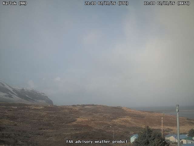
Ashfall Forecast

Click on the X on the graphic (upper right) to expand the map to show the map legend.

Ashfall Start Time

This map shows the modeled estimate of the time it would take for ashfall to begin following an eruption. It corresponds to the ashfall thickness forecast map shown above. This map uses the start time of either the twice-daily hypothetical model runs (time shown in the legend) or the actual eruption start time (if one were to occur). In the case of an actual eruption, the National Weather Service Anchorage Forecast Office will issue the official ashfall warning product that includes the ashfall start time and post them at weather.gov/afc

THESE PRODUCTS MAY NOT BE CURRENT.

During an actual eruption, see National Weather Service forecasts of ashfall:https://weather.gov/afc.

Ashfall Start Times Forecast

Click on the X on the graphic (upper right) to expand the map to show the map legend.
×