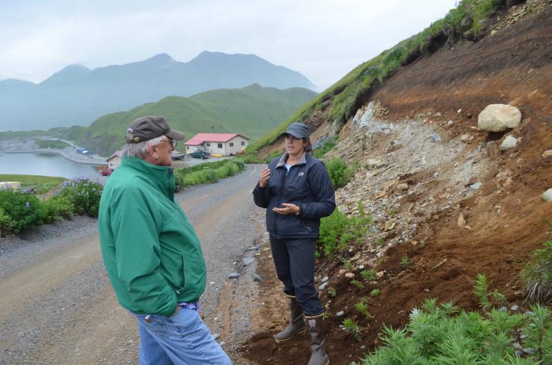
Check out our new geonarrative about Makushin Volcano! Makushin is an active, snow and ice-covered stratovolcano that inhabits the northern part of Unalaska Island. Its summit is located approximately 20 kilometers (12 miles) to the northwest of the Port of Dutch Harbor and City of Unalaska. Makushin last erupted in 1995 and has ongoing emissions of volcanic gases that are sometimes noticeable in communities down wind. An AVO geologist describes Makushin's past eruptions to a representative of the Ounalashka Corporation, and discusses impacts to Unalaska / Dutch Harbor if Makushin produces similar-sized eruptions in the future. This Makushin geonarrative gives an overview of Makushin and several other cones and craters in the Makushin volcanic field: Table Top Mountain, Wide Bay Cone, Sugarloaf cone, Pakushin cone, and the string of craters to the east of Point Kadin, along the northwestern shores of Unalaska Island. You will also learn more about how old each of these cones and craters are, and about ongoing monitoring activities and geological research in the Makushin Volcano area conducted by Alaska Volcano Observatory scientists.