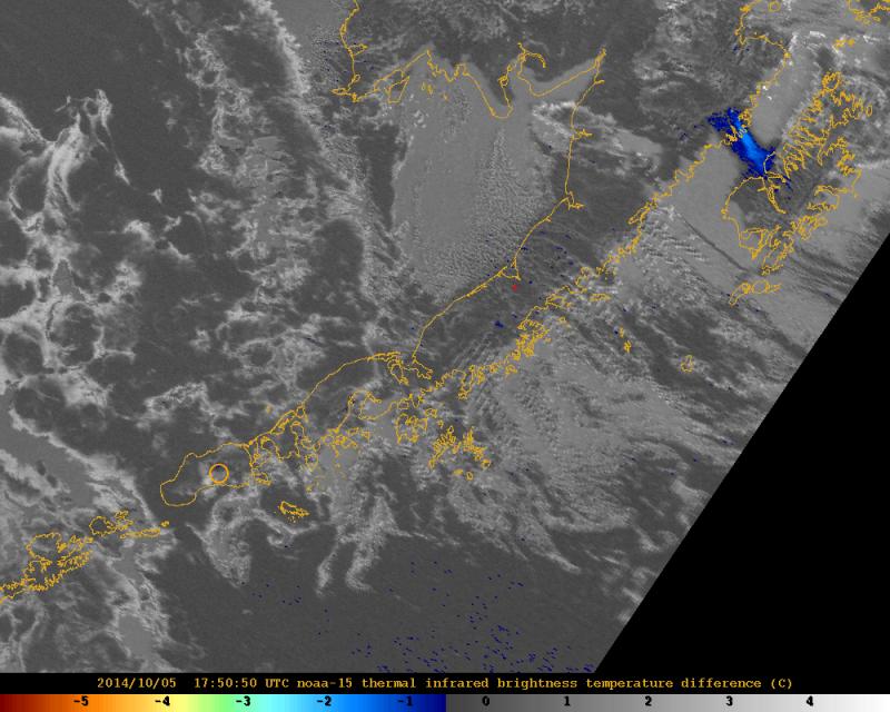
NOAA satellite image showing resuspended ash (blue area in the upper right) from the 1912 Novarupta eruption being carried southeast towards Kodiak Island. This plume of resuspended ash reached an estimated 4-6,000 ft ASL.
Volcano(es): Katmai Novarupta
Photographer: Alaska Volcano Observatory
URL: avo.alaska.edu/image/view/80451
Credit: Image courtesy of AVO/USGS.
Use Restriction: Please cite the photographer and the Alaska Volcano Observatory / U.S. Geological Survey when using this image.
Full Resolution.
Novarupta 2014/5
From Cameron and others, 2017: "Resuspension and transport of fine-grained volcanic ash from the Katmai National Park and Preserve region of Alaska frequently have been observed and documented for decades (Hadley and others, 2004; McGimsey and others, 2005), and five episodes of resuspended ash were documented in 2014. The 1912 eruption of Novarupta deposited large quantities of ash in valleys of the Katmai area, and the landscape remains desolate and largely vegetation-free, even more than a century later. During times of no snow and strong northwesterly winds, the ash can be resuspended and transported southeast across Shelikof Strait, Kodiak Island, and the Gulf of Alaska. These events commonly are identified by the presence of ash blowing from the Katmai area, often detected in satellite imagery, coupled with existing high winds and a lack of other volcanic signals (no thermal anomalies, no increased seismicity).
"On May 19, flights to Karluk on Kodiak Island were delayed because of weather conditions and a visible plume of resuspended ash originating from the Katmai area. The ash was weakly visible in satellite imagery, and strong northwesterly winds were blowing from the Katmai area towards the southeast. The National Weather Service Alaska Aviation Weather Unit (NWS AAWU) issued a Special Weather Statement. The NWS AAWU also issued SIGnificant METeorological information statements (SIGMETs) for resuspended Katmai ash due to strong winds on September 29 and October 5, when ash again was visible in satellite imagery blowing toward Kodiak Island. During the October 5 event, a citizen of Kodiak reported ash to AVO using via AVO’s "Is Ash Falling" system. Ash reached an altitude as high as 1,200-1,800 m (4,000-6,000 ft) ASL during the October 5 event.
On October 14, strong winds in the Katmai area once again picked up loose 1912 volcanic ash and carried it east over Shelikof Strait and Kodiak Island. The National Weather Service estimated the top of the cloud at an altitude of 1,200 m (4,000 ft) ASL. The NWS issued a Special Weather Statement, and AVO received a report of hazy conditions and trace ashfall (less than 1/32 in. deep) at Karluk on the southwestern side of Kodiak Island through AVO’s "Is Ash Falling" online ash reporting system. Federal Aviation Administration (FAA) Web camera images in Karluk also showed hazy conditions. AVO mentioned the resuspended ash event in the Friday, October 17, weekly update.
"The last ash resuspension event of 2014 occurred on Thursday, October 23, when strong winds resuspended 1912 volcanic ash and carried it southeast over Shelikof Strait, Kodiak Island, and the Gulf of Alaska. The ash was detected in satellite imagery, and the NWS issued Special Weather Statements, SIGMETs, and a Volcanic Ash Advisory. AVO
included the ash resuspension event in its Friday, October 24, weekly update."