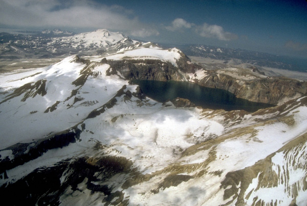
Katmai Caldera, a collapse feature that formed during the catastrophic eruption of nearby Novarupta volcano in June, 1912. Katmai Caldera is a steep-walled, 1.5-km (1 mi)-diameter crater that truncates a formerly 2,290-m (7,513 ft)-high stratovolcano. The caldera is partially filled by a blue-green lake about 250 m (820 ft) deep. The lake level was still rising when last measured in the mid-1970's. Beyond the caldera are the multiple peaks of Trident Volcano; Mount Mageik volcano is the snow and ice-covered cone on the skyline. View is to the northeast. Photograph by C. Nye, Alaska Division of Geological and Geophysical Surveys, August, 1991.
Date: August 1991
Volcano(es): Katmai Mageik Trident
Photographer: Nye, C. J.
URL: avo.alaska.edu/image/view/360
Credit: Image courtesy of AVO / Alaska Division of Geological & Geophysical Surveys.
Use Restriction: Please cite the photographer and Alaska Volcano Observatory / Alaska Division of Geological & Geophysical Surveys when using this image.
Full Resolution.