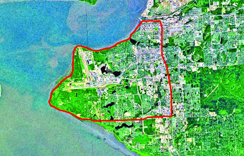
This is a satellite image of Anchorage, Alaska. The red line shows the equivalent area that the 2009 Redoubt lava dome would cover - to a depth of 3 feet! The dome is about 70 million cubic meters. This volume was calculated by USGS geologist Angie Diefenbach at the Cascades Volcano Observatory, using oblique photos taken by AVO geoscientists.
Date: 2000
Volcano(es): Redoubt
Photographer: Robbins, Doug
URL: avo.alaska.edu/image/view/19661
Credit: The satellite image is used courtesy of ESRI. Doug Robbins added the Redoubt volume comparison.
Use Restriction: Please cite ESRI, Doug Robbins, and AVO when using this image.
Full Resolution.
Volcano(es): Redoubt
Photographer: Robbins, Doug
URL: avo.alaska.edu/image/view/19661
Credit: The satellite image is used courtesy of ESRI. Doug Robbins added the Redoubt volume comparison.
Use Restriction: Please cite ESRI, Doug Robbins, and AVO when using this image.
Full Resolution.