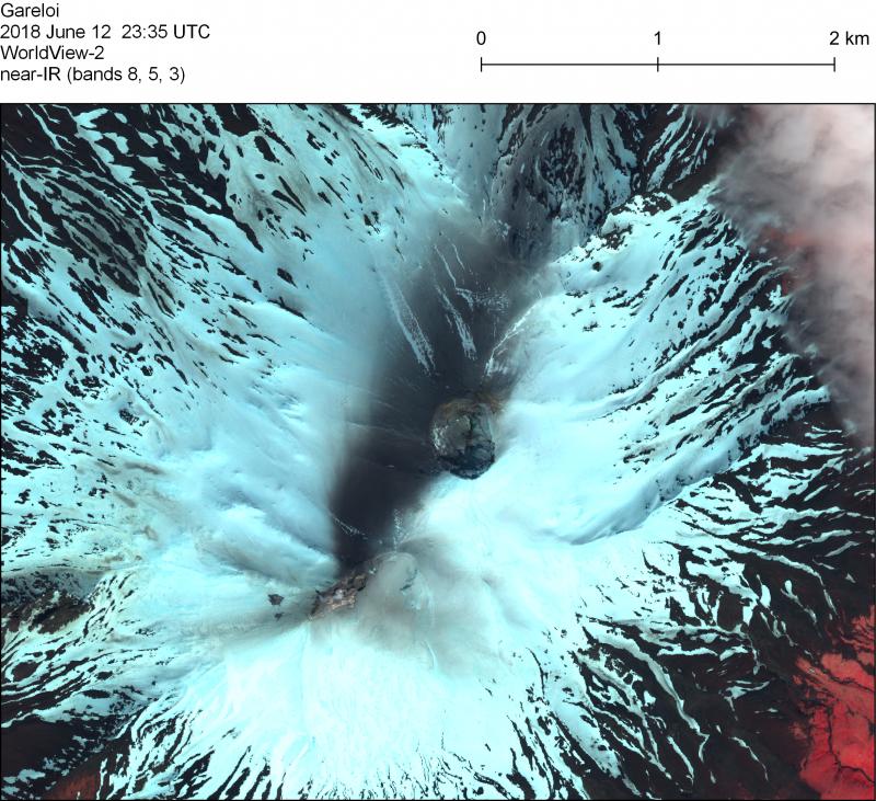
WorldView-2 near-infrared satellite image on June 12, 2018 showed an ash deposit trending ~5 km NNE from the south fumaroles on Gareloi.
Volcano(es): Gareloi
Photographer: Loewen, Matthew
URL: avo.alaska.edu/image/view/182888
Credit: Copyright Maxar 2018, accessed via NextView license
AVO does not hold copyright to this image and displays it with the permission of the copyright holder. This image is NOT in the public domain. Please see the use restrictions below.
Use Restriction: NextView license
Full Resolution.
Gareloi 2018/06
From Cameron and others, 2023: "The typical seismicity of Mount Gareloi is characterized by many low-frequency earthquakes that are commonly too small to be located by its seismic network, which comprises six stations on Gareloi Island and nearby Kavalga Island. Although the frequency of located seismic events varied in the past, seismicity at Mount Gareloi was fairly constant in recent years: 265 earthquakes were located in 2016 and 269 were located in 2017. In the summer of 2018, however, AVO located an anomalously high number of earthquakes, with 190 located in June and 178 in July. AVO then located 80 earthquakes in August and 77 in September before the volcano returned to typical activity levels in the fall. This period of increased activity was dominated by low-frequency earthquakes at depths of 5–15 km, which is typical for seismicity at Mount Gareloi. AVO paid close attention to the elevated seismicity rates but kept the Aviation Color Code and Volcano Alert Level at GREEN and NORMAL.
"In 2022, while retrospectively reviewing high-resolution satellite imagery of Mount Gareloi, AVO found a 2018 image showing an approximately 5-kilometer-long ash deposit extending north-northwest from the south fumarole field of the volcano. This image, taken by the WorldView-2 satellite on June 12, appears to record a previously unrecognized small ash emission (eruption). Satellite imagery acquired by Planet Labs PBC first shows the ash streak on June 6; the actual emission may have taken place on June 5."