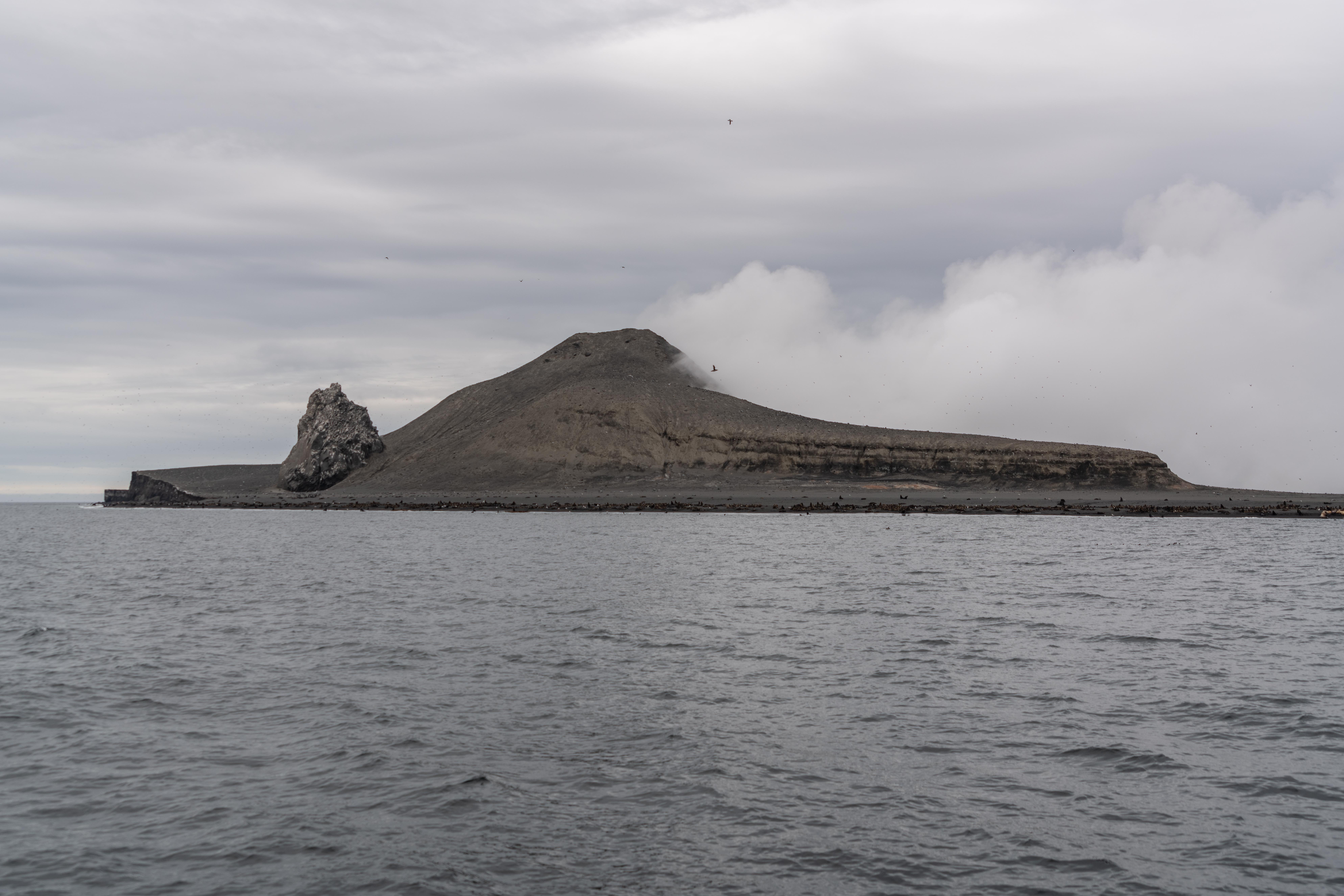
View of the southwest side of Bogoslof, July 14, 2019. Castle Rock is the prominent outcrop near the coast (erupted between 1796-1804). The high point on the island is a lava dome partially buried by pyroclastic debris. The sloping feature on the right side of the photograph are pyroclastic deposits from the 1926-27 eruption mantled by 1-2 m of material from the 2016-2017 eruption. At the base of the 1926-27 deposits are a few hydrothermally altered zones related to the 2016-2017 activity. Some of these areas are still warm. The vapor plume extending off to the right (south) is a persistent feature derived from ongoing degassing from numerous fumaroles in the center part of the island.
Date: Jul 14th, 2019
Volcano(es): Bogoslof
Photographer: Waythomas, Christopher
URL: avo.alaska.edu/image/view/142331
Credit: Image courtesy of AVO/USGS.
Use Restriction: Please cite the photographer and the Alaska Volcano Observatory / U.S. Geological Survey when using this image.
Full Resolution.
Volcano(es): Bogoslof
Photographer: Waythomas, Christopher
URL: avo.alaska.edu/image/view/142331
Credit: Image courtesy of AVO/USGS.
Use Restriction: Please cite the photographer and the Alaska Volcano Observatory / U.S. Geological Survey when using this image.
Full Resolution.
×
![Instrument data]()