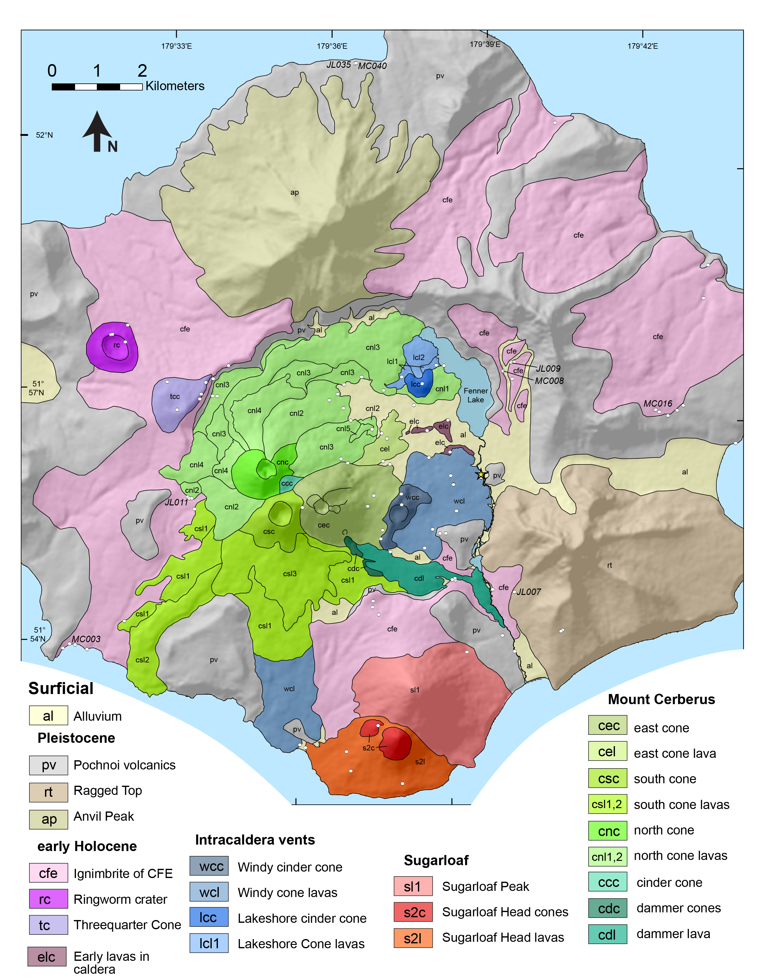
Generalized geologic map of Semisopochnoi Island, Alaska from Coombs et al. (2018). Hillshade base from Shuttle Radar Topography Mission (SRTM) 30-m digital elevation data. For Cerberus north and south cones, numbers on lava units indicate relative ages, with lowest numbers representing oldest lavas. Lines within Mount Cerberus units indicate contacts between individual lava flows. Yellow star shows location of Fenner Creek warm springs. CFE, caldera-forming eruption. Full report can be downloaded here: https://doi.org/10.3133/sir20175150
Date:
Volcano(es): Semisopochnoi
Photographer: Coombs, Michelle
URL: avo.alaska.edu/image/view/132711
Credit: Image courtesy of AVO/USGS.
Use Restriction: Please cite the photographer and the Alaska Volcano Observatory / U.S. Geological Survey when using this image.
Full Resolution.
Volcano(es): Semisopochnoi
Photographer: Coombs, Michelle
URL: avo.alaska.edu/image/view/132711
Credit: Image courtesy of AVO/USGS.
Use Restriction: Please cite the photographer and the Alaska Volcano Observatory / U.S. Geological Survey when using this image.
Full Resolution.
×
![Instrument data]()