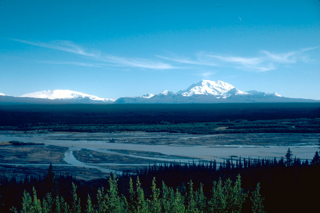
Mount Wrangell, a 4,317-m (14,163 ft)-high andesite shield volcano is visible to the left on the skyline; it is the only volcano in the Wrangell Mountains to have had documented historical activity. This consisted of several minor, possibly phreatic eruptions in the early 1900's. Mount Drum, 3,661 m (12,011 ft) high, is the westernmost volcano in the Wrangell volcanic field, and is visible to the right on the skyline. The Copper River is in the foreground. View is to the southeast. Photograph by D. Richter, U.S. Geological Survey, August 1981.
Date: August 2001
Volcano(es): Wrangell
Photographer: Richter, D. H.
URL: avo.alaska.edu/image/view/301
Credit: Image courtesy of AVO / U.S. Geological Survey.
Use Restriction: Please cite the photographer and the Alaska Volcano Observatory/U.S. Geological Survey when using this image.
Full Resolution.
Volcano(es): Wrangell
Photographer: Richter, D. H.
URL: avo.alaska.edu/image/view/301
Credit: Image courtesy of AVO / U.S. Geological Survey.
Use Restriction: Please cite the photographer and the Alaska Volcano Observatory/U.S. Geological Survey when using this image.
Full Resolution.
×
![Instrument data]()