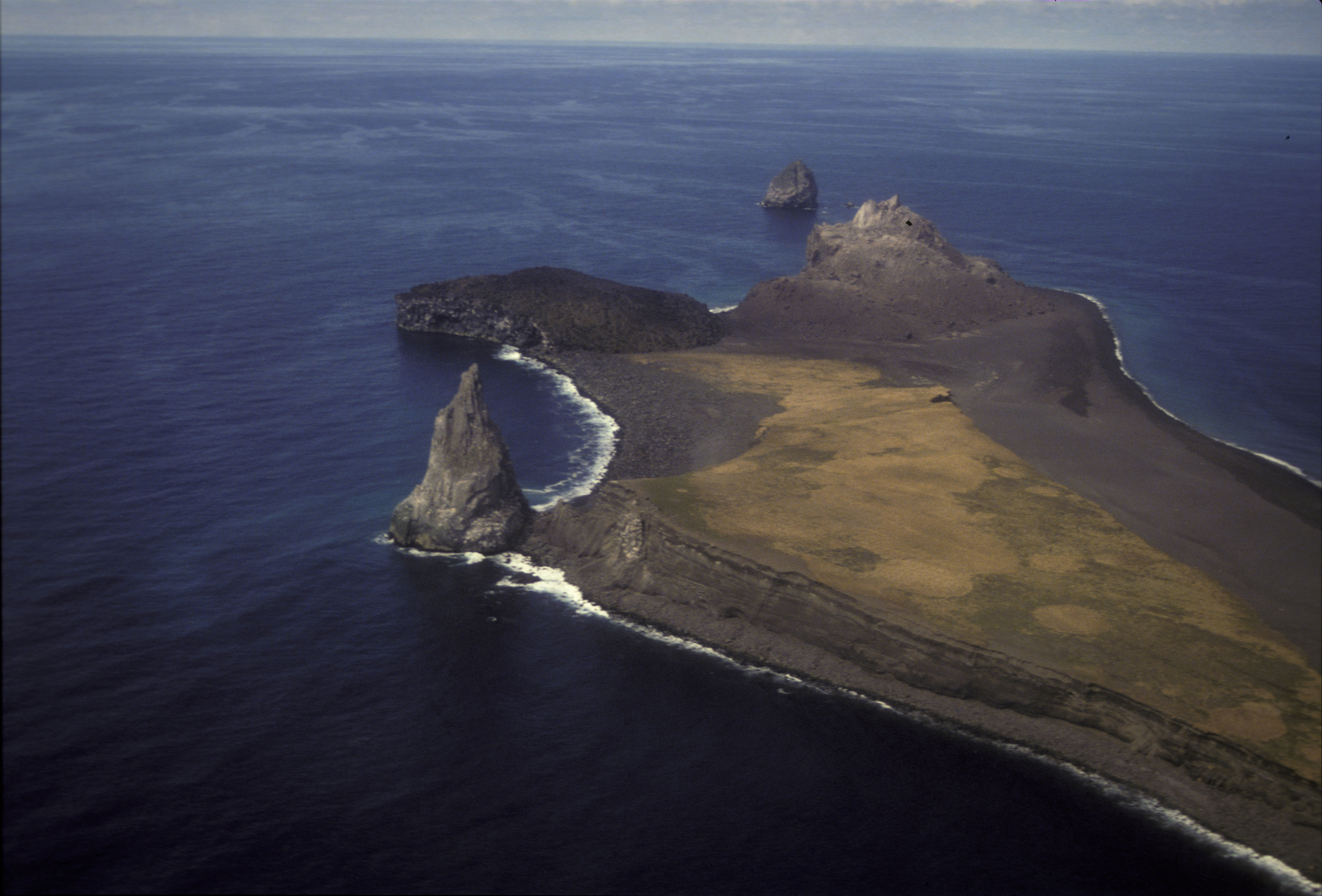
View from the southwest of the northern end of Bogoslof Island, and Fire Island just offshore to the north. Four lava domes are visible. the southernmost, a pinnacle along the west shore is Castle Rock (1796-1804). The flat-topped nearly circular dome is from 1927. The 1992 lava dome marks the far northern end of the island. Fire Island is a lava dome extruded during the 1883 eruption. The grassy terrace mid-island on Bogoslof is an accumulation of tephra deposits. Bogoslof and Fire Islands are the emergent summit of a submarine stratovolcano that rises 6000 feet from the floor of the Bering Sea.
Date: May 10th, 1994
Volcano(es): Bogoslof
Photographer: Nye, Christopher
URL: avo.alaska.edu/image/view/2758
Credit: Image courtesy of AVO / Alaska Division of Geological & Geophysical Surveys.
Use Restriction: Please cite the photographer and Alaska Volcano Observatory / Alaska Division of Geological & Geophysical Surveys when using this image.
Full Resolution.
×
![Instrument data]()