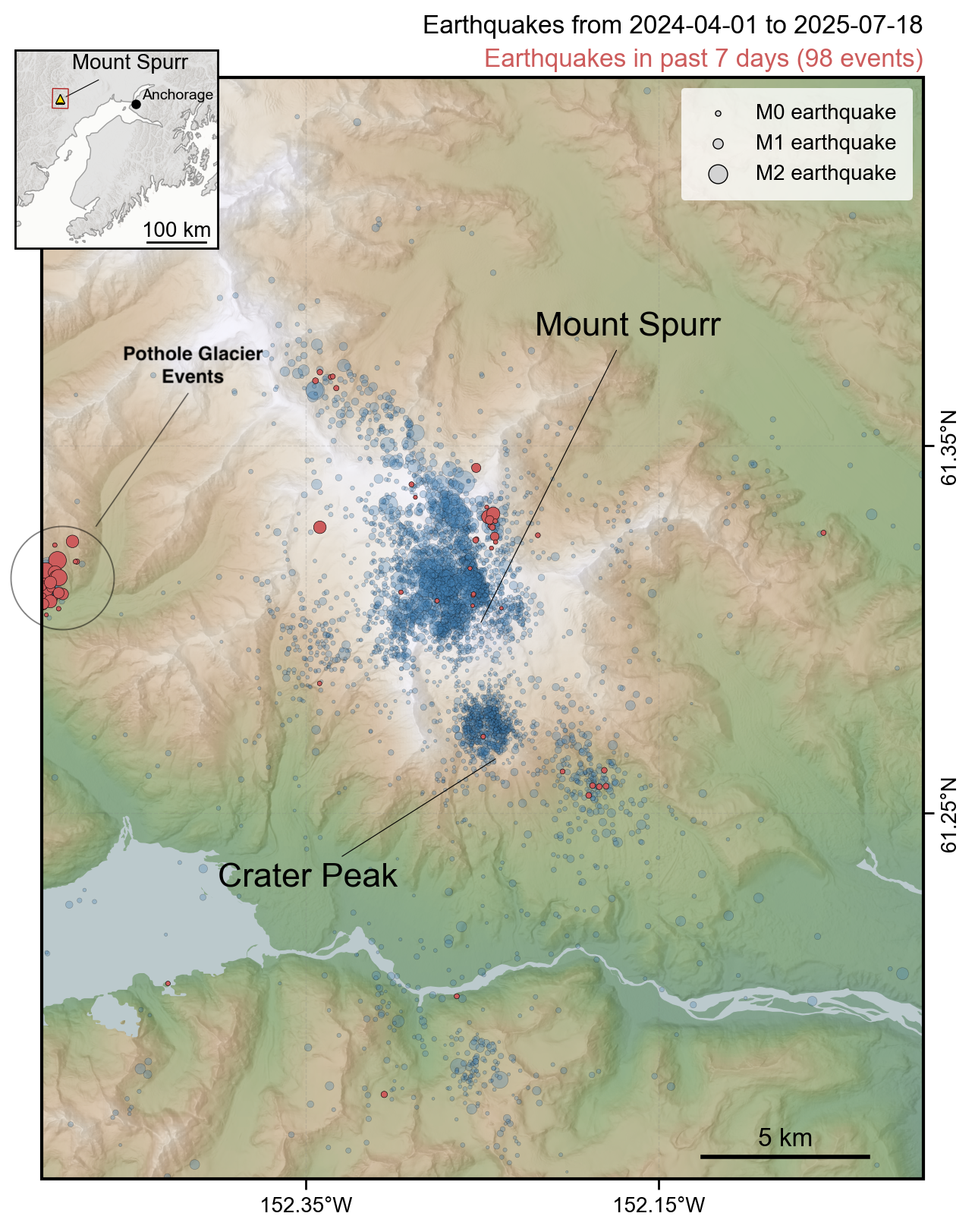
Map showing all earthquakes recorded within 25 km of Mount Spurr during the current unrest period from April 1, 2024 to July 17, 2025. Earthquakes within the past week (July 11 - July 17) are highlighted in red. Circles are scaled by earthquake magnitude. Most of the activity over the past week is the result of non-volcanic events associated with Pothole Glacier that are marked on the left side of the map.
Date: Jul 18th, 2025
Volcano(es): Spurr
Photographer: Wech, Aaron
URL: avo.alaska.edu/image/view/196762
Credit: Image courtesy of AVO/USGS.
Use Restriction: Please cite the photographer and the Alaska Volcano Observatory / U.S. Geological Survey when using this image.
Full Resolution.
Volcano(es): Spurr
Photographer: Wech, Aaron
URL: avo.alaska.edu/image/view/196762
Credit: Image courtesy of AVO/USGS.
Use Restriction: Please cite the photographer and the Alaska Volcano Observatory / U.S. Geological Survey when using this image.
Full Resolution.
×
![Instrument data]()