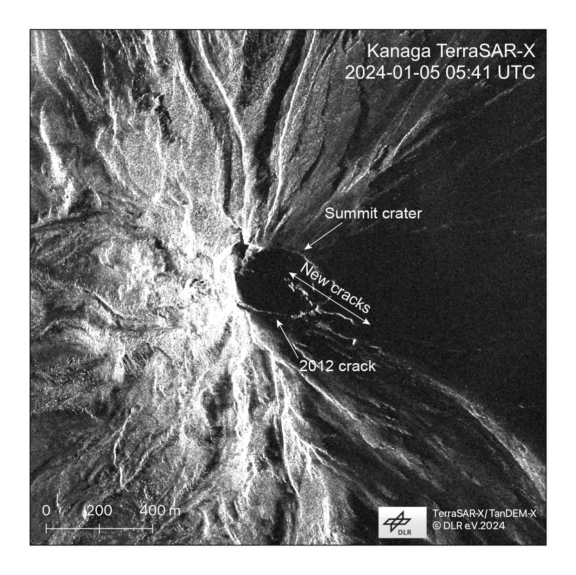
A series of new cracks extending across the summit crater and onto the upper southeast flank of Kanaga Volcano are visible in satellite radar imagery from the TanDEM-X on January 5, 2024. These formed during the December 18 event. Also visible is a long crack across the southern side of the summit of the volcano that formed in 2012. Radar illumination is from the southwest.
Volcano(es): Kanaga
Photographer: Dietterich, Hannah
URL: avo.alaska.edu/image/view/195260
Credit: TerraSAR-X/TanDEM-X ©DLR e.V. 2024. Imagery courtesy of Simon Plank (DLR).
Use Restriction:
Full Resolution.
Kanaga 2023/12
On December 19, 2023, AVO raised the alert levels at Kanaga Volcano to YELLOW/ADVISORY, stating: "A small explosion was detected at Kanaga Volcano overnight at 22:31 AKST Dec 18 (07:31 UTC Dec. 19), and AVO is increasing the Aviation Color Code to YELLOW and the Volcano Alert Level to ADVISORY. The event was detected in local infrasound and seismic data and was followed by elevated earthquake seismicity that is ongoing. No ash emisions have been observed in partly cloudy satellite images."
Increased earthquake activity followed the explosion, and satellite imagery taken afterwards showed a debris flow extending 0.9 miles northwest of the summit crater rim, and a series of northwest-southeast oriented fractures both within the summit crater and extending down the southeast flank. Minor steaming was observed when the weather was clear.
Elevated seismic activity was ongoing until January 2, when seismic stations (and webcams) for Kanaga went offline due to a weather-related outage. Satellite images of the volcano were obscured by clouds until two weeks later, when a clear view showed no further changes at the surface.
On January 28, connection to the seismic stations and webcams was restored. Webcam views showed steaming at the summit, and a few earthquakes were detected daily during the first week afterward. A period of weak seismic tremor was observed on January 31.
During February, earthquake rates dropped to a few per week.
On February 27, 2024, AVO lowered the alert levels to GREEN/NORMAL, stating that seismicity had decreased to background levels and satellite and webcam data showed no recent surface changes, elevated temperatures or gas emissions, though steaming was still sometimes present.