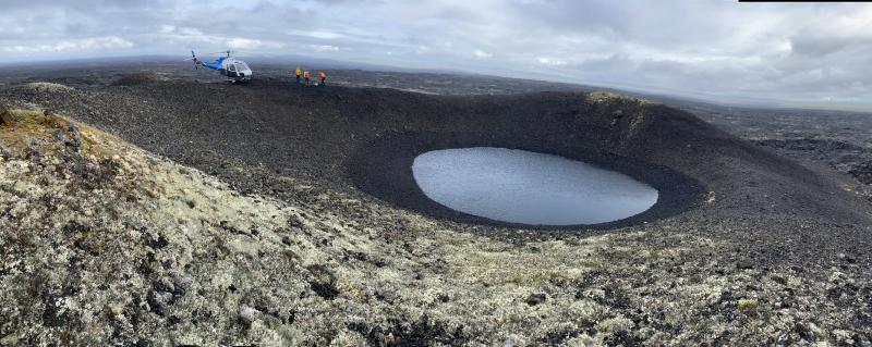
Panorama of the summit of the Lost Jim cone. A small lake fills the crater at the top of the cinder cone. The Lost Jim lava flow, the youngest lava flow in the Imuruk Lake Lava Field, is thought to have erupted roughly 1,000–2,000 years ago.
Date: Jun 27th, 2021
Volcano(es): Imuruk Lake Volc Field Lost Jim Cone
Photographer: Orr, Tim
URL: avo.alaska.edu/image/view/178611
Credit: Image courtesy of AVO/USGS.
Use Restriction: Please cite the photographer and the Alaska Volcano Observatory / U.S. Geological Survey when using this image.
Full Resolution.
Volcano(es): Imuruk Lake Volc Field Lost Jim Cone
Photographer: Orr, Tim
URL: avo.alaska.edu/image/view/178611
Location:
Latitude: 65.48755555
Longitude: -163.29704166667
Use Restriction: Please cite the photographer and the Alaska Volcano Observatory / U.S. Geological Survey when using this image.
Full Resolution.