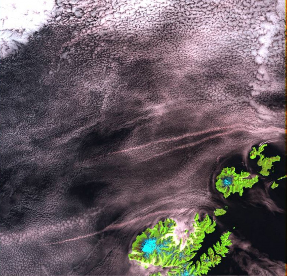
Landsat 7 ETM+ image of Unalaska Island, with Makushin volcano (lower left of image) and Akutan Island and volcano. Mt. Gilbert is on the northern tip of the small island to the right (east) of Akutan.
Date: 2001
Volcano(es): Makushin Akutan Gilbert
Photographer: Landsat 7 ETM+
URL: avo.alaska.edu/image/view/177
Credit: Image from the the MRLC Consortium of 2001 Landsat 7 ETM+ imagery.Volcano(es): Makushin Akutan Gilbert
Photographer: Landsat 7 ETM+
URL: avo.alaska.edu/image/view/177
Use Restriction: Please see the MRLC Consortium website(http://www.mrlc.gov/download_data.asp) for use restrictions.
Full Resolution.