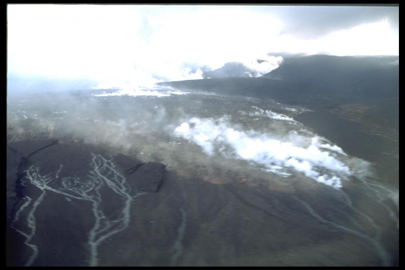
Westdahl, northeast lava flow
Volcano(es): Westdahl
Photographer: Neal, C. A.
URL: avo.alaska.edu/image/view/14089
Westdahl 1991/11
McGimsey and others (1995): ""A steam and ash cloud rising to more than 6 km above Westdahl volcano [see fig. 36-1 in original text] was first reported by commercial pilots on routine flights along the Aleutian Island chain on November 29, 1991 (BVE no. 31, p. 83-86). The next day, pilots reported eruptive activity along an 8-km-long fissure that extended from Westdahl Peak northeastward across the glaciated summit area [see fig. 36-2 in original text]. Many pits, craters, and gaping cracks were visible in the ice adjacent to the fissure. In addition to ash and steam venting, spectacular lava fountains along the lower few kilometers of the fissure fed a lava flow that extended 7 km from the vent and was as much as 1.5 km wide at the front and 5-10 m thick. An AVO crew aboard a Coast Guard C-130 observed the lava flow on December 3 as well as the still-steaming deposits of a lahar that had advanced 18 km from the vent to enter the sea. Stormy weather conditions prevented direct observation of the vent area for most of December, 1991, but pilots reported a constant steam plume, usually mixed with ash, punching through the weather cloud cover. Residents of False Pass, the nearest permanent settlement, 90 km NE of Westdahl Peak, also reported thunder-like rumbling sounds, the occasional smell of sulfur, and light ashfalls on November 30, December 16, 25, and 26 - evidence that the eruption was still continuing. Steam clouds rose to almost 5 km altitude on January 2-3, 1992. Ash clouds observed on January 8-9 reached 2.4 km altitude. Satellite images during the late afternoon of January 9 showed the plume extending about 150 km SE. By January 15, there was no sign of a vertical plume or any other eruptive activity. Also by mid-January, the lava flow viewed on December 3, 1991 had not advanced, but had widened to cover an area about 2-3 times greater than in December [see fig. 36-3 in original text]."
Siebert and Simkin (2002-) estimate this eruption produced 5x10^7 cubic meters of lava.
Use Restriction: Please cite the photographer and the Alaska Volcano Observatory / U.S. Geological Survey when using this image.
Full Resolution.