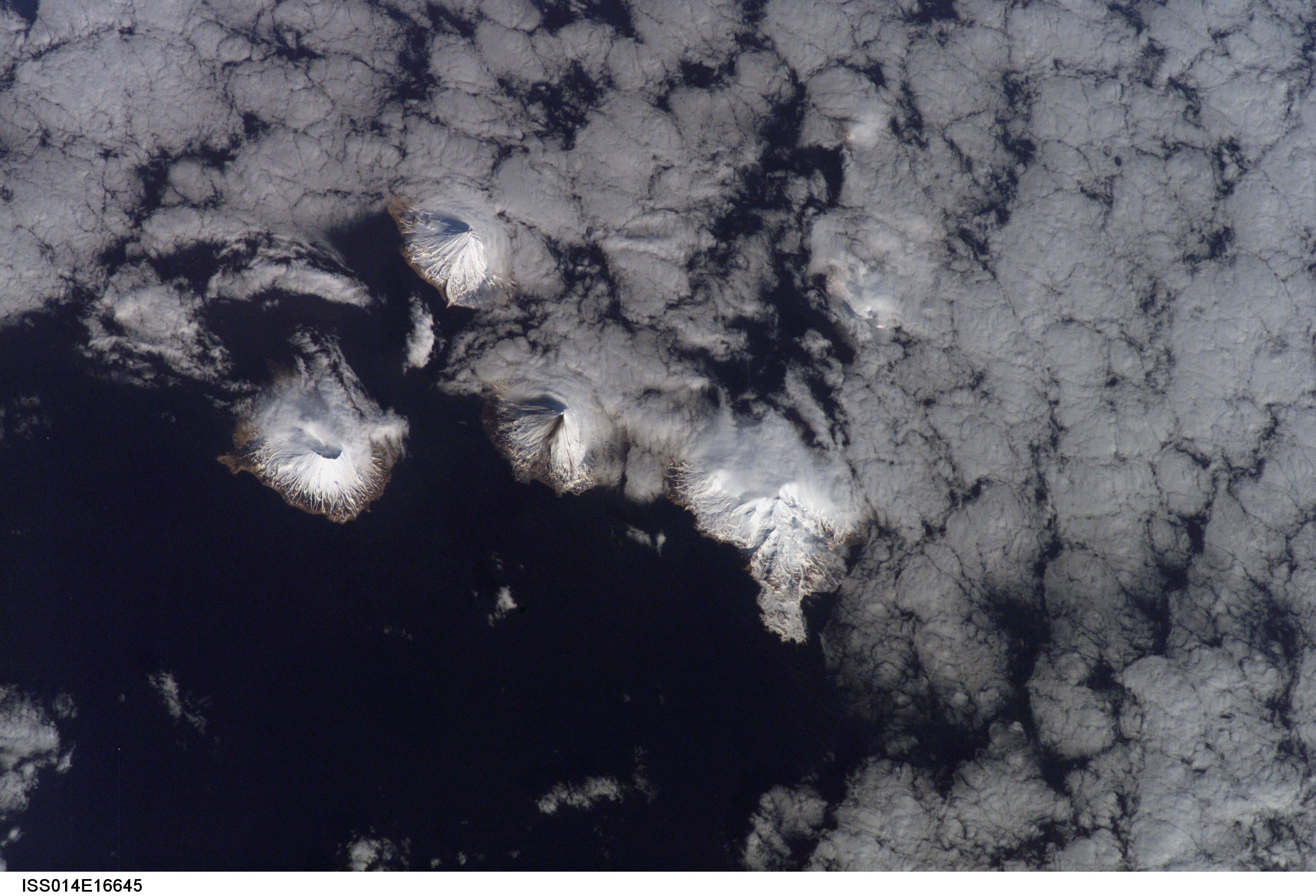
The Islands of the Four Mountains region, as viewed from space. The western-most volcano is Herbert, followed by Carlisle. Slightly to the east, the ash-streaked flank of Cleveland on Chuginadak Island is visible. Chuginadak's other volcano, Tana is also visible to the east of Cleveland. Kagamil lies further to the northeast, and is mostly obscured by clouds. This photograph is mission ISS014, Roll E, Frame 16045 from Image Science and Analysis Laboratory, NASA-Johnson Space Center. "The Gateway to Astronaut Photography of Earth." and is available at http://eol.jsc.nasa.gov/scripts/sseop/photo.pl?mission=ISS014&roll=E&frame=16045
Date: Mar 12th, 2007
Volcano(es): Carlisle Cleveland Herbert Kagamil Tanax̂ Angunax̂
Photographer: Image Science and Analysis Laboratory NASA-Johnson Space Center
URL: avo.alaska.edu/image/view/13938
Credit: Image courtesy of the Image Science and Analysis Laboratory, NASA-Johnson Space Center, \"The Gateway to Astronaut Photography of Earth.\"
Use Restriction: Please cite the Image Science and Analysis Laboratory, NASA-Johnson Space Center, \"The Gateway to Astronaut Photography of Earth.\" when using this image.
Full Resolution.
×
![Instrument data]()