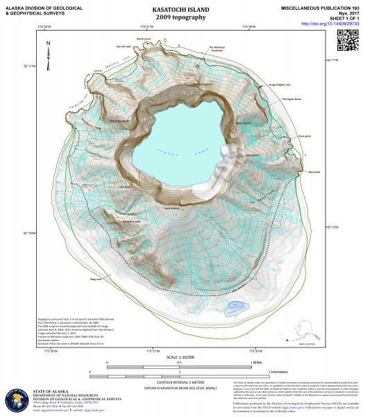
Topographic map of Kasatochi Island as of April 18, 2009. See http://doi.org/10.14509/29733 for details of map creation.
Date: Apr 18th, 2009
Volcano(es): Kasatochi
Photographer: Nye, Christopher
URL: avo.alaska.edu/image/view/115981
Credit: Image courtesy of the AVO/ADGGS.
Use Restriction: Please cite the photographer and the Alaska Volcano Observatory / Alaska Division of Geological & Geophysical Surveys when using this image.
Full Resolution.