Alaska Volcano Observatory

Home
Volcanoes
Webcams
Webcams
Ashcam GUI
News
Explore Data
Explore Data
References
Webicorder
Hazard Alert System
Eruptions
Locations
Glossary
Images
Get Involved
About AVO
About AVO
Staff
Study Areas
Alert Levels
FAQ

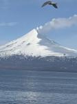
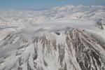
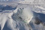
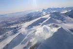
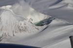
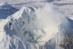
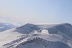
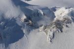
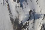
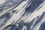
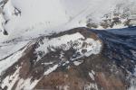
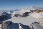
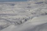
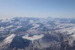
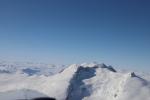
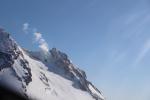
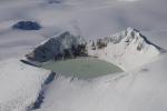
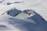
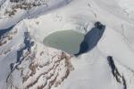
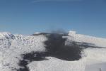
Twenty Five Most Recently Added Images

Map showing all earthquakes (blue) recorded within 25 km of Mount Spurr from January 4 2024 to May 9, 2025. Located earthquakes within the past week (May 2 - May 9) are highlighted in red. Circles are scaled by earthquake magnitude.
Summary of earthquake activity and deformation at Mount Spurr from November 1, 2023 to May 9, 2025. Top panel shows the Aviation Color Code at Mount Spurr. Airplane and helicopter symbols show approximate dates of observatory overflights and their respective aircraft type. Second panel plots the total number of earthquakes located per week within 25 km of Mount Spurr. The gray circles in the third panel show the magnitude of the largest earthquake recorded each week. The bottom panel shows daily positions at GNSS station SPBG with respect to a reference location in cm. Since the beginning of 2024 this station has moved more than 6 cm away from Mount Spurr.
Map showing all earthquakes (blue) recorded within 25 km of Mount Spurr from January 4 2024 to May 2, 2025. Located earthquakes within the past week (April 25 - May 2) are highlighted in red. Circles are scaled by earthquake magnitude.
Summary of earthquake activity and deformation at Mount Spurr from November 1, 2023 to May 2, 2025. Top panel shows the Aviation Color Code at Mount Spurr. Airplane and helicopter symbols show approximate dates of observatory overflights and their respective aircraft type. Second panel plots the total number of earthquakes located per week within 25 km of Mount Spurr. The gray circles in the third panel show the magnitude of the largest earthquake recorded each week. The bottom panel shows daily positions at GNSS station SPBG with respect to a reference location in cm. Since the beginning of 2024 this station has moved more than 6 cm away from Mount Spurr.
Seismic waveforms and spectrograms from various stations in the Atka volcanic complex monitoring network, covering the period of 18:30 to 18:40 UTC on April 25, 2025. The waveforms from each station are on top (black and white boxes) while the spectrograms are below (colored, larger boxes). Both types of data show the signal from an explosion at 10:34 AKDT April 25 (18:34 UTC April 25).
Map showing all earthquakes (blue) recorded within 25 km of Mount Spurr from January 4 2024 to April 25, 2025. Located earthquakes within the past week (April 17 - 25) are highlighted in red. Circles are scaled by earthquake magnitude.
Summary of earthquake activity and deformation at Mount Spurr from November 1, 2023 to April 25, 2025. Top panel shows the Aviation Color Code at Mount Spurr. Airplane and helicopter symbols show approximate dates of observatory overflights and their respective aircraft type. Second panel plots the total number of earthquakes located per week within 25 km of Mount Spurr. The gray circles in the third panel show the magnitude of the largest earthquake recorded each week. The bottom panel shows daily positions at GNSS station SPBG with respect to a reference location in cm. Since the beginning of 2024 this station has moved more than 6 cm away from Mount Spurr.
Representative thermal image of the Crater Peak fumarole area captured by a FLIR (forward-looking infrared) camera. The colors show approximate temperature in degrees Celsius (scale on the right hand side). The snow-free ridge that hosts the fumaroles is in the center of the image and is approximately the same temperature as the crater walls above it. The areas of bare rock are warmer than the areas of snow and ice (black to purple in this image) due to heating from the sun.
Representative thermal image of the Spurr summit crater lake and fumaroles, captured by a FLIR (forward-looking infrared) camera. The colors show approximate temperature in degrees Celsius (see scale bar on right hand side of the image). The warmest part of the lake is ~8°C (orange), but most of the lake remains covered in snow and ice (purple). The fumaroles are hotter (yellow and white) and are producing the the hazy steam and gas plume (visible in pink and purple).
Overhead view (south is to the top of image) of a ridge inside the Crater Peak crater. This ridge has been the source of subtle fumarolic activity and carbon dioxide emissions starting in February 2025.
Overhead view (west is to the top of image) of a ridge inside the Crater Peak crater. This ridge has been the source of subtle fumarolic activity and carbon dioxide emissions starting in February 2025.
View towards the north of a ridge inside the Crater Peak crater. This ridge has been the source of subtle fumarolic activity and carbon dioxide emissions starting in February 2025.
View into the south breach of Crater Peak's crater on an April 25 overflight and gas survey.
View looking southwest and upward at the Mount Spurr summit from above an upper arm of Capps Glacier. The summit gas plume can be seen drifting to the northwest.
Area of persistent fumarolic activity on the northeast flank of the Mount Spurr summit cone on April 25 during an AVO gas and photo survey.
View of the northeast flank of the Mount Spurr summit cone on April 25 during an AVO gas and photo survey. Steam and gas emissions are visible from the summit crater. A snowless patch in the center of the image is a long-lived warm area on the flank of the upper cone. Crater Peak is just visible in the center left of the image.
View of the Mount Spurr summit crater lake on an April 25 overflight and gas survey. The water is greenish blue to yellow, due to suspected sulfur precipitates in the water. Floating ice covers the southern half of the lake. The image is looking southeast with two fumarolic areas exposed under recently melted ice visible.
View of the Mount Spurr summit crater lake on an April 25 overflight and gas survey. The water is greenish blue to yellow, due to suspected sulfur precipitates in the water. Floating ice covers the southern half of the lake. The fumarole field on the north shoreline is visibly steaming (bottom of image).
View of the Mount Spurr summit crater lake on an April 25 overflight and gas survey. The water is greenish blue to yellow, due to suspected sulfur precipitates in the water. Floating ice covers the southern half of the lake. The fumarole field on the north shoreline is visibly steaming.
Mount Spurr summit and crater lake with Crater Peak in the upper left of the photo from and April 25 overflight and gas survey. View is looking south.
Overflight video of the summit of Mount Spurr showing the crater lake and steaming fumaroles inside and around the summit crater.
Mount Spurr summit and crater lake from and April 25 overflight and gas survey. View is looking southeast.
View of the Mount Spurr summit crater lake on an April 25 overflight and gas survey. The water is greenish blue to yellow, due to suspected sulfur precipitates in the water. Floating ice covers the southern half of the lake. View is looking south.
Mount Spurr summit and crater lake with Crater Peak just visible behind the summit cone. Photo from an April 25 overflight and gas survey. View is looking south.
  • USGS Volcano Notification Service
  • Contact AVO
  • Privacy
  • Accessibility
  • Information Quality
  • FOIA
  • Facebook
  • Instagram
  • YouTube

This website is supported by the U.S. Geological Survey under Cooperative Agreement Grant G22AC00137 and G23AC00070.

Mention of trade names or commercial products does not constitute their endorsement by the U.S. Geological Survey.