Tanaga 240000 yBP
Start: 240000 yBP [1]
Stop: 118000 yBP [1]
Event Type: Not an eruption
- Caldera/crater [1]
Description: From Coombs and others (2007): "The edifice was once much larger than it is today and probably was centered between Tanaga and Takawangha. A broadly crescent-shaped scarp, concave to the west, separates the Takawangha and Tanaga edifices. This ridge is thought to be the residual rim of an amphitheatre that formed as the older volcanic edifice partially collapsed, as a debris avalanche, into the sea (fig. 11 [in original text]). On the basis of radiometric dates of lava flows on either side of the collapse scar, this event occurred between 240,000 and 118,000 years ago. Similar collapses have been recognized for other Aleutian volcanoes that sit on the north edge of the underwater Aleutian ridge (Coombs and others, 2007). Although many volcanic collapses of this kind are accompanied by eruptions, no widespread eruptive deposit has been correlated to the Tanaga collapse. This information indicates either such a deposit has been erased by erosion, or the collapse was caused by gravitational instability of the growing volcano, until the volcano finally gave way and fell into the sea."
From Coombs and others (2007): "Lavas from the pre-Tanaga volcano that form the amphitheatre wall have been dated using 40 Ar/39Ar at 240 ka; the oldest lavas west of this scarp underlie the current Tanaga cone and have been dated at 140 ka, thus constraining amphitheatre formation to 240-140 ka (A. Calvert, unpublished data). This age is consistent with the eroded, scalloped morphology of the collapse scarp, which appears modified by glaciation. No extensive pyroclastic sheet or tephra was found that could correlate to caldera formation; however, glaciation may have destroyed evidence of such a deposit."
From Coombs and others (2007): "Lavas from the pre-Tanaga volcano that form the amphitheatre wall have been dated using 40 Ar/39Ar at 240 ka; the oldest lavas west of this scarp underlie the current Tanaga cone and have been dated at 140 ka, thus constraining amphitheatre formation to 240-140 ka (A. Calvert, unpublished data). This age is consistent with the eroded, scalloped morphology of the collapse scarp, which appears modified by glaciation. No extensive pyroclastic sheet or tephra was found that could correlate to caldera formation; however, glaciation may have destroyed evidence of such a deposit."
References Cited
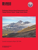
[1] Preliminary volcano-hazard assessment for the Tanaga Volcanic Cluster, Tanaga Island, Alaska, 2007
Coombs, M.L., McGimsey, R.G., and Browne, B.L., 2007, Preliminary volcano-hazard assessment for the Tanaga Volcanic Cluster, Tanaga Island, Alaska: U.S. Geological Survey Scientific Investigations Report 2007-5094, 36 p., available online at: http://pubs.usgs.gov/sir/2007/5094/ .[2] Massive edifice failure at Aleutian arc volcanoes, 2007
Coombs, M.L., White, S.M., and Scholl, D.W., 2007, Massive edifice failure at Aleutian arc volcanoes: Earth and Planetary Science Letters, v. 256, p. 403-418, doi: 10.1016/j.epsl.2007.01.030.Complete Eruption References
Preliminary volcano-hazard assessment for the Tanaga Volcanic Cluster, Tanaga Island, Alaska, 2007
Coombs, M.L., McGimsey, R.G., and Browne, B.L., 2007, Preliminary volcano-hazard assessment for the Tanaga Volcanic Cluster, Tanaga Island, Alaska: U.S. Geological Survey Scientific Investigations Report 2007-5094, 36 p., available online at: http://pubs.usgs.gov/sir/2007/5094/ .

Massive edifice failure at Aleutian arc volcanoes, 2007
Coombs, M.L., White, S.M., and Scholl, D.W., 2007, Massive edifice failure at Aleutian arc volcanoes: Earth and Planetary Science Letters, v. 256, p. 403-418, doi: 10.1016/j.epsl.2007.01.030.
