Douglas
Legend
✕
| Red (Warning) | |
| Orange (Watch) | |
| Yellow (Advisory) | |
| Green (Normal) | |
| Uninstrumented | |
| Community | |
| Webcam | |
| Instrument | |
| Earthquake Magnitude | |
|
0
| |
| Earthquake Age | |
| Last 2 Hours | |
| Last 2 Days | |
| Last 1 Week | |
Facts
- Official Name: Mount Douglas
- Seismically Monitored: No
- Color Code: UNASSIGNED
- Alert Level: UNASSIGNED
- Elevation: 2140m (7020ft)
- Latitude: 58.8596
- Longitude: -153.5351
- Smithsonian VNum: 312270
- Pronunciation:
-
Nearby Towns:
- Port William 43 mi (69 km) SE
- Kokhanok 59 mi (95 km) NW
- Pope-Vannoy Landing 59 mi (95 km) NW
- Aleneva 63 mi (101 km) SE
- Afognak 65 mi (105 km) SE
Distance from Anchorage: 206 mi (331 km)
Description
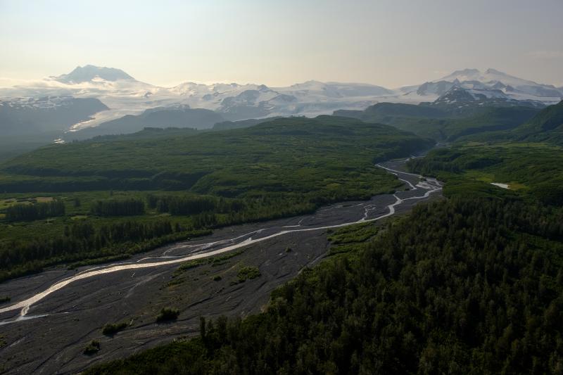
From Wood and Kienle (1990) [1] : "Mount Douglas is a dissected stratovolcano covered by ice of the Spotted Glacier. The summit of the volcano is marked by a crater with a small (160 m wide) crater lake. An active fumarole field on the north side of the crater keeps the area free of ice. A black scum floating on the lake in 1980 was probably sulfide minerals of some sort (consistent with a lake temperature of 25 degrees C and a pH of 1 measured in 1982)."Much of the volcano has been subjected to glacial erosion, but a ramp of lava flows on the northwest flank is relatively uneroded. Most of the volcano is ice-covered, but isolated outcrops of lava flows (high-silica andesite) are found within the ice. Reconnaissance geologic surveys suggest that the lavas extend to elevations lower than glacier's, but this has not been confirmed on the ground.
"No historic activity has been reported for Mount Douglas; however, the presence of unglaciated lava flows and the active fumaroles indicate recent activity."
Name Origin
Mount Douglas' name was derived from Cape Douglas, and reported by G.C. Martin in 1904 (Orth, 1971).
References Cited
[1] Volcanoes of North America: United States and Canada, 1990
Wood, C. A., and Kienle, Juergen, (eds.), 1990, Volcanoes of North America: United States and Canada: New York, Cambridge University Press, 354 p.Loading Past Activity...
Loading Images...
Loading Maps...
Loading Bibliography...
Before an eruption
Ashfall & Preparedness Information
- Ashfall impacts & preparedness (US Geological Survey)
- Volcanic health hazards & impacts (International Volcanic Health Hazards Network)
- Ash Alert! Pamphlet (AK Division of Homeland Security & Emergency Management)
- Volcanic Ashfall (AK Department of Environmental Conservation, Division of Air Quality)