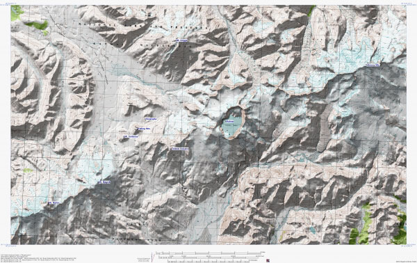
Topographic shaded relief map of the southern part of the Katmai area, including Snowy, Griggs, Trident, Novarupta, Falling Mtn., Mt. Cerberus, Martin, and Mageik.
Date: 2005
Volcano(es): Mageik Martin Cerberus, Mt Falling Mtn Novarupta Trident Griggs Snowy
Photographer: U.S. Geological Survey
URL: avo.alaska.edu/image/view/2948
Image created by the Alaska Volcano Observatory using BigTopo 7 software and AllTopo 7 U.S. Geological Survey topographic maps.Volcano(es): Mageik Martin Cerberus, Mt Falling Mtn Novarupta Trident Griggs Snowy
Photographer: U.S. Geological Survey
URL: avo.alaska.edu/image/view/2948
Please cite the Alaska Volcano Observatory, the U.S. Geological Survey, BigTopo 7, and AllTopo 7 when using this image.
Full Resolution.