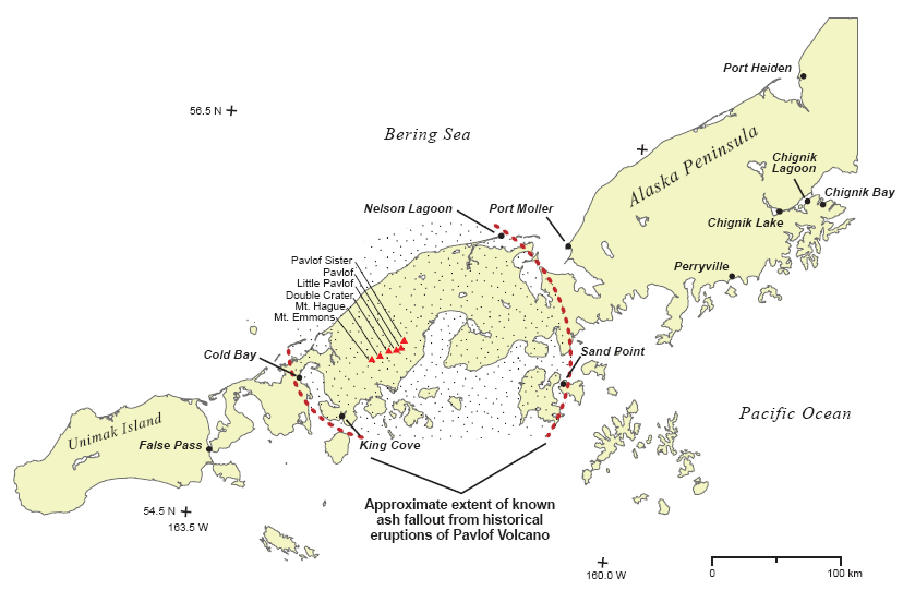
Map showing extent of tephra fallout from historical eruptions of Pavlof Volcano
Image courtesy of AVO/USGS.Please cite the photographer and the Alaska Volcano Observatory / U.S. Geological Survey when using this image.
Full Resolution.
Map showing extent of tephra fallout from historical eruptions of Pavlof Volcano
Image courtesy of AVO/USGS.