Aleutians
(52.0765, -176.1109)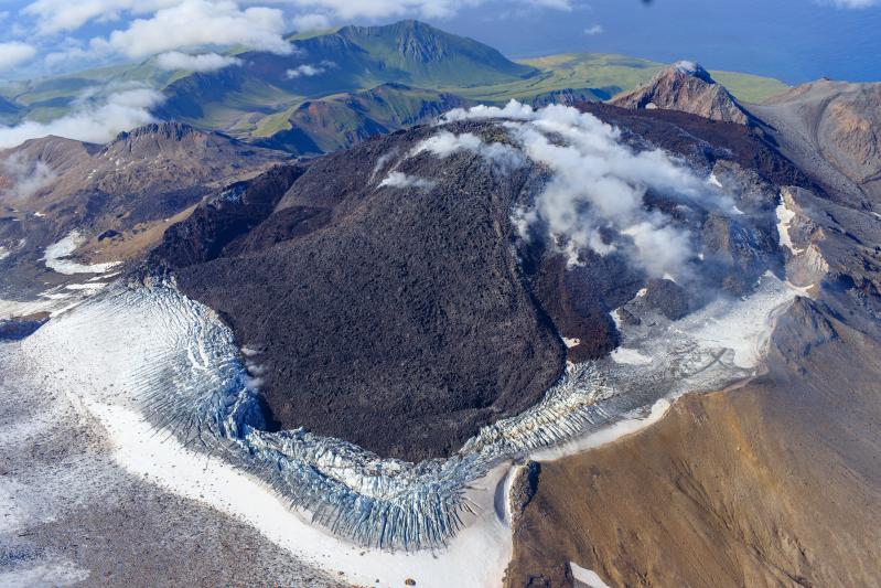
The eruption of lava within the summit crater of Great Sitkin Volcano continues. Satellite radar data through April 12, 2024, showed continued advance of lava flow lobes to the northwest, now extending about 850 ft (260 m) from the vent, and continued uplift of the lava flow surface above the vent. Weakly elevated surface temperatures were observed in satellite data on Tuesday and Thursday when weather conditions were favorable. Steaming from the summit was visible in webcam images when not hidden by clouds. Seismic activity was low, with occasional small volcanic earthquakes.
The current prolonged period of lava eruption at Great Sitkin Volcano began in July 2021. No explosive events have occurred since a single event in May 2021.
The volcano is monitored by local seismic, geodetic, and infrasound sensors and web cameras, as well as regional infrasound and lightning networks and satellite data.
Aleutians
(54.7554, -163.9711)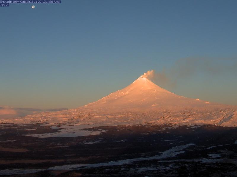
Low-level unrest continues at Shishaldin Volcano, with occasional small volcanic earthquakes and weak seismic tremor being observed throughout the week. Sulfur dioxide emissions were detected on April 14 with satellite-based sensors, but no ash emissions or new deposits were observed in satellite data. Weak steam emissions were occasionally seen in webcam views when the summit was clear. No changes at Shishaldin's summit were observed in satellite radar data, but minor rock falls associated with collapse events from the unstable ground in and near the summit crater are possible. These events may generate very small clouds of fine-grained ash that dissipate quickly in the immediate vicinity of the summit.
No significant eruptive activity has occurred since November 2023.
Local seismic and infrasound sensors, web cameras, and a geodetic network are used to monitor Shishaldin Volcano. In addition to the local monitoring network, AVO uses nearby geophysical networks, regional infrasound and lighting data, and satellite images to monitor the volcano.