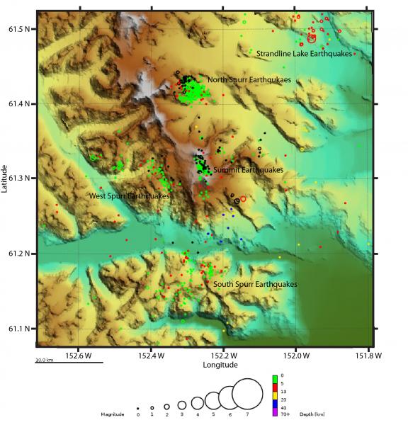
Epicentral map showing the clusters of seismicity near Mount Spurr in 2017. (A) Spurr summit earthquakes, (B) North Spurr earthquakes, (C) West Spurr earthquakes, (D) South Spurr earthquakes (E) Strandline Lake earthquakes.
Image courtesy of AVO/USGS.Please cite the photographer and the Alaska Volcano Observatory / U.S. Geological Survey when using this image.
Full Resolution.