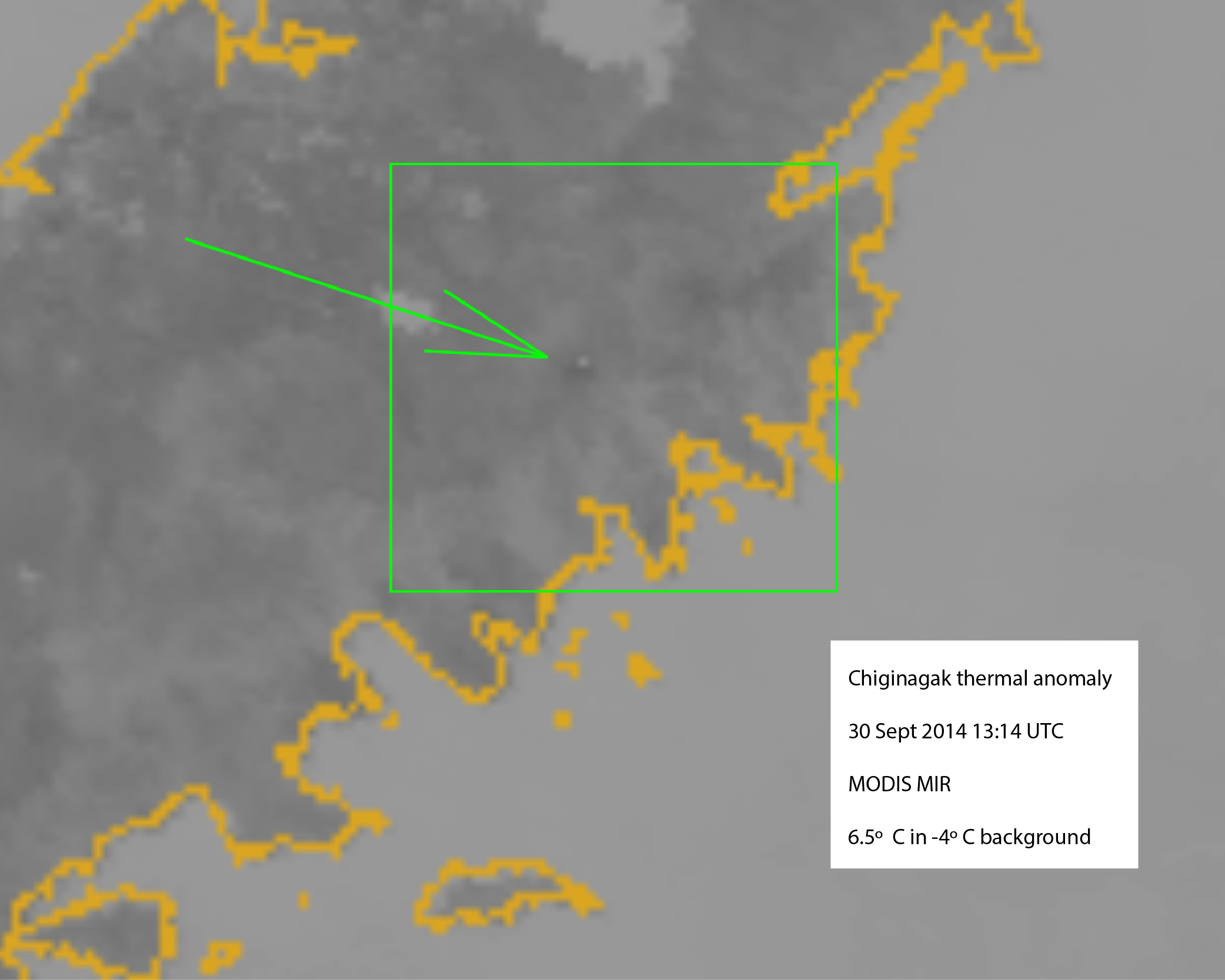
Elevated surface temperature at Chiginagak volcano (lighter-colored pixels) in a September 30, 2014 MODIS mid-infrared satellite image.
Volcano(es):
Photographer: Schaefer, Janet
URL: avo.alaska.edu/image/view/80471
Chiginagak 2014/9
From Cameron and others, 2017: "On September 30, 2014, AVO received an alert from the National Oceanic and Atmospheric Administration National Environmental Satellite, Data, and Information Service (NOAA-NESDIS) of elevated surface temperatures at Chiginagak volcano observed in MODIS and VIIRS satellite data . The thermal anomaly also was observed in AVHRR satellite data. Worldview data from July 31 and September 28 show no significant change in the summit crater; however, on September 29, AVO received a photograph of the northern flank of the Chiginagak volcano from a resident at lower Ugashik Lake, showing that the long-lived fumarole field on the northern flank had expanded several hundred meters downslope. After September 29, AVO received
no new photographs or satellite observations indicating the presence of this expanded fumarole field, so it is uncertain how long this increase in heat flow persisted. This is the most extensive expansion of the fumarole field that has occurred in recent years, at least since the 2004-2011 field seasons, when repeated visits were made (see northern flank fumarole photographs, fig. 29, in Schaefer and others, 2013)."
Please cite the photographer and the Alaska Volcano Observatory / Alaska Division of Geological & Geophysical Surveys when using this image.
Full Resolution.